GOMES EANNES DE AZURARA; (continued 2)
C. Raymond (Charles Raymond) Beazley translation
The Azores, or Western Islands, are also (in part) laid down in the Conosçimiento above quoted (of about a.d. 1330), and in the Medicean Portolano of 1351;[174] and when the Infant sent out Gonçalo Cabral[175] in this direction he was aided, it is said, by an Italian portolano, on which the aforesaid islands were depicted.[176] But no record of any voyage thereto earlier than that of Diego de Sevill[177] (1427) has been preserved; nor did any one before the Prince's time attempt, as far as is known, the colonisation or complete exploration of the Azores. To these, however, like the other Atlantic islands, Nordenskjöld's emphatic words[178] apply, as the cartographical evidence requires. To some extent at least all these groups "were known ... to skippers long before organised ... expeditions were sent to them by great feudal lords." Absolute novelty in geographical discovery is one of the most difficult things to prove, and in no field of historical inquiry does the saying more often occur to the inquirer: "Vixere fortes ante Agamemnona, multi."
The Cape Verdes is the only group of Atlantic Islands as to which we may be reasonably sure that the mediæval discovery at least was not made before Prince Henry's lifetime. Here the Infant's claim of priority is probably most in danger from Phœnician and Carthaginian sailors;[179] but even here the challenge is not very serious, unless we insist on considering as proven a number of pretensions which are almost impossible to substantiate.
2.—THE ATLANTIC ISLANDS
in prince henry's lifetime.
Azurara also requires some words of supplement as to the progress of discovery and colonisation among the Atlantic Islands in Prince Henry's lifetime.[180] And, first, in the Azores. After the first voyages of Diego de Sevill and Gonçalo Cabral, the latter (according to Cordeiro) sought unsuccessfully for an island which had been sighted by a runaway slave from the highest mountain in St. Mary; at last, corrected by the Prince's map-studies, he found the object of his search on the 8th May, 1444, and named it St. Michael, being the festival of the Apparition of the Archangel.[181] The colonisation of this (even more than of other islands in the group) was impeded by earthquakes, but was nevertheless commenced on September 29, 1445. From the number of hawks or kites[182] found in St. Michael and St. Mary, the present name now began to supersede all others[183] for the Archipelago. The island now called Terceira,[184] but originally "The Isle of Jesus Christ," was apparently discovered before a.d. 1450, either by Prince Henry's sailors, or by an expedition of Flemish mariners or colonists under one Josua van der Berge, a citizen of Bruges, who claimed the exclusive, honour of this achievement under date of 1445. Hence, in some Netherland maps and atlases, of later date, the Azores are called The Flemish Islands.[185] On the other hand, Cordeiro has printed the Infant's charter of March 2, 1450, to Jacques de Bruges,[186] his servant, giving him the Captaincy of the Isle of Jesu Christ, because the said Jacques had asked permission of the Prince to colonise this uninhabited spot. Jacques de Bruges bore all the expenses of this colonisation, and may have been specially recommended to Henry by his sister, the Duchess of Burgundy. He had married into a noble Portuguese family, and had previously rendered some services to the Infant.
Graciosa was colonised by Vasco Gil Sodré, a Portuguese, who had been under Prince Henry's orders to Africa, and at first intended to join in the settlement of Terceira, but afterwards passed over to Graciosa. The captaincy of this island he divided for some time with his brother-in-law, Duarte Barreto.
San Jorge received its first inhabitants through a venture of Willem van der Haagen,[187] one of Jacques de Bruges' companions: Van der Haagen brought two shiploads of people and plant from Flanders, but afterwards abandoned the city he had founded there, and transferred himself to the more fertile island of Fayal. The last name brings us to one of the controversial points in the early history of the Azores.
According to the received account, Fayal was first settled by a Fleming noble, Jobst Van Heurter,[188] Lord of Moerkerke, father-in-law of Martin Behaim, who commemorated this event in a legend on his globe of 1492. The famous Nuremberger declares that the Azores were colonised in 1466, after they had been granted by the King of Portugal to his sister, Isabel, Duchess of Burgundy; that in 1490 Job de Huerter came out to settle with "some thousands of souls," the Duchess "having granted these islands to him and his descendants;" that in 1431, when Prince Pedro was Regent, Prince Henry sent out two vessels for two years' sail beyond Finisterre, and sailing west 500 leagues, they found these ten uninhabited islands; that they called them Azores from the tame birds they found there; and that the King began to settle the islands with "domestic animals" in 1432. This account is full of inaccuracies, and from the documents,[189] noticed by Father Cordeiro, by Barros, and by the Archivo dos Açores, it appears probable that the grant of Fayal to Jobst van Heurter as first Captain Donatory was made after Prince Henry's death, perhaps in 1466, by Henry's successor, D. Ferdinand, at the request of the Duchess of Burgundy, and that this grant was confirmed by the Crown of Portugal; which, however, retained its sovereign rights over all the Azores, and did not part with them to the Duchess or anyone else.
Jobst van Heurter, some time after he had obtained the grant or sub-lease of Fayal, appears also to have become Captain Donatory of Pico, with a commission to colonise this island.
Flores and Corvo were first granted, as far as our records go, to a lady of Lisbon, Maria de Vilhena, likewise after the death of Prince Henry. It is said that Van der Haagen,[190] when he moved from S. Jorge to Fayal, did so at the invitation of Jobst van Heurter, who had been there four years, and now promised him a part of the island. The two quarrelled, however, and "Silveira" left Fayal and went to Terceira. Some time after this he visited Flanders, and returning to the Azores by way of Lisbon, became the guest of D. Vilhena, who had received a grant of Flores and Corvo. She now proposed to Van der Haagen that he should colonise and govern these islands for her, which he did for seven years.
* * * * *
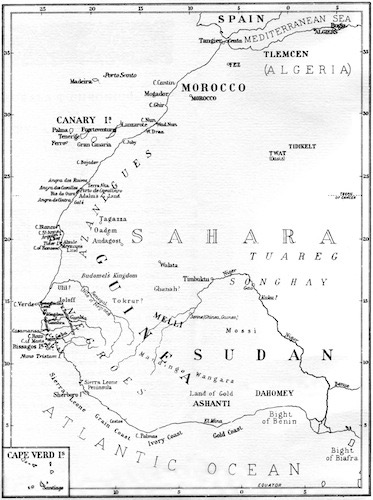
Next, as to the Cape Verde islands. There is no positive ground for supposing that any Europeans discovered or colonised these before Prince Henry. The ancient Gorgades, Hesperides, and so forth have been identified with them by some, but all this remains in the state of guess-work—guess-work which has no great probability behind it.
But as to the discovery of the Cape Verdes in the Infant's lifetime, a controversy exists between the claims of Cadamosto and Diego Gomez, which must be shortly noticed. It is happily beyond controversy that five at least of the Archipelago were discovered within the Prince's own "period," as their names occur in a document of December 3, 1460, hereafter noticed.
Cadamosto's claim to the discovery of the Cape Verde islands has been denied[191] on the following grounds:
1. A mariner sailing from Lagos in early May could not anchor at Santiago on SS. Philip and James' day (May 1st), as stated by Cadamosto.
2. Cadamosto drove three days before the wind from Cape Blanco W.N.W. to Bonavista. But this lies 100 miles S.W. of Cape Blanco.
3. Cadamosto claims to have seen Santiago from Bonavista, which is impossible.
4. Cadamosto is wrong in speaking of any river in Santiago as a "bow-shot wide," or of salt and turtles as found in the island.
To this it has been replied:
1. The first point is probably founded on a misprint. As a correction, d'Avezac[192] has suggested that Santiago was so called because the expedition set out on May 1st. It has also been noticed that the German and French versions of Cadamosto's Italian text (which contains this mistake) give March and not May as the month of sailing, while the translation in Temporal's Histoire de l'Afrique has July. Once more the festival of St. James (July 25th) has been suggested,[193] in exchange for that of SS. Philip and James. In support of this, the most likely alternative to a simple blunder, caused by haste, carelessness, and lapse of time, it is pointed out that Cadamosto seems to have arrived at the islands during the rainy season; that this season prevails from mid-June to November; and that the festival of St. James would agree with the time required for a voyage from Lagos, even if commencing not in March or May, but as late as the beginning of July.
This date is apparently confirmed by the earliest known official document which relates to the Cape Verde Islands, viz., a decree, dated December 3rd, 1460, issued just after the death of Prince Henry.[194] In this is given a list of seventeen islands discovered by the Infant's explorers, beginning with the Madeiras and Azores, and ending with five of the Cape Verdes, S. Jacobe (Santiago), S. Filippe (Fogo), De las Mayaes (Maio), Ilha Lana (Sal?), and S. Christovão (probably Bonavista). The only festival of St. Christopher in the Calendar falls on the day of St. James, or July 25th. We may notice that in the earliest map containing these islands,[195] Cadamosto's name of Bonavista prevails, as now, over "St. Christopher."
2. This charge seems founded on a mistranslation. In the original text of 1507, after a description of the process of putting out to sea from Cape Blanco, we have these words:[196] "and the following night there arose a strong wind from the south-west, and in order not to turn back we steered west and north-west ... so as to weather and hug the wind for two days and three nights." That is, the contrary wind met with after leaving Cape Blanco did not turn the ships back, as they managed to sail close to it.[197]
It is probable, however, that the text is corrupt, and it is only too common in records of this time to have mistakes as to points of the compass creeping into the record of voyages performed some time before. In any case, it is surely not enough to upset the whole of Cadamosto's narrative.
3. Here Cadamosto seems to have made no mistake, in his first printed text of 1507. The islands have never been properly surveyed, but Prof. C. Doelter, in his work Ueber die Kapverden nach dem Rio Grande (1884), speaks of seeing Bonavista from the Pico d'Antonio on Santiago, together with all the rest of the group, even the more distant Sal and St. Vincent. It is therefore quite probable that Cadamosto's sailors did see Santiago from Bonavista, and this feat was certainly possible.
4. In this once more Cadamosto is clearly right, and the attempt to discredit him ridiculous. Salt is so abundant in the Cape Verdes, especially in the western group, that these were at one time called the "Salt islands." Turtles are also common enough in the rainy season, and are mentioned by plenty of visitors and residents.[198] Lastly, the river in Santiago, "a bow-shot across," does not correspond to any fresh-water stream found there, but by this expression may be intended an inlet of the sea, like the Rio d'Ouro of Prince Henry's sailors, north of Arguim. Curiously enough, this very expression—"a bow-shot wide"—is employed by Dapper of the Estuary at Ribeira Grande in Santiago; while Blaeuw's Atlas (Amsterdam, 1663) speaks of the same point in exactly similar terms: "à son embouchure large d'environ un trait d'arc."
* * * * *
Thirdly, the attempts of Prince Henry to acquire possession of the Canaries for Portugal may be noticed. In 1414, Maciot de Béthencourt, nephew and heir of the famous John, "Jean le Conquérant," having, under threat of war from Castille, ceded the islands to Pedro Barba de Campos, Lord of Castro Forte, sailed away to Madeira; and in 1418, according to some authorities, he made a sale of the "Fortunatae" to Henry of Portugal. This was not enough for him, as afterwards he made a third bargain with the Count of Niebla; while meantime Jean de Béthencourt himself left his conquests by will to his brother Reynaud. Pedro Barba de Campos soon parted with his new rights, which passed successively to Fernando Perez of Seville, and the Count of Niebla. But the latter, though now uniting in himself all Spanish claims to the islands, did not cling to them, but made over everything to Guillem de las Casas, who passed on his rights to Fernam Peraza, his son-in-law. While this transference was going on in Castille and in France, Henry, in the name of Portugal, attempted in 1424 to settle the question by sending out a fleet under Fernando de Castro, with 2,500 foot and 120 horse. With this force he would probably have conquered the Archipelago, in spite of the costliness and trouble of the undertaking, if the protests of Castille had not led King John I to discourage the scheme and persuade his son to defer its execution.
In 1445,[199] seven of the Prince's caravels visited the islands, received the submission of the chiefs Bruco and Piste in Gomera (who had already experienced the Infant's hospitality and become his "grateful servitors"), and made slave-raids upon the islanders of Palma. Alvaro Gonçalvez de Atayde, João de Castilha, Alvaro Dornellas, Affonso Marta, and the page Diego Gonçalvez, with many others, took part in this descent, which did not altogether spare the friendly Gomerans, and brought on the perpetrators the severe rebuke of Prince Henry.
In 1446, however, he followed up the reconnaissance of 1445 by another attempt at complete conquest, which also seems to have ended in failure, though the account that remains is very inadequate; perhaps in the future it may be supplemented from the disinterred treasures of Spanish documentary collections. We only know that Henry obtained, in 1446, from the Regent D. Pedro a charter, giving him the exclusive right to sanction or forbid all Portuguese voyages to the Canaries; that in 1447 he conferred the captaincy of Lançarote on Antam Gonçalvez,[200] and that Gonçalvez sailed to establish himself there. So far, according to Azurara; Barros and the Spanish historians would ante-date all these measures of 1446-7 by several years. In 1455 Cadamosto, sailing in the Portuguese service, visited and described the islands, and in 1466 Henry's heir, D. Fernando, made one more attempt to reclaim the Canaries for Portugal. It failed, and in 1479 the islands were finally adjudged to Spain, or the now united monarchy of Castille and Aragon.
* * * * *
Fourthly, in the Madeira group, colonisation made progress during the Infant's lifetime. After the discoveries of 1418-20,[201] Madeira itself was divided up under the feudal lordship of John Gonçalvez Zarco and Tristam Vaz Teixeira; the former receiving the captaincy of the northern half with Machico for his chief settlement; the latter obtaining the southern portion, with Funchal as capital, and the Desertas as an annexe. From the language of the Infant's Charter[202] of September 18th, 1460, this settlement appears to have taken place in 1425, when the Prince was 35 years old.
According to Gaspar Fructuoso, Zarco, in clearing a path through the forests of Madeira, set the woodland on fire, and seven years elapsed before the last traces of the conflagration were extinguished. The seven years is, no doubt, an extra touch; but a fire of tremendous severity must have taken place, from Cadamosto's account.[203] The whole island, he declares, had once been in flames; the colonists only saved their lives by plunging into the torrents; and Zarco himself had to stand in a river-bed for two whole days and nights, with all his family. Yet, according to Azurara, so much wood was soon exported from the island to Portugal, that a change was produced in the housebuilding of Spain: loftier dwellings were built; and the Roman or Arab style was superseded by one originating in the new discoveries among the Atlantic Islands. Almost all Portugal, Cadamosto tells us in 1455, was now adorned with tables[204] and other furniture made from the wood of Madeira.
In the settlement of Porto Santo, Bartholemew Perestrello, a gentleman of the household of Prince Henry's brother, the Infant John, took part[205] with Zarco and Vaz. Perestrello imported rabbits, which destroyed all the colonists' experiments in crops and vegetable planting; but receiving the captaincy of the island, he made some profit from breeding goats and exporting dragon's blood. His grant of Porto Santo, originally for his lifetime only, was extended by decree of November 1st, 1446, to a donation in perpetuity for himself and his descendants. On the death of Bartholemew, Prince Henry bestowed the captaincy on his son-in-law, Pedro Correa da Cunha, in trust for the first Governor's son Bartholemew, who was still a minor. Da Cunha later contracted with young Bartholemew's mother and uncle—the widow and brother of the first grantee—for a sum of money in return for a cession of his interim rights; and Prince Henry authorised this contract by a decree from Lagos (May 17th, 1458), confirmed by King Affonso V at Cintra (August 17th, 1459).
Young Bartholemew entered into his governorship in 1473, and it was formally confirmed to him (15th March, 1473) by Affonso V. It was his sister, a daughter of the elder Bartholemew, named Felipa Moñiz de Perestrello, whom Christopher Columbus married in Lisbon; after which he lived for some time in Porto Santo, enjoying the use of Perestrello's papers, maps, and instruments.
Before many years had passed, Madeira became famous for its corn and honey, its sugar cane,[206] and, above all, its wine. The Malvoisie[207] grape, introduced from Crete, throve excellently, and at last produced the Madeira of commerce. When Cadamosto visited the island, in 1455, he found vine culture already advanced, and become the staple industry of the colonists, who exported red and white wine annually to Europe, and found a market for the vine staves as bows.
As early as 1430[208] the Infant issued a charter, regulating the settlement of Madeira; herein Ayres Ferreira (whose children, "Adam and Eve," were the first Europeans born in the island) is mentioned as a companion of Zarco. An early tradition, which has not yet been substantiated, also maintained that Prince Henry instituted family registers for his colonists in this group.[209] In 1433 (September 26th), King Duarte, in a charter from Cintra, granted the islands of Madeira, Porto Santo, and the Desertas to the Infant Henry; and in 1434 (October 26th), the spiritualities of the same were bestowed on the Order of Christ.[210] In December, 1452, a contract was made at Albufeira between the Infant D. Henry and Diego de Teive, one of his "esquires," for the construction of a water-mill to aid in the manufacture of cane-sugar,[211] the third part of the produce to go to the Prince. Finally, in 1455, on Cadamosto's visit, the island possessed four settlements and 800 inhabitants, and this prosperity seems to have steadily continued. The charter of 1460[212] has been already noticed.
From the work of the Portuguese among the Atlantic Islands arises one question of special interest. Did this westward enterprise of Prince Henry's seamen, which undoubtedly carried them in the Azores and Cape Verdes a great distance (from 20 to 22 degrees) westward of Portugal, lead them on further to a discovery of any part of the American mainland?
On the strength of an enigmatical inscription in the 1448 Map of Andrea Bianco, such a discovery of the north-east corner of Brazil in or before this year has been suggested;[213] but this, it must be admitted, is quite lacking in demonstrative evidence, however possible in itself. Yet once more, the "accidental" discovery of this same Land of the Holy Cross by Cabral in 1500 has been urged to much the same effect. For, if really accidental, a similar event might well have happened in earlier years—especially from the time of the Azores settlement of 1432, etc.; or if not accidental, it was based on information obtained from older navigators, who reached the same country.[214] Such older navigators towards the west were said to have been Diego de Teive and Pedro Velasco, who in 1452 claimed to have sailed more than 150 leagues west of Fayal; Gonçalo Fernandez de Tavira, who in 1462 sailed (in one tradition) W.N.W. of Madeira and the Canaries; Ruy Gonçalvez de Camara, who in 1473 tried to discover land west of the Cape Verdes; with a certain number of later instances. Some weight has also been attached to a statement of Las Casas, that on his third voyage, in 1498, Columbus planned a southern journey from the Cape Verde Islands in search of lands—especially because, proceeds Las Casas, "he wished to see what was the meaning of King John of Portugal, when he said there was terra firma to the South. Some of the ... inhabitants of ... Santiago came to ... him,[215] and said that to the South-West of the Isle of Fogo[216] an island was seen, and that King John wished to make discoveries towards the South-West, and that canoes had been known to go from the Guinea coast to the West with merchandise."
Further, Antonio Galvano, after speaking of a voyage which took place in 1447, goes on to mention another (undated, but probably conceived by the author as falling within a year or two of the last) in these terms. "It is moreover told that in the meantime a Portuguese ship, coming out of the Straits of Gibraltar, was carried westwards by a storm much further than was intended, and arrived at an island where there were seven cities, and people who spoke our language." This, however, is too much like an echo of the old Spanish tale of the Seven Bishops and their cities in the Island of "Antillia."
In the same connection a number of still looser and more doubtful assertions exist in Portuguese archives and chronicles. Thus, in 1457, the Infant D. Fernando, as heir of Prince Henry, planned Atlantic explorations; in 1484 and 1486 similar designs were entertained—possibly on the strength of Columbus' recent suggestions, which are known to have directly occasioned one unsuccessful venture at this time; and in 1473 João Vaz da Costa Cortereal was reported, by a now-exploded legend, to have actually discovered Newfoundland.
The "School of Sagres," etc.
Few things in connection with the life of Henry the Navigator are more interesting than the tradition of his educational and intellectual work, especially for the furtherance of geography, in the alleged School of Sagres and other supposed foundations or benefactions. Unfortunately, this tradition is not as clearly established as it might be, and it has been made more difficult by constant exaggeration. Not content with asserting that the Infant aimed at drawing the commerce of Cadiz and Ceuta—without reckoning other ports—to his town at Sagres, some have indulged in pictures of a geographical university established by the Prince upon this headland—pictures which are quite beyond any known means of verification. These flourishes, however, need not cause one to run into another extreme, and deny that Sagres became, during the latter part of Henry's life, especially from 1438 to his death, the centre of the exploring movement and the scientific study which the Infant inspired. At Sagres,[217] according to what may be called the older view—which, resting mainly upon Barros, is adopted by Major, de Veer, Wauwermans, and even Martins—Prince Henry usually resided, not merely during the last years of his life, or after his return from the Tangier expedition of 1437, but from the time of his reappearance in Portugal after the relief of Ceuta in 1418. At first, however (1418-1438) it was called Tercena[218] Nabal, or Naval Arsenal, after it emerged from the stage of a little harbour of refuge for passing ships; and only afterwards did it become (from 1438 onwards) the Villa do Iffante, "my town," from which some of Prince Henry's charters are dated. Shortly before the completion of Azurara's chronicle, according to this view, the town was fortified with strong walls and enlarged by the building of new houses.[219] In this settlement (within the narrow space of some 100 acres), there were said to have been, besides the Infant's own Court or palace, a church, a chapel,[220] a study, and an observatory (the earliest in Portugal), together with an arsenal, a dockyard, and a fort. Here cartography and astronomical geography were diligently studied, and practical mariners were equipped for their work.
Two original statements of Portuguese authors have been often quoted to support this tradition. The first comes from John de Barros, the Livy of Portugal (a.d. 1496-1570). "In his wish to gain a prosperous result from his efforts, the Prince devoted great industry and thought to the matter, and at great expense procured the aid of one Master Jacome[221] from Majorca, a man skilled in the art of navigation and in the making of maps and instruments, who was sent for, with certain of the Arab and Jewish mathematicians, to instruct the Portuguese officers in that science." Secondly, we have the statement of the mathematician Pedro Nuñes, that the Infant's mariners were "well taught and provided with instruments and rules of astrology and geometry which all map-makers should know."[222] On the other hand, it has been contended that there is no satisfactory evidence of the Infant's town having ever been finished, or of the Prince ever having lived there continuously, except during the last years of his life; and that our best authorities do not warrant us in believing that the settlement was even begun before the Tangier expedition. Henry's earlier charters are, with one exception, dated from other places, and his residence before 1438 seems to have been usually at Lisbon, Lagos, or Reposeira. Further, we have no right to speak of the "School," or "University," or "Academy" of Sagres; there may have been both teachers and learners, but there was nothing of an "institution for instruction" in the Prince's establishment.
Such is the minimising view; and most, in face of this sharp divergence, will agree with Baron Nordenskjöld that a really critical study of the subject, especially from a local antiquarian, is desirable. Very plausibly does Nordenskjöld himself sum up the probabilities of the case when he concludes that "a small school of navigation, important for the period in question, has probably received from laudatory biographers the name of an 'Academy.'"[223] The Swedish geographer, however, adds from his own special researches some important observations. He believes that in the La Cosa map of 1500[224] we have work which was based upon the observations of the Infant's captains, who, as shown in these results, were evidently able to keep reliable reckoning and take fairly correct altitudes. "Further, the extension of the normal or typical portolano along the West coast of Africa, as on the portolanos of Benincasa and others of the latter part of the fifteenth century, is shown by the legends of the same to have been based on observations made during the marine expeditions of Prince Henry."
No charts or other productions of the "Sagres School," in any definite sense of this term, no geographical or astronomical works emanating from the "Court" of the Infant, are now extant. But it may reasonably be inferred from passages in Azurara's Chronicle of Guinea that such charts were not only draughted under the Prince's orders, but used by his sailors;[225] Cadamosto tells us of the chart he kept on his voyage of 1455, probably by direction of the Infant; while it is probably true that the "extension of the portolanos beyond Cape Bojador, in Benincasa,[226] for instance, as well as in Fra Mauro's work of 1457-9, depended on information given by native and foreign skippers" sent out by Henry. Of course, it is obvious, in the light of present knowledge, that neither he nor his school in any sense invented the portolano type; although the mention of Master Jacome of Majorca reminds us of one of the earliest centres of the new scientific cartography[227] (which was probably first made effective by Catalan skippers and draughtsmen), and suggests that the Infant was in touch with the best map-science of the time. "Neither is it correct to say that he introduced hydrographic plane charts or map graduation in accordance with geographical co-ordinates."
But his life was almost certainly not without direct influence in the improvement of cartography, and the extension of the scientific type of map beyond its fourteenth-century limits—an improvement which we see in the great map of Fra Mauro executed shortly before the Infant's death. Also, he made his nation take a real interest in geographical discovery, broke down their superstitious fear of ocean sailing, and made a beginning in the circumnavigation of Africa. He altered the conditions of maritime exploration by giving permanence, organisation, and governmental support to a movement which had up to this time proved disappointing for lack of these very means. And he certainly improved the art of shipbuilding, which Cadamosto remarks upon as having rendered the caravels of Portugal the best sailing ships afloat.
As to the build of these caravels we are fortunately not without data. Cadamosto, indeed, though he describes them as the best sailing ships at sea in his time, does not give any details; but from other sources[228] it is possible to form some idea of their peculiar features. They were usually 20-30 metres long, 6-8 metres in breadth; were equipped with three masts, without rigging-tops, or yards; and had lateen sails stretched upon long oblique poles, hanging suspended from the masthead. These "winged arms," when their triangular sails were once spread, grazed the gunwale of the caravel, the points bending in the air according to the direction of the wind. They usually ran with all their sail, turning by means of it, and sailing straight upon a bow-line, driving before the wind. When they wished to change their course, it was enough to trim the sails.
It was with this type of vessel that the Madeira and Canary groups were "gained from the secrets of the Ocean;" that the Azores, at a distance of twenty-two degrees west of Portugal, and in the heart of the Atlantic, were discovered and colonised; and that open sea navigation of almost equal boldness was successfully employed in the finding and settlement of the Cape Verdes. Before the end of the year 1446, according to Azurara's estimate, the Infant had sent out fifty-one of these ships along the mainland coast of Africa, and they had passed 450 leagues[229] beyond Cape Bojador, which before the Prince's time was the furthest point "clearly known on the coast of the Great Sea." Also, the work of the "School of Sagres" may perhaps be recognised in Azurara's further claim that "what had before been laid down on the Mappemonde was not certain, but only by guesswork," whereas now it was "all from the survey by the eyes of our seamen," and that "all this coast towards the South with many points our prince commanded to add to the sailing chart."
It has been noticed that D. Pedro, according to the Portuguese tradition, presented Henry with a copy of Marco Polo's travels, and a map of the same, either drawn by the explorer himself or by one who knew his works, and belonged to his own city. Thereby, we are told, the work of the Infant was much furthered, and Galvano suggests that the same was extant in 1528, and that it contained many wonderful anticipations of later discoveries.[230]
It has also been surmised, without any certain evidence,[231] that D. Pedro presented his brother with various maps of Gabriel Valsecca,[232] and with the writings of Georg Purbach, the instructor of Regiomontanus. Much more certain and interesting is the allusion to the Infant's collection of old maps in the history of the discovery of St. Michael (1443-4) in the Azores. A runaway slave, having escaped to the highest peak in the Isle of St. Maria, sighted a distant land, and returned to his master to gain pardon with this news. Prince Henry was informed of this, consulted his ancient charts, and found them confirm the slave's discovery. So he sent out Gonçalo Velho Cabral to seek for the same. Cabral failed; but on his returning to the Prince, the latter showed him from the ancient maps how he had only missed it by a slight error of direction. On his second trial the explorer was successful, and reached St. Michael on May 8, 1444.
* * * * *
Prince Henry's connection with the Coimbra-Lisbon University (founded by King Dinis in 1300) opens another side of the same question. We have already mentioned the tradition that in 1431 the Infant provided new quarters in the parish of St. Thomas, in Lisbon, for the teachers and students, and afterwards established Chairs of Theology and Mathematics. This has been called by some a "Reform of Ancient Schools" under his influence and direction;[233] and recent enquiry[234] has endeavoured to prove that the Protector of Portuguese Studies was also the founder (in 1431) of a Chair of Medicine, and the donor of a room or lecture-hall in which was painted by his order a picture of Galen. In 1448 the Infant subsidised the Chair of Theology by a grant of twelve marks of silver annually from the revenues of Madeira.[235] It is perhaps noteworthy that the Prince does not appear to have founded any lectureship, or made any benefaction to promote directly the study of geography, though ancient texts bearing on this subject were now beginning to attract considerable attention. It may be open to question how far a university would then have welcomed an instructor in practical navigation or draughtsmanship; but students would have probably listened to lectures upon Ptolemy, or Strabo, or other classical geographers, and thereby a great impetus might have been given to the new exploring spirit. Thus in general we may fairly conclude that, so far as the Portuguese seamen of the next generation, Bartholemew Diaz, Da Gama, Cão, and others, "received their training from the Infant's School," it was usually through a rougher and more practical tradition than that of a class-room—by means of older mariners who had served in the Prince's ships rather than by university lecturers whom he had appointed.
Maps and Scientific Geography up to and during Prince Henry's Life.
Ancient maps were not without high merits in certain cases, and a little after Prince Henry's time the Renaissance editions of Ptolemy played a very important part in geographical history. But in the first part of the fifteenth century neither the work of the Alexandrian astronomer and cartographer, nor the ancient road maps of the Roman Empire and surrounding lands[236] seem to have been sufficiently known for the exercise of much influence in the progress of discovery or of geographical knowledge. The same result follows, for different reasons, in the case of almost all the earlier mediæval maps and charts,[237] which are quite unscientific in character, and often rather picture books of natural history legends than delineations of the world.
Strictly scientific map-making begins with the Mediterranean portolani. The earliest existing specimen of these is of about 1300, but the type then formed[238] must have been for some time in process of elaboration; and it is even probable that a fully-developed example from the middle of the thirteenth century may yet be discovered.
"A sea-chart—probably a portolano—is mentioned as early as the account of the Crusade of St. Louis, in 1270."[239] So in Raymond Lulli's Arbor Scientiæ, written about 1300, we have reference to compass, chart and needle, as necessary for sailors.[240] Once again, it is probable that Andrea Bianco's planisphere of 1436[241] is only a re-edition of a thirteenth-century work, when the "Normal Portolano" was just in process of making, but had not reached even the comparative perfection of the Carte Pisane, Carignano, or Vesconte examples.
The earliest dated portolan is that of 1311, by Petrus Vesconte; and from this time the maps of this class, whose central feature is an accurate Mediterranean coast-line, increase rapidly, being indeed all reproductions of one type,[242] occasionally introducing additions or corrections, especially in outlying parts, but not often varying much from one another in the central portions. The type is reasonably believed by some[243] to have originated among the Catalans, either of Spain, France, or the Balearic Isles, well within the thirteenth century.[244] In connection with this, we may recall the point mentioned by Barros, that Prince Henry the Navigator obtained the services of Master Jacome, or James, from Majorca to instruct the Portuguese captains in navigation, map-making, and the proper handling of nautical instruments.
These plans of practical seamen are a striking contrast, in their often modern accuracy, to the results of the literary or theological geography portrayed in such works as those of the "Beatus School," or of Robert of Haldingham.[245] Map surveys of this kind were apparently unknown to the ancient world. The old Peripli were sailing directions, not drawn but written; and the only Arabic portolan known to exist was copied from an Italian example. Long after the Italian leadership in exploration and commerce had begun to pass away, Italian science kept control of cartographical work; thus, among the early portolani, not only the majority—413 out of 498—but the most valuable, were executed by the countrymen of Carignano and Vesconte.
This department of geographical history is only just beginning to be appreciated at its full value—as marking the vital transition from ancient to modern, from empirical to scientific—but this need not surprise us much. The portolani, as has been well said, never had for their object to provide a popular or fashionable amusement; they were not drawn to illustrate the works of classical authors or learned prelates; still less did they illustrate the legends and dreams of chivalry and historical romance; they were seldom drawn by learned men; and small enough in return was the acknowledgment which the learned but too often made them, when the great geographical compilers of the Renaissance and Reformation times incorporated the earlier coast-charts in grander and more ambitious works.
Unquestionably, however, it is in maps of the portolano type that we must look for Prince Henry's primary geographical teachers, though the influence of books—and even of the older theoretical designs in cartography—must not be forgotten. Therefore, to understand his position—to realise what he had to draw from—we must briefly describe the chief designs which it was possible for him to consult for his scientific purposes, for his Ptolemaic ambition, διοθῶσαι τὸν ἀρχαῖον πίνακα.
(1) The "Carte Pisane" of the latest thirteenth or earliest fourteenth century is probably only a copy of an earlier work, though now itself our earliest example of the portolano type. The Mediterranean on this example (as well as the Black Sea, where it has survived injury) shows the new scientific or surveying method, but the Atlantic coasts of Spain and France, and still more the shore-lines of Britain, are of a different and inferior character. This alone points to an earlier date than, e.g., the works of Vesconte and Dulcert. In West Africa only a part of the Maroccan coast now remains.
(2) The Map of Giovanni di Carignano,[246] of c. 1300?-1310, though much damaged, shows the Black Sea and Britain with contours differing somewhat from the ordinary portolan; and the same is noticeable in the Baltic. The West African coast does not extend to Cape Non. Another work by Carignano, of c. 1306, "specially referring to Central Asia," is said to exist, but its present position is unknown.
(3) A portolan of the early fourteenth(?) century, belonging to Professor Tammar Luxoro, of Genoa, in 1882, and usually called after him, is believed by Nordenskjöld to be a "slightly altered copy of the normal portolano in its original form." In N.W. Africa it only gives us the shore-line as far as Sallé, with a series of names, beginning at Arzilla.[247]
(4) Marino Sanudo the Elder, to his work, Liber Secretorum fidelium Crucis, written between 1306 and 1321, added an atlas of ten maps. Among these, i-v form an ordinary portolano, corresponding especially with Vesconte's work,[248] but giving us no special information upon Africa; while No. vi is the famous map of the world often reproduced. Here a thoroughly conventional Africa is laid down, of the "Strabonian" or "Macrobian" type: its length, from east to west, traversed by the Negro Nile from near the Mountains of the Moon to the Atlantic, is equal to fully twice the breadth from north to south. The deep inlet in the West African coast penetrating east to a "Regio vii Montium" immediately south of the Negro Nile, is a prototype of the similar feature in Fra Mauro, and is perhaps only an exaggeration of the Sinus Hesperius of Ptolemy. This map was probably known to Prince Henry, like the book it accompanied, which contained many important particulars of fourteenth-century trade and navigation. The Mappemonde is a compromise between, or combination of, the portolano and the Mediæval theoretical map, and is quite a landmark in the history of cartography.
(5) Pietro Vesconte of Genoa has left three or four works executed between 1311 and 1321, and still extant, viz.: (α) Of 1311, which lacks the Western Mediterranean and West Africa, what remains giving us a "normal portolano" of the Levant and Black Sea. (β) Of 1318, depicting the entire Mediterranean, etc., with the Atlantic, North Sea coasts of Europe (in ten plates), and West Africa as far as "Mogador." (γ) Of 1318 (in six maps), which for our purposes need not be discriminated from (β); and lastly (δ) Of 1320, a map of the world, with plans of cities, a special chart of Palestine, etc. The Mappemonde, which principally concerns us here, is extremely like Sanudo's, and is perhaps the work of the same artist—Vesconte himself. Another work, of 1321, by Vesconte, is mentioned in Santarem,[249] but its whereabouts is now unknown.
Once more a work of 1327, signed "Perrinus Vesconte fecit ... mcccxxvii in Veneciis" is conjectured to be only another "normal-portolan" by Pietro Vesconte.
(6) Angelino Dulcert, a Catalan, composed in August 1339, in Majorca ("in civitate Majoricarum") a portolan of great merit. Dulcert's Baltic somewhat resembles Carignano's, but with more numerous legends. A star ("the Star in the East") placed by this draughtsman south of the Caspian is copied, or at least paralleled, in the Atlas Catalan of 1375 (No. 9, p. cxxvi), in the Andrea Bianco of 1436, and in the Borgian map of 1430-50, as well as in the Anonymous Catalan planisphere hereafter noticed (No. 14, p. cxxviii). Dulcert's Africa probably served in some respects as a prototype for the Catalan Atlas of 1375, and Prince Henry may have studied the Continent in one or other of these delineations, which are among the most complete pictures of the Sahara coasts and Sudan interior coming down from any period before that of his voyages. Some of the Canaries are marked in about their right position, with Lançarote showing the Cross of Genoa, and Fuerteventura to the south, while almost in the latitude of Ceuta appear "Canaria," St. Brandan's Isle, etc. On the mainland a long stretch of shore-line is given beyond Cape Non or Nun, but it is drawn very conventionally in a S.S.E. direction, with seven names,[250] or titles, and an inscription of two lines, the whole seeming to show pretty clearly that the draughtsman knew nothing at first hand of the coast between Non and Boyador, but was led to conjecture a continuation of the Desert Littoral. In the Interior, the Atlas range, the large seated figure of a king with sceptre, and most of the towns depicted on eminences, reappear with slight alterations in the Atlas Catalan; which, however, adds many details.
(7) Next comes the most famous, and perhaps in some respects the most advanced, specimen of the early portolani: that usually quoted as the Medicean or Laurentian Portolan of 1351 ("Atlante Mediceo," or "Portolano Laurenziano-Gaddiano"). The author was anonymous, but almost certainly a Genoese, and his work consists of eight plates, or tables. The second of these is the Mappemonde, which is the only one that need be noticed here. The Africa of this map, taken as a whole, is drawn with a nearer approach to general correctness than on any chart anterior to the voyage of B. Diaz in 1486;[251] both the Guinea coast to the Camaroons, and the southern projection of the Continent, are extraordinarily well conceived for the time. No details or names are inserted on the W. African mainland shore beyond Cape Bojador and the River of Gold—"Palolus."[252] In this it is similar to the Pizigani map of 1367.[253]
(8) Francisco Pizigano, of Venice, 1367-1373, aided by his brother Marco, executed two famous works still extant: (α) In 1367, a large chart comprising a good deal beyond the normal portolano's Mediterranean and Black Sea;—e.g., part of the Scandinavian Peninsula, the Baltic, the Caspian, etc. It is signed, "mccclxvii, Hoc opus compoxuid Franciscus Pizigano Veneciar et domnus In Venexia meffecit Marcus die xii Decembris." (β) In 1373, a normal portolano, signed "mccclxxiii a die viii de zugno Francischo Pisigany Venician in Venexia me fecit." The N.W. Africa of these two maps shows no advance on the Laurentian Portolano.
(9) The Atlas Catalan of 1375 is said to have been executed for Charles V of France, in whose library it was entered with the title, "Une quarte de mer en tableaux faicte par manière de unes tables, painte et histoirée, figurée et escripte, et fermant a quatre fermoners de cuivre." It is in six plates, the last four of which compose a mappemonde—"the most comprehensive cartographic work of the fourteenth century," especially rich in legends, and showing us the normal portolan, for shore-lines, blended with the theoretical map, for the interiors of countries, all designed on the most elaborate scale. The West African coast on this example is brought down to, and a little beyond, Cape Bojador, southwest of which appear the Catalan explorers of 1346[254] in their boat, with an inscription.[255] Beginning with Arzilla, and continuing south, we have besides the recognisable Sallé, Cantin, Mogador, and No[n], 35 other names before we reach Cavo de Buyet(e)der, after which we have only the legend "Danom," and the conclusion, "Cap de Finister(r)a occidental de Affricha."[256] More attention is given to the interior of North Africa in this design than in any other map of the fourteenth century.
(10) Guglielmo Soleri, of Majorca, between c. 1380 and 1385, executed two designs of some value, both "normal-portolans:" (α) is undated, probably executed about 1380, and signed "Guill'mo Soleri civis Majoricarum me ficit." (β) is inscribed "Guillmus Solerii civis Majoricarum me fecit anno mccclxxxv."
In (β) West Africa has a fairly good extension, a little beyond the latitude of the Canaries, where the rough and torn southern edge of the map cuts across all.[257]
(11) Next in order comes an anonymous Atlas of 1384 (?) in six sheets, usually called, after two of its possessors, the Pinelli-Walckenaer Portolano. It is probably a Genoese work. Its West Africa extends about as far as (or a little beyond) the Soleri of 1385, to what is apparently Cape Bojador, slightly south of the Canaries. Ten names occur beyond C. Non, among them Cavo de Sablon and Enbucder.[258] The little harbour existing to the south of Bojador seems indicated here.
(12) And now, coming to the fifteenth century, we have first the "Combitis" Portolan of c. 1410—an anonymous work, but inscribed "Haec tabula ex testamento domini Nicolai de Combitis devenit in Monasterio Cartusiae florentinae." This is, in some respects, closely similar to the Vesconte of 1318.
(13) Another cartographer of the early fifteenth century is Cristoforo Buondelmonte—otherwise Ensenius—whose "Description of the Cyclades" is accompanied by maps; who was the author of an important graduated chart of the North of Europe; and who also left a roughly-sketched mappemonde—perhaps a copy of a much older work—which may conceivably have been known to Prince Henry and have encouraged his explorations. This shows an Africa somewhat similar in contour to Fra Mauro's of 1457-9, but almost without names.[259]
(14) Last among these works of the "Preparatory Time," we may take an anonymous Catalan planisphere of the early fifteenth century (in the National Library of Florence) closely resembling the great Atlas of 1375.
This completes the list of important maps for the period immediately preceding the new Portuguese discoveries, and shows us the most likely examples of cartography for Prince Henry's study. Some of these he may have owned; many of them he probably inspected in person or by deputy.
It is probable enough that he was acquainted with some of the pre-scientific or "theoretical" designs, such as those of the "Beatus" type from the eighth and subsequent centuries; those which are to be found illustrating manuscripts of Sallust, Higden, Matthew Paris, St. Jerome, or Macrobius' Commentary on the "Dream of Scipio;" and those of Arabic geographers like Edrisi[260]—to name only a few examples—but he can hardly have derived much assistance from them. The great thirteenth century wheel-map pictures—as, for instance, those we know as the Hereford or Ebstorf Mappemondes—expressed the very antithesis of his spirit; and the same must be said of the greater part of the Mediæval cartography before the appearance of the portolani.
From certain books of travel, such as those of Carpini, Rubruquis, Odoric, Pegolotti, or Marco Polo, he may, however, have received great assistance. The merchants and missionaries who opened so much of Asia to the knowledge of Europe during the Crusading period, furnished the most direct stimulus for the discovery of a direct ocean route to the treasures of the East. And to find such a route by the circumnavigation of Africa was, as we have suggested before, one of the primary objects of the Infant's life and work.
But, in addition to the Maps of his predecessors, the Infant was almost certainly acquainted with some of the chief cartographical works of his own time, falling within the period of his exploring activity, and we must finish this brief survey with some notice of these. Continuing the catalogue, we have
(15) A map by Mecia de Viladestes of 1413. This is a Catalan portolano, signed "Mecia de Viladestes me fecit in ano 1413," and is noticeable as containing a reference to the voyage of Jayme Ferrer in 1346, similar to that on the great Catalan atlas of 1375.[261]
(16) Four, or possibly five, specimens of Jacobus Giroldis' draughtsmanship belonging to the years 1422-1446, viz., (α) a Mediterranean portolan of 1422, signed "mccccxxii mense Junii die primo Jachobus de Giroldis Veneciis me fecit;" (β) a Portolan atlas in six sheets, of a.d. 1426, thought by some to resemble the work of Andrea Bianco in river-markings, legends, etc. This work possesses a distance-scale, but no graduation for latitude. It is inscribed, "Jachobus de Ziraldis [Ziroldis?] de Veneciis me fecit ... mccccxxvi." The West Africa of this work ends at Bojador ("Buider"), and gives us thirty-nine names between Arzilla and this point. Its nomenclature here is very similar to, though somewhat less full than, that of the Catalan atlas (1375).[262] Besides these two works, Giroldis has left others of less importance, viz., (γ), a Portolan atlas of 1443, consisting of six maps; (δ), a Portolan atlas, also of six maps, dated 1446; (ε?), a Portolano, unsigned, in the Bibliotheca Ambrosiana at Florence, which is perhaps his work.
Passing by the (for our purposes) less important Portolans of Battista Becharius, or Beccario, of Genoa, executed in 1426 and 1435; of Francisco de Cesani of Venice (1421), of Claudius Clavus[263] (1427), of Cholla de Briaticho (1430), there are only about ten maps or atlases belonging to this period which have still to be noticed, and which with some probability may be connected with the work of Prince Henry.
These are—not counting the lost map brought back by D. Pedro from Venice in 1428,—
(17) The Atlas of 1435-1445, by Gratiosus Benincasa, of Ancona.
(18) The so-called Andrea Bianco of 1436.
(19) The Andrea Bianco of 1448.
(20) The Portolano of 1434-39 by Gabriele de Valsecca, of Majorca, together with one of 1447 by the same draughtsman.
(21) The anonymous planisphere of 1447.
(22) The planispheres of 1448 and 1452, by Giovanni Leardo (Leardus), of Venice.
(23) The planisphere of 1455, by Bartolommeo Pareto, of Genoa; and
(24) The planisphere of 1457-9, by Fra Mauro of the Camaldolese Convent of Murano, in Venice.
As to these, we need only remark:
No. (17) is the earliest known work of Gracioso Benincasa, consists of sixty-two maps, and belongs to a MS. giving sailing directions, etc. Its West Africa does not call for special remark, though the later discoveries of Prince Henry's lifetime are admirably illustrated in the same draughtsman's work of 1468, 1471, etc.
No. (18) consists of ten maps, including a graduated Ptolemaic mappemonde, and a circular world-map, somewhat resembling Vesconte, probably copied and re-edited from a very early portolan, with a certain theoretical extension.[264] The original of this is supposed by some to have been a late thirteenth-century work; its West African names and detailed charting end at Cape Non—an incredibly backward point for the time of revision, viz., a.d. 1436. A ship is, however, depicted in full sail far down the west coast[265] of a Continent whose general shape is conceived as "Strabonian" or "Macrobian," with its length from east to west, and consequently possessing a long southern shore. The Negro Nile flows straight from Babylon or Cairo, into the Atlantic, near (but north of) the picture labelled Rex de Maroco. The western Mediterranean, Adriatic and Ægaean, as well as the Black Sea and Caspian, are poorly drawn, and suggest an early and crude type of portolan.
No. (19), signed "Andrea Biancho venician comito di galia mi fexe a Londra mccccxxxxviii," was probably executed with a special view of illustrating the discoveries of the Portuguese along West Africa, and contains the enigmatical inscription in the S.W., which some have construed into a Portuguese discovery of South America about this time.[266] Besides the interest of this controversy, and of the fact that it was one of the first scientific maps drawn in England, this chart gives us in West Africa some of the earliest indications of the new Portuguese discoveries. Thus, beyond Cape Bojador, or Buyedor, we have on the mainland shore-line twenty-seven names reaching to Cape Roxo or Rosso, and including Rio d'Oro, Porto do Cavalleiro ("Pro Chavalero"), the Port of Galé ("Pedra de Gala"), Cape Branco, Cape St. Anne, and Cape Verde.
This example has often been spoken of as the earliest map-register of Prince Henry's discoveries, but herein it must yield to
No. (20), the Valsecca (Vallesecha) of 1434-9, which mentions the discoveries of Diego de Sevill in the Azores in 1427,[267] and maps the north-west coast of Africa scientifically to Cape Bojador (Bujeteder) and "theoretically" for some way beyond.
No. (21), of 1447, inscribed, "... Vera cosmographorum cum marino accordata terra, quorundam frivolis narrationibus rejectis mccccxlvii," denotes, as Nordenskjöld points out, not any connection with Marinus of Tyre (by means of a since lost MS., or otherwise), but merely the author's purpose, viz., "to present here a picture of the world, according to the conception of learned cosmographers, adapted to or grouped round a skipper-chart or portolan of the Inner Sea."
West Africa, in this chart, does not present anything specially noteworthy.
No. (22). Similar in purpose to No. (8) are both the Leardo Maps of 1448 and 1452, which in detail are somewhat similar to the Bianco of 1436.
The West African coast of these Designs does not call for special notice.
No. (23), of 1455, signed "Presbiter Bartolomeus de Pareto civis Janue ... composuit ... mcccclv. in Janua," is not of high value for its date, and shows no evidence of correspondence with Prince Henry's work. The West Africa of this design need not be specially noticed here.
No. (24), the most famous of the whole series, is more fully noticed on pp. cxl-cxliv. Fra Mauro was, perhaps, helped by Cadamosto among others. It is noteworthy that the Doge Foscarini, in the letter quoted below, pp. cxl-cxli, couples the success of Cadamosto and the work of Fra Mauro, as two things which should induce Prince Henry to persevere.[268]
A new mappemonde,[269] discovered by Kretschmer in the Vatican Library, and noticed in his monograph of 1891, is of 1448; while under date of 1444, Santarem refers to a "Portolan portugais inédit," which is not further known.
These were the works[270] which in cartography bore most closely upon the Infant's explorations; and we may here summarise the evidence of the same as to the advance of knowledge along the West African coast and among the Atlantic Islands.
At the beginning of the fourteenth century, as we have seen, there is no cartographical evidence of knowledge extending far beyond the Straits of Gibraltar—either down the mainland shore or among the Islands in the Ocean. But on Dulcert's Portolan of 1339, and on other productions of the same epoch, such as the Conosçimiento of about 1330, we meet with some of the Islands, and with the Continental coast as far as Bojador. Thus, in the Conosçimiento and the Laurentian Portolano of 1351, "the most important of the Azores, the Madeira group, and the Canary Islands, are denoted by the names they still bear," or by the prototypes of these names.[271] The same Medicean or Laurentian map of 1351, the Pizzigani of 1367-1373, the Catalan[272] of 1375, and others, "bear inscriptions even beyond C. Bojador"—inscriptions, however, which do not in their scattered and half-fabulous character give any decisive evidence of actual exploration to the south of this point before Henry's time.[273] Moreover, the shape of Africa in the "Atlante Mediceo" of 1351,[274] suggests—though it can hardly be said to prove—actual observations far beyond Cape Bojador made by the crews of storm-driven or India-seeking ships. But, after all, the map knowledge shown of Africa to the south of latitude 26° N. was so incomplete and so vague—perhaps even in the Laurentian Portolan the engrafting of a great theory on a tiny plant of fact—that the claim of first discovery in more southern regions cannot well be refused to Gil Eannes, Dinis Diaz, Cadamosto, and the other explorers of the Infant's school.
On the other hand, all the Atlantic groups, except the Cape Verdes and some of the Azores, were evidently known in whole or part to some of the fourteenth-century navigators and draughtsmen.
A good deal of hearsay knowledge about the interior of Africa is also indicated, as we have seen, in some of these maps, especially the Dulcert of 1339, and the Catalan of 1375; and in this connection we must refer to what has been said upon the trade-routes of North Africa; but these elaborate pictures of mountain ranges, Moslem kings, traders with their camels, and towns on eminences, have little more pretence to scientific accuracy than the Negro Nile of so many old geographers, which is probably a mistaken combination of the real but separate courses of the Benue, the Niger, and the Senegal.
Once more we have seen that the first two portolani plainly influenced by Prince Henry's discoveries are the Valsecca[275] of 1434-9 and the 1448 map of Andrea Bianco, drawn in London; and that the 1436 Bianco is probably a copy of a thirteenth-century work, showing no clear evidence of the new explorations. As to the Bianco of 1448, we may here add a word to what has been already said. On this example we find the west coast of Africa end suddenly with Cape Rosso, or Roxo, immediately south of Cape Verde, and "from this point the coast is drawn straight eastward in a style which indicates that the country beyond is unknown;" the "outline of this southern shore of Africa being delineated according to the maps of the Macrobius type." The work of 1448 is frequently copied in following years; as, for example, on several designs of Gratiosus Benincasa (1435 to 1482), wherein the west coast of Africa, from Ceuta to Cape Verde, "has the same contours and the same names."[276] All of these charts are believed by Nordenskjöld to be copies of the same Portuguese original. On the other hand, "Benincasa's Atlas of 1471 is widely divergent as regards the legends, and extends much further south.[277] It reproduces the discoveries along the coast down to Pedro de Sintra's voyage of 1462-3, and seems in part to be based on direct information from Cadamosto."[278]
Lastly, a more special notice must be taken of the great map of Fra Mauro, 1457-9.
In this undertaking[279] Andrea Bianco is said to have assisted, and the work was (either originally or in copy) executed for the Portuguese Government, and assisted by the same. King Affonso V supplied the draughtsmen with charts on which the recent discoveries of Prince Henry's seamen were laid down. Payment was liberal (12 to 15 sous a day to every one of the common artisans and copyists); and the Doge Francesco Foscarini, "when he witnessed the plan and the beginning of Mauro's work," trusted that Prince Henry would find therein fresh reasons for pressing on his explorations. The completed mappemonde was sent to Portugal, in charge of Stefano Trevigiano, on April 24th, 1459. This was based, perhaps, in part on the map, or maps, illustrating the voyages of Marco Polo, in the Doges' Palace in Venice, apparently on one of the walls of the Sala della Scudo. The "Polo" portions of the New Design were, however, chiefly in the Far East. In N.W. Africa, Cape Verde and Cape Rosso are marked, and near the S.W. coast of the Continent is a long inscription about the Portuguese voyages, stating that the latter "here gave new names to rivers, bays, harbours, etc., and that they made new charts, of which he (Fra Mauro) had had many in his possession." At the extreme south point of Africa is the name "Diab," with a legend telling how an Indian junk was said to have been storm-driven to this point in about 1420, and (without reaching land) to have sailed further westward for 2,000 miles during forty days. After this the Indians turned back, and after seventy days' sail, returned to Cavo di Diab, where they found on shore a huge bird's egg, as large as a barrel.[280] Fra Mauro had also himself spoken with a trustworthy person, who said that he had sailed from India past Sofala to "Garbin," a place located in the middle of the west coast of Africa close to "Dafur." "Fundan," again, a little south of Cape Rosso, may represent some Portuguese coast-name which has not elsewhere survived.
Yet, apart from these references, there is but little evidence of the new discoveries forthcoming, and, from a critical point of view, Fra Mauro's planisphere is somewhat disappointing. True it is in certain regions (its Mediterranean and Black Sea, for instance), of the portolano type, but in the more outlying parts of the world, and even in much of Africa, it is far more similar to one of the old Macrobius type of wheel-maps (continued in such fifteenth-century specimens[281] as the "Borgian" design of c. 1430), than to a specimen of enlightened cartography like the "Laurentian" example of 1351. The traditional centre at Jerusalem is not taken, but a point slightly north of Babylon serves instead. In Africa numerous tribes and cities are marked even beyond the Equator, in regions inscribed as "Inhabitabiles propter calorem;" but the general shape of the west coast is hardly satisfactory. Fra Mauro knows nothing of the great bend of the Guinea coast; N.W. Africa appears not as a great projection, but only as a gently-sloping shoulder of land; Cape Verde is not the westernmost point of the Continent. This position is given to the traditional "Promontory of Seven Mountains" (north of the Western Nile), which we have met with in earlier examples. To the south of the Green Cape appears a long and narrow inlet of sea,[282] which can hardly be supposed to represent in any way the South coast of "Guinea" from Sierra Leone to Benin, but perhaps is a combination and exaggeration of the great estuaries so recently visited by Henry's seamen—the Gambia, the Casamansa, the Rio Grande or Geba, and others. The Western or Negro Nile is drawn as flowing straight from Meroe in Nubia to the Atlantic, passing through a great swamp (Lake Chad?), an elongated piece of open water in the country of Melli (the Middle Niger in flood?), and the course of the Senegal. South of Cape Roxo, the coast, trending gradually south-east, exhibits a very broken contour and is fringed with many islands—evidence only too certain that the draughtsman is working by the light of imagination. Finally, although Africa is rightly conceived as on the whole projecting into the Southern Ocean, and having its length or greatest dimension from south to north rather than from east to west, it is greatly twisted out of shape by the inclination S.E., which bends round its southmost point almost to the longitude of Guzerat.[283] The general size of the Continent, however, is more accurately guessed[284] than on most maps of this or earlier time. Here Fra Mauro is nearer the truth even than the Laurentian Portolano of 1351, so far superior to the work of 1457-9 in many respects. Parallels of latitude and meridians of longitude are not indicated in the Camaldolese mappemonde, which has been sometimes referred to as "an immeasurable advance on all earlier cartography;" and the importance of this famous design, as an index to current geographical ideas, and as a world-picture of great size and magnificence, possessing in its time considerable official importance, must not lead us to take it as an example of cartographical perfection.
* * * * *
The use of the magnetic needle is essentially connected with the portolan type of map; this instrument was well known to Prince Henry's sailors, and is referred to by the Infant himself as being, like the sailing chart, a necessity for navigators.[285] But it could hardly come into general employment till men reached beyond the mediæval stage of a magnetic needle enclosed in a tube so as to float on water.
In the Discovery of the Compass four stages may be distinguished:
(1) The discovery of a species of stone with polar-magnetic qualities, i.e., with the power of attracting iron.
(2) The discovery that steel or hardened iron could be made polar-magnetic by rubbing it with a lode-stone.
(3) The discovery that the magnet (or magnetised iron) possessed the quality of definite direction, one of its poles always indicating the north, if it were so supported or suspended that it could move freely.
(4) The discovery of using the magnetised iron needle as a compass.
The first dates from a high antiquity, and is noticed by Plato, Theophrastus, Pliny, Ptolemy, Claudian, and many writers of the Mediæval as well as of the Classical period. The subsequent advances we cannot date, for Europe, earlier than the twelfth century; when Alexander Neckam and Guyot de Provins (c. 1190-1200) show us that some investigators had advanced as far as the third of the stages above recounted.
It is now generally understood that magnetic cars, "based on the same principle as the compass," were used in China much earlier than this. The Helleno-Roman world of antiquity, in describing the magnet, only dwelt on its attraction for iron, and did not notice its power of indicating the poles; whereas the Celestials were aware in the first place of the communication of magnetic fluid to iron, and in the second place of the mysterious power of iron so magnetized, as early as about a.d. 120. The earliest use of the water-compass in China is fixed by Klaproth at a.d. 1111-17; and as to the magnetic figures or magnetic cars with which in earlier times Chinese junks sailed to the south of Asia, and Chinese travellers made their way across the plains and mountains to the west of their country, it must not be assumed that their use was universal. Thus, in the fifth century a.d., when Wu-Ti, afterwards Emperor, stormed Singanfu (417 a.d.), he seized upon one of these as a great curiosity.
It is uncertain, as already remarked, when the complete compass, or even the polarity of the magnet, was first discovered in Europe. We may, however, note the following evidence:
(1) Alexander Neckam, an English monk of St. Albans (born 1157, died 1217), who had studied for some time in the University of Paris, refers more than once to what we may suppose was a compass needle, placed on a metal point.[286] This, he implies, was then in common use among sailors, and was not merely a secret of the learned. For, "when the mariners cannot see the sun clearly in murky weather or at night, and cannot tell which way their prow is tending, they put a needle above a magnet, which revolves until its point looks North and then stands still." These words were probably written between 1190-1200.
(2) Guyot de Provins, a satirist of Languedoc, in his poem, La Bible, written about 1200, wishes the Pope would more nearly resemble the Pole-star,[287] which always stands immovable in the firmament and guides the sailor. Even in darkness and mist can the Pole-star make itself felt. For the mariner has only to place in a vessel of water a straw pierced by a needle which has been rubbed with a black and ugly stone, that will draw iron to itself; and the point of the needle unfailingly turns towards the Pole-star.
(3) Jacques de Vitry, the French historian-bishop, writing about 1218, in his Historia Orientalis, speaks of "the iron needle which always turns to the North Star after it has touched the magnet" or "adamant."[288]
(4) "An unknown singer of the same period" speaks of sailors to Friesland, Venice, Greece or Acre, finding in the Pole-star a sign-post in heaven. Even in darkness and mist the star can still help them, for it has the same power as the magnet of attracting iron. So mariners attach an iron needle to a piece of cork and rub it with a black lodestone. The cork and needle are then put into water, and never fail to point to the north.
(5) Brunetto Latini, writing about 1260, tells how Roger Bacon showed him[289] a magnet, a stone black and ugly, and explained its use. If one rubbed a needle with it, and then put the needle, fixed to a straw, in water, the point of the needle always turned towards "the Star." By this the sailor could hold a straight course, whether the stars were visible or no.
(6) In the Landnamabok, or Icelandic Book of Settlement, the main text of which was finished before 1148, there occurs a passage, probably added about 1300,[290] which describes a voyage of the ninth century (c. 868) to Iceland, and explains the use of ravens to direct this early course—"for at that time the sailors of the northern countries had not yet any lodestone."
(7) The Arabic author of the Baïlak el Kibjaki, or "Handbook for Merchants in the Science of Stones," relates how, in 1242, on a voyage from Tripoli to Alexandria, he himself witnessed the use of the polarized needle. He adds that Moslem merchants sailing to India, instead of the magnet-needle attached to a straw, tube or cork, used a hollow iron fish which, thrown into water, pointed north and south.
"Subsequently the instrument was improved by degrees, till it assumed the shape of a box, containing a needle moving freely on a metal point, and covered by a compass-rose." It is here probably that the share of Amalfi is to be found,[291] and it may have been Flavio Gioja, or some other citizen of the oldest commercial republic of Italy, who first fitted the magnet into the box, and connected it with the compass-card, thus making it generally and easily available.[292]
This it certainly was not in Latini's time. "No mariner could use it (the polarized magnet), nor would sailors venture themselves to sea ... with an instrument so like one of infernal make." In the latter part of the thirteenth century, and not before, its use seems to have crept in among Mediterranean pilots and captains, and in the course of the fourteenth century it was almost universally accepted.
A mistake has been made on one point. The first scientific (or portolano) type of map is generally associated with the first scientific use of the magnet; but portolani began while men had not advanced beyond the use of the primitive water-compass above described; and "accurate determination by means of this" must have been very difficult on a tossing sea. "A comparison of the contours of the Mediterranean, according to various portolanos, with a modern chart, shows that the normal portolano contained no mistake due to the misdirection of the compass."[293] Nor do the earliest portolani contain any compass-roses or wind-roses. Gradually these were introduced into the new charts, e.g., they are found in the Catalan Atlas of 1375, in the Pinelli of 1384, and in many fifteenth-century portolani; but not till the sixteenth century do we have a number of these roses drawn on the same map-sheet.
The use of the quadrant by Prince Henry and his sailors is expressly mentioned by Diego Gomez; but neither in this case, nor in that of the compass, are we warranted in assuming (as some authorities have done) that to the Infant is due the first use of astronomical instruments at sea.
C. Raymond Beazley.
13, The Paragon, Blackheath. March 27th, 1899.
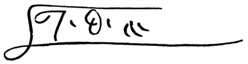
Facsimile of Prince Henry's Initial Signature. [I. D. A. = Iffante Dom Anrique.
hakluyt. s. i. v. c
AZURARA'S CHRONICLE
OF THE
DISCOVERY AND CONQUEST OF GUINEA.
CHAPTER XLI. How they took the ten Moors.
or that night there was no other agreement, save that each one took all the rest he could; but on the next day they all joined together to advise what they ought to do, for it was not a suitable place in which to take prolonged repose. And the captains, falling to talk about the matter, agreed among themselves that they should enter into their boats with certain of their people, and Luis Affonso Cayado as captain (who was to go along the shore), and that he should land with some of his men, leaving with the boats another in his place. Then he was to make his way by land with those men whom he took with him, and the boats were to follow after him a short way from the beach, while the caravels came two leagues behind, so as not to be discovered. And as they marched in this order they fell in with the track of Moors who were going into the Upland, and they went in doubt whether they should follow that track and go after them, holding that it might be a perilous matter to enter so far into the country where they had been now discovered, as they did not know the people that might be in the land. But their will, which was now burning to accomplish the affair, left no place to bare reason; and without more fear they went forward till they arrived at a place about three leagues further on where there were some few Moors, the which not only lacked courage to defend themselves, but even the heart to fly. And these were in all ten, counting men, women, and children.
CHAPTER XLII. How Alvaro Vasquez took the thirty-five Moors.
When those ten Moors had been brought off to the caravels, Alvaro Vasquez, like a man of noble birth, being desirous to show to all the others that he loved the service of his lord, spake with Dinis Eannes, to whom appertained the charge of the government for that day, saying that it appeared to him a good thing to order the people to go forth, since their coming from their own country was principally for that end. "How can you ask," said Dinis Eannes, "that we should again sally forth where we have been so often, insomuch that all this land has had warning of our presence? And of two things me seemeth that one would happen; either we should not light upon any Moors to take away, or we should encounter so many that it would be to our great danger to make an attack upon them; and so much the more as I am ill disposed for a fight by reason of weariness. Wherefore me thinketh it would not be well for us to sally forth again, as far as this land lieth, but that we should go onwards till we come to a place where we know well they could not be advised of us." And as they were going in accordance with that resolve, one part of the night being already passed, Alvaro Vasquez, still constant to his first design, came again to Dinis Eannes, and begged him to let him go on shore and entrust him with the charge of his captaincy, for that he knew many would go with him of right good will. "Inasmuch as this sally pleaseth you so greatly," said Dinis Eannes, "I only ask you that in your going you take good advisement that you bring no harm on yourselves nor sorrow on the rest of us." Then Alvaro Vasquez called Diego Gil, that other esquire of whom we spoke before, for he knew him for a brave man and one of his own upbringing; and they went through the other caravels in such wise that they gathered together those persons whom they thought sufficient for their safety. And all together they went on shore—there being yet some part of the night left for their march—but ere they had pressed on any farther, Alvaro Vasquez, wishful to admonish them, spake unto them thus. "Friends and Gentlemen, although I am not one of those three principal captains whom we brought with us from our kingdom, let it suffice that I am committed to you as captain by him who had the charge to command you. And because want of order is often a greater obstacle[A] than the multitude of the enemy, I desire first to know of you if it please you to have me for captain in this affair, that I may command you as men well pleased to receive governance; for much better were it that you should tell me now at this present, where we cannot well receive any harm, than when we are away from here, in some place where your disobedience might do hurt, not only to me, but also to every one of us in this company."
"We are all well content," said the others with one voice, "that you should be our captain, and well it pleaseth us to obey you as fully as any one of the other captains, and even better, if we can more perfectly do it."[B]
"Now," said he, "it seemeth well to me that we should go forward according to the same ordinance as on the other day, to wit, that I should go with some of you others along the land, and that the remainder should keep in the boats within call of us." And so, setting out and following the coast a good way, they fell in with a cape, to which they gave the name of St. Anne;[113] and immediately after that they lighted upon an arm of the sea which ran up into the land about four leagues, and appeared to them as though it were a river. And on reaching the entrance of the same, Alvaro Vasquez waited for the others in the boats, and when they had come up he bade them wait for him there, whilst he went along that water, for he conceived that if any people lived in that land it would be there. The others said that such an expedition would be very perilous, if only because the sun was already very high, and the heat of it was great, and they were very weary for the great lack they had had of sleep, and the toil of some in rowing, and of others in going on foot; and all the more because even if there were in that place a number of inhabitants, yet they could not make any good booty among them, because of necessity they would discern them from afar; and that if the natives perceived themselves strong enough to fight with them, they would await them, but if not, they could put themselves in safety quite easily. Alvaro Vasquez nevertheless pursued his journey as one who had determined to accomplish some great matter if his fortune were not contrary; and so, going forward about a league and a half, one of the company said to the Captain, "Methinks I see along this stream some rising objects like houses." The Captain looked attentively, and right well perceived that it was a village, and so it appeared to all the others who were there. "Now," said Alvaro Vasquez, "our booty is before our eyes, but it is so clearly discovered that of necessity we shall be seen before we can arrive at it; and because it doth not appear to me to be so great a settlement as that it can hold a people with whom we cannot cope, still, in order that we may achieve some sort of success, let each one run as fast as he can, and so let us stoutly fall upon them, and if we are not able to make captives of the young men, yet let us seize upon the old men, the women, and the little children, and let us take such advisement that whosoever putteth himself on his defence shall be slain without pity; and as to the others, let us seize them as best we can." And before he had quite finished these reasons, many of them began to increase their pace, while others were running as fast as they could; and the Moors,[114] like unwary people, little recking of such a danger, when their enemies came upon them, were all thrown into that confusion which the fortune of the case required. And when they saw men coming upon them so suddenly and so boldly, and armed with weapons quite strange to them, they were altogether amazed. Whereat our men took so much the greater boldness, seeing their timorous disorder, and at once began to seize upon as many of them as they could, and seeing that some sought to put themselves on their defence, they slew them without mercy. But the affair lasted not long at that time, for that the enemy soon began to fly. And there were many amongst them who then looked on their wives and children for the last time, and in a short space the booty would have been much larger if that arm of the sea had not been so near that many of them escaped into it, inasmuch as for the most part, not only the men but also the women and the children, all knew how to swim. And others who were bold and light-footed, trusting in their fleetness, escaped through all; though some were deceived in it, for they found others of our men who followed and captured them in spite of their lightness of foot, so that in all there were taken captive thirty-five, besides some that perished. Of a surety that Esquire who, as we have said, was their captain, found no little praise for that deed of his, since for a great space they discoursed of his energy and diligence, giving him thanks for the great toil he had undergone, as well for the service of the Infant as for the profit of them all in that journey. And, moreover, those who had stayed in the caravels were not a little glad at the coming of their partners with so good a profit, and this joy of theirs was much increased when they had heard in full measure the particulars of the adventure which the others had had.
CHAPTER XLIII. How they returned on shore, and of the Moor that they took.
Now the others who had remained in the caravels, seeing the toil of their partners, conceived that it would be to their great loss if they did not dispose themselves to some other matter as great, so that in future they should not receive dishonour. And so some of them joined together on the following night, and entering into their boats, they travelled two days and two nights and landed, but with all their great toil they were not able to capture more than one Moor; and with his guidance they set out to search for some three villages, which were a good way in the Upland. But they did not find in them anything that they could carry off, for they were already emptied of people, since the Moors who had fled had warned the whole country as far as their news could reach. And so they turned back to their ships, ill satisfied with the toil they had taken.
CHAPTER XLIV. How they sailed to the Land of the Negroes.
And now, perceiving that they could win no further profit in that land by reason of the advisement that the Moors had already received, the captains began to consult with the chief men of their ships concerning the manner of the action they should take.
"We," said some, "are not able, nor ought we to wait longer in this land, since we know that our stay brings no profit with it, but rather manifest loss, for we are wasting our provisions and wearying our bodies without hope of success. Wherefore it would be a counsel profitable for us, since God hath given us enough, that we should turn back to our country, contenting ourselves with the booty we have taken, the which is not so small that it will not be of value sufficient to compensate for our toils, and to save us from shame in the presence of our neighbours."
"Of a surety," replied others, "such a return would be shameful for such men as we are, for if we were to turn back in this wise it would be indeed an abatement of our honour; but let us go to the land of the negroes, where Dinis Diaz with one only ship went last year to make his capture; and even if we do nothing more than see the land, and afterwards give a relation thereof to the lord Infant, this would be to our honour.[C] Let us reach it, then, since we are so near, and though we accomplish but little, a great profit will be ours." All agreed that it was very well that they should go to that land, for it might be that God would then give them a greater success than they expected.
And so they hoisted their sails forthwith and pursued their voyage, and sailing on their course a space of 80 leagues they came near to the coast of Guinea,[115] where they made them ready with their boats to land, but when the black men caught sight of them they ran down to the shore with their shields and assegais, as men who sought to make themselves ready for battle; but although they showed so fierce a countenance, yet our men would have gone on shore if the roughness of the sea had consented thereto; and, far as they were from the shore, our men did yet perceive that it was a land very green, peopled by human folk and tame cattle, which the inhabitants of the land had with them for their use. And they would have gone further on still, but the storm increased upon them with much distemperature of the weather, so that they were forced to turn back without remedy.
CHAPTER XLV. How they forced their way upon shore.
Now that tempest lasted for the space of three days, and they were kept continually running backwards before a contrary wind, but after those three days were ended, that great tempest abated, and the weather became serene, when they had now come to the point where[116] they had previously captured the seven Moors; and on that day the captaincy happened to be with Mafaldo, and he waited for the other caravels to come up. And when they were all assembled in full day light, he came upon the deck of his ship and spake thus to the other captains: "You see right well that we are near to the place where we took the seven Moors, and you know that according to the track of those men which we lighted on, and the nets of their fishery, the land ought in reason to be peopled. Wherefore, if you think it well, I desire to go on shore and see if I can obtain any booty." And as you see that among many men there are always divers purposes, some began at first to say that such a sally appeared to them useless, since they had got enough wherewith to make their return to their own land, as they had already said before they set out for the land of the Negroes. Others again said that, forasmuch as the expedition was perilous, they ought to go by night and not by day.
"Now," said Mafaldo, "I am your captain to-day, and you are one and all bound to obey me as fully as you would obey the Infant our lord if he were present, and you may suppose that I do not love my life less than each one of you loveth his. Wherefore, my purpose is, notwithstanding your reasonings, to sally forth, for even supposing that the land be peopled it is not to be presumed that the Moors will be even now on the shore waiting for us. And if we go by day we shall have reason to see the country better, and know in what direction we have to go."
The others replied that it sufficed he was captain, for though the contrary opinion might be in favour with some of the company, it was necessary they should obey him; but they begged him to consider well the affair, for they would not turn back, no, not for any mishap that might befall them. The boats were at once lowered, and those who were to go forth were accoutred ready for starting, and, in fact, set out at once. They were in all about thirty-five men-at-arms, and as they went on their way towards the land, one of the men in the boats said to the captain, "I know not if you see what I do?" "And what do you see," said the captain, "that we do not?" "I see," said he, "as me thinketh, that those black things that are upon those banks of sand are the heads of men, and the more closely I look at them, the more it seemeth to me that I am right, and if you look narrowly you will see that they are moving." And the captain ordered the boats to stop still a little, whereat the Moors concluded that they were discovered, and forthwith they discovered themselves to the number of fifty men, apparelled for fighting, though with no other arms than lances. And when all had thus come forth, Mafaldo made his boats approach near to the shore, at which the Moors showed great pleasure, some wading into the water as high as their necks, and others lower, all of them desirous to get at the Christians. And when Mafaldo saw them thus on the beach, displaying a countenance of such hardihood, he signed to the other boats to draw near to him; and when they were all together he made them stop rowing, and began to speak to them in this wise: "Friends, you know the end for which we came forth from our country; how it was for the service of God, and of the Infant our lord, and for the honour and profit of ourselves, wherein by the grace of that great Lord who created all things, we have had a good enough profit of our booty without any danger to ourselves; yet all our honour is in being 500 leagues from our country in unknown lands, increasing our past victories with new adventures. And since God knoweth our good wills, He hath appointed us a place and time in the which we may gain an honourable victory; for you see before you those Moors with such pride, as if they held us in siege with great advantage to themselves and without hope of succour, provoking us, like men secure of victory over things already vanquished. And although they are more in number than we by a third, yet they are but Moors, and we are Christians, one of whom ought to suffice for two of them. For God is He in whose power lieth victory, and He knoweth our good wills in His holy service. But if we do not join battle with them it would be to our great dishonour, and we should make them full of courage against any others of our Law. Wherefore my counsel is, that the boats should all three together row straight among them, and then that each one should do the best he can."
"Your purpose," said the others, "is good enough and full of profit, but what are we to do if many more of their people are lying hidden? For just as these were lying in wait, so there may now be ambushed a much greater number of them unknown to us, and if there is a snare laid and we land, our perdition is assured." Others did not seek to correct these matters, but began to complain, saying that if they were always to reason thus, they would never do a single brave deed. "Is it right," said they, "to see our honour before our eyes, and to leave the matter thus through fear of a hap so doubtful? All the men opposed to us are not sufficient to withstand ten of ours in a fight. For they are but a handful of Moorish knaves, who have never learnt to fight except like beasts, and the first man to be wounded among them will frighten all the others, so that they will not know how to face our arms any longer. Bold indeed would be the men that have their armed ships in the Strait of Ceuta, and through all the Levant Sea, if they were to dread such a hostile gathering as this." These last reasons were well in accord with the will of the captain, and those that spake them were much praised of him.
Wherefore he commanded that in each boat three men should place themselves in the prow with lances and shields to protect themselves and those that rowed, if perchance they should be shot at by the Moors; and as soon as they should have rowed the boats ashore, these men were to leap out at once with their weapons. And he commanded the cross-bow men to keep their cross-bows charged, ordering their shots in such wise that their bolts should be employed to the best advantage. And after this he had the boats rowed as vigorously as possible, telling them to go bow forward among the Moors as had been before determined; the which matter was straightway put in action; and all shouting with a loud voice, "St. George," "St. James," "Portugal," leapt out upon them as men who feared little the valour of their enemies. And as if in a matter which God Himself willed to ordain, the Moors at the first onset at once discharged their arms, from which no Christian received any dangerous hurt; but, on the contrary, they proved of use later on, for our men possessed themselves of these arms and used them as if they had been their own.