VI. (continued 4)
Reading edition
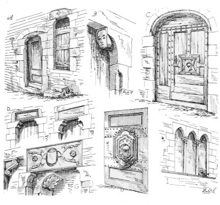
FIG. 222. DETAILS FROM ST PAUL-DU-VAR.
ancient shops. At almost every step one meets with the wide arch which contained both the door and window of the shop, the former being cut down to the door step, while the latter had the stonework built so as to form a sill about 2 feet high, on which the goods were exhibited. These sills are sometimes projected and moulded on the edge. At St Paul many of the shop fronts are now built up, but several are still in use (Fig. 223), and when piled up with their complex store of vegetables and fruits, mixed with the quaint and richly coloured jars of the country, present very tempting subjects for the artist. The street floor
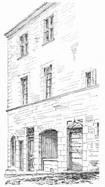
FIG. 223. OLD SHOPS AND HOUSES, ST PAUL-DU-VAR.
of the houses adjoining the north gateway (Fig. 226) is amongst the oldest and least altered examples. Numerous narrow lanes branch off the main street and descend by steps and arcades to the roads which run round the walls. In other cases arches are thrown across the street, and picturesque effects are thus produced (Figs. 225 and 227). Most of the buildings in the main street date from the time of Francis I. After the destructive invasion of Provence by Charles V., Francis found that his frontier in this quarter was insufficiently protected, and employed an engineer from Arles called Mandon to inspect the locality and fix on the best site for a fortress. Mandon chose the isolated hill on which stood the ancient town of St Paul as the best suited for this purpose; and it was accordingly fortified and surrounded with the walls and bastions which still subsist almost in their entirety. St Paul was thus raised into a place of some importance and security, and became the residence of a governor and several families of distinction. This no doubt led to the improvement of the architecture of which we have seen so many examples. Of the town houses of the governor and nobility some specimens still remain—one well preserved mansion of a somewhat later period is seen in sketch, Fig 225, and relics of others are also to be found, though in a sadly degraded and dilapidated state.
In the Maison Suraire (formerly Du Port), remains of ancient magnificence still exist in two richly decorated mantelpieces, of which Fig. 228 is one.
The original staircase of this house is also still in use; its richly-carved and ornamental balustrade of marble (Fig. 229) forming a strange contrast with its present humble position as an access to peasants’ houses. The mode of junction of the pedestals at the turn of the staircase by placing a boldly cut lion rampant between them is novel and effective.
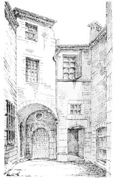
FIG. 224. SIDE STREET, ST PAUL-DU-VAR.
This house stands in the very diminutive and only little “place” in the town, where also is the fountain, and whence branches off the way to the church, which stands on the highest point of the site. The main street, and all the side alleys, are but continuations of the mule paths of the country, interrupted here and there with steps, and all too narrow to admit a cart or carriage of any kind. They are thus often so completely swept by the loads of firewood and brushwood on the mules’ backs, that passengers have to seek shelter in the recesses of the doorways. The walks round the walls are in part wider, and the small gardens of the houses sloping down to them, with the dark foliage and golden fruit of their orange groves, form a fine foreground to the lovely prospects visible in every direction.
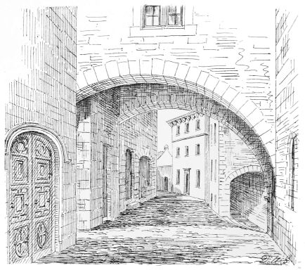
FIG. 225. MAIN STREET, ST PAUL-DU-VAR.
The gateway (Fig. 230) at the entrance to the town from the north has an older character than the fortifications of Mandon. This gateway seems to have formed the ancient entrance through a square tower placed for defence on the neck of land which joins the promontory to the mainland. It presents the same character as the square gate towers of Avignon, having a plain pointed archway and portcullis groove on the exterior, defended by a machicolated parapet above, the interior of the tower being left open towards the town, so that, if captured, it could not be turned to account against it (see Fig. 226).
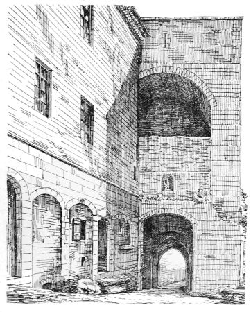
FIG. 226. INTERIOR OF N. GATEWAY, ST PAUL-DU-VAR.
This tower has been incorporated by Mandon in his works, and is strengthened externally by a bastion with another portcullis, and a narrow passage commanded from above.
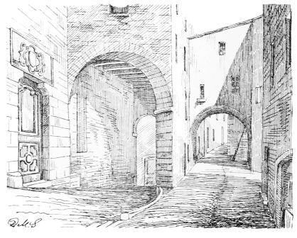
FIG. 227. MAIN STREET IN ST PAUL-DU-VAR.
But St Paul possesses memorials of a much older time even than this fourteenth century tower, in the ancient church and keep which crown the summit of its rocky site. The church is a small but remarkable monument. Externally the west front (Fig. 231) shews a central portion of plain ashlar work, with a simple pointed doorway, and a small pointed window above. There are also some corbels remaining, which probably supported the wall plate of the lean-to roof of an outer porch or narthex. The adjoining walls at the sides, and above the corbels, are all evidently much more modern than the central portion. The lofty square tower attached to this front appears, from an inscription it bears, to have been erected in the seventeenth century. On entering the building, the lowness of the central nave (Fig. 232), and the extreme simplicity of its construction and vaulting, are seen to correspond with the style of the central part of the exterior. The plain character of the whole recalls the work of the early Cistertian school. The church has probably been originally a simple nave, like Fréjus on a small scale. The aisles appear to have been added afterwards, the side walls having been cut through to give access to them (see Plan, Fig. 233). But so devoid is the building of ornament or features whereby a date may be determined, that the aisles may possibly have been original, although altered at a later date. The vaulting of the aisles, with its rounded or octagonal ribs, is certainly of more recent date than the plain intersecting vault without ribs of the central nave.
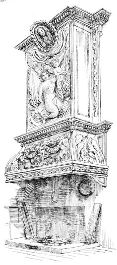
FIG. 228. CHIMNEY-PIECE IN THE MAISON SURAIRE, ST PAUL-DU-VAR.
Close to the church stands a very interesting example of the tower-built keeps of the Maritime Alps (Fig. 234). It is similar in general character to those of the Mont
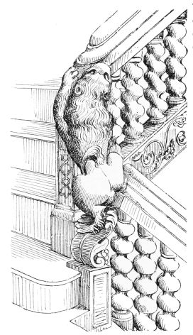
FIG. 229. STAIRCASE IN THE MAISON SURAIRE, ST PAUL-DU-VAR.
du Chevalier, Grasse, and Antibes, but has some peculiar and remarkable features of its own. The original masonry is of the usual rough-faced kind, but it has been repaired in several places with work of a smoother description. The top has evidently been modernised, and is covered with a tile roof instead of the proper crenellated parapet. Windows of an antique character are provided to light the apartments on the upper floors, instead of mere square holes in the wall like those of the Tour du Chevalier. Indeed, this keep seems to have been more of a habitation than the others we have met with, and was apparently connected with an ancient building of the same description of masonry, a few remains of which are visible to the left in the sketch. But the most remarkable features about this tower are the entrances and their defences. The lowest doorway is on the first floor level.
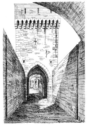
FIG. 230. NORTH GATEWAY, ST PAUL-DU-VAR.
It is semi-circular and is now built up. This doorway seems to have given access only to a guardroom on the first floor, from which the vaulted basement would be entered in the usual manner by an aperture in the floor. At the level of the doorway there was evidently a wooden platform projected outside of the door, from which a wooden overhanging stair led up to the chief entrance to the principal apartments of the keep on the floor above. The stone-work shews a projecting ledge at the line of junction of the wooden stair with the wall. The corbels, which supported a level platform above this stair, still remain, and it will be observed that there is no corbel opposite the place where the stair would pass through, as no floor would be required at that point.
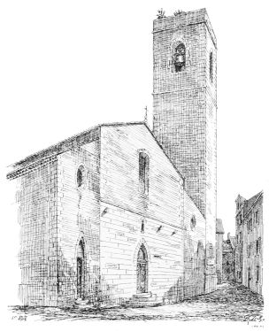
FIG. 231. WEST END OF CHURCH, ST PAUL-DU-VAR.
The two string courses on the next floor were no doubt inserted, one for the purpose of carrying the struts of a sloping roof, and the other to cover the junction of the roof with the stone-work. Although partly cut away, these strings are yet fairly preserved. The sloping roof
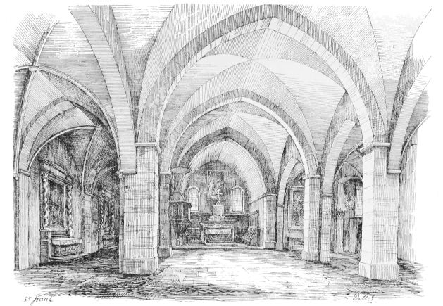
FIG. 232. CHURCH OF ST PAUL-DU-VAR.
would cover the wooden gallery or hoarding which, we have seen, protected the principal doorways and staircase.
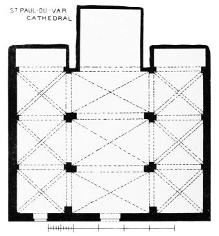
FIG. 233. PLAN OF CHURCH, ST PAUL-DU-VAR.
The outer approaches to this keep were thus most carefully defended. An assailant, who managed by scaling ladders to get up to the first floor or guardroom level and overpower the guard, would find no access from the interior to the upper floors. To reach these he would have to climb a steep stair, enclosed within a wooden casing with trapdoor shut, and would thus be exposed to attack with all kinds of missiles from the platform above, where the defenders stood within the shelter of their projecting hoarding or gallery.
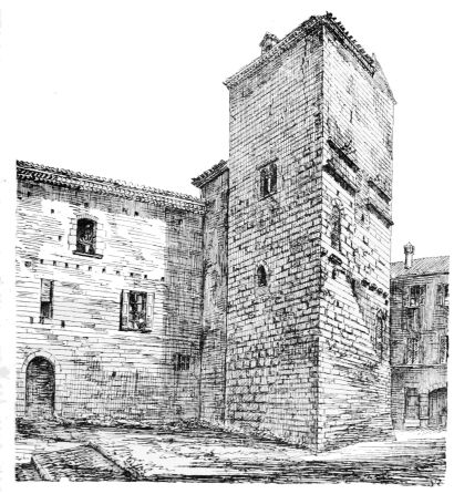
FIG. 234. TOWER OR KEEP, ST PAUL-DU-VAR.
A somewhat similar wooden balcony for the defence of the doorway existed at Preston Tower in Scotland, but so far as we have observed, that of St Paul is quite unique in the Riviera. The refinement shewn, both in the defensive features and in the windows of this tower, indicate a somewhat later date than those of Cannes or Antibes. The defensive works here correspond with the hoardings so common in France in the thirteenth century, such as those at Carcassonne and Aigues Mortes.
Vence.—A walk of about three miles along a good road gradually ascends from St Paul to Vence on either side of the Malvan Valley. That on the eastern side is the nearer, if the direct old mule path is taken about a mile from Vence, instead of the carefully engineered but winding modern roadway. Should the visit be made in December or January, a fine opportunity will probably present itself of witnessing the olive harvest on the way. Large sheets are spread out into which the ripe blackberries are showered down by shaking the branches. Men, women, and children all unite to expedite the work, and help to gather up the fruit which may have dropped upon the ground.
The road on the western side of the valley is more winding than the other, in consequence of a great gorge in the rocky mountain side having to be compassed and crossed. The descent to the point, where bridging it is practicable, also adds to the length and steepness of the ascent to the town. But the rugged way is interesting, the rocks being full of natural caves, evidently the result of the waves of a previous geological epoch. The town consists of two distinct parts—the old town enclosed within a circular or oval enceinte (now represented by a line of houses), and a circle of houses built outside the ancient ramparts. The position of the latter is now occupied by a wide street or boulevard running all round between the old and new divisions. One or two ancient gateways (similar to that of Mougins, Fig. 182) are still preserved, but they are small and unimportant. In the narrow streets specimens of old shop fronts, like those of St Paul, may be detected here and there, and in the newer part of the town some fair Renaissance designs are observable in the houses, that of the Hôtel de Ville being the finest.
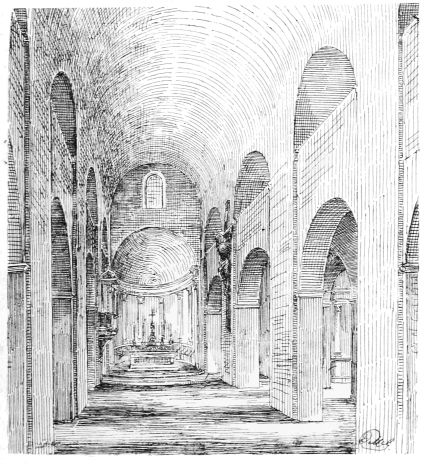
FIG. 235. VENCE CATHEDRAL.
Vence is a very ancient city. It was the Ventium of Roman times, of which period numerous inscriptions and relics are preserved and built into the northern wall of the cathedral. In mediæval times Vence was originally the see of a bishop, but was afterwards joined to that of Fréjus. The town suffered the usual casualties from the attacks of the Saracens and assaults during the wars of
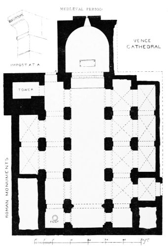
FIG. 236. PLAN OF VENCE CATHEDRAL.
religion. The cathedral, which is evidently very old, is supposed to have been rebuilt after the destruction of the original one by the Saracens in the ninth or tenth centuries. Owing to the simplicity of its style internally (Fig. 235), it has a most archaic appearance. Unfortunately, the exterior cannot be well seen in consequence of the chapels, houses, &c., which are built against it. Originally the church has consisted (Fig. 236) of a central nave 18 ft. 6 in. wide, with two side aisles each about 10 ft. wide. The chapels shewn projecting beyond the aisles are comparatively modern, and are lighted from the roof. The nave piers are (as regards design) simply portions of the side walls left standing, while the remainder is omitted so as to form round arched openings into the aisles. The side aisles are carried (as was often done) to a sufficient height to abut the central vault of the nave, and are divided into two storys—the upper story being a gallery—an arrangement very common in Lombardy and Germany. A more total absence of anything like ornament can scarcely be conceived. This plainness, taken in conjunction with the somewhat similar work at St Paul’s, seems to indicate that the design here owes its origin to the reign of the early Cistertian principles in the twelfth century. The choir and the tower at the north-east angle (Fig. 237) are evidently of a more recent date. The choir, with its circular apsidal termination, internally, converted into a square east end externally, is somewhat remarkable. It may be observed that the eastern termination of the churches of Antibes and St Paul are also square externally. There is a certain Italian character about the east end of Vence Cathedral with its single very small pointed window and its cornice enriched with modillions. The impost of the eastern door (Fig. 236) is also quite Italian, and judging from the style of this part of the church, it probably belongs to the thirteenth century.
The campanile adjoining the church likewise recalls those of the Italian cities. At Vence, as at Antibes, there are two such towers or keeps for defence, one being
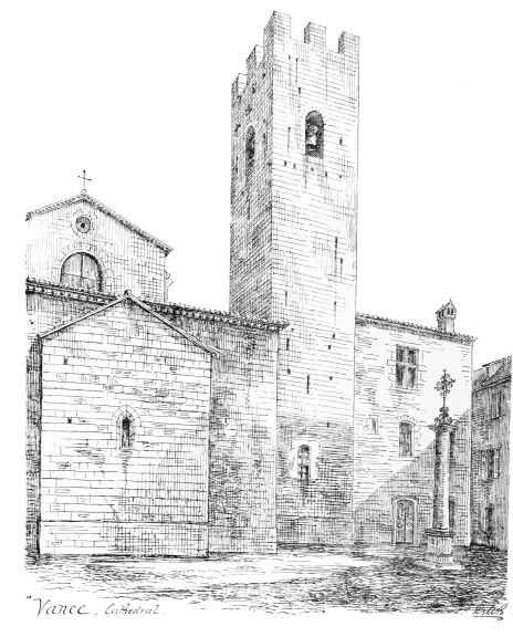
FIG. 237. EAST END, VENCE CATHEDRAL.
attached to the church, while the other was formerly connected with the castle, and now with the Hôtel de Ville (see Fig. 242). The ground floor of the former tower enters from the church, and forms a chapel where are deposited two very finely carved Gothic doors, which no doubt once served as the doors to the church. The font (Fig. 238) stands in a small chapel at the west end. Its design is peculiar and striking, and it is said to be very ancient. Adjoining the cathedral on the north are some ruinous remnants of the bishop’s palace, now converted into other uses (Fig. 239). In the “place” at the east end of the cathedral (see Fig. 237) stands a granite column raised on a pedestal, and said to have been the gift of the city of Massilia to her sister of Vence. In the same place some picturesque fragments of old houses are still preserved (Fig. 240), the late Gothic doorway on the right being given on a larger scale in Fig. 241.
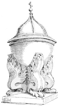
FIG. 238. FONT, VENCE CATHEDRAL.
There are several small “places” in the old town all containing a few relics of olden times. The tower of the Consuls (for Vence, like the other towns in the province, had her consuls and an independent government), has already been mentioned, and is shewn in Fig. 242, adjoining a gateway leading into a “place” with a fountain on one side, and the Hôtel de Ville on the other. This tower is of the same style of masonry as those we have met with in other towns, but it is now cut up into shops and houses, and has lost its primitive features.
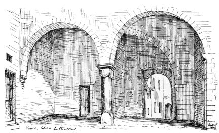
FIG. 239. BEHIND CATHEDRAL, VENCE.
From the wide terrace in front of the Hôtel de Ville, a magnificent view is obtained of the mountains to the northwards. At the base of their lofty precipices the ruins of the Commandery of St Martin may be observed. It seems to be a very short way off, but is found to be a good half hour’s walk and a stiff climb. However, the trouble is repaid, for the view presented, when the lofty point on which the Commandery stands is attained, is magnificent, extending over Vence, St Paul, and Cagnes to the sea, and embracing the whole coast from the Cap d’Antibes to the headlands beyond Nice. The Commandery itself is a shapeless ruin (Fig. 243). The eastern wall and the great gateway, with its wide machicolation in the style of the Pope’s palace, are the only parts sufficiently entire to
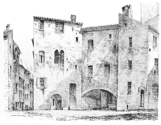
FIG. 240. ANCIENT HOUSE, VENCE.
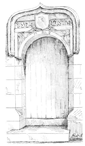
FIG. 241. DOORWAY IN VENCE.
give any indication of the nature of the buildings, which from these seem rather to have resembled a castle than a monastery. This was the chief house of the Templars in the district, and overlooked numerous and extensive lands with which the order was enriched. The tower of La Trinité, as already mentioned, formed one of the outlying forts of the Templars, and is well seen from the Commandery. When violent hands were laid upon the order by Philip the Fair, Hugorian was Master of St Martin-les-Vence. He was seized in 1308, and carried off to prison in Tarascon. This country was then under the dominion of Charles II. of Naples and Duke of Provence, whom Philip had persuaded to join in the destruction of the Templars. But in Provence the greater number of the Knights were allowed to escape, only forty-eight in all being captured. Their lands were chiefly bestowed on the Knights Hospitallers, who thus acquired great possessions in this part of Provence.
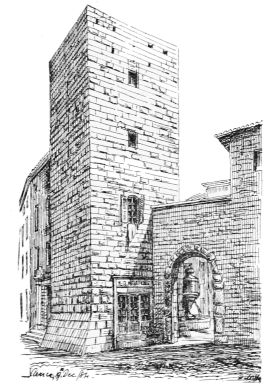
FIG. 242. TOWER OR KEEP OF THE CONSUL, VENCE.
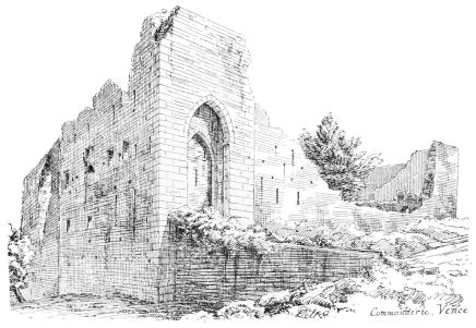
FIG. 243. COMMANDERY OF ST MARTIN-LES-VENCE.
A short railway journey conducts from Vence-Cagnes to Nice, across the Var, the “dyke” or wall which keeps the floods of this impetuous river within bounds being one of the most notable of French Engineering Works. The existing town of Nice is almost entirely modern. The streets, with their rows of shops and lines of trees, look like a small piece of Paris transported to the south. The wide promenade des Anglais by the shore, however, commands a prospect which nothing in Paris can match. The old town, with its narrow streets crowded round the port, is of ancient origin, being one of the original Phocæan colonies, and in the modern “Nice” may still be recognised its original Greek name of Nike (victory). But it became a place of secondary importance under the Romans, who made Cemenelum, an ancient town of the Ligurians on the hill which overlooks Nice from the north, the chief city of the Maritime Alps, to which Nice acted merely as the port. Being so near the frontier, both Cemenelum and Nice were exposed to attack on all hands, and suffered severely from the invasions of the Barbarians. In 578 the Lombards destroyed the strong city of Cemenelum or Cimiès, an event which, to some extent, restored the ancient importance of Nice. In 617 Nice joined the other towns of the coast in a league to free themselves from the Frankish kings. The town was frequently attacked by the Saracens, and more than once taken and destroyed. But after the Moors were driven from the Great Fraxinet in 975, the inhabitants of the town were comparatively free from their inroads. Although Nice stoutly defended her independence, she was, like the other towns of Provence, forced to yield to the Counts of Provence, who rebuilt the Castle both as a defence and menace to the inhabitants. Charles of Anjou was greatly indebted to Nice for ships to enable him to carry out his designs upon Naples. The incessant struggles between the powerful Nobles in the neighbourhood, the Grimaldi of Monaco, the Lascaris of Tende, and the Dorias of Dolce Aqua devastated the land, and brought famine and plague in their train. In the wars which followed the death of Queen Jeanne, the Niçois took the side of Ladislaus of Hungary, and called in the Count of Savoy to aid them against the King of Naples. Under the protection of Savoy, Nice soon regained her prosperity. The Counts of that house strengthened the Castle by every means in their power, and for this purpose the ancient Cathedral and Bishop’s Palace were removed.
In the sixteenth and seventeenth centuries Nice was exposed to damage from the armies both of the French and the Emperor, and suffered severely—so much so that the merest fragment is all that remains of the ancient castle
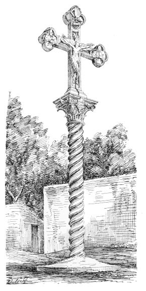
FIG. 244. CROSS AT CIMIÈS.
which gallantly withstood so many sieges, and not a single ancient building is preserved.
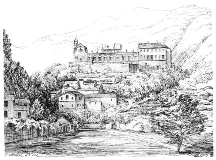
FIG. 245. CASTLE OF ST ANDRÉ, NEAR NICE.
The environs of Nice, although full of natural beauties, are remarkably destitute of architectural interest. The few Roman relics at Cemenelum have already been described. Near these is an old convent, where from the churchyard a fine view of the lofty and rugged banks of the valley of the Paillon (which runs through Nice) may be obtained. In the Parvis in front stands a remarkable cross (Fig. 244), bearing the image of the crucified seraph who appeared to St Francis of Assisi. The cross bears a quatrefoil on each of its three upper points, with the figure of a Bishop and a Monk carved in the side quatrefoils, and that of the emblematic Pelican on her nest feeding her young in the top quatrefoil. The cross is supported on a twisted marble shaft, some 9 or 10 feet high, having a composite capital, containing a shield bearing the arms of the founder. An inscription runs along the abacus, in which 1477 is legible. This date quite corresponds with the character of the design.
Descending by a steep mule path from the height of Cimiès to the valley of the Paillon past some great monasteries, or similar establishments, including that of St Pons, all surrounded with walls and studded with cypresses, we reach the high road. Following this road for three miles up the valley brings us in view of the Castle of St André, the sketch of which (Fig. 245) gives some idea of the nature of the scenery. Passing through the village of St André, and penetrating a short way further up the gorge of the torrent of the same name, Falicon is reached, famous for its grotto and natural bridge. The view looking back upon St André (Fig. 246) is strikingly picturesque.
From Nice the railway proceeds eastwards by a long tunnel under the ridge, formerly dominated by the old Castle, on emerging from which we find ourselves in one of the most charming scenes in the Riviera, the land-locked bay of Villefranche. On the margin of this sheltered and beautiful arm of the sea stands the old “Free-town,” surrounded with fortifications, and reflected in the quiet waters, on which, too, there are generally afloat one or two majestic representatives of foreign fleets. Between this and Monaco the railway passes along the narrow strip of shore which lies between the sea and the lofty precipices of tertiary limestone which here tower above it. At one of the sharp turns round the rocks, a first distant glimpse is caught of the old town and Castle of Eza (Fig. 247), set like an eyrie on the summit of its bare and lofty pyramidal peak. There is a railway station at the base of the mountain, and one feels tempted to alight and scale
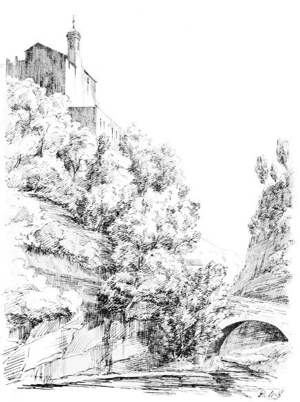
FIG. 246. ST ANDRÉ, NEAR NICE.
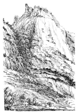
FIG. 247. EZA, FROM THE RAILWAY STATION.
the height, the buildings look so enticingly picturesque. But it is no easy task; there is scarcely any track for part of the way, and when visible, the path is rough and full of running stones, as well as steep and winding. One is glad to take a rest occasionally, and enjoy the various fine views of the town on its lofty pinnacle, and the extensive seaboard visible from this elevation. Fig. 248 gives some idea of the character of one of these prospects. When at last the ascent is scaled, the result, as regards the architecture, is, it must be confessed, on the whole rather disappointing. The entrance gateway to the town is interesting from the remarkable and strong way in which its defences are
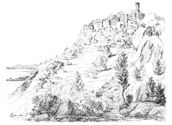
FIG. 248. EZA (from E.)
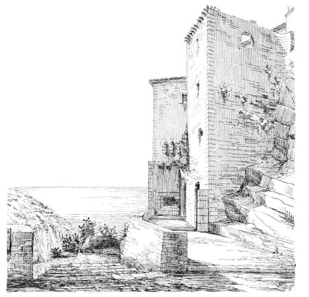
FIG. 249. APPROACH TO THE TOWN GATE, EZA.
arranged. The outer approach (Fig. 249) is by a passage faced by a cannon port-hole. From this access a gate at right angles leads to a second narrow enclosed passage commanded by a machicolated tower, through which a winding and ascending vaulted way conducts into the town (Fig. 250.)) The view of the interior of this gateway is very picturesque (Fig. 251.)) The town itself consists of a few narrow tortuous lanes bordered by decaying houses, chiefly tenanted by donkeys, pigs, and poultry. On the top of the bare rock, and approached by great steps cut in the solid limestone, a few scanty and unintelligible fragments of the castle are yet visible, but the greater portion has been entirely swept away.
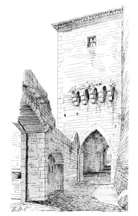
FIG. 250. ENTRANCE GATEWAY TO TOWN, EZA.
Eza was the Arisium of Antonine’s Itinerary, and it formed, like Gourdon, during mediæval times, a pretty secure retreat from the assaults of the Corsairs. The castle was, however, demolished by the Turks under Barbarossa in 1543. The arcaded tower house, and the door lintel, shewn in Figs. 252 and 253, were the only objects of architectural interest discoverable in the place.
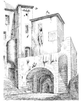
FIG. 251. INTERIOR OF ENTRANCE GATEWAY, EZA.
Between Eza and Monaco the railway continues to run along the base of the immense cliffs which overhang the sea, or through the frequent tunnels which penetrate them. One station short of Monaco we arrive at that for La Turbie; from which, by a very steep and zig-zag path, one may ascend the bare and nearly vertical hill above the railway, whence a pleasant walk of a mile or two through the pine forest leads to the town of La Turbie. This elevated situation is, however, more easily approached by a long well-paved but steep mule-path from Monaco. The
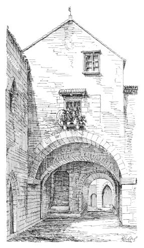
FIG. 252. HOUSE IN EZA.
monument to Augustus, which here marks the limit between Gaul and Italy, has already been described (ante, p. 87). This monument has provided a quarry, out of which the more important buildings of the town have been constructed. This is apparent from the great size of the stones used in the erection of the outer gateway to the
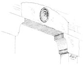
FIG. 253. DOORWAY IN EZA.
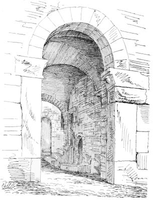
FIG. 254. OUTER SOUTH GATEWAY, LA TURBIE.
south (Fig. 254.)) Passing through this archway, an inner encircling street is entered, from which another picturesque and pointed gateway (Fig. 255) gives access to the centre of the town. There is also a third gateway of pointed form, with a long machicolation over it at the eastern entrance (Fig. 256), and some further fragments of the olden time are to be seen in the streets (Fig. 257). The great trophy of Augustus, from which the place derives its name, was converted in mediæval
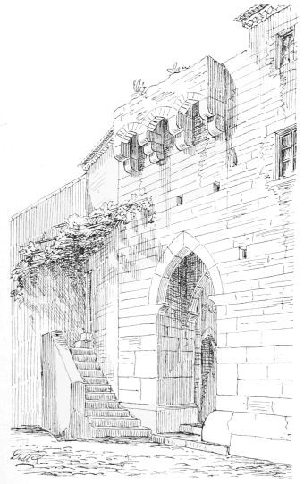
FIG. 255. INNER SOUTH GATEWAY, LA TURBIE.
times into a fortress, when the upper part has been rebuilt. The double tier of pointed arcade-ornaments (Fig. 32), which formed the support of the parapet, have quite an Italian character. They remind one of the similar ornament on Grasse Cathedral. This tower was blown up by Marshal Villars at the end of the seventeenth century.
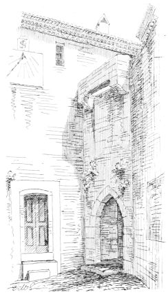
FIG. 256. EASTERN GATEWAY, LA TURBIE.
In descending by the steep and well-paved footpath from La Turbie to Monaco, delightful glimpses are obtained from amongst the luxuriant olives and citrons of the latter town on its isolated rock. Most of the towns on the sea-board have a prominent rock for their site, but that on which Monaco is built is the most detached and sea-girt of them all. It is of considerable height, and has perpendicular faces on all sides. On three sides these plunge sheer down into the sea, and on the fourth or northern side of the peninsula the precipitous rock is only joined to the mainland by a narrow strip of low-lying sandy beach. On the inaccessible platform above these precipices stands the ancient town, surrounded with its walls and bastions, and giving shelter and protection to the quiet harbour on its eastern flank. Of all these features we have a commanding prospect as we descend from the heights of the Cornice road, which passes by La Turbie.
The history or traditions of Monaco extend further back than those of most of the localities of the Riviera. It derives its name from Hercules, who is supposed to have touched here on his way into Spain, and to have gained a great victory over the native tribes. Hence the name of Portus Herculis, by which the place was known in the early centuries of our era. This was afterwards changed to Portus Herculis Monœci, and finally into Monaco. The rocky fortress subsequently fell into the hands of the Saracens, who are said to have been expelled from it in the tenth century by the same Grimoald or Grimaldi who dislodged the Moors from the Grand Fraxinet, and whose successors became the Princes of Monaco.
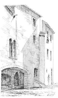
FIG. 257. HOUSES AT LA TURBIE.
In the eleventh century the place seems to have been abandoned, and in 1162 the Emperor Frederick I. presented it to the Republic of Genoa, who took possession, and rebuilt the fortifications in 1215. During the struggles of the Italian Republics, and the wars of the Guelphs and Ghibellines, Monaco several times changed hands, but was most frequently in the possession of the Grimaldi, and sometimes became the shelter of bands of pirates who scoured the Mediterranean. The Grimaldi sided with the French in the Italian wars of Charles VIII. and Louis XII., and through the influence of the latter became the governors of the whole of the Western Riviera.
During the struggle between France and Spain in the sixteenth and seventeenth centuries, Monaco was alternately under the protection of each. The boundaries of the principality then included Mentone and Roquebrune, but in 1848 Mentone declared itself a free town. Since the annexation of the county of Nice by France, the principality, which is about three miles long by about half a mile wide, is entirely surrounded by the French Canton of “Menton.”
A comparatively easy drive to the town has now been made up the east side of the rock, but the original approach was by a steep flight of steps, carefully defended with strongly fortified gates, and commanded by the battlements above (see sketch, Fig. 258). The existing works at this point are evidently of the seventeenth century. The north side, which overlooks the mainland, was fortified with a large circular bastion at the western angle (Fig. 259), and a square one at the eastern angle. The former still retains some of the large corbels which carried the original parapet of the fifteenth century; but the bastions have been heightened and made suitable for artillery at a later date. On arriving at the top of the entrance to the town, a wide open staircase ascends to the front of the Ducal Palace (Fig. 258). This edifice is a picturesque assemblage of buildings of several dates, chiefly of the Renaissance period. Some of the old towers retain their forked battlements, a form common in the North of Italy. The whole place is vast and palatial, and from its lofty site and splendid background, composed of a rugged mountain called the Tête de
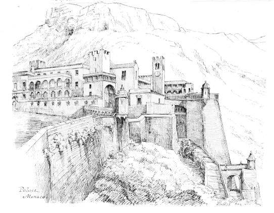
FIG. 258. DUCAL PALACE, MONACO.
Chien, has a noble and impressive appearance. The courtyard of the palace is also a fine though somewhat peculiar specimen of Italian design, the fresco paintings on the walls giving it a rich and southern aspect.
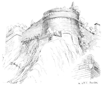
FIG. 259. DUCAL PALACE, MONACO (N.W. Bastion.)
The town consists of three parallel streets, and contains some good bits of old work. A large new church in the early Romanesque or Provençal style of architecture has recently been erected. The old church contained specimens of capitals, and other details very similar to those of the lower arcade in the Castle of St Honorat. The gardens of the palace, which extend round the western side of the rock, where every chink and crevice is filled with fig trees, aloes, pears, and palms, form a delightful promenade; and the views from the walls towards Monte Carlo and Mentone,
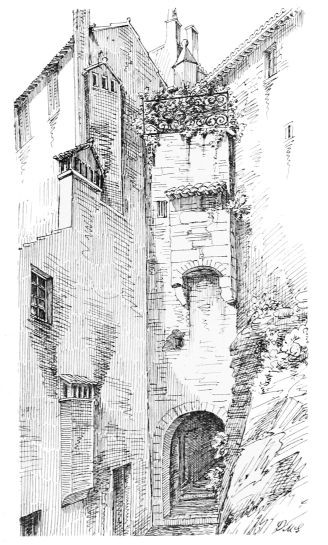
FIG. 260. ENTRANCE TO TOWN, ROQUEBRUNE.
with the mountain ranges behind them, are most charming. Only a few miles off (about an hour’s walk) the remark remarkable town of Roquebrune is seen embosomed in orange groves on the slope of the mountain. The ascent from the railway station is by a steep and narrow path, which penetrates into the town by a long vaulted and stepped passage, the entrance to which is through a small arched gateway, defended by a wide overhanging machicolation (Fig. 260). The church of St Margaret is then reached, in which the old font (Fig. 261) is worthy of note. The peculiarity of this town arises from the huge masses of rock which stand up amongst the houses, and at a short distance present the appearance of a great castle. These give the town its name, and one of them, larger than the rest, is actually crowned with the remains of the ancient fortress of the Lascaris (Fig. 262), which, however, is now but an empty shell. One or two open “places” amongst the great rocks form beautiful terraces, commanding fine and extensive prospects.
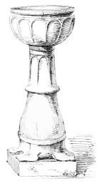
FIG. 261. FONT, ROQUEBRUNE.
The railway, after leaving Roquebrune, sweeps round the Cap Martin, and enters the bay of Mentone, which is only about four miles off. This town, like all the others on the coast, had its castle on the summit of a promontory which juts out into the sea, and divides the coast into two portions, called the eastern and western bays. The Counts of Ventimiglia and the Genoese had, at different times, possession of the town and castle, but it was for the most part an appanage of Monaco, and followed its fortunes. In 1848 the inhabitants formed themselves into a free Republic, and enjoyed autonomy for thirteen years, after which Mentone became the “chef lieu” of a French Canton. The town was at one time surrounded with walls, which rose straight up from the sea. It thus completely occupied
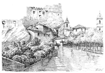
FIG. 262. ROQUEBRUNE CASTLE.
the narrow strip of land between the shore and the hill on which the castle stood, and barred the way along the coast. The eastern gate of the town, and the “Long Street,” which is also a very narrow one, leading through it, still remain, but a new and wider roadway, which forms part of the Cornice Road, has been constructed along the back of the houses in the eastern bay, and now encloses the harbour on the side next the town. An old square tower at the extreme point of the promontory is one of the few relics of the fortifications of the town. Above the “Long Street” the houses are built in terraces, rising rapidly tier above tier on the hillsides, and approached by long flights of steps and narrow vaulted lanes. In the midst of these stand the churches, buildings of the seventeenth century, of clumsy character. The towers and spires, however, form a picturesque group (Fig. 263); and along with the houses, as seen from the harbour, together with the magnificent background of lofty and partly snow-clad mountains which shelter Mentone on the north, they compose a splendid picture.
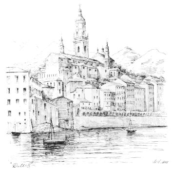
FIG. 263. MENTONE (from the Harbour).
The old castle which formerly crowned the summit, has been entirely demolished, and its site is occupied as a cemetery, from which very fine views are obtained both of the coast line and of the mountains on the north. Numerous narrow valleys and gorges run up from the sea towards the mountains, forming beautiful and interesting promenades and excursions, but there is little to attract the student of architecture.
At Gorbio, beautifully situated about five miles from Mentone to the west, and some distance up a charming valley, there are an old church with a dark nave, and the remains of a castle of the Lascaris. The houses here are united by arches thrown across the narrow streets, an arrangement very common in this district, and supposed to be for the purpose of resisting to some extent the effect of earthquakes.
Ste Agnès, not far from Gorbio, is also a favourite excursion. It is a lofty and beautiful spot, with the remains of an old castle said to be of Saracenic origin.
The ascent to Castellar forms another delightful walk of about an hour and a-half, giving a fine idea of the richness of the valleys of Mentone in lemons, in the growth of which they excel every place north of Palermo. The town of Castellar is of some extent, and its situation on a “col” at the top of a steep ascent is fine, but there is no architecture of importance. It is clumsily built, and has been at one time surrounded with walls, which now form the exterior of houses. Some remains of ditches and towers—one of the latter being converted into the belfry of the church—also still exist.
About a mile eastwards from Mentone the Cornice Road crosses by the bold arch of the Pont St Louis the ravine which now forms the boundary between France and Italy. Since 1861 the limits of France have been extended considerably further eastwards than in ancient times, when La Turbie marked the boundary of Gaul. In the course of our journey we have observed that as we approach the frontier, the towns possess a good deal of the Italian character, and that both historically and architecturally they have much in common with Italy. The architectural styles of France and Italy were observed to overlap each other in the district we have just examined. But when we pass the modern boundary of France at the Pont St Louis, we may
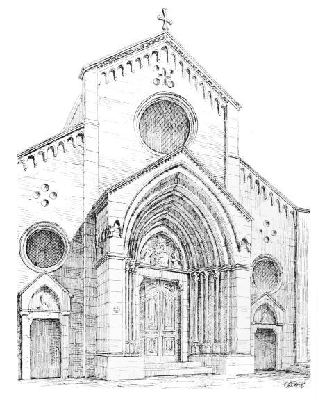
FIG. 264. WEST PORTAL OF CATHEDRAL, VENTIMIGLIA.
be said to have left nearly all trace of French and Provençal architecture behind, and in our further progress eastwards we shall meet with almost nothing which is not entirely Italian in style. We shall therefore in concluding our journey give only a rapid sketch of some of the more important buildings between Mentone and Genoa.
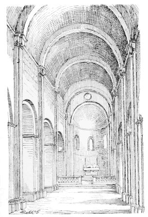
FIG. 265. INTERIOR OF CATHEDRAL, VENTIMIGLIA.
The railway eastwards from Mentone follows the coast line, and cuts through some lofty rocks at the mouth of the
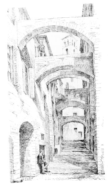
FIG. 266. STREET IN DOLCE AQUA.
torrent of St Louis, famous from containing the caves in which have been discovered human remains, associated with the bones of extinct animals, such as the mammoth, the great bear, the elk, &c.
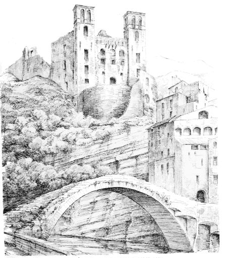
FIG. 267. CASTLE OF THE DORIAS, DOLCE AQUA.
About seven miles from Mentone, the line passes
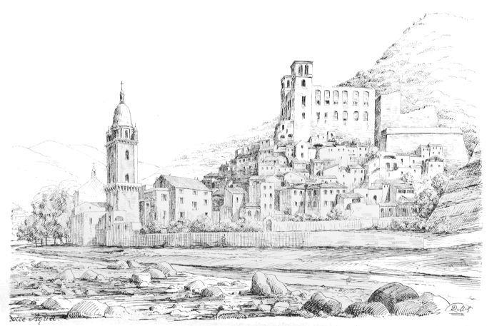
FIG. 268. DOLCE AQUA (from the S.W.)
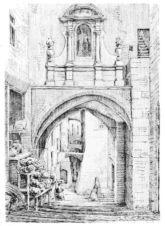
FIG. 269. STREET IN SAN REMO.
through a tunnel, on emerging from which the frontier town of Ventimiglia is seen towering above the plain of the river Roya. It stands on a bold rocky headland, defended on one side by the sea, and on the other by the river. Like all border towns, its possession was constantly disputed by the neighbouring suzerains, and it endured many sieges, but was generally under the authority of the town of Genoa. The streets are narrow and tortuous, and have the usual picturesque staircases and arches. The porch of the cathedral seen in the sketch (Fig. 264) is old, and is decidedly Italian in character, but the rest of the front is modern. The interior again (Fig. 265) might be a Provençal Cistertian design, such as that of Thoronet.
Two miles eastwards from Ventimiglia, the valley of the Nervia opens to the left. An easy and agreeable walk of about five miles up the valley leads to the very quaint old town of Dolce Aqua. On the way we pass through the decaying but picturesque town of Campo Rosso with an open “place” lined with arcaded footways.
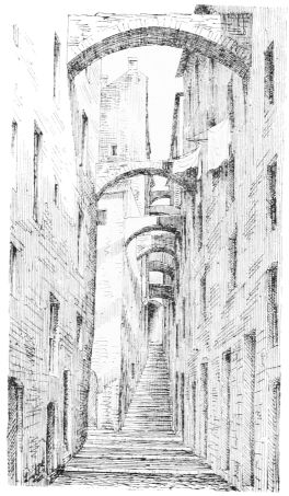
FIG. 270. HOUSES IN SAN REMO.
The most ancient part of Dolce Aqua lies on the left side of the river, which is crossed by an old bridge of one span, having the roadway stepped up on each side, and showing traces of old fortifications. Above this the houses rise in tiers, forming a dense and confused labyrinth of narrow lanes and dark tunnels—many of the former
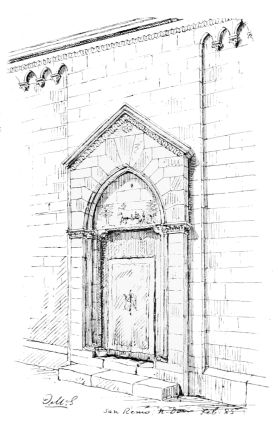
FIG. 271. SAN SIRO, SAN REMO (N. Doorway).
crossed by strengthening arches thrown between the houses on each side (Fig. 266). Dominating the whole stand the proud ruins of the castle of the Dorias (Fig. 267), a family famous in the history of Genoa and the Riviera. It is a building of a late date (seventeenth century), and has been defended with great bastions mounted with cannons (Fig. 268), surrounded with walls, and provided with a drawbridge. The castle has evidently contained large and sumptuous apartments, but the interior is now reduced to total ruin. The town has also been provided with fortifications, of which one tower near the river has been appropriated and heightened into a church steeple (Fig. 268). The castle has been abandoned since the wars of 1748, and the descendants of the Dorias now occupy a mansion, situated under the walls, in which there is a finely carved chimney piece, and an interesting collection of family portraits. The town of Pigna, about ten miles further up the valley, is said to contain a good church of the fifteenth century, with pointed arches, and a fine painting of the sixteenth century.
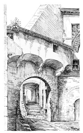
FIG. 272. GATEWAY AND STREET IN TAGGIA.
Passing the ancient republic of Bordighera, with its arcaded streets and splendid palm gardens, we soon reach San Remo. This ancient town, originally independent, came ultimately, like the rest of the Riviera, under the authority of Genoa. It consists as usual of one principal street along the narrow strip of ground between the base
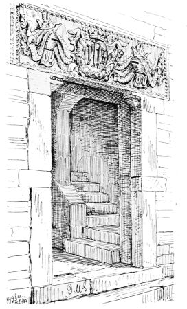
FIG. 273. DOORWAY IN TAGGIA.
of the hill on which the old town stands and the sea. The town consists of the ordinary pile of terraced houses with narrow tortuous streets and steep flights of steps leading up to them. There is here an extraordinary profusion of the arches, of which we have met with examples elsewhere, thrown across the narrow streets, in order to strengthen the houses against the shocks of earthquake to which this region is liable. These features sometime produce, together with the stairs and tall houses, extraordinary combinations and effects (Figs. 269 and 270).
The cathedral of San Siro, which stands detached in a small “place,” has some good Italian features still preserved,—amongst which are the north and south doorways (Fig. 271), the remainder having been greatly modernised and spoiled.
In the main street there are some fair specimens of Renaissance palaces, somewhat in the style of those of Genoa.
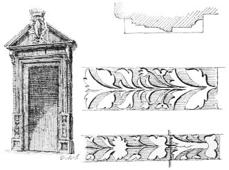
FIG. 274. DOORWAY IN TAGGIA.
From the railway station of Arma di Taggia, some miles east of San Remo, an expedition may be made about five miles up the valley to the exquisitely quaint old town of Taggia. It concentrates in itself all the various remarkable features of the towns of the Riviera in its arcaded streets and vaulted footpaths, narrow lanes crossed with arches, and approached by steep stairs and dark tunnels; and these features are here all combined in so profuse and picturesque a manner as to present an epitome of those of all the rest. In the midst of these striking general
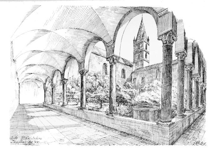
FIG. 275. CLOISTERS, ST CRISTOFERO, TAGGIA.
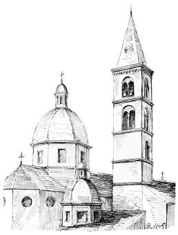
FIG. 276. CHURCH AT ALASSIO.
effects, so captivating to the artist, it is difficult, however, to pick out anything which may be regarded as really good architecture. Fig. 272 gives some idea of the picturesqueness of the arcaded streets and gateways, while Figs. 273 and 274 give a few good architectural details. The first (Fig. 273) might, from its style, be the lintel of any fifteenth century house in Genoa (a splendid example of a similar style of doorway at Genoa being shown in Fig. 281), and the other (Fig. 274) is a Renaissance doorway in black marble ornamented with raised arabesques. Close to the town is the monastery of San Cristofero, where the ancient cloister and tower (Fig. 275) are good specimens of early Italian work. The vaulting of
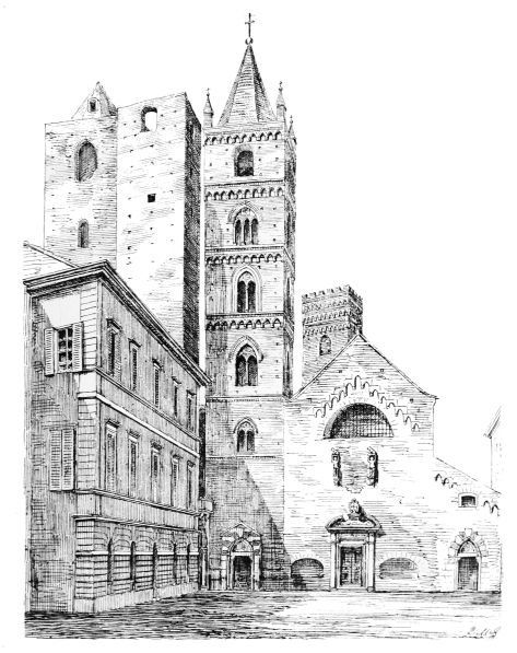
FIG. 277. TOWERS AND WEST END OF CHURCH, ALBENGA.
the cloister is late, the original roof being probably of timber. The tower is a good Italian campanile, with string courses of the arcaded ornament so common in Lombardy and the Rhineland.
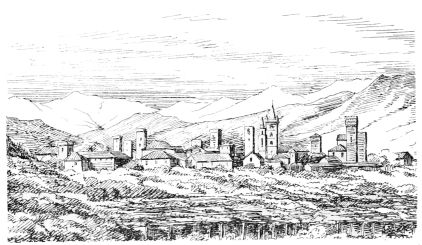
FIG. 278. ALBENGA (from Railway Station).
We are now in the centre of the district which suffered so severely from the earthquakes of 1887. Bussana is passed on the right in returning to the railway. The towns of Porto Maurizio (which stands on a solitary rock), Oneglia, and Diano Marina, all names too well known in connection with the above catastrophe, are reached in succession before arriving at Alassio, the furthest east of the health resorts of the Riviera. The tower of the church here (Fig. 276) has the usual form of the Italian campanile.
A few miles further east bring us to Albenga, which is, architecturally speaking, the most interesting town on this part of the coast. It lies in a hollow near the mouth of the river Acosia, and is defended from the cold winds of the North by an amphitheatre of lofty, snow-clad mountains. The general view of the town from the
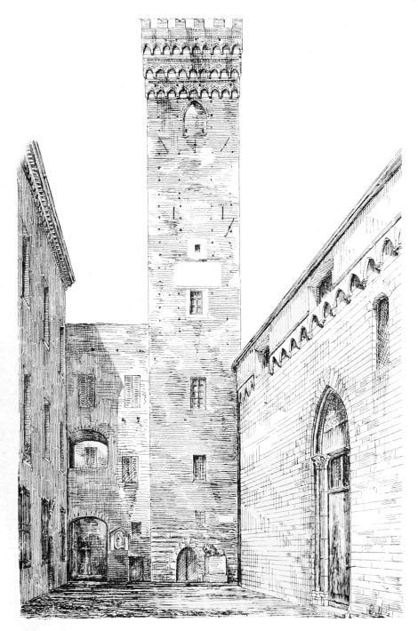
FIG. 279. TOWER AT NORTH-EAST OF CHURCH, ALBENGA.
railway station (Fig. 278) shews the peculiar preponderance of square towers for which it is remarkable. On closer inspection these are found to be no less surprising than when seen from a distance. They are generally quite plain and are built of brick. The view of the west end of the church (Fig. 277) shews four of these towers crowded close together, exhibiting examples of several different designs. That over the north entrance to the church has a strong resemblance to the campaniles of Lombardy, such as that of Mantua, and is thoroughly Italian in every detail, while the plain square towers adjoining recall similar examples at Bologna and elsewhere in Italy. That again at the east end of the church, which has the figure of the lion at its base (Fig. 279), with its plain brick shaft, its triple arcaded top, and fork-shaped battlements, is almost identical with those of Verona. The church has originally been an Italian design of the thirteenth century. Although now much altered and spoiled it has evidently had the same arcaded ornament at the eaves as we have observed at Grasse, San Remo, and elsewhere. The doorways also correspond in style with the above churches. To the north of the church is a very interesting baptistery, which reminds one of those of Fréjus and Aix. It is of octagonal form, 28 feet long by 26 feet wide, with a vault supported on Corinthian-like pillars, and has a very ancient but dismal and neglected appearance. One of the windows is filled with stone tracery of a Byzantine or Moorish character.
In moving eastwards we pass in succession Ceriale, with its fortifications, and Loano with its great monasteries, Verezzi with one good campanile, and Flnalmarino with two. From the latter a view is obtained of Finalborgo in the distance (about two miles off), where there are evidently the remains of a fine castellated structure. At
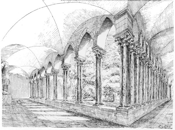
FIG. 280. CLOISTERS, SAN MATTEO, GENOA.
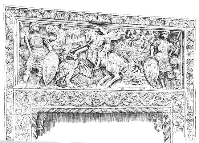
FIG. 281. DOORWAY, PIAZZA SAN MATTEO, GENOA.
Noli there is an ancient entrance tower with an archway through it. Savona retains its fortifications of the Vauban School, and Verazze the shattered ruins of an old castle.
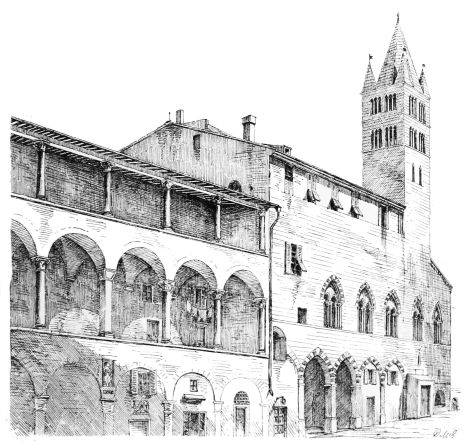
FIG. 282. CHURCH, CLOISTERS, ETC., GENOA.
It is not intended to attempt to describe the architecture of Genoa. That has already formed the subject of special works, and would require a volume to itself. Only, in closing this account of the architecture of the Riviera, one or two examples from Genoa are given, in order to make more distinct the analogies to which attention has been drawn between the architecture of a large part of the Riviera and that of the famous Republic, as well as the style of Italy generally. Thus the side doorway of the cathedral exhibits, in a remarkable manner, the same imitation of Roman architecture (see Vignette on title page, and Heading p. 25), modified by the introduction of Romanesque or Teutonic ornament, which we observed at St Gilles, Arles, and other churches of Provence. This doorway is part of the original building of the eleventh century, although the greater part of the cathedral was restored about 1300.
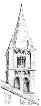
FIG. 283. CAMPANILE, GENOA.
The façade of San Matteo, on which are engraved so many inscriptions in honour of the various distinguished members of the family of Doria and that of San Stefano, shew the arcaded caves, and the inlaid moulding under the cornice which exist at Grasse, San Remo, Ventimiglia, &c. The doorways of these churches have the same flat porch, with small projection, and plain pointed gable, and the same sort of arch and shafts as several of the examples we have met with in the Riviera. San Matteo dates from 1278. The cloister (Fig. 280) which adjoins that church is of the beginning of the fourteenth century, and contains the monuments of the Dorias, which have been brought here from the suppressed church of Santa Dominica. The cloisters of San Matteo, and also those of San Lorenzo, present shafts and caps in the same Italian style as we have observed extended as far westwards as the cloisters at Fréjus, and the upper cloister of the castle of St Honorat. The sculptured lintel in the Piazza San Matteo (Fig. 281), exhibiting the combat of St George and the Dragon, although more elaborate, is similar in style to the lintel of the house at Taggia (Fig. 273); while the campaniles and arcades of other churches in Genoa (Figs. 282 and 283) recall the Italian style, of which we have met with so many examples in Provence.
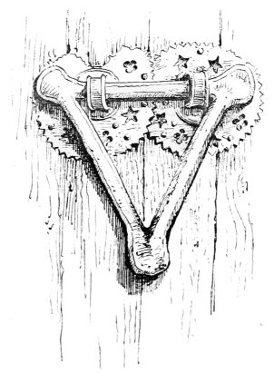
FIG. 284. KNOCKER, ELNE CATHEDRAL.
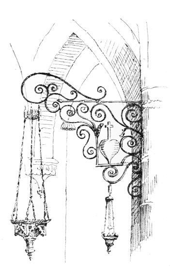
FIG. 285. LAMP FROM OLD CHURCH, MONACO.