XI THE CENTRAL VALLEY
Reading edition
TEHAMA COUNTY
Tehama County lies at the extreme northern end of the great Central Valley of the state. There is a village of the same name in the county, on the Sacramento River, twelve miles southeast of Red Bluff.
The name Tehama was derived from an Indian tribe, but the meaning of it has not been ascertained. Two definitions have been offered,—“high water,” in reference to the overflowing of the Sacramento River, and “low land,” but these may be among those attempts to account for our names by making the name fit the circumstances, a method which has resulted in many errors. All that can be positively stated is that the word is of Indian origin.
COLUSA
Colusa is a county in the northern part of the Central Valley, and has a county-seat of the same name, situated on the west bank of the Sacramento River, sixty-five miles northwest of Sacramento.
This name appears as Colus on the land grant located at that place, and is said by Powers, in his Tribes of California, to be a corruption of Ko-ru-si, a tribal name, a more reasonable explanation than any other that has been offered. General Will Green, said to have known the tribe well, was of the opinion that Colusa meant “the scratchers,” in allusion to a strange custom among these people of scratching one another’s faces. While it is true that the prevalence of this custom is mentioned by the Spaniards, Captain Fages referring to it in terms of great distaste, there is no scientific corroboration of that definition for the word Colusa.
YUBA
Yuba is the name of a county in the Central Valley, of Yuba City, the county-seat of Sutter County, and of the Yuba River, which is formed by the union of three branches rising in the Sierra Nevada.
The name Yuba was first applied to the river, the chief tributary of the Feather. The theory has been advanced that it received the name of Uba, or Uva, the Spanish word for grapes, from an exploring party in 1824, in reference to the immense quantities of vines loaded with wild grapes growing along its banks, Uba, becoming corrupted into Yuba, but Powers, in his Tribes of California, says Yuba is derived from a tribe of Maidu Indians named Yu-ba, who lived on the Feather River. This is probably the true explanation of the name. It is to be noted that Fremont, in his Memoirs, speaks of it as Indian: “We traveled across the valley plain, and in about sixteen miles reached Feather River, at twenty miles from its junction with the Sacramento, near the mouth of the Yuba, so-called from a village of Indians who live on it. The Indians aided us across the river with canoes and small rafts. Extending along the bank in front of the village was a range of wicker cribs, about twelve feet high, partly filled with what is there the Indians’ staff of life, acorns. A collection of huts, shaped like bee-hives, with naked Indians sunning themselves on the tops, and these acorn cribs, are the prominent objects in an Indian village.”
YOLO
Yolo is the name of a county in the northern part of the Central Valley, and of a village near Woodland.
Yolo, or Yoloy, was the name of a Patwin tribe, and the word is said by the Bureau of Ethnology to mean “a place abounding with rushes.”
In 1884 there were still forty-five of the tribe living in Yolo County.
SOLANO
This county, situated in the Central Valley, immediately northeast of San Francisco, was named, at the request of General Mariano Vallejo, in honor of an Indian chief of the Suisunes who had aided him in war against the other natives. The name of this chief in his own tongue is said to have been Sem Yeto, “the Fierce one of the Brave Hand,” or Sum-yet-ho, “the Mighty Arm,” and, judging by the description given of him by Dr. Vallejo, he must have been a living refutation of the common belief that the California Indians were invariably squat and ill-formed, for he was a splendid figure of a man, six feet, seven inches in height and large in proportion. He was converted to Christianity and received the name of the celebrated missionary, Francisco Solano, as well as a grant of land containing 17752 acres, known as the Suisún Grant.
SUISÚN
Suisún Bay is a body of navigable water connected with San Pablo Bay by the Carquínez Strait, and is the outlet of the San Joaquín and Sacramento Rivers. Suisún City is in Solano County, on a slough, about fifty miles northeast of San Francisco. Suisún was the name of an Indian village on that bay, and the word is said by some persons to mean a “big expanse.” The name was probably first given to the land grant.
This region was the home of an important tribe of Indians who had an interesting and tragic history. Their religious capital, if such it could be called, was at Napa, near which place there was a certain stone from which they believed one of their gods had ascended into upper air, leaving the impress of his foot upon the stone. General Vallejo says that in 1817 a military expedition under command of Lieutenant José Sánchez crossed the straits of Carquínez on rafts, for the double purpose of exploring the country and reducing it to Christianity. “On crossing the river they were attacked by the Suisún tribe, headed by their chief Malaca, and the Spaniards suffered considerable loss; the Indians fought bravely, but were forced to retire to their ranchería, where, being hotly pursued, and believing their fate sealed, these unfortunate people, incited by their chief, set fire to their own rush-built huts, and perished in the flames with their families. The soldiers endeavored to stay their desperate resolution, in order to save the women and children, but they preferred this doom to that which they believed to await them at the hands of their enemies.” The Suisún tribe is now entirely extinct, a large number having been carried off by a frightful epidemic of smallpox. Dr. Vallejo states that this tribe, a people described by him as possessing many attractive qualities, was estimated by his father to number at least 40,000 persons in 1835. After the great epidemic, which was brought down by the Russians from the north, and which lasted during the three consecutive years of 1837-38-39, there were barely two hundred left. Thus the disappearance of the California Indians was occasioned, not by the white man’s bullets or fire-water, nor even by the deteriorating influence of a changed mode of living, nor by the loss of native sturdiness through an acquired dependence upon the church, but suddenly and fearfully by the introduction of the hideous diseases of civilization.
SACRAMENTO
Sacramento County and the city of the same name, the state capital, situated near the center of the Great Valley, received their names from the river, which, following the usual custom of the Spaniards, was christened first, being named in honor of the Holy Sacrament.
Captain Moraga first gave the name of Jesús María to the main river, calling the branch Sacramento, but later the main stream became known as Sacramento, and the branch as El Río de las Plumas (the river of the feathers).
COSUMNE
Cosumne is the name of a village in Sacramento County, about twenty-two miles southeast of Sacramento. The Cosumne river rises in El Dorado County, near the Sierra Nevada, and enters the Mokelumne about twenty-five miles south of the city of Sacramento.
Cosumne is an Indian word, said to mean “salmon,” and was taken from the tribe who lived upon the river. The frequent occurrence of the ending amni, or umne, in the names of rivers in the Sierras has led to the mistaken conclusion that the suffix actually means “river,” but we have the statement of A. L. Kroeber, Professor of Anthropology in the University of California, that, “The supposition may be hazarded that the ending amni, or umne, is originally a Miwok ending, with the meaning ‘people of’.” Thus the meaning of Cosumne may be “people of the village of Coso,” and of Mokelumne, “people of the village of Mukkel,” and so on through all the names having this ending.
Powers, in his Tribes of California, says Kos-sum-mi was the Indian word for “salmon,” and that this is the probable origin of the name Cosumne.
The Bureau of Ethnology has an interesting paragraph on the manners and customs of these Indians: “They went almost naked; their houses were of bark, sometimes thatched with grass, and covered with earth; the bark was loosened from the trees by repeated blows with stone hatchets, the latter having the head fastened to the handle with deer sinews. Their ordinary weapons were bows and stone-tipped arrows. The women made finely-woven conical baskets of grass, the smaller ones of which held water. Their amusements were chiefly dancing and foot-ball; the dances, however, were in some degree ceremonial. Their principal deity was the sun, and the women had a ceremony which resembled the ‘sun dance’ of the tribes of the upper Missouri. Their dead were buried in graves in the earth. The tribe is now practically extinct.”—(quoted from Rice, in American Anthropology, III, 259, 1890.)
SAN JOAQUÍN
San Joaquín County, famous for its vast fields of wheat, is a part of the great Central Valley, and the river of the same name rises in the Sierras, flows north-northwest through the valley and unites with the Sacramento River near its mouth.
The river was named in honor of St. Joachim, the father of the Virgin. Lieutenant Moraga first gave the name to a rivulet which springs from the Sierra Nevada, and empties into Lake Buena Vista. The river derived its name from this rivulet.
The rich valley of the San Joaquín, two hundred miles long and thirty miles wide, with its wide, treeless expanses where the wild grasses grew rankly, was once a paradise for game. Fremont says: “Descending the valley we traveled among multitudinous herds of elk, antelope, and wild horses. Several of the latter which we killed for food were found to be very fat.” Herds of wild horses still range in California and Nevada, and are sometimes captured for sale, fine specimens bringing high prices.
STANISLAUS
Stanislaus is the name of the county just south of San Joaquín, and of one of the tributaries of the San Joaquín River.
The word Stanislaus is said to be derived from an Indian chief of that region, who became Christianized and was baptized under the Spanish name of Estanislao. He was educated at Mission San José, but became a renegade, and incited his tribe against the Spaniards. In 1826 he was defeated in a fierce battle on the banks of the river now bearing his name.
Fremont thus describes the scenery along the Stanislaus: “Issuing from the woods, we rode about sixteen miles over open prairie partly covered with bunch grass, the timber re-appearing on the rolling hills of the River Stanislaus, in the usual belt of evergreen oaks. The level valley was about forty feet below the upland, and the stream seventy yards broad, with the usual fertile bottom land which was covered with green grass among large oaks. We encamped in one of these bottoms, in a grove of the large white oaks previously mentioned.”
MERCED
Merced (mercy), is the name of the county south of Stanislaus, of its own principal stream, and of its county-seat. The river was named by the Spaniards, in honor of the Virgin, El Río de Nuestra Señora de la Merced (the river of our Lady of Mercy). This name was given to the stream by the Moraga party as an expression of their joy and gratitude at the sight of its sparkling waters, after an exhausting journey of forty miles through a water-less country.
According to Fremont, this stream was called Auxumne by the Indians: “In about seventeen miles we reached the Auxumne River, called by the Mexicans Merced.... We encamped on the southern side of the river, where broken hills made a steep bluff, with a narrow bottom. On the northern side was a low undulating wood and prairie land, over which a band of about three hundred elk was slowly coming to water, feeding as they approached.”
The Merced River is notable in that it flows along the floor of the Yosemite Valley. Like all the other streams that have their rise in the Sierras, its character in its upper and lower reaches is vastly dissimilar. In the days of its turbulent youth it is a wild and boisterous stream, and in the voice of its hissing, roaring waters the wayfarer hears no sound of “mercy,” but after it makes its tremendous plunge down the western slope of the Sierras, and debouches upon the floor of the valley, it takes on a serene air of maturity, and widens into a placid river, its current flowing sluggishly between low, level banks.
MADERA COUNTY
Madera (wood, timber), is the name of the county to the southwest of Stanislaus. It occupies a stretch of fertile land, and was called Madera by the Spaniards on account of its heavy growth of timber.
FRESNO COUNTY
Fresno (ash-tree), so-called in reference to the abundance of those trees in that region, is the name of a county in the San Joaquín Valley, in the heart of the grain and fruit country. Raisins and wine are its especial products. Its capital city and principal stream also bear the name of Fresno.
KINGS COUNTY
This county, now appearing under its English form, originally received its name from the river, which was discovered by a Spanish exploring party in 1805, and called by them El Río de los Santos Reyes (the river of the Holy Kings), in honor of the “three wise men.”
A considerable part of the area of this county was at one time covered by Tulare Lake, but the shrinkage of that body of water through the withdrawal of its sources of supply have added nearly the whole of the territory occupied by its waters to the arable land of the county. This subject is further discussed under the head of Tulare.
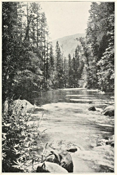
EL RÍO DE LOS SANTOS REYES (THE RIVER OF THE HOLY KINGS).
“ ... named in honor of the three wise men.”
The river seems to have been known at one time as the Lake Fork, by which name Fremont mentions it in the following paragraph: “We crossed an open plain still in a southeasterly direction, reaching in about twenty miles the Tulare Lake river. This is the Lake Fork, one of the largest and handsomest streams in the valley, being about one hundred yards broad, and having perhaps a larger body of fertile lands than any of the others. It is called by the Mexicans El Río de los Reyes. The broad alluvial bottoms were well wooded with several species of oaks. This is the principal affluent of the Tulare Lake, a strip of water which receives all the rivers in the upper or southern end of the valley.”
TULARE COUNTY
Tulare (place of tules, or rushes), is the name of a county in the south-central part of the state, of Tulare Lake in Kings County, and of a town in the San Joaquín Valley. The county is remarkable for the high mountain peaks of the Sierra Nevada, on its northeast border. Among these is Mount Whitney, about 14500 feet in height.
Tulare Lake, in Kings County, at one time filled a shallow depression about thirty miles in length, and received through a number of small streams the drainage from the southern part of the Sierra Nevada, soon losing the greater part of this water by evaporation. It is now practically dry, as a result of the withdrawal for irrigation purposes of Kings and Kern Rivers, and the territory formerly covered by it has been to a great extent placed under cultivation. The lake was discovered in 1773 by Commandant Fages, while hunting for deserters from the presidio at Monterey, and called by him Los Tules (the rushes), from the great number of those plants with which it was filled. In 1813 Captain Moraga passed through the valley of this lake, and named it Valle de los Tules (valley of the rushes).
SUPPLEMENTARY LIST
Acampo (common pasture), is the name of a village in San Joaquín County. See Final Index.
Arroyo Buenos Aires (creek of the good airs), is in San Joaquín County.
Caliente (hot), is the name of a town in Kern County.
Chico (little), is the name of a town in Butte County, ninety-six miles north of Sacramento. This place derives its name from the Rancho Chico (the little ranch), of which General John Bidwell was the original grantee. The Arroyo Chico and the town both took their names from the ranch.—(Mr. Charles B. Turrill.)
Chowchilla, a large ranch in the San Joaquín Valley, takes its name from the Chowchilla Indians, a branch of the Moquelumnan family. Fremont refers to this name under a somewhat different spelling: “The springs and streams hereabout were waters of the Chauchiles and Mariposas Rivers, and the Indians of this village belonged to the Chauchiles tribe.”
Dos Palos (two sticks, or trees), is in Merced County, twenty miles southwest of Merced.
Esparto (feather-grass), is a town in Yolo County.
Esperanza (hope), is in Kings County, west of Lake Tulare.
Hornitos (little ovens), is in Mariposa County, sixteen miles northwest of Mariposa. An attempt has been made to account for this name as a reference to the intense heat sometimes prevalent in that region, but the probable origin of the name is that given by Mr. J. P. Gagliardo, a resident of the place, who says it was derived “from a number of hornitos built here by the first settlers, who located here about the early fifties.” Hornos (ovens), of brick and adobe, built out-of-doors, and used to bake the bread for several families, were in very common use among the first Spanish settlers of California. Ovens were also used by the Indians, for, instead of eating their food raw or imperfectly cooked, they used quite elaborate methods in its preparation. Their ovens are thus described in the Handbook of American Indians, by Dr. Pliny E. Goddard, of the American Museum of Natural History: “The pit oven, consisting of a hole excavated in the ground, heated with fire, and then filled with food, which was covered over and allowed to cook, was general in America, though as a rule it was employed only occasionally, and principally for cooking vegetal substances. This method of cooking was found necessary to render acrid or poisonous foods harmless, and starchy foods saccharine, and as a preliminary in drying and preserving food for winter use. Most of the acorn-consuming Indians of California cooked acorn mush in small sand-pits. The soap-root was made palatable by cooking it in an earth-covered heap. The Hupa cook the same plant for about two days in a large pit lined with stones, in which a hot fire is maintained until the stones and surrounding earth are well heated; the fire is then drawn, the pit lined with leaves of wild grape and wood sorrel to improve the flavor of the bulbs, and a quantity of the bulbs thrown in; leaves are then placed on top, the whole is covered with earth, and a big fire built on top.” Mr. Charles B. Turrill states that “the meal of the ground acorns was placed in shallow hollows in the sand and water poured on it, by which means the bitter principle was leached out. Then the meal was placed in baskets and cooked by putting hot stones therein. The cooking was done in the basket, not in the sand.” Other Indians used pit ovens for baking clams, and the Panamints of California roasted cactus joints and mescal in pits. The Pueblo Indians used dome-shaped ovens of stone plastered with clay, a form that may have been imitated by the Spaniards, since their ovens were of that character.
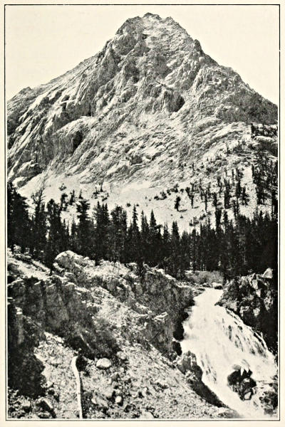
IN THE SIERRA NEVADAS.
“East Vidette, the Alps of the King-Kern divide.”
Modesto (modest), is the county-seat of Stanislaus County, and is thirty miles south of Stockton. According to residents of this town, “The place was first named Ralston in the year 1870, in honor of Mr. Ralston, who was then a very prominent resident of San Francisco, and president of the Bank of California. He was so modest that he preferred that some other name be adopted, so the name was changed to Modesto.” If this be the true story, it was surely a unique reason for the naming of a town.
Oroville (gold-town), is a hybrid word made up of the Spanish oro (gold), and the French ville (town). Oroville is the county-seat of Butte County, and is on the Feather River, in the heart of a mining and fruit region.
Río Vista (river view), is in Solano County, on the Sacramento River. Modern. Incorrect construction. It should be Vista del Río.
Tehachapi, an Indian word of which the meaning has not been ascertained, is the name of the mountain pass in Kern County across the Sierra Nevada, of which it approximately marks the southern limit, and of a town in the same county, thirty-five miles southeast of Bakersfield.
“In the famous Tahichapah Pass was a tribe called by themselves Ta-hi-cha-pa-han-na, and by the Kern Indians Ta-hich. This tribe is now extinct.”—(Powers’ Tribes of California.)
Vacaville is situated in a beautiful and fertile valley in Solano County. It received its name from a family named Vaca, who were at one time prominent in that region. Manuel Vaca, the founder of the family, was a native of New Mexico, and came to California in 1841. “He was a hospitable man of good repute.”