IX AROUND SAN FRANCISCO BAY
Reading edition
San Francisco. Many persons, misled by an incorrect translation of a certain passage in Palou’s Life of Serra, have ascribed the naming of the bay of San Francisco (St. Francis), to the Portolá expedition of 1769, but, as a matter of fact, the outer bay, the great indentation in the coast outside of the Golden Gate, between Point Reyes and Mussel Point, had received this name many years before. In remonstrating with the Visitador General because no mission had been provided for St. Francis in Upper California, Serra remarked, “And is there no mission for our Father St. Francis?” Señor Galvez replied, “Si San Francisco quiere misión, que haga se halla su puerto y se le pondrá (If St. Francis wants a mission, let him cause his port to be found and one will be placed there for him).” By “his port” Galvez referred to a port already discovered and named, but which had been lost sight of during the intervening years, and which he wished to have re-discovered. This is further carried out by the succeeding statements of Palou, in which he says that after failing to recognize the port of Monterey, “they came to the port of St. Francis, our father, and they all knew it immediately by the agreement of the descriptions which they carried,” referring to descriptions obtained from the papers of the first discoverers. Father Crespi, who accompanied the expedition, says: “All the descriptions which we found here we read in the log-book of the pilot Cabrera Bueno, in order to form a judgment that this is the port of San Francisco. To make it all clear, the Señor Commandante ordered that during the day Sergeant Ortega should go out with a party of soldiers to explore.” Further on in the same diary we read: “From the top of a hill we made out the great estuary, or arm of the sea, which probably has a width of four or five leagues.” This is undoubtedly the first occasion when the eye of a white man rested upon “the great arm of the sea,” that is, the inner harbor of San Francisco as we now know it.
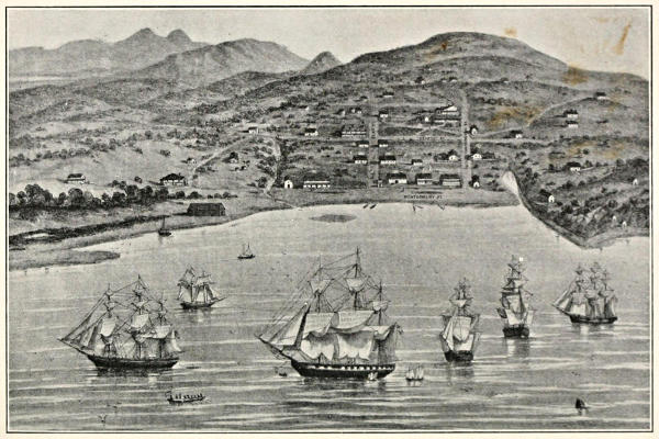
THE CITY OF YERBA BUENA (SAN FRANCISCO IN 1846-47)
“ ... so-called in reference to the profuse growth of that charming little vine about the locality.”
It must be remembered that until the arrival of Portolá, the Spaniards only knew this part of the coast from the sea side, having no knowledge of that great inland sea known to us as the bay of San Francisco. When the party came up by land on their futile search for Monterey, they reached Fort Point, and there recognized the marks of the outer bay as given by early navigators and called by them San Francisco. Then they climbed a hill, and looking to the landward saw the “great arm of the sea,” the inner harbor, to which the name of San Francisco was finally extended.
Palou ascribed the failure of the party to recognize the port of Monterey, and the consequent continuance of their journey as far as San Francisco, to a direct interposition of the divine hand, so that Galvez’s promise of a mission for St. Francis might be carried out.
The honor of the christening of our world-famous bay probably belongs to Sebastián Rodríguez Cermeñón, a Portuguese navigator, who was commissioned in the year 1595 by Philip II to search for safe harbors along the coast for vessels in the Philippine trade. These ships usually shaped their return course so as to touch first at about the latitude of Cape Mendocino, making a knowledge of the harbors south of that point a matter of great importance, especially in stormy weather. Cermeñón had the misfortune to lose his vessel, the San Agustín, on Point Reyes, and was compelled to make his way home, with great peril and suffering, in a small boat. In his Derrotero y Relación (Itinerary and Narrative), under date of April 24, 1596, he says: “We sighted New Spain at Cape Mendocino on November 4, 1595.... We left the bay and port of San Francisco, which is called by another name, a large bay, in 38⅔ degrees, and the islets [Farallones] in the mouth are in 38½ degrees, the distance between the two points of the bay being twenty-five leagues.” It is clear from this description that he referred to that great indentation in the coast between Point Reyes and one of the points to the south, possibly Mussel Point, and that he gave the name of San Francisco to it, displacing some other name by which it had been previously known. At any rate, if this is not the origin, it is likely to remain lost in the mists of the Pacific. Bancroft says: “There can be little doubt that Cermeñón named the port of his disaster San Francisco.”
An absurd theory advanced by certain persons that the name was derived from that of Sir Francis Drake is wholly unworthy of consideration. The resemblance between the two names must be regarded as purely a co-incidence, and any connection between “El Pirata” (the pirate) Drake, as the Spaniards usually called him, and the name of the gentle St. Francis must be taken in the light of a jest.
Portolá, then, although he was indubitably the discoverer of the bay as we know it,—the inner harbor,—found the name already applied to the outer ensenada by his predecessor, Cermeñón.
It is held by some persons that Portolá cannot in all fairness be considered the actual discoverer of the bay, since it is most probable that Lieutenant Ortega or perhaps some member of a hunting party which was sent out actually laid physical eyes upon it first, and it is even thought possible that Portolá never saw it at all, but remained in camp all the time during their stay on its shores. Even granting these facts, the question remains whether he, as the commander of the party making the expedition which resulted in the discovery, is not still entitled to the fame which has generally been granted to him.
A parallel might be drawn between the case of Portolá and that of Columbus. When the famous expedition of 1492 drew near to the shores of the new world, it was not the great admiral, but a common sailor, Rodrigo de Triana by name, who first raised the thrilling cry of “land! land!”; yet, nevertheless, the world justly awards the honor and glory of the discovery to Christopher Columbus, the leader and the soul of the party, whose splendid imagination and unconquerable resolution made it possible.
Although the Portolá party made a partial examination at this time of the shores of what they called the “great arm of the sea,” and Captain Fages returned for further explorations in 1770, and again in 1772, when he stood on the present site of Berkeley and looked out through the Golden Gate, the mission was not established until 1776. Father Palou was its founder, and he states in his Life of Serra that the presidio was established with solemn religious services, September 17, 1776, on the day of the “impressions of the stigmata of St. Francis,” but on account of a delay in receiving orders, the founding of the mission did not take place until October 9. On that day a procession was held with the image of St. Francis, and mass was celebrated by Father Palou himself.
So they prayed and sang their hymns, in the year of ’76, while their hearts beat high with the zeal of the missionary, and, happily, no echo of the roll of drums and boom of minute guns came to them across the untrodden miles of mountain and plain, of forest and prairie, that separated them from the alien race on the other rim of the continent, for whom they were all unconsciously preparing the way to the possession of a great principality.
No natives were present at this mass, for the reason that in the month of August they had been driven on their tule rafts to the islands of the bay and the opposite shores, by their enemies, the Salsonas, who lived about seven leagues to the southeast, and who had set fire to their rancherías and killed and wounded many of their people, the Spaniards not being able to prevent it.
The first settlement was three-fold, including the mission of San Francisco de Asís, on the Laguna de los Dolores (the lagoon of sorrows), the presidio, and the pueblo, separated from one another by about a league. The Pueblo was at first known as Yerba Buena, in reference to the profuse growth of that vine about the locality. The change of the name is ascribed by General Sherman, in his Memoirs, to jealousy of the town of Benicia, which was at first called Francisca, in honor of General Vallejo’s wife, and was thought to bear too marked a resemblance to the name of the great patron, San Francisco. General Vallejo himself states that the change was made as a matter of convenience, to bring the three points of the triangle, church, town, and presidio, all under one name. Whatever the reason for the change, it is a matter of congratulation that it occurred, for the name of the venerable saint carries a dignity more commensurate to a noble city than the poetic, but less impressive Yerba Buena.
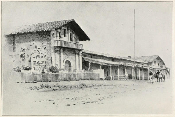
MISSION OF SAN FRANCISCO DE ASÍS, COMMONLY CALLED MISSION DOLORES.
“It stood unharmed through the earthquake and fire of 1906 which laid low all its proud modern neighbors.”
The church of San Francisco de Asís, popularly known as Mission Dolores, still stands in a good state of preservation, having almost miraculously withstood the earthquake and fire of 1906, which laid low all its proud modern neighbors. Of its patron, the gentle St. Francis, it may be said that he was the son of a rich merchant, but that he abandoned his riches, adopted vows of poverty, and founded the order of Franciscans. “While in a trance, or vision, after having fasted for fifty days, he received the miraculous imprint of the wounds of the Savior on his hands, feet, and side.” His chief attributes were humility, poverty, and love for animals. In pictures he is always represented as accompanied by a pet lamb.
THE GOLDEN GATE
Although this name, not being of Spanish or Indian origin, is not properly included in these pages, its close relationship to San Francisco, and its position as the gate-way to the entire state, will not permit it to be passed by.
In view of the comparatively recent origin of the name, 1844, and the accessibility of the story, it seems strange indeed that any writer should have advanced the theory that the Golden Gate received its name from Sir Francis Drake, yet this wholly unfounded explanation has found its way into print. In the first place, it has been pretty thoroughly established by historians that Drake never saw the inner harbor, and knew nothing of the narrow strait leading to it. In the report of his voyage, written by one of his companions, we read: “At 38 degrees toward the line, it pleased God to send us into a faire and good harborow, with a good wind to enter the same. Our General called this country Nova Albion, and that for two causes;—the one in respect of the white bankes and cliffes, which ly toward the sea; and the other that it might have some affinity with our country in name, which sometime was so-called.” The white cliffs under Point Reyes answer so well to this description that there can be little doubt that Drake’s anchorage was in the small outer bay under that point, now known as Drake’s Bay; to say nothing of the fact that the account of the voyage has no word concerning the great land-locked harbor, with a narrow strait as its only entrance, a circumstance so novel that, as Bancroft justly observes, Drake could not have failed to mention it had he known aught of it.
All discussion of the name Golden Gate is, moreover, brought to an end by the fact that its real author, John Charles Fremont, gives a circumstantial account of it in his Memoirs. After an elaborate description of the bay, and its surroundings, he says: “Between these points is the strait,—about one mile broad in its narrowest part, and five miles long from the sea to the bay. To this gate I gave the name of Chrysopylae, or Golden Gate; for the same reasons that the harbor of Byzantium (Constantinople afterwards), was called Chrysoceras, or Golden Horn. The form of the harbor and its advantages for commerce, and that before it became an entrepot of eastern commerce, suggested the name to the Greek founders of Byzantium. The form of the entrance into the bay of San Francisco, and its advantages for commerce, Asiatic inclusive, suggested to me the name which I gave to this entrance, and which I put upon the map that accompanied a geographical memoir addressed to the senate of the United States, in June, 1848.”
Here we have, told in the somewhat pedantic language of its author, the true story of the first appearance of the famous name Golden Gate upon the map of the world, and instead of its having been “named by Colonel Fremont because of the brilliant effect of the setting sun on the cliffs and hills,” as one writer has fondly imagined, or from any idea connected with the shining metal, which still lay buried deep from the sight of man beneath the mountains of the land, it was born in a sordid dream of commerce. Yet, for so wonderfully apt a name, whatever may have been Fremont’s motive in selecting it, we owe him a debt of gratitude.
There is some disposition to doubt this explanation of the name Golden Gate, partly on the ground of a distrust of Fremont’s trustworthiness, and partly because of its far-fetched nature. As to the latter objection it should be remembered that he was that kind of a man. He was possessed of a certain amount of erudition which he was fond of showing off, and this labored method of seeking for a name in the old Greek was quite in keeping with his character. As to his reliability, although it is quite possible that he colored events of a political character to suit his own purposes, in ordinary matters there seems to be no reason to doubt his statements. At all events, the name Golden Gate does in fact appear upon his map of 1848 as he says.
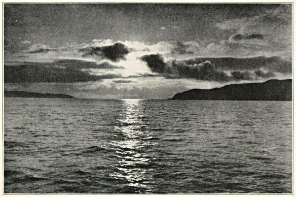
THE GOLDEN GATE.
“ ... called by the Indians Yulupa, (the place where the sun plunges into the sea.)”
According to Dr. Vallejo, the Golden Gate was called by the Indians Yulupa, pronounced ee-oo-loo-pa, which means “near the sea plunge,” that is, the plunge of the sun into the sea, and may be freely translated as the “Sunset Strait.” The suffix pa is said by Dr. Vallejo to signify “near.”—(Memoirs of the Vallejos, edited by James H. Wilkins, San Francisco Bulletin, January, 1914.)
ALCATRAZ
Alcatraz (pelican), the fortress-like island in the bay, just inside the channel, performs the triple duty of a fortified military post, prison, and light-house. Although but 1650 feet in length, it rises to a height of 130 feet above the water, and in the shadowy light just after sunset, its high, rocky walls, topped by the buildings of the fortifications and prison, make a silhouette against the sky strikingly like a great dreadnaught, standing guard at the harbor’s entrance.
The story of its naming can not be run to earth, but it probably originated in some circumstance connected with the great sea-birds whose ungainly forms may still be seen heavily flapping over the bay, or resting on the island.
ANGEL ISLAND
Angel Island, the Americanization of La Isla de los Ángeles (the isle of the angels), belies its name, since it has been devoted to the quite un-angelic business of quarantine station of San Francisco.
Palou, in speaking of the expedition of 1776, says: “They moved to the island which is in front of the mouth, which they called Nuestra Señora de los Ángeles [Our Lady of the Angels], on which they found good anchorage, and going on land, they found plenty of wood and water.”
A story has found its way into print that the island was named “from a miner who once settled there,” the writer probably mixing it up with the name of Angel’s Camp, in the Sierras. What a desecration for our island, with its romantic name of “Our Lady of the Angels,” piously given to it by the Spaniards in honor of the Virgin!
YERBA BUENA ISLAND
Yerba Buena (the good herb), is the name of a dainty little vine native to the California woods, which has an agreeable aromatic odor, and was much in use among the Spanish as a medicinal herb, and to add a pleasant aroma to their tea. Fremont, who, whatever else may be said of him, had enough poetry in his soul to feel an expansive joy over the plant life of this flowery land, describes it as follows: “A vine with a small white flower, called here la yerba buena, which, from its abundance, gives its name to an island and town in the bay, was to-day very frequent on our road, sometimes running on the ground, or climbing the trees.” It is said that the Hupa Indians were in the habit of weaving the tendrils of this vine in their hair for the sake of the perfume.
Some talk has arisen of late that this poetic and historic name is to be taken away from our island. Commuters, when you pass it on your daily journey, let your minds carry you back to the day when the delicate tendrils of the little vine waved on the island’s steep slopes, and its sweet scent was wafted on the breeze from the Golden Gate, and do not, I pray you, consent to call it Goat!
MARE ISLAND
Mare Island, in San Pablo Bay, separated from Vallejo by a strait one-half mile wide, a charming spot with an unpoetic name,—is another example of writers attempting to make difficulties where none exist, and so they would have us believe that the name of this isle arose, like Venus, from mare, the sea. Apart from the fact that this labored method of naming places, by seeking in the Latin, was quite foreign to the custom of the Spaniards, it happens that the true story in this case is at hand, and can scarcely be doubted, since it occurred in the immediate family of Dr. Vallejo, who tells it thus: “In early days, the only ferry-boat on the waters near Vallejo and Benicia was a rude one, made chiefly of oil barrels obtained from whaling ships, and propelled by sails. These barrels were secured together by beams and planking, and it was divided into compartments for the accommodation of cattle, to the transportation of which it was chiefly devoted. One day, while this boat was coming from Martínez to Benicia, a sudden squall overtook it, and the craft pitched fearfully; the animals, chiefly horses, became restive, and some of them broke through it. The boat was upset, and the living cargo thrown into the bay. Some of the livestock were drowned, and some managed to reach either shore by swimming. One of the horses, an old white mare, owned and much prized by General Vallejo, succeeded in effecting a landing on the island, and was rescued there a few days after by the General, who thereupon called the place La Isla de la Yegua (the island of the mare).”
An interesting corroboration of this story is found on page 574 of Fremont’s Memoirs, where he refers to the island as La Isla de la Yegua.
A statue of a white horse would perpetuate the history of this isle in a manner both appropriate and beautiful, in the same way that upon the heights of Angel Island a colossal figure of an angel, or of the Virgin, and upon Alcatraz a great pelican with outspread wings, might be placed to tell their stories. In the old world, many legends of the past are perpetuated in this way, and there is no reason why the equally romantic episodes in California’s history should not be so commemorated, at least in those cases that lend themselves readily to purposes of art.
ALAMEDA
It has been thought that this name may have been derived from the resemblance between Alameda creek, at one time thickly shaded along its banks by willows and silver-barked sycamores, and an alameda (an avenue shaded by trees), but since the primary meaning of the word is “a place where poplar trees grow,” from álamo (poplar or cottonwood), it requires less stretching of the imagination to believe that some such grove of cottonwoods near the creek gave it the name. Fray Dantí, in his diary of the exploration of “the Alameda” in 1795, says: “We came to the river of the Alameda, which has many large boulders, brought down by floods, and is well populated with willows, alders, and here and there a laurel. At a little distance from where the river runs, the tides of the Estuary come.”
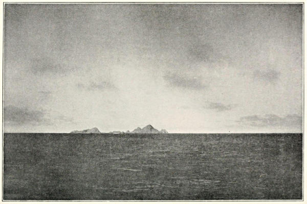
THE FARALLONES.
“ ... standing like watch-dogs at our outer gate.”
From the name of an insignificant little stream, Alameda has come to be the designation of one of the most important counties in the state, and of the flourishing city on the east side of San Francisco Bay, nine miles east-southeast of San Francisco. This city was once known as Encinal (place of oaks), on account of the groves of beautiful live-oaks there, nearly all of which have, most unfortunately, been sacrificed to so-called “improvements.” Yet, some fine specimens still remain in the county, perhaps the best being those on the campus of the University of California, at Berkeley, Alameda County. The encino (live-oak), is thus described by Professor Jepsen: “It is a low, broad-headed tree, commonly twenty to forty feet, but sometimes seventy feet high. The trunk is from one to four feet in diameter, usually short, and parting into wide-spread limbs, which often touch or trail along the ground.” This tree has little commercial value, but is highly regarded for its hardy nature, which permits it to flourish in exposed localities along the coast, where no other tree thrives, and for the perennial green with which it adorns an otherwise often bleak landscape.—(Notes taken from The Trees of California, by Professor Willis Linn Jepsen, of the University of California.)
LOS FARALLONES
Los Farallones, the three small islands standing like watch-dogs at our outer gate, about thirty-two miles due west of the entrance to the bay, derive their name from farallon, a word meaning “a small pointed island in the sea.” Although this word is commonly employed by the Spanish to designate such islands, and its use in this case is perfectly obvious, the statement has been made that our isles were named for a certain Ferolla, one of the early navigators, a theory entirely without value.
The Farallones are frequented by multitudes of sea-fowl, which breed there and at one time supplied great quantities of eggs for the San Francisco market. For some twenty years or more the United States Government, owing to the contentions of rival egg companies, has prohibited the gathering and sale of these eggs.
MOUNT TAMALPAIS
“To see the sun set over Tamalpais, Whose tented peak, suffused with rosy mist, Blended the colors of the sea and sky And made the mountain one great amethyst Hanging against the sunset.” (Edward Rowland Sill.)
Tamalpais (bay mountain), is in Marin County, five miles southwest of San Rafael; it rises to a height of 2606 feet above sea level, and dominates San Francisco Bay and the surrounding country, offering one of the most magnificent panoramas of sea and land to be seen anywhere on the earth’s surface. Its name is a compound of two Indian words, tamal (bay), and pais (mountain). The resemblance of the latter word to the Spanish pais (country), is thought by ethnologists to be purely accidental.
Dr. Vallejo has an explanation of the meaning of this word which differs somewhat from the one given by ethnologists. He says it was originally called Temel-pa (near the sea), and was corrupted into its present form by the Spaniards. According to Dr. Vallejo, the suffix pa signifies nearness. (Memoirs of the Vallejos, edited by James H. Wilkins, San Francisco Bulletin, January, 1914.)
A very remarkable circumstance in the history of this mountain is the fact that it underwent a change of position at the time of the great earthquake of 1906, of course in conjunction with the entire sheet of the earth’s surface upon which it stands. On that occasion, the northeast and southwest sides of the rift slipped upon each other, first carrying the sheet of land upon which Tamalpais rests to the north, then the “springback” carried it back toward the south again. According to the report of the State Earthquake Investigation Commission, “As a consequence of the movement, it is probable that the latitudes and longitudes of all points in the Coast Ranges have been permanently changed a few feet.”
So the old mountain, sitting in Indian stoicism, indifferent to the storms that sometimes lash its sturdy sides, the fogs that roll in a white, billowy sea around its foot, and earthquakes that shift its latitude and longitude some feet, has very appropriately received its name from the language of the aborigines who once dwelt at its base.
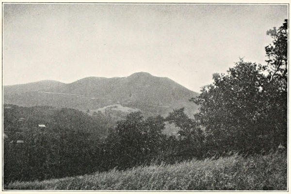
TAMALPAIS.
“ ... like one great amethyst hanging against the sunset.”
MOUNT DIABLO
Mount Diablo (devil mountain), is an isolated, conical peak of the Coast Range, in Contra Costa County, about thirty-eight miles northeast of San Francisco. It rises 3849 feet above the level of the sea, and is the most conspicuous land-mark in the central part of the state. General M. G. Vallejo tells the following story to account for the name: “In 1806, a military expedition from San Francisco marched against a tribe called the Bolgones, who were encamped at the foot of the mountain. There was a hot fight, which was won by the Indians. Near the end of the fight, a person, decorated with remarkable plumage, and making strange movements, suddenly appeared. After the victory, the person, called Puy (evil spirit), in the Indian tongue, departed toward the mountain. The soldiers heard that this spirit often appeared thus, and they named the mountain Diablo (devil). These appearances continued until the tribe was subdued by Lieutenant Moraga, in the same year.”
If this be the true story of the naming of Mount Diablo, and there seems to be no good reason to doubt it, it is quite likely that the Puy, or devil, was one of the “medicine men” who played upon the superstitions of the Indians by pretending to be the “spirit of the mountain.”
It is said by Dr. Vallejo that this mountain was regarded by the Indians as the home of the Devil, called in their language Pui, and that the medicine men claimed to be his agents. (Memoirs of the Vallejos, edited by James H. Wilkins, San Francisco Bulletin, January, 1914.)
SAUSALITO
Sausalito (little willow grove), the diminutive of sausal (willow grove), or, as formerly and officially written, Saucelito (little willow, from sauce), is on the west shore of the bay, in Marin County, six miles northwest of San Francisco. This is one of the delightful suburban towns around the bay, where business men of San Francisco have their homes.
MARIN COUNTY
Of Marin County, separated from San Francisco by the Golden Gate, and noted for the beauty of its scenery, we get the story from General M. G. Vallejo. It appears that in 1815 or ’16, an exploring party from San Francisco had a fight with the Licatiut tribe, so-called from a certain root used by them as food, especially in the Petaluma Valley. During this fight the chief was captured and carried to San Francisco, but afterwards escaped, and kept up constant hostilities in Petaluma Valley. He was finally converted to Christianity, and did good service for the whites as ferryman on the bay, and on account of his skill in navigating these waters, they called him El Marinero (the sailor); it is thought that the name of Marin County is a corruption of this word. El Marinero died at the mission of San Rafael in 1834.
TIBURÓN
Tiburón (shark), is on the Marin County shore, opposite San Francisco. It has been facetiously suggested that this name may have been derived from “sharks” of the land variety, but it probably came from some story connected with those of the sea.
SAN RAFAEL
Even in this land, so prodigal with its flowers from its northern to its southern borders, San Rafael, the county-seat of Marin County, fifteen miles north of San Francisco, is notable for the exceeding beauty of its gardens, where the lily and the rose bloom from year’s end to year’s end.
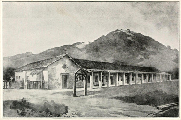
THE MISSION OF SAN RAFAEL, FOUNDED IN 1817.
“ ... where the lily and the rose bloom from year’s end to year’s end.”
Its patron, St. Raphael, “is considered the guardian angel of humanity. He was the herald who bore to the shepherds the ‘good tidings of great joy which shall be for all people’, and is especially the protector of the young, the pilgrim and the traveler.” The “herald of great joy” seems peculiarly fitting as the protector of a place where nature has done so much for the “joy of living.”
The mission of San Rafael Arcángel (St. Raphael the Archangel), founded in 1817, has now disappeared, not a vestige remaining of it.
A spur of the Coast Range in Southern California bears the name of the San Rafael Mountains.
BENICIA
Benicia (a surname), is the name of a town in Solano County, on the north side of Carquínez Strait, twenty-eight miles northeast of San Francisco. Its story may best be told in the words of General Sherman, in the following quotation from his Memoirs: “We found a solitary adobe house, occupied by Mr. Hastings and his family, embracing Dr. Semple, the proprietor of the ferry. The ferry was a ship’s boat, with a lateen sail, which could carry six or eight horses. It took us several days to cross over, and during that time we got well acquainted with the doctor, who was quite a character. He was about seven feet high. Foreseeing, as he thought, a great city on the bay somewhere, he selected Carquínez Straits as its location, and obtained from General Vallejo title to a league of land, on condition of building a city to bear the name of General Vallejo’s wife, Francisca Benicia. Accordingly, the city was first called Francisca. At this time, where San Francisco now is was known as Yerba Buena; now some of the chief men of that place, knowing the importance of a name, saw their danger, and so changed the name to San Francisco. Dr. Semple was so outraged at their changing the name to one so nearly like his town that he, in turn, changed his town’s name to the other name of Mrs. Vallejo, and Benicia it has been to this day.”
LAS PULGAS RANCHO
Las Pulgas Rancho (the fleas ranch), is near Redwood City. The story of this place, with its unpleasantly suggestive name, although of little importance in itself, is told here for the light it throws upon the manners and customs of the original dwellers in the land. Father Engelhardt, in his History of the California Missions, describes their way of living thus: “Their habitations were primitive, in summer often but a shady spot, or mere shelter of brush. Their winter quarters consisted of a flimsy structure of poles fixed in the ground, and drawn together at the top, at a height of ten or twelve feet. The poles were interwoven with small twigs, and the structure then covered with tules, or tufts of dried grass. In some places these dwellings were conical in shape, in others oblong, and their size ranged according to the number of people. At a distance they resembled large bee-hives, or small hay-stacks. On one side there was an opening for a door, at the top another for smoke. Here the family, including relatives and friends, huddled around the fire, without privacy, beds or other furniture. A few baskets, a stone mortar or two, weapons, some scanty rags of clothing, food obtained from the hunt, or seeds, were kept here. All refuse food and bones were left where they were dropped, giving the earth floor the appearance of a dog-kennel. Fleas and other vermin abounded in this mass of filth, which soon became too offensive even for savages, and they adopted the very simple method of setting fire to the hut and erecting another.”
After reading this description, we are not surprised when Father Crespi tells us that, having arrived at a deserted Indian village, and some of the soldiers having rashly taken refuge in the huts for the night, they soon rushed out with cries of “las pulgas! las pulgas!” (the fleas! the fleas!). He goes on to say, “for this reason, the soldiers called it the Ranchería de las Pulgas” (the village of the fleas), a name borne by the ranch to this day.
La Perouse, in his Voyage Autour du Monde, says the padres were never able to change this form of architecture common to the two Californias. The Indians said they liked open air, and that it was convenient, when the fleas became too numerous, to burn the house and construct a new one, an argument not without merit.
POINT LOBOS
Point Lobos (seal point, from lobo marino, sea-wolf), is just outside of the Golden Gate, on the south side, near the spot where the seals crawling about on the rocks have long been one of the chief attractions of the famous Cliff House.
SUPPLEMENTARY LIST
Álamo (cottonwood tree), is the name of a place in Contra Costa County, twenty-four miles northeast of San Francisco.
Alvarado (a surname), that of one of the first governors of the state. Alvarado is a village in Alameda County, on Alameda Creek, twenty-four miles southeast of San Francisco. Juan Bautista Alvarado was a central figure in California history. He was born at Monterey, February 14, 1809, and from ’27 on occupied various official positions, including that of governor of the state. Bancroft says of his character and appearance: “In physique Don Juan Bautista was of medium stature, stout build, fair complexion, and light hair; of genial temperament, courteous manners, and rare powers of winning friends. There was much in his character to praise, much to condemn. He was a man of dissipated habits, and engaged in intrigues, but in his favor it may be said that he had more brains, energy and executive ability than any three of his contemporaries combined; he was patriotic and with good intentions toward his country, honorable in private dealings, and never enriched himself by his intrigues. He was not personally guilty of having plundered the missions, only responsible through being governor at that time. The accusations made against him of an unjust policy towards foreigners were entirely false.”
Bolinas, the name of a town in Marin County, delightfully situated on Bolinas Bay, eighteen miles northwest of San Francisco. Bolinas is probably a corruption of Baulines, an Indian word of unknown meaning. A land grant called Los Baulines was located at the same place, and was probably the name of an Indian village.
Point Bonito (pretty point), is the southern extremity of Marin County, on the north side of the Golden Gate.
Carquínez is the name of the strait flowing between the counties of Contra Costa and Solano, and connects San Pablo Bay with Suisún Bay. The strait is eight miles long, and at its narrowest part nearly a mile wide. All the waters flowing through the great central valley of the state from the Sierra Nevada pass through this strait. According to the scientists the name Carquínez is derived from Karkin, the name of an Indian village in that region, but Dr. Vallejo has another story. He says the commandant at Monterey, who was a man with some classical education, named it from the Greek word karkin, crab, because of the report made by the Lieutenant Vallejo expedition of having found a great number of little crabs there. (Memoirs of the Vallejos, edited by James H. Wilkins, San Francisco Bulletin, January, 1914.)
Contra Costa (opposite coast), so-called on account of its original position directly opposite San Francisco. It should be explained that the name Contra Costa, which scarcely seems appropriate in its present application, was originally applied to the whole of the coast opposite San Francisco. Afterwards the part directly facing San Francisco was cut off to form Alameda County, thus destroying the significance of the name Contra Costa.
Martínez (a surname), is the name of the county-seat of Contra Costa County, and is on the south shore of Suisún Bay, thirty-six miles northeast of San Francisco. Ignacio Martínez was a native of the city of Mexico, born in 1771. He was a military officer under the Mexican government in California, and was commandante at San Francisco from 1822 to ’27. Bancroft says of him: “He was not popular as an officer, being haughty and despotic, but as a rancher he is spoken of as a very courteous and hospitable man. The town of Martínez takes its name from him or his family.”
Montara Point and Montara Mountains are in the western part of San Matéo County. Montara is a surname.
Olema, said to be an Indian word meaning “coyote,” is the name of a town in Marin County, one mile from the head of Tomales Bay, and thirty-five miles northwest of San Francisco.
Pacheco (a surname), that of a pioneer family of California. The town of Pacheco is in Contra Costa County, thirty miles northeast of San Francisco. Although Governor Romualdo Pacheco, of whom Bancroft says that “his record as a citizen, in respect of character, attainments and social standing was a good one,” was the most prominent member of the family, the town was not named in his honor, but for Salvio Pacheco, a man who served in many military and civil offices. “He spent his life on Mount Diablo Rancho, on which is the town bearing his name.”
Pescadero (fishing place), is in a fertile valley of San Matéo County, on the coast about forty-four miles south of San Francisco. There are a number of Pescaderos in the state.
Pinole is said to be an Aztec word, applied to any kind of grain or seeds, parched and ground. Of this flour a very appetizing sort of gruel was made. The town of Pinole is in Contra Costa County, twelve miles west of Martínez. It is the site of extensive powder works. See page 239.
Portolá (a surname), is the name of a town in San Matéo County, and was named in honor of the celebrated discoverer of San Francisco Bay.
Potrero (pasture ground), is one of the districts of San Francisco. This is only one of the many Potreros in the state.
Presidio is a word used by the Spaniards in the double meaning of prison or military post. It may be that the custom of using convicts as soldiers, prevalent with the Spanish, had something to do with this double usage of the word. The Presidio of San Francisco, now a regular military post of the United States, although still retaining its Castilian name, is picturesquely and delightfully situated on the north end of the peninsula. There is also a government presidio at Monterey.
Point Reyes (kings point), was named by Vizcaíno in honor of the “three wise men,” or “holy kings,” because it was discovered on the day of their devotion. This point is in Marin County and is the outer point of Drake’s Bay, where the noted adventurer is supposed to have made his anchorage, and where Cermeñón was wrecked.
Rodéo (round-up of cattle). Rodéos were held, and in some parts of the state still take place, for the purpose of separating and branding the cattle belonging to individual owners, an operation decidedly necessary when pastures were unfenced, and in early days one of the most picturesque features of California life. The village of Rodéo is in Contra Costa County.
San Anselmo (St. Anselm), is in Marin County.
San Bruno, a village near San Francisco, was named for St. Bruno, the founder and first abbot of the Carthusian Order. This order of monks is among the most severe in its rules, requiring almost perpetual silence of its members. Its devotees are only permitted to speak together once a week. They never eat flesh, and are compelled to labor constantly.
San Gerónimo (St. Jerome), is the saint usually pictured as accompanied by a lion, in commemoration of the well-known story of the removal of a thorn from the foot of one of those beasts by Jerome, and the devotion of the lion to him afterwards. San Gerónimo is the name of a small stream in Marin County, noted for its salmon fisheries.
San Gregorio (St. Gregory), is in San Matéo County, twenty-four miles southwest of Redwood City. St. Gregory was a noble Roman who devoted his wealth to charity, and turned his home into a hospital and monastery. He was elected to the high office of Pope, and became the composer of what is called from him the “Gregorian Chant.”
San Leandro (St. Leander), is in Alameda County, on San Leandro Creek, sixteen miles southeast of San Francisco. St. Leander was at one time Bishop of Seville, and is one of the patron saints of that city.
San Lorenzo (St. Lawrence), was a saint who suffered martyrdom by being roasted on a gridiron. The legend relates that he said to his tormentors, “I am now sufficiently cooked on this side, turn me over and roast me on the other.” San Lorenzo is in Alameda County, twenty miles southeast of San Francisco.
San Matéo (St. Matthew), is the name of a county bordering on San Francisco Bay, and of a town on the west shore of the bay, twenty-one miles south of San Francisco. St. Matthew was a Hebrew by birth, and the author of the book of the Scriptures that bears his name.
San Pablo (St. Paul), is in Contra Costa County, on San Pablo Bay, fifteen miles northeast of San Francisco. One of the legends concerning St. Paul is that “the church called ‘San Paolo delle Tre Fontane,’ near Rome, is built over three fountains which are said to have sprung up at the three places where the head of St. Paul fell and bounded, after being cut off by the executioner. It is said that the fountains vary in the warmth of the water,—the first, or the one where the head fell, being the hottest; the next, or that of the first bound, cooler; and the third still cooler.”
San Quentin (properly San Quintín) is a village in Marin County, on the west shore of San Francisco Bay, eleven miles north of San Francisco. This place, where the forbidding walls of the State’s Prison shut out the light of California’s glorious sun from the unfortunates enclosed there, very fittingly bears the name of a saint whose gloomy story runs thus: “San Quintín was the son of Zeno. He became converted and gave up a high command which he held in the Roman army, in order to preach. He labored especially in Belgium, and suffered death by being impaled on an iron spit.”—(Stories of the Saints.) It is probable, however, that the town was not directly named for this saint, but received the name indirectly from Point Quintín, on the Marin coast, which was so-called from an Indian chief of that region who had been thus christened by the Spaniards.
San Ramón (St. Raymond), is in Contra Costa County, nine miles east of Haywood. “St. Raymond belonged to the Order of Mercy, and labored for the captives among the Moors. By the Mahometans, among whom he was long a captive, for the ransom of his Christian brethren, his lips were bored through with a red-hot iron, and fastened with a padlock,” an effective, if cruel method of preventing him from preaching the Christian faith.
Suñol (a surname). Suñol is a town in Alameda County, thirty-six miles southeast of San Francisco. In Fremont’s Memoirs he refers to Don Antonio Suñol, probably a member of the same family for whom this town is named.
Tocaloma is a delightful secluded glen and creek in Marin County, not far north of San Francisco, where a hunting and fishing preserve is maintained. The word is Indian, but its meaning has not been ascertained.
Tomales Bay is an inlet of the Pacific Ocean, extending southeastward into Marin County. It is fourteen miles long. The village of Tomales is on the bay of the same name, fifty-five miles northwest of San Francisco. The name Tomales is a Spanish corruption of the Indian tamal (bay), a word which came to be applied to the natives in the neighborhood of San Francisco Bay.
Vallejo (a surname), is the name of a place in Solano County. The Vallejos were among the most prominent of the California pioneer families. “The founder of the family was Ignacio Vicente Ferrer Vallejo, born at Jalisco, Mexico, in 1748. He came of a family of pure Spanish blood, and of superior education. The most distinguished of his large family was Mariano Guadalupe, born at Monterey in 1808. Don Mariano served with great ability in various capacities under the Mexican government, and was at one time Commandante General of California. He was the founder of Sonoma, and it was to his untiring efforts that the development of the north was largely due. He foresaw the fate of his country, and finally cast in his lot with the United States, for which he seems to have been but ill-repaid. I have found none among the Californians whose public record in respect of honorable conduct, patriotic zeal, executive ability, and freedom from petty prejudices of race or religion or sectional politics is more evenly favorable than his.”—(Bancroft.)