V IN THE VICINITY OF SANTA BÁRBARA
Reading edition
Santa Bárbara, the charming little town that dreams away its existence among the flowers of its old gardens, on the shore of the sheltered stretch of water formed by the islands lying to the seaward, was named for a noble lady of Heliopolis, the daughter of Dioscorus. She became converted to Christianity, and was in consequence cruelly persecuted and finally beheaded by her own father. “The legend that her father was struck by lightning in punishment for this crime probably caused her to be regarded by the common people as the guardian saint against tempest and fire, and later, by analogy, as the protectress of artillery-men and miners.” (Catholic Encyclopedia.) For this reason her image was placed over the doors of powder magazines, and her name came at last to be applied to the magazines themselves, which are known to the Spanish people as santabárbaras. Thus is explained the apparent incongruity between the name of the gentle saint and the places for storage of the instruments of savage war.
At the time of the arrival of the Spaniards the shores of the Santa Bárbara channel probably supported a denser native population than any other part of the state. The gracious climate and never-failing food supply furnished by the generous waters of the ocean, enabled the Indians to live at ease.
When Cabrillo entered the channel in 1542, he reported that: “A great number of Indians issued from the bushes, yelling and dancing, and making signs, inviting us to come on shore. They laid down their bows and arrows and came to the vessel in a good canoe. They possessed boats, large enough to carry twelve or fourteen men, well-constructed of bent planks and cemented with bitumen.”
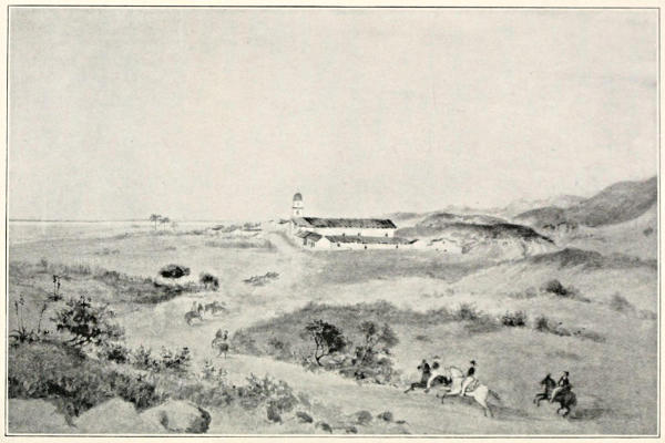
MISSION OF SANTA BÁRBARA.
“ ... its broad steps are deeply worn by the feet of many generations of worshipers.”
These Indians were of a higher order of intelligence than those further north, and were skilled in some of the arts, including the making of excellent pottery. They were expert fishermen, using nets for the purpose, and often eating the fish raw. They wore their hair long, tied up with long cords, to which many small daggers of flint, wood and bone were attached. They had some notion of music, using a primitive sort of flute, or whistle, made of the hollow bones of birds. They lived in conical houses, which were covered well down to the ground.
When Father Serra passed that way, more than two centuries later, he found the same conditions of population, counting as many as twenty populous villages along the channel. He was moved to bitter tears of grief over the delay in establishing a mission where so rich a harvest of souls lay ready to his hand. He died before this dearest wish of his heart was accomplished, yet Santa Bárbara may justly claim the honor of his presence at her birth, for he took part in the establishment of the presidio, which occurred in 1783, three years before the building of the mission. In Palou’s Life of Serra he describes that occasion thus: “The party traveled along the coast of the channel, in sight of the islands which form it, and when they judged it to be about half-way, about nine leagues from San Buenaventura, they stopped and selected a site for the presidio, in sight of the beach, which there forms a sort of bay, furnishing anchorage for ships. On this beach there was a large village of Gentiles. Here the cross was raised, Father Serra blessed it and the land, and held mass. The following day they began to cut wood for the building of the chapel, the priest’s house, officials’ houses, cuartel, almacenes (storehouses), houses for families of married soldiers and the stockade.”
The mission, which is still in an excellent state of preservation, was not established until December 4, 1786, although Serra looked upon that location as the most desirable in California, and spent the last years of his life in constant efforts to urge on the authorities to the work. That his hopes were realized to the full after his death, and that large numbers of natives, as well as the succeeding white parishioners, knelt before the altar dedicated to the gentle Santa Bárbara, is evidenced by the deeply worn marks of several generations of feet to be seen in the wide flight of steps at the entrance.
A circumstance that makes Santa Bárbara unique among the missions is that within her gardens, hidden behind their secluding walls, there is a “holy of holies” where no woman’s foot is permitted to desecrate the sacred ground. It is quite likely that this rule is kept up by the brothers now in charge of the mission, rather through a desire to preserve the traditions of the old church than through any unwarranted prejudice against the fair sex.
SAN BUENAVENTURA
San Buenaventura Mission, at the town now called Ventura, stands near the southeastern end of the Santa Bárbara channel. It was the last work of the great Serra, and was founded March 31, 1782, by the venerable president himself and Father Cambón. Palou gives us a detailed account of this event in his Life of Serra: “March 26, the whole party, the largest ever engaged in the founding of a mission, soldiers, settlers, and their families, muleteers, etc., but only two priests, Padres Serra and Cambón, set out.... They went on to the head of the channel, a site near the beach, on whose edge there was a large town of Gentiles, (unbaptized Indians), well built of pyramidal houses made of straw. They raised the cross, erected an arbor to serve as chapel, made an altar and adorned it. On the last day of March they took possession and held the first mass. The natives assisted willingly in building the chapel, and continued friendly, helping to build a house for the padre,—all of wood. The soldiers began to cut timbers for their houses, and for the stockade. They also went to work at once to conduct water by ditches from a neighboring stream, to bring it conveniently near the houses, and to serve to irrigate crops. By means of a neophyte, brought from San Gabriel, they were able to communicate with the natives, and to let them know that their only purpose in coming here was to direct their souls to Heaven.”
The patron of this mission was originally named Giovanni Fidanga. When a child he fell very ill, and was taken by his mother to St. Francis to be healed. When the saint saw him recovered he exclaimed: “O buena ventura!” whereupon his mother dedicated him to God by the name of Buenaventura (good fortune). It is a pity that a name of such happy augury should be mutilated by the amputation of its first part, the town and county now appearing as Ventura.
ASUNCIÓN
In the diaries of the Spanish pioneers, a distinct impression is conveyed that the California Indians, so far from being morose and taciturn, as their brothers in other parts of the United States are often portrayed, were rather a merry lot, and received the white men everywhere in their long journey up the coast, with music, feasting and the dance. In fact, we run across a complaint now and then that their hospitality was sometimes so insistent that their guests suffered from loss of sleep, the serenading being kept up during the entire night.
Their music, no doubt of the most primitive sort, was produced by means of “a small whistle, sometimes double, sometimes single, about the size and length of a common fife. It was held in the mouth by one end, without the aid of the fingers, and only about two notes could be sounded on it.”—(Bancroft, from Cal. Farmer.)
Along the Santa Bárbara channel the festivities in honor of the strangers were especially lively. At Asunción (Ascension), a point on the coast five leagues below Carpintería, they received a reception of which we read in Costansó’s diary of the Portolá expedition of 1769, date of August 14: “We reached the coast, and came in sight of a real town, situated on a tongue or point of land, right on the shore, which it dominated, seeming to command the waters. We counted as many as thirty large and capacious houses, spherical in form, well built and thatched with grass. We judged there could not be less than four hundred souls in the town. These natives are well built and of a good disposition, very agile and alert, diligent and skillful. Their handiness and ability were at their best in the construction of their canoes, made of good pine boards, well joined and calked, and of a pleasing form. They handle these with equal skill, and three or four men go out to sea in them to fish, for they will hold eight or ten men. They use long, double-bladed paddles, and row with indescribable agility and swiftness. All their work is neat and well finished, and what is most worthy of surprise is that to work the wood and stone they have no other tools than those made of flint.... We saw, and obtained in exchange for strings of glass beads, and other trinkets, some baskets or trays made of reeds, with different designs; wooden plates, and bowls of different forms and sizes, made of one piece, so that not even those turned out in a lathe could be more successful. They presented us with a quantity of fish, particularly the kind known as bonito; it had as good a flavor as that caught in the tunny-fisheries of Cartegena de Levante, and on the coasts of Granada. We gave it the name of La Asunción de Nuestra Señora (the Ascension of Our Lady), because we reached it on the eve of that festival.”—(Translation edited by Frederick T. Teggart.)
EL BAILARÍN
El Bailarín (the dancer). This spot, one league from Carpintería, was named in honor of a nimble-footed Indian, who cheered the weary travelers on their way, as thus told by Father Crespi, in his diary of the Portolá expedition: “This place was named through the notable fact of an Indian having feasted us extraordinarily two leagues beyond (always coasting the sea-shore), where there is a large town on a point of land on the same shore; which Indian was a robust man of good form, and a great dancer; through respect for him we called this town, of which our friend was a resident, El Pueblo del Bailarín (the Town of the Dancer).”
Ranchería del Baile de las Indias (Village of the Dance of the Indian Women). As a rule, the women seemed to take no part in the dances, but Costansó tells of one occasion when they joined in the festivities: “They honored us with a dance, and it was the first place where we saw the women dance. Two of these excelled the others; they had a bunch of flowers in their hands, and accompanied the dance with various graceful gestures and movements, without getting out of time in their songs. We called the place the Ranchería del Baile de las Indias.”
This place was about five leagues from Point Pedernales.
CARPINTERÍA
Carpintería is the name of a little cluster of houses near the shore about ten miles east of Santa Bárbara. It lies in a region once densely populated with natives of very “gentle and mild disposition.” The story of its naming is told by Father Crespi, of the Portolá party: “Not very far from the town we saw some springs of asphaltum. These Indians have many canoes, and at that time were constructing one, for which reason the soldiers named this town Carpintería (carpenter shop), but I baptized it with the name of San Roque.”
MONTECITO
Montecito (little hill or little wood), is the name of a small village about six miles from Santa Bárbara. The country in this vicinity, through its extraordinary charm of climate and scenery, has attracted a large number of very rich people, whose splendid country houses, in bizarre contrast, now occupy the self-same spots where the Indians once raised their flimsy huts of straw.
SANTA CRUZ ISLAND
While traversing the shore of Santa Bárbara channel, the Portolá expedition of 1769 took time to make trips to the islands and bestow names upon them. The island of Santa Cruz received its name from a rather trivial circumstance. By some chance the padres lost there a staff which bore a cross on the end. They gave it up as irretrievably lost, so were the more pleased when the Indians appeared the following day to restore it. From this they gave the island the name of Santa Cruz (Holy Cross).
RANCHERÍA DE LA ESPADA
Of the Ranchería de la Espada (village of the sword), Captain Fages, of the Portolá expedition says: “Two and a half leagues northwest of Point Conception, another glen is found with a population of twenty hearths, with 250 Indians, more or less. The natives of the settlement here are extremely poor and starved, so that they can scarcely live, being without canoes, in rugged land, and short of firewood. While here a soldier lost his sword, leaving it carelessly fastened, so that they took it from his belt. But the Indians who saw this theft themselves ran in pursuit of the thief, and deprived him of the article in order that its owner might recover it.” From this the place received the name of the Ranchería de la Espada, and the little story is still commemorated in the name of Espada Landing.
MATILIJA
Matilija Creek and Matilija Springs, in Ventura County, derive their name from an Indian village, one of those mentioned in the mission archives. The name is best known as applied to the Matilija poppy, that flower of the gods which has its native habitat along the banks of the creek. This giant poppy, by reason of its extraordinary size and delicate beauty, has a just claim to be called “queen of all California’s wild flowers,” as the Sequoia is king of her trees. It is a perennial plant, of shrubby character, and grows wild in the southern part of the state, from the Santa María River southward, extending into Lower California, where it spreads over large areas. It flourishes in particular luxuriance in the Matilija canyon, but the popular idea that that spot was its only habitat is erroneous. The shrub reaches a height of eight or ten feet, has gray-green foliage, and bears splendid, six-petaled white flowers, often six or seven inches in diameter, “of a crepe-like texture, pure glistening white, with bright yellow centers.” “It not only grows in fertile valleys, but seeks the seclusion of remote canyons, and nothing more magnificent could be imagined than a steep canyon-side covered with the great bushy plants, thickly covered with the enormous white flowers.”—(Miss Parsons, quoted by J. Burt Davy, in Bailey’s Cyclopedia of American Horticulture.)
POINT PEDERNALES
Captain Fages, of the Portolá party, says of this place: “Going two leagues through high land, and with a good outlook over the sea-coast, a flowing stream appears, with very good water, and near it a poor settlement of only ten houses, probably numbering about sixty inhabitants, crowded together. We stopped at the place near where a strip or point of land extends to the sea. There we gathered a multitude of flints, good for fire-arms, and so this place is called Los Pedernales (the flints).”
Point Pedernales still remains as the name of “that point of land extending into the sea,” a few miles north of Point Conception.
CAMULOS
Camulos, also spelled Kamulas, was the name of an Indian village near San Buenaventura. This village is among those mentioned in the mission archives, and is noted as the home of Ramona, the heroine of Mrs. Helen Hunt Jackson’s romance. The meaning of the word Camulos, according to Professor A. L. Kroeber, is “my fruit.”
SUPPLEMENTARY LIST
Los Álamos (the cottonwoods), is in Santa Bárbara County, northwest of Santa Bárbara. The álamo is a species of poplar tree indigenous to California and widely spread throughout the state.
Argüello Point is on the coast of Santa Bárbara County, just south of Point Pedernales. Argüello is a surname, that of a pioneer family, of which José Darío Argüello was the founder. “For many years Don José was the most prominent, influential and respected man in California.”—(Bancroft.)
Argüello Point was named by Vancouver in honor of the Spanish governor.—(Mr. Charles B. Turrill.)
El Cojo (the lame one). This place, near Point Conception, was so-named by the Spaniards because they saw here an Indian chief who was lame.
Point Concepción, the point at the southwestern extremity of Santa Bárbara County, was so-named in reference to the “immaculate conception” of the Virgin.
Los Dos Pueblos (the two towns), is on the coast a few miles west of Santa Bárbara. On October 16, 1542, the Cabrillo expedition anchored opposite two Indian villages here, and named the place Los Dos Pueblos. “Although these villages were separated only by a small stream, their inhabitants were of a different race and language, those on one side being short, thick and swarthy, and on the other tall, slender and not so dark. The depth of the kitchen refuse at the site of these two towns indicates that these Indians had lived here since the Christian era and were contemporary with the mound builders.”—(History of Santa Bárbara County.)
Gaviota (sea-gull), is on the shore a few miles west of Santa Bárbara. Father Crespi mentions having given this name to another place further down the coast: “We reached an estuary, on whose border stood a ranchería of fifty-two huts, with three hundred people. For having killed a sea-gull here, the soldiers called this place La Gaviota, but I named it San Luís Rey de Francia.” As San Luís Rey it has remained upon the map.
Gaviota Pass is an important gap in the Santa Inez range.
Every one who has crossed the bay of San Francisco in the winter season must have rejoiced in the sight of the flying convoy of those beautiful creatures, the gaviotas, by which each ferry-boat is accompanied.
Goleta (schooner), is the name of a village in Santa Bárbara County, seven miles west of Santa Bárbara.
Guadalupe (a Christian name). The town is near the northern border of Santa Bárbara County.
Lompoc is one of the names of Indian villages taken from the mission archives. It is situated fifty miles northwest of Santa Bárbara, on the Southern Pacific Railroad.
Nojoqui, in Santa Bárbara County, was presumably the name of an Indian village.
Los Olivos (the olives), is in Santa Bárbara County, on the Coast Line Railroad.
La Piedra Pintada (the painted rock), is about eighty miles from Santa Bárbara. Here there was a stone wigwam, forty or fifty yards in diameter, whose walls were covered with paintings in the form of halos and circles, with radiations from the center.—(History of Santa Bárbara County.)
Punta Gorda (fat or broad point), is one of the points of land running into the sea from the Santa Bárbara Coast. Its name indicates its shape.
Punta de las Ritas (point of the rites), perhaps refers to some religious ceremony held upon that spot.
Rincón Point (corner point), is one of the many points of land running out from the Santa Bárbara Coast.
Point Sal, was named for Hermenegi do Sal, who was one of the prominent figures in the early history of Southern California. He was a Spanish soldier who came to this coast in 1776 with Anza and his party of colonists. Sal filled many important military offices. This point was named by Vancouver for this official, who was at one time commandante of the presidio of San Francisco, in return for signal courtesies shown by him in 1792, when he permitted Vancouver to go to the mission of Santa Clara, this being the first occasion when this part of Spanish America was penetrated by any foreigner.
Sal Si Puedes (get out if you can). Several places in the state, one in the Santa Cruz Mountains, another in Santa Bárbara County, received this name, so eloquent of the rough road that the Spaniards sometimes had to travel. Captain Argüello, in his diary of the expedition of 1821, refers to his struggles in getting out of a certain canyon in these terms: “On account of its difficult situation it was named Montaña de Maltrato y Arroyo de Sal si Puedes” (mountain of ill-treatment and creek of get out if you can).
Santa Inez (St. Agnes), is the name of a river in Santa Bárbara County which rises in the coast range and falls into the Pacific Ocean about ten miles north of Cape Conception. The town of the same name is situated on this river. The Mission Santa Inez was founded September 17, 1804, by Padres Tapis, Calzada and Gutierrez. It flourished for a time, but was greatly damaged by an earthquake in 1812, was rebuilt and damaged again by the Indians in the revolt of 1824, and its partially ruined buildings still remain to tell of a vanished past. Its patroness, St. Agnes, was one of the four great virgin martyrs of the Latin Church. She was a Roman maiden of great beauty, and was condemned to death by the sword, by the Prefect Sempronius, in revenge for her refusal to marry his son, on the ground that she was “already affianced to a husband whom she loved, meaning Jesus.” Before causing her death Sempronius attempted to procure her dishonor by having her conveyed to a house of infamy, “but when she prayed to Christ that she might not be dishonored, she saw before her a shining white garment which she put on with joy, and the room was filled with great light.”
Santa María (St. Mary), so-named in honor of the mother of Christ, is in Santa Bárbara County, near the Santa María River.
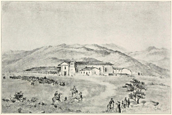
MISSION OF SANTA INEZ, FOUNDED IN 1804.
“Its patron saint is St. Agnes, one of the four great virgin martyrs of the Latin Church.”
Santa Paula (St. Paula), is in Ventura County, thirty-five miles west of San Fernando, on the Southern Pacific Railroad. “St. Paula was a noble Roman matron, a pupil and disciple of St. Jerome. Though descended from the Scipios and the Gracchi, and accustomed to luxurious self-indulgence, she preferred to follow her saintly teacher to Bethlehem and devote herself to a religious life. She built a monastery, a hospital, and three nunneries at Bethlehem.”—(Stories of the Saints.)
Sereno (serene), a place on the shore near Santa Bárbara, whose placid charm well befits its name.
Ventura (fortune), a town near the southeastern end of the Santa Bárbara channel.