SECOND DAY MORNING
Reading edition
FRESNES FORT—WITRY-LES-REIMS—BERRU—NOGENT L'ABBESSE—BEINE
(See complete Itineraries, p. 121, and map on p. 154.)
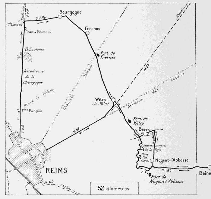
This Itinerary will lead the tourist through the region of the Forts to the north-east of Rheims, which formed the rear of the German lines during the stabilisation period of 1914-1918.
It was this line of forts that, in the German hands, held the French in check after the first Battle of the Marne. Practically the whole of these works were but little damaged by the relatively light bombardments, and have retained traces of the German organisation.
Leave Rheims by the Avenue de Laon (which begins at Les Pomenades, opposite Mars Gate), and the Rue de Neufchâtel (second street on the right), Sortie No. IX. of the Michelin Tourist Guide (see coloured plan, pp. 32-33).
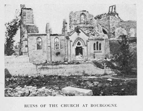
RUINS OF THE CHURCH AT BOURGOGNE
Follow in the contrary direction the route described in the preceding Itinerary (p. 134 to p. 159) as far as the crossing in the Berméricourt-Bourgogne road, where stood Landau Farm, now entirely in ruins. At this crossing take G.C. 30 on the right. German camouflaging is still visible on the right-hand side of the road.
Bourgogne—Fresnes
The village of Bourgogne, entirely in ruins, is soon reached.
The village is of very ancient origin. Formerly it was protected by a belt of moats, now partly filled in, and by earthen ramparts, almost everywhere levelled. The lines of these moats, planted with rows of elm-trees, are clearly distinguishable. There is a very extensive view from this original site.
A portion of the village was burnt by the Germans who, in 1916, destroyed the belfry of the church with dynamite.
This church (dedicated to St. Peter and St. Paul), with its fine Romanesque tower, was remarkable.
The greater part of it dated from the 12th and 13th centuries. It is now in ruins (photo above).
Cross straight through the village. Numerous German signs are still to be seen. At the cross-roads just outside the village, follow the railway, then cross it near the destroyed railway station of Fresnes. The village of Fresnes is reached shortly afterwards.
Turn to the right at the first crossing met with. The church stands about 100 yards away, on the left.
Norman in style, the Church of Fresnes comprises a central nave with aisles and a tower without transept. It dates back to the 12th century, but was several times extensively altered and restored both in the 18th century and in recent times.
A small porch of limestone added to the northern aisle, is reached by a round Norman bay of stone. In the corner of the porch, to the left on entering, is incrusted a fragment of a small funerary monument of the 16th century.
RUINED CHURCH OF WITRY-LES-REIMS
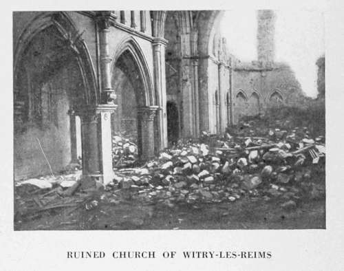
This church was almost entirely destroyed.
After turning to the right at the crossing mentioned above, keep straight on.
About 2 kilometres from Fresnes the road from that village to Witry-les-Reims crosses an old Roman causeway, at the side of which, slightly to the south of Hill 118, the Fort of Fresnes was built in 1878. This fort was blown up by the Germans during their retreat in 1918. Its ruins are impressive. In the moats of the fort are German trenches and shelters extending right up to the walls of the fort.
The village of Witry-les-Reims is next reached. It suffered severely from the numerous bombardments, which its situation near the first lines rendered inevitable.
Witry-les-Reims
After crossing the railway (l.c.) at the entrance to the village, keep straight on. The ruined church is on the left, near the entrance to the village.
Except for one tower, which dates from the 12th century, the church is modern. The spire was destroyed by the Germans. The belfry, used by the enemy as an observation-post, was struck by French shells.
Like many of the villages around Rheims, Witry-les-Reims is of Gallo-Roman origin. More than two hundred Gallic sepulchres and cinerary urns have been brought to light. The objects thus discovered, including a large number of vases, now form the Bourin pre-historic collection.
After visiting the church keep straight on. At the Mairie, of which only the front remains standing, turn to the right into the Rue Boucton-Fayréaux. Follow this street to the Place Gambetta (about 200 yards distant), where turn to the left. The entrance to "Pommern Tunnel," which connected up the German rear and front lines (photo, p. 163), is in this square.
The German inscriptions in the tunnel have been taken down, and the entrance blocked up, on account of the roof and walls giving way.
ENTRANCE TO "POMMERN TUNNEL" AT WITRY-LES-REIMS
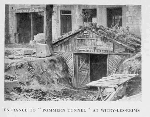
Leaving the Place Gambetta, take the Rheims-Rethel road (N. 51) on the left, then the first street on the right to the Fort of Witry.
Just outside the village the road crosses the old Roman causeway from Rheims to Trèves, and a little further on passes to the left of the Fort of Witry.
The Fort of Witry suffered but little from the bombardments.
The road climbs the northern slopes of the Berru Hill, across numerous German trenches. At the bottom of a short run-down, opposite the village of Berru, is a crossing of four ways. The road leading to the fort is the one straight ahead.
On the right, among the numerous defences, is a German cemetery containing a monument to the dead, ornamented with somewhat rudimentary carving and bearing an epitaph dedicated to the memory of the German soldiers who fell in the battles around Rheims.
The road continues up the slopes of Berru Hill, to the right of the way leading to the auxiliary battery of the fort of Vigie de Berru. The top of the hill is soon reached, on which the fort, known as the "Vigie de Berru," stands. This fort was little bombarded, and is practically intact.
Berru Hill, on account of its height, its sulphurous and ferruginous waters, flint quarries, and fertile soil, was inhabited in pre-historic times. At the summit, a campignien workshop, and farther down, above the springs which supply the village with water, a neolithic station have been discovered. Thousands of knives, arrow-heads, scrapers, saws, and other primitive tools have been unearthed. In the Gallo-Roman times the village must have been fairly important, judging by the vestiges of the ancient buildings discovered at the foot of the hill. It was near Berru that the Gaulish helmet, now in the National Museum of St. Germain, was found. Towards the end of the 16th century (about 1575), during the Leaguers' struggles around Rheims, the village was fortified, to protect it from pillaging by the soldiers. The moats and glacis which surrounded it are still visible to the south, where, covered with trees, they adjoin the gardens. Subterranean places of refuge, the entrance to which is no longer known, formerly existed underneath the village.
From the fort, the road, winds down the opposite slopes of the hill. At the bottom of the latter, leave on the right the road to the Fort of Nogent l'Abbesse, seen on the high ground to the right.
ENTRANCE TO BEINE VILLAGE BY THE ROAD TO NOGENT L'ABBESSE
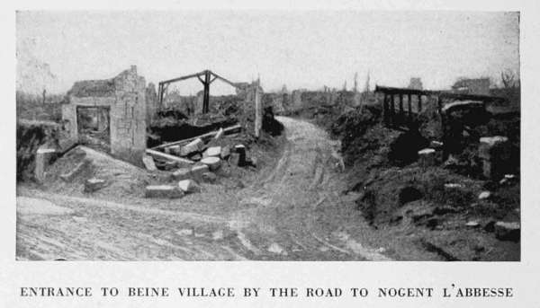
Nogent l'Abbesse—Beine—Berru
(See Itinerary, p. 160, and summary of the Military Operations, p. 154.)
The village of Nogent l'Abbesse is next reached, at the entrance to which the road divides into three branches. Take the middle one (G.C. 64), which leads to the ruined village of Beine. During the run-down to the village, there is a fine view of the Champagne Hills in front (Mont Cornillet and Mont Haut).
The village of Beine was one of the oldest demesnes belonging to the Abbey of St. Remi-de-Reims. It was made into a commune at the end of the 12th century.
The church of St. Laurent, situated in the centre of the village, was an excellent specimen of the transition style of the 12th century (photo below).
RUINS OF THE CHURCH AT BEINE
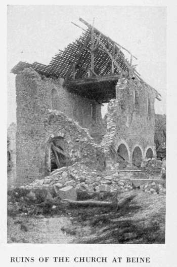
A road leading to Sillery leaves Beine in a south-westerly direction, but owing to its bad condition it is impossible to use it for returning to Rheims. The trenches and shell holes have barely been filled in, and the temporary bridges over the wider trenches would probably break down under a fairly heavy car. On the other hand, the huge craters made by the Germans in the course of their retreat, have only been summarily repaired and are not practicable for motor-cars. Tourists should therefore return to Nogent l'Abbesse by the road they came by.
BERRU CHURCH
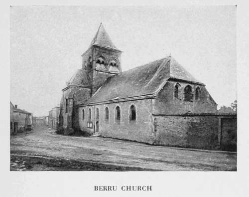
Enter the village by the main street, which follow as far as the church, whose belfry has been destroyed.
After the church, take the first street on the right, then the second road on the left (G.C. 64), which leads to Berru. In front of the village, turn to the left and cross straight through. The 12th century Church of St. Martin, which suffered only slightly from the bombardments, is in the middle of the village, on the left (photo above).
On leaving Berru, the tourist comes again to the crossing mentioned on p. 163. Turn to the right and return to Witry-les-Reims by the road previously followed.
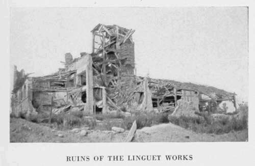
At Witry-les-Reims, take N. 51 on the left, passing by the ruined works of Linguet (photo below).
Rheims is reached by the Faubourg Cérès. Keep straight on to the Place Royale, via the Rue du Faubourg Cérès and the Rue Cérès.
RUINS OF THE LINGUET WORKS