SECOND DAY AFTERNOON
Reading edition
LA POMPELLE FORT-SILLERY
(See complete Itinerary, p. 121.)
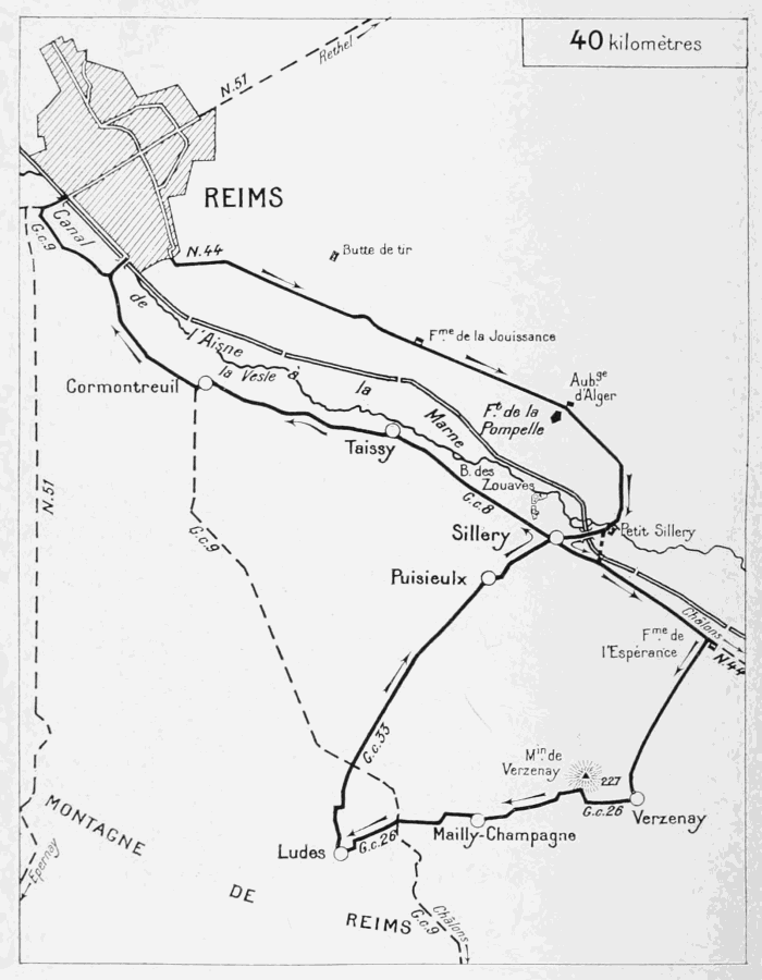
This Itinerary will take the tourist through two regions of entirely different characters.
The first part is devoted to visiting the battlefield south-east of Rheims, which was the scene of much desperate fighting throughout the war, but especially in 1918. This region formed the pivot of the French right wing, and remained firm despite the repeated powerful attacks of the enemy.
The second part of the Itinerary leaves the battlefield proper, and conducts the tourist across the most reputed vine-growing centres of Champagne (Verzenay, Mailly-Champagne and Ludes), through lovely, picturesque country, which, although it has somewhat suffered from the bombardments, has nevertheless retained its pre-war aspect.
Leave Rheims by the Avenue de Châlons, continued by N. 44 (see the plan of Rheims between pp. 32 and 33, F. 6 and H. 7).
The Avenue de Châlons was well within the first-line defences.
Two communicating trenches run along the footpaths on either side of the Avenue.
Skirt Pommery Park, on the left, completely ravaged by the bombardment and the network of trenches which cross it.
As soon as the last houses of the town have been left behind, the tourist finds himself in the midst of the battlefield.
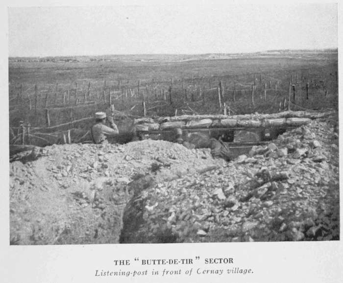
The sector, known as "La Butte-de-Tir," situated on the left, below Cernay and beyond the railway, was the scene of furious fighting throughout the German occupation of 1914 to 1918 (photo below).
THE "BUTTE-DE-TIR" SECTOR Listening-post in front of Cernay village.
COMMUNICATING TRENCH AT JOUISSANCE FARM (1915)
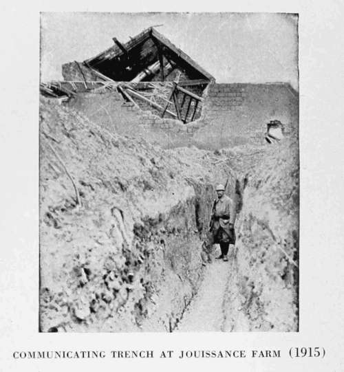
The road crosses the Châlons Railway (l.c.), and goes thence direct to the Fort of La Pompelle, passing through an inextricable network of trenches and barbed wire entanglements. The country hereabouts was completely ravaged by the terrific bombardments, and recalls the devastated regions around Verdun, near Vaux and Douaumont (see the Michelin Illustrated Guide: Verdun, and the Battles for its Possession).
La Jouissance Farm is next passed. Nothing remains either of it or of the road, which started from this point towards Cernay, on the left.
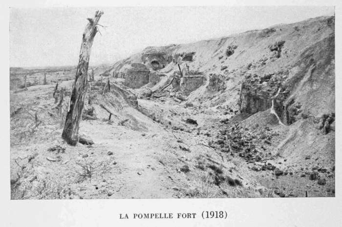
LA POMPELLE FORT (1918)
THE MOATS OF LA POMPELLE FORT (1918)
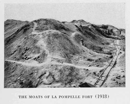
The Fort of La Pompelle, which is next reached, is now a mere heap of ruins. The road which led to the fort no longer exists. To visit the ruins of the fort, tourists will have to follow on foot the narrow-gauge railway which starts from the road (photo above).
Tradition has it that St. Timothy came from Asia to convert Rheims, suffered martyrdom, together with St. Apollinaris and several companions, on the hill known as La Pompelle, so-called perhaps from the procession (pompa or pompella) which, in the Middle Ages, used to visit the place of martyrdom of the saints.
This hill, which rises close to the crossing of the Rheims-St.-Hilaire-le-Grand and Rheims-Châlons Roads, was fortified after 1870, to flank the position of Berru on the south.
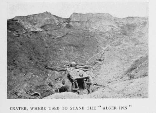
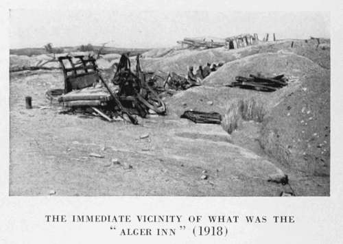
The road from Rheims to Saint-Hilaire-le-Grand (G.C. 7), which used to start from the "Alger Inn," at the cross-roads mentioned above, no longer exists. Like the inn, it was obliterated by the shelling. A huge crater now occupies the site of the Alger Inn (photo below).
CRATER, WHERE USED TO STAND THE "ALGER INN"
THE IMMEDIATE VICINITY OF WHAT WAS THE "ALGER INN" (1918)
Continue along N. 44. About 1 kilometre from the fort, at a bend in the road, the shattered remnants of trees of an avenue are visible on the left. Under the first fir-tree of this avenue, about 20 yards from the national road, is an armoured machine-gun shelter, almost intact.
Cross the railway (l.c.) near the entirely destroyed station of Petit-Sillery. After passing a ruined château on the left, cross the bridge over the Vesle. At the fork beyond the bridge, leave N. 44 and take G.C. 8 on the right to Sillery.
This village, renowned for its dry wine, is pleasantly situated on the banks of the Vesle. Throughout the war, it was quite close to the trenches and was frequently bombarded. In May, 1916, only some fifty of its inhabitants remained in the village, which subsequently suffered very severely, especially in 1918.
Take a turn in the village, then follow N. 44 towards Châlons (see Itinerary, p. 166).
THE "PLACE DE LA MAIRIE" AT SILLERY (1918)
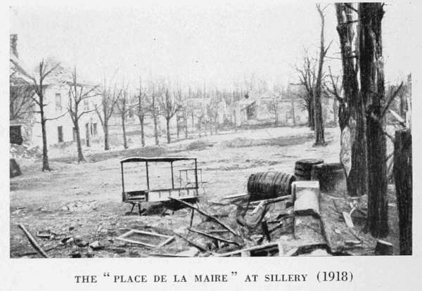
The region of Sillery-Pompelle was the scene of much fierce fighting throughout the war. After the capture of La Pompelle and the "Alger Inn" by the French 10th Corps on the night of September 17-18, 1914, the Germans increased the number of their attacks, with a view to regaining these important positions.
One of these attacks (that of December 30, 1914) was preceded by the explosion of a mine at the "Alger Inn," which made a hole 130 feet in diameter by 55 feet deep (see photo, p. 169). After a hand-to-hand fight, the French drove back the enemy and remained masters of the crater.
In 1918, during their offensives against Rheims, the Germans attacked several times in this region. On June 1, between Pommery Park (in the south-eastern outskirts of Rheims) and the north-east of Sillery, they attacked with eight or nine battalions and fifteen tanks. The garrison of Fort Pompelle, momentarily encircled, held out until a furious counter-attack by the French Colonial Infantry relieved it and drove back the assailants. The German tanks were either captured or destroyed. On the 18th, after an hour's intense bombardment, the Germans made a fresh attack and secured a footing in the Northern Cemetery of Rheims and in the north-eastern outskirts of Sillery, but French counter-attacks drove them out almost immediately. From July 15 to 17 their attacks on Sillery were likewise repulsed.
Continue along N. 44 to the destroyed Espérance Farm (about 2 kilometres distant), then turn to the right. Numerous military works were made by the French in the embankments of the Aisne-Marne canal along the left side of the road.
The road rises towards the "Mountain of Rheims." A white tower, dominating the whole plain, is seen on the left (photo below).
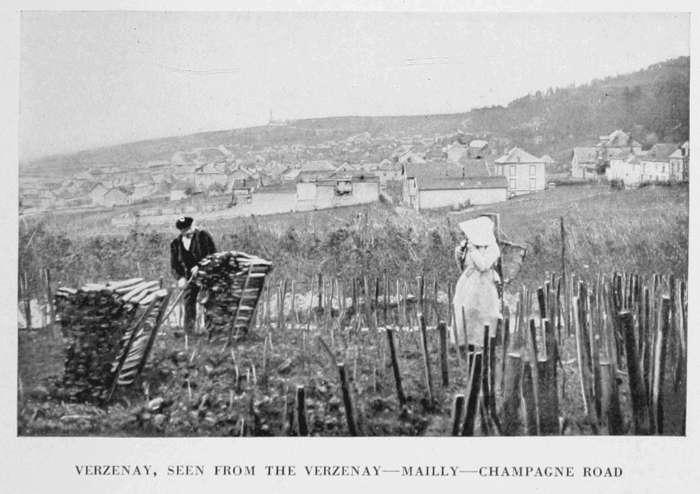
Verzenay is next reached by the Rue de Sillery.
VERZENAY, SEEN FROM THE VERZENAY—MAILLY—CHAMPAGNE ROAD
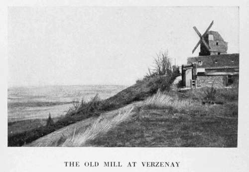
THE OLD MILL AT VERZENAY
It was at Verzenay that, on the evening of September 3, 1914, the German aeroplane, which had dropped bombs on Rheims the same morning, was brought down. It has suffered relatively little from the bombardments.
To visit the church, which contains the tomb of Saint-Basle (chapel on the right), take the Rue Gambetta, then the Rue Thiers.
After visiting the church, return to the Rue Thiers, at the end of which is the Rue de Mailly (G.C. 26).
Take the latter, which, on leaving Verzenay, rises fairly stiffly.
At the top of the hill, on the right, begins the road leading to Verzenay Mill, which crowns Hill 227 (see Itinerary, p. 166, and photo above).
This mill, whence there is a fine panorama of the plain as far as the hills of Berru and Moronvilliers, was a military observation-post of the first order during the siege warfare.
It belongs to the champagne-wine firm of Heidsieck Monopole, which allows tourists to visit it, as also their vineyards in the surrounding country.
The road dips down to Mailly-Champagne, at the entrance to which village turn to the right into the Rue Gambetta, then to the left into the Rue de Ludes (G.C. 26). The road, cut out of the hillside, is very picturesque as far as Ludes. In the forest, on the left of the road, are numerous "cendrières," or quarries, from which volcanic sulphurous cinders, used for improving the vines, are extracted. Heaps of these valuable cinders (grey, white and black) are frequently encountered at the side of the road.
Ludes is next reached by the Avenue de la Gare.
The region just passed through, including the villages of Verzenay, Mailly-Champagne and Ludes, as well as Verzy (to the east), and Rilly-la-Montagne and Villers-Allerand (to the west), are the wine-growing centres of the "Mountain of Rheims" properly so-called, the black grapes from which produce the best brands of Champagne. The villages are picturesquely situated at the edge of the forests which crown the hills, while the vineyards which cover the slopes of the latter descend to the chalky plain. These vineyards, divided into tiny plots, the ground of which before the ravages of the phylloxera cost as much as 93,000 francs per hectare (about 2-1/2 acres), constitute the principal wealth of the country. Here and there they have suffered from the war, but this has not prevented the vine-dressers from cultivating them (often with the help of the soldiers) or from gathering the grapes, under the continual menace of the German guns.
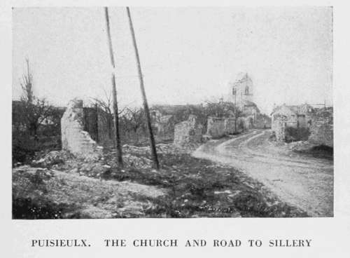
PUISIEULX. THE CHURCH AND ROAD TO SILLERY
At Ludes, in the Avenue de la Gare, turn to the right into the Rue de Cormontreuil, and again to the right, into the Rue de Puisieulx (G.C. 33).
At the crossing, 1 kilometre beyond Ludes, go straight on. After passing on the right an avenue bordered with trees leading to the Château of Romont, Puisieulx is reached.
At the first crossing, on entering the village, keep straight on, then turn to the right as far as the ruined church, with its curious loop-holed chevet. Leave the church on the right and, at the end of the village, turn to the left. There are a few graves on the right of the road. After skirting a large estate, the trees of which were destroyed by shell-fire, the tourist reaches Sillery.
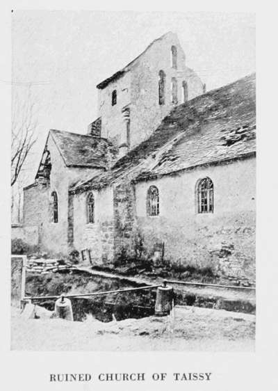
RUINED CHURCH OF TAISSY
Turn to the left into G.C. 8, at the entrance to the village. On the right are vestiges of a small wood, known as "Zouaves Wood," which was the scene of many sanguinary fights after its capture by the French in 1914.
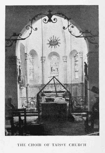
The tourist next reaches Taissy, whose ruined church is on the right, by the side of the Vesle (photo, p. 173).
This interesting church is largely Romanesque in style (tower, chevet and nave). The tabernacle, with altar-piece of carved wood, is Louis XIII. A fine wrought-iron railing encloses the sanctuary (photo below). The small, sonorous bell of the belfry is, strange to say, 13th or 14th century.
Pass straight through Taissy, then follow the tram-lines. Cormontreuil is entered by the Rue Victor-Hugo.
From Cormontreuil, the tourist may return to Rheims either by turning to the right in the village, beyond the tram station (in this case he will enter Rheims by the Rue de Cormontreuil which leads to the Place Dieu-Lumière) or by continuing straight ahead. In the latter case he will cross the Faubourg Fléchambault by the Rue Ledru-Rollin. At the end of the latter, turn to the right into the Rue Fléchambault which, after crossing the Vesle and the canal, leads to the Church of St. Remi.
THE CHOIR OF TAISSY CHURCH