ECONOMIC MINERALS.
Reading edition
With the exception of the area of iron-bearing rocks on the islands along the east coast of Hudson bay, no systematic prospecting has been done for minerals in the wide region covered by this report. Active mining at the present is confined to a mine of mica, situated at Lake harbour, on the north side of Hudson strait, a few miles east of Big island. Earlier mining consisted of the extraction of small quantities of coal from the outcrops of that mineral on Melville and Ellesmere islands by expeditions wintering there. Our knowledge of the minerals extends only to the chance observations of the earlier explorers, and to the hurried examinations made by members of the staff of the Geological Survey in the southern parts of the region under consideration.
The occurrence of Laurentian and Huronian rocks over large portions of the area, both on the islands and mainland, leads to the belief that important mineral deposits exist there in the same manner as in more southern regions of similar rocks; in fact, specimens of the more important minerals are reported from the north.
Gold.—The occurrence of gold is reported only from the head of Wager inlet, where specimens of free gold were found in the dark rocks of that locality by Dr. Rae.
The presence of large areas of undisturbed Tertiary sands and clays in the northern part of Baffin island and elsewhere are favourable to the accumulation of placer gold deposits, if the precious metal occurs in the underlying Laurentian and Huronian rocks. It would be well to test the beds of the streams flowing through these deposits when they are again visited.
Silver.—A small quantity of silver is found in the galena, which occurs in pockets in the limestone along the Whale river coast on the east side of Hudson bay. The amount of galena is small, and so widely scattered that it would probably be unprofitable to mine even in favourable circumstances.
Copper.—Tyrrell discovered large masses of Huronian rocks along the western shores of Hudson bay, to the south of Marble island. In these were many bands and masses of dark schists, all carrying quantities of iron and copper sulphides. Of these deposits he reports as follows:
‘At a point northeast of Rabbit island the character of the shore changes, and dark-green Huronian schists crop out from beneath the boulders.’
‘North of Rabbit island is a high point, on which the Eskimos are accustomed to camp while waiting for the traders from Churchill. The point is composed of green calcareous, chloritic schist, striking S. 55° W., and dipping N. 35° W. at an angle of 60°. The schist is cut by a dike seventy-five feet wide, of massive green, highly altered diabase, containing a large amount of mispickel. This diabase also outcrops along the shore, where it incloses many bands of schists.’
‘The rock at the point south of Corbett inlet is a massive green, fine or medium-grained diabase, which is now almost entirely altered into a mass of chlorite, epidote, zoisite and calcite.————This diabase is cut by many small veins of quartz and calcite, which contain large quantities of pyrite, arseno-pyrite and chalcopyrite.’
‘From Term point westward the shore is rocky, and the steep rocky cliffs descend into rather deep water. The rock is a dark-green diabase almost entirely altered to sausserite, and is cut by many veins of quartz and calcite, holding copper-pyrites.’
‘On the northern shore of Mistake bay, nine miles west of Term point, is a long point of similar diabase. Seven miles further southwest, about the middle of the west shore of Mistake bay, is a high point of similar dark-green diabase, containing in many places a large amount of copper-pyrites, and cut by small veins of quartz studded with iron pyrites.’
‘Two miles south of Sir Biddy island is a prominent rocky point, with a high rocky island lying a short distance off it. From this prominent point the shore turns westward, and is bold and rocky, being composed of dark-green fine-grained diabase, studded with copper-pyrites.’
The above extracts from Tyrrell’s report show that on his hurried journey southward from Chesterfield inlet he found Huronian rocks occupying the shores of the bay for a distance of nearly a hundred miles. At haphazard landings along this shore traces of copper deposits were found in a number of places, and these would point to important discoveries as likely to follow systematic search on this area.
A considerable amount of magnetic pyrites was found in the squeezed diabase rocks along the east coast of Hudson bay, but careful analyses failed to show any contained gold, nickel or copper in a number of specimens from various localities on that coast, and it is highly probable that no important deposits will be found in the basic rocks of that side of the bay.
Small quantities of copper-pyrites were observed in the diabase schists of the south side of Hudson strait, but never in sufficient amounts to constitute mines of that mineral.
I was informed by Captain Adams, of the whaler Diana, that he had picked up specimens of copper ore lying loose on the surface a few miles in rear of Clyde river on the east coast of Baffin island.
Among the specimens brought home by Hall from Frobisher and Cyrus Field bays, in the southeast part of Baffin island, were bornite and pyrite, showing that copper ores also occur in that portion of the island.
Iron.—Mention has been made of the iron ores on the west shores of Ungava bay, on the north side of Payne river. The rocks in which these ores are found have been altered by the intrusion of granites. They now consist of quartzites, mica-hornblende schist and crystalline limestone, and are the metamorphic representatives of the unaltered iron-bearing rocks of the interior of Labrador peninsula and the east coast of Hudson bay. In localities where the rocks are unaltered the iron ores occur either as carbonates in a cherty rock, or as a mixture of magnetite and hematite intimately associated with chert and jasper. At Payne river the iron-bearing beds have a thickness of 420 feet. The upper 70 feet is a light-yellow, fine granular quartzite containing patches of ankerite and lime. Towards the top the rock shades to a dark bluish-gray, from the presence of large quantities of magnetite in small flattened grains, together with small scales of specular iron. These are usually mixed with quartz with evidence of foliation, and at other places are in large masses of nearly pure ore. Underlying these beds is 350 feet of dark-bluish slaty quartzite holding considerable magnetite and hematite, and shading upwards into a barren quartzite. Most of the ore of this locality would probably require separation and concentration from the admixed quartz before being of a grade sufficiently high for smelting. The position of the deposits on the west side of Ungava bay, where the tide rises and falls forty feet or more, is not very promising for shipping.
More attention has been given to the iron deposits of the east side of Hudson bay than to any other of the mineral deposits of the north. In 1877, Dr. Bell explored the east shore of Hudson bay as far north as Cape Dufferin, and in his report on this exploration called attention to the deposits of iron ore found in a bedded series of rocks, chiefly sandstones, cherts and dolomites. These rocks he found forming the islands along that coast from Cape Jones, at the mouth of James bay, to Cape Dufferin, some 300 miles farther north. A strip of the same rocks occupies the mainland from the vicinity of Great Whale river to beyond the head of Richmond gulf, a distance of 120 miles.
The iron ores of value were found to be confined to the Nastapoka chain of islands, which extend northward from Little Whale river for a distance of 100 miles.
A further examination of these iron-bearing rocks was made by the writer during the summers of 1898 and 1899, and more closely during the summers of 1901 and 1902 when engaged in this work for a private company.
These iron-bearing rocks of the east side of Hudson bay have a close resemblance to those of Lake Superior, so famous for the amount and quality of their associated ores of iron. They consist of bedded sandstones, cherts, shales, graywackes and dolomites, associated with great outflows and sills of trap. The following general section of the rocks of the Nastapoka islands will give a good idea of the rocks there, while on the mainland other strata, free from or poor in iron, are found.
Descending order:—
feet.
1.Rusty weathering, dark gray, siliceous rock containing ankerite (carbonate of iron and magnesia) and magnetite20 to 100
2.Dark gray siliceous rock, containing magnetite with small quantities of ankerite50 to 250
3.Red jaspilite rich in hematite ore10 to 100
4.Red jaspilite poor in hematite ore5 to 20
5.Purple or greenish weathering, dark-green graywacke shales10 to 70
6.Red jaspilite poor in hematite ore0 to 5
7.Light greenish-gray sandstone and shale10 to 300
8.Fine grained dolomite0 to 50
The iron ores have a greater thickness and are richer on the islands in the middle of the chain than elsewhere.
The rusty weathering, dark-gray siliceous rocks of division I. are found on all the islands from Flint to McTavish, being wanting only on Cotter island. The typical rock is a dark-gray chert made up of finely divided silica showing under the microscope small grains of quartz filled in by later accessions of that material in a finely divided state. It contains minute crystals of magnetite scattered through the mass, and also patches of crystalline carbonates. At the southern end of the chain it is cherty and sometimes light-green in colour. These rocks are usually in thin beds, the parting between the beds filled with brownish ankerite, which also occurs in flat lenticular masses inclosed in the cherts; many of these masses are several inches in thickness and several square feet in area, so that the rock usually contains from twenty to fifty per cent of ankerite. These ores are too much broken and too intimately mixed with the cherts for profitable mining. The rusty character of the rock is due to surface decomposition of ankerite to limonite. The beds increase in thickness as the islands are followed northward, and reach their maximum development on Davieau island and northward to McTavish island, where they have a thickness of fifty feet. These measures can be traced southward from the Nastapoka chain in the outer islands lying along the coast for upward of 150 miles, being last seen on Long island just north of Cape Jones, where they are overlaid by a considerable thickness of trap.
The second division of the section is an arbitrary one, and was made to embrace all the beds containing important deposits of magnetite. The upper beds of the division grade into those of division I, while the lower pass gradually into division III.
The typical rock of these measures is a dark-gray, fine-grained variety of quartzite chert, containing considerable magnetite scattered through it in minute crystals; it also contains small quantities of carbonates of iron, magnesia and lime. The beds are usually thin (from one to twelve inches) and the partings between them are filled with a mixture of silica and magnetite with small quantities of ankerite. These partings vary in thickness, but are generally thin between the upper beds of the division, and quite thick (six inches to forty-eight inches) towards the bottom, where they form important ores of iron; as the beds of chert are often quite thin between two or more thick partings of ore, they might easily be neglected in mining. The mixture of silica and magnetite in the ore is an intimate one, with the silica usually in a finely divided state.
The proportion of these substances is not constant, so that the ores vary from a lean ferruginous chert to a rich ore containing upwards of sixty per cent of iron. Large quantities of the better ores occur in the lower beds of the division. The occurrence of these ores between the beds of gray siliceous rock, and their intimate association with finely divided silica, point to their deposition and enrichment from the infiltrations of waters carrying solutions of iron and silica which were deposited in the waters in cracks and between the bedding of the already-formed siliceous rocks. This mode of formation has been described by Van Hise for similar ores in the Lake Superior region.
On the three southern islands of the chain there is a gradual change in the nature of these measures. They pass into a brownish-black siliceous shale, rich in iron and containing considerable carbon as small scales of graphite. This is the form in which they are found to the southward on the islands as far as Long island. The thickness of the division is very constant on the islands northward to McTavish, but it does not occur on Cotter island.
The rocks belonging to the third division, as before stated, grade into the division above them, and the line between them cannot be drawn sharply.
The typical rock of the division is fine-grained and very siliceous, with minute particles of silica coated with red oxide of iron, forming a coarse impure red jasper.
These jasper rocks usually occur in thin broken bands, the partings between them being filled with a finely-divided mixture of hematite, magnetite and jasper. The hematite is greatly in excess of the magnetite. The association of the iron ores and the jasper is intimate, and they must have been deposited simultaneously from aqueous solutions probably leached from the cherty carbonate measures above. Microscopic sections from these rocks are almost identical with those of jaspilite figured by Van Hise in his monograph on the iron-bearing rocks of the Lake Superior region; and they must have had the same origin that he has assigned to these rocks, namely, enrichments deposited by water subsequent to the formation of the bedded rocks in which they are found as partings, and filling the most minute cavities.
The amount of ore in this admixture of hematite and jasper varies greatly. Where the ore is poor, the jaspery rock predominates and incloses lenses of hematite, while where the hematite is most plentiful it incloses similar lenses of jasper. The detailed description of these rocks shows that the measures of this division contain an immense amount of hematite. The rocks of the division do not occur on all the islands, being wanting on Flint, Belanger and Ross. On Anderson they are represented by a few thin beds not rich in ore, while on Clarke they form the summit of the section with a thickness of eighty feet. They reach their maximum development on Gillies and Taylor, where their ores are richest and most concentrated. Farther northward they become thinner and poorer in ore, being twenty feet thick on Davieau and only eight feet thick on McTavish, where they die out. No trace of these measures is found underlying the upper rocks on the islands south of the Nastapoka group.
The fourth division, consisting of red jaspilites, is an arbitrary one, of use only as a subdivision of the iron-bearing rocks. Wherever the jaspilites are well developed the richer beds are underlain with leaner measures, unfit for working, and these poorer ores constitute this division. On Clarke island these beds are twenty feet thick; on Gillies they vary from ten to twenty feet in thickness, on Taylor they are ten feet, while to the northward they merge into the overlying division, all poor in iron ores.
The richest ores are found in division III, where extensive beds several feet in thickness are found containing ore practically free from jasper, and ranging in iron values from thirty per cent to sixty per cent. Most of these ores, however, would require separation from the bands and lenses of jasper before becoming sufficiently rich to be economically treated in the furnace. The position of the ores on the islands separated from the mainland by a sound varying from a mile to four miles in width, with excellent, almost tideless, harbours, constitute ideal conditions for shipment. The mining of the ores would also be easy and cheap, if advantage were taken of the great waterpower of the Nastapoka river, which falls 160 feet into the sea within a few miles of the best ore deposits, and from which electrical power might be generated easily and cheaply. Owing to the distance of these ores from the nearest furnaces, and the want of experience in the navigation of Hudson strait, the shipment of them is at present out of the question. No coal is found in Hudson bay, so that economical smelting near the mines cannot be attempted, until electrical smelting becomes practicable some time in the future.
In all the fields where extensive areas of iron-bearing rocks occur in the Lake Superior region, the search by drilling has disclosed large deposits of concentrated ore, and there is little doubt that such a search in the Hudson bay region would lead to similar discoveries, as the manner in which the ores occur is favourable for such concentrations.
Mica.—Active mining operations for mica are being carried on at Lake harbour, on the north side of Hudson strait. This mine is being worked in connection with the whaling steamer Active. A number of white men are brought to the place from Scotland in the early summer, who, with the assistance of the Eskimos, work the mine, and then return home in the fall. Last summer thirteen tons of excellent mica were taken out in this manner. Other deposits of this mineral will probably be found on that coast to the westward in association with the crystalline limestones so largely developed there. A mica mine was opened some years ago on the west side of Cumberland gulf, but for some reason was shortly after abandoned.
Graphite.—Extensive bands, or veins, of this mineral were discovered by Mr. Caldwell to the south of Port Burwell along the east shore of Ungava bay. Graphite has also been found in the neighbourhood of Cape Wolstenholme, and along the east side of Baffin island, but no attempt has been made to develop any of the outcrops.
Molybdenite.—Flattened crystals of molybdenite have been found in many localities in the pegmatite veins penetrating the Laurentian rocks, but in no place has the quantity been sufficient for mining.
There is no doubt that the combined areas of Carboniferous and Tertiary coals are very extensive, and that they would form a valuable addition to the mineral wealth of the Dominion if they were located in a more accessible region. Situated as they are in the northern Arctic islands, where navigation is at all times uncertain and unusually perilous, it is very doubtful if they will ever prove of economic value.
Lignite.—Attention has been drawn to the occurrence of lignite of an excellent quality in the sand and clay deposits of Tertiary age along the northern and eastern shores of Baffin island and on the east side of Bylot island.
Little is known of these deposits, as the only information concerning them is derived from small float specimens picked from the beds of the streams that flow over these sands and clays. These lignites probably correspond to the bituminous coal found in the folded Tertiary rocks of the far north, and may prove to be quite extensive and of economic value, as the localities at which they have been found, although within the Arctic circle, are by no means so dangerous of access as the coal beds of the north.
Coal.—The presence of extensive deposits of coal on the island north of Lancaster sound has already been mentioned in the discussion of the Carboniferous and Tertiary formations of the northern islands. The Carboniferous rocks cover all the western islands of the Parry group, and extend northwesterly into the northwest part of Ellesmere. Parry first discovered coal in the cliffs at Winter harbour on Melville island, and used it for fuel on his ships. The Franklin search parties later found outcrops of coal in other places along the southern and eastern shores of that island and in the cliffs of Bathurst island.
These outcrops of coal indicate that the seams seen in the southern cliffs will be found extending inland over the greater portion of the islands, where they are covered by several hundred feet of newer rocks. No coal has been found in the Carboniferous rocks of Ellesmere island.
The mineral occurs in thin beds along with sandstones and shales, and is a good quality of bituminous coal.
In the folded Tertiary rocks found in the vicinity of Lady Franklin sound on the west side of Kennedy channel several outcrops of excellent bituminous coal have been discovered. The beds in the neighbourhood of Fort Conger have been mined along the outcrop and used for fuel by the Nares expedition and by Greely and Peary.
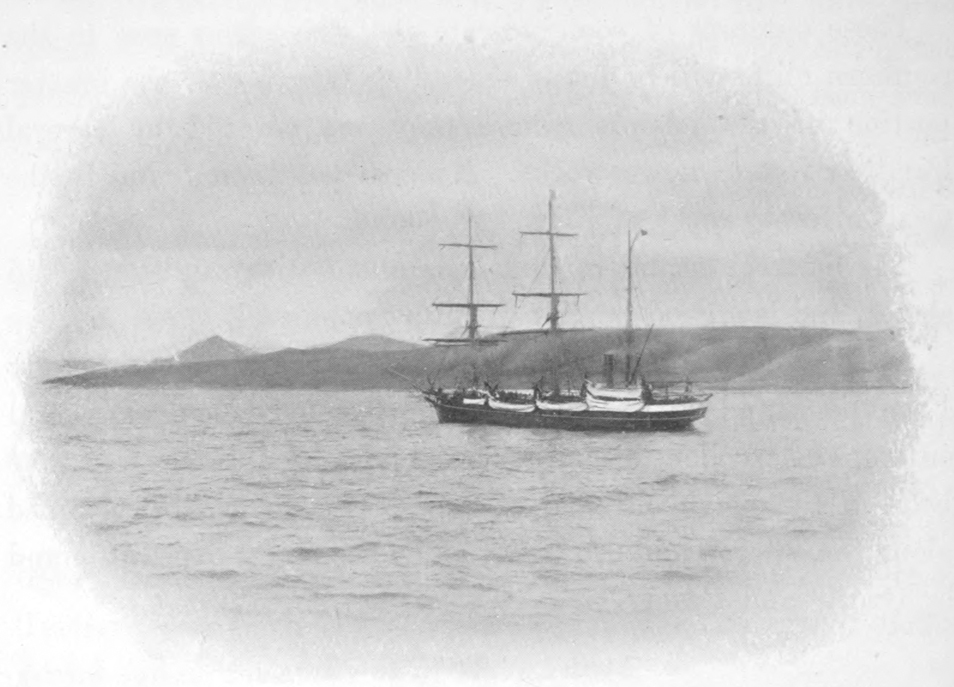
Scottish Whaler ‘Eclipse.’