Hudson's River on the West.
Reading edition
Neversink, now so written as the name of the hills on the south side of the lower or Raritan Bay, is written Neuversin by Van der Donck, Neyswesinck by Van Tienhoven, Newasons by Ogilby, 1671, and more generally in early records Naver, Neuver, Newe, and Naoshink. The original was no doubt the Lenape Newas-ink, "At the point, comer, or promontory." The root Ne (English Nâï), means, "To come to a point," "To form a point," or, as rendered by Dr. Trumbull, "A corner, angle or point," Nâïag. Dr. Schoolcraft's translation, "Between waters," and Dr. O'Callaghan's "A stream between hills," are incorrect, as can be abundantly proved. (See Nyack.)
Perth Amboy, at the mouth of Raritan River, is in part, from James, Earl of Perth, Lord High Chancellor of Scotland, who founded a settlement there, and part from Amboy (English Ambo), meaning any rising or stage, a hill or any elevation. A writer in 1684 notes: "Where the town of Perth is now building is on a shelf of land rising twenty, thirty and forty feet." Smith (Hist. of New Jersey) wrote: "Ambo, in Indian, 'A point;'" but there is no such word as Ambo, meaning "A point," in any Indian dialect. Heckewelder's interpretation: "Ompoge, from which Amboy is derived, and also Emboli, means 'A bottle,' or a place resembling a bottle," is equally erroneous, although Emboli may easily have been an Indian pronunciation of Amboy. The Indian deed of 1651 reads, "From the Raritan Point, called Ompoge," which may be read from Ompaé, Alg. generic, "Standing or upright," of which Amboy, English, is a fair interpretation.
Raritangs (Van Tienhoven), Rariton (Van der Donck), Raretans, Raritanoos, Nanakans, etc., a stream flowing to tide-water west of Staten Island, extended to the Indian sub-tribal organization which occupied the Raritan Valley, is from the radical Nâï, "A point," as in Naragan, Naraticon, Narrangansett, Nanakan, Nahican, etc., fairly traced by Dr. Trumbull in an analysis of Narragansett, and apparently conclusively established in Nanakan and Narratschoen on the Hudson, the Verdrietig Hoek, or "Tedious Point," of Dutch notation, where, after several forms it culminates in Navish. Lindstrom's Naratic-on, on the lower Delaware, was probably Cape May, and an equivalent substantially of the New England Nayantukq-ut, "A point on a tidal river," and Raritan was the point of the peninsula which the clan occupied terminating on Raritan Bay, where, probably, the name was first met by Dutch navigators. The dialectic exchange of N and R, and of the surd mutes k and t are clear in comparing Nanakan on the Hudson, Naratic-on on the Delaware, and Raritan on the Raritan. Van der Donck's map locates the clan bearing the name in four villages at and above the junction of a branch of the stream at New Brunswick, N. J., where there is a certain point as well as on Raritan Bay. The clan was conspicuous in the early days of Dutch New Netherland. Van Tienhoven wrote that it had been compelled to remove further inland on account of freshets, but mainly from its inability to resist the raids of the southern Indians; that the lands which they left unoccupied was between "two high mountains far distant from one to the other;" that it was "the handsomest and pleasantest country that man can behold." The great southern trunk-line Indian path led through this valley, and was then, as it is now, the great route of travel between the northern and the southern coast. (See Nanakan, Nyack-on-the-Hudson, and Orange.)
Orange, a familiar name in eastern New Jersey and supposed to refer to the two mountains that bound the Raritan Valley, may have been from the name of a sachem or place or both. In Breeden Raedt it is written: "The delegates from all the savage tribes, such as the Raritans, whose chiefs called themselves Oringkes from Orange." Oringkes seems to be a form of Owinickes, from Owini, N. J. (Inini, Chip., Lenni, Del.), meaning "Original, pure," etc., and -ke, "country"—literally, "First or original people of the country," an interpretation which agrees with the claim of the Indians generally when speaking of themselves. [FN] Orange is Oranje, Dutch, pure and simple, but evidently introduced to represent the sound of an Indian word. What that word was may, probably, be traced from the name given as that of the sachem, Auronge (Treaty of 1645), which seems to be an apheresis of W'scha-já-won-ge, "On the hill side," or "On the side of a hill." (Zeisb.) Awonge, Auronge, Oranje, Orange, is an intelligible progression, and, in connection with "from Orange," indicates the location of a village or the side of a hill, which the chiefs represented.
[FN] Dr. D. G. Brinton wrote me "I believe you are right in identifying Oringkes with Owine—possibly with locative k."
Succasunna, Morris County, N. J., is probably from Sûkeu, "Black," and -achsün, "Stone," with substantive verbal affix -ni. It seems to describe a place where there were black stones, but whether there are black stones there or not has not been ascertained.
Aquackanonck, Aquenonga, Aquainnuck, etc.. is probably from Achquam'kan-ong, "Bushnet fishing place." Zeisberger wrote "Achquanican, a fish dam." The locative was a point of land formed by a bend in Pasaeck River on the east side, now included in the City of Paterson. Jasper Bankers and Peter Sluyter wrote, in 1679-80: "Acquakenon: on one side is the kil, on the other is a small stream by which it (the point) is almost surrounded." The Dutch wrote here, Slooterdam, i. e. a dam with a gate or sluiceway in it, probably constructed of stone, the sluiceway being left open to enable shad to run up the stream, and closed by bushes to prevent their return to the sea. (Nelson.)
Watchung (Wacht-unk, Del.) is from Wachtschu (Zeisb.), "Hill or mountain," and -unk, locative, "at" or "on." Wachtsûnk, "On the mountain" (Zeisb.); otherwise written Wakhunk. The original application was to a hill some twelve miles west of the Hudson. The first deed (1667) placed the boundmark of the tract "At the foot of the great mountain," and the second deed (1677) extended the limit "To the top of the mountain called Watchung."
Achkinckeshacky; Hackinkeshacky, 1645; Hackinghsackin, Hackinkesack (1660); Hackensack (1685); Ackinsack, Hockquindachque; Hackquinsack, are early record forms of the name of primary application to the stream now known as the Hackensack, from which it was extended to the adjacent district, to an Indian settlement, and to an Indian sachem, or, as Van Tienhoven wrote, "A certain savage chief, named Haickquinsacq." (Breeden Raedt.) The most satisfactory interpretation of the name is that suggested by the late Dr. Trumbull: "From Huckquan, Mass., Hócquaan, Len., 'Hook,' and sauk, 'mouth of a river'—literally, 'Hook-shaped mouth,' descriptive of the course of the stream around Bergen Point, by the Kil van Kull, [FN-1] to New York Bay." Campanus wrote Hócküng, "Hook," and Zeisberger, Hócquaan. [FN-2] The German Hacken, now Hackensack, means "Hook," as in German Russel Hacken, "Pot-hook," a hook incurved at both ends, as the letter S; in Lenape Hócquoan (Zeisb.). Probably simply a substitution.
[FN-1] Before entering New York Harbor, Hudson anchored his ship below the Narrows and sent out an exploring party in a boat, who entered the Narrows and ascended as far as Bergen Point, where they encountered a second channel which they explored as far as Newark Bay. The place where the second channel was met they called "The Kils," or channels, and so it has remained—incorrectly "Kills." The Narrows they called Col, a pass or defile, or mountain-pass, hence Kil van Col, channel of the Narrow Pass, and hence Achter Col, a place behind the narrow channel. "Those [Indians] of Hackingsack, otherwise called Achter Col." (Journal of New Neth., 1641-47, Doc. Hist. N. Y., iv, 9.) . . . "Whether the Indians would sell us the hook of land behind the Kil van Col." (Col. Hist. N. Y., xiii, 280.) Achter Col became a general name for all that section of New Jersey. Kul and Kull are corruptions of Col. Arthur Kull is now applied to Newark Bay.
[FN-2] Heckewelder wrote "Okhúcquan, Woâkhucquoan, or short Húcquan for the modern Occoquan, the name of a river in Virginia, and remarked, 'All these names signify a hook.'" (Trumbull.) Rev. Thomas Campanus (Holm), who was chaplain to the Swedish settlements on the Delaware, 1642-9, and who collected a vocabulary, wrote Hócküng (ueug), "Hook." This sound of the word may have led the Dutch to adopt Hackingh as an orthography—modern Haking, "Hooking," incurved as a hook.
Commoenapa, written in several forms, was the name of the most southern of the six early Dutch settlements on the west side of Hudson's River, known in their order as Commoenapa, Aresseck, Bergen, Ahasimus, Hoboken-Hackingh, and Awiehacken. Commoenapa is now preserved as the name of the upland between Communipaw Avenue and Walnut Street, Jersey City, but was primarily applied to the arm of the main land beginning at Konstabel's Hoek, and later to the site of the ancient Dutch village of Gamœnapa, as written by De Vries in 1640, and by the local scribes, Gamœnapaen. [FN] (Col. Hist. N. Y. xiii, 36, 37.) Dunlap (Hist. N. Y., i, 50) claimed the name as Dutch from Gemeente, "Commons, public property," and Paen, "Soft land," or in combination, "Tillable land and marsh belonging to the community," a relation which the lands certainly sustained. (Col. Hist. N. Y., xiii, 234.) The lands were purchased by Michael Pauw in 1630, and sold by him to the Dutch government in 1638. Although clearly a Dutch name it has been claimed as Indian, from Lenape Gamenowinink (Zeisb.), "England, on the other side of the sea." Gamœnapaug, one of the forms of the name, is quoted as the basis of this claim; also, Acomunipag, "On the other side of the bay." The Dutch did substitute paen for paug in some cases, but it is very doubtful if they did here.
[FN] Jasper Dankers and Peter Sluyter wrote in their Journal: "Gamaenapaen is an arm of the main land on the west side of the North River, beginning at Constable's Hook, directly opposite to Staten Island, from which it is separated by the Kil van Kol. It is almost an hour broad, but has large salt meadows or marshes on the Kil van Kol. It is everywhere accessible by water from the city."
Ahasimus—Achassemus in deed to Michael Pauw, 1630—now preserved in Harsimus, was a place lying west of the "Little Island, Aressick;" later described as "The corn-land of the Indians," indicating that the name was from Lenape Chasqummes (Zeisb.), "Small corn." Ashki'muis, "Sea maize." [FN] (See Arisheck.)
[FN] "The aforesaid land Ahasimus and Aressick, by us called the Whore's Corner, extending along the river Maurites and the Island Manhates on the east side, and the Island Hobokan-Hackingh on the north side, surrounded by swamps, which are sufficiently distinct for boundaries." (Pauw Deed, Nov. 22, 1630; Col. Hist. N. Y., xiii, 3.) Mr. Winfield located Ahasimus "At that portion of Jersey City which lies east of Union Hill, excepting Paulus' Hoeck (Areisheck), . . . generally from Warren to near Grove Street."
Bergen, the name of the third settlement, is met in Scandinavian and in German dialects. "Bergen, the Flemish for Mons (Latin), 'a hill,' a town of Belgium." (Lippincott.) "Bergen, op. Zoom, 18 miles north of Antwerp, 'a hill at (or near) the bank,' or border." The original settlement was on what is now known as Jersey City Heights.
Arisheck—"The Little Island Aressick" (See Ahasimus), called by the Dutch Aresseck Houck, Hoeren Houck, and Paulus Houck—now the eastern point of Jersey City—was purchased from the Indians by Michael Pauw, Nov. 22, 1630, with "the land called Ahasimus," and, with the "Island Hobokan-Hackingh," purchased by him in July of the same year, was included in his plantation under the general name of Pavonia, a Latinized form of his own name, from Pavo, "Peacock" (Dutch Pauw), which is retained in the name of the Erie R. R. Ferry. Primarily, Arisseck was a low neck of land divided by a marsh, the eastern end forming what was called an island. The West India Company had a trading post there conducted by one Michael Paulis, from whom it was called Paulus' Hook, which it retains, Pauw also established a trading post there which, as it lay directly in the line of the great Indian trunk-path (see Saponickan), so seriously interfered with the trade of the Dutch post that the Company purchased the land from him in 1638, and in the same year sold the island to one Abraham Planck. In the deed to Planck the description reads: "A certain parcel of land called Pauwels Hoek, situated westward of the Island Manhates and eastward of Ahasimus, extending from the North River into the valley which runs around it there." (Col. Hist. N, Y., xiii, 3.) The Indian name, Arisheck or Aresseck, is so badly corrupted that the original cannot be satisfactorily detected, but, by exchanging n for r, and adding the initial K, we would have Kaniskeck, "A long grassy marsh or meadow."
Hoboken, now so written—Hobocan-Hacking, July, 1630; Hobokan-Hacking, Nov. 1630; Hobokina, 1635; Hobocken, 1643; Hoboken, 1647; Hobuck and Harboken, 1655-6—appears of record first in the Indian deed to Michael Pauw, July 12, 1630, negotiated by the Director-general and Council of New Netherland, and therein by them stated, "By us called Hobocan-Hacking." Primarily it was applied to the low promontory [FN-1] below Castle Point, [FN-2] bounded, recites the deed, on the south by the "land Ahasimus and Aressick." On ancient charts Aressick and Hoboken-Hacking are represented as two long necks of land or points separated by a cove on the river front now filled in, both points being called hooks. In records it was called an island, and later as "A neck of land almost an island, called Hobuk, . . . extending on the south side to Ahasimus; eastward to the river Mauritus, and on the west side surrounded by a valley or morass through which the boundary can be seen with sufficient clearness." (Winfield's Hist. Hudson Co.; Col. Hist. N. Y., xiii, 2, 3, 4.) In "Freedoms and Exemptions," 1635; "But every one is notified that the Company reserves, unto itself the Island Manhates; Fort Orange, with the lands and islands appertaining thereto; Staten Island; the land of Achassemes, Arassick and Hobokina." The West India Company purchased the latter lands from Michael Pauw in 1638-9, and leased and sold in three parcels as stated in the Pauw deeds. The first settlement of the parcel called by the Dutch Hobocan-Hacking is located by Whitehead (Hist. East N. J.) immediately north of Hobokan Kill and called Hobuk. Smith, in his "History of New Jersey," wrote Hobuck, and stated that it was a plantation "owned by a Dutch merchant who in the Indian wars, had his wife, children and servants murdered by the Indians." In a narrative of events occurring in 1655, it is written: "Presently we saw the house on Harboken in flames. This done the whole Pavonia was immediately in flames." [FN-3] (Col. Hist. N. Y., xii, 98.) The deed statement, "By us named," is explicit, and obviously implies that the terms in the name were Dutch and not Indian, and Dutch they surely were. Dr. A. S. Gatschet, of the Bureau of Ethnology, wrote me: "Hoboken, called after a village on the river Scheldt, a few miles below Antwerp, [FN-4] and after a high elevation on its north side. Ho-, hoh-, is the radical of 'high' in all German dialects, and Buck is 'elevation' in most of them. Buckel (Germ.), Bochel (Dutch), means 'hump,' 'hump-back.' Hump (Low German) is 'heap,' 'hill.' Ho-bok-an locates a place that is distinguished by a hill, or by a hill in some way associated with it." Presumably from the ancient village of Hoboken came to Manhattan, about 1655, one Harmon van Hobocoon, a schoolmaster, who evidently was given his family name from the village from whence he came. He certainly did not give his family name to Hoboken twenty years prior to his landing at Manhattan.
Hacking and Haken are unquestionably Dutch from the radical Haak, "hook." The first is a participle, meaning Hooking, "incurved as a hook," by metonymie, "a hook." It was used in that sense by the early Dutch as a substitute for Lenape Hócquan, "hook," in Hackingsack, and Zeisberger used it in "Ressel Hacken, pot-hook." No doubt Stuyvesant used it in the same sense in writing Hobokan-Hacking, describing thereby both a hill and a hook, corresponding with the topography, to distinguish it from its twin-hook Arisheck. Had there been an Indian name given him for it, he would have written it as surely as he wrote Arisheck. When he wrote, "By us called," he meant just what he said and what he understood the terms to mean. To assume that he wrote the terms as a substitute for Lenape Hopoakan-hacki-ug, "At (or on) the smoking-pipe land." or place where materials were obtained for making smoking-pipes, has no warrant in the record narrative. Hacking was dropped from the name in 1635.
[FN-1] An ancient view of the shore-line represents it as a considerable elevation—a hill.
[FN-2] Castle Point is just below Wehawken Cove in which Hudson is supposed to have anchored his ship in 1609. In Juet's Journal this land is described as "beautiful" and the cliff as of "the color of white green, as though it was either a copper or silver mine." It has long been a noted resort for mineralogists.
[FN-3] Teunissed van Putten was the first white resident of Hoboken. He leased the land for twelve years from Jan. 1, 1641. The West India Company was to erect a small house for him. Presumably this house is referred to in the narrative. It was north of Hoboken Kill.
[FN-4] Now a commercial village of Belgium. The prevailing dialect spoken there was Flemish, usually classed as Low German. The Low German dialects of three centuries ago are imperfectly represented in modern orthographies. In and around Manhattan eighteen different European dialects were spoken, as noted of record—Dutch, Flemish, German, Scandinavian, Walloon, etc.
Wehawken and Weehawken, as now written, is written Awiehaken in deed by Director Stuyvesant, 1658-9. Other orthographies are Wiehacken, Whehockan, Weehacken, Wehauk, obvious corruptions of the original, but all retaining a resemblance in sound. The name is preserved as that of a village, a ferry, and a railroad station about three miles north of Jersey City, and is historically noted for its association with the ancient custom of dueling, the particular resort for that purpose being a rough shelf of the cliff about two and one-half miles north of Hoboken and about opposite 28th Street, Manhattan. The locative of the name is described in a grant by Director Stuyvesant, in 1647, to one Maryn Adriaensen, of "A piece of land called Awiehaken, situate on the west side of the North River, bounded on the south by Hoboken Kil, and running thence north to the next kil, and towards the woods with the same breadth, altogether fifty morgens of land." [FN] (Col. Hist. N. Y., xiii, 22.) The "next kil" is presumed to have been that flowing to the Hudson in a wild ravine just south of the dueling ground, now called the Awiehackan. A later description (1710) reads: "Between the southernmost cliffs of Tappaen and Ahasimus, at a place called Wiehake." (Cal. N. Y. Land Papers, 98.) The petition was by Samuel Bayard, who then owned the land on both sides of Wiehacken Creek, for a ferry charter covering the passage "Between the southernmost cliffs of Tappaen and New York Island, at a place called Wiehake," the landing-place of which was established at or near the mouth of Awiehacken Creek just below what is now known as King's Point. Of the location generally Winfield (Hist.. Hudson Co., N. J.) wrote: "Before the iconoclastic hand of enterprise had touched it the whole region about was charming beyond description. Just south of the dueling ground was the wild ravine down which leaped and laughed the Awiehacken. Immediately above the dueling ground was King's Point looking boldly down upon the Hudson. From this height still opens as fair, as varied, as beautiful a scene as one could wish to see. The rocks rise almost perpendicularly to one hundred and fifty feet above the river. Under these heights, about twenty feet above the water, on a shelf about six feet wide and eleven paces long, reached by an almost inaccessible flight of steps, was the dueling ground." South of King's Point were the famed Elysian Fields, at the southern extremity of which, under Castle Point, was Sibyl's Cave, a rocky cavern containing a fine spring of water.
The place to which the name was applied in the deed of 1658 seems to have been an open tract between the streams named, presumably a field lying along the Hudson, from the description, "running back towards the woods," suggesting that it was from the Lenape radical Tauwa, as written by Zeisberger in Tauwi-échen, "Open;" as a noun, "Open or unobstructed space, clear land, without trees." Dropping the initial we have Auwi, Awie, of the early orthography; dropping A we have Wie and Wee, and from -échen we have -ákan, -haken, -hawking, etc. As the name stands now it has no meaning in itself, although a Hollander might read Wie as Wei, "A meadow," and Hacken as "Hooking," incurved as a hook, which would fairly describe Weehawking Cove as it was.
Submitted to him in one of its modern forms, the late Dr. Trumbull wrote that Wehawing "Seemed" to him as "most probably from Wehoak, Mohegan, and -ing, Lenape, locative, 'At the end (of the Palisades)'" and in his interpretation violated his own rules of interpretation which require that translation of Indian names must be sought in the dialect spoken in the district where the name appears. The word for "End," in the dialect spoken here, was Wiqui. Zeisberger wrote Wiquiechung, "End, point," which certainly does not appear in any form of the name. The Dr.'s translation is simply worthless, as are several others that have been suggested. It is surprising that the Dr. should quote a Mohegan adjectival and attach to it a Lenape locative suffix.
[FN] A Dutch "morgen"' was about two English acres.
Espating (Hespating, Staten Island deed) is claimed to have been the Indian name of what is now known as Union Hill, in Jersey City, where, it is presumed, there was an Indian village. The name is from the root Ashp (Usp, Mass.; Esp, Lenape; Ishp, Chip.), "High," and -ink, locative, "At or on a high place." From the same root Ishpat-ink, Hespating. (O'Callaghan.) See Ashpetong.
Siskakes, now Secaucus, is written as the name of a tract on Hackensack meadows, from which it was extended to Snake Hill. It is from Sikkâkâskeg, meaning "Salt sedge marsh." (Gerard.) The Dutch found snakes on Snake Hill and called it Slangberg, literally, "Snake Hill."
Passaic is a modern orthography of Pasaeck (Unami-Lenape), German notation, signifying "Vale or valley." Zeisberger wrote Pachsójeck in the Minsi dialect. The valley gave name to the stream. In Rockland County it has been corrupted to Paskack, Pasqueck, etc.
Paquapick is entered on Pownal's map as the name of Passaic Falls. It is from Poqui, "Divided, broken," and -ápuchk, "Rock." Jasper Dankers and Peter Sluyter, who visited the falls in 1679-80, wrote in their Journal that the falls were "formed by a rock stretching obliquely across the river, the top dry, with a chasm in the center about ten feet wide into which the water rushed and fell about eighty feet." It is this rock and chasm to which the name refers—"Divided rock," or an open place in a rock.
Pequannock, now so written, is the name of a stream flowing across the Highlands from Hamburgh, N. J. to Pompton, written Pachquak'onck by Van der Donck (1656); Paquan-nock or Pasqueck, in 1694; Paqunneck, Indian deed of 1709, and in other forms, was the name of a certain field, from which it was extended to the stream. Dr. Trumbull recognized it as the equivalent of Mass. Paquan'noc, Pequan'nuc, Pohqu'un-auke, etc., "A name common to all cleared land, i. e. land from which the trees and bushes had been removed to fit it for cultivation." Zeisberger wrote, Pachqu (Paghqu), as in Pachqu-échen, "Meadow;" Pachquak'onck, "At (or on) the open land."
Peram-sepus, Paramp-seapus, record forms of the name of Saddle River, [FN] Bergen County, N. J., and adopted in Paramus as the name of an early Dutch village, of which one reads in Revolutionary history as the headquarters of General George Clinton's Brigade, appears in deed for a tract of land the survey of which reads: "Beginning at a spring called Assinmayk-apahaka, being the northeastern most head-spring of a river called by the Indians Peram-sepus, and by the Christians Saddle River." Nelson (Hist. Ind. of New Jersey) quoted from a deed of 1671: "Warepeake, a run of water so called by the Indians, but the right name is Rerakanes, by the English called Saddle River." Peram-sepus also appears as Wieramius, suggesting that Pera, Para, Wara, and Wiera were written as equivalent sounds, from the root Wil (Willi, Winne, Wirri, Waure), meaning, "Good, fine, pleasant," etc. The suffix varies, Sepus meaning "Brook"; Peake (-peék), "Water-place," and Anes, "Small stream," or, substantially, Sepus, which, by the prefix Ware, was pronounced "A fine stream," or place of water.
[FN] Called "Saddle River," probably, from Richard Saddler, a purchaser of lands from the Indians in 1674. (Col. Hist. N. Y., xiii, 478.)
Monsey, a village in Rockland County, takes that name from an Indian resident who was known by his tribal name, Monsey—"the Monseys, Minsis, or Minisinks."
Mahway, Mawayway, Mawawier, etc., a stream and place now Mahway, N. J., was primarily applied to a place described: "An Indian field called Maywayway, just over the north side of a small red hill called Mainatanung." The stream, on an old survey, is marked as flowing south to the Ramapo from a point west of Cheesekook Mountain. The name is probably from Mawéwi (Zeisb.), "Assembly," where streams or paths, or boundaries, meet or come together. (See Mahequa.)
Mainaitanung, Cal. N. Y. Land Papers, and Mainating in N. J. Records, given as the name of "A small red hill" (see Mahway), does not describe a "Red hill," but a place "at" a small hill—Min-attinuey-unk. The suffixed locative, -unk, seems to have been generally used in connection with the names of hills.
Pompton—Ponton, East N. J. Records, 1695; Pompeton, Pumpton, Pompeton, N. Y. Records—now preserved in Pompton as the name of a village at the junction of the Pequannock, the Wynokie, and the Ramapo, and continued as the name of the united stream south of Pompton Village to its junction with the Passaic, and also as the name of a town in Passaic County, N. J., as well as in Pompton Falls, Pompton Plains, etc., and historically as the name of an Indian clan, appears primarily as the name of the Ramapo River as now known. It is not met in early New York Records, but in English Records, in 1694, a tract of land is described as being "On a river called Paquannock, or Pasqueck, near the falls of Pampeton," and in 1695, in application to lands described as lying "On Pompton Creek, about twenty miles above ye mouth of said creek where it falls into Paquanneck River," the particular place referred to being known as Ramopuch, and now as Ramapo. (See Ramapo.) Rev. Heckewelder located the name at the mouth of the Pompton (as now known) where it falls into the Passaic, and interpreted it from Pihm (root Pimé), "Crooked mouth," an interpretation now rejected by Algonquian students from the fact that the mouth of the stream is not crooked. A reasonable suggestion is that the original was Pomoten, a representative town, or a combination of towns. [FN-1] which would readily be converted to Pompton. In 1710, "Memerescum, 'sole sachem of all the nations (towns or families) of Indians on Remopuck River, and on the east and west branches thereof, on Saddle River, Pasqueck River, Narranshunk River and Tappan,' gave title to all the lands in upper or northwestern Bergen and Passaic counties." (Nelson, "Indians of New Jersey," 111), indicating a combination of clans. Fifty years later the tribal title is entered in the treaty of Easton (1758) as the "Wappings, Opings or Pomptons," [FN-2] as claimants of an interest in lands in northern New Jersey, [FN-3] subordinately to the "Minsis, Monseys or Minisinks," with whom the treaty was made. The clan was then living at Otsiningo as ward's of the Senecas, and seems to have been composed of representatives of several historic northern New Jersey families. It has been inferred that their designation as "Wappings" classed them as immigrants from the clans on the east side of the Hudson. Obviously, however, the term described them as of the most eastern family of the Minsis or Minisinks, which they were.
[FN-1] Pomoteneyu, "There are towns." (Zeisb.) Pompotowwut-Muhheakan-neau, was the name of the capital town of the Mahicans.
[FN-2] So recognized in the treaty of Easton.
[FN-3] The territory in which the Pomptons claimed an interest included northern New Jersey as bounded on the north by a line drawn from Cochecton, Sullivan County, to the mouth of Tappan Creek on the Hudson, thence south to Sandy Hook, thence west to the Delaware, and thence north to Cochecton, lat. 41 deg. 40 min., as appears by treaty deed in Smith's hist, of New Jersey.
Ramapo, now so written and applied to a village and a town in Rockland County, and also to a valley, a stream of water and adjacent hills, is written Ramepog in N. Y. Records, 1695; Ramepogh, 1711, and Ramapog in 1775. In New Jersey Records the orthographies are Ramopock, Romopock and Remopuck, and on Smith's map Ramopough. The earliest description of the locative of the name appears in N. Y. Records, 1695: "A certain tract of land in Orange County called Ramepogh, being upon Pompton Creek, about twenty miles above ye mouth of said creek where it falls into Pequanneck River, being a piece of low land lying at ye forks on ye west side of ye creek, and going down the said creek for ye space of six or seven miles to a small run running into said creek out of a small lake, several pieces of land lying on both sides of said creek, computed in all about ninety or one hundred acres, with upland adjoining thereto to ye quantity of twelve hundred acres." In other words: "A piece of low land lying at the forks of said river, about twenty miles above the mouth of the stream where it falls into the Pequannock, with upland adjoining." The Pompton, so called then, is now the Ramapo, and the place described in the deed has been known as Remapuck, Romapuck, Ramopuck, Ramapock, Pemerpuck, and Ramapo, since the era of first settlement. The somewhat poetic interpretation of the name, "Many ponds," is without warrant, nor does the name belong to a "Round pond," or to the stream, now the Ramapo except by extension to it. Apparently, by dialectic exchange of initials L and R, Reme, Rama, or Romo becomes Lamó from Lomówo (Zeisb.), "Downward, slanting, oblique," and -pogh, -puck, etc., is a compression of -apughk (-puchk, German notation), meaning—"Rock." Lamów-ápuchk, by contraction and pronunciation, Ramápuck, meaning "Slanting rock," an equivalent of Pimápuchk, met in the district in Pemerpock, in 1674, denoting "Place or country of the slanting rock." [FN] Ramapo River is supposed to have its head in Round Pond, in the northwest part of the town of Monroe, Orange County. It also received the overflow of eight other ponds. Ramapo Pass, beginning about a mile below Pierson's, is fourteen miles long. (See Pompton.)
[FN] Dr. John C. Smock, late State Geologist of New Jersey, wrote me of the location of the name at Suffern: "There is the name of the stream and the name of the settlement (in Rockland County, near the New Jersey line), and the land is low-lying, and along the creek, and above a forks, i. e. above the forks at Suffern. On the 1774 map in my possession, Romapock is certainly the present Ramapo. The term 'Slanting rock' is eminently applicable to that vicinity." The Ramapock Patent of 1704 covered 42,500 acres, and, with the name, followed the mountains as its western boundary.
Wynokie, now so written as the name of a stream flowing to the Pequannock at Pompton, takes that name from a beautiful valley through which it passes, about thirteen miles northwest of Paterson. The stream is the outlet of Greenwood Lake and is entered on old maps as the Ringwood. The name is in several orthographies—Wanaque, Wynogkee, Wynachkee, etc. It is from the root Win, "Good, fine, pleasant," and -aki, land or place. (See Wynogkee.)
Pamerpock, 1674, now preserved in Pamrepo as the name of a village in the northwest part of the city of Bayonne, N. J., is probably another form of Pemé-apuchk, "Slanting rock." [FN] (See Ramapo.) The name seems to have been widely distributed.
[FN] Pemé is Pemi in the Massachusetts dialect. "It may generally be translated by 'sloping' or 'aslant.' In Abnaki Pemadené (Pemi-adené) denotes a sloping mountain side," wrote Dr. Trumbull. The affix, -ápuchk, changes the meaning to sloping rock, or "slanting rock," as Zeisberger wrote.
Hohokus, the name of a village and of a railroad station, is probably from Mehŏkhókus (Zeisb.), "Red cedar." It was, presumably, primarily at least, a place where red cedar abounded. The Indian name of the stream here is written Raighkawack, an orthography of Lechauwaak, "Fork" (Zeisb.), which, by the way, is also the name of a place.
Tuxedo, now a familiar name, is a corruption of P'tuck-sepo, meaning, "A crooked river or creek." Its equivalent is P'tuck-hanné (Len. Eng. Dic.), "A bend in the river"—"Winding in the creek or river"—"A bend in a river." The earliest form of the original appears in 1754—Tuxcito, 1768; Tuxetough, Tugseto, Duckcedar, Ducksider, etc., are later. Zeisberger wrote Pduk, from which probably Duckcedar. The name seems to have been that of a bend in the river at some point in the vicinity of Tuxedo Pond to which it was extended from a certain bend or bends in the stream. A modern interpretation from P'tuksit, "Round foot," is of no merit except in its first word. It was the metaphorical name, among the Delawares, of the wolf. It would be a misnomer applied to either a river or a pond. Sepo is generic for a long river. (See Esopus.)
Mombasha, Mombashes, etc., the name of a small lake in Southfield, Orange County, is presumed to be a corruption of M'biìsses (Zeisb.), "Small lake or pond," "Small water-place." The apostrophe indicates a sound produced with the lips closed, readily pronouncing o (Mom). Charles Clinton, in his survey of the Cheesec-ook Patent in 1735, wrote Mount-Basha. Mombasa is an Arabic name for a coral island on the east coast of Africa. It may have been introduced here as the sound of the Indian name.
Wesegrorap, Wesegroraep, Wassagroras, given as the name of "A barren plain," in the Kakiate Patent, is probably from Wisachgan, "Bitter," sad, distressing, pitiable. Ziesberger wrote, "Wisachgak, Black oak," the bark of which is bitter and astringent. A black oak tree on "the west-southwest side" of the plain may have given name to the plain.
Narranshaw, Nanaschunck, etc., a place so called in the Kakiate Patent boundary, is probably a corruption of Van der Donck's Narratschæn, "A promontory" or high point. (See Nyack-on-the-Hudson.)
Kakiate, the name of patented lands in Rockland County, is from Dutch Kijkuit, meaning "Look out," or "Place of observation, as a tower, hill," etc. The highest hill in Westchester County bears the same name in Kakcout, and Kaykuit is the name of a hill in Kingston, Ulster County. The tract to which the name was extended in Rockland County is described, "Commonly called by the Indians Kackyachteweke, on a neck of land which runs under a great hill, bounded on the north by a creek called Sheamaweck or Peasqua." Hackyackawack is another orthography. The name seems to be from Schach-achgeu-ackey, meaning "Straight land," "Straight along," (Zeisb.); i. e. direct, as "A neck of land"—"A pass between mountains," or, as the description reads, "A neck of land which runs under a great hill." Compare Cal. N. Y. Land Papers, 48, 183, etc.
Torne, the name of a high hill which forms a conspicuous object in the Ramapo Valley, is from Dutch Torenherg, "A tower or turret, a high pointed hill, a pinnacle." (Prov. Eng.) The hill is claimed to have been the northwest boundmark of the Haverstraw Patent. In recent times it has been applied to two elevations, the Little Torne, west of the Hudson, and the Great Torne, near the Hudson, south of Haverstraw. (Cal. N. Y. Land Papers, 46.)
Cheesek-ook, Cheesek-okes, Cheesec-oks, Cheesquaki, are forms of the name given as that of a tract of "Upland and meadow," so described in Indian deed, 1702, and included in the Cheesek-ook Patent, covering parts of the present counties of Rockland and Orange. It is now preserved as the name of a hill, to which it was assigned at an early date, and is also quoted as the name of adjacent lands in New Jersey. The suffix -ook, -oke, -aki, etc., shows that it was the name of land or place (N. J., -ahke; Len. -aki). It is probably met in Cheshek-ohke, Ct., translated by Dr. Trumbull from Kussukoe, Moh., "High," and -ohke, "Land or place"—literally, high land or upland. The final s in some forms, is an English plural: it does not belong to the root. (See Coxackie.) In pronunciation the accent should not be thrown on the letter k; that letter belongs to the first word. There is no Kook about it.
Tappans, Carte Figurative of date (presumed) 1614-16, is entered thereon as the name of an Indian village in Lat. 41° 15', claimed, traditionally, to have been at or near the site of the later Dutch village known as Tappan, in Rockland County. In the triangulation of the locative on the ancient map is inscribed, "En effen veldt" (a flat field), the general character of which probably gave name to the Indian village. Primarily, it was a district of low, soft land, abounding in marshes and long grasses, with little variation from level, extending along the Hudson from Tappan to Bergen Point, a distance of twenty-seven miles. Wassenaer wrote, in 1621-25, Tapants; DeLaet wrote, in 1624, Tappaans; in Breeden Raedt, Tappanders; Tappaen, De Vries, 1639; Tappaen, Van der Horst deed, 1651: Tappaens, official Dutch; "Savages of Tappaen"; Tappaans, Van der Donck, are the early orthographies of the name and establish it as having been written by the Dutch with the long sound of a in the last word—paan (-paen)—which may be read pan, as a pan of any kind, natural or artificial—a stratum of earth lying below the soil—the pan of a tap into which water flows—a mortar pit. [FN-1] The compound word Tap-pan is not found in modern Dutch dictionaries, but it evidently existed in some of the German dialects, as it is certainly met in Tappan-ooli (uli) on the west coast of Summatra, in application, to a low district lying between the mountains and the sea, opposite a fine bay, in Dutch possession as early as 1618, and also in Tappan-huacanga, a Dutch possession in Brazil of contemporary date. It is difficult to believe that Tappan was transferred to those distant parts from an Indian name on Hudson's River; on the contrary its presence in those parts forces the conclusion that it was conferred by the Dutch from their own, or from some dialect with which they were familiar, precisely as it was on Hudson's River and was descriptive of a district of country the features of which supply the meaning. DeLaet wrote in his "New World" (Leyden Edition, 1625-6) of the general locative of the name on the Hudson: "Within the first reach, on the west side of the river, where the land is low, dwells a nation of savages named Tappaans," presumably so named by the Dutch from the place where they had jurisdiction, i. e. the low lands. Specifically, De Vries wrote in 1639, Tappaen as the name of a place where he found and purchased, "A beautiful valley of clay land, some three or four feet above the water, lying under the mountains, along the river," presumed to have been in the meadows south of Piermont, into which flows from the mountains Tappan Creek, now called Spar Kill, [FN-2] as well as the overflow of Tappan Zee, of which he wrote without other name than "bay": "There flows here a strong flood and ebb, but the ebb is not more than four feet on account of the great quantity of water that flows from above, overflowing the low lands in the spring," converting them into veritable soft lands. Gamænapaen, now a district in Jersey City, was interpreted by the late Judge Benson, "Tillable land and marsh." Dr. Trumbull wrote: "Petuckquapaugh, Dumpling Pond (round pond) gave name to part of the township of Greenwich, Ct. The Dutch called this tract Petuck-quapaen." The tract is now known as Strickland Plain, [FN-3] and is described as "Plain and water-land"—"A valley but little above tidewater; on the southwest an extended marsh now reclaimed in part." The same general features were met in Petuckquapaen, now Greenbath, opposite Albany, N. Y. Dr. Trumbull also wrote, "The Dutch met on Long Island the word Seaump as the name of corn boiled to a pap. The root is Saupáe (Eliot), 'soft,' i. e. 'made soft by water,' as Saupáe manoosh, 'mortar,' literally 'softened clay.' Hence the Dutch word Sappaen—adopted by Webster Se-pawn." Other examples could be quoted but are not necessary to establish the meaning of Dutch Tappaan, or Tappaen. An interpretation by Rev. Heckewelder, quoted by Yates & Moulton, and adopted by Brodhead presumably without examination: "From Thuhaune (Del.), cold stream," is worthless. No Delaware Indian would have given it as the name of Tappan Creek, and no Hollander would have converted it into Tappaan or Tappaen.
The Palisade Range, which enters the State from New Jersey, and borders the Hudson on the west, terminates abruptly at Piermont. Classed by geologists as Trap Rock, or rock of volcanic origin, adds interest to their general appearance as calumnar masses. The aboriginal owners were not versed in geologic terms. To them the Palisades were simply -ompsk, "Standing or upright rock."
[FN-1] Paen, old French, meaning Pagan, a heathen or resident of a heath, from Pagus, Latin, a heath, a district of waste land.
[FN-2] Tappan Creek is now known as the Spar Kill, and ancient Tappan Landing as Tappan Slote. Slote is from Dutch Sloot. "Dutch, trench, moat." "Sloops could enter the mouth of the creek, if lightly laden, at high tide, through what, from its resemblance to a ditch, was called the Slote." (Hist. Rockl. Co.) The man or men who changed the name of the creek to Spar Kill cannot be credited with a very large volume of appreciation for the historic. The cove and mouth of the creek was no doubt the landing-place from which the Indian village was approached, and the latter was accepted for many years as the boundmark on the Hudson of the jurisdiction of New Jersey.
[FN-3] Strickland Plain was the site of the terrible massacre of Indians by English and Dutch troops under Capt. Underhill, in March, 1645. (Broadhead, Hist. N. Y., i, 390.) About eight hundred Indians were killed by fire and sword, and a considerable number of prisoners taken and sold into slavery. The Indian fort here was in a retreat of difficult access.
Mattasink, Mattaconga and Mattaconck, forms of names given to certain boundmarks "of the land or island called Mattasink, or Welch's Island," Rockland County, describe two different features. Mattaconck was "a swampy or hassocky meadow," lying on the west side of Quaspeck Pond, from whence the line ran north, 72 degrees east, "to the south side of the rock on the top of the hill," called Mattasinck. In the surveyor's notes the rock is described as "a certain rock in the form of a sugar loaf." The name is probably an equivalent of Mat-assin-ink, "At (or to) a bad rock," or a rock of unusual form. Mattac-onck seems to be an orthography of Maskék-onck, "At a swamp or hassocky meadow." Surd mutes and linguals are so frequently exchanged in this district that locatives must be relied upon to identify names. Mattac has no meaning in itself. The sound is that of Maskék.
Nyack, Rockland County, does not take that name from Kestaub-niuk, a place-name on the east side of the Hudson, as stated by Schoolcraft, nor was the name imported from Long Island, as stated by a local historian; on the contrary, it is a generic Algonquian term applicable to any point. It was met in place here at the earliest period of settlement in application to the south end of Verdrietig Hoek Mountain, as noted in "The Cove or Nyack Patent," near or on which the present village of Nyack has its habitations. It means "Land or place at the angle, point or corner," from Néïak (Del.), "Where there is a point." (See Nyack, L. I.) The root appears in many forms in record orthographies, due largely to the efforts of European scribes to express the sound in either the German or the English alphabet. Adriaen Block wrote, in 1614-16, Nahicans as the name of the people on Montauk Point; Eliot wrote Naiyag (-ag formative); Roger Williams wrote Nanhigan and Narragan; Van der Donck wrote Narratschoan on the Verdrietig Hoek Mountain on the Hudson; Naraticon appears on the lower Delaware, and Narraoch and Njack (Nyack) are met on Long Island. The root is the same in all cases, Van der Donck's Narratschoan on the Hudson, and Narraticon on the Delaware, meaning "The point of a mountain which has the character of a promontory," kindred to Néwas (Del.), "A promontory," or a high point. [FN] The Indian name of Verdrietig Hoek, or Tedious Point, is of record Newas-ink in the De Hart Patent, and in several other forms of record—Navish, Navoash-ink, Naurasonk, Navisonk, Newasons, etc., and Neiak takes the forms of Narratsch, Narrich, Narrock, Nyack, etc. Verdrietig Hoek, the northeastern promontory of Hook Mountain, is a rocky precipitous bluff forming the angle of the range. It rises six hundred and sixty-eight feet above the level of the Hudson into which it projects like a buttress. Its Dutch-English name "Tedious Point," has been spoken of in connection with Pocantico, which see.
[FN] Dr. Trumbull wrote: "Náï, 'Having corners'; Náïyag, 'A corner or angle'; Náïg-an-eag, 'The people about the point.'" William R. Gerard wrote: "The Algonquian root Ne (written by the English Náï) means 'To come to a point,' or 'To form a point.' From this came Ojibwe Naiá-shi, 'Point of land in a body of water.' The Lenape Newás, with the locative affix, makes Newás-ing, 'At the promontory.' The Lenape had another word for 'Point of land.' This was Néïak (corrupted to Nyack). It is the participial form of Néïan, 'It is a point.' The participle means, 'Where there is a point,' or literally, 'There being a point.'"
Essawatene—"North by the top of a certain hill called Essawatene," so described in deed to Hermanus Dow, in 1677—means "A hill beyond," or on the other side of the speaker. It is from Awassi (Len.), "Beyond," and -achtenne, "Hill," or mountain. Oosadenighĕ (Abn.), "Above, beyond, the mountain," or "Over the mountain." We have the same derivative in Housaten-ûk, now Housatonic.
Quaspeck, Quaspeek, Quaspeach, "Quaspeach or Pond Patent"—"A tract of land called in the Indian language Quaspeach, being bounded by the brook Kill-the-Beast, running out of a great pond." (Cal. N. Y. Land Papers, 53, 56, 70, 82.) The land included in the patent was described as "A hassocky meadow on the west side of the lake." (See Mattasink.) The full meaning of the name is uncertain. The substantival -peék, or -peach, means "Lake, pond or body of still water." [FN] As the word stands its adjectival does not mean anything. The local interpretation "Black," is entirely without merit. The pond is now known as Rockland Lake. It lies west of the Verdrietig Hoek range, which intervenes between it and the Hudson. It is sheltered on its northeast shore by the range. The ridge intervening between it and the Hudson rises 640 feet. It is a beautiful lake of clear water reposing on a sandy bottom, 160 feet above the level of the Hudson.
[FN] The equivalent Mass. word is paug, "Where water is," or "Place of water." (Trumbull.) Quassa-paug or Quas-paug, is the largest lake in Woodbury, Ct. Dr. Trumbull failed to detect the derivative of Quas, but suggested, Kiche, "Great." Probably a satisfactory interpretation will be found in Kussûk, "High." (See Quassaick.)
Menisak-cungue, so written in Indian deed to De Hart in 1666, and also in deed from De Hart to Johannes Minnie in 1695, is written Amisconge on Pownal's map, as the name of a stream in the town of Haverstraw. As De Hart was the first purchaser of lands at Haverstraw, the name could not have been from that of a later owner, as locally supposed. Pownal's orthography suggests that the original was Ommissak-kontu, Mass., "Where Alewives or small fishes are abundant." The locative was at the mouth of the stream at Grassy Point. [FN] Minnie's Falls, a creek so known, no doubt, took that name from Johannes Minnie. On some maps it is called Florus' Falls, from Florus Crom, an early settler. An unlocated place on the stream was called "The Devil's Horse Race."
[FN] Kontu, an abundance verb, is sometimes written contee, easily corrupted to cungue. Dutch Congé means "Discharge," the tail-race of a mill, or a strong, swift current. Minnie's Congé, the tail-race of Minnie's mill.
Mahequa and Mawewier are forms of the name of a small stream which constitutes one of the boundaries of what is known as Welch's Island. They are from the root Mawe, "Meeting," Mawewi, "Assembly" (Zeisb.), i. e. "Brought together," as "Where paths or streams or boundaries come together." The reference may have been to the place where the stream unites with Demarest's Kill, as shown on a map of survey in "History of Rockland County." Welch's Island was so called from its enclosure by streams and a marsh. (See Mattaconga and Mahway.)
Skoonnenoghky is written as the name of a hill which formed the southwest boundmark of a district of country purchased from the Indians by Governor Dongan in 1685, and patented to Capt. John Evans by him in 1694, described in the Indian deed as beginning on the Hudson, "At about the place called the Dancing Chamber, thence south to the north side of the land called Haverstraw, thence northwest along the hill called Skoonnenoghky" to the bound of a previous purchase made by Dongan "Called Meretange pond." (See Pitkiskaker.) The hill was specifically located in a survey of part of the line of the Evans Patent, by Cadwallader Colden, in 1722, noted as "Beginning at Stony Point and running over a high hill, part of which makes the Stony Point, and is called Kunnoghky or Kunnoghkin." (Cal. N. Y. Land Papers, 162.) The south side of Stony Point was then accepted as the "North side of the land called Haverstraw." The hills in immediate proximity, at varying points of compass, are the Bochberg (Dutch, Bochelberg, "Humpback hill"), and the Donderberg, neither of which, however, have connection with Stony Point, leaving the conclusion certain that from the fact that the line had its beginning at the extreme southeastern limit of the Point on the Hudson, the hill referred to in the survey must have been that on which the Stony Point fort of the Revolution was erected, "Part of which hill" certainly "makes the Stony Point." Colden's form of the name, "Kunnoghky or Kunnoghkin," is obviously an equivalent of Dongan's Schoonnenoghky. Both forms are from the generic root Gún, Lenape (Qûn, Mass.), meaning "Long"—Gúnaquot, Lenape, "Long, tall, high, extending upwards"; Qunnúhqui (Mass.), "Tall, high, extending upwards"; Qunnúhqui-ohke or Kunn'oghky, "Land extending upwards," high land, gradual ascent. The name being generic was easily shifted about and so it was that in adjusting the northwest line of the Evans Patent it came to have permanent abode as that of the hill now known as Schunnemunk in the town of Cornwall, Orange County, to the advantage of the proprietors of the Minisink Patent. [FN] Reference to the old patent line will be met in other connections.
[FN] The patent to Capt. John Evans was granted by Gov. Dongan in 1694, and vacated by act of the Colonial Assembly in 1708, approved by the Queen in 1708. It included Gov. Dongan's two purchases of 1784-85. {sic} It was not surveyed; its southeast, or properly its northwest line was never satisfactorily determined, but was supposed to run from Stony Point to a certain pond called Maretanze in the present town of Greenville, Orange County. Following the vacation of the patent in 1708, several small patents were granted which were described in general terms as a part of the lands which it covered. In order to locate them the Surveyor-General of the Province in 1722, propounded an inquiry as to the bounds of the original grant; hence the survey by Cadwallader Colden. The line then established was called "The New Northwest Line." It was substantially the old line from Stony Point to Maretanze Pond (now Binnenwater), in Greenville, and cut off a portion of the territory which was supposed to have been included in the Wawayanda Patent. Another line was projected in 1765-6, by the proprietors of the Minisink Patent, running further northeast and the boundmark shifted to a pond north of Sam's Point, the name going with it. The transaction formed the well-known Minisink Angle, and netted the Minisink proprietors 56,000 acres of unoccupied lands. (Doc. Hist. N. Y., iii, 986.) Compare Cal. N. Y. Land Papers, 164, 168, 171, 172, and Map of Patents in Hist. Orange Co., quarto edition.
Reckgawank, of record in 1645 as the name of Haverstraw, appears in several later forms. Dr. O'Callaghan (Hist. New Neth.) noted: "Sessegehout, chief of Rewechnong of Haverstraw." In Col. Hist. N. Y., "Keseshout [FN-1] chief of Rewechnough, or Haverstraw," "Curruppin, brother, and representative of the chief of Rumachnanck, alias Haverstraw." In the treaty of 1645: "Sesekemick and Willem, chiefs of Tappans and Reckgawank," which Brodhead found converted to "Kumachenack, or Haverstraw." [FN-2] The original is no doubt from Rekau, "Sand, gravel," with verb substantive wi, and locative -ng, or -ink; written by Zeisberger, Lekauwi. The same word appears in Rechqua-akie, now Rockaway, L. I. The general meaning, with the locative -nk or -ink, is "At the sandy place," and the reference to the sandy flats, at Haverstraw, where Sesegehout presumably resided. There is no reason for placing this clan on Long Island.
[FN-1] Sesehout seems to have been written to convey an idea of the rank of the sachem from the Dutch word Schout, "Sheriff." K'schi-sakima, "Chief, principal," or "greatest sachem." In Duchess County the latter is written t'see-saghamaugh.
[FN-2] Haverstraw is from Dutch Haverstroo. "Oat straw," presumably so named from the wild oats which grew abundantly on the flats.
Nawasink, Yan Dakah, Caquaney and Aquamack, are entered in the Indian deed to De Hart as names for lands purchased by him at Haverstraw in 1666. The deed reads: "A piece of land and meadow lying upon Hudson's River in several parcels, called by the Indians Nawasink, Yan Dakah, Caquaney, and Aquamack, within the limits of Averstraw, bounded on the east and north by Hudson's River, on the west by a creek called Menisakcungue, and on the south by the mountain." The mountain on the south could have been no other than Verdrietig Hoek, and the limit on the north the mouth of the creek in the cove formed by Grassy Point, which was long known as "The further neck." Further than is revealed by the names the places cannot be certainly identified. Taken in the order in the deed, Newasink located a place that was "At (or on) a point or promontory." It is a pure Lenape name. Yan Dakah is probably from Yu Undach, "On this side," i. e. on the side towards the speaker. Caquancy is so badly corrupted that its derivative is not recognizable. Aquamack seems to be the same word that we have in Accomack, Va., meaning, "On the Other side," or "Other side lands." In deed to Florus Crom is mentioned "Another parcel of upland and meadow known by the name of Ahequerenoy, lying north of the brook called Florus Falls and extending to Stony Point," the south line of which was the north line of the Haverstraw lands as later understood. The tract was known for years as "The end place."
Sankapogh, Indian deed to Van Cortlandt, 1683—Sinkapogh, Songepogh, Tongapogh—is given as the name of a small stream flowing to the Hudson south of the stream called Assinapink, locally now known as Swamp Kill and Snake-hole Creek. The stream is the outlet of a pool or spring which forms a marsh at or near the foot of precipitous rocks. Probably an equivalent of Natick Sonkippog, "Cool water."
Poplopen's Creek, now so written, the name of the stream flowing to the Hudson between the sites of the Revolutionary forts Clinton and Montgomery, south of West Point, and also the name of one of the ponds of which the stream is the outlet, seems to be from English Pop-looping (Dutch Loopen), and to describe the stream as flowing out quickly—Pop, "To issue forth with a quick, sudden movement"; Looping, "To run," to flow, to stream. The flow of the stream was controlled by the rise and fall of the waters in the ponds on the hills, seven in number. The outlet of Poplopen Pond is now dammed back to retain a head of water for milling purposes. It is a curious name. The possessive 's does not belong to the original—Pop-looping Creek.
Assinapink, the name of a small stream of water flowing to the Hudson from a lake bearing the same name—colloquially Sinsapink—known in Revolutionary history as Bloody Pond—is of record, "A small rivulet of water called Assin-napa-ink" (Cal. N, Y. Land Papers, 99), from Assin, "stone"; Napa, "lake, pond," or place of water, and -ink, locative, literally, "Place of water at or on the stone." The current interpretation, "Water from the solid rock," is not specially inappropriate, as the lake is at the foot of the rocks of Bare Mountain. At a certain place in the course of the stream a legal description reads: "A whitewood tree standing near the southerly side of a ridge of rocks, lying on the south side of a brook there called by the Indians Sickbosten Kill, and by the Christians Stony Brook." [FN] The Indians never called the stream Sickbosten, unless they learned that word from the Dutch, for corrupted Dutch it is. The derivative is Boos, "Wicked, evil, angry"; Zich Boos Maken, "To grow angry," referring particularly to the character of the stream in freshets.
[FN] Adv. in Newburgh Mirror, June 18, 1798.
Prince's Falls, so called in description of survey of patent to Samuel Staats, 1712: "Beginning at ye mouth of a small rivulet called by the Indians Assin-napa-ink, then up the river (Hudson) as it runs, two hundred chains, which is about four chains north of Prince's Falls, including a small rocky isle and a small piece of boggy meadow called John Cantton Huck; also a small slip of land on each side of a fall of water just below ye meadow at ye said John Cantonhuck." (Cal. N. Y. Land Papers, 99.) Long known as Buttermilk Falls and more recently as Highland Falls. In early days the falls were one of the most noted features on the lower Hudson. They were formed by the discharge over a precipice of the outlet waters of Bog-meadow Brook. They were called Prince's Falls in honor of Prince Maurice of Holland. The name was extended to the creek in the Staats survey—Prince's Kill.
Manahawaghin is of record as the name of what is now known as Iona Island, in connection with "A certain tract of land on the west side of Hudson's River, beginning on the south side of a creek called Assinapink, together with a certain island and parcel of meadow called Manahawaghin, and by the Christians Salisbury Island." The island lies about one mile south of directly opposite Anthony's Nose, and is divided from the main land by a narrow channel or marshy water-course. The tract of land lies immediately north of the Donderberg; it was the site of the settlement known as Doodletown in Revolutionary history. The name is probably from Mannahatin, the indefinite or diminutive form of Mannahata, "The Island"—literally, "Small island." The last word of the record form is badly mangled. (See Manhattan.)
Manahan, meaning "Island"—indefinite -an—is a record name of what is now known as Constitution Island, the latter title from Fort Constitution which was erected thereon during the war of the Revolution. The early Dutch navigators called it Martelaer's Rack Eiland, from Martelaer, "Martyr," and Rack, a reach or sailing course—"the Martyr's Reach"—from the baffling winds and currents encountered in passing West Point. The effort of Judge Benson to convert "Martelaer's" to "Murderer's." and "Rack" to "Rock"—"the Murderer's Rock"—was unfortunate.
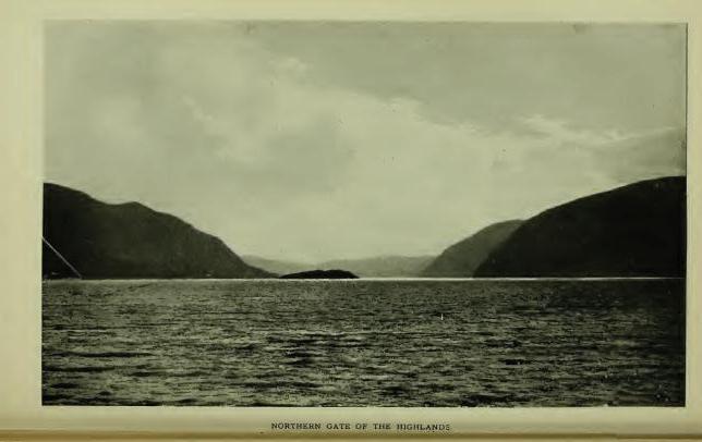
Pollepel Eiland, a small rocky island in the Hudson at the northern entrance to the Highlands, was given that name by an early Dutch navigator. It means, literally, "Pot-ladle Island," so called, presumably, from its fancied resemblance to a Dutch pot-ladle. Jasper Dankers and Peter Sluyter wrote the name in their Journal in 1679-80, indicating that the island was then well known by that title. On Van der Donck's map of 1656 the island is named Kaes Eiland. Dutch Kaas (cheese) Eiland. Dankers and Sluyter also wrote, "Boter-berg (Butter-hill), because it is like the rolls of butter which the farmers of Holland take to market." Read in connection the names are Butter Hill and Cheese Island. The same writers wrote, "Hays-berg (Hay-hill), because it is like a hay-stack in Holland," and "Donder-berg (Thunder-hill), so called from the echoes of thunder peals which culminated there." The latter retains its ancient Dutch title. It is eminently the Echo Hill of the Highlands. The oldest record name of any of the hills is Klinker-berg, which is written on the Carte Figurative of 1614-16 directly opposite a small island and apparently referred to Butter Hill. It means literally, "Stone Mountain." The passage between Butter Hill and Break Neck, on the east side of the river, was called "Wey-gat, or Wind-gate, because the wind often blowed through it with great force," wrote Dr. Dwight. The surviving name, however, is Warragat, from Dutch Warrelgat, "Wind-gate." It was at the northern entrance to this troublesome passage that Hudson anchored the Half-Moon, September 29th, 1609. Brodhead suggested (Note K, Vol. I) that Pollepel Island was that known in early Dutch history as Prince's Island, or Murderer's Creek Island, and that thereon was erected Fort Wilhelmus, referred to by Wassenaer in 1626. (Doc. Hist. N. Y., iii, 35.) The evidence is quite clear, however, that the island to which Wassenaer referred was in the vicinity of Schodac, where there was also a Murderer's Creek.
Hudson, on his exploration of the river which now bears his name, sailed into the bay immediately north of Butter Hill, now known as Newburgh Bay, on the morning of the 15th of September, 1709. After spending several days in the northern part of the river, he reached Newburgh Bay on his return voyage in the afternoon of September 29th, and cast anchor, or as stated in Juet's Journal, "Turned down to the edge of the mountains, or the northernmost of the mountains, and anchored, because the high lands hath many points, and a narrow channel, and hath many eddie winds. So we rode quietly all night." The hill or mountain long known as Breakneck, on the east side of the river, may be claimed as the northernmost, which would place his anchorage about midway between Newburgh and Pollepel Island.
Quassaick, now so written, is of record, Quasek, 1709; "Near to a place called Quasaik," 1709-10; Quasseck, 1713; "Quassaick Creek upon Hudson's River," 1714. It was employed to locate the place of settlement of the Palatine immigrants in 1709—"The Parish of Quassaick," later, "The Parish of Newburgh." It is now preserved as the name of the creek which bounds (in part) the city of Newburgh on the south. "Near to a place called Quasek," indicates that the place of settlement was located by the name of some other place which was near to it and generally known by the name. The late Dr. E. B. O'Callaghan read it, in 1856: "From Qussuk, 'Stone,' and -ick, 'Place where,' literally, 'A place of stone,'" the presumed reference being to the district through which the stream flows, which is remarkable for its deposit of glacial bowlders. The correctness of this interpretation has been questioned on very tenable grounds. Qusuk is not in the plural number and -uk does not stand for -ick. Eliot wrote: "Qussuk, a rock," and "Qussukquan-ash, rocks." Qussuk, as a substantive simply, would be accepted as the name of a place called "A rock," by metonymie, "A stone." No other meaning can be drawn from it. It does not belong to the dialect of the district, the local terms being -ápuch, "Rock," and -assin, or -achsûn, "Stone." Dr. O'Callaghan's interpretation may safely be rejected. William R. Gerard writes: "The worst corrupted name that I know of is Wequaskeg or Wequaskeek, meaning, 'At the end of the marsh.' It appears in innumerable forms—Weaxashuk, Wickerschriek, Weaquassic, etc. I think that Quassaick, changed from Quasek (1709), is one of these corruptions. The original word probably referred to some place at the end of a swamp. The word would easily become Quasekek, Quasek, and Quassaick. The formative -ek, in words meaning swamp, marsh, etc., was often dropped by both Dutch and English scribes." This conjecture would seem to locate the name as that of the end of Big Swamp, nearly five miles distant from the place of settlement. My conjecture is that the name is from Moh. Kussuhkoe, meaning "High;" with substantive Kussuhkohke, "High lands," the place of settlement being described as "Near the Highlands," which became the official designation of "The Precinct of the Highlands." Kussuhk is pretty certainly met in Cheesek-ook, the name of patented lands in the Highlands, described as "Uplands and meadows;" also in Quasigh-ook, Columbia County, which is described as "A high place on a high hill." The Palatine settlers at Quasek, wrote, in 1714, that their place was "all uplands," a description which will not be disputed at the present day. (See Cheesekook, Quissichkook, etc.)
Much-Hattoos, a hill so called in petition of William Chambers and William Sutherland, in 1709, for a tract of land in what is now the town of New Windsor, and in patent to them in 1712, a boundmark described as "West by the hill called Much-Hattoes," is apparently from Match, "Evil, bad;" -adchu, "Hill" or mountain, and -es, "Small"—"A small hill bad," or a small hill that for some reason was not regarded with favor. [FN] The eastern face of the hill is a rugged wall of gneiss; the western face slopes gradually to a swamp not far from its base and to a small lake, the latter now utilized for supplying the city of Newburgh with water, with a primary outlet through a passage under a spur of the hill, which the Indians may have regarded as a mysterious or bad place. In local nomenclature the hill has long been known as Snake Hill, from the traditionary abundance of rattle-snakes on it, though few have been seen there in later years.
[FN] "I think your reading of Muchattoos as an orthography of original Matchatchu's, is very plausible. I think Massachusetts is the same word, plus a locative suffix and English sign of the plural. It was formerly spelled in many ways: Mattachusetts, Massutchet, Matetusses, etc. Dr. Trumbull read it as standing for Mass-adchu-set, 'At the big hills'; but I learn from history that Massachusetts was originally the name of a hillock situated in the midst of a salt marsh. It was a locality selected by the sachem of his tribe as one of his places of residence. He stood in fear of his enemies, the Penobscotts, and this hillock, from its situation was a 'bad,' or difficult place to reach. So Massachsat for Matsadchuset or Mat-adchu-set plainly means, 'On the bad hillock.'" (Wm. R. Gerard.)
Cronomer's Hill and Cronomer's Valley, about three miles west of the city of Newburgh, take their names from a traditionary Indian called Cronomer, the location of whose wigwam is said to be still known as "The hut lot." The name is probably a corruption of the original, which may have been Dutch Jeronimo.
Murderer's Creek, so called in English records for many years, and by the Dutch "den Moordenaars' Kil," is entered on map of 1666, "R. Tans Kamer," or River of the Dance Chamber, and the point immediately south of its mouth, "de Bedrieghlyke Hoek" (Dutch, Bedrieglijk), meaning "a deceitful, fraudulent hook," or corner, cape, or angle. Presumably the Dutch navigator was deceived by the pleasant appearance of the bay, sailed into it and found his vessel in the mouth of the Warrelgat. Tradition affirms in explanation of the Dutch Moordenaars that an early company of traders entered their vessel in the mouth of the stream; that they were enticed on shore at Sloop Hill and there murdered. Paulding, in his beautiful story, "Naoman," related the massacre of a pioneer family at the same place. The event, however, which probably gave the name to the stream occurred in August, 1643, when boats passing down the river from Fort Orange, laden with furs, were attacked by the Indians "above the Highlands" and "nine Christians, including two women were murdered, and one woman and two children carried away prisoners," (Doc. Hist. N. Y., iv, 12), the narrative locating the occurrence by the name "den Moordenaars' Kil," i. e. the kill from which the attacking party issued forth or on which the murderers resided. The first appearance of the name in English records is in a deed to Governor Dongan, in 1685, in which the lands purchased by him included "the lands of the Murderers' Creek Indians," the stream being then well known by the name. The present name, Moodna, was converted to that form, by N. P. Willis from the Dutch "Moordenaar," by dropping letters, an inexcusable emasculation from a historic standpoint, but made poetical by his interpretation, "Meeting of the waters."
Schunnemunk, now so written, the name of a detached hill in the town of Cornwall, Orange County, appears of record in that connection, first, in the Wilson and Aske Patent of 1709, in which the tract granted is described as lying "Between the hills at Scoonemoke." Skoonnemoghky, Skonanaky, Schunnemock, Schonmack Clove, Schunnemock Hill, are other forms. In 1750 Schunnamunk appears, and in 1774, on Sauthier's map (1776) Schunnamank is applied to the range of hills which have been described as "The High Hills to the west of the Highlands." 'In a legal brief in the controversy to determine finally the northwest line of the Evans Patent, the name is written Skonanake, and the claim made that it was the hill named Skoonnemoghky in the deed from the Indians to Governor Dongan, in 1685, and therein given as the southeast boundmark of the lands of "The Murderer's Creek Indians," and, later, the hill along which the northwest line of the Evans Patent ran, which it certainly was not, although the name is probably from the same generic. (See Schoonnenoghky.) The hill forms the west shoulder of Woodbury Valley. It is a somewhat remarkable elevation in geological formation and bears on its summit many glacial scratches. On its north spur stood the castle of Maringoman, one of the grantors of the deed to Governor Dongan, and who later removed to the north side of the Otter Kill where his wigwam became a boundmark in two patents. [FN] The traditionary word "castle," in early days of Indian history, was employed as the equivalent of town, whether palisaded or not. In this case we may read the name, "Maringoman's Town," which may or may not have been palisaded. It seems to have been the seat of the "Murderer's Creek Indians." The burial ground of the clan is marked on a map of the Wilson and Aske Patent, and has been located by Surveyor Fred J. McKnight (1898) on the north side of the Cornwall and Monroe line and very near the present road past the Houghton farm, near which the castle stood. The later "cabin" of the early sachem is plainly located.
[FN] Van Dam Patent (1709) and Mompesson Patent (1709-12). The late Hon. George W. Tuthill wrote me in 1858: "On the northwestern bank of Murderers' Creek, about half a mile below Washingtonville, stands the dwelling-house of Henry Page (a colored man), said to be the site of Maringoman's wigman, referred to in the Van Dam Patent of 1709. The southwesterly corner of that patent is in a southwesterly direction from said Page's house."
In the controversy in regard to the northwest line of the Evans Patent, one of the counsel said: "It is also remarkable that the Murderers' Creek extends to the hill Skonanaky, and that the Indian, Maringoman, who sold the lands, did live on the south side of Murderers' Creek, opposite the house where John McLean now (1756) dwells, near the said hill, and also lived on the north bank of Murderers' Creek, where Colonel Mathews lives. The first station of his boundaries is a stone set in the ground at Maringoman's castle."
Winegtekonck, 1709—Wenighkonck, 1726; Wienackonck, 1739—is quoted as the name of what is now known as Woodcock Mountain, in the town of Blooming-Grove, It is not so connected, however, in the record of 1709, which reads: "A certain tract of land by the Indians called Wineghtek-onck and parts adjacent, lying on both sides of Murderers' Kill" (Cal. N. Y. Land Papers, 91), in which connection it seems to be another form of Mahican Wanun-ketukok, "At the winding of the river"—"A bend-of-the-river-place." Presumably the reference is to a place where the stream bends in the vicinity of the hill. The name appears in an abstract of an Indian deed to Sir Henry Ashurst, in 1709, for a tract of land of about sixteen square miles. The purchase was not patented, the place being included in the Governor Dongan purchase of 1685, and in the Evans Patent.
Sugar Loaf, the name of a conical hill in the town of Chester, Orange County, is not an Indian name of course, but it enters into an enumeration of Indian places, as in its vicinity were found by Charles Clinton, in his survey of the Cheesec-ock Patent in 1738, the unmistakable evidences of the site of an Indian village, then probably not long abandoned, and Mr. Eager (Hist. Orange Co.) quoted evidences showing that on a farm then (1846) owned by Jonathan Archer, was an Indian burying ground, the marks of which were still distinct prior to the Revolution.
Runbolt's Run, a spring and creek in the town of Goshen, are said to have taken that name from Rombout, one of the Indian grantors of the Wawayanda tract. It is probable, however, that the name is a corruption of Dutch Rondbocht, meaning, "A tortuous pool, puddle, marsh," at or near which the chief may have resided. Rombout (Dutch) means "Bull-fly." It could hardly have been the name of a run of water.
Mistucky, the name of a small stream in the town of Warwick, has lost some of its letters. Mishquawtucke (Nar.), would read, "Place of red cedars."
Pochuck, given as the name of "A wild, rugged and romantic region" in Sussex County, N. J., to a creek near Goshen, and, modernly, to a place in Newburgh lying under the shadow of Muchhattoes Hill, is no doubt from Putscheck (Len.), "A corner or repress," a retired or "out-of-the-way place." Eliot wrote Poochag, in the Natick dialect, and Zeisberger, in the Minsi-Lenape, Puts-cheek, which is certainly heard in Pochuck.
Chouckhass, one of the Indian grantors of the Wawayanda tract, left his name to what is now called Chouck's Hill, in the town of Warwick. The land on which he lived and in which he was buried came into possession of Daniel Burt, an early settler, who gave decent sepulture to the bones of the chief. [FN]
[FN] The traditional places of residence of several of the sachems who signed the Wawayanda deed is stated by a writer in "Magazine of American History," and may be repeated on that authority, viz: "Oshaquememus, chief of a village, near the point where the Beaver-dam Brook empties into Murderers' Creek near Campbell Hall; Moshopuck, on the flats now known as Haverstraw; Ariwimack, chief, on the Wallkill, extending from Goshen to Shawongunk; Guliapaw, chief of a clan residing near Long Pond (Greenwood Lake), within fifty rods of the north end of the pond; Rapingonick died about 1730 at the Delaware Water-Gap." The names given by the writer do not include all the signers of the deed. One of the unnamed grantors was Claus, so called from Klaas (Dutch), "A tall ninny"; an impertinent, silly fellow; a ninny-jack. The name may have accurately described the personality of the Indian.
Jogee Hill, in the town of Minisink, takes its name from and preserves the place of residence of Keghekapowell, alias Jokhem (Dutch Jockem for Joachim), one of the grantors of lands to Governor Dongan in 1684. The first word of his Indian name, Keghe, stands for Keche, "Chief, principal, greatest," and defined his rank as principal sachem. The canton which he ruled was of considerable number. He remained in occupation of the hill long after his associates had departed.
Wawayanda, 1702—Wawayanda or Wocrawin, 1702; Wawayunda, 1722-23; Wiwanda, Wowando, Index Col. Hist. N. Y.—the first form, one of the most familiar names in Orange County, is preserved as that of a town, a stream of water, and of a large district of country known as the Wawayanda Patent, in which latter connection it appears of record, first, in 1702, in a petition of Dr. Samuel Staats, of Albany, and others, for license to purchase "A tract of land called Wawayanda, in the county of Ulster, containing by estimation about five thousand acres, more or less, lying about thirty miles backward in the woods from Hudson's River." (Land Papers, 56.) In February of the same year the parties filed a second petition for license to "purchase five thousand acres adjoining thereto, as the petitioners had learned that their first purchase, 'called Wawayanda' was 'altogether a swamp and not worth anything.'" In November of the same year, having made the additional purchase, the parties asked for a patent for ten thousand acres "Lying at Wawayanda or Woerawin." Meanwhile Dr. John Bridges and Company, of New York, purchased under license and later received patent for "certain tracts and parcels of vacant lands in the county of Orange, called Wawayanda, and some other small tracts and parcels of lands," and succeeded in including in their patent the lands which had previously been purchased by Dr. Staats. Specifically the tract called Wawayanda or Woerawin was never located, nor were the several "certain tracts of land called Wawayanda" purchased by Dr. Bridges. The former learned in a short time, however, that his purchase was not "altogether a swamp," although it may have included or adjoined one, and the latter found that his purchase included a number of pieces of very fine lands and a number of swamps, and especially the district known as the Drowned Lands, covering some 50,000 acres, in which were several elevations called islands, now mainly obliterated by drainage and traversed by turnpikes and railroads. Several water-courses were there also, notably the stream now known as the Wallkill, and that known as the Wawayanda or Warwick Creek, a stream remarkable for its tortuous course.
What and where was Wawayanda? The early settlers on the patent seem to have been able to answer. Mr. Samuel Vantz, who then had been on the patent for fifty-five years, gave testimony in 1785, that Wawayanda was "Within a musket-shot of where DeKay lived." The reference was to the homestead house of Col. Thomas DeKay, who was then dead since 1758. The foundation of the house remains and its site is well known. In adjusting the boundary line between New York and New Jersey it was cut off from Orange County and is now in Vernon, New Jersey, where it is still known as the "Wawayanda Homestead." Within a musket-shot of the site of the ancient dwelling flows Wawayanda Creek, and with the exception of the meadows through which it flows in a remarkably sinuous course, is the only object in proximity to the place where DeKay lived, except the meadow and the valley in which it flows. The locative of the name at that point seems to be established with reasonable certainty as well as the object to which it was applied—the creek.
The meaning of the name remains to be considered. Its first two syllables are surely from the root Wai or Wae; iterative and frequentive Wawai, or Waway, meaning "Winding around many times." It is a generic combination met in several forms—Wawau, Lenape; Wohwayen, Moh.; [FN] Wawai, Shawano; Wawy, Wawi, Wawei, etc., on the North-central-Hudson, as in Waweiqate-pek-ook, Greene County, and Wawayachton-ock, Dutchess County. Dr. Albert S. Gatschet, of the Bureau of Ethnology, wrote me: "Wawayanda, as a name formed by syllabic reduplication, presupposes a simple form, Wayanda, 'Winding around.' The reduplication is Wawai, or Waway-anda, 'many' or 'several' windings, as a complex of river bends." As the name stands it is a participial or verbal noun. Waway, "Winding around many times";—-anda, "action, motion" (radical -an, "to move, to go"), and, inferentially, the place where the action of the verb is performed, as in Guttanda, "Taste it," the action of the throat in tasting being referred to, and in Popachándamen, "To beat; to strike." As the verb termination of Waway, "Round about many times," it is entirely proper. The uniformity of the orthography leaves little room for presuming that any other word was used by the grantors, or that any letters were lost or dropped by the scribe in recording. It stands simply as the name of an object without telling what that object was, but what was it that could have had action, motion—that had many windings—except Wawayanda Creek?
[FN] "Wohwayen (Moh.), where the brook 'winds about,' turning to the west and then to the east." (Trumbull.) Wowoaushin, "It winds about." (Eliot.) Woweeyouchwan. "It flows circuitously, winds about." (Ib.)
Mr. Ralph Wisner, of Florida, Orange County, recently reproduced in the Warwick Advertiser, an affidavit made by Adam Wisner, May 19th, 1785, at a hearing in Chester, in the contention to determine the boundary line of the Cheesec-ock Patent, in which he stated that he was 86 years old on the 15th of April past; that he had lived on the Wawayanda Patent since 1715; that he "learned the Indian language" when he was a young man; that the Indians "had told him that Wawayanda signified 'the egg-shape,' or shape of an egg." Adam Wisner was an interpreter of the local Indian dialect; he is met as such in records. His interpretations, as were those of other interpreters, were mainly based on signs, motions, objects. Waway, "Winding about many times," would describe the lines of an egg, but it is doubtful if the suffix, -anda, had the meaning of "shape."
The familiar reading of Wawayanda, "Away-over-yonder," is a word-play, like Irving's "Manhattan, Man-with-a-hat-on." Dr. Schoolcraft's interpretation, "Our homes or places of dwelling," quoted in "History of Orange County," is pronounced by competent authority to be "Dialectically and grammatically untenable." It has poetic merit, but nothing more. Schoolcraft borrowed it from Gallatin.
Woerawin, given by Dr. Staats as the name of his second purchase, is also a verbal noun. By dialectic exchange of l for r and giving to the Dutch æ its English equivalent ü as in bull, it is probably from the root Wul, "Good, fine, handsome," etc., with the verbal termination -wi (Chippeway -win), indicating "objective existence," hence "place," a most appropriate description for many places in the Wawayanda or Warwick Valley.
Monhagen, the name of a stream in the town of Wallkill, is, if Indian as claimed, an equivalent of Monheagan, from Maingan, "A wolf," the totem of the Mohegans of Connecticut. The name, however, has the sound of Monagan—correctly, Monaghan, the name of a county in Ireland, and quite an extensive family name in Orange County.
Long-house, Wawayanda, and Pochuck are local names for what may be regarded as one and the same stream. It rises in the Drowned Lands, in New Jersey, where it is known as Long-house Creek; flows north until it receives the outlet of Wickham's Pond, in Warwick, Orange County, and from thence the united streams form the Wawayanda or Warwick Creek, which flows southwesterly for some miles into New Jersey and falls into Pochuck Creek, which approaches from the northwest, and from thence the flow is northwest into Orange County again to a junction with the Wallkill, which, rising in Pine Swamp, Sparta, N. J., flows north and forms the main drainage channel of the Drowned Lands. In addition to its general course Wawayanda Creek is especially sinuous in the New Milford and Sandfordville districts of Warwick, the bends multiplying at short distances, and also in the vicinity of the De Kay homestead in Vernon. In Warwick the stream has been known as "Wandering River" for many years. The patented lands are on this stream. Its name, Long-house Creek, was, no doubt, from one of the peculiar dwellings constructed by the Indians known as a Long House, [FN] which probably stood on or near the stream, and was occupied by the clan who sold the lands. Pochuck is from a generic meaning "A recess or corner." It is met in several places. (See Wawayanda and Pochuck.)
[FN] The Indian Long House was from fifty to six hundred and fifty feet in length by twenty feet in width, the length depending upon the number of persons or families to be accommodated, each family having its own fire. They were formed by saplings set in the ground, the tops bent together and the whole covered with bark. The Five Nations compared their confederacy to a long house reaching, figuratively, from Hudson's River to Lake Erie.
Gentge-kamike, "A field appropriated for holding dances," may reasonably have been the Indian name of the plateau adjoining the rocky point, at the head of Newburgh Bay, which, from very early times, has been known as The Dans Kamer (Dance Chamber), a designation which appears of record first in a Journal by David Pietersen de Vries of a trip made by him in his sloop from Fort Amsterdam to Fort Orange, in 1639, who wrote, under date of April 15: "At night came by the Dans Kamer, where there was a party of Indians, who were very riotous, seeking only mischief; so we were on our guard." Obviously the place was then as well known as a landmark as was Esopus (Kingston), and may safely be claimed as having received its Dutch name from the earliest Dutch navigators, from whom it has been handed down not only as "The Dans Kamer," but as "t' Duivel's Dans Kamer," the latter presumably designative of the fearful orgies which were held there familiarly known as "Devil worship." During the Esopus War of 1663, Lieut. Couwenhoven, who was lying with his sloop opposite the Dans Kamer, wrote, under date of August 14th, that "the Indians thereabout on the river side" made "a great uproar every night, firing guns and Kintecaying, so that the woods rang again." There can be no doubt from the records that the plateau was an established place for holding the many dances of the Indians. The word Kinte is a form of Géntge (Zeisb.), meaning "dance." Its root is Kanti, a verbal, meaning "To sing." Géntgeen, "To dance" (Zeisb.), Gent' Keh'n (Heck.), comes down in the local Dutch records Kinticka, Kinte-Kaye, Kintecaw, Kintekaying (dancing), and has found a resting place in the English word Canticoy, "A social dance." Dancing was eminently a feature among the Indians. They had their war dances, their festival dances, their social dances, etc. As a rule, their social dances were pleasant affairs. Rev. Heckewelder wrote that he would prefer being present at a social Kintecoy for a full hour, than a few minutes only at such dances as he had witnessed in country taverns among white people. "Feast days," wrote Van der Donck in 1656, "are concluded by old and middle aged men with smoking; by the young with a Kintecaw, singing and dancing." Every Indian captive doomed to death, asked and was granted the privilege of singing and dancing his Kintekaye, or death song. War dances were riotous; the scenes of actual battle were enacted. The religious dances and rites were so wonderful that even the missionaries shrank from them, and the English government forbade their being held within one hundred miles of European settlements. The holding of a war dance was equivalent to opening a recruiting station, men only attending and if participating in the dance expressed thereby their readiness to enter upon the war. It was probably one of these Kantecoys that Couwenhoven witnessed in 1663.
There were two dancing fields here—so specified in deed—the "Large Dans Kamer" and the "Little Dans Kamer," the latter a limited plateau on the point and the former the large plateau now occupied in part by the site of the Armstrong House. The Little Dans Kamer is now practically destroyed by the cut on the West-shore Railroad. 'Sufficient of the Large Dans Kamer remains to evidence its natural adaptation for the purposes to which the Indians assigned it. Paths lead to the place from all directions. Negotiations for the exchange of prisoners held by the Esopus Indians were conducted there, and there the Esopus Indians had direct connection with the castle of the Wappingers on the east side of the Hudson. There are few places on the Hudson more directly associated with Indian customs and history than the Dans Kamer.
Arackook, Kachawaweek, and Oghgotacton are record but unlocated names of places on the east side of the Wallkill, by some presumed to have been in the vicinity of Walden, Orange County, from the description: "Beginning at a fall called Arackook and running thence northwesterly on the east side of Paltz Creek until it comes to Kachawaweek." The petitioner for the tract was Robert Sanders, a noted interpreter, who renewed his petition in 1702, calling the tract Oghgotacton, and presented a claim to title from a chief called Corporwin, as the representative of his brother Punguanis, "Who had been ten years gone to the Ottowawas." He again gave the description, "Beginning at the fall called Arackook," but there is no trace of the location of the patent in the vicinity of Walden.
Hashdisch was quoted by the late John W. Hasbrouck, of Kingston, as the name of what has long been known as "The High Falls of the Wallkill" at Walden. Authority not stated, but presumably met by Mr. Hasbrouck in local records. It may be from Ashp, Hesp, etc., "High," and -ish, derogative. The falls descend in cascades and rapids about eighty feet at an angle of forty-five degrees. Though their primary appearance has been marred by dams and mills, they are still impressive in freshet seasons.
Twischsawkin is quoted as the name of the Wallkill at some place in New Jersey. On Sauthier's map it stands where two small ponds are represented and seems to have reference to the outlet. Twisch may be an equivalent of Tisch, "Strong," and Sawkin may be an equivalent of Heckewelder's Saucon, "Outlet," or mouth of a river, pond, etc. Wallkill, the name of the stream as now written, is an Anglicism of Dutch Waal, "Haven, gulf, depth," etc., and Kil, "Channel" or water-course. It is the name of an arm of the Rhine in the Netherlands, and was transferred here by the Huguenots who located in New Paltz. (See Wawayanda.)
Shawangunk, the name of a town, a stream of water, and a range of hills in Ulster County, was that of a specific place from which it was extended. It is of record in many orthographies, the first in 1684, of a place called Chauwanghungh, [FN-1] in deed from the Indians to Governor Dongan, in the same year, Chawangon, [FN-2] and Chanwangung in 1686, [FN-3] later forms running to variants of Shawangunk. The locative is made specific in a grant to Thomas Lloyd in 1687; [FN-4] in a grant to Severeign Tenhout in 1702, [FN-5] and in a description in 1709, "Adjoining Shawangung, Nescotack and the Palze." [FN-6] In several other patent descriptions the locative is further identified by "near to" or "adjoining," and finally (1723) by "near the village of Showangunck," at which time the "village" consisted of the dwellings of Thomas Lloyd, on the north side of Shawangunk Kill; Severeign Tenhout on the south side; and Jacobus Bruyn, Benjamin Smedes, and others, with a mill, at and around what was known later as the village of Tuthiltown. In 1744, Jacobus Bruyn was the owner of the Lloyd tract. [FN-7] The distribution of the name over the district as a general locative is distinctly traceable from this center. It was never the name of the mountain, nor of the stream, and it should be distinctly understood that it does not appear in Kregier's Journal of the Second Esopus War, nor in any record prior to 1684, and could not have been that of any place other than that distinctly named in Governor Dongan's deed and in Lloyd's Patent.
Topographically, the tract was at and on the side of a hill running north from the fiats on the stream to a point of which Nescotack was the summit, the Lloyd grant lying in part on the hill-side and in part on the low lands on the stream. The mountain is eight miles distant. Without knowledge of the precise location of the name several interpretations of it have been made, generally from Shawan, "South"—South Mountain, South Water, South Place. [FN-8] The latter is possible, i. e. a place lying south of Nescotack, as in the sentence: "Schawangung, Nescotack, and the Paltz." From the topography of the locative, however, Mr. William R. Gerard suggests that the derivatives are Scha (or Shaw), "Side," -ong, "hill," and -unk, locative, the combination reading, "At (or on) the hill-side." [FN-9] This reading is literally sustained by the locative.
The name is of especial interest from its association with the Dutch and Indian War of 1663, although not mentioned in Kregier's narrative of the destruction of the Indian palisaded village called "New Fort," and later Shawongunk Fort. The narrative is very complete in colonial records. [FN-10] The village or fort was not as large as that called Kahanksan, which had previously been destroyed. It was composed of ten huts, probably capable of accommodating two or three hundred people. The palisade around them formed "a perfect square," on the brow of a tract of table-land on the bank of Shawongunk Kill. Since first settlement the location has been known as "New Fort." It is on the east side of the stream about three miles west of the village of Wallkill. [FN-11] In the treaty of 1664 the site and the fields around it were conceded, with other lands, to the Dutch, by the Indians, as having been "conquered by the sword," but were subsequently included (1684) in the purchase by Governor Dongan. Later were included in the patent to Capt. John Evans, and was later covered by one of the smaller patents into which the Evans Patent was divided. When the Dutch troops left it it was a terrible picture of desolation. The huts had been burned, the bodies of the Indians who had been killed and thrown into the corn-pits had been unearthed by wolves and their skeletons left to bleach on the plain, with here and there the half eaten body of a child. For years it was a fable told to children that the place was haunted by the ghosts of the slain, and even now the timid feel a peculiar sensation, when visiting the site, whenever a strange cry breaks on the ear, and the assurance that it is real comes with gratefulness in the shouts of the harvesters in the nearby fields. It is a place full of history, full of poetry, full of the footprints of the aboriginal lords, "Further down the creek," says the narrative, "several large wigwams stood, which we also burned, and divers maize fields which we also destroyed." On the sites of some of these wigwams fine specimens of Indian pottery and stone vessels and implements have been found, as well as many arrow-points of flint.