Hudson's River on the West. (continued 3)
Reading edition
Nachtenak is quoted as the Mahican name of Waterford, or rather as the name of the point of land now occupied by that city, lying between the Mohawk and the Hudson. Probably the same as the following:
Mathahenaak, "being a part of a parcel of land called the foreland of the Half-Moon, and by the Indians Mathahenaack, being on the north of the fourth branch or fork of the Mohawk." Matha is an orthography of Macha (Stockbridge, Naukhu; Del. Lechau), with locative ûk, "At the fork"—now or otherwise known as Half-Moon Point, Waterford.
Quahemiscos is a record form of the name of what is now known as Long Island, near Waterford.
Monemius Island, otherwise Cohoes Island and Haver Island, just below Cohoes Falls, the site of Monemius's Castle, or residence of Monemius or Moenemines, a sachem of the Mahicans in 1630, so entered on Van Rensselaer's map. Haver is Dutch, "Oat straw." (See Haverstraw.)
Saratoga, now so written, was, primarily, the name of a specific place extended to a district of country lying on both sides of the Hudson, described, in a deed from the Indian owners to Cornelis van Dyk, Peter Schuyler, and others, July 26, 1683, as "A tract of land called Sarachtogoe" (by the Dutch), "or by the Maquas Ochseratongue or Ochsechrage, and by the Machicanders Amissohaendiek, situated to the north of Albany, beginning at the utmost limits of the land bought from the Indians by Goose Gerritse and Philip Pieterse Schuyler deceased, there being" (i. e. the bound-mark) "a kil called Tioneendehouwe, and reaching northward on both sides of the river to the end of the lands of Sarachtoge, bordering on a kil, on the east side of the river, called Dionandogeha and having the same length on the west side to opposite the kil (Tioneendehouwe), and reaching westward through the woods as far as the Indian proprietors will show, and the same distance through the woods on the east side." The boundary streams of this tract are now known as the Hoosick (Tioneendehowe), and the Batten Kill (Dionondehowe), as written on the map of the patent. The boundaries included, specifically, the section of the Hudson known as "The Still Water," [FN-1] noted from the earliest Dutch occupation as the Great Fishing Place and Beaver Country, two elements the most dear to the Indian heart and the most contributive to his support, inciting wars for possession. Specifically, too, the locative of the name, from the language of the deed and contemporary evidence, would seem to have been on the east side of the river—"the end of the lands of Sarachtoge, bordering on a kil on the east side of the river, called," etc., a place which Governor Dongan selected, in 1685, on which to settle the Mohawk Catholic converts, who had been induced to remove to Canada, as a condition of their return, and which he described as a tract of land "called Serachtogue, lying upon Hudson's River, about forty miles above Albany," and for the protection of which Fort Saratoga was erected in 1709; noted by Governor Cornbury in 1703, as "A place called Saractoga, which is the northernmost settlement we have"; topographically described, in later years, as "a broad interval on the east side of the river, south of Batten Kill," and as including the mouth of the kill and lake Cossayuna. (Col. Hist. N. Y.; Fitch's Survey; Kalm's Travels.) On the destruction of the fort, in the war of 1746, the settlement was removed to the opposite side of the river and the name went with it, but to which it had no legitimate title. (See Kayauderossa.)
Apparently the Mahican name, Amissohaendiek, is the oldest. It carries with it a history in connection with the wars between the Mohawks and the Mahicans. At the sale of the lands, the Mahicans who were present renounced claim to compensation "because in olden time the lands belonged to them, before the Maquas took it from them." [FN-2] (Col. Hist. N. Y., xiii, 537.) It is this section of Hudson's River that the only claim was ever made and conceded of Mohawk possession by conquest.
The Mohawk name, Ochseratongue or Ochsechrage, became, in the course of its transmission, Osarague and Saratoga, and in the latter form, without reference to its antecedents, was translated by the late Henry R. Schoolcraft "From Assarat, 'Sparkling water,' and Oga, 'place,' 'the place of the sparkling water,'" the reference being to the mineral springs, one of which. "High Rock," was, traditionally, known to the Indians, who, it is said, conveyed Sir William Johnson thither, in 1767, to test the medicinal virtues of the water; but, while the tradition may recite a fact the translation is worthless.
With a view to obtain a satisfactory explanation of the record names, the writer submitted them to the late eminent Iroquoian philologist, Horatio Hale, M. A., of Clinton, Ontario, Canada, and to the eminent Algonquian linguist, the late Dr. D. G. Brinton, of Philadelphia. In reply, Mr. Hale wrote: . . . "Your letter has proved very acceptable, as the facts you present have thrown light on an interesting question which has heretofore perplexed me. I have vainly sought to discover the origin and meaning of the name Saratoga. My late distinguished friend, L. H. Morgan, was, it seems, equally unsuccessful. In the appendix of local names added to his admirable 'League of the Iroquois,' Saratoga is given in the Indian form as Sharlatoga, with the addition, 'signification lost.' There can be no doubt that the word, as we have it, and indeed as Morgan heard it, is, as you suggest, much abbreviated and corrupted. One of the ancient forms, however, which you give from the old Dutch authorities, seems to put us at once on the right track. This form is Ochsechrage. The 'digraph' ch in this word evidently represents the hard guttural aspirate, common to both the Dutch and the German languages. This aspirate is of frequent occurrence in the Iroquois dialects, but it is not a radical element. As I have elsewhere said, it appears and disappears as capriciously as the common h in the speech of the south of England. In etymologies it may always be disregarded. Omitting it, we have the well-known word Oserage—in modern Iroquois orthography Oserake, meaning 'At the beaver-dam.' It is derived from osera, 'beaver-dam,' with the locative particle ge or ke affixed.
"In Iroquois r and l are interchangeable, and s frequently sounds like sh. Thus we can understand how in Cartier's orthography Oserake (pronounced with an aspirate) became Hochelaga, the well-known aboriginal name of what is now Montreal. That this name meant simply 'At the beaver-dam' is not questioned. It is rather curious, though not surprising, that two such noted Indian names as Saratoga and Hochelaga should have the same origin. In Ochseratongue the name is lengthened by an addition which is so evidently corrupted that I hesitate to explain it. I may say, however, that I suspect it to be a 'verbalized' form. It may possibly be derived from the verb atona, 'to become' (in its perfect tense atonk), added to osera, in which case the word would mean, 'where a beaver-dam has been forming,' or, as we should express it in English, 'where the beavers have been making a dam.'
"With regard to the Mahican name Amissohaendiek or Amissohaendick (whichever it is) I cannot say much, my knowledge of the Algonquin dialects not being sufficient to warrant me in venturing on etymologies. I remark, however, that 'beaver' in Mahican, as in several other Algonquin dialects, is Amisk or some variant of that word. This would apparently account for the first two syllables of the name. In Iroquois the word for 'beaver-dam' 'has no connection with the word 'beaver,' but it may be otherwise in Mahican." . . .
Dr. Brinton wrote:
. . . "I have little doubt but that the Mahican term is practically a translation of the Iroquois name. It certainly begins with the element Amik, Amisk or Amisque, 'Beaver,' and terminates with the locative ck or k. The intermediate portion I am not clear about. There is probably considerable garbling of the middle syllables, and this obscures their forms. In a general way, however, it means 'Place where beavers live,' or 'are found.'"
Father Le June wrote Amisc-ou, "Beaver," an equivalent of Amis-so in the text. Dr. Trumbull wrote: "Amisk, a generic name for beaver-kind, has been retained in the principal Algonquian dialects." The district was a part of Ochsaraga, "The beaver-hunting country of the Confederate Indians," conquered by them about 1624. The evolution from Ochsera-tongue (deed of 1683) appears in Serachtogue (Dongan, 1685); Serasteau (contemporary French); Saractoga (Cornbury, 1703); Saratoga (modern). The Ossarague, noted by Father Jogues, in 1646, as a famous fishing-place, is now assigned to Schuylerville.
Aside from its linguistic associations, the Batten Kill is an interesting stream. It has two falls, one of which, near the Hudson, is seventy-five feet and preserves in its modern name, Dionandoghe, its Mohawk name, Ti-oneenda-houwe, for the meaning of which see Hoosick.
[FN-1] "At a place called the Still Water, so named for that the water passeth so slowly as not to be discovered, yet at a little distance both above and below is disturbed and rageth as in a sea, occasioned by great rocks and great falls therein." (Col. Hist. N. Y., x, 194.)
[FN-2] The war in which the Mahicans lost and the Mohawks gained possession of the lands here occurred in 1627, as stated in Dutch records (Doc. Hist. N. Y., iii, 48), sustained by the deed to King George in 1701. (Doc. Hist. N. Y., i, 773.) There was no conquest on the Hudson south of Cohoes Falls.
Sacondaga, quoted as the name of the west branch of the Hudson, is not the name of the stream but of its mouth or outlet at Warrensburgh, Warren County. It is from Mohawk generic Swe'ken, the equivalent of Lenape Sacon (Zeisb.), meaning "Outlet," or "Mouth of a river," "Pouring out," and -daga, a softened form of -take, "At the," the composition meaning, literally, "At the outlet" or mouth of a river. (Hale.) Ti-osar-onda, met in connection with the stream, means "Branch" or "Tributory stream." (Hewitt.) The reference may have been to the stream as a branch of the Hudson, or to some other stream. The stream comes down from small lakes and streams in Lewis and Hamilton counties, and is the principal northwestern affluent of the Hudson.
Scharon, Scarron, Schroon, orthographies of the name now conferred on a lake and its outlet, and on a mountain range and a town in Essex County, is said to have been originally given to the lake by French officers in honor of the widow Scarron, the celebrated Madam Maintenon of the reign of Louis XVI. (Watson.) The present form, Schroon, is quite modern. On Sauthier's map the orthography is Scaron. The lake is about ten miles long and forms a reservoir of waters flowing from a number of lakes and springs in the Adirondacks. Its outlet unites with the Hudson on the east side at Warrensburgh, Warren County, and has been known for many years as the East Branch of Hudson's River. The Mohawk-Iroquoian name of the stream at one place is of record At-a-te'ton, from Ganawatecton (Bruyas), meaning "Rapid river," "Swift current." (J. B. N. Hewitt.) A little valley at the junction of the stream with the Hudson at Warrensburgh, dignified by the name of "Indian Pass," bears the record name of Teohoken, from Iroquois generic De-ya-oken, meaning "Where it forks," or "Where the stream forks or enters the Hudson." (J. B. N. Hewitt.) The little valley is described as "a picture of beauty and repose in strong contrast with the rugged hills around." (Lossing.)
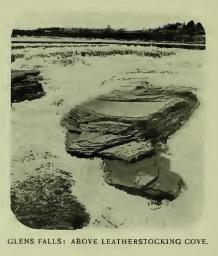
Oi-o-gue, the name given by the Mohawks to Father Jogues in 1646, at Lake George, to what we now fondly call Hudson's River, is fully explained in another connection. The stream has its sources among the highest peaks of the Adirondacks, the most quoted springlet being that in what is known as "Adirondack or Indian Pass," a deep and rugged gorge between the steep slopes of Mt. Mclntyre and the cliffs of Wallface Mountain, in Essex County. The level of this gorge is 2,937 feet above tide. [FN-1] The highest lakelet-head sources, however, are noted in Verplanck Colvin's survey of the Adirondack region as Lake Moss and Lake Tear-of-the-clouds on Mount Marcy, [FN-2] the former having an elevation of 4,312 feet above sea-level and the latter 4,326 feet, "the loftiest water-mirror of the stars" in the State. The little streams descending from these lakes, gathering strength from other small lakes and springlets, flow rapidly into Warren County, where they receive the Sacondaga and Schroon. Between Warrensburgh and Glen's Falls the stream sweeps, in tortuous course with a wealth of rapids, eastward among the lofty hills of the Luzerne [FN-3] range of mountains, and at Glen's Falls descends about sixty feet, passing over a precipice, in cataract, in flood seasons, about nine hundred feet long, and then separates into three channels by rocks piled in confusion. In times of low water there is, on the south side of the gorge, a perpendicular descent of about forty feet. Below, the channels unite and in one deep stream flow on gently between the grained cliffs of fine black marble, which rises in some places from thirty to seventy feet. At the foot of the fall the current is divided by a small island which is said to bear on its flat rock surface a petrifaction having the appearance of a big snake, which may have been regarded by the Mohawks with awe as the personification of the spirit of evil, according to the Huron legend, "Onniare jotohatienn tiotkon, The demon takes the figure of a snake." (Bruyas.) Under the rock is a cave over which the serpent lies as a keeper, extending from one channel to the other and which, as well as the snake, comes down to us embalmed in Cooper's "Last of the Mohegans," though some visitors with clear heads have failed to discover the snake. In times of flood the cave is filled with water and all the dividing rocks below the fall are covered, presenting one vast foaming sheet.
At Sandy Hill the river-channel curves to the south and pursues a broken course to what are known as Baker's Falls, where the descent is between seventy and eighty feet—primarily nearly as picturesque as at Glen's Falls, untouched by Cooper's pen. The bend to the south at Sandy Hill is substantially the head of the valley of Hudson's River. Throughout the mountainous region above that point several Indian names are quoted by writers in obscure orthographies and very doubtful interpretations, the most tangible, aside from those which have been noticed, being that which is said to have been the name of Glen's Falls, but was actually the name of the very large district known as Kay-au-do-ros-sa. In Mohawk, Sandy Hill would probably be called Gea-di-go, "Beautiful plain," but it has no Indian name of record. The village stands upon a high sandy plain. It has its traditionary Indian story, of course; in this section of country it is easy to coin traditions of the wars of the Mohawks, the Hurons, and the Algonquians; they interest but do not harm any one.
[FN-1] This famous Pass is partly in the town of Newcomb and partly in the town of North Elba, Essex County. Wall-face, on the west side, is a perpendicular precipice 800 to 1,000 feet high, and Mt. Mclntyre rises over 3,000 feet. The gorge is seldom traversed, even adventurous tourists are repelled by its ruggedness.
[FN-2] By Colvin's survey Mount Marcy has an elevation of 5,344.411 feet "above mean-tide level in the Hudson." It is the highest mountain in the State. Put four Butter Hills on the top of each other and the elevation would be only a few hundred feet higher.
[FN-3] French, "Spanish Trefoil." "Having a three-lobed extremity or extremities, as a cross." Botanically, plants having three leaves, as white clover, etc. Topographically, a mountain having three points or extremities.
Kay-au-do-ros-sa (modern), Kancader-osseras, Kanicader-oseras (primary), the name given as that of a stream of water, of a district of country, and of a range of mountains, was originally the name of the stream now known as Fish Creek, [FN] the outlet of Saratoga Lake, and signifies, literally, "Where the lake mouths itself out." Horatio Hale wrote me: "Lake, in Iroquois, is, in the French missionary spelling, Kaniatare, the word being sounded as in Italian. Mouth is Osa, whence (writes the Rev. J. A. Cuoq in his Lexique de la langue Iroquois), Osara, mouth of a river, 'boudhe d'un fleure, embouchure d'une riviere.' This word combined would give either Kauicatarosa or Kaniatarossa, with the meaning of 'Lake mouth,' applicable to the mouth of a lake, or rather, according to the verbalizing habit of the language, 'the place where the lake disembogues,' literally, 'mouths itself out.'" To which J. B. N. Hewitt added the explanation, "Or flood-lands of the lake—the overflow of the lake."
[FN] "About Kayaderossres Creek and the lakes in that quarter." "The chief tract of hunting land we have left, called Kayaderossres, with a great quantity of land about it." (Doc. Hist. N. Y., ii, 110.) The stream drains an extensive district of country, flows into and becomes the outlet of Saratoga Lake, and is now known as Fish Creek and Fish Kill, a very cheap substitute for the expressive Mohawk term.
Adirondacks, or Ratirontaks, a name now improperly applied to the mountainous district of northern New York, is said to have been primarily bestowed by the Iroquois on a tribe occupying the left bank of the St. Lawrence above the present site of Quebec, who were called by the French Algonquins specifically, as representatives of a title which had come to be of general application to a group of tribes speaking radically the same language. [FN-1] The term is understood to mean, "They eat trees," i. e. people Who eat the bark of certain trees for food, presumably from the climatic difficulty in raising corn in the latitude in which they lived. [FN-2] Horatio Hale analyzed the name: "From Adi, 'they'; aronda, 'tree,' and ikeks, 'eat.'" The name was not that of the district, nor is it convertible with Algonquin. The later is a French rendering of Algoumquin, from A'goumak, "On the other side of the river," i. e. opposite their neighbors lower down. (Trumbull.) Schoolcraft gave substantially the same interpretation from the Chippewa, "Odis-qua-guma, 'People at the end of the waters,'" making its application specific to the Chippewas as the original Algonquins, instead of the Ottawas. The accepted interpretation, "Country of mountains and forests," is correct only in that that it is descriptive of the country. The record names of the district are Cough-sagh-raga and Canagariarchio, the former entered on Pownal's map with the addition "Or the beaver—hunting country of the Confederate Indians," and the latter entered in the deed from the Five Nations to the King in 1701. (Col, Hist. N. Y., iv, 909.) Cough-sagh-raga is now written Koghsarage (Elliot) and Kohserake (modern), and signifies "Winter" or "Winter land"; but the older name, Cana-gariarc-hio, means, "The beaver-hunting country." [FN-3] It is not expected that this explanation will affect the continuance, by conference, of Adirondacks as the name of the district; but it may lead to the replanting of the much more expressive Iroquoian title, Kohsarake, on some hill-top in the ancient wilderness.
[FN] The specific tribe called Algonquins by the French, were seated, in 1738, near Montreal, and described as a remnant of "A nation the most warlike, the most polished, and the most attached to the French." Their armorial bearing, or totem, was an evergreen oak. (Doc. Hist. N. Y., i, 16.) It is claimed that they were principally Ottawas, residing on the Ottawa River. (Schoolcraft.) The primary location of the language is only measurably involved in the first application of the name, the honor being claimed for the Chippewa, the Cree, and the Lenni-Lenape. The Eastern Algonquins substituted for the Iroquois Adirondacks, Mihtukméchaick (Williams) with the same meaning.
[FN-2] The bark of the chestnut, the walnut, and of other trees was dried, macerated, and rolled in the fat of bears or other animals, and probably formed a palatable and a healthful diet. Presumably the eating of the bark of trees was not confined to a particular tribe.
[FN-3] "Coughsaghrage, or the Beaver-Hunting Country of the Confederate Indians. The Confederates, called by the French Iroquois, surrendered this country to the English at Albany, on the 19th day of July, 1701; and their action was confirmed the 14th of September, 1724. It belongs to New York, and is full of Swamps, Lakes, Rivers, Drowned Lands; a Long Chain of Snowy Mountains which are seen. Lake Champlain runs thro' the whole tract. North and South. This country is not only uninhabited, but even unknown except towards the South where several grants have been made since the Peace."
So wrote Governor Pownal on his map of 1775. There is no question that Coughsaghraga means "Winter." It may also mean "At the Beaver-dam," or "In the country of Beaver-dams." Kohseraka may be a form of Hochelaga or Ochseraga. Osera means "Beaver-dam" as well as "Winter," wrote Horatio Hale. (See Saratoga.) In explanation of Canagariachio Mr. Hale wrote: "Kanagariarchio is a slightly corrupted form of the Iroquois word Kanna'kari-kario, which means simply 'Beaver.' It is a descriptive term compounded of Kannagare, 'Stick' or club, Kakarien, To bite,' and Kario, 'Wild animal.' It is not the most common Iroquois word for Beaver, which, in the Mohawk dialect is Tsionuito, or Djonuito. That the word should be understood to mean 'The Beaver-Hunting Country,' is in accordance with Indian usage."