Hudson's River on the West. (continued 2)
Reading edition
[FN-1] "Land lying about six or seven miles beyond ye Town where ye Walloons dwell, upon ye same creek; ye name of ye place is Chauwanghungh and Nescotack, two small parcels of land lying together." (N. Y. Land Papers, 29, 30.)
[FN-2] "Comprehending all those lands, meadows and woods called Nescotack, Chawangon, Memorasink, Kakogh, Getawanuck and Ghittatawah." (Deed to Gov. Dongan.)
[FN-3] "Beginning on the east side of the river (now Wallkill), and at the south end of a small island in the river, at the mouth of the river Chauwangung, in the County of Ulster, laid out for James Graham and John Delaval." (N. Y. Land Papers, 38.)
[FN-4] "Description of a survey of 410 acres of land, called by the Indian name Chauwangung, laid out for Thomas Lloyd." (N. Y. Land Papers, 44.)
[FN-5] N. Y. Land Papers, 60.
[FN-6] Ib. 169. Other early forms are Shawongunk (1685), Shawongonck (1709), Shawongunge (1712).
[FN-7] From Jacobus Bruyn came the ancient hamlet still known as Bruynswick. He erected a stone mansion on the tract, in the front wall of which was cut on a marble tablet, "Jacobus Bruyn. 1724." The house was destroyed by fire in 1870 (about), and a frame dwelling erected on its old foundation. It is about half-way between Bruynswick and Tuthilltown; owned later by John V. McKinstry. The location is certain from the will of Jacobus Bruyn in 1744.
[FN-8] The most worthless interpretation is that in Spofford's Gazeteer and copied by Mather in his Geological Survey: "Shawen, in the Mohegan language, means 'White,' also 'Salt.' and Gunk, 'A large pile of rocks,' hence 'White Rocks' or mountain." The trouble with it is that there is no such word as Shawen, meaning "White" in any Algonquian dialect, and no such word as Gunk, meaning "Rocks."
[FN-9] The monosyllable Shaw or Schaw, radical Scha, means "Side, edge, border, shore," etc. Schauwunuppéque, "On the shore of the lake." Enda-tacht-schawûnge, "At the narrows where the hill comes close to the river." (Heck.) Schajawonge, "Hill-side" (Zeisb.), from which Schawong-unk, "On the hill-side," or at the side of the hill, the precise bound of the name cannot be stated.
[FN-10] Doc. Hist. N. Y., iv, 71, 72, et. seq. Col. Hist. N. Y., xiii, 272, 326.
[FN-11] Authorities quoted and paper by Rev. Charles Scott, D. D., in "Proceedings Ulster Co. Hist. Soc."
Memorasink, Kahogh, Gatawanuk, and Ghittatawagh, names handed down in the Indian deed to Governor Dongan in 1684, have no other record, nor were they ever specifically located. The lands conveyed to him extended from the Shawangunk range to the Hudson, bounded on the north by the line of the Paltz Patent, and south by a line drawn from about the Dans Kamer. Ghittatawagh is probably from Kitchi, "Great, strong," etc., and Towatawik, "Wilderness"—the great wilderness, or uninhabited district. Gatawanuk seems to be from Kitchi, "Strong," -awan, impersonal verb termination, and -uk, locative, and to describe a place on a strong current or flowing stream. The same name seems to appear in Kitchawan, now Croton River. It may have located lands on the Wallkill.
Nescotack, a certain place so called in the Dongan deed of 1684, is referred to in connection with Shawongunk. It was granted by patent to Jacob Rutsen and described as "A tract of land by the Indians called Nescotack and by the Christians Guilford." (N. Y. Land Papers, 29, 30.) Guilford was known for many years as Guilford Church, immediately west of Shawongunk. The actual location of the name, however, is claimed for a hamlet now called Libertyville, further north, which was long known as Nescotack. The district is an extended ridge which rises gradually from the Shawongunk River-bottoms on the east and falls off on the west more abruptly. The name, probably, describes this ridge as "High lands," an equivalent of Esquatak and Eskwatack on the Upper Hudson; Ashpotag, Mass., and Westchester Co. Esp, Hesp, Ishp, Hesko, Nesco, etc., are record orthographies. (See Schodac and Shawongunk.)
Wishauwemis, a place-name in Shawongunk, was translated by Rev. Dr. Scott, "The place of beeches," from Schauwemi, "Beech wood"; but seems to be an equivalent of Moh. Wesauwemisk, a species of oak with yellow bark used for dyeing. Wisaminschi, "Yellow-wood tree." (Zeisb.)
Wickquatennhonck, a place so called in patent to Jacobus Bruyn and Benj. Smedes, 1709, is described as "Land lying near a small hill called, in ye Indian tongue, Wickqutenhonck," in another paper Wickquatennhonck, "Land lying near the end of the hill." The name means, "At the end of the hill," from Wequa, "End of"; -ateune (-achtenne, Zeisb.), "hill," and -unk, "at." The location was near the end of what is still known as the Hoogte-berg (Hooge-berg, Dutch), a range of hills, where the proprietors located dwellings which remained many years.
Wanaksink, a region of meadow and maize land in the Shawongunk district, was translated by Dr. Scott from Winachk, "Sassafras" (Zeisb.); but Wanachk may and probably does stand for Wonachk, "The tip or extremity of anything," and -sing means "Near," or less than. A piece of land that was near the end of a certain place or piece of land. It is not the word that is met in Wynogkee.
Maschabeneer, Masseks, Maskack, Massekex, a certain tract or tracts of land in the present town of Shawongunk, appear in a description of survey, Dec. 10, 1701, of seven hundred and ten acres "at a place called Maschabeneer Shawengonck," laid out for Mathias Mott, accompanied by an affidavit by Jacob Rutsen concerning the purchase of the same from the Indians. At a previous date (Sept. 22) Mott asked for a patent for four hundred acres "at a place called Shawungunk," which was "given him when a child by the Indians." Whether the two tracts were the same or not does not appear; but in 1702, June 10, Severeyn Tenhout remonstrated against granting to Mott the land which he had petitioned for, and accompanied his remonstrance by an extract from the minutes of the Court at Kingston, in 1693, granting the land to himself. He asked for a patent and gave the name of the tract "Called by the Indians Masseecks, near Shawengonck," i. e. near the certain tract called Shawongunk which had been granted to Thomas Lloyd. He received a patent. In 1709, Mott petitioned "in relation to a certain tract of land upon Showangonck River" which had been granted to Tenhout, asking that the "same be so divided" that he (Mott) should "have a proportion of the good land upon the said river"—obviously a section of low land or meadow, described by the name of a place thereon called Maskeék (Zeisb.), meaning "Swamp, bog"; Maskeht (Eliot), "Grass." The radical is ask, "green, raw, immature." The suffix -eghs represents an intensive form of the guttural formative, which the German missionaries softened to -ech and -ck, and the English to -sh, and is frequently met in X. Heckewelder wrote that the original sound was that of the Greek X, hence Maskex and x in Coxsackie. Maschabeneer, the name given by Mott, is not satisfactorily translatable.
Pitkiskaker and Aioskawasting appear in deed from the Esopus Indians to Governor Dongan, in 1684, as the names of divisions of what are now known as the Shawongunk Mountains south of Mohunk or Paltz Point. The deed description reads: "Extending from the Paltz," i. e. from the southeast boundmark of the Paltz Patent on the Hudson, now known as Blue Point (see Magaat-Ramis), south "along the river to the lands of the Indians at Murderers' Kill, thence west to the foot of the high hills called Pitkiskaker and Aioskawasting, thence southwesterly all along the said hills and the river called Peakadasink to a water-pond lying upon said hills called Meretange." [FN-1] Apparently the general boundaries were the line of the Paltz Patent on the north, the Hudson on the east, a line from "about the Dancing Chamber" on the Hudson to Sam's Point on the Shawongunk range on the southwest, and on the west by that range and the river Peakadasank. The Peakadasank is now known as Shawangunk Kill. The pond "called Meretange," is claimed by some authorities, as that now known as Binnen-water in the town of Mount Hope, Orange County. On Sauthier's map it is located on the southern division of the range noted as "Alaskayering Mts.," and represented as the head of Shawongunk Kill. The same distinction is claimed for Meretange or Peakadasank Swamp in the town of Greenville, Orange County. A third Maratanza Pond is located a short distance west of Sam's Point. The name of the hill has been changed from Aioskawasting to Awosting as the name of a lake and a waterfall about four miles north of Sam's Point, and translated from Awoss (Lenape), "Beyond," "On the other side," and claimed to have been originally applied to a crossing-place in the depression north of Sam's Point, neither of which interpretations is tenable. The prefix, Aioska, cannot be dropped and the name have a meaning, and the adjectival, Awoss, cannot be used as a substantive and followed by the locative -ing, "at, on," etc. Awoss means "Beyond," surely, but must be followed by a substantive telling what it is that is "beyond." The particular features of the Shawongunk range covered by the boundary line of the deed are "The Traps," a cleft which divides the range a short distance south of Mohunk, and Sam's Point, [FN-2] about nine miles south of Mohunk. The latter stands out very conspicuously, its general surface covered by perpendicular rocks from one hundred to two hundred and fifty feet high, the point itself crowned by a wall of rock which rises 2200 feet above the valley below.
[FN-1] Meretange, Maretange, or Maratanza, is from Old English Mere, "A pond or pool," and Tanze, "Sharp" or offensive to the taste. The name was transferred to this pond from the pond first bearing it in the town of Greenville, Orange County, in changing the northwest line of the Evans Patent. (See Peakadasank.) The pond is about a mile in circumference and is lined with cranberry bushes and other shrubbery, but the water is clear and sweet. It lies about three-quarters of a mile west of Sam's Point. Long Pond, lying about four miles north of Maratanza, is now called Awosting Lake. It is about two miles long by possibly one-quarter of a mile wide and lies in a clove or cleft of the hills. Its outlet was called by the Dutch Verkerde Kil, now changed to Awosting. About one mile further north lies "The Great Salt Pond," so called in records of the town of Shawongunk. It is now called Lake Minnewaska, a name introduced from the Chippeway dialect, said to mean "Colored water," which has been changed to "Frozen water." The lake is particularly described as being "Set into the hills like a bowl." It has an altitude of 1,600 feet and a depth of seventy to ninety feet of water of crystal clearness through which the pebbly bottom can be seen. The fourth pond is that known as Lake Mohonk.
[FN-2] Sam's Point is in the town of Wawarsing, about seven miles south of the village of Ellenville and about nine miles south of Mohunk or Paltz Point. It is the highest point on the Shawongunk range in New York State. Its name is from Samuel Gonsaulus, who owned the tract. Gertruyd's Nose, the name of another point, was so called from the fancied resemblance of its shadow to the nose of Mrs. Gertrude, wife of Jacobus Bruyn, who owned the tract. The pass, cleft or clove known as "The Traps," was so called from the supposed character of the rock which it divides. The rock, however, is not Trappean. The pass is 650 feet wide and runs through the entire range. Its sides present the appearance of the hill having slipped apart.
Peakadasank, so written in Indian deed to Governor Dongan in 1684—Pachanasinck in patent to Jacob Bruyn, 1719; Peckanasinck, Pachanassinck, etc.—is given as the name of a stream bounding a tract of land, the Dongan deed description reading: "Thence southwesterly all along said hills and the river Peakadasank to a water-pond lying on said hills called Meretange." The name is preserved in two streams known as the Big and the Little Pachanasink, in Orange County, and in Ulster County as the "Pachanasink District," covering the south part of the town of Shawongunk. The Big Pachanasink is now known as Shawongunk Kill. In 1719, Nov. 26, a certain tract of land "called Pachanasink" was granted to Jacobus Bruyn and described in survey as "on the north side of Shawongunck Creek, beginning where the Verkerde Kill [FN] flows into said river," indicating locative of the name at the Verkerde Branch. In a brief submitted in the boundary contention, it is said that the line of the Dongan purchase ran "along the foot of the hills from a place called Pachanasink, where the Indians who sold the land had a large village and place," and from thence "to the head of the said river, and no where else the said river is called by that name." The evidence is cumulative that the name was that of the dominant feature of the district, from which it was transferred to the stream. It is a district strewn with masses of conglomerate rocks thrown off from the hills and precipitous cliffs. The two forms of the name, Peakadasank (1684) and Pachanassink (1717), were no doubt employed as equivalents. They differ in meaning, however. Wm. R. Gerard writes: "Peakadasank, or Pakadassin, means, 'It is laid out through the effects of a blow,' or some other action. The participial form is Pakadasing, meaning, 'Where it is laid out,' or 'Where it lies fallen.' The reference in this case would seem to be to the stone which had fallen off or been thrown down from the hills." Pachanasink means, "At the split rocks"; Pachassin, "Split stone." In either form the name is from the split rocks.
[FN] The Verkerde Kill falls over a precipice of about seventy feet. The exposed surface of the precipice is marked by strata in the conglomerate as primarily laid down. The entire district is a region of split rocks. Verkerde Kill takes that name from Dutch Verkeerd, meaning "Wrong, bad, angry, turbulent," etc. It is the outlet of Meretange Pond near Sam's Point. It flows from the pond to the falls and from the falls at nearly a right angle over a series of cascades aggregating in all a fall of two hundred and forty feet. The falls are in the town of Gardiner, Ulster County. (See Aioskawasting.)
The lands granted to Bruyn included the tract "Known by the Indian name of Pacanasink," now in the town of Shawongunk, and also a tract "Known by the Indian name of Shensechonck," now in the town of Crawford, Orange County. The latter seems to have been a parcel of level upland. It was about one mile to the southward of the stream.
Alaskayering, entered on Sauthier's map of 1774, as the name of the south part of the Shawongunk range, was conferred by the English, possibly as a substitute for Aioskawasting. The first word is heard in Alaska, which is said, on competent authority, to mean, "The high bald rocks"; with locative -ing, "At (or on) the high bald rocks." This interpretation is a literal description of the hill, and Aioskawasting may have the same meaning, although those who wrote the former may not have had a thought about the latter. [FN] (See Pitkiskaker.)
[FN] High Point, the highest elevation in the southern division of the range, is in New Jersey. It is said to be higher than Sam's Point, and to bear the same general description.
Achsinink, quoted by the late Rev. Charles Soott, D. D., from local records probably, as the name of Shawongunk Kill, is an apheresis apparently of Pach-achsün-ink, "At (or on) a place of split stones." Many of the split rocks thrown off from the mountain lie in the bed of the stream, in places utilized for crossing. "There are rocks in it, so that it is easy to get across." (Col. Hist. N. Y., viii, 272.) Achsün, as a substantive, cannot be used as an independent word with a locative. An adjectival prefix is necessary. (See Pakadasink.)
Palmagat, the name of the bend in the mountain north of Sam's Point, regarded by some as Indian, is a Dutch term descriptive of the growth there of palm or holly (Ilex opaca), possibly of shrub oaks the leaf of which resembles the holly. Gat is Dutch for opening, gap, etc.
Moggonck, Maggonck, Moggonick, Moggoneck, Mohonk, etc., are forms of the name given as that of the "high hill" which forms the southwest boundmark of the Paltz Patent, so known, now generally called locally, Paltz Point, and widely known as Mohunk. The hill is a point of rock formation on the Shawongunk range. It rises about 1,000 feet above the plain below and is crowned by an apex which rises as a battlement about 400 feet above the brow of the hill, now called Sky Top. Moggonck and Maggonck are interchangeable orthographies. The former appears in the Indian deed from Matseyay, and other owners, to Louis Du Bois, and others, May 26, 1677, and is carried forward in the patent issued to them in September of the same year. Moggoneck appears in Mr. Berthold Fernow's translation of the Indian deed in Colonial History of N. Y., xiii, 506. Moggonick was written by Surveyor Aug. Graham on his map of survey in 1709, and Mohunk is a modern pronunciation. The boundary description of the tract, as translated by the late Dr. E. B. O'Callaghan, from the Dutch deed (N. Y. Land Papers, 15), reads: "Beginning at the high hill called Moggonck, then southeast to Juffrouw's Hook in the Long Reach, on the Great River (called in Indian Magaat Ramis), thence north to the island called Raphoos, lying in the Kromme Elbow at the commencement of the Long Reach, thence west to the high hill to a place [called] Warachaes and Tawarataque, along the high hill to Moggonck." The translation in Colonial History is substantially the same except in the forms of the names. "Beginning from the high hill, at a place called Moggonck," is a translation of the deed by Rev. Ame Vaneme, in "History of New Paltz." It seems to be based on a recognition of the locative of the name as established by Surveyor Graham in 1709, rather than on the original manuscript. In the patent the reading is: "Beginning at the high mountain called Moggonck," and the southwest line is described as extending from Tawarataque "To Moggonck, formerly so called," indicating that the patentees had not located the name as they would like to have it located; certainly, that they had discovered that a line drawn from the apex of the hill on a southeast course to Juffrouw's Hook, would divide a certain fine piece of land, which they called the Groot Stuk (great piece), lying between the hill and the Wallkill and fertilized by that stream, which they wished to have included in the grant as a whole. So it came about that they hurried to Governor Andros and secured an amended wording in the patent of the deed description, and Surveyor-General Graham, when he came upon the scene in 1709, to run the patent lines, found the locatives "fixed," and wrote in his description, "Beginning at a certain point on the hill called Moggonick, . . . thence south, thirty-six degrees easterly, to a certain small creek called Moggonck, at the south end of the great piece of land, and from thence south, fifty-five degrees easterly, to the south side of Uffroe's Hook." Thereafter "The south end of the great piece," and the "certain small creek," became the "First station," as it was called. Graham marked the place by a stone which was found standing by Cadwallader Colden in a survey by him in 1729, and noted as at "The west end of a small gully which falls into Paltz River, . . . from the said stone down the said gully two chains and forty-six links to the Paltz River." The "west end" of the gully was the east end of the "Certain small creek" noted in Graham's survey. The precise point is over three miles from the hill. In the course of the years by the action of frost or flood, the stone was carried away. In 1892, from actual survey by Abram LeFever, Surveyor, assisted by Capt. W. H. D. Blake, to whom I am indebted for the facts stated, it was replaced by another bearing the original inscription. By deepening the gully the swamp of which the stream is the drainage channel, has been mainly reclaimed, but the stream and the gully remain, as does also the Groot Stuk. This record narrative is more fully explained by the following certificate which is on file in the office of the Clerk of Ulster County:
"These are to certify, that the inhabitants of the town of New Paltz, being desirous that the first station of their patent, named Moggonck, might be kept in remembrance, did desire us, Joseph Horsbrouck, John Hardenburgh, and Roeloff Elting, Esqs., Justices of the Peace, to accompany them, and there being Ancrop, the Indian, then brought us to the High Mountain, which he named Maggeanapogh, at or near the foot of which hill is a small run of water and a swamp, which he called Maggonck, and the said Ancrop affirmed it to be the right Indian names of the said places, as witness our hands the nineteenth day of December, 1722."
Ancrop, or Ankerop as otherwise written, was a sachem of the Esopus Indians in 1677, and was still serving in that office in 1722. He was obviously an old man at the latter date. He had, however, no jurisdiction over or part in the sale of the lands to the New Paltz Company in 1677. His testimony, given forty-five years after the sale by the Indians, was simply confirmatory in general terms of a location which had been made in 1677, and the interpretation of what he said was obviously given by the Justices in terms to correspond with what his employers wished him to say. In the days of the locations of boundmarks of patents, his testimony would have been regarded with suspicion. Locations of boundmarks were then frequently changed by patentees who desired to increase their holdings, by "Taking some Indians in a public manner to show such places as they might name to them," wrote Sir William Johnson, for many years Superintendent of Indian Affairs, adding that it was "Well known" that an Indian "Would shew any place by any name you please to give him, for a small blanket or a bottle of rum." Presumably Ankerop received either "A small blanket or a bottle of rum" for his services, but it is not to be inferred that the location of the boundmarks in 1677 was tainted by the "sharp practice" which prevailed later. It is reasonable to presume, however, that the name would never have been removed from the foot of the hill had not the Groot Stuk been situated as it was with reference to a southeast line drawn from its apex to Juffrouw's Hook.
Algonquian students who have been consulted, regard the name as it stands as without meaning; that some part of the original was lost by mishearing or dropped in pronunciation; that in the dialect which is supposed to have been spoken here the suffix -onck is classed as a locative and the adjectival Mogg is not complete. Several restorations of presumed lost letters have been suggested to give the name a meaning, none of which, however, are satisfactory. Apparently the most satisfactory reading is from Magonck, or Magunk (Mohegan), "A great tree," explained by Dr. Trumbull: "From Mogki, 'Great,' and -unk, 'A tree while standing.'" It is met as the name of a boundmark on the Connecticut, and on the east side of the Hudson, within forty miles of the locative here, Moghongh-kamigh, "Place of a great tree," is met as the name of a boundmark. Mogkunk is also in the Natick dialect, and there is no good reason for saying that it was not in the local dialect here. There may have been a certain great tree at the foot of the hill, from which the name was extended to the hill, and there may have been one on the Wallkill, which Ankerop said "Was the right Indian name of the place." It will be remembered that the deed boundmark was "The foot of the hill." It is safe to say that the name never could have described "A small run of water and a swamp," nor did it mean "Sky-Top." The former features were introduced by the Justices to identify the place where the boundary-stone was located and have no other value; the latter is a fanciful creation, "Not consistent with fact or reason," but very good as an advertisement.
Maggeanapogh, the name which Ankerop gave as that of the hill called Moggonck, bears every evidence of correctness. It is reasonably pure Lenape or Delaware, to which stock Ankerop probably belonged. The first word, Maggean, is an orthography of Machen (Meechin, Zeisb.; Mashkan, Chippeway), meaning "Great," big, large, strong, hard, occupying chief position, etc., and the second, -apogh, written in other local names -apugh, -apick, etc., is from -ápughk (-ápuchk, Zeisb.), meaning "Rock," the combination reading, literally, "A great rock." In the related Chippeway dialect the formative word for rock is -bik, and the radical is -ic or -ick, of which Dr. Schoolcraft wrote, "Rock, or solid formation of rock." No particular part of the hill was referred to, the text reading, "There being Ankerop, the Indian, then brought us to the High Mountain which he named Maggeanapogh." The time has passed when the name could have been made permanent. For all coming time the hill will bear the familiar name of Mohonk, the Moggonck of 1677, the Paltz Point and the High Point of local history, from the foot of which the place of beginning of the boundary line was never removed, although the course from it was changed.
Magaat-Ramis, the record name of the southeast boundmark of the Paltz Patent, is located in the boundary description at "Juffrou's Hook, in the Long Reach, on the Great River (called in Indian Magaat-Ramis)." (Cal. N. Y. Land Papers, 15.) Juffrouw's Hook is now known as Blue Point. It is about two miles north of Milton-on-the-Hudson, and takes its modern name from the color of the rock which projects from a blue-stone promontory and runs for some distance under the water of the river, deflecting the current to the northwest. The primal appearance of the promontory has been changed by the cut for the West Shore Railroad, but the submerged point remains. The Dutch name, Juffrouw's Hook, was obviously employed by the purchasers to locate the boundmark by terms which were then generally understood. Juffrouw, the first word, means "Maiden," one of the meanings of which is "Haai-rog"; "rog" means "skate," or Angel-fish, of special application to a species of shark, but in English shad, or any fish of the herring family, especially the female. Hook means "Corner, cape, angle, incurved as a hook"; hence "Maiden Hook," an angle or corner noted as a resort for shad, alewives, etc.: by metonymie, "A noted or well-known fishing-place." The first word of the Indian name, Magaat, stands for Maghaak (Moh.), Machak (Zeisb., the hard surd mutes k and t exchanged), meaning "Great," large, extended, occupying chief position. The second word, Ramis is obscure. It has the appearance of a mishearing of the native word. What that word was, however, may be inferred from the description, "Juffrou's Hook, in the Long Reach, on the Great River (called in Indian Magaat-Ramis)," or as written in the patent, "To a certain Point or Hooke called the Jeuffrou's Hooke, lying in the Long Reach, named by the Indians Magaat-Ramis." That the name was that of the river at that place—the Long Reach—is made clear by the sentence which follows: "Thence north along the river to the island called Rappoos, at the commencement of the Long Reach," in which connection Ramis would stand for Kamis or Gamis, from Gami, an Algonquian noun-generic meaning "Water," frequently met in varying forms in Abnaki and Chippeway—less frequently in the Delaware. In Cree the orthography is Kume. The final s is the equivalent of k, locative, as in Abnaki Gami-k, a particular place of water. "On the Great Water," is probably the meaning of Ramis. In Chippeway Keeche-gummee, "The greatest water," was the name of Lake Superior. As the name of the "Great Water," Magaat-Ramis is worthy of preservation.
Rappoos, which formed the northeast boundmark of the Paltz Patent, is specifically located in the Indian deed "Thence north [from Juffrou's Hook] along the river to the island called Rappoos, lying in the Kromme Elbow, at the commencement of the Long Reach." The island is now known as Little Esopus Island, taking that name from Little Esopus Creek, which flows to the Hudson at that point. It lies near the main land on the east side of the river, and divides the current in two channels, the most narrow of which is on the east. Kromme Elleboog (Crooked elbow), is the abrupt bend in the river at the island, and the Long Reach extends from the island south to Pollepel's Island. The name is of record Rappoos, Raphoes, Raphos and Whaphoos, an equivalent, apparently, of Wabose and Warpose, the latter met on Manhattan Island. It is not the name of the island, but of the small channel on the east side of it from which it was extended to the island. It means, "The narrows," in a general sense, and specifically, "The small passage," or strait. The root is Wab, or Wap, meaning, "A light or open place between two shores." (Brinton.)
Tawarataque, now written and pronounced Tower-a-tauch, the name of the northwestern boundmark of the Paltz Patent, is described in the Indian deed already quoted: "Thence [from Rappoos] west to the high hills to a place called Warachoes and Tawarataque," which may refer to one and the same place, or two different places. Surveyor Graham held that two different places were referred to and marked the first on the east side of the Wallkill at a place not now known, from whence by a sharp angle he located the second "On the point of a small ridge of hills," where he marked a flat rock, which, by the way, is not referred to in the name. The precise place was at the south end of a clove between the hills, access to which is by a small opening in the hills at a place now known as Mud Hook. Probably Warachoes referred to this opening. By dialectic exchange of l and r the word is Walachoes—Walak, "Hole," "A hollow or excavation"; -oes, "Small," as a small or limited hollow or open place. "Through this opening," referring to the opening in the side of the hill at Mud Hook, "A road now runs leading to the clove between the ridges of the mountain," wrote Mr. Ralph LeFever, editor of the "New Paltz Independent," from personal knowledge. Tawarataque was the name of this clove. It embodies the root Walak prefixed by the radical Tau or Taw, meaning "Open," as an open space, a hollow, a clove, an open field, etc., suffixed by the verb termination -aque, meaning "Place," or -áke as Zeisberger wrote in Wochitáke, "Upon the house." The reading in Tawarataque is, "Where there is an open space"; i. e., the clove. [FN] The late Hon. Edward Elting, of New Paltz, wrote me: "The flat rock which Surveyor Graham marked as the bound, lies on the east side of the depression of the Shawongunk Mountain Range leading northwesterly from Mohunk, at the south end of the clove known as Mud Hook, near the boundary line between New Paltz and Rosendale, say about half a mile west of the Wallkill Valley R. R. station at Rosendale. I think, but am not certain, that the rock can be seen as you pass on the railroad. It is of the character known as Esopus Millstone, a white or gray conglomerate. I cannot say that it bears the Surveyor's inscription."
It is not often that four boundmarks are met that stand out with the distinctness of those of the Paltz Patent, or that are clothed with deeper interest as geological features, or that preserve more distinctly the geographical landmarks of the aboriginal people.
[FN] The adjectival formative -alagat, or -aragat, enters into the composition of several words denoting "Hole," or "Open space," as Taw-álachg-at, "Open space," Sag-álachg-at, "So deep the hole." The verb substantive suffix -aque, or -ake (qu the sound of k), meaning "Place," is entirely proper as a substitute for the verbal termination -at.
Ossangwak is written on Pownal's map as the name of what is known as the Great Binnenwater (Dutch, "Inland water") in the town of Lloyd. The orthography disguises the original, which may have been a pronunciation of Achsün (Minsi), "Stone," as in Otstónwakin, read by Reichel, "A high rock," or rocky hill. Perhaps the name referred to the rocky bluff which bounds the Hudson there, immediately west of which the lake is situated.
Esopus—so written on Carte Figurative of 1614-16, and also by De Laet in 1624-5; Sopus, contemporaneously; Sypous, Rev. Megapolensis, 1657, is from Sepuus (Natick), "A brook"; in Delaware, Sipoes (Zeisberger). It is from Sepu, "River," and -es, "small." On the Carte Figurative it is written on the east side of the river near a stream north of Wappingers' Creek, as it may have been legitimately, but in 1623 it came to be located permanently at what is now Rondout Creek, from which it was extended to several streams, [FN] to the Dutch settlement now Kingston, to the resident Indians, and to a large district of country. The chirographer of 1614-16 seems to have added the initial E from the uncertain sound of the initial S, and later scribes further corrupted it to the Greek and Latin Æ. (See Waronawanka.)
[FN] The streams entering the Hudson in proximity came to be known as the Kleine Esopus, south of Rondout; the Groot Esopus, now the Rondout, and the Esopus, now the Saugerties. In the valley west of old Kingston was a brook, called in records the "Mill Stream."
Waronawanka, Carte Figurative 1614-16—Warrawannan-koncks, Wassenaer, 1621-5; Warranawankongs, De Laet, 1621-5, and Waranawankcougys, 1633; Waranawankongs, Van der Donck, 1656; Waerinnewongh, local, 1677—is located on the Carte Figurative on the west side of the Hudson a few miles north of latitude 42. On Van der Donck's map it is placed on the west side between Pollepel's Island and the Dans Kamer. De Laet wrote in his "New World" (Leyden edition): "This reach [Vischer's, covering Newburgh Bay] extends to another narrow pass, where, on the west side of the river, there is a point of land juts out covered with sand, opposite a bend in the river on which another nation of savages called the Waoranecks, have their abode at a place called Esopus. A little beyond, on the west side of the river, where there is a creek, and the river becomes more shallow, the Waranawankongs reside. Here are several small islands." In his French and Latin edition, 1633-40, the reading is: "A little beyond where projects a sandy point and the river becomes narrower, there is a place called Esopus, where the Waoranekys have their abode. To them succeed, after a short interval, the Waranawancougys, on the opposite side of the river." Read together there would seem to be no doubt that the Waoranecks were seated on or around the cove or bay at Low Point and the estuary of Wappingers' Creek, and that the Waranatwankongs were seated at and around the cove or bay at Kingston Point, "Where a creek comes in and the river becomes more shallow."
Of the meaning of the name Dr. A. S. Gatschet, of the Bureau of Ethnology, wrote me: "If the Warana-wan-ka lived on a bay or cove of Hudson's River, their name is certainly from Walina, which means 'hollowing, concave site,' and 'cove, bay,' in several eastern languages. A good parallel are the Wawenocks of S. W. Maine, now living at St. Francis, who call themselves Walinaki, or those living on a cove—'cove dwellers'—in referring to their old home on the Atlantic coast near Portland. In the Micmac (N. S.) dialect Walini is 'bay, cove,' and even the large Bay of Fundy is called so. The meaning of k or ka is not clear, but ong, in the later forms, is the locative 'at, on, upon.'"
It is safe to say that at either the Dans Kamer, Low Point, or Kingston Point, the clan would have been seated on a bay, cove, recess or indentation shaped like a bay, and it is also safe to say that Warona and Walina may be read as equivalents, the former in the local dialect, and the latter in the Eastern, and that its general meaning is "Concave, hollowing site." Zeisberger wrote l instead of r in the Minsi-Lenape, hence Woalac, "A hollow or excavation"; Walóh, "A cove"; Walpecat, "Very deep water." The dialectic r prevails pretty generally on the Hudson and on the Upper Delaware. On the latter, near Port Jervis, is met of record Warin-sags-kameck, which is surely the equivalent of Walina-ask-kameck, "A hollowing or concave site, a meadow or field." It was written by Arent Schuyler, the noted interpreter, as the name of a field which he described as "A meadow or vly." Vly is a contraction of Dutch Vallei, meaning "A hollow or depression in which water stands in the rainy season and is dry at other times," hence "hollowing." Ask (generic), meaning "Green, raw," is the radical of words meaning "meadow," "marsh," etc., and -kameck stands for an enclosed field, or place having definite boundaries as a hollow. Awan (-awan, -wan, -uan, etc.), as Dr. Gatschet probably read the orthography, is an impersonal verb termination met on the Hudson in Matteawan, Kitchiwan, etc. Mr. Gerard writes that it was sometimes followed by the participial and subjunctive k. It may have been so written here, but it seems to be a form of the guttural aspirate gh, for which it is exchanged in many cases, here and in Kitchiwangh. In Connecticut on the Sound apparently the same name is met in Waranawankek, indicating that whoever wrote it on the Figurative of 1614-16 was familiar with the dialect of the coast Indians. As it stands the name is one of the oldest and most sonorous in the valley of Hudson's River.
Ponkhockie is the familiar form of the name of the point, cove or landing-place on the south side of Kingston Point. It is from Dutch Punthoekje, meaning, "Point of a small hook, or angle." The local interpretation, "Canoe harbor," is not in the name, except inferentially from the fact that the cove was a favorite landing place for canoes. [FN-1] After the erection of a stockaded redoubt there, the Dutch called the place Rondhout, meaning. "Standing timber," and the English followed with Redoubt, and extended the name to the creek, as of record in 1670. The present form is substantially a restoration of the early Dutch Rondhout. The stockade was erected by Director Stuyvesant, at the suggestion of the Amsterdam Chamber of the West India Company, about 1660. There were Dutch traders here certainly as early as 1622, and presumably as early as 1614, but no permanent settlement appears of record prior to 1652-3, nor is there evidence that there was a Rondhout here prior to 1657-8. Compare Stuyvesant's letter of September, 1657, and Kregier's Journal of the "Second Esopus War" (Col. Hist N. Y., xiii, 73, 314, also page 189), showing that the Rondhout was not completed until the fall and winter of 1660. De Vries wrote in 1639-40, referring to Kingston Point probably: "Some Indians live here and have some corn-lands, but the lands are poor and stony." When Stuyvesant visited the place, in 1658, he anchored his barge "opposite to the two little houses of the savages standing near the bank of the kil." (Col. Hist. N. Y., xiii, 82.) In the vicinity the war of 1658 had its initiative in an unwise attack by some settlers on a party of Indians who had been made crazy drunk on brandy furnished them by Captain Thomas Chambers. Two houses were burned belonging to settlers, and hostilities continued for eight or nine days. "At the tennis-court near the Strand," a company of eleven Dutch soldiers "allowed themselves to be taken prisoners," by the Indians, in 1659. It does not seem probable that the Dutch had a Tennis Court here at that early date, but the record so reads. [FN-2] The hook or cove, was the most desirable place for landing on the south side of the Point. It has since been the commercial centre of the town and city. Punthoekje is certainly not without interesting history.
[FN-1] In early times there were two principal landing places: One at Punthoekje and one north of the present steamboat landing, or Columbus Point as it is called. The Point is a low formation on the Hudson and was primarily divided from the main land by a marsh. It was literally "a concave, hollowing site." The marsh was later crossed by a corduroyed turnpike connecting with the old Strand Road, now Union Avenue. A ferry was established here in 1752 and is still operated under its original charter. The Point is now traversed by rail and trolley roads.
[FN-2] Perhaps an Indian Football Court, resembling a Tennis Court. A writer in 1609 says of the Virginia natives: "They use, beside, football play, which women and boys do much play at. They have their goals as ours, only they never fight and pull each other down." There was a famous Tennis Court (Dutch Kaatsbaan) in the town of Saugerties, which seems to have been there long before the Dutch settlement. The Tennis Court referred to in the text is said to have been near the site of the present City Hall in Kingston, but would that place be strictly "near the Strand"? "Strand" means "shore, beach." It was probably on the beach.
Atkarkarton, claimed by some local authorities as the Indian name of Kingston, comes down to us from Rev. Megapolensis, who wrote, in 1657: "About eighteen miles [Dutch] up the North River lies a place called by the Dutch Esopus or Sypous, by the Indians Atkarkarton. It is an exceedingly beautiful land." (Doc, Hist. N. Y., iii, 103.) The Reverend writer obviously quoted the name as of general application, although it would seem to have been that of a particular place. As stated in another connection, Esopus, Sypous, and Sopus were at first (1623) applied to a trading-post on the Hudson, from which it was extended inland as a general name and later became specific as that of the first palisaded Dutch village named Wildwijk, which was founded a year after Megapolensis wrote. At the date of his writing the territory called Sopus included the river front, the plateau on which Kingston stands, and the flats on the Esopus immediately west, particularly the flat known as the Groot Plat, and later (1662) as the Nieuw Dorp or New Village, [FN-1] as distinguished from Sopus or Wildwijk, or the Old Village, the specific site of which could not have been referred to. Of the site of the Old Village, Director Stuyvesant wrote in 1658: "The spot marked out for the settlement has a circumference of about two hundred and ten rods [FN-2] and is well adapted for defensive purposes. When necessity requires it, it can be surrounded by water on three sides, and it may be enlarged according to the convenience and requirements of the present and of future inhabitants." The palisaded enclosure was enlarged by Stuyvesant, in 1661, to over three times its original size. The precise spot was on the northwest corner of the plateau. It was separated from the low lands of the Esopus Valley by a ridge of moderate height extending on the north, east, and west, and had on the south "a swampish morass" which was required to be drained, in 1669, for the health of the town "and the improvement of so much ground." The Groot Plat in the Esopus Valley was a garden spot ready for the plough and was regarded as of size sufficient for "fifty bouweries" (farms). From the description quoted, and present conditions, it may be said with certainty that the site of the Old Village of Wildwijk was a knoll in an area of prairie and marsh. Neither of the village sites seem to have been occupied by the Indians except by temporary huts and corn-lands. The Wildwijk site was given to Director Stuyvesant by the Indians, in 1658, "to grease his feet with" after his "long journey" from Manhattan. Of the Groot Plat one-half was given by the Indians to Jacob Jansen Stoll in compensation for damages. A commission appointed at that time to examine the tract, and to ascertain what part of it the Indians wished to retain, reported that the Indians had "some plantations" there, "but of little value"; that it was "only a question of one or two pieces of cloth, then they would remove and surrender the whole piece." (Col. Hist. N. Y., xiii, 86, 89.) Instead of paying the Indians for the lands, however, the settlers commenced occupation, with the result that the Indians burned the New Village, June 7, 1663, attacked the Old Village, killed eighteen persons and carried away thirty captives, women and children. The war of 1663 followed, the results of which are accessible in several publications, but especially in Colonial History of New York, Vol. xiii. It is sufficient to say here that the Indians lost the lands in controversy and a much larger territory. Interpretation of the name can only be made conjecturally. William R. Gerard wrote me: "I think Atkarkarton simply disguises Atuk-ak-aten, meaning 'Deerhill,' from Atuk, 'Deer'; ak, plural, and aten, 'hill.' The r's in the name do not mean anything; they simply indicate that the a's which precede them were nasal." The Delaware word for "deer" is Achtuch. Dr. Schoolcraft wrote the tradition that the first deers were the hunters of men.
[FN-1] The land or place on the Esopus flat on which the New Village was founded, is now known as Old Hurley Village. It is repeatedly and specifically designated as "The Groot Plat"—"The large tract of land called the New Village"—"The burnt village called the Groot Plat." (Col. Hist. N. Y., xiii, 275, et. seq.) Hurley was given to it by Governor Lovelace in 1669, from his family, who were Barons Hurley of Ireland.
[FN-2] A Dutch rod is twelve feet, which would give this circumference at less than an English half mile. Schoonmaker writes in "History of Kingston": "The average length of the stockade was about thirteen hundred feet, and the width about twelve hundred feet." Substantially, it enclosed a square of about one-quarter of a mile.
Wildwijk, Dutch—Wiltwyck, modern—the name given by Governor Stuyvesant, in 1650, to the palisaded village which later became Kingston, and then and later called Sopus, is a composition of Dutch Wild, meaning "Wild, savage," and Wijk, "Retreat, refuge, quarter"; constructively, "A village, fort or refuge from the savages." The claim that the place was so called by Stuyvesant as an acknowledgment of the fact that the land was a gift from the Indians, is a figment. The English came in possession, in 1664, and, in 1669, [FN] changed the early name to Kingston. The Dutch recovered possession in 1673, and changed the name to Swanendale, and the English restored Kingston in 1674. (See Atkarkarton.)
[FN] "On this day (vizt 25th) the towne formerly called Sopez was named Kingston." Date Sept. 25th, 1669. (Col. Hist. N. Y., xiii, 435.)
Nanoseck, Manoseck, forms of the name of a small island in Rondout Creek, so "called by the Indians" says the record, may be from Natick Nohōōsik, "Pointed or tapering." The Dutch called it "Little Cupper's Island." Cupper, "One who applies a cupping glass." Another island in the same stream, was "called by the Indians Assinke," that is "Stony land" or place. (See Mattassink.) Another island was called by the Dutch Slypsten Eiland, that is, "Whetstone Island"; probably from the quality of the stone found on it. It lies in the Hudson next to Magdalen Island.
Wildmeet, an Indian "house" so called by the Dutch, means, in the Dutch language, "A place of meeting of savages." It was not a palisaded village. It was burned by the Dutch forces in the war of 1660, at which time, the narrative states, some sixty Indians had assembled at or were living in it. Its location, by the late John W. Hasbrouck, at the junction of the Vernoy and Rondout kills, is of doubtful correctness, as is also his statement that it was "The council-house of all the Esopus Indians." Its location was about two (Dutch) miles from Wildwyck, or about six or seven English miles. Judge Schoonmaker wrote: "Supposed to have been located in Marbletown."
Preumaker's Land, a tract described as "Lying upon Esopus Kil, within the bounds of Hurley," granted to Venike Rosen, April 1, 1686, was the place of residence of Preumaker, "The oldest and best" of the Esopus sachems, whose life was tragically ended by Dutch soldiers in the war of 1660. The location of his "house" is described as having been "At the second fall of Kit Davits Kil." [FN-1] A creek now bears the name of the sachem, who was a hero if he was a savage.
[FN] "Kit Davits' Kil" or the Rondout was so called from Christopher Davids, an Englishman, who was first at Fort Orange, and was an interpreter. He obtained, in 1656, a patent for about sixty-five acres, described as "Situate about a league (about three miles) inland from the North River in the Esopus, on the west side of the Great Kil, opposite to the land of Thomas Chambers, running west and northeast halfway to a small pond on the border of a valley which divides this parcel and the land of John de Hulter, deceased." Ensign Smith wrote: "I came with my men to the second valley on Kit Davietsen's River.. . . Further up in said valley I crossed the stream and found their house." (Col. Hist. N. Y., xiii.) Supposed to have been at LeFever's Falls in Rosendale. (Schoonmaker.)
Frudyachkamik, so written in treaty—deed of 1677 as the name of a place on the Hudson at the mouth of Esopus (now Saugerties) Creek, is written Tintiagquanneck in deed of 1767 (Cal. Land Papers, 454), and by the late John W. Hasbrouck, Tendeyachameck. The deed orthography of 1677 is certainly wrong as there is no sound of F in Algonquian. (See Kerhonksen.)
{TN} {Unable to locate interlinear references to the following two notes which appear on this page.}
[FN-1] Saugerties is probably a corruption of Dutch Zager's Kiltje, meaning in English, "Sawyer's little Kill." The original appears first of record in Kregier's Journal of the Second Esopus War (1663), "They were at Zager's Kiletje"; "To Sager's little Kill"; "To the Sager's Killetje." (Col. Hist. N. Y., xiii, 342, 344.) The first corruption of record also belongs to that period. It was by a Mohawk sachem who visited Esopus and at a conference converted Zager's Kiltje to Sagertjen. Some of the local Dutch followed with "de Zaagertje's." Other corruptions were numerous until the English brought in Saugerties. The original Zager, however, seems to have held legal place for many years. In 1683, in a survey of the Meals Patent, covering lands now included in Saugerties, it is written: "Being part of the land called Sagers," and in another, "Between Cattskill and Sager's Kill." It is also of record that a man known by the surname of Zager located on the stream prior to 1663, obtained a cession of the lands on the kill from Kaelcop, an Esopus sachem, and later disappeared without perfecting his title by patent. Zager is now converted to Sager, and in English to Sawyer. The claim that Zager had a sawmill at the mouth of the stream seems to rest entirely upon his presumed occupation from the meaning of his name. A sawmill here, in 1663, would seem to have been a useless venture. In 1750, ninety years later, one Burregan had a mill at the mouth of the kill. "Burregan" stands for Burhans.
[FN-2] "To Freudeyachkamik on the Groote River." (Col. Hist. N. Y., xiii, 505.) It was probably the peninsular now known as Flatbush, Glasco, etc., at the mouth of the creek. The orthographies of the name are uncertain. An island south of the mouth of the creek was called Qusieries. Three or four miles north is Wanton Island, the site of a traditionary battle between the Mohawks and the Katskill Indians. It is now the northeast boundmark of Ulster County. Neither of these islands could have been the boundmark of the lands granted by the Indians. Wanton seems to be from Wanquon (Wankon, Del.), "Heel"—resembling a human heel in shape—pertuberant. The letter t in the name is simply an exchange of the surd mutes k and l. Modern changes have destroyed the original appearance of the island.
Kerhonkson, now so written as the name of a stream of water and of a village in the town of Wawarsing, Ulster County, is of record in several forms—Kahanksen, Kahanghsen, Kahanksnix, Kahanckasink, etc. It takes interest from its connection with the history and location of what is known, in records of the Esopus Indian War of 1663, as the Old Fort as distinguished from the New Fort. In the treaty of peace with the Dutch in 1664, the fort is spoken of without name in connection with a district of country admitted by the Indians to have been "conquered by the sword," including the "two captured forts." In the subsequent treaty (1665) with Governor Nicolls the ceded district is described as "A certain parcel of land lying and being to the west or southwest of a certain creek or river called by the name of Kahanksen, and so up to the head thereof where the Old Fort was; and so with a direct line from thence through the woods and crosse the meadows to the Great Hill lying to the west or southwest, which Great Hill is to be the true west or southwest bounds, and the said creek called Kahanksen the north or northeast bounds of the said lands." In a treaty deed with Governor Andros twelve years later (April 27, 1677), the boundary lines "as they were to be thereafter," are described: "Beginning at the Rondouyt Kill, thence to a kill called Kahanksnix, thence north along the hills to a kill called Maggowasinghingh, thence to the Second Fall, easterly to Freudyachkamick on the Groot River, south to Rondouyt Kill." In other words the district conceded to have been "conquered by the sword" lay between the Esopus and the Rondout on the Hudson, and extended west to the stream called Kahanksen, thence north to a stream called Maggowasinghingh, thence north, etc. The only stream that has been certainly identified as the Maggowasinghingh is the Rondout, where it flows from the west to its junction with the Sandberg Kill, east of Honk Falls, and this identification certainly places Kahanksen south of that stream. And in this connection it may be stated that the conquered lands did not extend west of the Rondout. The Beekman and the Beake patents were held primarily by Indian deeds. After the conquest the Indians did not sell lands east of the boundary line, but did sell lands west of that line. The deed from Beekman to Lowe distinctly states that the lands conveyed were "within the bounds belonging to the Indians." As the lands on the west of the kill were not conquered and ceded to the Dutch, the Old Fort could not have been on that side of the stream. In reaching conclusions respect must be had to Indian laws, treaties, and boundary descriptions. In the records of the town of Rochester, of which town Wawarsing was a part, is the entry, under date of July 22, 1709, "Marynus van Aken desired the conveyance of about one hundred acres of land lying over against the land of Colonel Jacob Rutsen called Kahankasinck, known as Masseecs," that is the land asked for by Van Aken took the name of Masseecs from a swamp which the name means. Colonel Rutsen's land has not been located; he held several tracts at different times, and one especially on the west line of Marbletown known as Rosendale. Whatever its location it shows that its name of Kahankasinck was extended to it or from it from some general feature. Obviously from the ancient treaty and deed boundaries the site of the Old Fort has not been ascertained, nor has the Great Hill been located. Presumably both must be looked for on Shawongunk Mountain.
The fort, as described by Kregier in his "Journal of the Second Esopus War," was a palisaded village and the largest settlement of the Esopus Indians. He made no reference to a stream or to a ravine, but did note that he was obliged to pass over swamps, frequent kills, and "divers mountains" that were so steep that it was necessary to "haul the wagons and cannon up and down with ropes." His course was "mostly southwest" from Wildwijk, and the fort "about ten miles" (Dutch), or from thirty to thirty-five miles English. It was not so far southwest from Wildwijk (Kingston) as the New Fort by "about four hours," a time measure equal to nine or ten English miles. The Indians did not defend the fort; they abandoned it "two days before" the Dutch troops arrived. No particular description of it has been handed down. Under date of July 31, 1663, Kregier wrote: "In the morning at dawn of day set fire to the fort and all the houses, and while they were in full blaze marched out in good order." And so disappeared forever the historic Indian settlement, not even the name by which it was known certainly translatable in the absence of knowledge of the topography of its precise location. [FN]
[FN] The name has the appearance of derivation from Gahan (Del.), "Shallow, low water"'; spoken with the guttural aspirate -gks (Gahaks), and indefinite formative -an. As a generic it would be applicable to the headwaters of any small stream, or place of low water, and may be met in several places.
Magowasinghinck, so written in its earliest form in treaty deed of 1677 (Col. Hist. N. Y., xiii) as the name of an Indian family, and also as the name of a certain kill, or river—"Land lying on both sides of Rondout Kill, or river, and known by the name of Moggewarsinck," in survey for Henry Beekman, 1685—"Land on this side of Rondout Kill named Ragowasinck, from the limits of Frederick Hussay, to a kill that runs in the Ronduyt Kill, or where a large rock lies in the kill," grant to George Davis, 1677. The Beekman grant was on both sides of Rondout Creek west and immediately above Honk Falls, where a large rock lying in the kill was the boundmark to which the name referred and from which it was extended to the stream and place. The George Davis grant has not been located, and may never have been taken up. Beekman sold to Peter Lowe in 1708, and the survey of the latter, in 1722, described his boundary as running west from "the great fall called Heneck." In Mr. Lindsay's History of Ulster County it is said that the grant was half a mile wide on the southeast side of the stream and a mile wide on the northwest side. Hon. Th. E. Benedict writes me: "The Rondout is eminently a river of rocks. It rises on the east side of Peekamoose, Table, and Lone mountains, and west side of Hanover Mountain of the Catskills, and flows through chasms of giant rocks. All the way down there are notable rocks reared in midstream. The rock above Honk Falls is hogback shape, a hundred or more feet long. It lies entirely in the stream and divides it into two swift channels which join together just above the falls. Here, amid the roar, the swirl and dash of waters breaking through rocky barriers, with the rapids at the falls, the Great Rock was an object to be remembered as a boundmark."
Without knowledge of the locative of the name or of the facts of record concerning it, the late Dr. D. G. Brinton, replying to inquiry, wrote me: "I take Magow or Moggew-assing-ink to be from Macheu (Del.), 'It is great, large'; achsün, 'stone', and ink locative; literally 'at the place of the large stone'." The name does not describe the place where the rock lies. The Davis grant in terms other than the Indian name located one as lying "in the kill," and the other is described in the survey of the patent to Beekman: "Land situate, lying and being upon both sides of Rondout Kill or river, and known by the name of Moggewarsinck, beginning at a great rock stone in the middle of the river and opposite to a marked tree on the south side of the river, between two great rock stones, which is the bounds betwixt it and the purchase of Mr. William Fisher," etc.; both records confirm Dr. Brinton's interpretation. As a generic the name may, like Kahanksan, be found in several places, but the particularly certain place in the Beekman grant was at the falls called Honneck, now Honk.
Wawarasinke, so written by the surveyor as the name of a tract of land granted to Anna Beake and her children in 1685, has been retained as the name of a village situate in part on that tract, about four miles north of Ellenville. The precise location of the southern boundmark of the patent was on the west bank of the Rondout, south of the mouth of Wawarsing Creek, or Vernooy Kill as now called, which flows to the Rondout in a deep rocky channel, the southern bank forming a very steep, high hill or point. It is claimed that the Old Fort was on this hill, and that to and from it an Indian path led east across the Shawongunk Mountain to the New Fort and is still distinctly marked by the later travel of the pioneers. That there was an Indian path will not be questioned, nor will it be questioned that there may have been at least a modern Indian village on the hill, but the Old Fort was not there. At the point where the boundmark of the patent was placed the Rondout turns at nearly a right angle from an east and west course to nearly north, winding around a very considerable point or promontory. The orthography of the name is imperfect. By dialectic exchange of n and r, it may be read Wa-wa-nawás-ink, "At a place where the stream winds, bends, twists, or eddies around a point or promontory." This explanation is fully sustained by the topography. Hon. Th. E. Benedict writes me: "The Rondout at that point (the corner of the Anna Beake Patent) winds around at almost a right angle. At the bend is a deep pool with an eddying current, caused by a rock in the bank below the bend. The bend is caused by a point of high land. It is a promontory seventy-five feet high." The inquiry as to the meaning of the name need not be pursued further. The frequently quoted interpretation, "Blackbird's Nest," is puerile. (See Wawayanda.)
Honk, now so written as the name of the falls on Rondout Creek at Napanock, appears first in Rochester town records, in 1704, Hoonek, as the name of the stream. In the Lowe Patent (1722), the reading is: "Beginning by a Great Fall called Honeck." The Rochester record is probably correct in the designation of the name as that of the creek, indicating that the original was Hannek (Del.), meaning, "A rapid stream," or a stream flowing down descending slopes. As now written the name means nothing unless read from Dutch Honck, "Home, a standing post or place of beginning," but that could not have been the derivative for the name was in place before the falls became the boundmark. The familiar interpretation: "From Honck (Nar.), 'Goose'—'Wild-goose Falls,'" is worthless. The local word for Goose was Kaak. The falls descend two hundred feet, of which sixty is in a single cataract—primarily a wild, dashing water-fall.
Lackawack appears of record as the name of a stream in Sullivan County, otherwise known as the West Branch of Rondout Creek, and also as the name of the valley through which it passes. The valley passes into the town of Wawarsing, Ulster County, where the name is met in the Beekman and in the Lowe patents, with special application to the valley above Honk Falls, and is retained as the name of a modern village. In the Lowe Patent it is written Ragawack, the initials L and R exchanged; in the Hardenberg Patent it is Laughawake. The German missionary orthography is Lechauwak (Zeisb.), "Fork, division, separation," that which forks or divides, or comes together in the form of a fork; literally, "The Fork." Lechauwak, "Fork"; Lechau-hanne, "Fork of a river," from which Lackawanna; Lechau-wiechen, "Fork of a road," from which Lackawaxen—"abbreviated by the Germans to Lecha, and by the English to Lehigh." (Reichel.)
Napanoch, on the Rondout below Honk Falls, is probably the same word that is met in Nepeak, translated by Dr. Trumbull, "Water-land, or land overflowed by water." At or near Port Jervis, Napeneck, Napenack, etc. The adjectival is Nepé, Napé, "Water."
Wassahawassing, in the Lowe Patent and also in the deed to Lowe from Henry Beekman, is probably from Awossi-newás-ing (Del.), "At the point or promontory beyond," or on the other side of a certain place.
Mopochock—"A certain Great Kil called Mopochock," in patent to Joachim Staats, 1688, is said to have been the name of what is now known as Sandberg Kill, but was not, as that stream was in no way connected with the Staats Patent.
Naversing is entered on Pownal's map between Rosendale and Fountain creeks, in the old town of Rochester. The map location may not be correct. The name is from Newás-ing, (Del.), "At a point or promontory." The familiar form is Neversink.
Mattachonts, a modern orthography, preserves the name of a place in the town of Rochester, Ulster County, and not that of an Indian maiden as locally stated. The boundary description refers to a creek and to a swamp. The record orthographies are Magtigkenighonk and Maghkenighonk, in Calendar of Land Papers, and "Mattekah-onk Kill," local.
Amangag-arickan, given as the name of an Indian family in western Ulster (Col. Hist. N. Y., xiii, 505), is probably from Amangak, "Large," with the related meaning of terrible, and Anakakan, "Rushes," or sharp rushes. Amangak is from Amangi, "Big, large, powerful, dire," etc., and -ak, animate plural.
Ochmoachk-ing, an unlocated place, is described as "Above the village called Mombackus, extending from the north bound of the land of Anna Beake southerly on both sides of the creek or river to a certain place called Ochmoachking." (Patent to Staats, 1688.)
Shokan, the name of a village on Esopus Creek, in the town of Olive, has been interpreted as a pronunciation of Schokkan (Dutch), "To jolt, to shake," etc., by metonymie, "A rough country." The district is mountainous and a considerable portion of it is too rough for successful cultivation, but no Hollander ever used the word Schokken to describe rough land. At or near the village bearing the name a small creek flows from the west to the Esopus, indicating that Shokan is a corruption of Sohkan, "Outlet or mouth of a stream." Sohk is an eastern form and an is an indefinite or diminutive formative. Heckewelder wrote in the Delaware, Saucon, "The outlet of a small stream into a larger one." Ashokan is a pronunciation. The same name is met at the mouth of the East or Paghatagan Branch of the Delaware. Shokan Point is an elevation rising 3100 feet.
Koxing Kil, a stream so called in Rosendale, is of record Cocksing and Cucksink—"A piece of land; it lyeth almost behind Marbletown." It is not the name of the stream but of a place that was at or near some other place; probably from Koghksuhksing, "Near a high place." (See Coxackie.) On map of U. S. Geological Survey the name is given to the outlet of Minnewaska Lake, which lies in a basin of hills on Shawongunk Mountain, 1650 feet above sea level.
Shandaken, the name of a town in Ulster County, is not from any word meaning "Rapid water," as has been suggested, but is probably from Schindak, "Hemlock woods"—Schindak-ing, "At the hemlock woods," or place of hemlocks. The region has been noted for hemlocks from early times.
Mombackus, accepted as the name of a place in the present town of Rochester, Ulster County, is first met in 1676, in application to three grants of land described as "At ye Esopus at ye Mumbackers, lying at ye Round Doubt River." In a grant to Tjerck Classen de Witt, in 1685, the orthography is Mombackhouse—"Lying upon both sides of the Mumbackehous Kill or brook." The stream is now known as Rochester Creek flowing from a small lake in the town of Olive. The late John W. Hasbrouck wrote, "Mombakkus is a Dutch term, literally meaning 'Silent head,' from Mom, 'silent,' and Bak or Bakkus, 'head.' It originated from the figure of a man's face cut in a sycamore tree which stood near the confluence of the Mombakkus and Rondout kills on the patent to Tjerck Classen de Witt, and was carved, tradition says, to commemorate a battle fought near the spot," that "for this information" he was "indebted to the late Dr. Westbrook, who said the stump of the tree yet stood in his youthful days." Although the evidence of the existence of a tree marked as described is not entirely positive, the fact that trees similarly marked were frequently met by Europeans in the ancient forests gives to its existence reasonable probability. In his treatment of the name Mr. Hasbrouck made several mistakes. "Place of death" is not in the word, and Dutch Mom or Mum does not mean "Silent"; it means "Mask," or covering, and Bak or Bakkes, does not mean "head," it is a cant term for "Face, chops, visage." Mombakkes is plainly a vulgar Dutch word for "Mask." It describes a grotesque face as seen on a Mascaron in architecture, or a rude painting. Usually trees marked in the manner described included other figures commemorative of the deeds of a warrior designed to be honored. Sometimes the paintings were drawn by a member of the clan or family to which the subject belonged, and sometimes by the hero himself, who was flattered by the expectation that his memory would thereby be preserved, or his importance or prowess impressed upon his associates, or on those of other clans, and perhaps handed down to later generations.
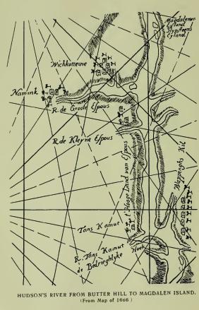
Wieskottine, located on Van der Donck's map (1656), north of Esopus Creek and apparently in the territory of the Catskill Indians, is a Dutch notation of Wishquot-attiny, meaning, literally, "Walnut Hill." A hill and trees are figured on the map. The dialect of the Catskill Indians was Mahican or Mohegan. It seems to have influenced very considerably the adjoining Lenape dialect. On a map of 1666, the orthography is Wichkotteine, and the location placed more immediately north of the stream. The settlement represented can be no other than that of the ancient Wildwijk, now Kingston. The name has disappeared of record, as has also Namink on the Groot Esopus.
Catskill, now so written, primarily Dutch Kat's Kil, presumably from Káterákts, or "Kil of the Katarakts," has come down from a very early date in Katskil. On Van der Donck's map of 1656 it is written Kats Kill, but he never wrote Kil with two l's. Older than Van der Donck's map it evidently was from the frequent reference to the "Kats Kil Indians" in Fort Orange records. Its origin is, of course, uncertain. Reasonably and presumably it was a colloquial form of Katerakts Kil—reasonably, because the falls on that stream would have naturally attracted the attention of the early Dutch navigators, as they have attracted the attention of many thousands of modern travelers. It was the absence of an authoritative explanation that led Judge Benson to inflict upon the innocent streams which now bear them the distinguishing names of Kat's and Kauter's, and to relate that as catamounts were probably very abundant in the mountains there and were naturally of the male and female species, the former called by the Dutch Kauter, or "He cat," and the latter Kat, "She cat," the streams were called by those names. His hypothesis is absurd, but is firmly believed by most of modern residents, who do not hesitate to write Kauter, "He cat," on their cards and on their steamboats, although it is no older than Judge Benson's application. He might have found a better basis for his conjecture in the fact that in 1650, on the north side of the Kat's Kil reigned in royal majesty, Nipapoa, a squaw sachem, while on the other side Machak-nimano, "The great man of his people," held sway; that, as they painted on their cabins a rude figure of a wolf, their totemic emblem, easily mistaken for a catamount, the name of "He cat" was given to one stream, and "She cat" to the other.
Katarakts Kil, as it is met of record—now Judge Benson's Kauter Kil—is formed by the outlets of two small lakes lying west of the well-known Mountain House. A little below the lakes the united streams leap over a ledge and fall 175 feet to a shelf of rock, and a few rod's below fall 85 feet to a ravine from which they find their way to the Kat's Kil. Beautiful are the falls and appropriate is the ancient name "The Kil of the Kataracts." Compare it, please, with Judge Benson's "He cat kil."
The Kat's Kil Indians have an interesting history. They are supposed to have been the "loving people" spoken of in Juet's Journal of Hudson's voyage in 1609. They were Mahicans and always friendly in their intercourse with the Dutch. In the wars with the Esopus Indians they took no part. Their hereditary enemies were the Mohawks who adjoined them on the west side of the mountains, their respective territories following the line of the watersheds. They came to be more or less mixed with fugitives from the eastern provinces, after the overthrow of King Philip. A palisaded village they had north of the Esopus, and fierce traditional battles with the Mohawks. They disappeared gradually by the sale of their lands, and gave place to the Rip van Winkles of modern history.
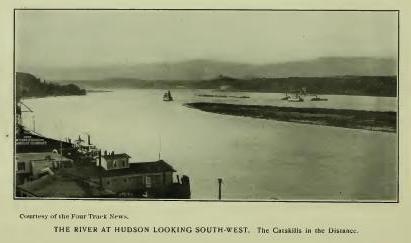
Quatawichnack and Katawichnack, record forms of the name given as that of a fall on Kauter's Kill, now so written, supposed to be the fall near the bridge on the road to High Falls, has been interpreted "Place of the greatest overflow," from the overflow of the stream which forms a marsh, which, however, the name describes as a "Moist, boggy meadow," or boggy land. (See Quatackuaohe.)
Mawignack, Mawichnack, Machawanick, Machwehenoc, forms of the name given as that of the meadow at the junction of the Kauter Kil and the Kat's Kil, locally interpreted, "Place where two streams meet," means, "At the fork of the river." (See Mawichnauk.)
Pasgatikook is another record name of the Katskill, varied in Pascakook and Pistakook. It is an orthography of Pishgachtigûk (Moh.), meaning, "Where the river divides, or branches." (See Schaghticoke.) In patent to John Bronck, 1705, the name is given to "A small piece of land called Pascak-ook, lying on the north side of Katskil creek." The locative is claimed by the village of Leeds.
Teteachkie, the name of a tract granted to Francis Salisbury and described as "A place lying upon Katskill Creek," has not been located. Teke, from Teke-ne, may stand for "Wood," and -achkie stand for land—a piece of woodland.
Quachanock, modern Quajack, the name of a place described as the west boundary of a tract sold to Jacob Lockerman, does not mean "Christian corn-lands," as locally interpreted, although the Indians may have called "the five great plains" the "Christian corn-land" after their occupation by the purchasers. The original word was probably Pahquioke, or Pohqu'un-auke (-ock), "Cleared, opened land," or land from which the trees and bushes had been removed to fit it for cultivation.
Wachachkeek, of record as the name of the first of "five great flats, with the woodland around them," which were included in the Catskill Patent of 35,000 acres, is otherwise written Machachkeek. It is described as "lying on both sides of Catskil Creek," and is claimed to be known as a place west of the village of Leeds. Dr. O'Callaghan interpreted the name from Wacheu, "hill," and -keag, "land" or place—"Hill country," and Dr. Trumbull gave the same meaning from Wadchuauke. The orthography of the second form, however, is probably the most correct—Machachkeek—which pretty surely, from the locative, stands for Maskekeck, meaning, "Marsh or wet meadow."
Wichquanachtekok, the name of the second flat, is no doubt an equivalent of Wequan-achten-ûk, "At the end of the hill," from Wequa, "the end"; -achtene, "hill" or mountain, and -ûk, locative.
Pachquyak, Pachquyak, Paquiage, etc., forms of the name of the third flat (Pachquayack, 1678), given also as the name of a flat "in the Great Imbocht," [FN] is the equivalent of Panqua-auke, Mass., "Clear land, open country." Brodhead wrote Paquiage as the name of the place on the west side of the Hudson to which the followers of King Philip retreated in 1675, but the name may have been that of any other open or unoccupied land west of the Hudson. (See Potik.)
[FN] Dutch Inbocht, "In the bend," "bay," etc. "Great" was added as an identification of the particular bend spoken off.
Paskaecq—"a certain piece of land at Katskill, on the north side of the kill, called by the Indians Paskaecq, lying under a hill to the west of it." Conveyed to Jan Bronk in 1674-5. The name describes a vale, cleft or valley. It is widely distributed. (See Paskack.)
Assiskowachok or Assiskowacheck, the name of record as that of the fourth flat, is no doubt from Assiskeu, "Mud"—Assiskew-aughk-ûk, "At (or on) a muddy place."
Potic, the name of the fifth flat, is also of record Potick, Potatik, and Potateuck, probably an equivalent of Powntuckûk (Mass.), denoting, "Country about the falls." (Trumbull.) From the flat the name was extended to a hill and to a creek in the town of Athens. Hubbard, in his "History of Indian Wars," assigns the same name to a place on the east side of Hudson's River. (See Pachquyak and Schaghticoke.)
Ganasnix and Ganasenix, given as the name of a creek constituting the southern boundary of the Lockerman Patent (1686), seems to be an orthography of Kaniskek, which see.
Waweiantepakook, Waweantepakoak, Wawantepekoak, are forms of a name given as that of "a high round hill" near Catskill. The description reads: "A place on the northeast side of a brook called Kiskatamenakook, on the west side of a hill called Waweantepakoak." (Land Papers, 242.) The location has not been ascertained. Antpéch (Antpek, Zeisb.), means "Head." In Mass. (Eliot), Puhkuk—Muppukuk, "A head." Wawei is a reduplicative of Wai or Way; it means, "Many windings around," or deviations from a direct line. The name is sufficiently explained by the description, "On the west side of a hill," or a hill-side, but descriptive of a hill resembling a head—"high, erect"—with the accessory meaning of superiority. "Indian Head" is now applied to one of the peaks of the Catskills. The parts of the body were sometimes applied by the Indians to inanimate objects just as we apply them in English—head of a cove, leg of a table, etc. (See Wawayanda.)
Kiskatom, a village and a stream of water so called in Greene County, appears in two forms in original records, Kiskatammeeche and Kiskatamenakoak. The abbreviated form, Kiskatom, appears in 1708, more particularly describing "A certain tract by a place called Kiskatammeeche, beginning at a turn of Catrick's Kill ten chains below where Kiskatammeeche Kill watereth into Catrick's Kill," and "Under the great mountain called Kiskatameck." Dr. Trumbull wrote: "Kiskato-minak-auke, 'Place of thin-shelled nuts,' or shag-bark hickory nuts." He explained: "Shag-bark hickory nuts, 'nuts to be cracked by the teeth,' are the 'Kiskatominies' and 'Kisky Thomas nuts' of the descendants of the Dutch colonists of New Jersey and New York." (Comp. Ind. Geographical Names.)
Kaniskek, or Caniskek, of record as the name of Athens, is described in original deeds: "A certain tract of land on the west side of North River opposite Claverack, called Caniskek, which stretches along the river from the lands of Peter Bronck down to the valley lying near the point of the main land behind the Barren Island, called Mackawameck," now known as Black Rock, at the south part of Athens. The description covers the long marshy flat in front of Athens, or between Athens and Hudson. The name seems to be from Quana (Quinnih, Eliot), "Long"; -ask, the radical of all names meaning grass, marsh, meadow, etc., and -ek, formative—literally, "Long marsh or meadow." The early settlement at Athens was called Loonenburgh, from one Jan van Loon, who located there in 1706. Esperanza succeeded this name and was followed by Athens. The particular place of first settlement is described as running "from the corner called Mackawameck west into the woodland to the Kattskill road or path, which land is called Loonenburgh." Athens is from the capital of the ancient Greek State of Attica.
Keessienwey's Hoeck, a place so called, [FN-1] has not been located. It is presumed to have been in the vicinity of Kaniskek and to have taken its name from the noted "chief or sachem" of the Katskill Indians called Keessienwey, Keesiewey, Kesewig, Keeseway, etc. On the east side of the river, south of Stockport, Kesieway's Kil is of record. Mr. Bernard Fernow, in his translation of the Dutch text wrote, "Keessienweyshoeck (Mallows Meadow Hook)," but no meadow of that character is of local record. Kessiewey was a peace chief, or resident ruler, whose office it was to negotiate treaties of peace for his own people, or for other clans when requested, and in this capacity, with associates, announced himself at Fort Orange, in 1660, as coming, "in the name of the Esopus sachems, to ask for peace" with them. [FN-2] He was engaged in similar work in negotiating the Esopus treaty of 1664; signed the deed for Kaniskek in 1665, and disappears of record after that date. In "History of Greene County," he is confused with Aepjen, a peace chief of the Mahicans, and in some records is classed as a Mahican, which he no doubt was tribally, but not the less "a Katskil Indian." Beyond his footprints of record, nothing is known of the noted diplomat. His name is probably from Keeche, "Chief, principal, greatest." Keechewae, "He is chief." (See Schodac.)
[FN-1] ". . . We have, therefore, gathered information from the Mahicanders, who thought we knew of it, that more than fifteen days ago some Esopus [Indians] had been at Keessienwey's Hoeck who wanted to come up [to Fort Orange], but had been prevented until this time, and in order to get at the truth of the matter, we have concluded to send for two or three sachems of the Katskil Indians, especially Macsachneminanau and Safpagood, also Keesienwey, to come hither." (Col. Hist. N. Y., xiii, 309.)
[FN-2] "May 24, 1660. To-day appeared [at Fort Orange] three Mahican chiefs, namely, Eskuvius, alias Aepjen (Little Ape), Aupaumut, and Keessienway, alias Teunis, who answered that they came in the name of the Esopus sachems to ask for peace."
Machawameck, the south boundmark of Kaniskek, was not the name of Barrent's Island, as stated in French's Gazetteer. It was the name of a noted fishing place, now known as Black Rock, in the south part of Athens. The prefix Macha, is the equivalent of Massa (Natick Mogge), meaning "Great," and -ameck is an equivalent of -ameek (-amuk, Del.), "Fishing-place." As the root, -am, means "To take by the mouth," the place would seem to have been noted for fish of the smaller sort. The Dutch called the place Vlugt Hoek, "Flying corner," it is so entered in deed. Qr. "Flying," fishing with a hook in the form of a fly.
Koghkehaeje, Kachhachinge, Coghsacky, now Coxsackie, a very early place name where it is still retained, was translated by Dr. Schoolcraft from Kuxakee (Chip.), "The place of the cut banks," and by Dr. O'Callaghan, "A corruption of Algonquin Kaakaki, from Kaak, 'goose,' and -aki, 'place.'" In his translation of the Journal of Jasper Dankers and Peter Sluyter, in which the name is written Koch-ackie (German notation; Dutch, Kok, "cook"), the late Hon. Henry C. Murphy wrote: "The true orthography is probably Koek's-rackie (the Cook's Little Reach), to distinguish it from the Koek's Reach below the Highlands, near New York." Unfortunately there is no evidence that there was a reach called the Cook's north of the Highlands, while it is certain that the name is Algonquian. Dankers and Sluyter gave no description of the place in 1679-80, but their notice of it indicates that it was familiar at that date. In 1718 it was given as the name of a bound-mark of a tract described as "having on the east the land called Vlackte and Coxsackie." (Cal. N. Y. Land Papers, 124.) Vlackte (Vlakte) is Dutch for "Plain or flat," and no doubt described the Great Nutten Hoek Flat which lies fronting Coxsackie Landing, and Coxackie described the clay bluff which skirts the river rising about one hundred feet. The bluff and flat bounded the tract on the east. From the locative the name may be translated from Mass. Koghksuhk-ohke, meaning "High land." The guttural ghks had the sound of Greek x, hence Kox or Cox.
Stighcook, a tract of land so called, now in Greene County, granted to Casparus Brunk and others in 1743, is located in patent as lying "to the westward of Koghsacky." In Indian deed to Edward Collins, in 1734, the description reads, "Westerly by the high woods known and called by the Indian name Sticktakook." Apparently from Mass. Mishuntugkook, "At a place of much wood." The district seems to have been famed for nut trees. It is noted on Van der Donck's map "Noten Hoeck," from which it was extended to Great Nutten Hook Island and Little Nutten Hook Island, on which there were nut trees. (See Wieskottine, Kiskatom, etc.)
Siesk-assin, a boundmark of the Coeymans Patent, is described as a point on the west side of the Hudson, "opposite the middle of the island called Sapanakock and by the Dutch called Barrent's Island." The suffix -assin, probably stands for Assin, "Stone," but the prefix is unintelligible. Sapanak-ock means, "Place of wild potatoes," or bulbous roots. (See Passapenoc.) Barrent's is from Barrent Coeymans, the founder of the village of Coeymans. The earlier Dutch name was Beerin Island, or "She-bear's Island," usually read Bear's Island.
Achquetuck is given as the name of the flat at Coeyman's Hollow. The suffix -tuck probably stands for "A tidal river or estuary," and Achque means "On this side," or before. The reference seems to have been to land before or on this side of the estuary, or the side toward the speaker.
Oniskethau, quoted as the name of Coeymans' Creek, is said to have been the name of a Sunk-squa, or sachem's wife. Authority not given. The stream descends in two falls at Coeymans' Village, covering seventy-five feet. The same name is met in Onisquathaw, now Niskata, of record as the name of a place in the town of New Scotland, Albany County.
Hahnakrois, or Haanakrois, the name of a small stream sometimes called Coeymans' Creek, which enters the Hudson in the northeast corner of Greene County, is Dutch corrupted. The original was Haan-Kraait, meaning "Cock-crowing" Kill, perhaps from the sound of the waterfall.
Sankagag, otherwise written Sanckhagag, is given, in deed to Van Rensselaer, 1630, as the name of a tract of land described as "Situated on the west side of the North River, stretching in length from a little above Beeren Island along the river upward to Smack's Island, and in width two days' journey inland." Beeren Island is about twelve miles south of Albany, and Smack's Island is near or at that city. The western limit of the tract included the Helderberg [FN] hills.
[FN] Helder (Dutch) means "Clear, bright, light, clearly, brightly," and Berg means "hill" or mountain. It was probably employed to express the appearance of the hills in the landscape. Some of the peaks of the range afford fine view of the valley of Hudson's River.
Nepestekoak, a tract of land described, "Beginning at the northernmost fall of water in a certain brook, called by the Indians Nepestekoak"; in another paper, Nepeesteegtock. The name was that of the place. It is now assigned to a pond in the town of Cairo, Greene County. (See Neweskeke.)
Neweskeke, -keek, about ten miles south of Albany, is described as "The corner of a neck of land having a fresh water river running to the east of it." In another paper the neck is located "near a pool of water called Nepeesteek," and "a brook called Napeesteegtock." The name of the brook and that of the pool is from Nepé, "Water," the first describing "Water at rest," a pool or lake, and the second a place adjoining extending to the stream. Neweskeke means "Promontory, point or corner," [FN]
[FN] This name appears to be a contraction of Newas-askeg, "Marshy promontory,' or a promontory or point near a marsh." (Gerard.)
Pachonahellick and Pachonakellick are record forms of the name of Long or Mahikander's Island, otherwise known historically as Castle Island. It is the first island south of Albany, and lies on the west side of the river, near the main land opposite the mouth of Norman's Kill. On some maps it is called Patroon's Island and Martin Garretson's Island. The first Dutch traders were permitted to occupy it, and they are said to have erected on it, in 1614, a fort or "castle," which they called Fort Nassau. In the spring of 1617 this fort was almost wholly destroyed by freshet. The traders then erected a fort on the west bank of the river, on the north side of Norman's Kill, which they called Fort Orange. This fort was succeeded, in 1623, by one on or near the present steamboat landing in Albany, to which the name was transferred and which was known as Fort Orange until the English obtained possession (1664), when the name was changed to Fort Albany, from which the present name of the capital of the State. [FN-1] In addition to the early history of the island the claim is made by Weise, in his "History of Albany," that it was occupied by French traders in 1540; that they erected a fort or castle thereon, which they were forced to leave by a freshet in the spring of 1542, and that they called the river, and also their trading post, "Norumbega." These facts are also stated in another connection. There is some evidence that French traders visited the river, and that they constructed a fort on Castle Island, but none that they called the river "Norumbega." (See Muhheak-unuk.) By the construction of an embankment and the filling of the passage between the island and the main land, the island has nearly disappeared. [FN-2]
[FN-1] Fort Albany was succeeded by a quadrangular fort called Fort Frederick, built by the English (1742-3) on what is now State Street, between St. Peter's Church and Geological Hall. It was demolished soon after the Revolution. Wassenaer wrote, under date of 1625: "Right opposite [Fort Orange] is the fort of the Maykans which they built against their enemies the Maquas" [Mohawks]. "Right opposite" means "directly opposite," i. e. directly opposite the present steamboat landing at Albany, presumably on the bluff at Greenbush.
[FN-2] The name seems to have been that of the mouth of Norman's Kill immediately west of the island, and to be from Sacona-hillak. "An out-pour of water," the mouth of the stream serving to locate the island. "Patroon's Island" and "Patroon's Creek" were local Dutch names. (See Norman's Kill.)
Norman's Kill, so well known locally, took that name from one Albert Andriessen, Brat de Noordman (the Northman), who leased the privilege and erected a mill for grinding corn, sometime about 1638. On Van Rensselaer's map of 1630 it is entered "Godyn's Kil and Water Val," a mill stream, not a cataract. Brat de Noordman's mill was in the town of Bethlehem, adjoining the city of Albany. The stream rises in Schenectady County and flows southeast about twenty-eight miles to the Hudson. The Mohawks called it Tawalsontha. In a petition for a grant of land near Schenectady, in 1713, is the entry, "By ye Indian name Tawalsontha, otherwise ye Norman's Kill"—"A creek called D'Wasontha" (1726)—from the generic Toowawsuntha (Gallatin), meaning, "The falls of a stream"; Twasenta (Bruyas), "Sault d'eau," applied by the French to rapids in a stream—a leaping, jumping, tumbling waterfall.
Aside from the names of the stream it has especial historic interest in connection with early Dutch settlement and the location of Fort Orange where Indians of all nations and tongues assembled for intercourse with the government. (See Pachonahellick.) Dr. Schoolcraft wrote, without any authority that I have been able to find, Tawasentha as the name of the mound on which Fort Orange was erected, with the meaning, "Place of the many dead," adding that the Mohawks had a village near and buried their dead on this hill; a pure fiction certainly in connection with the period to which he referred. The Mohawks never had a village here, nor owned a foot of land east of the Helderberg range. The Mahicans were the owners and occupants, but neither Mahicans or Mohawks would have permitted the Dutch to build a fort on their burial ground. Heckewelder wrote, in his "Indian Nations," "Gaaschtinick, since called by the name of Norman's Kill," and recited a Delaware tradition, with the coloring of truth, that that nation consented there, under advisement of the Dutch, to take the rank of women, i. e. a nation without authority to make war or sell lands. The tradition is worthless. The Dutch did make "covenants of friendship" here with several tribes as early as 1625 (Doc Hist. N. Y. iii, 51), but none of the character stated. All the tribes were treated as equals in trade and friendship. Whatever of special favor there was was with the Mahicans among whom they located. The first treaty, "offensive and defensive," which was made was by the English with the Five Nations in 1664-5. The Mahicans had then sold their lands and retired to the Housatenuk, and the Mohawks and their alliant nations had become the dominant power at Albany.