5. Permanence of Lakes.
Reading edition
In regard to lakes and salt-marshes, the permanence of those occupying the depressions of Areg, Bahrein, Sittra, and Qattara can only, I think, be adequately explained by regarding them as fed, at least in part, by underground supplies coming into them from the south. The total area of the lakes of Bahrein, Nuemisa, Sittra, and Moghara is nearly 20 square kilometres, and that of the salt-marshes (sabakha) is not less than 5000 square kilometres. The depressions are situated in a region which is nearly rainless; in Siwa the mean annual rainfall is only about a quarter of an inch, and that in the depressions farther south, such as Bahrein and Sittra, is doubtless even smaller. The mean daily evaporation from the lake-surfaces cannot well be less than some 4 mm., which would mean a lowering of the lake-levels by evaporation of 1½ metres each year unless there was some inflow to make up for the loss. And though the rate of evaporation from the salt-marshes, area for area, is doubtless very much smaller than that of the lakes, the 250-fold greater extent of the marshes makes it certain that the total quantity of water annually evaporated from them must far exceed that from the lakes.
It appears unlikely that the loss by evaporation in the lakes and marshes can be entirely made up from local rainfall and by seepages from the northern slopes. The rocks forming the surface of the great Miocene plateau, 200 metres high, which separates the depressions from the sea, are chiefly limestones and clays; the beds are nearly horizontal, but such slight dips as exist are believed to be towards the sea. The average annual rainfall on the coastal portion of the plateau is about 6 inches; but it falls off rapidly inland, till it is only about a quarter of an inch near Siwa. The heaviest rainfall on the plateau thus occurs along a strip parallel to the coast, where it is largely drained off towards the sea by the gullies which indent the plateau-edge. Of that which falls on the plateau-surface farther inland comparatively little is absorbed, owing to the generally non-porous nature of the uppermost rocks; after a heavy shower, water lies on the surface in shallow pools for a few days and is soon evaporated. So impervious to water is the limestone in this region, that the Romans excavated chambers in it to form reservoirs, of which many hundreds still exist. Nor can we think that much surface drainage-water from the country to the south ever finds its way into the depressions; for there is an almost complete absence of drainage-lines entering them. At the feet of the northern scarps of the Qattara depression, and along the north-eastern shores of the lakes in the Wadi Natrun, there are, indeed, small springs which show that some of the rain falling on the plateau does actually penetrate the rocks and escape by seepage into the depressions. But the amount of this seepage appears to be insignificant compared with the volume of water which must annually disappear from the lakes and marshes by evaporation. A further consideration bearing on this point is that whatever may have been the agency by which the depression of Siwa was formed, that same agency almost certainly operated to produce the other depressions of the northern chain; and it seems most unlikely that a connection should have been opened up with the underground water-bearing beds in Siwa, and not also in the larger and much deeper depression of Qattara.
It would be a difficult matter to estimate the relative proportion of the water entering the depressions by underground flow from the south, to that contributed by local rainfall and seepage from the northern slopes. But that is not necessary for our immediate purpose. It is sufficient to show that there must be some influx into the depressions from the same source as that which supplies the wells of the greater oases, to establish the existence of that underground water-connection which is all that we need to justify us in regarding the levels of the lakes and salt-marshes as furnishing us with points on the static water-surface; and from the considerations mentioned above it seems to me certain that some influx of underground water really does take place.
I have also thought it justifiable to include the Birket el Qarun in my collection of static water-level data, because although that lake was probably first formed by an overflow of the Nile into the Faiyum, and is even now being fed by Nile water through the Faiyum drains at the rate of some 350 million tons a year, there is a certain amount of evidence suggesting that it has some underground water-connection with the Qattara depression. That evidence, to which attention was first drawn by Professor Schweinfurth,[20] consists in the relatively low salinity (1·3 per cent.) of the lake, notwithstanding the long period through which it has been subject to evaporation and the fact of its having shrunk to dimensions very much smaller than it possessed in ancient times. Unless there has been a large underground efflux of salt water from the lake, it appears impossible to account for its present degree of freshness. In Professor Schweinfurth’s day, of course, the existence of the Qattara depression was unknown, and it was puzzling to suggest where the salt water had gone to.[21] An underground leakage from the Birket el Qarun into the Qattara depression is quite conceivable, for although the two places are separated by some 200 kilometres, there is a very considerable fall between them. Thus the salt in the marshes of the Qattara depression may possibly have come in part from the Birket el Qarun. The present rate of discharge of the Faiyum drains into the lake is, however, just sufficient to make up for an average daily evaporation from the lake-surface of a little over 4 mm., which is about the rate we might expect; and although the level of the lake-surface has fallen some 5 metres since observations of it were first made in 1886, it is now nearly stationary; hence it does not appear likely that there is much underground leakage at present. If the former leakage from the lake took place by lateral flow into porous strata near its surface, of course the leakage may have been arrested by the lowering of the lake-level uncovering the porous beds into which it took place; but I think a more likely explanation is that the leakage occurred at or near the bed of the lake, and has gradually been reduced by the continued deposition of Nile mud on the lake-bottom, and by the diminution of head due to the fall in the water-level.
In regard to the tapping of the artesian waters by the Nile, there is only one locality in which this is known to take place; but the quantity of underground water which is there withdrawn by the river is probably very considerable. When I was surveying the Nile Valley between Aswan and Korosko in December 1898, I observed that in the vicinity of the temple of Dakka (about 105 kilometres south of Aswan) the lands on the west bank of the river were being irrigated with warm water, drawn by “sakias” (water-raising machines) from pits sunk in the alluvial flat which extends between the river and the edge of the sandstone desert. The length of the tract over which the warm water was being withdrawn for irrigation was found to be about 16 kilometres, stretching from 2 kilometres north of Dakka temple southwards to the temple of Maharraga; and the width of the alluvial tract at Dakka, where it is widest, was about 1300 metres. Some of the water-pits were more than a kilometre from the river. Levelling from the Nile (the surface of which was then about 99 metres above sea) across the cultivation to one of the sakia-pits 750 metres west of the river, I found the level of the ground at the sakia-pit to be 7·9 metres above that of the Nile, and the water-surface in the pit to be 8·4 metres below the ground-level; there was 1·2 metres depth of water in the pit. The temperature of the water in the pit I found to be 83° F., while that of the Nile was 60° F. and that of the air was 67° F. The headman of Dakka told me that the exploitation of this warm underground water had begun about 1887; they dig out the sandy mud, and then see the water oozing rapidly into the pit out of the sandstone below. On crossing to the east bank of the river, I found that there also the warm water was being similarly raised for irrigation, though to a smaller extent, because on that side the sandstone desert approaches more closely to the river and there is much less cultivable land. The exploitation of the water on the east side of the Nile extended only over a distance of about 5 kilometres along the bank, with a maximum width of alluvial plain of 600 metres, just at the place where the great Wadi Alagi debouches into the Nile Valley. As the sandstone bed from which the warm water issues is less than 2 metres below the level of the water-surface of the Nile, and the water occurs on both sides of the river, it is certain that the water-bearing bed is cut through by the Nile channel itself; the seepage into the river along the stretch of 16 kilometres must therefore be very considerable. It seems evident that the water is not derived from the bed of the Wadi Alagi, great drainage-channel though that wadi is; for we could not then account for the temperature of the water, nor for its appearing to a larger extent on the west bank than on the east, with the river in between. Moreover, the water appeared to be much more free from salts than we should expect it to be if it were merely drainage from the Wadi Alagi. It strongly resembles, in fact, both in temperature and character, the artesian water of the greater oases, and there can hardly be the smallest doubt that at Dakka the Nile is not only continually abstracting artesian water from the same underground water-sheet that feeds the oases, but is abstracting it in far larger quantities than those yielded by all the oasis wells and springs put together.[22] It is certainly remarkable that the place where considerable supplies of warm underground water enter the Nile should coincide with the embouchure of what is perhaps the greatest drainage channel of the Eastern Desert of Egypt; but I think it is likely that the explanation of the coincidence may be a tectonic one; the water-bearing beds may have been brought up by a local fold in the strata, and the same fold may in some way have conditioned the formation of the primitive drainage-line which was ultimately to become the Wadi Alagi.
Having now indicated briefly the grounds for their acceptance, I give below a table showing the various points which I have adopted as furnishing data for constructing the contours of the static water-surface underlying the Libyan Desert, together with the altitudes of the points above or below sea, and the sources of these level-data. The levels are doubtless in some cases slightly inaccurate; but a few metres of error are immaterial to the object in view, and it is believed that even those levels which rest on barometric determinations are sufficiently accurate for our purpose.
List of Adopted Points on the Static Water-Surface
Place. Level (metres). Determined by.
Wadi Natrun, surface of lakes − 23 Ball, Trigonometric levelling, 1914.
Birket el Qarun, surface of lake − 45 Survey of Egypt, 1926. Based on spirit levelling from Alexandria.
Moghara, surface of lake − 23 Walpole, Trigonometric levelling, 1924.
Qattara Depression, various points on salt-marsh, the lowest being − 80[23] „ „ „
Sittra, surface of lake − 16 „ „ „
Areg, surface of lake − 25 „ „ „
Siwa − 17 „ „ „
Jaghbub + 32 Hassanein, Barometric observations, 1923.
Jalo + 61 „ „ „
Bir Butaffal + 98 „ „ „
El Harrash + 310 „ „ „
Awadel (Kufra Oasis) + 434 „ „ „
Ezeila (Kufra Oasis) + 389 „ „ „
Bawitti (Baharia Oasis) + 129 Ball, 1917, and Walpole, 1924. Trigonometric levelling.
El Hez (Baharia Oasis) + 134 „ „ „
B6 Well (water surface in) + 34 Walpole, Trigonometric levelling, 1924, and military records of depth, 1916.
Lageita (Eastern Desert) + 121 Murray, Trigonometric levelling, 1921.
Farafra + 90 Ball, Barometric observations, 1924.
Abu Mungar + 117 „ „ „
Mut (Dakhla Oasis) + 119 „ „ „
Kharga (average of numerous wells) + 70 Beadnell, Spirit levelling, 1909.
Ain Ismail (Kharga Oasis) + 67 Ball, Barometric observations, 1925.
Bir Murr + 156 „ „ „
Bir Abu Hussein + 182 „ „ „
Bir Kassaba + 176 „ „ „
Sheb Well + 228 „ „ „
Safsaf + 230 „ „ „
Bir Terfawi + 244 „ „ „
Merga, surface of lake + 509 „ „ „
Dakka, water-surface in wells + 99 Ball, Spirit levelling from the Nile, 1898.
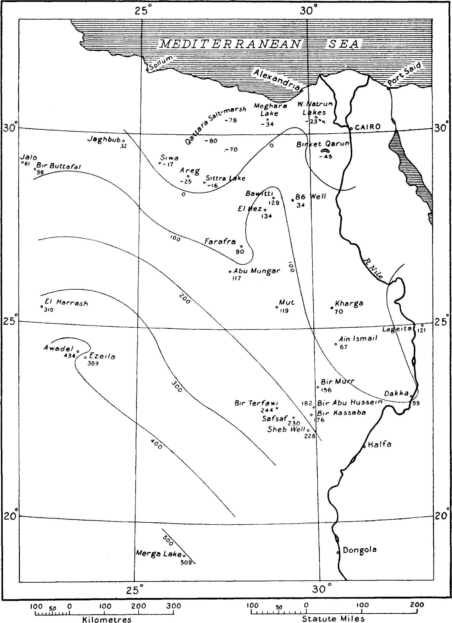
To prepare a map showing the contours of the static water-surface, I took a graticuled sheet and plotted the above-scheduled points on it in their ascertained geographical positions, affixing the adopted level to each. To get points on the various contours at vertical intervals of 100 metres, I joined each pair of points on the map by a pencil line, and then, by interpolation from the terminal levels, found the points on this line where the various contours crossed it, on the assumption of a uniform gradient between the terminal points. Many of the lines thus drawn of course crossed each other, so that interpolation of the static level at the point of their intersection gave two values for the same place. But their agreement was wonderfully close, considering the fewness and the scattered nature of the datum-points, and this went a long way to encourage me in the belief that the hypothesis on which I had been working, namely, that of an underground water-connection between all the points included in my list, was correct. I found that the contours of the static water-surface could be approximately represented by a series of smooth curves, as shown (on a reduced scale) in the outline map below.
Apart from the general smoothness of the curves, especially in the south-west, where it may in part be due to the scantiness of control-points, the most striking thing on this outline map is the north-eastward projection of the 100-metre static contour, where it runs out so as to include Baharia Oasis. The reasons for this projection are obviously the efflux of water, on the one hand north-westwards into the great Qattara depression, and on the other hand into the Nile at Dakka. The indentation of the 400-metre contour near Kufra is likewise explained by the withdrawal of water from the wells of that oasis. The general parallelism of the curves in the south-western part of the map, showing a gradual rise in a south-westerly direction towards the Erdi and Ennedi country (which, as I have already stated, is the most probable source of the underground water) is strikingly apparent. I have not been able to extend the contours far to the east and west of Merga, for lack of control-points. It is much to be hoped that some future traveller will determine the water-levels at Selima and Lagia, which would enable the static contours to be extended into the region between Merga and Dongola; provided, of course, that an examination of the water-sources at these places proves their supplies to be artesian.
The most effective way of testing any working hypothesis in natural science being the prediction of hitherto unobserved facts, I venture to forecast that if, as is most likely, the water-sources of Selima and Lagia are artesian, their levels when eventually determined will not be found to differ very much from 270 and 390 metres above sea respectively. These are the approximate levels deduced by prolonging the static water-contours of my maps into the localities of these wells, assuming the contours to continue as smooth curves.
Outline map of the Libyan Desert, showing the points where the static water-levels are known, and the deduced contours of the underground static water-surface, on the hypothesis of a continuous hydraulic connection between the points
Another interesting prognostication which I think may fairly be deduced from the map is that if ever the well at Sarra is considerably deepened, a much more abundant water-supply will probably be obtainable. The ground-level at Sarra, according to observations made by Prince Kemal el Din, is 461 metres above sea, and the water-level in the well varies in different years from about 390 to about 410 metres above sea. But an examination of the static contours of the map shows that the static level of the true artesian water in the neighbourhood of the well is probably somewhere about 500 metres above sea, though an exact estimation of the static level at that spot is not possible because of the lack of data farther west. As already remarked on p. 110, I think the present supply at Sarra is derived from more or less local rainfall, conveyed by higher-lying permeable strata than those which convey the main artesian supplies of Kufra and the Egyptian oases; by deepening the well considerably, lower-lying beds might be reached so as to tap the main supply, and the water might even be expected to overflow at the surface.
Interesting as are the static water-level contours in themselves, they become vastly more so when superposed on the ground-contours, as is done in the larger map (G.J., July, following p. 96). From the two sets of contours on that map we can estimate at any point the approximate depth of the static water-level below the ground; and this information affords new light on some of the most interesting, but hitherto the most difficult, of the problems connected with the Libyan Desert.
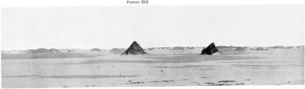
Pottery Hill, possible site of “Zerzura,” from the south-west
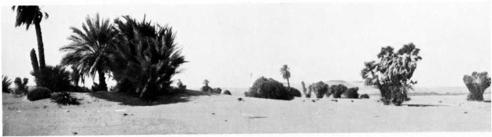
Bir Kassaba, a watering-place on the Darb el Arba’in
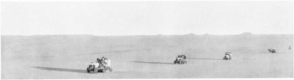
The waterless stretch of the Darb el Arba’in between Bir Murr and Kharga
Bir Sheb, a well on the Darb el Ar ba’in