11. The Sand-Dunes.
Reading edition
The sand-dunes of the Libyan Desert have been the subject of careful studies by Mr. Beadnell and Mr. Harding King, and practically all that was known concerning them up to the outbreak of the Great War is contained in the excellent papers by them which were read and discussed at meetings of the Royal Geographical Society in 1910, 1916, and 1918.[45]
With the commencement of the Senussi campaign in Egypt in 1915, the sand-dunes sprang into new and unexpected importance, from the fact that they formed one of the principal hindrances to the free movement of troops, and more especially of military motor transport, across the desert. Every line of dunes of any considerable extent had now to be carefully mapped and examined for possible car-passages through it; the result was to add greatly to our knowledge of the distribution and extent of these remarkable features of the Libyan Desert, especially in the northern parts, where many long lines of dunes were found of which the existence was previously unsuspected by geographers, though they are familiar landmarks to the Bedouin of the region, and all except the smallest bear Arabic names. After the cessation of hostilities, interest in the distribution of dunes was maintained, because of the increasing use of motor-cars in place of camels for transport across the desert; and this circumstance has recently led to light being thrown on the distribution of the dunes in those southern regions which lay outside the field of operations during the war.
It is rather curious to note that although the sand-dunes form the greatest obstacle to motor-cars in the desert, yet it is chiefly by means of motor-cars that the true extent and distribution of the sand-dunes has been ascertained. Dunes are the most difficult of all desert features to map properly by ordinary reconnaissance methods with camel transport. Their smooth outlines provide no points on which intersections can be made, and no survey marks put on them will remain in place for more than a few hours, or at most a few days; they occur mostly in nearly level country, where it is impossible to find a station whence they can be overlooked; the absence of shadows on them renders it impossible to say whether one is looking at a single line of dunes, or at several lines, miles apart, one behind the other in echelon. The only sure way of mapping dunes is to traverse their sides along their entire length, and this is impracticable with camels owing to the enormous distances which would have to be covered without water. But with motor-cars one can run alongside them at 40 kilometres an hour instead of the camel’s 4, and their distribution can thus be rapidly and easily ascertained.
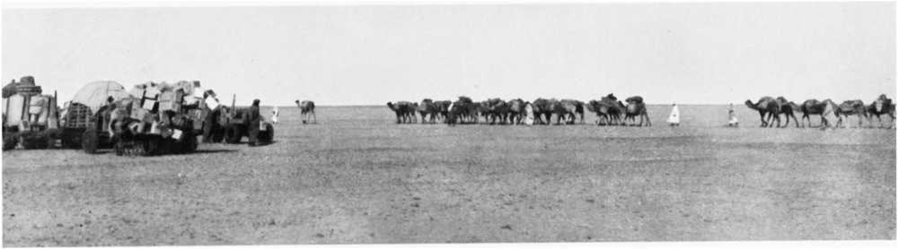
Prince Kemal el Din’s expedition of 1925 leaving Bir Terfawi for the waterless journey of 250 miles to Owenat
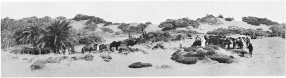
The well at Bir Terfawi in the palm clump
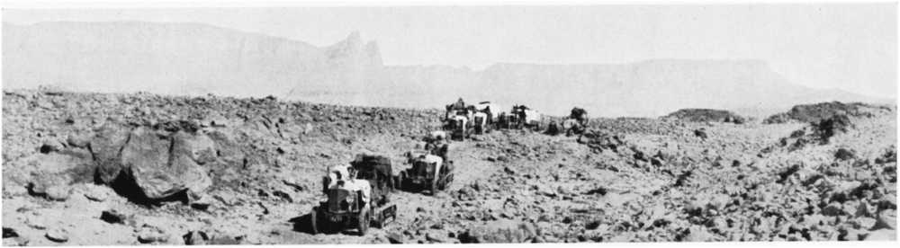
Jebel Owenat from the south: the triple peak (5635 feet) in centre
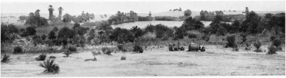
The lake at Merga located by Prince Kemal el Din’s expedition of 1925
On the map I have shown the distribution of sand-dunes as far as it is known at the present day. A comparison of this latest map with that given by Mr. Beadnell in his paper of 1910 will show how large is the number of dunes discovered and mapped in more recent years; and it will be noticed how pronounced is the constancy of the general direction of all the lines in the Egyptian portion of the Libyan Desert. Though no new lines of dunes comparable in extent with the great Abu Moharik belt have been added to the map, some of the newly discovered lines are of very considerable length, and they show an even more remarkable ratio of length to breadth than the Abu Moharik belt; the Ramak dunes, for instance, extend from near Moghara south-south-eastwards in a straight line for more than 100 kilometres, with only a single small break, and their width nowhere exceeds 1 kilometre. Moreover, the linear arrangement in a direction from about 20° west of north to about 20° east of south is even more pronounced in the newly discovered northern dunes than it is in those previously known farther south. In the “great sand sea” of Rohlfs, to the west of Dakhla and Farafra, the same directional arrangement of the individual lines of dunes is very noticeable, at least in the part near “Regenfeld” where I have penetrated it; and I found the same general direction to hold for most of the lines of dunes which I crossed on the way from Terfawi to Owenat. During the war I received a number of reports of dunes extending nearly east and west, often in curved lines; but investigations on the spot showed practically all these reports to be erroneous, the commonest mistake having been that of sighting different lines of dunes from different places under the impression that they were a single one.
The general south-south-easterly direction which is so marked a feature of the lines of dunes in the Egyptian portion of the Libyan Desert is not, however, preserved in the extreme south-west of the country. The line of dunes which crosses the Egypt-Sudan frontier in longitude 25° 40′ has a direction of about 30° west of south, and the dunes which extend from near Gebel Arkenu to the west of Gebel Owenat run about 38° west of south. From a point about 80 kilometres to the south-west of Gebel Owenat, the dune-lines make a still further distinct bend to the west, changing their direction by some 20° to about 58° west of south, and this latter direction is maintained by the dunes in the neighbourhood of Sarra Well.[46] According to the maps of Rohlfs and Mrs. Forbes, the dunes in the sandy tract to the north-west of Kufra follow approximately the same bearing as those near Sarra. The suggestion has been made that this swinging round of the direction of the dunes in the south-western part of the Libyan Desert may be due to a deflection of the prevailing wind by the mountain-masses. It is almost certainly caused by differences in the prevailing winds—in fact, the dune-lines probably afford a very exact index to the general wind-direction in the areas where they occur—but I am inclined to think that the regional distribution of atmospheric pressure, rather than local deflection by mountain masses, is the cause of the differences of wind-direction. The dunes, especially those near Sarra and Kufra, extend into localities which seem to me to be too distant from the mountains for the influence of the latter on the prevailing winds to afford a satisfactory explanation.[47]
In certain areas, especially in the south, as for instance on the Arbain road from Kharga to Sheb, around Pottery Hill, and in the region between Owenat and Erdi, there are sand-covered tracts which can hardly be mapped as dunes, because there are no very marked crests. These tracts are easily crossed by camels, but give much trouble with cars, and would probably be classed as dunes by car-drivers; but they are really only vast undulating fields of drifted sand. On the old Darb el Arbain slave road between Kharga and Sheb, one travels for more than 100 miles over drifts of this kind. No footprint of camel marks the track, footprints being obliterated in an hour or two. But one is never in doubt about the way, for it is indicated by the skeletons of countless camels which have perished on the weary march.
As regards the relation between dunes and the relief of the ground, there is a gradual rise in the general level of the country from north to south of about 1 in 1000, so that the southern ends of most of the Egyptian lines of dunes lie at higher altitudes than the northern ends; but I am fairly certain that this slight general inclination has nothing to do with dune-formation. The straightest and cleanest-cut lines of dunes are found in the flattest and most open parts of the desert, over which the wind can sweep without obstruction. When a line of dunes encounters in its southward progression a sudden fall in the ground-level, as for instance at the north end of Kharga Oasis and to the east of Pottery Hill, it usually breaks up; sometimes, as in Kharga, to resume its course as dunes in more open formation, and at other times, as near Pottery Hill, to spread out into a rolling plain of drifted sand. It is not uncommon for the south end of a line of dunes to split up, even on level ground, and the same can be seen, though less often, at the northern ends; but this is probably merely because the dunes are lower near the ends of the lines, and the width of the individual dunes is consequently less.
The great lines of dunes are probably extending southwards at a very slow rate, under the action of the prevailing wind. In this connection it is interesting to note that Arabs always speak of the south end of a line of dunes as its head, and of the north end as its tail; just the opposite of what one would instinctively call them from merely looking at the map, but correct if the dunes are known to have a southward progression. Mr. Beadnell found the average rate of progression of isolated small dunes in Kharga to be 15 metres per annum; but he remarks that large dunes move more slowly than small ones, owing to the greater mass of material to be transported. It is interesting to make a rough guess at the antiquity of the dunes from the length of certain of the longer lines and an estimated rate of progression. The Abu Moharik belt, for instance, has a total length of about 350 kilometres; hence, if its tail has remained stationary and its head has advanced southwards at an average rate of 10 metres a year, some 35,000 years must have been occupied in its formation.
As regards the height of the dunes, the only one I have carefully measured is that close west of Rohlfs’ camp at Regenfeld, which I found to be exactly 30 metres. Some of the dunes in the Abu Moharik and Ramak belts are considerably higher; but I doubt if any of the Libyan dunes rise much over 50 metres above ground-level, except in the “great sand sea” which commences some 14 kilometres to the north-west of Regenfeld, where Jordan estimated them to attain 100 metres or more.[48] The top of a high dune to the south of Melfa Oasis was found by triangulation to be 172 metres above sea; the level of the ground at its foot is unknown, but is probably not very much above the sea-level, so that Jordan’s estimate of the height of some of the dunes in the “sand sea” is probably by no means an exaggerated one.
Much has been written about eddies in connection with dune-formation. The only observations I have made in this connection have been when endeavouring to place temporary marks on dunes to form survey-points; and the observations seem to show that if eddies are artificially created at the top of a dune, a rapid lowering of the dune-crest results. At first I used to thrust a walking-stick or ranging-rod some 2 or 3 feet into the dune-crest. The stick or rod, though quite firmly fixed at first, was always found after a few hours lying halfway down the dune-slope. The same thing happened with tripods firmly pressed down into the crest. When I was carrying out a little triangulation to determine the position of Rohlfs’ cairn at Regenfeld in 1924, I had occasion to place a mark on a high dune, and I used an empty 4-gallon petrol tin filled with sand, bedding it well into the dune; but the next day it had disappeared from the crest, and was found, as the other things had been, halfway down the slope. These observations remind me of Mr. Barclay’s description of the method of dealing with sand-accumulations in the Peruvian Desert,[49] where, as soon as dunes appear and threaten to obstruct a railway, the local inhabitants turn out and scatter pebbles and stones on the dunes, and very soon the dunes are gone, having been carried away owing to eddies produced by the wind around the stones. This device for removing incipient dunes might, I think, be tried along the Kharga Railway, where the screens put up at Mr. Harding King’s suggestion have not been entirely successful in preventing the encroachment of sand on the line. I am the more disposed to think an experiment of this kind might succeed, because I have noticed that at the gap in the Ramak dunes (discovered by Col. Partridge and known during the war as “Partridge Gap”) there are great lumps of silicified wood, which may have led to the gap being formed.
There are two other physical characteristics of dunes which I do not remember having seen mentioned. One of these is their low thermal conductivity. On a hot day, one has only to thrust one’s hand a few inches into a dune to encounter cool sand, while on a bitterly cold day one can warm one’s hands by the same action; thus while the diurnal variation of temperature of the surface of a dune is frequently very great, it is almost insensible at quite a shallow depth in the interior. It follows that diurnal expansion and contraction of the grains composing the dune must be confined to the superficial layers, and the movements thereby caused may materially assist in consolidating the dune, by causing a “packing” of the grains. The other characteristic I have noticed is that the surfaces of the dunes always appear to be harder underfoot in the cool of the early morning than in the heat of the day. This may, of course, be an illusion owing to one’s being less sensitive to fatigue in the early morning, when one’s body has been refreshed by sleep, and when the air-temperature is comfortable; but I have often fancied there is more in it than that, and it may easily be that the “packing” which has taken place owing to the considerable fall of temperature in the night, to say nothing of the action of dew, may have caused a real compacting of the surface layers.
In his paper of 1910, Mr. Beadnell considered that the sand composing the dunes must be derived from arenaceous formations to the north, and he made special mention of the need for a careful survey of the region in which the dunes originate. A reference to the map will show how correct was Mr. Beadnell’s surmise, at least in the case of the Egyptian dunes which he had studied. The dunes originate in the great depressions which stretch from Siwa to the Wadi Natrun, where, as Mr. Beadnell inferred, the supply of arenaceous material from the loosely compacted Miocene and Oligocene beds is almost inexhaustible. We have here one of the clearest possible examples of the powerful action of the wind as an excavating and transporting agent. The Qattara depression has been excavated, largely by the wind, to a depth of over 130 metres below sea-level, and the excavated material has been carried southwards, some of it for nearly 1000 kilometres in distance and more than 500 metres in height, to form the dunes. We see not only the excavated hollow, but also the transported and piled-up arenaceous material removed from it; and the total quantity of rock thus removed and re-deposited must amount to hundreds of cubic kilometres.[50]
It is noticeable, however, that to the north of the “great sand sea” of Rohlfs, which extends for an unknown distance westward, the known depressions are much shallower; and yet the total quantity of sand in this region is probably greater than that of all the more easterly dunes put together. The country between Jarabub and Jalo is however almost unexplored, though it is known to be very sandy and to be the theatre of violent sandstorms. Whether similar deep depressions to that of Qattara have been excavated along, or to the north of, the Jarabub-Jalo road, or whether the area of loosely compacted arenaceous rocks exposed there is so enormous as to have yielded such a quantity of sand without any very deep depressions being formed, is a point that can only be cleared up by further exploration in Cyrenaica.
We now come to the most puzzling of all the questions connected with the sand-dunes, namely, why do they persist as sharply defined long narrow lines in certain places, while the ground elsewhere is almost absolutely free from sand? As Mr. Harding King puts it, the dunes appear to have a curious power of collecting all the sand in the neighbourhood.[51] The sheltering effect of ripples in the dunes, and a “shepherding” effect of winds a point or two off the normal, have been suggested as possibly affording some explanation of this apparent collecting-power,[52] but neither of these suggestions appears to be adequate. I think a more direct explanation is possible; namely, that the dunes really have the power of attracting sand from the air, and that this power is due to the well-known law of attraction between a conducting surface at zero potential and an electrically charged body. That air-borne sand-grains in the neighbourhood of a dune may carry electric charges was shown by Mr. Harding King’s experiments, recorded in his paper of 1916, and I have since found sand-grains to carry electric charges of high voltage during sandstorms in Cairo. As to how the grains become charged with electricity, it can hardly be due to friction against each other, for the sand is remarkably uniform in composition, consisting generally of rounded grains of almost pure silica coated with a thin translucent film of ferric oxide,[53] and for the production of frictional electricity it is generally regarded as necessary that the two bodies which are rubbed together should be of dissimilar materials;[54] nor is it likely that they are electrified by friction with the air, for they travel with it. But if the particles are carried into an upper air-stratum, they will gradually acquire its potential by conduction; and the ordinary potential gradient in the air in Egypt is over 100 volts per metre of height.[55] Hence a sand-particle carried along for some time in the air at a height of only 20 metres above the ground may become charged to 7 electro-static units of potential, or 2100 volts; and on approaching a dune rising to about that height it will be attracted to the dune, which being in connection with the earth is at zero potential. The attraction will be very small unless the sand-grain approaches very closely to the surface of the dune; from some calculations I have made, a spherical grain of silica half a millimetre in diameter charged to a potential of 2100 volts will not be attracted with a force equal to half its own weight until it approaches within a centimetre of the conducting surface, and the grain will have to approach within 7 millimetres of the surface before the attraction is equal to the weight of the grain. But the important thing to note is that the attraction is independent both of the sign of the charge and of the direction of the wind which carries the particle. Another way of looking at the matter is to consider the probable distribution of the equipotential surfaces in the air about a dune, as in the diagram below, which represents a section taken perpendicular to the direction of the wind and to the axis of the line of dunes:
Diagram showing suggested distribution of equipotential surfaces and directions of lines of force in the neighbourhood of a sand-dune
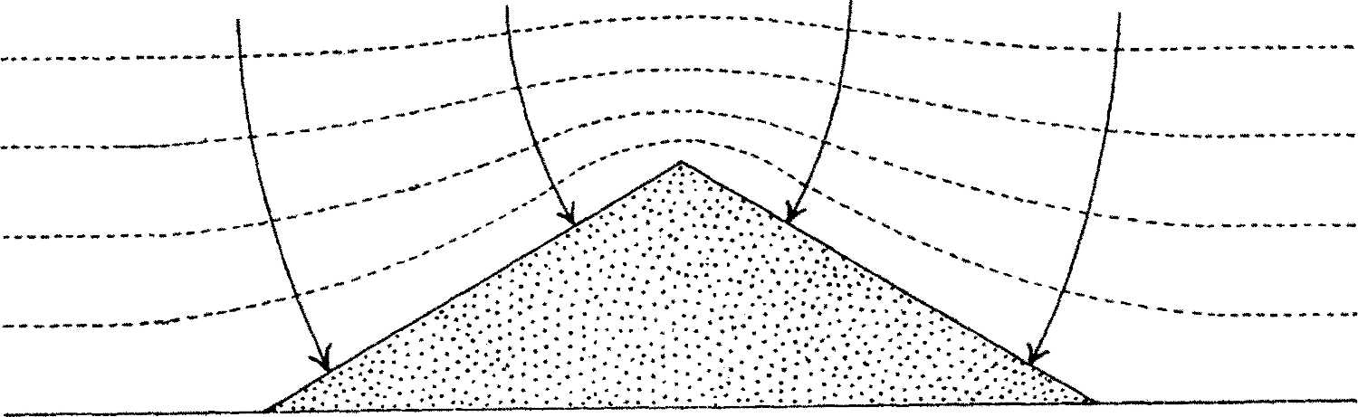
The equipotential surfaces, shown by dotted lines, will be squeezed together over the dune, and the electric forces, shown by full lines and arrows, being everywhere normal to those surfaces, will converge to the dune. Thus the dune will attract any particles carried by the wind and charged by conduction to the potential of the air conveying them. If the wind changes its direction, the attraction will still persist unaltered. Another point worth mention is that a sand-dune may be far more effective in its attraction of sand than a rocky ridge of the same size and shape would be; for when the electrified grains approach the surface of the dune, uncharged grains can rise from the dune to meet them; possibly some of the dancing of sand-grains which is frequently observable along the crest of a dune during a wind may be due to this cause.[56] During violent sandstorms, particles of sand may be whirled aloft and kept suspended at high altitudes for a period long enough for them to acquire very high potentials, and a sudden cessation of the storm may cause them to fall so rapidly that much of the charge may be retained; in which case, of course, electrical attraction may cause a very considerable deviation from the purely gravitational paths of the falling particles, the deviation being always towards the dune. Since the closeness of the equipotential surfaces and the mobility of the sand-grains composing the dune are greatest along the dune-crest, the maximum rate of deposition will be at the top of the dune, which is also the place where the wind exerts its greatest action in conveying the sand of the dunes southward. That the long axes of the lines of dunes do really correspond with the direction of the prevailing wind is certain, both from Mr. Beadnell’s observations of wind-direction[57] and from the fact that the scoring of the limestones in the Libyan Desert by wind-borne sand coincides in direction with the lines of dunes.[58] Thus I suggest that while the extension of the lines of dunes southwards is purely the result of the prevailing north-north-west wind, their clean-cut character and narrow width is the consequence of lateral attraction by the dunes themselves on the flying electrified particles of sand.
If the hypothesis I have ventured to put forward is regarded as likely to furnish the true explanation for the formation of the lines of dunes, I hope that someone possessing the necessary skill in electrostatic measurement will put it to a crucial test, by carrying out observations on and near the dunes themselves. If a number of flying sand-grains could be caught from different levels in an insulated metallic receiver connected to an electrometer, the readings of the electrometer would enable the potentials to which the grains were charged at different levels to be calculated, provided the electrostatic capacity of the receiving system and the number and diameter of the grains giving up their charge were measured. Allowance would, of course, have to be made for any electrification of the receiver by the air, or by uncaught sand-grains, as well as for losses by imperfect insulation of the collecting system. In a preliminary experiment of this kind which I made in Cairo during a sandstorm, leakage from the electrometer was found to be so great as to vitiate any attempts at accurate measurement; but I think this particular difficulty could be overcome with a specially designed apparatus, or that at least the leakage could be measured and allowed for. The taking of observations of any kind in dune areas during windy weather is a most difficult and trying operation, and commonly means, in addition, a sojourn of some weeks in isolated and otherwise uninteresting areas. But the advent of the motor-car has so greatly facilitated communication in the deserts that difficulties of access are now not so great as they used to be; the south end of the 35-kilometre line of the Kattania Dunes, for instance, about 90 kilometres west-south-west of Cairo, which would form an excellent site for detailed observations, can now be reached by a four or five hours’ car journey from Cairo instead of the several days’ journey by camel which was formerly necessary.