3. The Possibility of Utilization of Depressions in the Libyan Desert for Irrigation, Drainage, or Hydraulic Power.
Reading edition
The depression known as the Wadi Rayan, discovered by Mr. Cope Whitehouse about 1883, situated some 40 kilometres west of the Nile Valley and about 100 kilometres south of the latitude of Cairo, has been so frequently described and considered in regard to its utilization as a reservoir or as a flood-protection for Lower Egypt, that I need say little about it beyond a reference to the principal published works dealing with it.[12] There is no other depression in the Libyan Desert which has received so much attention from the economic standpoint. That the Wadi Rayan has not already been utilized as a reservoir has depended on a variety of considerations, of which one of the principal has been the doubts always entertained as to whether there might not be an underground leakage from it, resulting not only in a loss of part of the stored water, but also in damage to the adjacent flourishing province of the Faiyum. These doubts will not be lessened by the converging lines of evidence which I shall bring forward in dealing with the artesian water-supplies, all leading to the conclusion that there is an underground water-connection between the various depressions of the Egyptian Libyan Desert. Of late years, however, it has been proposed to make use of the Wadi Rayan, not as a reservoir, but as a sump for disposing of the drainage water of Upper Egypt by evaporation; and to this, in consequence of the lower level at which the water would stand in the depression, there is far less objection from the point of view of possible leakage or damage to the Faiyum.
The Wadi Natrun, which, though considerably less deep, is not greatly less in extent than the Wadi Rayan, has received some consideration as a possible sump for disposing of some of the drainage water of the Behera Province of the Delta. So long ago as 1895 the Public Works Department studied the possibility of draining Lake Mariut into the Wadi Natrun, and thus doing away with the increasing cost of keeping down the level of the lake by pumping water from it into the sea.[13] The Wadi Natrun has an area, even at the low contour of 10 metres below sea-level, of nearly 100 square kilometres, and the average rate of evaporation from an open water-surface within it could not well be much less than 3 mm. per day; the wadi could therefore dispose annually of at least 100 million cubic metres of drainage water by evaporation alone, and probably of a considerable additional quantity by seepage. But the high cost of cutting a drainage channel from Lake Mariut to the wadi, and the heavy maintenance charges which would be incurred in keeping the drain open, were formidable objections to the scheme. From a reconnaissance carried out in 1896, Mr. Verschoyle found that the length of the proposed drain would have to be almost 80 kilometres, and for the greater part of the way it would have to be a cutting 20 metres in depth through desert and ridges of drifting sand; he remarked that if it were an easy matter to make the connection, it would be no easy matter to maintain it; and he concluded that the scheme was an impracticable one.[14] A more recent proposal has been to construct a partly tunnelled channel instead of an open drain; but this has likewise been found to be impracticable, as involving too heavy an outlay for the benefits which would result.[15]
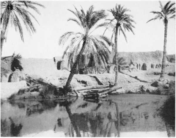
7. Qasr Farafra, seen from the north over plain of powdery chalk forming floor of depression
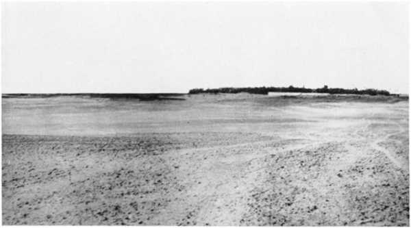
8. Escarpment and “Hattia” of Abu Mungar from the south
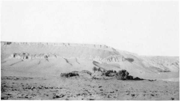
9. The “Hattia” of Abu Mungar from the east: well on earth-mound on right
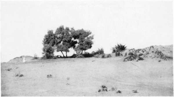
10. The principal well at Qasr Farafra
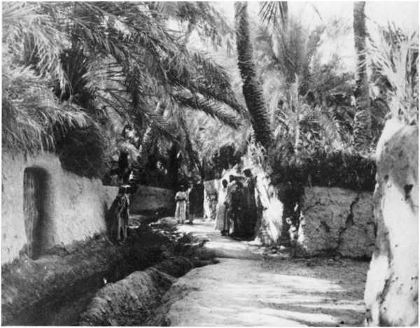
11. A street in Qasr Farafra, with irrigation canal
When the great extent and depth of the Qattara depression were established by Mr. Walpole’s explorations of last year, hopes were immediately entertained that the depression might be made to serve some useful economic purpose. Any idea of its being of use as a Nile reservoir was of course at once cut out, not only by reason of its position and distance from the Nile, but also by its immense size; for even if we could turn the whole Nile flood into it, some twenty years or more would be occupied in filling it to a sufficiently high level,[16] and the loss by evaporation from so large an area would be enormous. As a receptacle for drainage water from the Delta it appeared equally impossible of consideration, because of the great length and depth of the channels which would have to be cut to reach it. A more reasonable prospect seemed to be that of admitting sea-water from the Mediterranean into it by means of a navigable canal from the Arabs Gulf; this would only have to be about 56 kilometres in length to reach the nearest point of the depression; and once the canal was made and the depression filled, ships might sail almost to Siwa. Other advantages which might accrue from the formation of this inland sea were an increased humidity of the climate along the Mediterranean Littoral of Egypt, leading to increased rain-crops in that region, the establishment of a valuable fishery, and a possible increase in the water-supply of the oases by the causing of a slight rise in the static water-level there. Another idea, which rapidly followed the first one, was to utilize the depression as a source of electrical power for driving pumps by which the drainage of the northern parts of the Nile Delta might be improved. At first sight this latter prospect looked a very attractive one. The salt-marsh which covers much of the floor of the depression appeared suggestive of a former sea-connection, and if we could trace out this old connection, the cutting of a canal along it might not, it was thought, be a very expensive matter. Moreover, it was apparent that evaporation from an inland sea or lake of so large an area would keep pace with quite a large influx from the Mediterranean, so that if the influx were restricted to such a quantity as would permit of the lake-surface being maintained at a level considerably below that of the Mediterranean, power could be generated continuously. Suppose, for instance, that we maintained a permanent water-level in the lake of 50 metres below the sea; the estimated area of the lake at this level being 9000 square kilometres and the mean evaporation assumed to be 4 millimetres a day, an influx of no less than 36 million cubic metres of water per day could be passed into the lake without altering its level, and this with a fall of 50 metres would suffice theoretically for the continuous generation of over 270,000 horse-power. Of course the lake would gradually get more and more saline, but the power might continue to be maintained for very many years before the lake became as rich in salt as the Dead Sea.
But alas! an investigation of the northern borders of the depression showed that the hoped-for traces of a former connection with the Mediterranean Sea do not exist. The depression is entirely shut in from the north, either by great cliffs, or by ground lying so high that the cutting of a canal to the sea is utterly impracticable. Of the 56½ kilometres from the sea-level contour of the depression to the coast along a line running 12° east of north from Moghara Lake (which is the easiest line hitherto found for the cutting of a canal), only 16 kilometres are at less than 50 metres above sea; 31 kilometres lie at altitudes between 50 and 100 metres; and 9½ kilometres are above the 100-metre level. An open channel being thus put out of the question, it was next natural to inquire whether a tunnel, or a channel partly open and partly tunnelled, could be excavated to serve for the conveyance of sea-water into the depression. But even this, though perhaps not impracticable, would be a very costly undertaking. The conveyance of the requisite quantity of water, even at a relatively high velocity (which of course implies a considerable slope), would necessitate a tunnel or tunnels of very large dimensions. To convey 36 million cubic metres a day at a velocity of 5 kilometres per hour would require a sectional area of 300 square metres—i.e. if two tunnels were made, each would have to be 14 metres in diameter. The cost of boring and lining such tunnels would certainly be very great, and it is doubtful whether the value of the power generated could justify the capital expenditure involved in the excavation and other works which would be necessary. Until more is known of the nature of the strata through which the aqueduct would have to pass, and as to the length of tunnelling and amount of open cutting which would be required, it is impossible to form even an approximate estimate of the expense which the undertaking would involve. All that can be said at present is that the utilization of the Qattara Depression offers a possible means of obtaining power on a large scale for the drainage of the low-lying lands of the Delta, with at the same time a prospect of improving in some measure the agricultural resources of the Mediterranean Littoral; much further investigation will have to be accomplished before any judgment can be formed as to whether such a project would be an economically sound one.
In formulating any scheme for improving the drainage of the Delta, it is of course important to consider, not only the manner in which the drainage water could be ultimately disposed of, but also the modifications which would have to be made in the existing drains and irrigation canals—modifications which would need to be carried out without serious interruption to existing agriculture. A scheme which otherwise appeared attractive might easily prove to be impracticable by reason of the heavy expenses and inconveniences of the subsidiary works which would be required to make it effective.
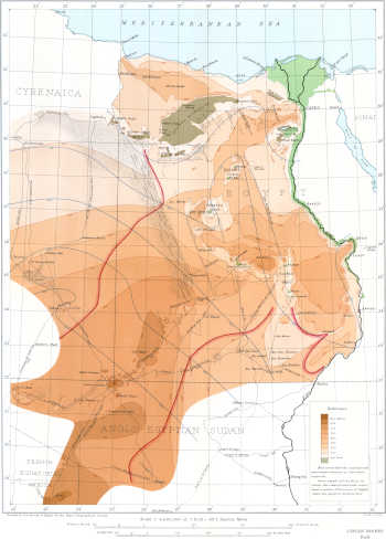
THE LIBYAN DESERT Showing Surface-Relief, Contours of Static Underground Water-levels, Distribution of Sand-dunes, and Routes of Principal Exploratory Expeditions in the West and South by Dr. JOHN BALL THE GEOGRAPHICAL JOURNAL JULY 1927