1. Did the Nile, or a Branch of it, ever flow through the Libyan Desert to the Mediterranean?
Reading edition
The idea that a “dry river” exists in the Libyan Desert is a very old one, and seems to have had its origin in the fact that barren depressions in that region are sometimes called by the local Arabs Bahr bela ma, that is, “sea without water.” But the Arabic word bahr, which properly means a sea or a lake, as in Bahr Lot (the Dead Sea), is also applied in Egypt and the Sudan to a river, as in Bahr el Nil (the Nile) and Bahr el Azrak (the Blue Nile).[5]
The earliest depression to be discovered bearing the name of Bahr bela ma was the one now known as the Wadi Faregh (the “empty wadi”), situated immediately south of the Wadi Natrun. Father Sicard, who visited the place in 1712, correctly interpreted the Arabic name to mean literally “sea without water,” and having discovered fossil trees there, which he imagined to be the petrified remains of masts of ships, he inferred that a narrow arm of the sea formerly extended from the Mediterranean into the locality.[6] At a later date Sicard’s view that the petrified trees were the masts of ships was recognized to be a mistaken one; but a greater error was committed by changing the translation of Bahr bela ma from “sea without water” into “river without water,” as was done by D’Anville in his ‘Mémoires sur l’Egypte,’ published at Paris in 1766. D’Anville was a great authority in his day, and his translation was adopted by subsequent writers for over a hundred years. General Andreossi, who commanded Napoleon’s artillery in the expedition of 1798 and 1799, made a map of the “Dry River” and the “Valley of the Natron Lakes,” in which both depressions are shown open at both ends, instead of being closed in as they really are. Andreossi considered that the “Bahr bela ma” was the dry bed of an ancient branch of the Nile, which left the present Nile Valley somewhere in Middle Egypt and entered the sea to the west of Alexandria; he also thought that the ancient Lake Moeris was probably formed by the damming of the “dry river” near its supposed offtake from the Nile.[7] Later on, after Cailliaud and other early nineteenth-century travellers had discovered that other depressions existed in widely separated localities and bore the same Arabic name of Bahr bela ma, it seems to have been hastily assumed by the cartographers of the time that all the depressions bearing the same name were parts of a single dried-up river-channel. Thus, on a large map of Egypt compiled by Colonel Lapin and published at Paris in 1856, the “Bahar Belah-mah ou Fleuve sans eau” is stated to come from the Congo and is depicted as coursing through the Oasis of Dakhla, thence passing to the east of Baharia Oasis and on to the Mediterranean. On another large map of Egypt, compiled by Muzzi Bey, the then Director-General of Egyptian Posts, and published in Florence in 1876, a continuous valley is boldly shown leading from the mountains of Darfur to the Mediterranean, while cross-valleys, labelled “Old Bed of the Nile,” are depicted as connecting the main valley with that of the Nile at Korosko and Dongola.
The Rohlfs expedition of 1874 proved that there was no such channel running northwards through Dakhla Oasis; that the “Bahr bela ma” which had been crossed by Cailliaud between Siwa and Baharia was merely a closed-in local depression, and that the continuous empty river-beds which were shown on the maps of that period had no real existence.[8]
But though the continuous “Bahr bela ma” channel of the old cartographers has been shown to be purely imaginary, and has in consequence disappeared from our modern maps, the belief that an old dry river-bed may exist somewhere in the Libyan Desert has apparently persisted in many minds even to our own day. Only a few years ago I was called upon by the Government to discuss a suggestion, made in all seriousness by a person of considerable eminence, that the Nile, or a branch of it, must at one time have followed a course from somewhere near Dongola through some of the Egyptian oases to the Mediterranean; and that by tracing out the old channel, and deepening it artificially where necessary, a part of the river might be taken off along this path and its water utilized to irrigate the desert country on either side of it. To the few scientific travellers who have journeyed extensively in the Libyan Desert, it will doubtless appear incredible that such a suggestion as this could be seriously made. But old traditions concerning the geography of little-known regions die hard, and this particular one has probably been fostered by the circumstance that on most small-scale maps the oasis-depressions have been shown without any precise indication of the altitude of the intervening ground, as well as by the speculations of geologists as to the existence of a river in the region in past geological ages. Blanckenhorn, for instance, published in 1902 a series of small-scale maps depicting the course of a hypothetical river, the “Libyan Ur-Nile,” running northwards through the desert in the Eocene and Oligocene periods, and ceasing to exist in the Pliocene.[9]
That a river flowed during late Eocene or early Oligocene times in a north-easterly direction through what is now the Libyan Desert, and entered a sea near what is now the Faiyum, can scarcely be questioned; for it is only by the existence of such a river that we can account for the assemblage of fossil trees and curious remains of Eocene animals (including the ancestors of the elephant) discovered by Mr. Beadnell north of the Birket el Qarun and described by the late Dr. Andrews.[10] As to the size, length, and exact position of this river of the geological past there is very great doubt; but neither its situation nor even its existence can be considered material to our present inquiry. No one conversant with the known facts bearing on the general geological history of Egypt during late Tertiary and Quaternary times could make the mistake of thinking that the path of an Eocene river might be traceable in the present desert relief. The evidences of such path must be purely of a geological nature. In his endeavours to suggest what might possibly have been the course of the river on whose banks the Eocene animals lived, Mr. Beadnell found in two localities deposits which might have been formed along the ancient drainage-line; and in both these localities the deposits now occupy the summits of hills. There is insufficient evidence of any kind to justify so exact a location of the Eocene river as Blanckenhorn’s maps would suggest, and none whatever of any relationship, either between the present surface-configuration of the desert and Eocene or Oligocene drainage-lines, or between those drainage-lines and the River Nile. The appellation “Ur-Nile” of Blanckenhorn is thus a misleading one. If we are to look for traces of a dried-up river in the surface-forms of the Libyan Desert of to-day, it must be a river which, like the streams which eroded the great wadis of the Eastern Desert, existed in geologically recent times, and which became dry either through the continual deepening of the present Nile-channel, with consequent capturing of the former drainage, or through climatic changes causing a diminution of rainfall in the collecting area.
A study of the contoured map seems to me to be absolutely conclusive on the question at issue, for it indicates clearly that at no time within the geologically recent period can there have been any such continuous channel as has been supposed. Let us try and trace, with the aid of the map, the most likely course along which the ancient Libyan Nile-branch, if ever one existed, must have flowed. Starting from the Nile in the neighbourhood of Dongola, we observe that the lowest possible track is through Sheb towards Kharga. But Sheb can only be reached after passing over some 350 kilometres of desert lying well above the level of the Nile at Dongola, which is about 230 metres above sea. It is, of course, quite conceivable that even within geologically recent times the Nile at Dongola may have been considerably above its present level; so that we may pass over this first difficulty as not being definitely conclusive against the hypothesis we are pursuing. From Sheb to the south end of the Kharga depression there is a drop of about 160 metres, so that up to this point a channel may have been possible. But from here onwards, difficulties come in. If we turn northwards, we soon encounter the north wall of Kharga, rising to 300 metres above sea-level; so there is no continuing that way. Instead, we turn westwards towards Dakhla. But from Kharga we have to pass over ground reaching very nearly to the 200-metre contour for some 80 kilometres to enter the Dakhla depression, where we drop to a level of 119 metres. We have to traverse some 15 kilometres at altitudes above 200 metres to reach Abu Mungar, where the level is 117 metres; then a further 12 kilometres lying above the 200-metre contour to get to Farafra, where the level descends to about 90 metres. To get out of Farafra, we have again to traverse country lying over 200 metres above sea, whether we choose a north-westerly route viâ Sittra to the Qattara depression, or a north-westerly one viâ Baharia to the Wadi Rayan and the Faiyum. Taking the first of these alternatives as being the shorter, we cross some 30 kilometres of ground above the 200-metre level, and a further 120 kilometres lying between the 200- and 100-metre contours, before reaching the Qattara depression. And once we are in the Qattara depression (the lowest point of which is 134 metres below sea), there is no possibility of reaching the Mediterranean except by crossing a considerable tract where the ground-level is over 100 metres above sea-level.
A section of the route described, with a comparison-line passing through the present Nile-levels in corresponding latitudes, is shown in the figure below:
Profile from the Nile at Dongola through the depressions of Kharga, Dakhla, Abu Mungar, Farafra, and Qattara to the Mediterranean. Vertical scale 500 times the horizontal. Total length of section about 1700 kilometres; for more than half this distance the ground-level is seen to be above a line drawn through the levels of the Nile in corresponding latitudes.

Can any one believe that a course of this kind was ever that of a river? To make a through channel would entail deep cutting for more than half the total distance of 1700 kilometres, and would consequently involve excavating hundreds of millions of cubic metres of rock, much of it of considerable hardness. Moreover, it cannot be supposed, in the present state of our knowledge of the region, that more favourable lines of communication exist and have been overlooked. Many depressions doubtless still remain to be discovered; but these, like those already known, will surely prove to be merely local basins. So many cross-country journeys have now been made in various directions through the desert, that it is inconceivable that any continuous channel of the kind we are discussing could possibly have escaped notice. Nor can we reasonably suppose that recent earth-movements have produced the present severance of the various depressions; such movements might perhaps be invoked to account for one or two of the separating elevations, but certainly not for all. We can therefore be absolutely certain that neither the Nile nor any branch of it ever passed through the Libyan Desert to the sea.[11]
Even channels of tributary streams to the Nile, such as abundantly survive in the great wadis which enter the Nile valley on its eastern side, are markedly absent in the Libyan Desert. The contours on the map suggest that possibly one such tributary stream may formerly have drained the south-western faces of the great plateau in which the depressions of Dakhla and Kharga form bays, and have entered the Nile somewhere between Aswan and Halfa; but if such a channel ever did exist, its actual traces have long since been obliterated by the smoothing action of subsequent denudation, and only the great escarpment of the plateau which it half encircled remains to tell the tale.
Photographs by Prince Kemal el Din, Dr. Ball, and Mr. Walpole
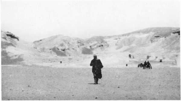
1. Desert exploration with the ordinary car, requiring help even on flat ground in sandy tracts
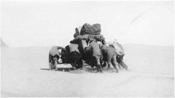
2. Caterpillar cars carrying heavy loads over a sand-dune between Bir Terfawi and Gebel Owenat
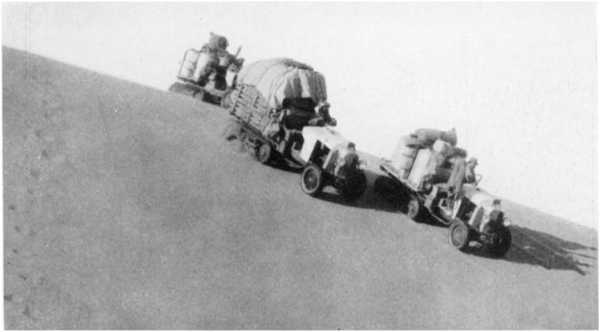
3. The western wall of the Qattara depression 35 km. S.S.W. of Qara Oasis. Top of cliff about 3 m. and floor of depression 133 m. below sea-level
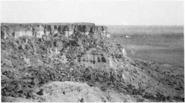
4. Ain el Hez, Baharia Oasis, irrigated by free flow from well
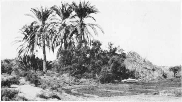
5. Overlooking the Baharia depression from the pass at its southern end: cars bound for Farafra
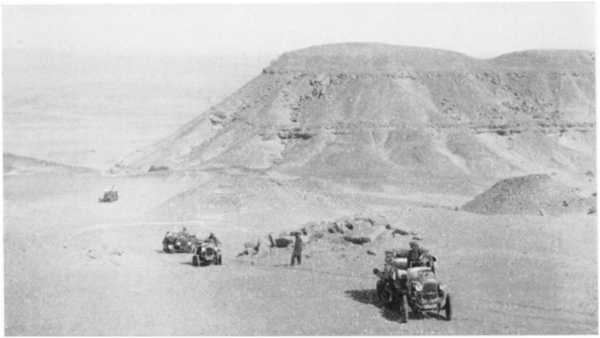
6. Northern end of Farafra depression: sandy ravine cutting back into chalk plateau