STORIES OF CONGO DISCOVERY.
Reading edition
THE SECOND LARGEST RIVER IN THE WORLD.
BY CYRUS C. ADAMS.
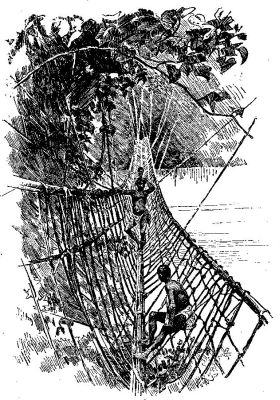
A NATIVE RIVER BRIDGE.
About a hundred years ago the school children of our country were reading in their Morse's Geography that there were no great mountains in North America, and that our largest mountains were the Alleghanies, which were supposed to be a continuation of the Andes, interrupted by the Gulf of Mexico. Teachers in those days edified boys and girls with more or less amusing misinformation such as this about the land they lived in. It was three hundred years after Columbus had discovered America, and such blunders in the text-books show how very slowly geographical knowledge had grown in those centuries.
But there has been a revolution. For over fifty years men and women have been eagerly studying this great house where we abide, with its five big rooms and its thousands of little ones. No one ever saw before such zeal for geographical discovery. Africa heads the list, for that continent, a fourth larger than our own, which was scarcely known a century ago, except in its outlines and along some of its rivers, has been thrown open to our gaze in nearly every corner; and the part of Africa where the greatest amount of work, the largest interest, and the most surprising discoveries have centred is the basin of the Congo, the second largest of the world's river systems.
Europe knew of this mighty river before she ever heard of Columbus. For four centuries sailors of various lands saw the Atlantic tinted for forty miles from the shore by the yellow Congo tide; but no one knew till Stanley told, eighteen years ago, where this mighty flood came from. Livingstone lived and travelled for many months along the far upper Congo, but the great old man died in the belief that he had traced one of the sources of the Nile. It was the Niger problem reversed. Nobody knew for centuries where the Niger River reached the sea. Nobody knew where the Congo gathered its great floods. One river needed a mouth, and the other a fountainhead, and so some wise geographers united the two, making the Niger the upper part of the Congo. Mungo Park, who traced the upper Niger for a thousand miles, believed it was a Congo tributary, if not the Congo itself; and the Tuckey expedition perished of fever among the lower Congo cataracts in 1816, while bravely trying to fulfil their mission to ascend the Congo to the Niger, if the two rivers were really one.
Eighteen years ago Stanley traced the Congo from central Africa over 1500 miles to the ocean. His great discovery made him famous, but other men who followed him, some of whose names are hardly known, except to geographers, have travelled far more widely in the Congo basin than Stanley was able to do. He led the way, and forty or fifty followers, scattering all over the Congo basin, which is half as large as the United States, have been revealing this land to us; and students of the ocean have been studying the sea-bed off its mouth. Let us glance at a few facts that have been learned about this mighty river system.
It is found that more water pours into the ocean through the Congo's mouth, which is six miles wide, than from all the other rivers in Africa put together. The soft, dark-colored mud brought down by the river has been distinctly traced on the ocean bottom for six hundred miles from the land. In no other part of any ocean do the influences of the land waters make themselves felt so far out to sea.
But it is not the deep lower Congo, which large steamers from Europe ascend to the foot of the rapids, nor the roaring torrents along the 235 miles of the cataract region, that have attracted most attention. It is the placid upper Congo, with its few reaches of rapids, and its many tributaries, stretching away to far-distant parts of inner Africa, that has kept the map-makers busy. This is the part of the continent where explorers have been most active and the results most remarkable. No part of the world of the same extent ever yielded so many geographical surprises as did this region from 1885 to 1890. It was simply impossible for the cartographers to keep their maps abreast of the news as it came from the upper Congo.
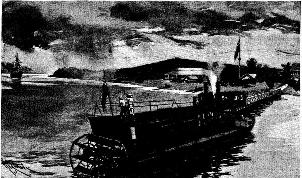
BOMA, THE CAPITAL OF THE CONGO STATE. STANLEY'S BOAT IN THE FOREGROUND.
In January, 1885, the missionary George Grenfell started from Stanley Pool on his little steamboat in quest of villages of friendly natives where mission stations might be planted with good prospects of success. He had previously been far up the river, and thought he knew it very well; but on this trip he accidentally got out of the Congo, and did not discover his mistake until he had steamed along a whole day, and found that his little craft was pushing into a region where no white man had ever been before. Grenfell had stumbled into the mouth of the Mobangi-Makua River. For more than two years Stanley and his followers had been travelling up and down the Congo, but they never saw—or at least they never recognized—this great affluent, which is larger than any European river except the Volga and the Danube. Grenfell forgot his missions for the time, became the zealous explorer, and kept on his course up the wide river until he was stopped by rapids, having left the Congo about 400 miles behind; and while he was threading the virgin stream Stanley was in England making his large map of the Congo, on which not a trace of its greatest tributary appeared. The distinguished explorer was the first victim of the swarm of discoveries which from that day for years made every new map of the Congo behind the times as soon as the next mails arrived from the river.
Perhaps some of the other white men had seen the mouth of the Mobangi-Makua, and thought it merely an arm of the Congo enclosing an island; for this is the region of the sealike expansion of the river, where only a water horizon could be seen from either shore if it were not for the myriad islands that cut the river into scores of tortuous channels. There were white men on these Congo banks who neither saw nor heard of the fleet of vessels that passed them a few miles away, carrying the hundreds of men of the Emin relief expedition. Before Stanley came whole tribes on one shore had never seen the people who lived across the river.
A little later in 1885 a steamboat was sent up the Congo to the mouth of the big river that enters it at Equatorville. No vessel could have a more pleasant mission, for this steamer was the bearer of loving letters from home and fresh supplies of European food for Wissman's party of explorers, who had been in the African wilderness for many months, and might be in sore need of succor. It was thought the party was quite certain to emerge from the great unknown region south of the Congo at Equatorville, and the reason for this belief is interesting.
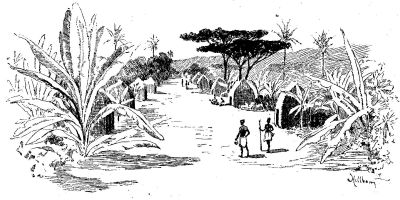
NATIVE VILLAGE WHERE WISSMAN STARTED DOWN THE KASSAI.
Many years before, Livingstone had crossed the upper waters of a river, the Kassai, now known as the second largest Congo tributary. Stanley believed the Kassai emptied into the Congo at Equatorville, and all the map-makers adopted his hypothesis. Captain Wissman and his comrades were sent from Germany to march inland from the Atlantic to the upper waters of the Kassai, and then to follow it to its mouth; and as this point was supposed to be at Equatorville, the mails and supplies for Wissman were sent there, and the officers of the steamer expected any day to see his expedition float into view.
Wissman reached the upper Kassai, and discovered there a remarkable tribe, the Baluba, whose chief had cut down all the palm-trees in his country to keep his people from getting drunk on palm wine. This chief helped Wissman to hollow big canoes out of tree-trunks, and then he and many of his subjects, who engaged with the explorer as paddlers, set out with the white men down the unknown stream.
Wissman expected that the river would carry him far to the north, but in a few days he was much surprised to find that he was travelling much further west than north. Day after day he floated further and further to the west, and after many weeks, and some curious adventures that cannot be told in this chapter, he reached the Congo. A few days later another stern-wheeler ascended the Congo, and at Equatorville pulled up to the shore alongside the waiting vessel.
"What are you doing here?" asked the Captain.
"Oh, we're waiting for Wissman, and it's high time he came."
"Let's see; how long have you been waiting for Wissman?"
"Well, we've been here a little over two months. We're running short of supplies ourselves, and if the party doesn't turn up here within the next week, we shall leave Wissman's mails and boxes, and go back to Stanley Pool."
"Well, Wissman has the start of you. He's at Stanley Pool now."
"You don't mean it! Reached the Congo? How long ago?"
"Just a week."
"Why didn't he follow the Kassai to its mouth, as he was ordered to do?"
"He did. You see, this river here isn't the Kassai. The Kwa River is the Kassai. Wissman reached the Congo at Kwamouth over 200 miles south of here."
More work for the map-makers. This story illustrates the surprises that came to Europe month after month from the Congo basin. The geographers had to pull to pieces most of their preconceptions about the lay of the land and the extent and direction of the rivers. The waters of the Sankuru, for instance, which Livingstone and Stanley had crossed in their upper part, were found to reach the Congo about 700 miles from the supposed point of confluence. Lakes that had appeared on the maps, on native or Arab authority, were wiped out. A part of the Lualaba, or western head stream of the Congo, was found to have no counterpart in Africa. The narrow gorge, forty-three miles long, through which it flows, walled in by perpendicular rock masses rising a quarter of a mile above the stream, resembles our great Western cañons. In these few years nearly all of our notions of Congo hydrography away from the main stream were completely changed.
This was not all. While threading these numerous rivers in their little steamboats, the explorers found many new peoples who had been buried from the world's view in the dark Congo forests or on the vast inland plains. You have read of the ancient troglodytes and of the prehistoric lake-dwellers of Europe. Proofs of their existence are found among the earliest evidences of human life; but the Congo basin to-day has two large centres of lake-dwellers. Many thousands of people live in huts reared high on piles out of reach of floods; and a few lakes are dotted with these habitations, thus placed beyond the easy reach of enemies.
The explorers discovered the widespread haunts of the Batwa dwarfs—the keen little hunters who had been seen when Stanley wrote his book, The Congo. Their researches proved that the Congo basin is the greatest hotbed of cannibalism the world ever saw. These and many other discoveries kept geographers on the alert. Thus the Congo basin has contributed a chapter to geographical and anthropological discovery that has scarcely been surpassed in importance or romantic interest.