THE GEOLOGY OF WASHINGTON TERRITORY.
Reading edition
HISTORICAL AND STRUCTURAL.
I shall not say much about the historical geology of Washington Territory, because it contains some problems which have never been adequately studied, and which I had no opportunity to investigate. It is to be hoped that the regular work of the Government Survey may soon be extended to this important region. Hitherto it has been neglected. A few able geologists such as Joseph Le Conte, Pumpelly, Newberry, Bailey Willis, and some others, have made visits to the country on special errands; but except the treatise of Bailey Willis in Vol. XV. of the Census Reports, and some brief allusions to the country in systematic works on general geology, I had nothing to guide me as to the structure of the country, or the age of its deposits. For all practical purposes, however, I had no difficulty in understanding the work I had to do.
All agree that the country west of the Rocky Mountains proper, and including nearly all of California, Oregon, and Washington Territory,The Western Coast regions younger than the Rocky Mountains and Appalachians. is geologically younger than the main range, and younger than the Appalachian country. At the close of the carboniferous period proper, the Rocky Mountain range constituted a separate continent, with a sea covering what is now the main Mississippi Valley, including the wide plains immediately east of the Rocky Mountains, and connecting, probably, with the polar sea, whilst the Pacific Ocean washed the western edge of this Rocky Mountain continent; so that until after that period there were no Wahsatch and Uintah mountains, no Sierra Nevada and Cascade Range, no Coast Range, and, of course, none of the intervening country. It is quite possible, however, that there was a third continent lying west of the present continentAn outlying Continent. in what is now ocean, from whose waste the sediments were derived which were afterwards elevated and became the land now included in the three States bordering the Pacific, whilst the mother continent, which furnished the sediments, sank beneath the ocean. If there were such an outlying continent, additional force is given to the views of Dr. George F. Becker, endorsed by Dr. C. A. White, and to some extent anticipated by Prof. J. D. Whitney, which render it probable on other grounds that the two great lines of mountains, viz., the Sierra Nevada and Cascade Range and the Coast Range, began their upward movement simultaneously during the early ages of the Juro-Trias.The rise of the West Coast. The rise of these mountain lines was gradual and marked by reverse movements, whereby, after appearing above the surface, they sank and rose alternately, receiving fresh sediments, which, especially in the Washington Territory region and part of Oregon and California, when above water, became clothed with an enormous vegetation which was packed into coal-beds, layer after layer. In the lapse of time these all came above the surface. The mountains grew higher and higher, attended by intense heat in the axes of the ranges, and at different periods, down almost to the present, exhibiting volcanic action on an enormous scale. At other periods, a large portion of the region was visited by ice-floods, succeeded by water-floods, which top-dressed great areas with a mingled deposit of gravel, sand and mud, and carried away vast blocks of the rocky substance of the country, and cut deep channels in all the highlands.
As Washington Territory is now presented to us, it exhibits a scene of mountains, lowlands, and elevated plateaus, which are full of interest and variety. Some general account of its topography has already been given.
LOWER SNOQUALMIE FALLS, 268 FEET HIGH, ON LINE OF SEATTLE, LAKE SHORE AND EASTERN RAILWAY.
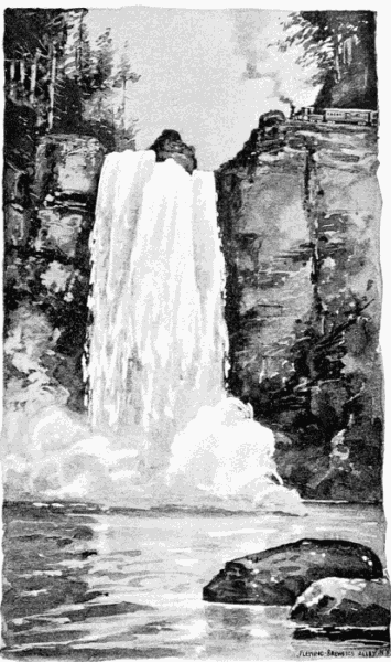
The rocks and minerals of the Cascade Mountains.The core of these high ranges is chiefly rock originally stratified, which has been metamorphosed by heat, and perhaps inside of all, with branches bursting out at various places, are plutonic rocks which have never been stratified. This is the state of things on the top of the Cascade Range, near Snoqualmie Pass, as well as on some subordinate peaks and ranges. On Mount Logan, the Denny Mountain, etc., are large bodies of syenitic granite whose age I have no means of determining. Associated with this are quartzites of fine grain, and extremely hard, porphyries, and serpentinoid and chloritic rocks of different sorts, in which are imbedded the magnetic iron ores; and also large beds of crystalline limestone, both fine and coarse grained. Crossing these, at various angles, are veins containing the precious and base metals.
The metamorphic rocks of doubtful origin.Whether these rocks are Palæozoic or Archæan in their origin, or whether they are simply the metamorphosed strata of the upper Juro-Trias, or the lower Cretaceous, is a question for future study. These plutonic and metamorphic rocks are believed to extend through the mountainous region lying north of the Columbia River; and they are reported also in the Cœur d'Alene Mountains. It is quite certain that on both flanks of the Cascade Mountains we find in their natural state Cretaceous conglomerates, sandstones, and shales bearing coal, at least in their upper beds. The deposits on the east side of the mountain have been much grooved and denuded, until we find only small areas of the Cretaceous strata on the Yakima and the Wenatchie rivers, and the Peshastan ridge between, with a patch of the coal-bearing rocks on the Yakima, and another on the Wenatchie. On the west side of the mountain range, the Cretaceous and coal-bearing areas are much larger.
The coal beds.The coal deposits of all the Cretaceous regions of the West are regarded as belonging to the Laramie period which closed the Cretaceous age, and constitutes a transition period between the Cretaceous and Tertiary. But I do not regard this question as settled. The inferior lignites of the Rocky Mountains, and the semi-lignites which constitute the upper beds of the Washington Cretaceous coal properly belong to the Laramie period; but to include the underlying bituminous coals in the same group may be a matter of question. More will be said in reference to these coal beds under the next head. The Western coal-bearing rocks begin on outlying mountains, standing at the west foot of the main Cascade Range. These outlyers are irregular in size, height and direction; but many of them are 1,000 to 1,500 feet in height, and they are found in groups, separated by denuded spaces, from the Cascade Mountains to the Pacific Ocean, and from the Canada line nearly to the Columbia River. The largest and most important field, however, lies south of the Snoqualmie River and between Puget Sound and the Cascade Mountains. Some of the coals found in the most southern part of the field, and on the Coast Range, are referred to the Tertiary period.
A smaller and wholly undeveloped field lies on the Skagit River, and another on, and west of Bellingham Bay. Similar beds are found on Vancouver's Island. Coal-bearing strata are found also on the Chehalis, Des Chutes, Nisqually and Cowlitz rivers. Whilst some of these southern and western strata are referred to the Tertiary period, there has been no systematic study of their geologic relations.
The volcanic mountains and their great activity.It seems to be settled, however, that the lofty volcanic mountains which form conspicuous features in the scenery of the Cascade Range, were active in the Tertiary period, and not only built their own crests 9,000 to 15,000 feet high, but inundated much of the surrounding country with lava to an amazing breadth and depth. In this region, Mount Baker, Mount Ranier (also called Mount Tacoma), Mount St. Helens and Mount Adams in Washington Territory, and Mount Hood in Oregon, were the centres of the grandest operations; and so continued for ages.
We see gigantic results of this activity in the cañonThe wonderful cañon of the Columbia River. 1,000 to over 3,000 feet deep, which the Columbia River has cut through this volcanic matter in its passage through the Cascade Mountains. This volcanic deposit consists of brown basalt, which in cooling crystallized into vertical, polygonal prisms, or columns, which have been sculptured by the weather into endlessly varied forms, beautiful, fantastic, and grand; altogether presenting a scene, or succession of scenes, for twenty-five miles, such as can nowhere else be equaled on the American continent, unless it be near by, on a tributary of the Columbia, the Des Chutes River of Oregon.
The great sheets of basalt.This great pile of basalt was built up by a succession of overflows of lava, the joints of which are plainly visible. The basaltic area, though perhaps thickest here, continues with a thickness of 1,000 to 1,500 feet up the Columbia for hundreds of miles; indeed the whole plateau, or prairie country of East Washington, which is a quadrilateral of some 200 miles in diameter, is but a continuation of the great lava-sheet seen at the Cascades and the Dalles. Through it the Columbia and Snake rivers have cut deep channels; and other, though shallower channels, have been cut across the surface of the plateau by departed streams.
Origin of the rich soil of East Washington.Whether the extremely fertile soil which overlies the basalt in East Washington is a top-dressing of volcanic ashes, or is decomposed basalt, cannot readily be determined. It cannot be referred to the Glacial period, as I observed no appearance of drift anywhere except in the valley of Spokane River. Such a wide spread of lava is not unexampled in view of somewhat similar overflows now occurring at intervals in the Sandwich Islands, where lava runs and spreads itself like water. These Hawaiian flows are mentioned by Captain C. F. Dutton in his report of the Zuni Plateau.
A ledge of sandstone belonging to the Meiocene Tertiary is visible under the basalt at the lower cascade in the Columbia River; and a stratum of iron ore and vegetable matter is found on the Willamette at Oswego, lying horizontally between great masses of basalt, showing a long interval between overflows. The volcanoes not wholly extinct.These eruptions probably continued with diminishing force until near the present time. It is reported that Mount Hood has sent out smoke or steam since the settlement of Oregon. The crater of Mount Ranier was visited by two gentlemen within a few years, and a night spent in its bottom by the side of a jet of steam. Such, at least, is the account given by one of them, Mr. Stevens.
Glacial drift.The Quaternary or Drift Period has left abundant, though by no means universal, traces of its presence. As before intimated, I saw no relics of it in East Washington, except a deposit of rather small, generally very small, and well-rounded quartz gravel, thickly strewing, and really forming, the flats bordering Spokane River. This gravel macadamizes the streets of the City of Spokane Falls, and the neighboring roads, so as to make them firm at all seasons. These gravelly bottoms are not tillable except in a few spots.
The undulating country north and east of Puget Sound is in many places deeply covered with drift material which shows the effect of both ice and water. Blocks of partially rounded granite several feet in diameter are found on the hills around Seattle. This gravel deposit is not often found on high points, but there is a ridge in the Cascade Mountains, near Salal Prairie, which is thickly bestrewed at an elevation of 1,000 feet. This, however, was quite exceptional, and may be the lateral moraine of a local glacier. The deposit around Seattle is not only easy to cultivate (its soil being a light blue loam), but seems fertile. The bottom lands are free from gravel.
So much for the general geology.
ECONOMIC GEOLOGY.
Note.—The location of the coal-fields and collieries mentioned in the following pages may be seen on an accompanying map.
Under the head of Economic Geology, I shall describe with more detail the mineral beds which have a commercial value, and in the following order:—I. Coal; II. Iron Ore; III. Granite, Limestone, and Marble; IV. Precious and Base Metals.Thickness of the Coal Measures.
I. Coal.—The thickness of the Coal Measures of the Puget Sound basin is estimated by Bailey Willis at something like 14,000 feet, though he admits the obvious possibility of error in the calculation by reason of undiscovered faults. We may fairly expect them, however, to be thicker than the same group in the Rocky Mountains, which measure about 9,000 feet. As heretofore remarked, the sediments become thinner from west to east. Of course, the maximum thickness is not to be expected in every locality. Mr. Willis's estimate was made in the Wilkeson and Green River fields, and really did not reach the limit of the coal-bearing rocks. The coal rocks of the Cedar River and Snoqualmie basin have never, so far as I know, been estimated, but probably this group is equal in thickness to that of any other part of the field. The difficulty of measurement arises from the numerous fractures and changes of strike which exist.
Fifteen workable seams.The number of distinct workable seams of coal of three feet and upwards, belonging to the measures, may safely be put down at not less than fifteen.
Before considering the quality of these coals, I will, for better understanding, make some Different kinds of coal described.prefatory statements in regard to the character of coals generally. Charcoal has greater purity than mineral coals usually have, because there is nothing in the charcoal except what naturally belongs to the woody matter. Mineral coal, however, having been buried in water, mud, and sand, must, almost of necessity, have some mixture of foreign matter, either slate, which is simply hardened mud; silica, which may have been derived from sand; iron and sulphur, some of which may have been in the wood, but most of it, probably, introduced in solutions; to which should be added, unexpelled oxygen, which is not only useless as fuel, but which combines with a portion of the contained hydrogen, and forms water in the substance of the coal.
The proportion of ash in coals of the same class is usually determined by the amount of slate in the coal, in addition to the mineral matter which belonged originally to the vegetable material from which the coal was formed. In the pure state, the proportion of ash increases as the transformation of woody fibre goes on from peat to anthracite.
The chemical changes in coal beds.It is worth while to note what are the changes which take place in the vegetable matter during the process. It may be described in a word as a progressive loss of oxygen, and by this loss the coal becomes richer, for the reason just given. The deoxidizing process is carried on by means of chemical changes in the substance of the coaly matter. The oxygen combining with a certain proportion of the carbon, forms carbon di-oxide, or carbonic acid gas; and a certain other portion, combining with hydrogen, forms water. Both of these are volatile in their character, and gradually escape. Another loss is effected by the combination of hydrogen and carbon, forming marsh gas. We have deadly proof that these combinations are in progress in all coal mines by the occurrence of "choke-damp" and "fire-damp," which are the miners' names for these gases.
Deficient nomenclature.Unfortunately, we have no settled nomenclature for the varieties of coal, excepting the broad names lignite or brown coal, bituminous coal, and anthracite. Even the term "bituminous" is scientifically inaccurate, there being, in fact, no bitumen in any coal. But it is applied to such coals as contain more oxygen and volatile combustible matter and water than anthracite, and less of these elements than lignite. The term lignite is made to include a great variety of substances, covering the lignites of the Juro-Trias of James River (Dutch Gap), which retain not only the structure, but the appearance of decaying wood; the lignites of the State of Mississippi, which are of the same geologic age as those of the Rocky Mountains, but which, owing to their watery and crumbly character, are unfit for market; the lignites of the Grand and Moreau rivers of Dakota, which are reported to have no commercial value; the lignites of Bozeman, Montana, which are really valuable, but soon break down into chips and grits; the lignites of Green River, Wyoming, which are firm, bright, lump coals; and the lignites of King County, Washington Territory, many of which are hard, bright, steam and shipping coals. And when brought to the laboratory, it is found that chemically these lignites vary even more than they do optically.
This want of a varied nomenclature is to be regretted, because it sometimes handicaps a good coal with an inferior name.Lignite an unsuitable name for the coals of Washington Territory. It is only of late that the Laramie or Cretaceous coals of Washington Territory have been divided into lignites, bituminous coals, and anthracites. These grade into each other so insensibly that it would be impossible to classify them sharply. None of the lignites which I saw were as low in grade as the typical lignite. The woody structure was quite discernible in some samples of the Franklin coal, and less in the Newcastle and Green River; but in respect to the two latter, I could not with the naked eye discern more of the woody structure than I have seen in some of the West Virginia coals, which belong to the Carboniferous period. I sat by fires of Newcastle and neighboring coals for a month, and observed no unusual amount of smoke, and no peculiar odor. By analysis, these coals show a larger percentage of oxygen than the typical bituminous coal, but decidedly less than is found in the brown coal of Germany, or in some of the lignites of Montana. They need a new name. Their heating power is not so great as that of the bituminous coals of the same region. Their streak and powder are less black, and their fracture more conchoidal, but not decidedly so.
The bituminous coals have the usual cubical fracture. The Wilkeson readily breaks down into small cubes. The lignites are black and lustrous. They come out as lumpy as ordinary coal, and, when exposed to weather, do not break up into powder and grits like ordinary lignite. This is true, at least, of the Newcastle coal.
The coking quality not general in these coals, but found in some.The coking quality of these coals cannot be determined by calculating the proportion between the fixed carbon and the volatile, combustible matter. I am not sure that Professor Fraser's fuel ratio tables are a safe guide in any case. So far as now known, only a few of the Washington Territory coals can be made into good coke. On this point, however, we have only laboratory and rough field tests, excepting at the Wilkeson mines, where twenty-five ovens were turning out a superior quality of coke, as proved by every test save the use of it in high furnace stacks, in which there had been no opportunity for trial. It is claimed by many persons that seams on Green River, Skagit, Yakima, and Snoqualmie will furnish good coking coal. The coal on Snoqualmie Mountain, near Hop Ranch, has not been studied, but it certainly has the external characteristics of good coking coal, and Mr. Peter Kirke made a rough trial of it in an earth-pit with decidedly encouraging results.
Somewhat similar coal is found on Raging River, but where opened, so much slate was interleaved with the coal that washing would be necessary before use. More will be said hereafter with regard to these coals; but the remark may be repeated here in respect to the entire Puget Sound basin, that much additional examination is necessary before its coals will be fully understood. The variations in character of these are not owing entirely, or even chiefly, to their relative ages, but also to the conditions to which they have been subjected, especially in respect to heat. This metamorphic agency has acted not only in the body of the Cascade Mountains, but all through the coal-fields, where faults, flexures, and intrusive rocks have occasioned changes in the original condition of the coal-beds, giving results along the whole scale of metamorphism from lignite to anthracite.
Analyses of Washington Territory coals.I here introduce (on the opposite page) a table of analyses made in Washington City from representative samples of Washington Territory coals and lignites selected by Mr. Bailey Willis during the examination which he made of this field for the Census Bureau, and found in Vol. XV. of the Census Reports.
THE COLLIERIES.
I will now give some account of the principal coal seams which have been worked in Washington Territory, namely, those in the field lying east and southeast of Puget Sound; and in so doing I shall add to my own knowledge all information from any reliable sources. Unfortunately, the sources of information are few.
ENTRANCE TO GILMAN COAL MINE ON THE LINE OF THE SEATTLE, LAKE SHORE AND EASTERN RAILWAY.
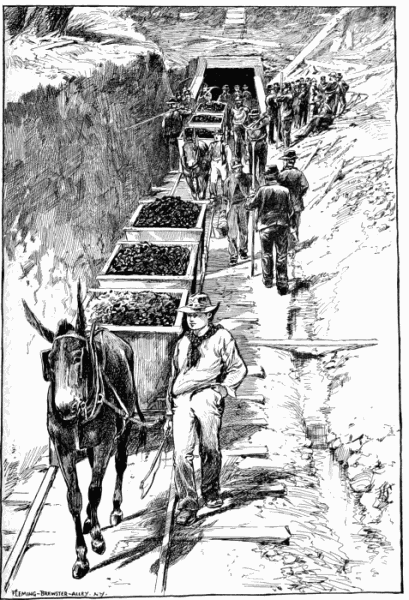
In the Report of Bailey Willis to Professor Pumpelly for the Census Bureau, we have the best account extant of the Carbon River and Green River basins.Authorities. Mr. Willis spent three years in his examination, assisted by topographical engineers. He made numerous trial-pits and borings with diamond drill, and forwarded samples to Washington City for analysis. Mr. F. H. Whitworth, of Seattle, accompanied me in my excursions, and prepared maps which are filed herewith. Mr. Whitworth has probably more practical knowledge of the Puget Sound coal basin than any one else. A small volume on the Pacific coal field was prepared some years ago by Mr. W. A. Goodyear. And Governor Squire's lucid and intelligent reports contain valuable information upon the coal, and all the other interests of Washington Territory. Governor Semple has also, in his Report for 1887, given us the latest official information.
ANALYSES OF REPRESENTATIVE SAMPLES OF WASHINGTON TERRITORY COALS AND LIGNITES.
Key for Sites
A— Miles City, Dakota.
B— Newcastle, Washington Territory.
C— Vein (?) G. R. C.
D— Vein 33, G. R. C.
E— Vein (?), G. R. C.
F— Vein xviii. G. R. C.
G— Vein ix. G. R. C.
H— Vein vi. G. R. C.
I— Vein iii. G. R. C.
J— Upper Yakima River, Wash'n Ter.
K— Carbon Station, Wyoming Territory.
L— Rock Springs, Wyoming Territory.
M— Wingate Vein, Carbonado.
N— Vein cxxiii. W. C.
O— Vein xviii. W. C.
P— Vein v. W. C.
Q— Vein i. W. C.
R— Vein lviii. B. B. C.
S— Vein xliv. B. B. C.
T— Vein d, Carbon River, W. C.
U— Skagit River, Washington Territory.
V— Raton, New Mexico.
W— El Moro, New Mexico.
Key to abbreviations for final row "Coke"
Wls— Worthless
Exc— Excellent
B&F— Black and Friable
Ra Poor— Rather Poor
LIGNITES. BITUMINOUS LIGNITES. BITUMINOUS COALS.
Green River Field, Washington Ter. Wilkeson Field, Washington Territory.
Altered by Intrusive Rocks.
A B C D E F G H I J K L M N O P Q R S T U V W
Original Sample No. 79 24 59 56 50 27 42 43 45 — — — 12 125 17 64 37 136 135 68 76 — —
Moisture14.10 4.16 7.27 9.98 8.68 2.50 4.82 3.34 3.24 0.80 8.10 7.00 1.80 3.98 1.33 1.16 1.54 0.61 0.44 2.56 1.17 2.0 1.66
Volatile Hydro-Carbons36.9544.8436.0240.6335.9045.7142.0239.3939.5240.8734.7036.8142.2728.6425.8829.0928.1729.58 5.84 8.4314.4037.134.48
Fixed Carbon35.7643.8628.4841.0747.0748.3737.1241.4948.3946.3951.6554.4652.1154.1060.6760.3859.7056.1873.9883.2764.5651.660.08
Ash13.19 7.1428.23 8.32 8.35 3.4216.0415.78 9.8511.94 5.55 1.73 3.8213.2812.12 9.3710.5913.6319.74 5.7419.87 9.3 3.78
F. C.—V. H. C. 0.97 0.98 0.79 1.01 1.31 1.06 0.88 1.05 1.22 1.13 1.48 1.48 1.23 1.88 2.34 2.07 2.12 1.8912.67 9.87 4.48 1.39 1.74
Coke None None None None None Poor None[B] None[C] Wls Fair —— —— Very Good None [D] Exc Exc Poor [E] B&F None None Ra Poor Good Good
Note.—G. R. C.—Green River column. W. C.—Wilkeson column. B. B. C.—Busy Brook column.
The different mines.In my brief sketches, I shall group the coal-beds as follows: a, Carbon River Group; b, the Green River Group; c, Cedar River Group; d, the Squak, Raging River, and Snoqualmie Groups; e, the Yakima and Wenatchie Group; f, Bellingham Bay, Skagit River, etc.; g, British Columbia Group.
a. Carbon River Group.—These beds lie on South Prairie Creek and Carbon River, tributaries of the Puyallup River.Anthracite, coking and gas coals. Anthracite coal in thin beds is reported high up on Carbon River, near the base of Mount Ranier; the result of metamorphism. Also undeveloped outcrops of soft coal at numerous points on the same river. There are, however, only three collieries at work in this group. One is called the Carbonado mines, which are on the Carbon River. Three miles north, a little east, are the famous Wilkeson mines; and two miles northwest of Wilkeson, are the South Prairie mines, on South Prairie Creek. (See Map.)
MAP OF WILKESON COALFIELD
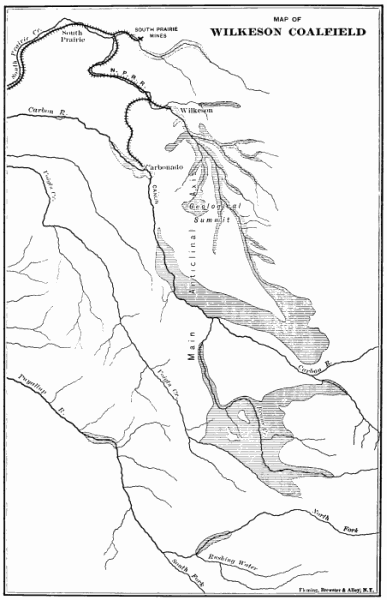
These coal-beds stand at high angles (fifty degrees and upwards), and dip in different directions. At Carbonado, there are four seams in pairs, separated by Carbon River, two of which dip to the south, and two to the north. At the South Prairie mines there are two seams, one of which dips to the east, and the other to the west. At Wilkeson there are three seams, all of which dip to the west. Mr. Willis interprets this coal-field as being a dome-like anticlinal, with compressed and crumpled sides, whose major axis runs nearly north and south. The Wilkeson and South Prairie mines are on the line of the major axis, whilst the Carbonado mines are in a group of subordinate short folds lying south of the main line. The anticline extends to Nisqually River, and shows two other coal areas south of Carbon River, the coal of which is said to resemble the Wilkeson coal.
The Carbon River coal-field first having been almost engulphed by volcanic uplifts and overflows, and almost buried by glacial drift, is now visible only in narrow strips along creeks, and at intervals along the Carbon River.
Owing probably to the heating of its beds, we find in this little field the coal which stands highest in reputation for coking and heating qualities. There are some differences in the coal at the three mines. That at South Prairie was sold chiefly for making gas. The best of the Wilkeson coal is made into coke, and is in demand beyond the supply. The price is $7.00 a ton at the ovens. The entire product of the Carbonado mines is said to go to the Central Pacific Railway. It is impossible to say what may be under the Drift; but, to all appearance, the amount of coal here is not large, and the beds are sadly faulted, and pitch deep into the ground.
b. The Green River Group.—I include in this group the Black Diamond and Franklin collieries, the Kirke or Moss Bay Company mines, and the Sugar Loaf Mountain beds. This, as well as the Carbon River field, is nearly equidistant from Tacoma and Seattle, being about thirty miles in a right line from each place. The Carbon River basin is geologically associated with Mount Ranier; the Green River basin with the outliers or foot ridges of the Cascade Mountains. The latter are much more approachable than the former. At the east edge of this field, the Northern Pacific Railroad emerges from the Cascade Mountains, having come down the cañon of Green River. This point is known as "The Common Point,"The Common Point, equidistant between Tacoma and Seattle. because the cities of Tacoma and Seattle are about equally distant, and the routes afford equally good grades from this point.
The narrow gauge road from Seattle now comes to the Franklin mines, and by continuing it a few miles to connect with the Northern Pacific there would be railroad connection to Seattle as well as to Tacoma. The river here cuts through the Coal Measures, leaving the less valuable part of the field on the south side. The area of this field is roughly estimated at fifty square miles. It contains all, or nearly all, the grades of coal from lignite to bituminous; the variety of coal depending upon the degree of local disturbance. As a rule, so long as the coal is not crushed, the more pitched and flexed the rocks, the better the coal; which fact indemnifies the miner for extra expense in mining. Here, the tendency is for the seams to become steeper and more broken from west to east; i.e., as they approach the foot-hills of the Cascade Mountains. The strata in Lizard Mountain on the south side, however, form an exception. Here the strata are nearly horizontal.
Franklin and Black Diamond mines.The Franklin mines are on the north bank of Green River and at the south edge of what has been known as the McKay basin, and the Black Diamond mines are on, or near, the north edge of the same small, oval synclinal basin. From this basin the dips become steeper toward the mountain, where Kirke's beds stand at a high angle. On the west edge of the Green River basin, say a mile west of Franklin, there is an outcrop of lignite. The coal of the Franklin and Black Diamond mines is bituminous lignite. The Kirke coal, or at least part of it, as judged by the eye, may be called bituminous coal, though not so much deoxidized as the Wilkeson. The coals mined in this basin are firm, black and shiny; they burn freely, and make but little dust. They have not, however, so far as tested, the heating power or coking qualities of the Wilkeson coal. Two seams are worked at Franklin, and three at Black Diamond. All of the seams worked are above four feet. A number of volcanic dikes and flows are found in and around this basin.The Kirke or Moss Bay Company (English) mines.
The Kirke or Moss Bay Company mines are six miles east of Franklin, and within a mile of Green River. They lie against the mountain. The strike of the mountain is northwest. The coal beds dip toward the mountain at a high angle. There are five seams of from five to fifteen feet in thickness; one of them (No. 2) may be said to be over forty-seven feet in thickness, though not all good coal, as the details given below will show. The top of the outcrops above sea-level are as follows:
FEET.
No. 1970
No. 21,160
No. 31,350
No. 41,461
No. 51,513
Some places on the outcrop rise much higher. The base of the mountain is about five hundred feet above sea-level. No shipping has been done from here. A gang of miners was at work opening the beds, with the special view of testing their coking qualities in order to be used, if practicable, by the Moss Bay Company for smelting the steel ores of the Cascade Mountains.
The only seam well opened when I was there (Nov. 17th and 18th) was No. 3, which is a large bed and shows an excellent quality of bituminous coal. The bed shows the side and end (or "tooth") structure. The coal is very black and moderately lustrous, and breaks readily into small rectangles of less than an inch. Its coking qualities have not been tested. Nos. 4 and 5 are said to be softer and more powdery, and may possibly be better for coke than No. 3. They have an available thickness of about ten feet each. The details of No. 3 are as follows:
Roof, Black Shale.FT.INS.
Coal09
Bone16
Coal07
Hard Slate20
Coal08
Bone02
Coal05
Bone01
Coal12
Soft Parting0½
Coal10
Bone and Coal07
Coal10
Bone01
Coal13
Bone0¼
Coal05
Bone0½
Coal07
Bone and Coal18
Coal04½
Bone01
Coal07
Sandstone bottom.—————
Total15 ft. ¾ ins.
There is a natural exposure of No. 2, the "Big Seam," which I saw on the mountain-side above the miners' camp, and took the following details:
No. 2, Big Seam, descending.FT.INS.
Coal12
Bone02½
Coal05
Bone04
Coal14
Bone01½
Coal10
Bone0¼
Coal08
Bone01½
Coal07
Bone01
Nigger-head and Coal06
Bone01½
Coal18
Bone0¼
Coal20
Bone04
Coal110
Bone01
Coal07
Bone01½
Coal10
Bone0¼
Coal12
Bone02½
Coal06
Bone01½
Coal03
Bone0¼
Coal13
Bone0¼
Coal18
Shale01½
Coal06
Bone04
Impure Bituminous Matter215¾
Coal, clean and good56
Total47 ft. 6 ins.
The Kirke mines are sixteen miles from Salal Prairie, and two miles from the Northern Pacific Railroad at the Common Point. The route has been surveyed by the Northern Pacific Railroad.
Adjoining the Kirke, or Moss Bay Company property, is a section of coal land (No. 34) on Sugar Loaf Mountain, owned by parties in Seattle, who offer it at $50,000. There are a number of seams on the property, but I could examine only one which had been opened near the foot of the mountain. It is a good seam of bituminous coal, of the same character with the Kirke coal. I took the following details:
Sandstone Roof.FT.INS.
Coal16
Soft Shale0¼
Coal02
Soft Clay0¼
Coal01
Soft Material, mining.12
Coal06½
Slate0¼
Coal10
Bone0½
Coal010
Bone0½
Coal05
Bone0½
Coal07
Bone01
Coal04½
Bone02½
Coal14
Hard Slate Floor.—————
Total8 ft. 5¾ ins.
c. The Cedar River Group.—This group consists of the Cedar River mines, nineteen miles from Seattle by rail, the Renton and Talbot mines, ten miles, and the Newcastle, eighteen miles. These coals are in the same river basin, and are all high grade lignites.Cedar River mines.
The first shipment made from the Cedar River mines was in July, 1884. There are two good seams here, one of which measures eleven feet. The outcrop curves from a south to a southwest strike. The dip is 20° toward the east.
Talbot and Renton mines.The Talbot and Renton mines, ten miles from Seattle, are on the same seam, but, owing to faults and other causes, they have not been worked of late. The seam is seven to nine feet of good coal, resembling the Newcastle, but has a bad roof, and soon reaches water. The dip is to the southeast at the grade of 10° to 25°. The outcrop curves as at Cedar Mountain. This always bodes trouble.
Newcastle Mine.The principal mine in this basin is the Newcastle, from which more coal by far has been mined than from any other. Its present annual output is equaled only by the Carbonado mines, which are pressed to their full capacity by the Central Pacific Railroad. The Newcastle coal is a high grade lignite, of firm texture, shining black color, and angular fracture. It is not a coking coal, but has a wide and established reputation for grate, stove, and boiler uses. It is the typical "Seattle" coal, and is sold chiefly in Oregon and California. (To-day, owing to scarcity, it would bring $25 per ton in Los Angeles). It has not the heating power of bituminous coal, but it is greatly superior to many of the lignitic coals. Many difficulties have been met with in the mining at Newcastle, the most of which seem to have been owing to the necessity for mining on the down grade, or fall of the coal; and the mines being now 1,000 feet deep.
I was twice at these mines, but, owing to the just previous destruction of the hoisting machinery, I could not make an examination.
An additional difficulty was that the mine had taken fire.
Cost of mining.The cost of mining at Newcastle has ranged from 85 cents to $1.50 per ton, averaging about $1.10.
According to Governor Squire, in 1884, the beds mined at Newcastle were, beginning at the lowest, 14 feet, 10 feet, and 5 feet in thickness. The dip is 30° to 40° northward, and the trend north 80° west. Governor Semple gives the following as the output of the Newcastle mines from June 30, 1878, to June 30, 1887:Large production.
1879127,381
1880128,853
1881149,602
1882158,340
1883218,742
1884149,948
1885149,050
188685,561
1887140,701
Total1,308,178
Average per year145,353
"The great falling off in the output for 1886 is attributable mainly to the labor troubles of that year, the mine being closed for several months; also the abandonment of the workings from the No. 4 vein."
The slope has now been sunk to a depth of 950 feet, and the mine is being operated entirely from this level. When this lift is finished, it is thought that several others of equal depth can be sunk as the basin is likely to be very deep.
Misrepresentation.After writing the foregoing, I received a volume issued annually by the United States Geological Survey on the Mineral Resources of the United States for 1886; and on page 364 I read with surprise the following statements in regard to the Newcastle mines of Washington Territory: "Considerable iron pyrites is present in this coal, which fact, added to the chaff-like character of the coal for igniting, causes much annoyance and cost to the mine from fires. Coal, or the mine refuse, piled in large quantities quickly ignites."
I knew when I was in the Territory that the mine was on fire, as I have heretofore stated; but I heard no intimation of spontaneous combustion. In fact, I was told that it was accidental.
I wrote at once to Mr. David T. Day, of the Government Survey, who is the present editor of this valuable work, asking his authority for such statements concerning this mine as had never, so far as I knew, been made before; though the mines have been described, or mentioned, in all the preceding volumes of the same work, and were mentioned with approval by Bailey Willis, Goodyear, and all other writers on the resources of Washington Territory. Moreover, that I had spent weeks in the neighborhood of the mines, and never heard anything of iron pyrites or spontaneous combustion.
Mr. Day replied that he had no personal knowledge on the subject; but that those statements had been furnished him by Mr. James F. Jones, who is connected with some mining operations along the Northern Pacific Railway.
I wrote also to Mr. F. H. Whitworth, of Seattle, calling his attention to the above statements, and asking what was the truth of the matter. I received his reply just in time to insert in this Report. I copy below all that he says on the subject, which puts a different face on the matter.
"No, I do not think there is any of any consequence of iron pyrite in the Newcastle mines. Nor do I consider that the fires in the mine Correction by Mr. Whitworth.originated in the decomposition of the pyrites. The fire in the mine originally started in the 'gob,' close to the furnace used for ventilation, and where the ashes of the furnace were thrown. Therefore, I have always believed that the fire was not spontaneous in its origin. The fire originated in the upper water level 'lift.' But it was led down into the second and third 'lifts' by carelessly breaking through the chain pillar, and thus letting the fire down. Several years before the fire started in the mine, and about three-quarters of a mile, or a mile, west of the point where it started, by careless mining and drawing of pillars, there was a 'squeeze,' and the mine heated; the result, I think, of the crush; but the mine did not fire. While you were out here the mines were in danger of firing, and when the cause was not the proximity of the present fire—but that, too, I think, was brought on by reckless mining. Running their 'breasts' 75 feet wide and more, and leaving only skeleton pillars, a 'squeeze,' of course, resulted, and the crushing produced the heat, and it did finally fire. The crushing being so great that the top work came down to within five or six inches of the bottom, you see easily producing crushing sufficient to cause fire.
"But the coal does fire outside spontaneously, or rather the slack does, when it is piled in considerable quantities, and after a year or more of exposure. The combustion in the slack piles usually commences in the firing of the shaley cap rock, which is thrown in with the slack as the rock disintegrates, or as that process goes on with the 'nigger-heads' thrown into the slack pile. And yet I feel satisfied that the slack piles fire when there appears to be almost none of the rock or 'nigger-head' in it. Two conditions, I think, are required: first, that the slack particles be small, and second, that large quantities of water be present. And I have supposed the heat and firing was caused by changing of the conditions; small particles of slack by disintegration to much smaller particles.
"And yet it may be possible that there may be sulphur in the form of pyrite present in sufficient quantity to do its work. Very semi-occasionally, very seldom, I have seen in the sulphur streaks some slight indications of pyrite; but generally the sulphur streaks, or balls, seem to be composed almost entirely of sand, with very little sulphur, and some coaly matter.
"The coal never has fired on shipboard.
"I remember that, several years, ago Mr. Howard, of the O. I. Co., had collected and stored in his yard in San Francisco, Cal., in one pile, several thousand tons of Newcastle coal, and was carrying it for some time in stock, and that he complained that his coal was heating, and feared fire. Since then they [have not] stowed in such large piles, nor carried stock so long.
"No, sir; the sulphur that we rooted [out] at Gilman was not in form of pyrite, nor have I seen any so far. I do not fear spontaneous combustion, because in the Newcastle, when it has occurred, it has resulted from carelessness."
This statement from Mr. Whitworth is certainly satisfactory on the main point, namely, that there is nothing in this suggestion which need diminish the reputation of the Newcastle coal as a stocking and shipping coal.
In 1884, Mr. Jones (the same man) made a special report to Governor Squire on the coals of Washington Territory, in which he describes the Newcastle coal, speaking of it most highly, and saying nothing of spontaneous combustion. He uses the following language concerning the Newcastle coal: "The coal is taken from three beds, and is commercially known as the 'Seattle lignite,' having a bright lustre and good fracture. It is a good and choice fuel for steam generating and for domestic use. The condition of the coal adds much to its value."
d. The Squak Creek, Raging River, and Snoqualmie Group.—These are not all in the same hydrographic basin, but they are considered together because they are the coals which will be reached by the Seattle, Lake Shore and Eastern Railroad. A great outcrop of coal seams occurs in the valley of Squak Creek in the mountain spur which lies between Squak and the Newcastle mines. These seams are now being opened by theGilman Mines. Seattle Coal and Iron Company, and are known as "The Gilman Mines."
Structure of Squak Mountain.The geological structure of the Squak Mountain and its coal seams is peculiar. With all their local irregularities, the general trend of the coal-bearing rocks in Washington Territory is north and south; so determined by the line of the Cascade Mountains, which is the main axis of elevation, with numerous subordinate and parallel axes. But on Squak Mountain we find the whole group of rocks and coal seams whirled at right angles to the general line. In other words, their general direction is east and west, instead of north and south, and the rocks lie in regular order against their central axis, dipping northward at a high angle, and showing no fault, so far as I know, except, possibly, a vertical fracture somewhere in the mountain, as suggested by a change of 38° in the strike at a point about one mile west of the outcrop on Squak. If the fracture exists, it does not follow that there is any serious dislocation. These coal seams are thus carried almost squarely across the spur from Squak Creek to Coal Creek, or from the Gilman Mines to the Newcastle Mines.
The simple explanation is, that, in the upheaval of the country, the Squak Mountain was made by a cross axis of elevation which runs east and west, or at right angles with the Cascade Mountains. Its metamorphic core shows itself along the crest of the mountain.
The part of the mountain which holds the coal seams is a high spur which puts off at right angles northward from the crest or backbone, and continues to Lake Washington, a distance of five miles. At the point where the spur leaves the backbone, it may be 1,000 or 1,200 feet high, and it declines gradually to the lake, and then makes a bluff shore-line. On the east side of the spur on Squak Creek it is steep, whilst on the west side, next Newcastle, it drops off more gradually. This difference of grade occasions a great difference in the economy of mining on the two sides.Peculiar advantages for mining possessed by the Gilman Mines. On the east, or Squak Creek side, the ends of the seams are boldly presented, showing in diagonal parallel lines extending from the top of the spur to the creek level, an average exposure of, say, 900 feet in elevation. Here the entries are being driven in horizontally near the water level, and the future progress of the mining will be inward and upward instead of downward and sidewise, as at Newcastle. The entries will all be on the horizontal line crossing the seams. The extreme distance, 1,300 feet. The length of the seams on the company's land is about two miles. Depth below water level, indefinite.
No shipments have yet been made from Squak Creek, Raging River, or Snoqualmie Mountain, but active developing work has been in progress since September last at the Gilman Mines (forty miles from Seattle), and shipping will begin shortly. A switch of only 600 yards in length is required from the main line of railway to reach the outcrop of the coal, and there is every natural advantage for mining.
Seattle Coal and Iron Company.The Seattle Coal and Iron Company own this property, which consists of 1,300 acres underlaid by seven coal seams, five of which will be mined ultimately, three in the beginning. I was able to examine three seams which will Seven seams.be mined at first, and give the following details.
Details.Top Seam, No. 4, descending:
Roof, rich Bituminous Black Slate, containing streaks of––
FT.INS.
Coal23
Bone01½
Coal07
Slate, variable00½
Coal011
Clay00½
Coal20
Clay, variable01¾
Coal11
Clay, mining0
Coal11
Total, good6 ft. 3¼ ins.
Good coal.This is a good seam of coal, five feet six inches of which can be depended on for shipping. The coal is dull-black in color, and easily mined. The bottom is soft sandstone. Overlying the roof-slate, is sandstone. The seam here is said to be one foot thicker than it is at Newcastle.
COAL-BUNKERS OF THE SEATTLE, LAKE SHORE AND EASTERN RAILWAY, ON SEATTLE HARBOR.
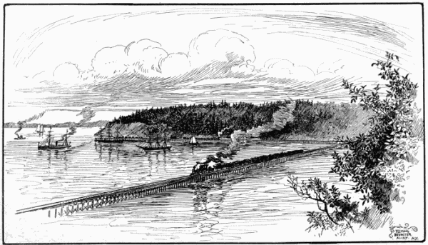
Another good coal seam.Seam No. 2 has been uncovered by the diggings on the railroad, and happens to be at an unfortunate place for showing the coal. A stump, partly silicified, with part of its bark lignified, had been taken out of the coal bed, and on each side of it was a tapering band of "Nigger-head," tapering from eight inches at the stump to nothing at the distance of five feet six inches from the stump. Selecting an average place, I got the following section, descending:
Good roof of Argilaceous Sandstone.FT.INS.
Bone01
Coal06
Nigger-head, local05
Coal110
Coal, sulphurous03
Coal13
Bone00½
Coal20
Black slate floor.—————
Total6 ft. 4½ ins.
Judging from this outcrop, which I suspect does not do full justice to the bed, at least six feet of merchantable lignitic coal may be depended on from this seam.
And another.Andrew's bed could only be seen at a point 200 feet above the railroad. It is nearest to the metamorphic axis of the mountain, and hence is the bottom seam in the group. It is said to be wanting at Newcastle. The coal is in two benches, descending:
UPPER BENCH.
Slate roof:FT.INS.
Coal05
Bone00 1/16
Coal04
Bone03
Coal18
Pyrite01½
Coal12
Slate05
Coal44
Total 8 ft. 8 9/16 ins.
LOWER BENCH.
FT. INS.
Fire-clay0 6
Coal1 4
Clay0 1
Coal0 4
Clay0 0½
Coal1 1
Bone0 1
Coal1 9
Total4 ft. 8½ ins.
The lower bench would probably be neglected for the present, but the upper bench is worthy of immediate development. The coal is of good quality. Perhaps on analysis it would be classed with bituminous coals, although the woody structure is discernible in places. It burns freely. The outcrop of this bed is visible lower down the creek in a crushed condition.
Large body of valuable coal.My visit was rather premature for a proper study of the group; but there can be no doubt that there is here a large body of valuable coal. The quantity is estimated by the mining engineer, Mr. Whitworth, at 10,500,000 tons. I saw no other coal beds in the territory so favorably situated for mining and loading. Of course, coal standing at an angle of forty degrees cannot be mined so cheaply as if it were horizontal; but all the mines in Washington Territory must contend with this disadvantage, and in all cases coming under my observation, except this one, the mining had to be done on the down grade, which involved much hoisting, pumping, bad air, etc., which can be avoided at the Gilman Mines.
An incidental advantage, also, is that the Squak Valley furnishes any amount of timber for building, propping, railroad ties, etc., and when more generally cultivated, a superabundance of agricultural products. The experience of Newcastle, and the rapid growth of the market, indicate that these mines may be enlarged in their operations, almost without limit.
Washington Mines.Washington Mines, on one of the upper branches of Squak Creek, show the outcroppings of three seams of lignite coal, dipping S. of W. I did not visit this place, but was informed that a company, known as the Washington Coal Company, was engaged in cutting these seams; but I am not informed as to what are their prospects.
Raging River coals.The Raging River Coals. Six miles east of Gilman Mines, where the railroad enters the Raging River Valley, is found another group of coal seams, older than the Squak coals, and perhaps corresponding in age with the Franklin and Black Diamond coals, though apparently more bituminous than they. Raging River is about twelve miles long, and the railroad first approaches it about midway its length. There are indications of local metamorphism, if not intrusion, visible in the rocks between Squak Creek and Raging River, and this is further indicated by an outcrop of anthracite at the north end of the coal seams, within a mile of the road. Mr. Whitworth represents this anthracite seam as five feet thick, but crushed and fragile. Its structure is laminated, and it breaks into small cubes. He spoke, also, of another seam of anthracite high up on Raging River, three feet thick, with three inches slate six inches from the top. He mined in on this for thirty feet without observing any change. The outcrop of this group of coal seams extends from near the line of the railroad, up the west side of the valley, parallel with the river, and about a mile from it, and lying in high hills. This coal property is also owned by the Seattle Coal and Iron Company. The principal mining camp is near the head of the valley, ten miles above Falls City, six miles above the line of railway. Here I saw the coal seams, which had been uncovered without having been cut into sufficiently to determine fully their character. One seam is open in a ravine, half way up the mountain, but most of them near the top, at an elevation of about 800 feet above the river. There are at least six seams, and if the one on the mountain side be a different seam, there are seven. The coal generally is of good quality: bituminous, with cubical fracture; but its value is greatly diminished by numerous slate partings, and some of the seams are too thin for profitable mining. The dip is to the southwest at high angles: about eighty degrees on the mountain side—less in the top seams.
Details.The seam on the mountain side showed a total thickness of seven feet with sandstone over and under; but of this there was only about 2 feet 8 inches of good coal in a body, and the rest coal and slate interleaved. Near the top of the mountain there are six seams open near a rivulet, and quite near together. Reaching the top of the mountain, I found the upper opening (geologically the under opening), No. 1, to contain about two feet of good black coal, with one slate parting of an inch thick.
No. 2. This seam shows a total thickness of eight feet, but it contains so many slate partings that I could not estimate the bed highly.
No. 3. Here I saw fifteen inches of coal, with slate partings.
No. 4. An irregular bed, four to seven feet in thickness, crushed, and probably dislocated, and so slaty as to be of doubtful value.
No. 5. Another crushed and irregular exposure, four to six feet thick. The coal looks better, and promises to be a good seam when found in its natural state.
No. 6. A two-foot seam resembling No. 1.
Mr. Whitworth furnished me the following details of an opening near the camp on Raging River, which was not in a condition to be seen during my visit, but which has since been gone in upon for about fifteen feet. From bed-rock, ascending:
FT.INS.
Clay02
Coal, crushed05
Black bone01
Coal, crushed011
Black bone01
Coal, hard06
Sand rock03
Coal, good010
Bone02
Coal, good06
Bone01½
Coal, good06
Bone01
Coal, crushed036
Clay and rock (diminishing) 46
Coal, crushed30
Strike, north, 76½° east.
Dip 22° to south.
Mr. Whitworth says that the coal improved as he went in, and he is quite hopeful about this seam. But his record reads to me like the description of a slide; still it may not be so.
The show upon the whole, as seen by me, was not satisfactory—and yet the beds might possibly improve inward; and if the coal should coke well, it might pay to wash it; as could easily be done at Raging River.
Snoqualmie Mountain Coal Group.The Snoqualmie Coal Group outcrops some hundreds of feet up the west side of Snoqualmie Mountain, and about three miles southwest of Hop Ranch. The outcrop has been traced perhaps one mile. There are five seams here running north and south with the strike of the mountain rocks. The seams dip west at an angle of 45°, i.e., away from the axis of the mountain.
Details.Seam No. 3 is the third seam from the bottom. A side entry had been driven in on the coal for 60 feet, but water now barred the entrance and prevented a thorough scrutiny of the seam. Its thickness was about 3 feet 6 inches, of which there was a band of lignitic coal of three-quarters of an inch near the top, and five inches of the same near the bottom. The weathered outcrop of this, as of the coal-beds of Washington Territory generally, had a brownish hue, but the fresh surfaces showed a good black bituminous coal. It lies firm and regular in its bed. When dug and handled, it goes to small pieces, and may generally be crushed to powder in the hand; which, of itself, is no bad sign of a good coking coal.
Good coking coal.Seam No. 4, the second seam from the bottom, descending:
FT.INS.
Roof, Slate20
Bone20
Coal06
Fine-grained Sandstone, average22
Natural Coke06
Bituminous Shale06
Coal42
Bottom, Sandstone.
The coal of this seam is soft, black and lustrous. An entry was driven in 50 feet, which required much propping, the roof being bad. At the end of this distance we came squarely against a wall of sandstone, showing a fault. At this point six inches of the top coal is thrown up vertically, which showed that the seam thus far had dropped, and that the continuation was to be looked for at a higher level. Mining upward through the soft material, the coal had been again struck at an elevation of 16 feet, but not the full thickness of the seam, and not in its true position; but after following it upward 4 feet more the seam was found in its natural state.
There seems to be no slate in this seam, but occasionally there is found in it a ball of "nigger-head," or hard sulphurous matter, from the size of a man's head down.
An experiment of coking this coal in a small pit at the mouth of this bank was made by Mr. Kirke and his coal-bank manager, with as satisfactory results as could be expected from so imperfect a trial.Also good coking coal. I found pieces of the coke lying near, and saw better samples which have been brought from here. While, of course, the coke thus made is not the best quality, it certainly promises well.
Large and valuable bed.Seam No. 2, descending:
Roof, fine-grained Sandstone, under
which is seven inches Black Slate.FT. INS.
Coal06
Slate20
Coal07
Slate04
Coal05
Slate05
Argillaceous and Ferruginous Rock17
Coal01½
Bone05
Coal (main bench) of good quality70
Nigger-head02
Coal10
Slate01½
Coal, good06
Slate and Clay07
Lignite (brown coal)21
Bituminous Slate18
Coal0½
Nigger-head04½
Clay and Bony Slate07
Coal01
Nigger-head01½
Coal01/16
Bituminous Slate12
Coal01
Slate07
Coal07
Slate and Sandstone bottom.—————
Total23 ft. 19/16 in.
Another good bed.Seam No. 1 is only partially exposed, the workings having caved in; but enough of the seam was visible to show that it was a bright, soft, friable, bituminous coal, of good quality, containing some slate and nigger-head. Its fracture would be called dicey by some geologists, because it breaks readily into small cubes, even smaller than dice. The seam is probably about five feet in thickness.
Geological relations.This group probably corresponds geologically with the Kirke Mines, on Green River; but, judging by the eye, it is a more bituminous coal and better suited to coking. The large bed here may correspond with one of the large beds at the Kirke Mines.
I fear that faults are numerous in the coal rocks of this group, which, of course, would add to the expense of mining. But if, as expected, it furnishes a good smelting coke, the field will be extremely valuable from its contiguity to the magnetic ores of the Cascade Mountains and the scarcity of coking coals.
This property was for sale when I visited it, and would have been sold but for a claim of ownership set up by the Northern Pacific Railroad, which, however, in the opinion of good lawyers, had no foundation.
This the bottom group.This is the bottom group of the Washington Territory coal field. It will be seen that, taking the Gilman group, the Raging River group, and the Snoqualmie group on one line, and the Cedar River, Carbon River, and Green River group on another line, it may be fairly claimed that there are at least fifteen working seams of three feet and upward in the Washington Territory coal field.
e. The Yakima and Wenatchie Group. This field lies on the east flank of the Cascade Mountains, on the waters of the Yakima and its tributaries, Cle-ellum and Teanaway. It is believed to extend also into the Wenatchie Valley, although the area here is probably disconnected from the Yakima area. I purposely refrained from visiting this region, and for my statements I am indebted chiefly to Bailey Willis, F. H. Whitworth, Charles Burch, and Mr. Jamieson of the Kirke Mines.
Yakima or Roslyn coal field.The Yakima area lies north of the Yakima River, near to the Northern Pacific Railroad, and to the projected line of the Seattle, Lake Shore and Eastern Railway, and extends about sixty miles east and west, and six miles north and south. Its dip is gentle, say twelve to twenty degrees. It holds three coal seams of 2 feet 6 inches, and 5 feet and 5 feet respectively. There is not much evidence of fracture in any part of the field. The total thickness of the coal-bearing rocks is estimated by Bailey Willis to be 1,000 feet. This is evidently the lower part of the coal series, the upper part having been carried away. The best seam is mined at Roslyn, four miles north of the Northern Pacific Railroad, in the interest of that railroad.
The seam here furnishes upward of four feet of good coal. The coal is bituminous, dull black, firm, and free burning. Mr. Jamieson thinks it will not make good coke. Others, however, think that it will, and these are supported partially by the laboratory test in Washington City, D. C. (See Table of Coal Analyses, page 107.) It is called in the table Roslyn coal.
This coal is used chiefly in the locomotives; but the popular demand for it is very great in the plateau country of East Washington.
Coal on the Wenatchie.I have no knowledge of the coal on Wenatchie River except what I obtained from Mr. Burch, who says that there are two seams of coal exposed in that valley, one of eight feet and one of three feet. The coal-bearing rocks extend for thirty-five miles up the river, and have a width of ten miles.
Coal under the Great Bend country.The coal is reported by Mr. Burch to appear east of the Columbia River, opposite to the fields just described, and to disappear under the basalt. If so, here is a resource for the future. Concerning the importance of this coal field to the Seattle, Lake Shore and Eastern Railway, I will speak in another connection.
The first mining on Bellingham Bay.f. Bellingham Bay, Skagit River, and other Coal Fields. The first shipping of coal from Washington Territory was done from the Seahome Mines, on Bellingham Bay, Puget Sound, about twenty-five miles south of the Canada line. The mines were very badly managed; they took fire on several occasions. The coal was of the lignitic grade, but not of the best quality, and when other mines of better coal were opened the Bellingham Bay mines were closed. It is reported that coking coal has been found some distance back from the bay.
Coal on Skagit River.Coal has also been found on Skagit River, which, I suspect, from a sample which I saw and from what I heard (some of it), is good, and possibly might coke well. One of the coal properties is held by A. Ford and others. The following description is furnished by Mr. Norman B. Kelly.
It is found about three miles north of the Skagit River, and about five miles from Sedro. The country is hilly. There are at least six or eight coal seams, perhaps more. Those examined run from eighteen inches to thirty inches, and are thought to be clean coal. The seams lie between sandrocks. The outcrops begin near the level of the valley, and continue in a series to an altitude of 550 feet above the valley. The highest outcrops are those of the lowest seams geologically. The strike is north sixty degrees west. At the foot of the hill, the seams dip forty-five degrees to the southwest, but the angle becomes steeper on the mountain side, until finally they are vertical. All the outcrops are within 1,500 feet horizontal distance. Blacksmiths use the coal and pronounce it equal to Cumberland. It cokes readily in the open fire; burns with a bright, hot, but small flame, and seems to leave but little ash.
Of course, the thinness of these seams is an objection. There is coal, also, upon the south side of the river; but there has been but little development in this field. An analysis of this coal is given in the table preceding, but I cannot say from what seam the sample was derived.
The following analysis of coal of the Crystal Mine, near Sterling, is said to have been made by Mr. Wm. G. Tenne, assayer, of Portland, Oregon:
Coke71.31
Combustible gases23.17
Ash5.31
Moisture.21
A very fine showing.
Coal south of Puget Sound.It has long been known that there are considerable areas of coal south and southwest of Puget Sound. But they have not been very highly esteemed, the coals being lignite of not the best quality. There are at least two seams of seven to twelve feet thickness, and they lie at an angle of five degrees, with good roof and floor. Some effort is now making on Skookumchuck and Chehalis rivers to develop these seams.
Governor Semple, in his report for 1887,Total shipments of coal from Washington Territory.gives as the total shipment for the year ending June 30, 1887, the amount 525,705 tons. And he gives as the total output of coal from all the Washington Territory mines from the beginning of shipments to June 30, 1887:
MINES.TONS.
Newcastle1,308,178
Franklin46,272
Black Diamond148,418
Renton35,015
Talbot10,000
Cedar River64,816
Carbonado402,207
South Prairie139,792
Wilkeson10,372
Bucoda4,550
Roslyn40,987
Bellingham Bay (estimated)250,000
Clallam Bay500
Total2,461,108
I have now given a sketch of all the coal mines and coal areas of Washington Territory, and will conclude with a few words on the coal of Vancouver's Island.
Coal on Vancouver's Island.g. Coal Seams in British Columbia. The productive coal field is on Vancouver's Island, on the east side of the Gulf of Georgia. There are three mines in operation as given below:
ANNUAL OUTPUT.
SHORT TONS.
Nanaimo Colliery112,761
Wellington Colliery185,846
East Wellington Colliery28,029
This coal is marketed chiefly in California. The coal is lignitic; and yet it is said to coke well. It is also good stocking coal. The beds dip from 5° to 30° southward. The cost of transportation to San Francisco is about the same as from Seattle, and the cost of delivering on board ship about the same as from the Newcastle mines. The tariff of 75 cents per ton on foreign coal is regarded with satisfaction by the coal men of Washington Territory. The repeal of this tariff would inflict a heavy blow upon the mining industry of the Territory.
The Iron Ores.II. Iron Ore.—The iron ores of Washington Territory consist of Bog ore, Brown ore (Limonite), some Red, or Specular ore (Hematite), and Magnetic ore (Magnetite). The bog ore has been found in considerable quantities underlying the flats bordering Puget Sound, and has been worked in a furnace on Bellingham Bay. These ores, no doubt, come from the decomposition of the limonites, the magnetites and the basaltic rocks of the high lands, especially on the Cascade Mountains. These Bellingham Bay ores generally have an excess of phosphorus, and yield about 42 per cent. of metallic iron. Brown ore is reported on the Skagit River, sufficiently abundant, perhaps, but not containing more than 40 per cent. metallic iron. I saw a remarkable deposit of brown ore on the Willamette, near Portland, Oregon. It is a horizontal stratum varying from 4 to 20 feet in thickness, lying between masses of basalt. It has been worked in the Oswego furnace, but yielded only about 40 per cent. metallic iron. I did not see any specular ore in place in Washington Territory, but saw samples, said to have been brought from near the Middle Fork of Snoqualmie River.The great magnetic ore beds of Cascade Mountains.
But unquestionably the most important, as well as the largest, are the magnetic ore beds on the Cascade Mountains. These ores are found 1,000 to 1,500 feet above the chief water-courses on those high ridges and peaks which make up the Cascade Range along the headwaters of the Snoqualmie, on the west side of the mountain, and of the Yakima on the east flank of the mountain. Resembles the Cranberry ore deposits.These ores are underlaid by syenite and quartzite, and overlaid by limestone. The ore itself is found in conditions similar to that of the Cranberry ore in the Unaka Mountains of North Carolina; that is, it lies in pockets of various sizes in hornblendic, porphyritic and epidotic rocks.
I visited two exposures of this ore, one on Mount Logan and the other on Mount Denny. These are only a mile or two from the line of the railroad. On Mount Logan there was only one large outcrop of iron-bearing rocks, Guye Mine on Mount Logan.but float was seen at numerous points on the mountain. The main exposure showed an ore-bearing rock, presenting a horizontal front some sixty feet in length, and forty to fifty feet in height or thickness. At one place a considerable area in this space seemed to be pure ore. For the rest, the pockets were smaller, and, of course, the amount of rock proportionally larger. What is to be found on going in from the surface can never be told in advance in ore beds of this sort. In working the great mine of Cranberry, North Carolina, the largest body of ore was reached 100 to 200 feet from the surface.
This bed of ore is known as The Summit, or Guye Mine. Its elevation is 1,250 feet above the grade of the Lake Shore Railroad, and about 1,000 feet above the small stream at the foot of the mountain. There would be no difficulty in building an inclined plane from the ore bank to the small valley below. The snow in winter might interfere with mining.
Ascending the mountain above the main exposure, I found what seemed to be another level of iron ore 100 feet higher; but possibly it may be the same bed displaced. Still higher appeared to be a third level of ore, and higher still, I observed a little float ore at a point nearly 2,000 feet above the grade of the railroad, on what may be called the summit of Mount Logan, at a point which my barometer made 4,700 feet above Puget Sound.
Denny Mine.The Denny Mine is on a different mountain, somewhat farther to the west, but about the same distance from the railroad. It is reached also by a narrow valley from which a steep ascent of nearly 1,100 feet is made to the main exposure, which shows an edge of pure fine-grained magnetite, about twenty feet thick, with limestone above, and also beneath, apparently. Fragments of epidote, porphyry and flinty quartzite lay around. The limestone did not show so large here as on Mount Logan. The ore dips steeply toward the south, and seemed to encrust the mountain for a distance of, perhaps, 225 feet, but with a somewhat broken surface. It then passed with its limestone under quartzite cliffs which crest the mountain. The bed might have been followed around the mountain, where it is said to show at a number of places. It seemed to pass into a matrix of chert.
Chair Peak, or Kelly Mine.I did not visit the Chair Peak, or Kelly Mine, which is some miles distant; but I conversed with probably every man who ever saw it, some half a dozen, including Mr. Whitworth, who made a survey of the property. It is reported as probably the largest and purest of all the deposits of magnetic ore, and lies at about the same height on the mountains. This ore would come out by way of the Middle Fork of Snoqualmie.
Middle Fork Mines.I did not visit Guye's other mine, which lies high, perhaps 3,000 feet above Middle Fork. Mr. Guye represents it as similar in character to the bed elsewhere, with the addition of some brown and red ore. The other deposits mentioned I received no description of.
All easily reached from Seattle, Lake Shore and Eastern Railway.None of these mines have been developed beyond the uncovering of a face. As yet there is no furnace for smelting them, and no means provided for bringing them off the mountains. There is no difficulty about reaching them with spur railroads and inclined planes. It has occurred to me as possible that a narrow gauge railroad might reach all of these mines, without heavy grades, by starting at the highest point of the Lake Shore road and following the divides from mountain to mountain. This, however, can only be determined by a special reconnaissance.
There are large deposits of iron ore also on the east side of the Cascade Mountains, not Cle-ellum ore beds.far from the crest line, on the waters of the Cle-ellum River. Three distinct beds are reported. They are all in the valley of the Cle-ellum River. The upper bed is situated about eight miles above Cle-ellum Lake, on the main and east fork of the Cle-ellum River. This bed has been described to me by Mr. Whitworth and Mr. Burch. The distance from the Northern Pacific Railroad is twenty-five miles, following the Cle-ellum valley. It is within sixteen miles of the most distant location made of the Seattle, Lake Shore and Eastern Railway; and by another route which has been spoken of, this railroad would pass close to the ore bed. Mr. Whitworth says concerning it: "The ledge is well defined, and is traced and located about two miles, its course being nearly north and south. It is apparently from forty to sixty feet in width, and pitches at about an angle of 20° to the west. The casing rock is porphyry. The deposit is evidently extensive. The ore appears rich, is magnetic, and is reported to assay from 56½ to 66 per cent. I obtained samples of the rock, from which satisfactory tests can be, no doubt, obtained."
The elevation of the iron ore outcrop is estimated at 3,000 feet, which would place it nearly on a level with the summit of Snoqualmie Pass; but it is only about 200 feet above the local water-level.
Mr. Burch says concerning this ore bed, which has now been bought by Mr. Kirke for the Moss Bay Company, that the strike of the bed is northeast, whilst the outcrop runs northwest. The ore is in five or more separate beds, each bed being on an average forty to fifty feet thick, and the beds separated by rock. The ore can be followed but a short distance along the strike.
Burch's ore bed.Burch's iron ore bed approaches the Cle-ellum River about four miles below the Kirke bed, and extends in a northeast direction to the headwaters of Boulder Creek, a distance of five miles. The outcrop crosses three high ridges. The dip is south, at an angle of 45°. The width is at least twenty feet. A ferruginous limestone lies against the ore on the south side. The limestone is 300 or 400 feet thick. It seems to overlie the iron bed. Its outside or top layers are pure blue limestone.
A gray sandstone, rather soft, overlies the limestone, and over this comes a coal-bearing rock in which are dykes of gray iron ore, some of them standing out of the ground 80 or 100 feet. The magnetic iron ore is associated with hornblende and quartzite. All rocks dip south. Mr. Burch says that this ore resembles the Kirke ore, but has some of the characteristics of hematite. Mr. Guye talks in the same way about his iron ore on Middle Fork.
At one point, not far from Cle-ellum River, a bed of gray iron ore crosses the magnetic ore at right angles. This gray ore is not well understood. It may be an altered copper lode. The main ore bed is more strongly magnetic near the intersection than it is elsewhere.
I may here remark that Mr. Burch reports considerable float of rich magnetite on the shores of Lake Chelan.
Dudley ore bed.I have no description of the Dudley iron ore bed, but it is said to be large, and of the best quality. Its location is also in the Cle-ellum valley, between Burch's bed and the lake, and within four or five miles of the lake. This information I get through a letter written from Cle-ellum to Mr. Whitworth. I have no personal knowledge of these Cle-ellum beds.
Undoubtedly large beds of steel ores.There can be no doubt as to the existence in the Cascade Mountains along this line of superior iron ore in large quantities, the most of which is suited to the manufacture of steel.
Of superior quality.There can be no doubt as to the superior quality of the Snoqualmie iron ores. Analysis shows that they rank with the best steel ores in their large percentage of metallic iron and small admixture of deleterious impurities. Of the following tables, the first gives all the reliable analyses I could obtain of the ores of the Snoqualmie region of the Cascade Mountains. Those reported from Mr. Kirke and Mr. Dewey are of high authority. Those from Mr. Jenner are given in Governor Squire's report for 1885, and are probably equally reliable.
ANALYSES OF SNOQUALMIE IRON ORES.
Kind.Locality. Silica. Metallic Iron. Sulphur.Phosphorus.Authority.
Magnetite. Mt. Logan { Summit. " " " " 1.30 2.73 2.23 1.87 1.67 71.17 68.56 69.40 70.18 67.00 .00½ .02 .00¾ .04 .03½ .03½ .03 0.02 Dewey (chemist). } Reported by Kirke. }
Average1.96 69.261/5 .019/16 .031/5
Bog Ironstone. Micaceous. Hematite. Middle Fork (Guye). { 9.37 6.03 22.32 3.33 11.77 45.50 64.50 59.50 67.80 60.90 Traces 0.05 0.05 0.03 0.02 0.08 —— Trace Trace Trace Reported by Kirke. }
Magnetite. Denny Mt. { No. 1 No. 2 No. 3 No. 4 No. 5 No. 6 2.72 1.30 2.73 4.02 2.23 1.87 69.39 71.17 68.56 67.17 69.40 70.18 0.042 0.005 0.019 0.041 0.008 0.013 0.035 0.039 0.035 0.031 0.035 0.031 Reported by Chas. K. Jenner, from a Philadelphia chemist.
Average 2.47⅚ 69.31⅙ 0.021⅓ 0.034⅓
By way of comparison, I next introduce a table of analyses, which begins with what Mr. Phineas Barnes, in his report on the steel industry of the United States (1885), gives as a typical steel ore from the best American mines. Proved by analysis to be unsurpassed, if equaled.The second analysis gives the average of fourteen analyses of the best Lake Superior steel ores. The third is a typical steel ore from the Iron Mountain of Missouri. The fourth is the average of all the analyses of the magnetic ores of the Snoqualmie Valley, which name I give to them to distinguish them from similar ores on the east side of the Cascade Mountains, of which I have no analyses:
COMPARATIVE ANALYSES OF STEEL ORES.
Metallic Iron. Sulphur. Phosphorus.Silica.
Typical Steel Ore9.24⅔.20⅔.03⅔6.17⅔
Lake Superior68.48——.0532.07
Iron Mountain65.500.016.0405.750
Snoqualmie68.808/13.0234/13.028⅔2.6110/13
This showing places the Snoqualmie ores in the front rank of American steel ores; indeed, it shows a little higher in metallic iron, and a little lower in phosphorus, than any of the others. These analyses are, of course, made from the ore proper; i.e., without any addition of the matrix, or gangue-rock, in which the ores are imbedded. With all magnetites of this type it is only in exceptional spots that much of the ore can be gotten, free from the enclosing rock. Under ordinary circumstances something like 20 per cent. of the ore sent to the furnace will be gangue-rock. There is reason to hope, however, that ere long there will be a practical method for separating the rock from the ore, and at the same time getting rid of most of the sulphur. At Cranberry, N. C., the ore is now roasted and stamped into small bits, and an experiment has been made of passing the ore through a jigger, whereby the hornblendic and other enclosing rocks were separated by the pulsations of the water, as in coal washing.
Improved processes.The Lackawanna Iron and Coal Company, Pennsylvania, has been separating the ore from the rock with good results. The same has been done at Crown Point, N. Y., Lion Mountain, near Plattsburg, N. Y., Negaunee, Mich., and Beach Glen, N. J.
The process is really one of concentration, in some respects similar to that pursued with the refractory ores of the precious and base metals. The ore is first calcined sufficiently to make it friable. It is then crushed, by a Blake or other rock-breaker, and is finally sluiced, or jigged, or both. The aim is to produce a Bessemer concentrate which would yield 60 per cent. or more metallic iron, and at the same time get rid of whatever phosphorus might be in the gangue-rock. In the best experiments the object was more than accomplished. The concentrate contained 63 per cent. of metallic iron, the middlings 55 per cent., and the tailings 16 per cent. This experiment was made with a refractory Adirondack magnetite, which was so intermixed with hornblende, quartz, mica, etc., that the ore might be described as a hornblendic gneiss, carrying a large proportion of magnetite. No doubt experience will teach some way of saving the ore that is now wasted in the tailings.
Thus we may hope to see removed in a short time the only practical difficulty in working the crystalline magnetites, such as those of Snoqualmie, and many others.
Granite.III. Granite, Limestone and Marble.—What is here called granite is really syenite. It is found high on the mountains, associated, as already intimated, with the magnetic iron ore, and with hard quartzite, porphyry, epidote, hornblende, and limestone largely marbleized. This group of rocks forms the core of the Cascade Mountains, and hence underlies all the coal-bearing rocks to the westward. The group has been assigned by some geologists to the Archæan age; but it is possible that they are metamorphosed strata of the Silurian, or some subsequent period. Some of this syenite has a large proportion of quartz, which gives it a light appearance; but in other places the hornblende crystals are of good size and in full proportion, and the feldspar is of the orthoclase variety, which gives a mixture of three colors, and makes fully as handsome a stone as the Quincy granite.
Limestone is reported as existing in some of the islands in Puget Sound, where it is burnt into lime; but I have met with no particular account of it.
Marble and limestone.The limestone and marble associated with the iron ore on the Cascade Mountains has already been alluded to. It is of fine quality, very abundant, and easily quarried. It will have great value for flux and commercial lime. It is also beautiful in color, varying from the purest white to blue, and mixtures of the two colors. In texture it is sometimes exceedingly fine grained, and in others crystallized into a true and beautiful marble, which, so far as can be judged by eye, would be well adapted to both inside and outside finishing and statuary. On Mount Logan the limestone deposit almost covers the mountain above the lower line of the iron ore, and is so exposed as to be quarried with the greatest ease.
The same association of limestone in heavy beds with iron ore seems to exist also on the Cle-ellum, as mentioned by Mr. Burch. This gentleman spoke to me, also, of a very beautiful and easily burned limestone in the Wenatchie Valley. Large beds of limestone also exist in connection with the precious and base metals, which are next to be described. In the Colville country limestone seems to abound.
Precious metals on Cascade Mountains.IV. The Precious and Base Metals.—In the Cascade Mountains, and in the mountains north of the plateau country of East Washington, and in the Cœur d'Alene Mountains, within the border of Idaho, occur numerous veins bearing gold, silver, copper, lead, sulphur and iron. Discoveries on Cascade Mountain proper have been made on both sides, chiefly in the region of the iron ore. Those at the Denny and Chair Peak mines have been most spoken of. Professor Mason, of the "Rennselaer Polytechnic Institute," Troy, New York, gives the following assay of two samples sent from the Chair Peak claim of Kelly, Wilson & Co.:
1st.Silver13.9 oz. per ton.
2d.Silver12.4
Both14% copper.
Professor Price, of San Francisco, also assayed a sample from the same vein.
Silver$3.63 per ton.
12% copper.
On Cle-ellum River.Metallic veins are found also in connection with iron ore on Cle-ellum River. Mr. Burch reports a copper and silver lode, and also two lodes of gold and silver, in this neighborhood. He reports the ores as high grade, of good, workable thickness, and outcropping for several thousand feet. There is a gray ore in the same region, the character of which has not yet been determined. This has already been mentioned as lying close to the iron ore, and may possibly be metamorphosed chalcopyrite. Mr. Burch thinks that the silver ores will run from forty to eighty ounces, while in some spots the richness is very extraordinary. The lead ore in association ranges from fifteen to forty per cent.
Large copper vein in Stevens County.The same gentleman, who is a resident of the Okinagane region, reports a remarkable lode of copper ore running due south across Stevens County, from the Canada line to the Columbia River. It shows a plain outcrop for about forty miles. The vein carries both native and gray copper and a small percentage of silver.
Precious metals on Methow River.Reports, apparently authentic, are made of numerous other veins of metal in the same region, particularly in the valley of the Methow River and the valley of the Okinagane River. The Colville region, beginning fifty miles north of Spokane Falls, is well known as a rich mining centre.
What I know of these regions I learned from the oral or written testimony of men who had seen what they described, and some of them residents of the localities.
The basin of the Methow River has been but little prospected, and although I gathered many favorable items concerning the mineral deposits there, I met but one man who had personally examined the country, and he confirmed the favorable reports. He said the ores were similar to those on the Okinagane, but were more abundant.
The rich mines of Okinagane.The Okinagane country is well known, hundreds of men having been at work there last summer, and some of its mines, particularly the Ruby and Arlington, having become notable for their richness. Among my informants are Mr. Burch and Mr. Thomas Lothian, who both reside on the Okinagane River; and also Mr. J. E. Clayton, mining engineer, who made a professional report on the country, which was printed in the Spokane Falls Review.
The mining district is on Conconnully Creek (misnamed Salmon River), which enters Okinagane River from the northwest, about twenty miles from its mouth. There are two wagon roads to the Conconnully, one from Spokane Falls, with a branch from Sprague, distance 150 miles, on which stages ran last summer. Another road starts from Ellensburg on the Yakima, and is 195 miles long. With an expenditure of a few thousand dollars on the channel of the Okinagane, the mouth of the Conconnully could be reached from the Columbia by light-draught steamers, from which a railway fifteen miles long would reach the mines. Mr. Burch says that he and his father sounded the river, and also the Columbia, and that steamers can start at Rock Island Rapids and go to the mouth of the Conconnully, and, in flush water, can ascend the creek. Mr. Clayton makes the same statement as to the river. The country rocks in the mining districts are of the same character as those associated with the iron ore on Mount Logan and the Denny Mountain—hard metamorphic and plutonic rocks.
The principal mineral lode is described by Mr. Clayton as "composed of true quartz gangue carrying the silver ore in disseminated grains of black sulphurets of silver, with some copper-silver glance, and a brittle sulphuret, resembling tennantite, giving a dark, red, powdery streak, approaching the characteristics of dark antimonial ruby silver. In addition to this is found galena and zinc-blende."
Assays made by Mr. Wm. H. Fuller, of Spokane Falls, gave for first-class ore from this lode: Silver, $186.45, and gold, $4.50 = $190.95 value per ton. Second-class ore assayed $34.16 silver and 45 cents gold. Mr. Slater thinks that one-third of the vein will yield first-class ore. It is a rich vein, averaging eight feet so far as opened. There are two or three lodes in the district. Years will be required to ascertain their limits. But all the indications point to large mining operations in the Okinagane country as soon as the transportation can be supplied.
My chief authority for the following statements concerning the Colville region is Mr. Kearney, one of the firm of Kearney Brothers, owners of the two largest mines of that country, namely, the Old Dominion and the Daisy. I incorporate some statements also from two articles published in the Spokane Falls Review, one by W. E. Sullivan, and the other by J. B. Slater.
The mines in the Colville region.The Colville region is the east end of Stevens County, the part lying east of the Columbia River and north of Spokane Falls. Its chief town (500 inhabitants) is called Colville, from the fort of that name which was situated there. It is ninety-one miles north of Spokane Falls. Between the two points there is almost a continuous valley of great productiveness. The mineral region begins at Chewelah, fifty miles north of Spokane Falls, and continues at least forty miles north of Colville. Granite, porphyry, and limestone are found here, as in the other metalliferous regions. In some cases the ores are in slate and quartz; in others, in granite and porphyry; in still others, limestone. Some of the ores are iron carbonates, carrying silver, gold, and lead in paying quantities. In other cases, as at the Old Dominion mines, the ore exists in the form of a chloride and black sulphate in limestone walls.
Rich mines of argentiferous galena were discovered last summer three or four miles east of Chewelah, and vigorously developed at numerous points. Seven miles west of Chewelah shafts were sunk on a rich vein, three feet wide, of gray copper and silver chloride. The Eagle Mine was the first discovery, and is the most noted. It is black metal, containing galena, silver, and gold. Altogether, there are said to be two hundred mining claims, more or less developed, in the district around Chewelah.
The Old Dominion Mine.The mines in the Colville district are very numerous. The Old Dominion Mine is six miles east of the town. It is on an 8-foot fissure vein, which assays 150 ounces silver, 25 per cent. galena, and $7.00 gold to the ton of ore. There are ten mines in the Old Dominion group; and Mr. Slater states that the $80,000 worth of silver reported as the product of Washington Territory in 1886, all went from the Old Dominion group.
The Daisy Mine.The Daisy Mine is twenty-four miles southward from Colville. The vein here is 25 feet wide, with a streak of ore in it 18 inches wide, which widens to 11 feet 8 inches at the bottom of the shaft. This shaft is 127 feet deep. Seventy-five feet from the top of the shaft, a tunnel has been run off horizontally in five feet of ore. The assay reported for the Daisy ore gives silver 50 ounces, gold $2.00, lead 30 per cent., and iron 25 per cent. It is self-fluxing.
Young America Company.Sixteen miles and a half northward from Colville, near the Columbia River, a rich discovery of silver-lead ore has been made by the Young America Consolidated Company. The vein averages five feet, runs northeast and southwest, and has been shafted through ore to the depth of 180 feet. A test showed 90 ounces of silver and 40 per cent. of lead. A number of other openings have been made on the lode.
The Little Dalles.The Little Dalles, thirty-eight miles north of Colville, is another neighborhood rich in mineral. The ores are galena and lead carbonate, with silver. On Bruce Creek, and east of Bruce Creek, twelve miles north of Colville, are similar veins. A smelter of twenty tons capacity has been erected at Colville, which affords encouragement to mining; but it is not satisfactory to the largest owners. Smelting should be done on a large scale, and in a centre of large business. There can be no doubt that here, also, will be a region of great activity and large production as soon as it is connected by rail with Spokane Falls.
I have indicated the mining localities on the map accompanying this Report as nearly as my information would allow, but only an approximation is expected.
Cœur d'Alene Mines.The region that just now is attracting most attention is the Cœur d'Alene country, because the mines are more developed; and they are more developed because the miners have better transportation than exists in the Colville and the other mineral regions. Some thousands of men were at work last season on the streams entering the lake, particularly on the South Fork of the Cœur d'Alene River.
At Spokane Falls I was able to get reliable information concerning the region, and would mention as chief among my authorities Mr. S. S. Glidden, at one time well known in Alabama as an able iron manufacturer, now proprietor of the Tiger Mine, on Canyon Creek, which empties into one branch of Cœur d'Alene River. By reference to the map, the following description may be readily understood:
The Cœur d'Alene Mountains, River and Lake are in Idaho Territory, near the line of Washington Territory. The drainage is through Spokane River into the Columbia. The distance from the nearest point on the lake to Spokane Falls is twenty-five miles. The Cœur d'Alene River has two branches, on both of which mining has been done, but most largely on the South Fork. Previous to 1886, all the mining on this fork was done at Eagle, Beaver, Delta, Murray, etc., and was chiefly gold placer mining, which was not particularly remunerative. Placer mining has also been done on the South Fork; but the chief ores on this branch are argentiferous galena, with some gold in quartz. A large number of claims have been worked into since the beginning in 1885, and the increase of mining population has been going on rapidly. Mr. Glidden thought that there were ten thousand people last fall in the Cœur d'Alene mining country. The veins are accessible and very thick, some of them as much as forty feet. The ores usually carry 40 to 60 per cent. of lead, 5 to 50 ounces of silver, and often about $3.00 in gold to the ton of ore. The veins are true fissures, and strike across the country rocks, which are principally porphyry and quartzite. The strike of the main veins runs parallel to the river, and at a distance of two to six miles from it. There are many cross gulches which cut the veins at right angles, and thus present vertical faces which offer the best facilities for prospecting and for mining.
The veins have been opened at so many places as to put beyond doubt their continuity on long lines, and their great abundance. In fact, the indications point to a development resembling that made near Leadville.
The large tonnage from and to the mines.Some of the ore must be concentrated, and much of it must be shipped in bulk to the reduction works. Such tonnage is considered the best possible for a railroad. The ore can be carried in any kind of car, and is not subject to theft or any sort of damage; and yet its precious character enables it to bear higher freight rates than pig-iron. There are no fluxes in the country outside of the ore itself, and it will be more economical to carry the ore out than to bring in fluxes. The smelting of the ores on the ground would be further embarrassed by the difficulty in getting fuel. The timber is in patches, and often inaccessible; hence charcoal would be costly, and there is no coke to be gotten anywhere near. The smelting of mixed ores of this sort is a very complicated process, requiring quite a number of different elements, and can be most economically conducted on a large scale, and by the mixture of various different ores. Hence the advantage of having these works at some great centre where ores of many kinds may be brought. In the establishment of such a centre, of course, reference should be had to commercial and trading facilities. A large mining community in one place and a large commercial and manufacturing community in another, involves large transportation of crude materials, and of manufactured products, of food, and of passengers.