APPENDIX.
Reading edition
LIST OF EXPORTS OF DOMESTIC MERCHANDISE, YEAR ENDING JUNE 30, 1885. EXPORTED FROM THE SEVEN CUSTOMS DISTRICTS OF THE PACIFIC.
Agricultural Implements.
Animals.
Art Works.
Bark, and Extract for Tanning.
Billiard Tables, etc.
Blacking.
Bones, Hoofs, Horns, etc.
Books, Maps, etc.
Brass, and Manufactures of.
Breadstuffs, Wheat, etc.
Bricks.
Broom-corn, Brooms and Brushes.
Candles.
Carriages, and parts of.
Cars, passenger and freight.
Casings for Sausages.
Chemicals, Drugs, Dyes, and Medicines.
Clocks and Watches.
Coal.
Coffee and Cocoa, ground or prepared, and Chocolate.
Copper, and Manufactures of.
Cotton, Manufactures of.
Earthen, Stone, and China Ware.
Eggs.
Fancy Articles.
Fertilizers.
Fish.
Flax, Hemp, Jute, and Manufactures of.
Fruits.
Furs and Fur-skins.
Glass and Glassware.
Glucose, or Grape-Sugar.
Glue.
Grease, and all Soap Stock.
Gunpowder, and other Explosives.
Hair, and Manufactures of.
Hides, and Skins other than Furs.
Hay.
Honey.
Hops.
Ice.
India-rubber and Gutta-percha, and Manufactures of.
Ink.
Instruments and Apparatus for Scientific purposes.
Iron and Steel, and Manufactures of.
Jewelry, and Manufactures of Gold and Silver.
Lamps, etc.
Lead, and Manufactures of.
Leather, and Manufactures of.
Lime and Cement.
Malt Liquors.
Marble and Stone, and Manufactures of.
Matches.
Musical Instruments.
Naval Stores.
Oakum.
Oil-cake and Oil-cake Meal.
Oils.
Ore, Gold and Silver bearing.
Paraffine and Paraffine Wax.
Paints and Painters' Colors.
Paper, and Manufactures of.
Plated Ware.
Provisions (comprising Meat and Dairy Products).
Quicksilver.
Rags.
Rice.
Salt.
Seeds—Timothy, etc.
Silk, and Manufactures of.
Soap.
Spermaceti and Spermaceti Wax.
Spices, ground and prepared.
Spirits, Whisky, etc.
Spirits of Turpentine.
Starch.
Stationery, except Paper.
Stereotype and Electrotype Plates.
Straw and Palm-leaf, and Manufactures of.
Sugar and Molasses.
Tin, Manufactures of.
Tobacco, and Manufactures of.
Trunks, Valises, etc.
Umbrellas, etc.
Varnish.
Vegetables.
Vessels sold to foreigners.
Vinegar.
Wax (Bees').
Wine.
Wood, and Manufactures of.
Zinc (pigs, bars, plates, and sheets).
LIST OF IMPORTS OF MERCHANDISE, YEAR ENDING JUNE 30, 1885. IMPORTED INTO THE SEVEN CUSTOMS DISTRICTS OF THE PACIFIC.
Animals.
Articles, the growth, produce or manufacture of the United States, returned.
Art Works.
Art Works, the production of American artists.
Books, etc.
Brass, and Manufactures of.
Brushes.
Buttons, some kinds of.
Cement.
Chemicals, Drugs and Dyes.
Clays, etc.
Clocks, and parts of.
Coal, bituminous.
Cocoa, Coffee.
Confectionery.
Copper, and Manufactures of.
Corsets.
Cotton, Manufactures of.
Cotton, unmanufactured.
Dairy Products.
Diamonds, uncut.
Earthen, Stone, and China Ware.
Eggs.
Fancy Articles.
Farinaceous Substances, and preparations of.
Fish, a few.
Flax, Hemp, Jute, etc., and Manufactures of.
Fruits and Nuts, some.
Furs and Fur-skins, undressed.
Furs, dressed, and Manufactures of.
Glass and Glassware.
Household and Personal Effects, Clothing, Tools, etc., of persons arriving from foreign countries.
Hair, Hats and Bonnets, etc.
India-rubber and Gutta-percha.
Iron, Steel, and Manufactures of.
Jewelry, Manufactures of Gold, Silver, and Precious Stones.
Lead, and Manufactures of.
Leather, and Manufactures of.
Malt Liquors.
Marble and Stone, Manufactures of.
Meats, prepared, of all kinds, and Extracts, etc.
Metals, some.
Musical Instruments, and parts of.
Oil, animal and vegetable.
Opium, and other Medicines.
Paints and Colors.
Paper, and Manufactures of.
Paper Stock, crude.
Plaster-of-Paris, unground.
Rice.
Salt.
Seeds.
Silk, Manufactures of.
Silk, unmanufactured.
Soap.
Some Breadstuffs.
Spices, ground.
Spices, unground.
Spirits, Distilled and Spirituous.
Sponges.
Sugar and Molasses.
Tea.
Tin (bars, blocks, etc.).
Tobacco, and Manufactures of.
Vegetables, some, in natural state, in brine, preserved, etc.
Wines.
Wood, and Manufactures of.
Wood, unmanufactured.
Wools, Hair of the Alpaca goat, etc., and Manufactures of.
Zinc, Spelter or Tutenegue, and Manufactures of.
APPROXIMATE POPULATION IN THE YEAR 1887 OF
The World1,500,000,000
Japan, Siberia, Chinese Empire, Anam, Siam, Oceanica, India792,500,000
Mexico, Central America11,800,000
U. S. of Colombia, Ecuador, Peru, Bolivia, Chili, Patagonia11,700,000
Canada4,500,000
Total820,000,000
TOPOGRAPHY OF WASHINGTON TERRITORY.
Washington Territory will make one of the largest States of the Union. It is larger than England and Wales combined, as will be seen by the following table:
Washington Territory66,880squaremiles.
New York47,620""
Virginia40,125""
England and Wales58,320""
The shape of the Territory is regular, having the general form of a parallelogram, with its longer axis running east and west. Its relief is simple. Along the Pacific coast runs the Coast Range of mountains from the mouth of the Columbia River to the Straits of Juan de Fuca. In this range there is only one practicable opening from the interior, which is the trough of the Chehalis River, which terminates in Gray's Harbor. The bar here, as at the mouth of Columbia River, forms a serious obstruction to the entrance of vessels drawing more than twenty feet of water.
Sixty miles east of the Coast Range, and parallel to it, runs the Cascade Range, which divides the Territory by a north and south line. It is a lofty range, presenting a serrated outline, whose lower depressions are 3,000 to 4,000 feet above tide, while summits of 5,000 to 8,000 feet are common; and at intervals still higher peaks raise their snow-covered heads from 8,000 to 14,500 feet.
Between the Cascade Mountains and the Coast Range lies Puget Sound, with its outlet through the Strait of Fuca. South of this sound, and on each side, are wide spaces of flat and rolling country, with numerous and somewhat disconnected mountains of comparatively small size, though some of them rise as high as 1,500 feet. These mountains show many natural terraces, which may be the result of land-slides.
LAKE WASHINGTON—SHOWING MOUNT RANIER IN THE DISTANCE—ON LINE OF SEATTLE, LAKE SHORE AND EASTERN RAILWAY.
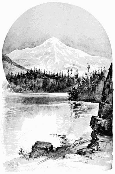
Puget Sound.The Puget Sound basin is exceedingly well supplied with streams and lakes; whilst the Sound itself, with its sheltered position, its deep water, and indented shore-line, is one of the most interesting and valuable inland bodies of water in the world. It has a broad outlet to the ocean. Lake WashingtonLake Washington. is a beautiful and navigable sheet of water. There are numerous other lakes scattered over the Territory, enlivening its scenery and often affording convenient waterways. Quite a number of the rivers emptying into Puget Sound are partially navigable for small steamers. The rivers and creeks generally have bottom-lands, which are sometimes narrow, and sometimes wide. Cowlitz River flows south into the Columbia River. It has fine bottom-lands, and its valley may be regarded as a prolongation and complement of the Willamette Valley, Oregon.
West Washington and East Washington.All the country lying west of the crest-line of the Cascade Mountains is known as West Washington, and is quite different in topography, as in many other respects, from the country known as East Washington, which name applies to all of the Territory lying east of the Cascade axis.
East Washington is a rectangular plateau, set in a frame of mountains, and drained by the Columbia River and its tributaries. The Cascade Range being the west side of the frame, the north side is formed by irregular spurs which run out at right angles from the Cascade Mountains along the Canada border, and connect with the Cabinet Mountains. The east side of the frame is in Idaho, and consists chiefly of the Cœur d'Alene Mountains. On the south lie the Blue Mountains, which are partly in Washington Territory, but chiefly in Oregon. The mountains on the north have a few peaks 5,000 to 9,000 feet high, and many of the dividing ridges are high, steep and rugged. Much of the region is described, however, as high plateau country, dotted over with small, conical mountains. It abounds in streams of water, generally small. A strip of arable land runs on the east side of the Columbia River from the mouth of the Spokane River to the mouth of the Colville River and the valleys of Colville and the Little Spokane River are highly spoken of as agricultural regions. The elevation of these river valleys is from 1,200 to 1,600 feet above tide-water.
Passing to the east side, we find the plateau country at its north corner extending to the Idaho line where the foot-hills of the Rocky Mountains begin, and soon rise into the Cœur d'Alene Mountains.Cœur d'Alene Mountains, which—being the local name for part of the Bitter Root Range—is a part of the western branch of the Rocky Mountains. The Cœur d'Alene River and Lake belong to the Columbia River basin, and are so naturally connected in mining and trading interests with Washington Territory, that in another connection I shall have much to say of the Cœur d'Alene country, as also of the Colville country, and other parts of the mountain rim. South of the Cœur d'Alene Lake the plateau country extends far into Idaho, and gives to that State its best farming lands.
The Blue Mountains which mark the southern limit of the plateau in Washington Territory do not extend more than half-way across the plain, leaving a long projection of the plateau to extend southward into Oregon.
The Great Plateau.The shape of the plateau in Washington Territory is an irregular square with a diameter each way of about 150 miles. Followed into Idaho and Oregon, the diameters would reach 200 miles. Its surface is generally smooth, but there are frequent patches of rock, and sometimes large areas are roughened by rocky outcrops. The plateau is elevated and rolling, rising from 1,000 to 3,000 feet above the surface of Columbia River. Its elevations usually are mere swells, except along the precipitous edges of coulées. I know of only one mountain upon it, and that is quite a small one; but it served as a refuge for Lieutenant Steptoe and his handful of soldiers when attacked by the Indians; and hence is called Steptoe Butte. The surface of the plain is scarred in a number of places with couléesCoulées., or dry river-beds, which are cut down twenty to one hundred feet, and sometimes more, and their sides are usually marked by bluffs, often of rock. These coulées are an advantage, or a disadvantage, in road-making, according to whether the road goes with, or across, the coulée. The Northern Pacific Railroad found it convenient to use one of them for a long distance. The deepest cuts in the plateau are made by its rivers. Of these the Columbia is chief. This river, as already intimated, has cut a channel for itself along the north and west edge of the plain from 1,000 to 2,000 feet below the general level. The Snake River, which is the largest affluent of the Columbia, has numerous branches, all cut deep into the basalt which underlies the plain.
Columbia and Snake Rivers.The Columbia and Snake are both steamboat rivers, but navigation is interrupted by rocky rapids, which prevent through lines of steamers. The Columbia is one of the largest rivers in the world, and has abundant water for steamboats from its mouth to a point in Canada, north of Farwell, where it is crossed by the Canadian Pacific Railway, and steamboats run at intervals to the most northerly point; and there are navigable stretches not yet used for boats which will have steamers in connection with future railroads. The steamers on Snake River are very useful, and run to Lewiston, in Idaho, and perhaps further.
This plateau, or Great Plain of the Columbia, as it is called sometimes, is a most interesting and important region, concerning which I shall have much to say under subsequent heads.
ALTITUDES IN WASHINGTON TERRITORY.
FEET.
Mount Ranier (Tacoma)14,444
Mount Baker10,827
Mount Adams9,570
Mount St. Helens9,750
Natchess Pass4,900
Stampede Pass, Summit3,980
Tunnel, Stampede Pass2,885
Snoqualmie Pass3,110
Kechelus Lake2,388
Kachess Lake2,158
Ellensburg1,518
Yakima City990
Ainsworth351
Palouse Junction858
Sprague1,200
Spokane Falls1,910
Colville1,917
Fort Spokane1,300
Okinagane Lake1,163
Great Plain of Columbia River1,000 to 3,000
Snake River, N. P. R. R.358
Colfax1,941
Dayton1,360
Walla Walla1,000
Wallula Junction326
CLIMATE.
The Climate of Washington Territory.Climate is a matter of temperature, moisture and atmospheric dynamics. The general law of temperature is that the farther north the colder the weather; and yet currents of water and prevailing winds may give to the country a climate geographically belonging to quite a different latitude. We know how this is with England, which, judged by latitude, ought to be colder than Maine, but which, in fact, has one of the mildest and most equable climates in the world. England is farther north than Washington Territory, which latter is in the latitude of France; but it is also in the latitude of Montana, Dakota and Maine, States remarkable for sudden changes and for terrible cold. But it is well known that our Pacific States, at least on their western borders, have a temperature free from extremes in both summer and winter. Taking July and January as the hottest and coldest months, it will be found that the average temperature at San Francisco and Puget Sound is from 7° to 14° cooler than it is in the Rocky Mountains and in New England during the same months. And on the other hand, taking January as the coldest month, we find that Bismarck, Denver, New England, etc., are 30° to 40° colder than the points on the Pacific. In other words, that the range of the thermometer between extremes averages near 50° more in the East than it does in the West in the localities named; a very great difference when we consider comfort, health, cost of living, and opportunity to labor in the open air.
Mild and equable.This greater mildness and equability of temperature on the Pacific Coast is to be ascribed to the winds and currents of the great ocean. During the summer the winds come from the northwest, and during the winter from the southwest and south. Much influence in tempering the cold of winter is ascribed also to the Japan Current, mentioned under a former head. It does for the Pacific Coast what the Gulf Stream does for England.
The same causes regulate also the rainfall on the Pacific Coast. In one respect there is the same peculiarity along the whole coast, namely, dry summers and, comparatively, wet winters. There is, however, a gradual increase in the amount of rainfall northward from San Diego to Sitka; so that when we reach Washington Territory we do not find the excessive dryness which characterizes the summer climate of California.
The figures of different authorities do not agree exactly as toRainfall. the precipitation on the Pacific Coast: for example, in the older volume on Rain Tables, published by the Smithsonian Institution, the annual rainfall and melted snow on Puget Sound, measured at Steilacoom, near Olympia, from 1849 to 1867, amounted to 43.98 inches. Governor Semple, however, gives from Sergeant McGovern, in charge of the station, a total of 53.89 inches annually, measured at Olympia from 1878 to 1886. But I find in the report of the chief signal officer to the War Department for 1884, that the average from July 1, 1877, to December, 1883, for Olympia, was 62.81 inches. This difference of nine inches is partly accounted for by the fact that the precipitation in the subsequent years not included in the report of the Signal Service Bureau, namely, 1884, 1885 and 1886, averaged only 41.88 inches, which would, in great measure, relieve the discrepancy. It will probably turn out on further observation that 53 inches is about the total annual rainfall for Puget Sound. But according to the report of the chief signal officer for 1884, we have the following annual totals: San Diego, 9.40; San Francisco, 23.32; Portland, Oregon, 54.16; Puget Sound, 62.81; Sitka, Alaska, 97.28 inches.
Comparing these with points farther east, we have Bismarck, Dakota, 21.35; Denver, 14.97; Sandusky, Ohio, 41.43; New Haven, Connecticut, 51.55; Norfolk, Virginia, 52.14 inches.
The value of rainfall depends more on its distribution among the months than on its annual aggregate. England has but 25 inches rain per annum, but it comes at such times as makes it most effective. The rains on the Pacific Coast are not distributed in the most favorable way for agriculture—the summers being too dry. At San Diego there is less than one-third of an inch in the three summer months, and still less at San Francisco. On Puget Sound, for that time, the fall is 2.57. In Washington Territory the spring rains are as abundant as in the Atlantic States, and the summer breezes seem laden with moisture.
No blizzards or cyclones.In respect to cold waves, winds and storms, Washington Territory is singularly favored. There is nothing to correspond with the blizzards, northers, hurricanes and cyclones which trouble some other States. Even ordinary thunder-storms are rare. The climate of East WashingtonDifferences between East and West Washington. is different from that of West Washington, and yet, when compared with that of Montana and Dakota, it will be seen that it is really transitional and intermediate between the climates on each side. The range of thermometer from the heat of July to the cold of January is, at Bismarck, 65°; at Spokane Falls, 45°, and on Puget Sound, 22°. And, in like manner, the amount of rain is intermediate between the heavy rainfall of the Sound and the lighter rains of the Rocky Mountain country. The explanation of this is, that while the Cascade Range, like all high mountains, condenses the moisture of the air on the windward side and changes its temperature, yet this range is not sufficiently high and cold to have the effect of the Himalayas or the Andes in depriving the leeward lands of rain.
The mountain rim of the plateau country has not the moisture which distinguishes the west side of the Cascade, and it varies in its amount at different places.
Some statements have already been made in reference to the dryness and summer heat of the Yakima Valley on the east flank of the main mountain. The mountains running along the Canada line have probably a better summer climate than the east side of the main mountain. I do not know how it is with the Cœur d'Alene and Blue Mountains, but the climate of the plateau has no unusual character in the matter of temperature. Half of the States of the Union have as great or greater extremes; but the plateau has less than half the precipitation of Puget Sound, as shown in the tables given on pages 56 and 57. And the rainfall in the summer is so scant that one would not, a priori, expect any form of vegetation to progress at all. These meteorological phenomena render almost unaccountable the facts of agriculture, which will be given hereafter.
Chinook wind.The Chinook wind, which springs up in winter and melts the snow on the plateau, and to some extent in the mountains, is simply a southerly wind, such as is common in the Mississippi Valley and even on the Atlantic seaboard. In the Pacific States it does not, from the descriptions, appear to differ from the breezes of the coast, except in its greater strength and steadiness. I heard an intelligent gentleman, residing in Spokane Falls, say that he thought the Chinook was a disadvantage in winter, as it caused a disagreeable thaw, and so relaxed the human system as to render it more sensitive to cold; but generally the Chinook is enjoyed in East Washington.
SOILS.
Soils all fertile.The arable soils of Washington Territory, so far as I could see, or otherwise learn, may be classified as follows, to wit: a. Humus; b. Alluvium; c. Drift; d. Loam; e. Basalt.
a. Humus. In West Washington the whole country is top-dressed with vegetable mould, derived obviously from the heavy growth which has covered the surface for ages. Of course there are bare spots, and where the growth has been light, the top-dressing is thin; but the mountain sides, the hills, and notably the low grounds, are overlaid from one to ten inches, and often much more, with this vegetable mould.
TABLE SHOWING THE MEANS OF THE DAILY MAXIMUM AND MINIMUM TEMPERATURES IN DEGREES FAHRENHEIT.
The Means are obtained by dividing the sum of the daily readings of the Maximum and Minimum Self-registering Thermometers by the number of days in the month.
1883 1884
July.Aug.Sept.Oct.Nov.Dec.Jan.Feb.March.April.May.June.
STATIONS.Mean.Mean.Mean.Mean.Mean.Mean.Mean.Mean.Mean.Mean.Mean.Mean.
Max.Min.Max. Min. Max.Min.Max.Min.Max.Min.Max.Min.Max.Min. Max.Min.Max.Min.Max.Min.Max.Min.Max.Min.
Bismarck, Dak.79.555.878.654.869.443.748.333.438.715.025.04.514.57.68.99.829.910.547.630.267.144.181.254.8
Dayton, W. T.87.353.685.153.277.545.257.834.751.633.335.818.531.011.524.94.835.619.643.929.659.540.773.751.8
Denver, Col.82.658.783.658.8 74.750.257.636.856.131.136.817.425.75.330.810.843.025.758.239.671.550.281.261.3
Lewiston, Idaho90.059.187.157.676.047.757.939.557.635.541.729.339.125.935.118.853.634.766.642.179.348.980.857.3
New Haven, Conn.80.362.477.657.970.450.658.440.450.534.138.321.532.615.840.824.342.426.654.137.265.847.278.255.4
Norfolk, Virginia.87.971.182.468.976.463.868.456.762.245.053.938.846.729.959.041.058.142.161.947.076.958.881.864.6
Olympia, W. T.76.148.271.355.167.048.157.342.950.244.945.935.444.735.242.127.552.534.461.741.670.143.971.548.9
Portland, Oregon.80.057.073.854.272.352.658.445.852.872.049.036.846.233.344.429.455.637.865.145.373.648.774.953.7
San Diego, Cal.75.564.075.963.578.262.969.054.767.750.265.749.064.545.662.948.662.950.464.451.167.556.172.158.4
Sandusky, Ohio——77.162.869.255.859.247.352.537.239.827.526.912.939.024.441.628.752.139.368.851.377.962.7
San Francisco, Cal.64.555.064.453.969.956.362.952.958.849.455.546.254.746.655.945.659.249.861.250.765.353.465.255.3
Sitka, Alaska57.948.159.348.858.948.550.641.038.627.341.630.543.834.237.825.842.533.351.737.751.940.857.946.4
Spokane Falls, W. T. 85.053.483.272.572.444.253.735.046.632.035.622.432.617.530.212.746.427.862.239.074.546.078.753.9
Washington City.87.767.282.462.774.856.265.549.356.239.463.145.349.731.865.647.067.851.673.654.881.463.087.468.5
TABLE SHOWING THE AVERAGE PRECIPITATION AT STATIONS OF THE SIGNAL SERVICE,
Computed from the Commencement of Observations at each, to and including December, 1883.
TAKEN FROM THE REPORT OF THE CHIEF SIGNAL OFFICER TO THE WAR DEPARTMENT FOR 1884.
STATIONS.Established. Jan. Feb.March.April. May. June. July. Aug. Sept. Oct. Nov. Dec.Total Inches.
Bismarck, Dak. Sept. 15, 18740.570.661.212.943.313.642.212.711.341.330.710.7221.35
Dayton, Wash. Terr. July 1, 18794.113.642.043.262.020.860.790.490.672.642.554.9528.02
Denver, Colorado Nov. 19, 18710.690.430.861.713.051.601.891.540.960.790.740.7114.97
Lewiston, Idaho July 1, 18792.451.531.161.281.120.940.760.360.521.931.663.4017.11
New Haven, Conn. Dec. 10, 18724.204.225.294.323.713.804.865.624.153.854.153.3851.55
Norfolk, Virginia Jan. 1, 18713.893.854.354.293.544.155.396.115.233.963.583.8052.14
Olympia, Wash. Terr. July 1, 18779.3610.676.204.342.760.880.860.832.985.608.1610.1762.81
Portland, Oregon Nov. 1, 18717.348.117.273.482.441.820.710.811.624.957.348.2754.16
San Diego, Cal. Nov. 1, 18711.852.070.970.680.260.050.020.230.050.400.702.129.40
Sandusky, Ohio Aug. 2, 18772.193.132.902.793.345.064.064.273.543.503.682.9741.43
San Francisco, Cal. March 8, 18715.103.952.881.800.710.160.010.010.151.132.704.7223.32
Sitka, Alaska March 30, 18819.4411.649.764.403.233.135.825.829.979.3311.8712.8797.28
Spokane Falls, Wash. Terr. Feb. 5, 18813.343.020.851.991.381.001.040.251.142.902.222.0621.19
Washington City Nov. 1, 18703.162.854.043.072.984.234.084.974.423.002.842.9242.56
b. Alluvium. This includes the transported matter of the bottom-lands, the swales, and the tidal flats. Here we have humus, not only as a top-dressing, but also intermixed, and sometimes constituting a large proportion of the soil for a considerable depth. No land could be richer than this, and its relative proportion to the whole is larger than would be inferred even from the great number of streams, for it includes the lowlands about Puget Sound and the lakes. The mountain streams have, with some exceptions, but little alluvial land. There are areas of swale, or wet bottom-lands, which may be drained to advantage. The tidal flats along the Sound are peculiarly fertile, because enriched by both vegetable and animal matter, including calcareous shells and fish bones. Owing to this great fertility, and the ease with which large areas are reclaimed by dykes, their convenience to transportation, and, it may be added, the labor of clearing the forest lands, the work of dyking these flats has been commenced, especially in Snohomish and Skagit counties, and it is thought that two hundred thousand acres may thus be redeemed from the water. Alluvial lands constitute but a small feature in East Washington.
c. Drift. The origin of these gravel soils is given hereafter, under the head of Geology. They constitute the hill lands, as distinguished from the bottom lands and Sound flats on the one hand, and the mountain lands on the other. They are composed of sand, clay, gravel, and some large boulders. Rarely the gravel predominates so as to render the land unfit for cultivation. Sometimes there are only clay and sand, and sometimes chiefly clay. This soil, though not equal to the alluvium, or to the basaltic land, is much better than glacial precipitate usually is. It gave all the indications of a fertile soil, resembling the best hay lands of Massachusetts, which have the same glacial origin. Its natural growth is luxuriant, and when cleared it inclines to clothe itself in white clover and the grasses. It is said to be specially adapted to fruits and vegetables.
d. Loam. I mean by this a clay soil containing fine-grained sand enough to make it friable. This is the soil made by the slates and sandstones of the coal measures, and is generally found on the highlands above the drift. It is a medium land as to quality, but valuable for the tendency to grass, which characterizes all the lands of West Washington. Much of it will make good cropping land. There is a great deal of it. It is found high on the cretaceous hills and mountains, often extending to the top.
e.A remarkable soil. Basalt. This is the magic soil of the Great Plain (or plateau) of the Columbia. And it is found also in large areas on the Cascade Mountains. It has an ashy look and texture; sometimes black, but generally of ashen hue. Rarely it is compact and clayey. There are perhaps twenty thousand square miles of this basaltic land; enough of itself to make a medium-sized State. Of course there are inequalities in the productiveness of this land. The basaltic rock in many places crops out, as mentioned under the head of Topography, and there are coulées and galled spots. I cannot say what proportion of the surface is rendered valueless by these irregularities. The outcropping basalt does not destroy the value of the land; for the soil spaces between the rocks may be greater than the rock spaces, and whilst unfit for the plough, they may be suited to trees, or cattle range. But, judging by all that I saw and heard, I should think that the smooth land considerably predominates over the rough. Certainly there is more smooth, comparatively level, fertile, productive, and easily cultivated land here in proportion to the whole area than I have ever seen elsewhere. The great plain of East Colorado is a vast and beautiful stretch of country, but it is unproductive without irrigation. Taking everything into consideration, the plateau of East Washington seems to me to be unequaled in combined extent and productiveness.
This subject of soils will be incidentally continued in connection with the next two heads.
NATURAL VEGETATION.
Vast vegetation.Here the two sides of the Cascade Mountains must again, as under other heads, be considered separately. The natural vegetation of the west side is vast rather than varied. Wherever the sun touches the ground, one may expect to see grass; chiefly white clover and green sward, which seem to be indigenous to the country. There are, of course, many herbs and shrubs which need not be mentioned in a report like this. The ferns of the Snoqualmie bottoms, for size, remind one of the tree ferns of the carboniferous period, though, of course, not so large. Many of them were seven feet high, which is five feet higher than I ever saw elsewhere. The Sal-al is a low shrub, almost herbaceous, and semi-procumbent, of brown foliage, bearing a berry and belonging to the wintergreen family, though much larger than the wintergreen of the Alleghenies. The Sal-al abounds on the little prairie which bears its name. The mosses are most abundant and luxuriant in the deep, moist shades of the evergreen forests, and I noticed that the Cayuse ponies fed upon them as eagerly as reindeer upon the Iceland mosses.
Deciduous trees.Deciduous trees are rare, but not wholly wanting. The cottonwood grows to rather extra size. The alder, which is only a large bush in the Alleghenies, here becomes a tree, perhaps thirty feet high. I saw some small maples. It is said that there are groves of oak and maple of sufficient size to cut for lumber.
A VIEW OF THE FOREST ON THE LINE OF THE SEATTLE, LAKE SHORE AND EASTERN RAILWAY.
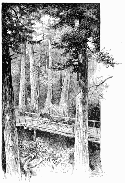
Larch.The Larch (tamarack) is interspersed among the evergreens on the Cascade Mountains, and attains good size. The American larch is rather more slender in habit than the European variety, but it has a heavy, close-grained wood, and is regarded as specially suited for railroad ties—an important point in this country. It is also reported to make durable fence-posts and ground sills. In Europe its bark is valued for tanning next to oak bark, and the two are used together. The Venice turpentine comes from the resinous sap of the larch. The older trees are better than the younger ones for durability. But with regard to this class of trees, results depend much on incidental circumstances. Larch is one of the woods used in Europe for making gas. These are the only deciduous trees I know of in Washington Territory, except fruit trees.
Extraordinary evergreen forests.Evergreens constitute the bulk of the great forests, and I shall name these in the order of their importance: Douglas (or red) fir, white cedar, hemlock spruce, white pine, balsam (or white) fir and yew.
Douglas fir, or Oregon pine.The Douglas Fir constitutes the greater part of the forests, but not so large a proportion as seven-eighths, as stated in the Census report, but more than one-third, which is the proportion given in Hough's Forestry Report. The wood of this tree is yellow when young, and hence some persons make two varieties out of the same tree. When older, it becomes an orange color, but not red like the heart of the sweet gum and red cedar. It is, however, usually called the red fir. The tree yields a clear yellow resin, which is not at present collected. Its timber is of the best quality, greatly superior to that of the fir tribe generally, probably superior to that of any other fir-tree in the world. The firs shade into each other by an almost insensible gradation, and are much modified by soil and climate, and names have been multiplied unnecessarily. The fir, like the larch, must be studied in each locality in order to determine its value. The firs of Sweden and Norway make good masts and spars, and soft, light boards; but the boards are apt to split and are not strong enough for ship-work. But the timber of the Douglas fir is heavy, strong and firm, and well suited toThe best of ship timber. ship-building, as has been abundantly demonstrated on Puget Sound. For all ordinary building purposes this timber has a world-wide reputation. It is often called the "Oregon Pine." Its growth as a tree is luxuriant on good soil, and often gigantic. I saw many single specimens which I estimated at 300 feet in height and 10 to 12 feet in diameter. When disconnected, they have the usual conical shape of the firs, with limbs branching from the ground, but it is rare to see such specimens in Washington Territory, as the forests are so dense there is no room for limbs, except near the top. The trunks stand as straight and regular as posts set with a plumb-line. This crowding often prevents the full development of the trunk also, except on the most moist and fertile lands. The absence of lower branches insures a great length of lumber free from knots.
White cedar.The White Cedar is a variety of the well-known arbor vitæ of the Eastern States, but there is a wonderful difference in the size and habits of the tree on the two sides of the Continent. On the Atlantic side it may, under very favorable circumstances, reach fifty feet in height, but usually it is dwarfish and crooked. But in Washington Territory the white cedar is the peer of the Douglas fir,Beautiful house lumber. and its largest specimens perhaps exceed the latter somewhat in diameter. It is also next in abundance and value. Its wood is soft, light and cream-colored. It splits with remarkable ease and regularity, so that the pioneer with axe and frow can prepare all the timbers needed for his house. For shingles it is fully equal to its congener, the cypress; and for house-facings and some kinds of furniture it is the favorite wood.
Hemlock spruce.Hemlock Spruce is not so abundant, but it constitutes a noticeable element in the Snoqualmie Valley forests. It seems to be exactly the same tree which so abounds in our Eastern and Northern Lake States, and is common in the moist valleys all along the Appalachian Mountains. It is called hemlock in the Northern States, and spruce in the Southern. Its wood, though unsuited for many purposes, is largely used in the North for the frames of cheapTanners wanted. buildings and also for fencing-plank, and its bark is in great demand for tanning, especially for making the red sole leather. It is also used for tanning upper leather and calf-skins, though its light leather is not so good as that made from the oak barks. The hemlock bark has not been considered quite equal to the chestnut-oak (or rock oak) bark for any tanning purposes, but in Virginia the price is usually the same. It certainly makes good sole leather. The logger in Washington Territory neglects this tree, and there are no tanneries yet to call for it, but this will soon be changed, and the hemlock will take its position, not only as the most beautiful of the evergreens, but as among the most useful. This tree does not attain as great size as the two above mentioned, but I observed many specimens ranging from four to five feet in diameter.
White pine.The general character of the White Pine is well known. I saw but a few of them, and they not specially good. I doubt whether this tree forms an important feature in these forests.
Balsam fir.The Balsam (or White) Fir abounds on the higher slopes of the Cascade Mountains, and it is so balsamic that it will receive attention from the collectors of "Canada Balsam," which is becoming increasingly popular for many purposes,Large supply of Canada Balsam. especially in mounting specimens for the microscope. Such forests as lie near the Snoqualmie Pass will not long remain unnoticed. The wood is white and easily worked, but the trees do not rank in size or value with those previously mentioned.
The yew.The Yew is found sparingly on the mountain heights; but, though interesting, it seems to have no economic value.
As to the extent of these evergreen forests, they may be said to cover West Washington with almost unbroken continuity, though they vary in density and the size of the trees, some tracts containing little or no mill-timber. In my The superior timber of Snoqualmie Valley. travels, which were, of course, quite limited, I saw no forests which answered the usual unqualified descriptions, except in the Snoqualmie Valley, and here they far exceeded my expectation, as will be shown in the detailed description, given hereafter, of the country lying along the line of the Seattle, Lake Shore & Eastern Railway. The finest forests lie between Puget Sound and the crest of the Cascade Mountains, though even in this area there are variations. And after all the chopping and sawing—of which more will be told later—the forests as yet show but little diminution.
East of the Cascade Range the forests are smaller, and confined to the mountain sides. There are some narrow belts of pine along the northern edge of the Great Plain of the Columbia, which furnish a little lumber for local uses; but these will soon be worked out. The mountain rim lying along the Canada line is said to be covered with forest, some of it heavy. The Douglas Fir, the Yellow Pine, the White Pine, and the Larch are all to be found there. There are also skirts of the same timber along the Spokane River. And, at wide intervals, there are strips and bunches of scrubby yellow pine on the Great Plain, which is, however, generally treeless.
The spurs and ridges of the Blue Mountains are thinly covered with small pines and larches. There are some areas of mill-timber on the east and southeast flanks of the Cascade Mountains.
The flora of the great plateau presents a strange appearance to the traveler. The vegetation is short and scanty, the chief growth being the "sage-brush," a dwarfish, dead-looking shrub, with a hard, crooked stem, of no value as forage, but which is sometimes used for fuel when nothing else is to be had. There are said to be some medicinal, and also some edible, plants; but the only thing of any value is the dry, thin, short, bunch grass which furnishes a fattening food for horses and cattle; though many acres are required to support an animal,Range for horses and cattle. and close grazing is rapidly destroying this resource. Indeed, the tract is so barren and desert-like in appearance that in the geographies of my boyhood it was put down as a part of the Great American Desert. And yet, as will be seen hereafter, this is probably the most productive upland in America.
LUMBERING.
Lumbering was the first industry of Washington Territory. Even food was imported for a time. Logging began on Puget Sound, and went up such streams as afforded transportation and water-power. Steam-power soon became the chief reliance for sawing, but water-power will be largely used when the railroads penetrate inland.
Logging and sawing are separate branches of business, which may or may not be carried on by the same parties. And so with transportation to the mill and to market. Large concerns carry on all the branches, even to the building and owning of ships.
Magnitude of the lumber business.Governor Semple gives the capacity of the Washington Territory saw-mills in 1887 as 645,500,000 feet of lumber per annum, of which the Puget Sound mills produce 344,500,000 feet. Of this, they (Puget Sound mills) sent 200,000,000 feet to California; 2,600,000 to Boston, Mass.; 500,000 feet to other Atlantic ports, and over 100,000,000 feet to foreign ports. Among foreign ports, London received 551,500 feet, and the rest went to Mexico, South America, China, Australia, and other Pacific Islands.
Mr. Cyrus Walker, of the Puget Mill Company, Port Ludlow, in a letter which I have from him, says:
Vast extent of the lumber market."It is safe to say that the lumber market of the Sound may be considered all countries and ports on the Pacific Ocean."
But it may make a more vivid impression of the Pacific market for me to give a list of the ports to which shipments have been actually made in the last year by the lumber dealers of Puget Sound. This list I get not only from public documents, but directly from the millers and port officials:
Melbourne,
Callao,
Sydney,
Guaymas,
Iquique,
Taku,
Hilo, H. I.,
San Francisco,
Townsville,
West Coast,
Brisbane,
Sandwich Islands,
New Caledonia,
Mollendo,
Montevideo,
Honolulu,
Valpa,
Suava, Feejee Is.,
Kahalui,
Cadera, Chili,
San Diego,
San Pedro,
Hong Kong,
Enseneda, Mex.,
Falmouth,
Shanghai,
Autofogasta,
Rio de Janeiro,
Broken Bay,
Adelaide,
Coquimbo.
This is not a complete list of all the ports visited by the lumber ships of Puget Sound, and by no means represents the business of the future, which will increase as fast as the mills can be built to furnish the lumber.
No one without seeing it can have an adequate idea of the magnitude of the operations of one of the great saw-mills of Puget Sound.The great saw-mills. The Puget Mill Company, for the first ten months of last year, sawed on an average 290,000 feet every day of ten working hours. I visited the Port Blakely Mills, just across the Sound from Seattle. There I found a fleet of ships in the harbor, owned chiefly by the company; also, ships building on the stocks; railroads going out to the logging camps; a basin for receiving the logs, and a mill, with four separate tracks, bringing the logs in at one end, and carrying out the lumber at the other. A high iron trestle carried off the slabs to an enormous fire which never ceased to burn, where all this waste was consumed.
Around the mill was quite a town, in which a large number of races and nationalities were represented. This mill cut about 59,000,000 feet in 1887. Up to the 10th of November it had shipped as follows: To California, 32,464,763 feet; to South America, 6,847,427 feet; to Sandwich Islands, 1,799,891 feet; to Australia, 6,681,668 feet; to Feejee Islands, 511,815 feet; and used at home for ship-building, railroads, etc., 2,312,000 feet.
The Tacoma Mill Company and the Washington Mill Company produced the following lumber, etc., during 1886 and the first ten months of 1887:
LUMBER. FEET.LATH. NO.PILES. LINEAR FT.
Tacoma Mill103,448,35028,815,095642,385
Washington Mill42,195,4788,772,800266,403
There were other large mills whose statistics I was not able to get in time. Mr. Walker thinks that the cut of all the mills on Puget Sound averages 1,200,000 feet per day; all of which finds ready sale.
I was not able to ascertain the profits of these mills,Profits and prices. but there can be no doubt that, with proper management, the profits are very good. The Seattle wholesale prices were as follows:
Lumber, common, per thousand feet$12 00
"sized,"""14 00
"Flooring$15 00 to 20 00
Dressed lumber, per thousand feet14 00 to 30 00
Laths2 00 to 2 25
Shingles1 50 to 2 00
AGRICULTURE.
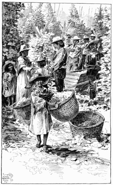
After hearing of the forests in West Washington, one cannot be surprised to learn that the agricultural interest develops slowly in this part of the Territory. Even after the logger has taken what he wants, there remains a heavy mass of vegetation which is expensive to clear away.Clearing the land. A thorough clearing, including the removal of stumps, costs $75 to $100 per acre; and yet this is sometimes done for hops, hay and vegetables. But the common way is to "slash and burn," at an expense of ten to fifteen dollars an acre. This clears off everything but stumps, and such trees as may be reserved for the mill or other purposes. There are fine farms in every direction, but I had no means of ascertaining the proportion of cleared land, or of the agricultural population. The natural Demand for agricultural products.fertility of the soil, the high prices of produce, and the rapidly growing demand, both foreign and local, will tempt to a wasteful destruction of timber in order to prepare the ground for crops. There need be no doubt as to the extraordinary productiveness of the soils, even beyond that of the same quality of lands elsewhere;Large crops. because the climatic conditions are extra favorable for the growth of all crops suited to the country. There are some crops, such as corn, lima beans and sweet potatoes, which are contra-indicated. The cool summer nights check the maturing of these. Wheat, also, is not suited, though produced to some extent. But for almost everything else the conditions favor extra production. The conditions could scarcely be better for grass and hay. The scantiness of the summer rains is more than compensated for by the long growing seasons in fall and spring. No soil and climate could be better for oats and potatoes. The reported yield of these three staples would be called fabulous if not established by good testimony. Three tons of hay, 100 bushels of oats, and 600 bushels of potatoes per acre are above the average, but by no means reach the maximum on the best lands. Most fruits do well.Hop-growing on a large scale. In the production of hops West Washington has become celebrated as to quality and yield per acre. This is probably the largest of the agricultural interests in this part of the Territory, and was at one time enormously profitable. Present prices are thought to leave some margin, but not much.
INDIANS GATHERING HOPS, WASHINGTON TERRITORY, ON LINE OF SEATTLE, LAKE SHORE AND EASTERN RAILWAY.
The changed agricultural conditions of East Washington.As heretofore remarked, the agricultural conditions change suddenly on crossing the Cascade Mountains to the eastward; and this change begins at the crest line, and is more marked on the mountain side and near its base than anywhere else. The winters are longer and more severe, and the summers drier and hotter. There is natural pasturage similar to that of the plateau country, coming up to the timber line, the lower edge of which is high on the mountain. Much of this mountain land, though covered scantily with sage brush and bunch grass, is really fertile, and, besides supporting cattle, can be made to bring fair crops of wheat and other things; but the rainfall is so insufficient that irrigation is necessary for the development of any large agricultural interest. Irrigation in the Yakima Valley.Fortunately, in the large basin of the Yakima, irrigating streams are abundant, and its enterprising people are availing themselves of this happy resource. By reference to a good map it will be seen that the Yakima River is made up of an unusual number of streams. A group of these come together near Ellensburg, and another group near the town of North Yakima; and there are said to be large bodies of land susceptible of irrigation by these streams. The Ellensburg valley is thirty miles long, and about ten miles wide; and is the best agricultural section in Kittitas County. It is claimed that forty bushels of wheat to the acre can be produced here without irrigation; and that 1,000,000 bushels of wheat were actually produced in this basin in 1887. Hay, hops, vegetables, berries and fruits also do well naturally, but with irrigation the product is uniformly large. There are four irrigating canals in the valley. The Teanaway Ditch Company has one fifty miles long which can water 75,000 acres of land. The Ellensburg Ditch Company has a ditch ten miles long, covering 10,000 acres. Mr. Bull has one six miles long, and the owners of the new roller mill have two and a half miles of ditch.
Next below Kittitas is Yakima County, which contains a number of fertile valleys, and also good uplands, and is well supplied with irrigating streams, which have already been brought into use. Two large ditches are drawn from the Natchess River. Ditches are also taken from the Ahtanum, which is the principal hop-raising section. A plateau, three by ten miles, between the Cowiche and Natchess, will all be irrigated. The Moxee Valley is largely owned by Eastern and other capitalists, who seem to be expending much money in the improvement of the country. This company has fourteen miles of ditch.
Varied crops.By the help of these ditches the people of Yakima Valley are producing corn, which under the hot sun of the locality perfects its product. Tobacco has been tried also with fair results. And the Moxee County will try the dairy business. There is a disposition also to try improved breeds of cattle. The spirit of enterprise has resulted largely from the passage of the Northern Pacific Railroad along the Yakima Valley; but at the same time the greatest obstacle in the way of irrigation lies in the ownership of alternate sections by this railroad. The Yakima Indians have good lands, and Klickatat County is well spoken of. Sweet potatoes, tomatoes, peaches, grapes, and other things requiring much heat, are said to thrive in the lower parts of the Yakima Valley.
The Great Plain.We enter now the last grand division of the country, the Great Plain, or, more strictly, plateau of the Columbia River. In spite of its unpromising aspect, this is the chief agricultural region of the Pacific States. To get the exact boundary,Boundaries. find the point (a little below Wallula Junction) where Washington and Oregon both corner on the Columbia River. From this point, follow the Columbia up to the mouth of Spokane River; follow Spokane River up to the Idaho line; follow the Idaho line south to the Oregon line; follow the Oregon line due-west to the beginning, and within these lines lies the region which is destined to be the granary of the Pacific States.
Early history.The settlement of this plain began near Walla Walla, where a Christian mission was established by Whitman, the hero and martyr, who saved this country to the United States. Hence the most thickly populated part of the plain is between the Oregon line and Snake River. This region was supplied with transportation by the Oregon Railway and Navigation Company. The largest agricultural production is here.
Immigration next moved north of Snake River into the valley of the Palouse River, and here we have the next largest area of production. When the Northern Pacific Railroad came in from the east, the new-comers entered the Great Bend country, which is the northern half of the plain. The chief settlement here is in Spokane and Lincoln counties, which cover nearly half of the Great Bend. Douglas County covers the remainder, and is beginning to be settled. There are ten counties on the plateau, with an aggregate area of 20,000 square miles and a population of 52,000.Area and population. Of this population, 20,000 is south of the Snake River, 14,000 north of Snake River, and 18,000 in the Great Bend, including Spokane Falls.
Amazing wheat crops: surpassing all other States.The great staple of this country is wheat, though almost every crop is grown, and most of them with remarkable results. Corn is grown only south of Snake River, where it yields thirty bushels to the acre. The average yield of wheat year by year for the entire Territory is put by Governor Squire at twenty-five bushels, and no one who knows the country can regard this otherwise than as a moderate estimate. This average places Washington Territory beyond comparison first among the States of America, and, so far as I can learn, second only to England among other nations. England, by the highest manuring, has brought her wheat product up to thirty bushels, which is double the average of former years. By the census of 1880, Washington Territory, as a whole, leads all the other States. The following tables give the average of ten of the chief wheat-producing States:
WHEAT, PER ACRE.BUSHELS.
California15.8
Dakota10.6
Minnesota11.3
New York15.7
Ohio18.0
Pennsylvania13.4
Virginia8.6
Washington Territory23.5
Oregon16.8
Illinois15.5
The year 1886 was the worst wheat year ever known in Washington Territory: its crop averaged sixteen and a half bushels.
Railroads overwhelmed with freight.It is thought that the wheat crop of East Washington for 1887 will exceed 10,000,000 bushels. It certainly went far beyond the ability of the railroads to carry it away before winter. The most amazing glut of freight I have ever seen was along the railroads in Walla Walla County. Not only were the depots crowded to the roof, but piles of sacks larger than the depots stood outside. It was a common sight through the whole Snake River country to see 10,000 sacks of wheat in one pile outside of the depots.
The price of wheat runs from 40 cents to 60 cents a bushel; whilst the cost of production on good land need not exceed 25 cents a bushel.Price of wheat and cost of production. Mr. Hamilton, of Colfax, has a farm which he cultivates entirely by hired labor, and he told me that the cost of his wheat was from 20 cents to 25 cents, and that his profit was $5 per acre. Good farms about Colfax can be rented out at $2.50 per acre for the whole farm. Mr. Miles C. Moore, of Walla Walla, probably the most exact business man of that region, farms largely by hiring labor. He gave me the following statement of his own operations:
WHEAT GROWING AND DELIVERING.
Dr.Cost of ploughing, per acre$1 50
Cost of twice harrowing and sowing1 00
Seed, 1-1/4 bushel 62
Thirteen sacks at 8 cents1 04
Keeping up fences10
Harvesting and hauling five miles to
depot, 17 cents per bushel4 76
$9 02
Cr.By 28 bushels per acre at 50 cents$14 00
Cost of production9 00
Profit$5 00
This product could not be expected on inferior lands, but with the working farmer the cost of production is less. The yield of wheat on the best lands of East Washington is large—almost beyond belief. Mr. Houghton, attorney for the Spokane Falls and Palouse Railroad, told me that he had known of 800 bushels of wheat being raised on ten acres; that it was measured by a committee. Mr. Miles C. Moore has known 1,000 acres to average fifty bushels. A farmer (apparently honest) told me that he had raised seventy-five bushels to the acre over his whole wheat area. His crop was harvested by the acre, and the area measured by the county surveyor. It was all sold, except seed. Thus he got both area and product accurately. Many more instances were stated to me on good authority. But there are different grades of fertility in these lands as in other lands, and the amount of rainfall makes a difference also. Wallula has but twelve inches of rain, and is unproductive. There must be fifteen inches for wheat. Walla Walla has seventeen, and is productive. Nearer to the Blue Mountains the rainfall is thirty to thirty-five inches; here are the largest crops. Spokane Falls has twenty-one inches. Yet where else on the earth can such crops be raised even occasionally? I have been growing wheat for thirty-five years on good land in the Valley of Virginia, and I never could reach thirty bushels to the acre on a single field; and I do not believe that my neighbors can do better than I do. We count twenty bushels an extra crop.
Also barley and oats.Besides wheat, these lands produce barley of superior quality, weighing fifty pounds to the bushel, at the rate of fifty to sixty bushels per acre, and oats weighing thirty-eight pounds to the bushel at the same rate per acre. The weight of wheat is sixty pounds to the bushel. Barley sells at 90 cents per 100 pounds, and is largely shipped East to be made into beer.
The wheat usually grown is the Little Club, a short, strong white wheat; but the Little Giant, Red Chaff and Chili Giant are productive. Spring wheat is generally sown, but winter wheat is probably best. Blue stem brings five cents extra in Portland. Freight, $5 a ton from Walla Walla to Portland; thirty-three bushels counted a ton.
The wheat here has no enemies—no fly, nor rust, nor weeds, nor lodging.
Much of the land has been cultivated for sixteen years without rest or manure, and without diminution of crop; but the best farmers prefer to rest and cultivate in alternate years. By the latter system the ploughing is done in the off-year, and the land left a naked fallow. This is thought to cleanse the land and renew its strength.The soil a natural fertilizer. And in some cases in which lands have an excess of alkali, their productiveness increases with cultivation. Sometimes the land contains as much as eighteen pounds of potash to the cubic yard; which fact, by the way, suggests the possibility of leaching the land to procure potash and other alkalies.
Quality of the wheat.The wheat of the Pacific coast has 4 per cent. less gluten in it than the Eastern wheat, and this practically shuts it out of the Eastern market. Nitrogen in Washington Territory wheat is 22 per cent. to 26 per cent., whilst in the Eastern it is 34 per cent. to 40 per cent., and inferior in quality. The true gluten is too brittle. It is better than the California wheat, however, which has 4 per cent. to 6 per cent. less nitrogenous matter, and the gluten inferior in quality. But the California wheat makes a whiter flour than the Washington Territory wheat, which is an advantage in selling. It should be remarked that the term nitrogen, when applied technically to wheat, includes true gluten, the phosphates, and all albuminoids, and excludes starch, sugar and water, which latter comprise about seventy-two per cent. of the wheat. Still, the Washington Territory wheat-grower has the advantage in quantity per acre, which gives him a better profit than is now made in California or any Eastern State. The price at Spokane Falls varies from 45 cents to 60 cents per bushel, which would give the farmer $10 to $12.50 per acre for his crop, which is more than the average Eastern farmer gets, whilst the cost of production ought to be, and ultimately will be, less.
The market in England, China, and other Asiatic ports.Flour is sent to England, by Cape Horn, at a cost of $1.30 per barrel from Spokane Falls, and in Liverpool brings within 20 cents a barrel as much as the Minneapolis flour, and it is also shipped to China and other Asiatic ports, where it seems destined to supersede rice for bread. China raises wheat, but not nearly enough for home consumption. The Asiatic and Oceanic market will, ultimately, want all the wheat of our Pacific States.
Astonishing growth of vegetables.Besides the cereals, vegetables of nearly all kinds grow to great size on this plateau. Those requiring a more uniformly warm temperature, such as tomatoes, sweet potatoes, beans and peanuts, do best in the region lying south of the Snake River, which is much less elevated than the country north and east. And this is true also of peaches, grapes, and other fruits requiring similar conditions. But as regards most vegetables, especially roots, and also fruits, the plateau generally is very productive. This is almost unaccountable in view of the fact that after the first of JuneCrops without rain. there is little or no rain until late in the fall. Whilst rain seems to be necessary to start the small seeds, large crops of potatoes are sometimes raised without a drop of rain. The moisture must come partly from the soil, which has retained the winter water, and partly from the deposition of moisture by the sea-air which comes through the gap in the Cascade Mountains and penetrates the deep, loose soil. Mr. Paul F. Mohr has measured a parsnip four feet long and eight inches across the top. I saw potatoes in Colfax, thirty of which filled a bushel measure.
As before intimated, I doubt whether the plateau can ever become a good grass and hay country. For long forage, besides straw, the people must depend upon the cereals mowed in the green state.West (not East) Washington is to be the great cattle country.
For this reason the plateau, as will also be the case with the great plains eastward, can never carry the number of cattle that can be grazed in a grass country. A farmer told me it required fifteen acres of bunch grass to support one horse or steer, whilst in a grass country three acres are ample, and on the best sods one acre is sufficient. Still, the bunch grass is, and ought to be, utilized. And the areas of unimproved land are so vast that the herds of cattle, horses and sheep which range upon them altogether constitute a large item of wealth. And on these treeless plains the effort seems to be to train the cattle and horses to live like buffaloes and wild horses in both summer and winter.
Tree-planting.The tree problem will, I think, work out satisfactorily, though, of course, no such trees can ever be produced there as abound in West Washington. Walla Walla is embowered in trees of artificial growth. The Lombardy poplar seems to have been most successful. At various points I saw plantations of box elder, and was told that this tree is easily grown. The cottonwood is said to grow readily. Captain John McGowan reports the successful culture of locust, walnut, maple and catalpa in Lincoln County. He says, also, that the plum, peach, apricot, apple, pear and grape succeed: and so with strawberries, raspberries and blackberries. All these fruits are grown about Spokane Falls, but I think that the grape and peach sometimes fail to mature. A good many plantations of trees have been set out under the timber-culture act of Congress, but it is thought that much imposition has been practised on the Government by the failure to take proper care of the trees after they were planted. The truth about the whole matter seems to be that, with proper care, trees of most varieties may be grown on the plateau, but that they will grow slowly and not attain large size. I might add many details concerning the products of this wonderful country, but these will suffice as illustrations.
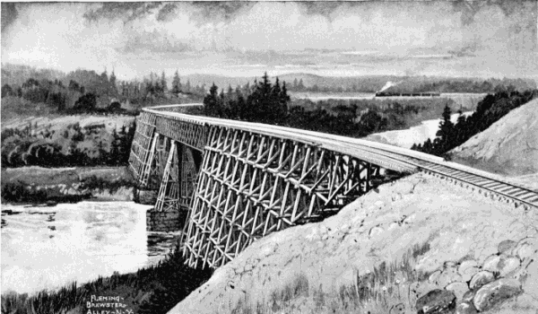
BRIDGE OVER THE SPOKANE RIVER, SEATTLE, LAKE SHORE AND EASTERN RAILWAY.
LABOR.
Good supply of labor, but more wanted.Under this head I will merely say that, though the laboring population of Washington Territory is very mixed and has not the settled character of labor in the old States, and though many more laborers could find employment, there does not seem to be any special deficiency of this class, and the high wages that are paid will, no doubt, bring in more workmen as they are wanted.
Wages.Governor Squire, in his report for 1885, page 41, gives quite a detailed list of wages, which shows that the rates are at least fifty per cent. higher than in the Middle States, and double what is paid in the Southern Atlantic States. Farm laborers get from $25 to $30 a month and board. Loggers pay from $35 to $40 per month to common hands, and $65 to $70 to teamsters. Skilled labor receives high wages, and railway contractors sometimes have to pay $2 to $2.50 per day for common hands. Servant girls are scarce, and wanted, at $15 a month and board. Hotel servants get from $20 to $25 a month. Chinamen are extensively employed for family servants. Many of them are tolerable cooks, and get $30 a month and board. Indians are working more than formerly. The men "slash" the forests, pick hops, etc. Squaws always were industrious—had to be! The Sandwich Islands, as well as China and Japan, furnish some laborers. The employers are favorable to this class of immigrants, whilst the white laborers are bitterly opposed to them. Canada will continue to employ cheap Chinese labor, and thus place our Pacific States at a disadvantage, if the present policy of excluding Chinese labor is continued.