VILLAGES AND FORMS OF STRUCTURES. (continued 3)
Reading edition
On the morning of February 7, "I was still asleep, when the women began their noisy preparations for our march. The striking of the tents, the tongues of the women, and the cries of the dogs, were all heard at once. At the first dawn of day, we commenced our journey. Nothing was visible but the snow and sky; and the snow was drifted into ridges, resembling waves.
"Soon after sunrise, we descried a herd of oxen, extending a mile and a half in length, and too numerous to be counted. They travelled, not one after another, as, in the snow, other animals usually do, but, in a broad phalanx, slowly, and sometimes stopping to feed."
One week was required to reach their destination, and during the morning of the 12th of February the party arrived at a small wood, in which the Assiniboin village stood. And "at the entrance of the wood, we were met by a large band of Indians, having the appearance of a guard; each man being armed with his bow and spear, and having his quiver filled with arrows.... Forming themselves in regular file, on either side of us, they escorted us to the lodge, or tent, which was assigned us. It was of a circular form, covered with leather, and not less than twenty feet in diameter. On the ground within, ox-skins were spread, for beds and seats."
Later, the same day of their arrival, they were invited to a feast in the tent of the chief. An Indian appeared. "We followed him accordingly, and he carried us to the tent of the great chief, which we found neither more ornamented, nor better furnished, than the rest." And another feast followed in the evening, "Every thing was nearly as before, except that in the morning all the guests were men, and now half were women. All the women were seated on one side of the floor of the tent, and all the men on the other, with a fire placed between them."
The village consisted of about 200 tents, "each tent containing from two to four families." And here "I saw, for the first time, one of those herds of horses which the Osinipoilles possess in numbers. It was feeding on the skirts of the plain." (Henry, (1), pp. 275-289.) Such was a great Assiniboin village nearly a century and a half ago.
The entire village was to return to Fort des Prairies, and so, on the morning of February 20, 1776, the tents were struck, and "Soon after sunrise, the march began. In the van were twenty-five soldiers, who were to beat the path, so that the dogs might walk. They were followed by about twenty men, apparently in readiness for contingent services; and after these went the women, each driving one or two, and some, five loaded dogs. The number of these animals, actually drawing loads, exceeded five hundred. After the baggage, marched the main body of men, carrying only their arms. The rear was guarded by about forty soldiers. The line of march certainly exceeded three miles in length." (Op. cit., p. 309.)
It is easy to visualize this great body of Indians passing over the frozen plain, camping at night under the scant protection of a small cluster of trees. The hundreds of dogs carrying the skin lodges of the villages, the men and women moving forward on snowshoes, undoubtedly stopping to kill buffalo and thus to obtain food for all. An exciting and animated scene it must have been, but only typical and characteristic, not unusual.
The preceding description of the movement of an entire village suggests a passage in the journal of La Verendrye, treating of the same people a generation earlier. Late in the autumn of 1738 a small party of French, accompanied by a numerous band of Assiniboin, set out from the village of the latter to visit the Mandan, who lived many leagues distant. La Verendrye, the leader of the expedition, wrote: "I observed to M. de la Marque the good order in which the Assiniboins march to prevent surprise, marching always on the prairies, the hillsides and valleys from the first mountain, which did not make them fatigued by mounting and descending often in their march during the day. There are magnificent plains of three or four leagues. The march of the Assiniboins, especially when they are numerous, is in three columns, having skirmishers in front, with a good rear guard, the old and lame march in the middle, forming the central column.... If the skirmishers discovered herds of cattle on the road, as often happens, they raise a cry which is soon returned by the rear guard, and all the most active men in the columns join the vanguard to hem in the cattle, of which they secure a number, and each takes what flesh he wants. Since that stops the march, the vanguard marks out the encampment which is not to be passed; the women and dogs carry all the baggage, the men are burdened only with their arms; they make the dogs even carry wood to make the fires, being often obliged to encamp in the open prairie, from which the clumps of wood may be at a great distance." (La Verendrye, (1), p. 13.)
The Assiniboin appear to have possessed a great fondness for visiting other tribes, and many narratives of journeys in the upper Missouri Valley contain references to meeting with such parties.
The size of the Assiniboin camps was often mentioned by the early writers. Thus Tanner wrote: "When we came from the Little Saskawjawun into the Assinneboin river, we came to the rapids, where was a village of one hundred and fifty lodges of Assinneboins, and some Crees." (James, (2), p. 57.) This was a century ago, when the villages retained their primitive appearance, and so it is to be regretted that no detailed description was prepared of this large group of skin-covered tipis.
The two associated tribes extended their wanderings to the southward, reaching the Missouri, a large gathering of the allies being encountered by Lewis and Clark at the Mandan towns in November, 1804. In their journal, on November 14, appears this entry: "The river rose last night half an inch, and is now filled with floating ice. This morning was cloudy with some snow: about seventy lodges of Assiniboins and some Knistenaux are at the Mandan village, and this being the day of adoption and exchange of property between them all, it is accompanied by a dance, which prevents our seeing more than two Indians to-day: these Knistenaux are a band of Chippeways whose language they speak; they live on the Assiniboin and Saskashawan rivers, and are about two hundred and forty men...." And on the following day: "The ceremony of yesterday seem to continue still, for we were not visited by a single Indian. The swan are still passing to the south." (Lewis and Clark, (1), I, p. 127.)
As will be recalled, the expedition under command of Lewis and Clark wintered near the Mandan towns, and on April 7, 1805, proceeded on their journey up the Missouri. On the 13th of April they arrived at a small creek which entered the Missouri about 20 miles above the mouth of the Little Missouri. They ascended the creek and at a distance of about 1½ miles reached a pond "which seemed to have been once the bed of the Missouri: near this lake were the remains of forty-three temporary lodges which seem to belong to the Assiniboins, who are now on the river of the same name." The following day, April 14, 1805, after advancing about 15 miles beyond the creek entered on the 13th, "we passed timbered low grounds and a small creek: in these low grounds are several uninhabited lodges built with the boughs of the elm, and the remains of two recent encampments, which from the hoops of small kegs found in them we judged could belong to Assiniboins only, as they are the only Missouri Indians who use spirituous liquors: of these they are so passionately fond that it forms their chief inducement to visit the British on the Assiniboin." (Lewis and Clark, (1), I, pp. 185-186.)
During the days following many Assiniboin camps were discovered.
From these brief statements recorded in 1804 and 1805 it will be understood that when a large party of the Assiniboin moved, or when on a visit to another tribe, they carried with them their skin lodges, but when on a hunting trip they raised temporary shelters of brush and boughs, and the same custom was undoubtedly followed by war parties.
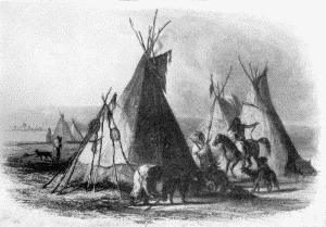
Evidently the establishment in after years of posts of the American Fur Company at certain points along the course of the upper Missouri served to attract bands of the Assiniboin as well as representatives of other tribes. Several interesting accounts of the arrival of such parties at Fort Union, near the mouth of the Yellowstone, are preserved. Thus Maximilian wrote when at the fort, June 29, 1833: "The expected arrival of more Assiniboins was delayed; they do not willingly travel with their leather tents in wet weather, because their baggage then becomes very heavy.... On the 30th of June, at noon, a band of Indians had arrived, and twenty-five tents were set up near the fort. The women, who were short, and mostly stout, with faces painted red, soon finished this work, and dug up with their instruments the clods of turf, which they lay round the lower part of the hut. One of these tents, the dwelling of a chief, was distinguished from the rest. It was painted of the colour of yellow ochre, had a broad reddish-brown border below, and on each of its sides a large black bear was painted (something of a caricature it must be confessed), to the head of which, just above the nose, a piece of red cloth, that fluttered in the wind, was fastened, doubtless a medicine." Continuing, the narrative recorded the arrival of others. "Another band of Assiniboins appeared at a distance. To the west, along the wood by the river-side, the prairie was suddenly covered with red men, most of whom went singly, with their dogs drawing the loaded sledges. The warriors, about sixty in number, formed a close column.... The whole column entered the fort, where they smoked, ate, and drank: and, meantime, forty-two tents were set up. The new camp had a very pretty appearance; the tents stood in a semicircle, and all the fires were smoking, while all around was life and activity." (Maximilian, (1), pp. 202-204.)
A painting of the dwelling of the chief, with a broad border at the bottom, "and on each of its sides a large black bear," was made by Bodmer and reproduced by Maximilian. It is here shown in plate 24, c. Several interesting details are represented in this graphic sketch. The dog travois is well shown, both the manner in which a dog appeared when the frame was attached, and the several pairs of poles with the small net-covered frames, standing together to the left of the principal tipi.
The preceding quotation from Maximilian is suggestive of an entry in the journal of the Swiss artist Friedrich Kurz, made some years later. Kurz wrote while at Fort Union: "October 13, 1851. As we were weighing and hanging up dried meat, a lot of Assiniboins came to the fort with squaws and many horse and dog travois. As a whole these trading parties do not show much of interest, but there are always many details to be picked up, of great value to a painter." (Bushnell, (3), p. 15.) Kurz remained at Fort Union until April 19, 1852, when he descended the Missouri to St. Louis, and thence returned to his native city of Bern. While still at Fort Union on March 21, 1852, he made the sketch now reproduced in plate 25, b, which bears the legend, "Horse camp of the Assiniboins." It shows a group of skin-covered lodges in the midst of a grove of cottonwoods, and evidently the Missouri is in the distance on the right. At that time (1851-52), according to Kurz, the Assiniboin then living in the vicinity of Fort Union numbered 420 lodges, with 1,050 men, but "from 2-3000 Assiniboins live far above, near lake Winnibeg."
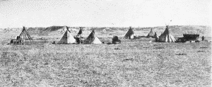
BUREAU OF AMERICAN ETHNOLOGY BULLETIN 77 PLATE 24
a. Near Fort Laramie, 1868
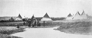
b. Near Fort Laramie, 1868
c. "A skin lodge of an Assiniboin chief." Karl Bodmer
BUREAU OF AMERICAN ETHNOLOGY BULLETIN 77 PLATE 25
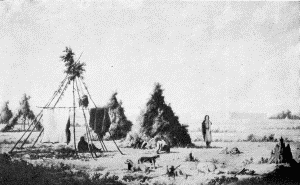
a. Assiniboin lodges "formed entirely of pine branches." Paul Kane, 1848
b. "Horse camp of the Assiniboins, March 21, 1852." Friedrich Kurz
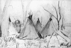
BUREAU OF AMERICAN ETHNOLOGY BULLETIN 77 PLATE 26
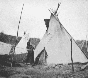
a. Tipi of Gi-he-ga, an Omaha chief. Photograph by W. H. Jackson, 1871
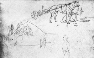
b. Page of Kurz's Sketchbook
BUREAU OF AMERICAN ETHNOLOGY BULLETIN 77 PLATE 27
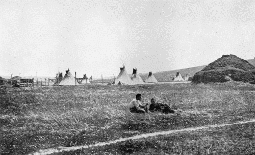
"THE VILLAGE OF THE OMAHAS" Photograph by W. H. Jackson, 1871
The Assiniboin living in the far northwest had another and simpler form of temporary structure, as mentioned by Kane. He wrote, when arriving at Rocky Mountain Fort, a post of the Hudson's Bay Company, April 21, 1848: "This fort is beautifully situated on the banks of the Saskatchewan, in a small prairie, backed by the Rocky Mountains in the distance. In the vicinity was a camp of Assiniboine lodges, formed entirely of pine branches." (Kane, (1), p. 408.) The painting made by him showing the fort and lodges is reproduced in plate 25, a.
dhegiha group.
Five tribes are considered as belonging to this group of the Siouan linguistic family: Omaha, Ponca, Quapaw, Osage, and Kansa. Distinct from the Dakota-Assiniboin tribes already mentioned, these undoubtedly some centuries ago lived in the central and upper Ohio valleys, whence they moved westward to and beyond the Mississippi. To these tribes may be attributed the great earthworks of the southern portion of Ohio and the adjacent regions bordering the Ohio River. To quote from the Handbook: "Hale and Dorsey concluded from a study of the languages and traditions that, in the westward migration of the Dhegiha from their seat on Ohio and Wabash rivers, after the separation, at least as early as 1500, of the Quapaw, who went down the Mississippi from the mouth of the Ohio, the Omaha branch moved up the great river, remaining awhile near the mouth of the Missouri while war and hunting parties explored the country to the northwest. The Osage remained on Osage River, and the Kansa continued up the Missouri, while the Omaha, still including the Ponca, crossed the latter stream and remained for a period in Iowa, ranging as far as the Pipestone quarry at the present Pipestone, Minnesota."
While living in the heavily timbered valleys reaching to the Ohio the several tribes now being considered unquestionably occupied villages consisting of groups of mat-covered lodges of the type erected by the Osage and Quapaw until the present time. But with the Omaha, Ponca, and Kansa, it was different, and when they reached the intermediate region, where forest and prairie joined, they were compelled to adopt a new form of structure, one suited to the natural environments, and thus they began to make use of the earth-covered lodge, and the conical skin tipi, with certain variations in form. The characteristic structures of the five tribes will now be briefly described, beginning with those of the Omaha.
Omaha.
When Lewis and Clark ascended the Missouri in 1804 they found the Omaha village not far from the Missouri, in the present Dakota County, Nebraska. On the 13th of August the expedition reached the mouth of a creek entering the right bank of the Missouri. Just beyond they encamped on a sandbar, "opposite the lower point of a large island." From here Sergeant Ordway and four men were sent to the Omaha village and returned the following day. "After crossing a prairie covered with high grass, they reached the Maha creek, along which they proceeded to its three forks, which join near the village: they crossed the north branch and went along the south; the walk was very fatiguing, as they were forced to break their way through grass, sunflowers, and thistles, all above ten feet high, and interspersed with wild pea. Five miles from our camp they reached the position of the ancient Maha village: it had once consisted of three hundred cabins, but was burnt about four years ago, soon after the smallpox had destroyed four hundred men, and a proportion of women and children. On a hill, in the rear of the village, are the graves of the nation." (Lewis and Clark, (1), I, pp. 44-45.)
Seven years after Lewis and Clark ascended the Missouri the traveler Bradbury visited the Omaha village standing on or near the site of the one mentioned in the earlier narrative. May 12, 1811, while away from the boat and traversing the country in search of botanical specimens, he arrived on the summit of the bluffs, and, to quote from his journal: "I had a fine view of the town below. It had a singular appearance; the framework of the lodges consists of ten or twelve long poles, placed in the periphery of a circle of about sixteen feet in diameter, and are inclined towards each other, so as to cross at a little more than half their length from the bottom; and the tops diverging with the same angle, exhibit the appearance of one cone inverted on the apex of another. The lower cone is covered with dressed buffalo skins, sewed together, and fancifully painted; some with an undulating red or yellow band of ten or twelve inches in breadth, surrounding the lodge at half its height; on others, rude figures of horses, buffaloes, or deer were painted; others again with attempts at the human face, in a circle, as the moon is sometimes painted; these were not less than four feet in diameter. I judged there were not fewer than eighty lodges. I did not remain long on the summit of the bluffs, as I perceived, from the heaps of earth, some of these recent, that it was a burial ground, and I knew the veneration they have for the graves of their ancestors." (Bradbury, (1), pp. 65-67.)
It is interesting to read of the number of decorated lodges then standing in an Omaha village, but in later years fewer structures were so ornamented. A typical example of a tipi of half a century ago is shown in plate 26, a, from a photograph made by Jackson in 1871.
According to the best authorities on the Omaha, from whose monographs much of the following information has been gleaned, the earth lodge and the skin tipi are the only forms of habitations made use of by the Omaha in recent generations. The earth lodge resembled those of other tribes of the upper Missouri, and among the Omaha the work of erecting such a structure was shared in by both man and woman.
"The marking out of the site and the cutting of the heavy logs were done by the men. When the location was chosen, a stick was thrust in the spot where the fireplace was to be, one end of a rawhide rope was fastened to the stick and a circle 20 to 60 feet in diameter was drawn on the earth to mark where the wall was to be erected. The sod within the circle was removed, the ground excavated about a foot in depth, and the earth thrown around the circle like an embankment. Small crotched posts about 10 feet high were set 8 or 10 feet apart and 1½ feet within the circle, and on these were laid beams. Outside this frame split posts were set close together, having one end braced against the bottom of the bank and the other end leaning against the beams, thus forming a wall of timber. The opening generally, though not always, faced the east. Midway between the central fireplace and the wall were planted 4 to 8 large crotched posts about 10 feet in height, on which heavy beams rested, these serving to support the roof. This was made of long, slender, tapering trees stripped of their bark. These were tied at their large ends with cords (made from the inner bark of the linden) to the beams at the top of the stockade and at the middle to those resting in the crotches of the large posts forming the inner circle about the fireplace. The slender ends were cut so as to form the circular opening for the smoke, the edges being woven together with elm twine, so as to be firm. Outside the woodwork of the walls and roof, branches of willow were laid crosswise and bound tight to each slab and pole. Over the willows a heavy thatch of coarse grass was arranged so as to shed water. On the grass was placed a thick coating of sod. The sods were cut to lap and be laid like shingles. Finally they were tamped with earth and made impervious to rain. The entrance way, 6 to 10 feet long, projected from the door and was built in the same manner as the lodge and formed a part of it. A curtain of skin hung at the inner and one at the outer door of this entrance way. Much labor was expended on the floor of the lodge. The loose earth was carefully removed and the ground then tamped. It was next flooded with water, after which dried grass was spread over it and set on fire. Then the ground was tamped once again. This wetting and heating was repeated two or three times, until the floor became hard and level and could be easily swept and kept clean. Brooms were made of brush or twigs tied together. Couches were arranged around the wall in the spaces between the posts of the framework. These were provided with skins and pillows, and served as seats by day and as beds by night. In the building of an earth lodge the cutting and putting on of the sods was always done by women, and as this part of the task had to be accomplished rapidly to prevent the drying out of the sods, which must hold well together, kindred helped one another. The erection of this class of dwelling required considerable labor, hence only the industrious and thrifty possessed these lodges." (Fletcher and La Flesche, (1), pp. 97-98.)
Although the earth-covered lodge, as just described, was used in the permanent villages, nevertheless in the same villages were to have been seen many of the conical skin tipis. Both types of habitation were standing at the Omaha village in 1871 when the photograph, now reproduced in plate 27, was made by W. H. Jackson.
Near each earth lodge, "generally to the left of the entrance, the cache was built. This consisted of a hole in the ground about 8 feet deep, rounded at the bottom and sides, provided with a neck just large enough to admit the body of a person. The whole was lined with split posts, to which was tied an inner lining of bunches of dried grass. The opening was protected by grass, over which sod was placed. In these caches the winter supply of food was stored; the shelled corn was put into skin bags, long strings of corn on the cob were made by braiding the outer husks, while the jerked meat was packed in parfleche cases. Pelts, regalia, and extra clothing were generally kept in the cache; but these were laid in ornamented parfleche cases, never used but for this purpose." (Op. cit., p. 98.)
BUREAU OF AMERICAN ETHNOLOGY BULLETIN 77 PLATE 28
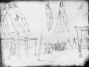
a. Page of Kurz's Sketchbook showing Omaha village, May 20, 1851
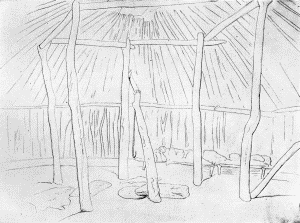
b. Page of Kurz's Sketchbook showing interior of an Omaha lodge, May 16, 1851
BUREAU OF AMERICAN ETHNOLOGY BULLETIN 77 PLATE 29
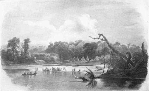
"PUNKA INDIANS ENCAMPED ON THE BANKS OF THE MISSOURI" Karl Bodmer, 1833
On pages 95 and 96 of the work just cited appears a very interesting description of the making and raising of a skin tipi. "Formerly the cover was made of 9 to 12 buffalo skins tanned on both sides. To cut and sew this cover so that it would fit well and be shapely when stretched over the circular framework of poles required skilful workmanship, the result of training and of accurate measurements.... The tent poles were 14 to 16 feet long. Straight young cedar poles were preferred. The bark was removed and the poles were rubbed smooth. The setting up of a tent was always a woman's task. She first took four poles, laid them together on the ground, and then tied them firmly with a thong about 3 feet from one end. She then raised the poles and spread their free ends apart and thrust them firmly into the ground. These four tied poles formed the true framework of the tent. Other poles—10 to 20 in number, according to the size of the tent—were arranged in a circle, one end pressed well into the ground, the other end laid in the forks made by the tied ends of the four poles. There was a definite order in setting up the poles so that they would lock one another, and when they were all in place they constituted an elastic but firm frame, which could resist a fairly heavy wind." There was probably very little variation in the ways and customs of the different members of the tribe, and the tents of an entire village would have been raised after the same, long-established manner. But the structures in an Omaha village did not surround an open space, "nor were they set so the people could live in the order of their gentes, an order observed when they were on the hunt and during their tribal ceremonies. Yet each family knew to what gens it belonged, observed its rites, and obeyed strictly the rule of exogamy. To the outward appearance a village presented a motley group of tribesmen. The dwellings and their different corrals were huddled together; the passageways between the lodges were narrow and tortuous. There was little of the picturesque. The grass and weeds that grew over the earth lodges while the people were off on their summer buffalo hunt were all cut away when the tribe returned. So, except for the decorations on the skin tents, there was nothing to relieve the dun-colored aspect." (Op. cit., p. 99.) Such was the appearance of an Omaha village in the valley of the Missouri.
In 1847 the Omaha erected a village on the banks of Papillon Creek, near the line between Sarpy and Douglas Counties, Nebraska. Four years later it was visited by Kurz during his journey up the Missouri. Kurz was camped near Council Bluffs, on the left bank of the Missouri. Opposite was Bellevue, the trading post of Peter A. Sarpy, and while at the latter place, May 16, 1851, Kurz entered in his journal: "In Bellevue I have drawn an Indian winter house made of earth, and also a Pawnee girl." And on May 20 he wrote: "Again crossed the river to Bellevue in order to visit the Omaha village some six miles distant; went over the bluffs, as being the shortest way, then crossed the high prairie ... to the Papillon creek which partly surrounds the village of the Omahas. The village itself is built on a hill.... The camp or village is composed of leather tents and earth-covered lodges. Between the tents and lodges are scaffolds for drying meat and also an enclosure for the horses.... I walked into the village and watched a group of young men endeavoring to throw lances through rolling rings, the others being gathered on top the earth lodges, [pl. 26 b] as spectators." (Bushnell, (3), p. 11.) Sketches made by Kurz at that time are reproduced in plate 28. The interior of an earth lodge, drawn at Bellevue May 16, 1851, is shown in b; the couches extending along the wall are clearly indicated, also the fireplace in the center of the lodge, over which is hanging a hook for the suspension of a kettle. The village, which stood on the banks of Papillion Creek, is shown in the lower part of a, of the same plate. Both forms of dwellings are represented in the sketch; also the scaffolds for drying meat and other purposes, and several inclosures in which their horses were confined.
On June 12 Kurz attended a sacred dance performed for the benefit of a wounded man. He referred to it in his journal as being given by the Buffalo Society, where all wore buffalo masks. It was held in a large earth lodge, and he was accompanied by the chief, Joseph La Flesche.
The site of the small village mentioned by Kurz was identified a few years ago by Gilder, and some of the ruins were examined. It stood in the forks of the Papillion, about 4 miles in a direct line west of the Missouri. To quote from the brief narrative: "It was here the Omaha lived last before going on a reservation, and where they were visited by the Swiss artist, Kurz.... It was found that the ruins were quite shallow and had left but slight depressions, while others left small circular mounds above the surrounding level. The Rock Island Railroad has cut through the village, and at least one cache was exposed from top to bottom—about fifteen feet. In all instances the caches were outside the lodge sites.
"The surface yielded fractured iron pots, delft or figured china of white man's manufacture, and rusty iron objects, besides flint scrapers and chips, potsherds, and the usual accumulations of a village prior to contact with white people. The writer cannot attribute the flint implements to the Omaha, but considers the favorable site on a plateau at the junction of two streams to have been used by another people long before the Omaha erected their lodges there." (Gilder, (1), p. 75.)
Innumerable ruins of earth lodges were to have been found in the vicinity of the present city of Omaha, the great majority of which stood in early days before the arrival of Europeans in the valley of the Missouri, and it is not possible to say by which tribe the villages were erected. Many large ruins were discovered on Childs Point, in the extreme northeastern corner of Sarpy County, just south of Omaha, and some 4 miles northeast of the small village visited by Kurz. Some of the ruins were carefully examined by Gilder. One, which appears to have been considered as possessing the typical characteristics of the group, was described by Gilder, who wrote: "In all house ruins similar to the one here described, the main fireplace, four or five feet in diameter, is situated near the exact center. From this fireplace the floor extends, nearly flat, to within ten feet of the extreme outer edge or periphery of the ruin. Here a platform, or step, twelve to fourteen inches high and almost vertical, rose from the floor and sloped rather sharply to the outer rim.... Around the line of the inner circumference of the platform, at distances of approximately five feet, the remains of posts six or seven inches in diameter were discovered. These were either in the form of charcoal or of wood dust. Sometimes bowlders lay about the remains of the posts, as if designed to aid in holding them in position. The grain of the charcoal posts indicated the wood to have been oak. About the posts, under the floor, and also under the platform, objects were more numerous than at other points in the ruin. The charred remains of four posts about eight feet apart surrounded the central fireplace. There were two features of house construction that stand out conspicuously: (1) the floor was approximately six to eight feet lower than the level of the surrounding ridge; (2) the angle at which the slabs, logs, or paling probably leaned inward from the periphery seems to indicate the highest part of the roof at about the same distance above the surrounding level as the floor was below, making the highest part of the roof about fifteen feet above the fireplace in the center of the dwelling.... Little besides broken flint instruments, flint chips, shells, potsherds, and fractured drift bowlders were found upon the floor itself; the major number of objects was beneath the floor surface, very often covered with bowlders, as if the latter had been placed to mark the spot. Small fireplaces were of frequent occurrence on all parts of the floor.
"Three caches were found in the first ruin.... In one, fifteen feet west of the center of the dwelling were found flint blades, a score of Unio shells, a mano or muller made from a rounded drift bowlder ... and a pottery pipe in form of a soaring bird.... The bottom of this cache was six feet from the surface. The second cache lay at the southeastern side of the ruin. Its bottom was eight feet from the surface of the ground. It contained thirty shells, several large flint blades, other large flint implements of unknown use ... animal bones, projectile points, and a small piece of galena. The third cache, in the northeastern part of the ruin, was the largest and deepest of the three, its bottom being nine feet and a half from the surface. On a small shelf, or niche, at its eastern side, two feet from the bottom, lay, a small image of a human face carved from pink soapstone, a number of animal bones and skulls, fish bones and scales, and Unio shells.
"So many and varied were the objects found in the ruin, so abundant the charred sticks and grasses, that the impression is conveyed that the dwelling had been abandoned in haste and that it had burned to the ground." (Gilder, (1), pp. 58-61.) The objects discovered in this ancient ruin were truly varied, as the discoverer remarked, and likewise of the greatest interest, including specimens of stone, bone, and pottery, with bones of animals which had probably served as food. But how interesting it would be to know the date of the construction of this large lodge, and the tribe to which its occupants belonged—questions which may never be determined. However, it unquestionably belonged to people of a tribe who reared and occupied similar structures in the valley of the Missouri as late as the latter half of the nineteenth century.
Other quite similar ruins a short distance north of the city of Omaha were examined by Gilder. Many objects of bone, stone, and pottery were discovered. Caches were encountered, and to quote from his account of the work: "The caches within the house sites are smaller in diameter near the top than at the bottom, the latter part flaring out somewhat in the manner of a large earthen pot. The bottom of the caches are rounded, and the walls are almost as hard as fired clay. In the very bottom of each cache was a quantity of dust, or earth as fine as dust (not compact as at other points), in which were found small arrowpoints, flint blades, shell beads, and flint flakes. In each case where the cache was found within the house circle it occurred close under the western wall, back of the fireplace and exactly opposite the entrance to the lodge, the latter in every instance facing the east." (Gilder, (2), p. 716.)
Before closing this brief sketch of the Omaha villages and forms of structures, it will be of interest to quote from the writings of one who was intimately acquainted with the people of whom he wrote. Referring to their various types of habitations, he says:
"The primitive domiciles of the Omaha were chiefly (1) lodges of earth or, more rarely, of bark or mats, and (2) skin lodges or tents. It may be observed that there were no sacred rites connected with the earth lodge-building or tent-making among the Omaha and Ponka. When earth lodges were built, the people did not make them in a tribal circle, each man erecting his lodge where he wished; yet kindred commonly built near one another. The earth lodges were made by the women, and were intended principally for summer use, when the people were not migrating or going on the hunt.... Earth lodges were generally used for large gatherings, such as feasts, councils, or dances.... On a bluff near the Omaha agency I found the remains of several ancient earth lodges, with entrances on the southern sides. Two of these were 75 feet and one was 100 feet in diameter. In the center of the largest there was a hollow about 3 feet deep and nearly 4 feet below the surface outside the lodge.
"The Omaha sometimes make bark lodges for summer occupancy, as did the Iowa and Sak." (Dorsey, (1), pp. 269-271.)
Referring to the more temporary structure, the skin tipi: "The tent was used when the people were migrating, and also when they were traveling in search of the buffalo. It was also the favorite abode of a household during the winter season, as the earth lodge was generally erected in an exposed situation, selected on account of comfort in the summer. The tent could be pitched in the timber or brush, or down in wooded ravines, where the cold winds never had full sweep. Hence, many Indians abandoned their houses in winter and went into their tents, even when they were of canvas.
"The tent was commonly made of ten or a dozen dressed or tanned buffalo skins. It was in the shape of a sugar loaf, and was from 10 to 12 feet high, 10 or 15 feet in diameter at the bottom, and about a foot and a half in diameter at the top, which served as a smoke-hole.... No totem posts were in use among the Omaha. The tent of the principal man of each gens was decorated on the outside with his gentile badge, which was painted on each side of the entrance as well as on the back of the tent." (Op. cit., pp. 271-274.)
In an earlier work, "A Study of Siouan Cults," Dr. Dorsey showed the varied designs on ceremonial tipis of the different Siouan tribes. Among other interesting illustrations are pictures of lodges erected at the time of the Sun dance, with the great camp circle as formed at that time. (Dorsey, (2).)
A clear insight into the ways of life of the primitive Omaha of a century ago, before their native manners and customs had been changed through influence with the whites, may be obtained from the narrative of the Long expedition. A great part of the recorded information was imparted by John Dougherty, at that time deputy Indian agent for the tribes of the Missouri.
In 1819 and 1820, the period of the narrative, the permanent village of the tribe stood on the banks of Omaha Creek, about 2½ miles from the right bank of the Missouri, in the present Dakota County, Nebraska. As told on preceding pages, this was the large, permanent village of the tribe, but nevertheless it was occupied for less than half the year, and as related by Dougherty: "The inhabitants occupy their village not longer than five months in the year. In April they arrive from their hunting excursions, and in the month of May they attend to their horticultural interests, and plant maize, beans, pumpkins, and watermelons, besides which they cultivate no other vegetable. They also, at this season, dress the bison skins, which have been procured during the winter hunt, for the traders, who generally appear for the purpose of obtaining them. The young men, in the mean time, are employed in hunting within the distance of seventy or eighty miles around, for beaver, otter, deer, muskrat, elk, &c.
"When the trading and planting occupations of the people are terminated, and provisions begin to fail them, which occurs generally in June, the chiefs assemble a council for the purpose of deliberating upon the further arrangements necessary to be made...." A feast is prepared, and all gather to determine where and when the next hunt shall take place. These important questions being settled, all are in readiness, and "The day assigned for their departure having arrived, the squaws load their horses and dogs, and take as great a weight upon their own backs, as they can conveniently transport, and, after having closed the entrances to their several habitations, by placing a considerable quantity of brushwood before them, the whole nation departs from the village." And thus they continue to move until word is brought that herds of buffalo are near, then they encamp at the nearest watercourse. The skin lodges, having been conveyed by means of the travois, are soon set up, to be occupied during the period of the hunt. These "are often fancifully ornamented on the exterior, with figures, in blue and red paint, rudely executed, though sometimes depicted with no small degree of taste." The buffalo skins obtained during the summer hunt were known as summer skins, and were used especially for the covering of their lodges and also for their garments. After a successful hunt all parts of the buffalo were carried to the camp and the vertebrae were crushed "by means of stone axes, similar to those which are not unfrequently ploughed up out of the earth in the Atlantic states."
After the summer hunt "The nation return towards their village in the month of August, having visited for a short time the Pawnee villages for the purpose of trading their guns for horses. They are sometimes so successful, in their expedition, in the accumulation of meat, as to be obliged to make double trips, returning about mid-day for half the whole quantity, which was left in the morning. When within two or three days journey of their own village, runners are dispatched to it, charged with the duty of ascertaining the safety of it, and the state of the maize.
"On the return of the nation, which is generally early in September, a different kind of employment awaits the ever industrious squaws. The property buried in the earth is to be taken up and arranged in the lodges, which are cleaned out, and put in order. The weeds which during their absence had grown up, in every direction through the village, are cut down and removed. A sufficient quantity of sweet corn is next to be prepared, for present and future use."
Being now plentifully supplied with food, unless for some unforeseen cause having an ample quantity of buffalo meat and corn, together with the other products of the gardens, they would "content themselves in their village until the latter part of October, when, without the formality of a council, or other ceremony, they again depart from the village, and move in separate parties to various situations on both sides of the Missouri, and its tributaries, as far down as the Platte. Their primary object at this time, is to obtain, on credit from the traders, various articles, indispensably necessary to their fall, winter, and spring hunts; such as guns, particularly those of Mackinaw, powder, ball, and flints, beaver traps, brass, tin, and camp-kettles, knives, hoes, squaw-axes and tomahawks.
"Having obtained these implements, they go in pursuit of deer, or apply themselves to trapping for beaver and otter. Elk was some time since an object of pursuit, but these animals are now rather rare, in the Omawhaw territories.
"This hunt continues until towards the close of December, and during the rigours of the season they experience an alternation of abundance and scarcity of food."
The skins secured during the late autumn hunt would be carried to the traders and left as payment for the goods previously obtained on credit, and also given in exchange for blankets, wampum, and various other articles. Thence they would return to their permanent village "in order to procure a supply of maize from their places of concealment, after which they continue their journey, in pursuit of bisons.... This expedition continues until the month of April, when they return to their village as before stated, loaded with provisions. It is during this expedition that they procure all the skins, of which the bison robes of commerce are made; the animals at this season having their perfect winter dress, the hair and wool of which are long and dense." (James, (1), I, pp. 200-221.)
Such was the life of the Omaha a hundred years ago, and it may have been quite the same for many generations, omitting, of course, the visits made to the traders. But their systematic hunts had probably been performed ever since the Omaha reached the valley of the Missouri, and possibly long before.
Ponca.
That the Ponca and Omaha were formerly a single tribe is accepted without question, and that the separation took place long after they crossed the Mississippi from their ancient habitat is established by the traditions of the two tribes. Probably the two tribes in later years, after the separation, continued to resemble one another to such a degree that the villages of one could not have been distinguished from those of the other.
A deserted village of the Ponca was discovered by members of the Lewis and Clark expedition in 1804, and according to the narrative of the expedition on September 5 they arrived at the "river Poncara," which entered the Missouri from the south, and at its mouth was 30 yards in width. "Two men whom we despatched to the village of the same name, returned with information that they had found it on the lower side of the creek; but as this is the hunting season, the town was so completely deserted that they had killed a buffaloe in the village itself." (Lewis and Clark, (1), I, pp. 66-67.) The "river Poncara," later to be known as Ponca Creek, enters the right bank of the Missouri in the western part of the present Knox County, Nebraska. Here they continued to live for some years, and during the spring of 1833 Maximilian said they "dwell on both sides of Running-water River, and on Ponca Creek, which Lewis and Clark call Poncara." Running-water River was the earlier name of the Niobrara. "The band of them, which we met with here, has set up eight or nine leather tents, at the mouth of Basil Creek, on a fine forest." On May 12, 1833, appears this note in the narrative: Arrived "opposite the huts of the Punca Indians. They lay in the shade of a forest, like white cones, and, in front of them, a sand bank extended into the river, which was separated from the land by a narrow channel. The whole troop was assembled on the edge of the bank, and it was amusing to see how the motley group crowded together, wrapped in brown buffalo skins, white and red blankets—some naked, of a deep brown colour." (Maximilian, (1), pp. 137-139.) A sketch made at that time by Bodmer and reproduced by Maximilian is here shown in plate 29. It bears the legend "Punka Indians Encamped on the Banks of the Missouri."
Although at that time living in the typical skin tipi, Maximilian stated (p. 137), "They formerly lived, like the Omahas, in clay huts at the mouth of the river, but their powerful enemies, the Sioux and the Pawnees, destroyed their villages, and they have since adopted the mode of life of the former, living more generally in tents made of skins, and changing their place from time to time." The village visited by members of the Lewis and Clark expedition, September 5, 1804, when they "killed a buffaloe in the village itself," was probably composed of earth-covered lodges.
When discovering a trail, or rather tracks made by a number of Indians crossing the prairie, it was often possible to determine the nature of the party. The Ponca, who often moved from place to place, setting up their tipis in various localities during the course of the year, could have been held in mind by Gregg when he wrote: "These lodges are always pitched or set up by the squaws, and with such expedition, that, upon the stopping of an itinerant band, a town springs up in a desert valley in a few minutes, as if by enchantment. The lodge-poles are often neatly prepared, and carried along from camp to camp. In conveying them one end frequently drags on the ground, whereby the trail is known to be that of a band with families, as war parties never carry lodge-poles." (Gregg, (1), II, pp. 286-288.) The rapidity and skill with which the squaws set up and arranged the tipis, when the site of the camp had been selected, was commented on by many writers, and what an interesting and animated scene it must have been.
Kansa.
To quote from the Handbook: "Their linguistic relations are closest with the Osage, and are close with the Quapaw. In the traditional migration of the group, after the Quapaw had first separated therefrom, the main body divided at the mouth of Osage River, the Osage moving up that stream and the Omaha and Ponca crossing Missouri River and proceeding northward, while the Kansa ascended the Missouri on the south side to the mouth of Kansa River. Here a brief halt was made, after which they ascended the Missouri on the south side until they reached the present north boundary of Kansas, where they were attacked by the Cheyenne and compelled to retrace their steps. They settled again at the mouth of Kansas River, where the Big Knives, as they called the whites, came with gifts and induced them to go farther west. The native narrators of this tradition give an account of about 20 villages occupied successively along Kansas River before the settlement at Council Grove, Kansas, whence they were finally removed to their reservation in Indian Ter. Marquette's autograph map, drawn probably as early as 1674, places the Kansas a considerable distance directly west of the Osage and some distance south of the Omaha, indicating that they were then on Kansas River.... It is known that the Kansa moved up Kansas River in historic times as far as Big Blue River, and thence went to Council Grove in 1847. The move to the Big Blue must have taken place after 1723."
Thus it would appear that for many generations the villages of the Kansa had stood near the eastern boundary of the great plains, a region where buffalo were plentiful, one suited to the wants and requirements of the native tribes.
On June 26, 1804, the Lewis and Clark expedition reached the mouth of the Kansas and encamped on the north side, where they remained two days. In the journal of those days they referred to the Kansa, and said: "On the banks of the Kanzas reside the Indians of the same name, consisting of two villages, one at about twenty, the other forty leagues from its mouth, and amounting to about three hundred men. They once lived twenty-four leagues higher than the Kanzas [river], on the south bank of the Missouri.... This nation is now hunting in the plains for the buffaloe which our hunters have seen for the first time." (Lewis and Clark, (1), I, pp. 18-19.) A few days later, July 2, after advancing a short distance up the Missouri, above the mouth of the Kansas, they arrived at the site of an ancient village of the tribe. In the journal (p. 20) is this account: "Opposite our camp is a valley, in which was situated an old village of the Kansas, between two high points of land, and on the bank of the river. About a mile in the rear of the village was a small fort, built by the French on an elevation. There are now no traces of the village, but the situation of the fort may be recognized by some remains of chimnies, and the general outline of the fortification, as well as by the fine spring which supplied it with water." Three days later, July 5, 1804, while on the right bank of the Missouri, they "came along the bank of an extensive and beautiful prairie, interspersed with copses of timber, and watered by Independence creek. On this bank formerly stood the second village of the Kanzas; from the remains it must have been once a large town." (Op. cit., pp. 21-22.)
The village mentioned by Lewis and Clark as standing on the banks of the Kansas River some 40 league above its confluence with the Missouri may have been the one visited and described by Maj. George C. Sibley during the summer of 1811. Sibley wrote in his journal: "The Konsee town is seated immediately on the north bank of the Konsee River, about one hundred miles by its course above its junction with the Missouri; in a beautiful prairie of moderate extent, which is nearly encircled by the River; one of its Northern branches (commonly called the Republican fork, which falls in a few hundred paces above the village) and a small creek that flows into the north branch. On the north and southwest it is overhung by a chain of high prairie hills which give a very pleasing effect to the whole scene.
"The town contains one hundred and twenty-eight houses or lodges which are generally about 60 feet long and 25 feet wide, constructed of stout poles and saplings arranged in form of an arbour and covered with skins, bark and mats; they are commodious and quite comfortable. The place for fire is simply a hole in the earth, under the ridge pole of the roof, where an opening is left for the smoke to pass off. All the larger lodges have two, sometimes three, fire places; one for each family dwelling in it. The town is built without much regard to order; there are no regular streets or avenues. The lodges are erected pretty compactly together in crooked rows, allowing barely space sufficient to admit a man to pass between them. The avenues between these crooked rows are kept in tolerable decent order and the village is on the whole rather neat and cleanly than otherwise. Their little fields or patches of corn, beans and pumpkins, which they had just finished planting, and which constitute their whole variety, are seen in various directions, at convenient distances around the village. The prairie was covered with their horses and mules (they have no other domestic animals except dogs)."
The manuscript journal from which the preceding quotation is made is now in the possession of Lindenwood College, St. Charles, Mo., the copy having been made by Mrs. N. H. Beauregard.
The preceding is a clear though all too brief account of a native village, prepared at a time when it continued in a primitive condition. The site, on the left bank of Kansas River just below the mouth of the Republican, would have been about the present Fort Riley, near the northern line of Geary County. In some respects this is the most interesting description of a Kansa village given in the present work. The habitations—long mat-covered lodges—were of the type erected by the Osage and Quapaw, kindred tribes of the Kansa, and it is highly probable they represented the form of dwellings reared by the same tribes many generations before in their ancient villages which then stood in the valley of the Ohio, far east of the Mississippi.
Just 15 years elapsed between the time of the Lewis and Clark expedition and the arrival of the Long party in the country of the Kansa. In August, 1819, to those aboard the steamboat Western Engineer, "The site of an old village of the Konzas, and the remains of a fortification erected by the French, were pointed out a few miles below Isle au Vache. This island, which lies about one hundred miles above Fort Osage, was the wintering post of Capt. Martin's detachment, destined to proceed in advance of the troops ordered to the Missouri." And nothing shows more clearly the changed conditions in that region during the past century than the continuation of this narrative: "Captain Martin, with three companies of the rifle regiment, left Bellefontain in September 1818, and arrived at Isle au Vache in October, with the expectation of resuming his march, as early in the following spring as the weather would permit. But not having received the necessary supplies of provisions as anticipated, they had been compelled to remain till the time of our arrival, subsisting themselves principally by hunting.... Between two and three thousand deer, besides great numbers of bears, turkies, &c. had been taken." On August 23, 1819, a large number of Kansa Indians, from their villages on the river bearing their tribal name, gathered at Isle au Vache to meet members of the Long party in council. "There were present at this council, one hundred and sixty-one Konzas, including chiefs and warriors, and thirteen Osages." (James, (1), I, pp. 110-112.)
While at Fort Osage members of the Long expedition left for an overland journey to the Kansa towns. The party was led by Say, and left the fort August 6, arriving at the villages just two weeks later. The Kansa town then stood in the extreme southwestern corner of the present Pottawatomie County, Kansas, at the mouth of the Big Blue. And "as they approached the village, they perceived the tops of the lodges red with the crowds of natives; the chiefs and warriors came rushing out on horseback, painted and decorated, and followed by great numbers on foot ... the village was in confusion, the hunters having lately returned; and being then engaged in preparations for the journey to Isle au Vache." The journey was that mentioned above, when the Indians arrived at Isle au Vache to hold council with Long. Continuing the narrative: "The approach to the village is over a fine level prairie of considerable extent; passing which, you ascend an abrupt bank of the height of ten feet, to a second level, on which the village is situate in the distance, within about ¼ of a mile of the river. It consists of about 120 lodges, placed as closely together as convenient, and destitute of any regularity of arrangement. The ground area of each lodge is circular, and is excavated to the depth of from one to three feet, and the general form of the exterior may be denominated hemispheric.
"The lodge, in which we reside, is larger than any other in the town, and being that of the grand chief, it serves as a council house for the nation. The roof is supported by two series of pillars, or rough vertical posts, forked at top for the reception of the transverse connecting pieces of each series; twelve of these pillars form the outer series, placed in a circle; and eight longer ones, the inner series, also describing a circle; the outer wall, of rude frame work, placed at a proper distance from the exterior series of pillars, is five or six feet high. Poles, as thick as the leg at base, rest with their butts upon the wall, extending on the cross pieces, which are upheld by the pillars of the two series, and are of sufficient length to reach nearly to the summit. These poles are very numerous, and, agreeable to the position which we have indicated, they are placed all around in a radiating manner, and support the roof like rafters. Across these are laid long and slender sticks or twigs, attached parallel to each other by means of bark cord; these are covered by mats made of long grass, or reeds, or with the bark of trees; the whole is then covered completely over with earth, which, near the ground, is banked up to the eaves. A hole is permitted to remain in the middle of the roof to give exit to the smoke. Around the walls of the interior, a continuous series of mats are suspended; these are of neat workmanship, composed of a soft reed, united by bark cord, in straight or undulated lines, between which, lines of black paint sometimes occur. The bedsteads are elevated to the height of a common seat from the ground, and are about six feet wide; they extend in an uninterrupted line around three-fourths of the circumference of the apartment, and are formed in the simplest manner of numerous sticks, or slender pieces of wood resting at their ends on cross pieces, which are supported by short notched or forked posts, driven into the ground; bison skins supply them with a comfortable bedding. Several medicine or mystic bags are carefully attached to the mats of the wall, these are cylindrical, and neatly bound up; several reeds are usually placed upon them, and a human scalp serves for the fringe and tassels. Of their contents we know nothing. The fireplace is a simple shallow cavity, in the center of the apartment, with an upright and a projecting arm for the support of the culinary apparatus." (Op. cit., pp. 120-121.)
Say and his associates left the Kansa village to rejoin the main party aboard the steamboat Western Engineer, then waiting near Isle au Vache, but soon after starting on the journey were attacked by some wandering Pawnee and forced to return to seek refuge among those whom they had just left. And as told in the narrative, they were, as a consequence, able to witness an interesting ceremony in one of the large earth lodges. This was August 23, 1819. "Mr. Say's party were kindly received at the village they had left on the preceding day. In the evening they had retired to rest in the lodge set apart for their accommodation, when they were alarmed by a party of savages, rushing in armed with bows, arrows and lances, shouting and yelling in a most frightful manner. The gentlemen of the party had immediate recourse to their arms, but observing that some squaws, who were in the lodge, appeared unmoved, they began to suspect that no molestation to them was intended. The Indians collected around the fire in the centre of the lodge, yelling incessantly; at length their howlings assumed something of a measured tone, and they began to accompany their voices with a sort of drum and rattles. After singing for some time, one who appeared to be their leader, struck the post over the fire with his lance, and they all began to dance, keeping very exact time with the music. Each warrior had, besides his arms, and rattles made of strings of deer's hoof, some part of the intestines of an animal inflated, and inclosing a few small stones, which produced a sound like pebbles in a gourd shell. After dancing round the fire for some time, without appearing to notice the strangers, they departed, raising the same wolfish howl, with which they had entered; but their music and their yelling continued to be heard about the village during the night.
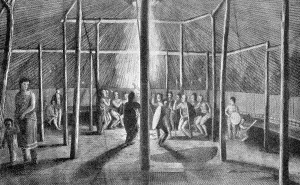
"This ceremony, called the dog dance, was performed by the Konzas for the entertainment of their guests. Mr. Seymour took an opportunity to sketch the attitudes and dresses of the principal figures." (Op. cit., p. 135.) The sketch made by Seymour was engraved and served as an illustration in the narrative of the expedition prepared by James. It is here reproduced as plate 30, b. The interior of the large earth lodge is clearly shown. The "continuous series of mats" are suspended around the wall, and the "bedsteads," as described, serve as seats for the guests. Mats are also represented as spread over the floor in the foreground.
On August 25, 1819, the steamboat Western Engineer steamed away from Isle au Vache, and that night, after having advanced about 23 miles up the Missouri, stopped at the mouth of Independence Creek, and a little above the creek, on the right bank of the Missouri, was "the site of an old Konza town, called formerly the village of the Twenty Four." This was evidently the same site as mentioned by Lewis and Clark, July 5, 1804. Ruins of the earth lodges had undoubtedly remained quite distinct, being overgrown with the grass of the prairie.
Isle au Vache, in the Missouri, faces Oak Mills, Atchison County, Kansas, and Iatan, Platte County, Missouri. A brief history of the island was prepared a few years ago. (Remsburg, (1), pp. 436-443.)
Interesting notes on the habitations of the Kansa Indians are contained in a narrative prepared by one who passed through their country during the month of May, 1834.
On the night of May 1 the party encamped on a small branch of the Kansas River, where they were joined by some members of the Kansa tribe who occupied six lodges in a near-by woods. "This party is a small division of a portion of this tribe, who are constantly wandering; but although their journeys are sometimes pretty extensive, they seldom approach nearer to the settlements than they are at present." Later they arrived at the banks of the Kansas River, and as it was approached, so the narrative continues, "we saw a number of Indian lodges, made of saplings driven into the ground, bent over and tied at top, and covered with bark and buffalo skins. These lodges, or wigwams, are numerous on both sides of the river. As we passed them, the inhabitants, men, women, and children, flocked out to see us, and almost prevented our progress by their eager greetings. Our party stopped on the bank of the river, and the horses were unloaded and driven into the water." They crossed the river by means of a large flat-bottomed boat, and reaching the opposite bank saw many Indian lodges with some frame houses occupied by whites. "The canoes used by the Indians are mostly made of buffalo skins, stretched, while recent, over a light frame work of wood, the seams sewed with sinews, and so closely, as to be wholly impervious to water. These light vessels are remarkably buoyant, and capable of sustaining very heavy burthens." That evening they were visited by the Kansa chief who lived near by, a "young man about twenty-five years of age, straight as a poplar, and with a noble countenance and bearing.... The Kaws living here appear to be much more wealthy than those who joined our camp on the prairie below.... Their dress consists, universally of deer skin leggings, belted around the loins, and over the upper part of the body a buffalo robe or blanket." (Townsend, (1), pp. 30-33.)
During the morning of May 20, 1834, the party departed from the Kansa settlement on or near the banks of the Kansas River, "leaving the river immediately, and making a N. W. by W. course—and the next day came to another village of the same tribe, consisting of about thirty lodges, and situated in the midst of a beautiful level prairie.... The lodges here are constructed very differently from those of the lower village. They are made of large and strong timbers, a ridge Pole runs along the top, and the different pieces are fastened together by leathern thongs. The roofs, which are single, make but one angle, are of stout poplar bark, and forms an excellent defence, both against rain and the rays of the sun, which must be intense during midsummer in this region. These prairies are often visited by heavy gales of wind, which would probably demolish the huts, were they built of frail materials like those below. We encamped in the evening on a small stream called Little Vermillion creek...." (Op. cit., pp. 33-34.)
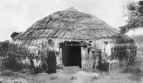
The sketch by Seymour conveys a very good idea of the general appearance of the interior of a Kansa lodge, and an equally interesting picture of the village, as it was just 22 years later, is to be found in one of Father de Smet's works. He arrived at the first of the villages May 19, 1841, and in describing it said: "At the first sight of their wigwams, we were struck at the resemblance they bore to the large stacks of wheat which cover our fields in harvest-time. There were of these in all no more than about twenty, grouped together without order, but each covering a space about one hundred and twenty feet in circumference, and sufficient to shelter from thirty to forty persons. The entire village appeared to us to consist of from seven to eight hundred souls,—an approximation which is justified by the fact that the total population of the tribe is confined to two villages, together numbering 1900 inhabitants. These cabins, however humble they may appear, are solidly built and convenient. From the top of the wall, which is about six feet in height, rise inclined poles, which terminate round an opening above, serving at once for a chimney and window. The door of the edifice consists of an undressed hide on the most sheltered side, the hearth occupies the centre and is in the midst of four upright posts destined to support the rotunda; the beds are ranged round the wall and the space between the beds and the hearth is occupied by the members of the family, some standing, others sitting or lying on skins, or yellow colored mats. It would seem that this last named article is regarded as a piece of extra finery, for the lodge assigned to us had one of them." (De Smet, (1), pp. 65-66.) Following this description of a lodge is an account of its occupants. He refers to the women busily engaged at various occupations, and the men, some eating or smoking, and others plucking the hair from their brows and beard. The brief description of the interior of the lodge conforms with those of the earlier writers, but it is to be regretted that more was not said about the outside of the structure. Were they covered with earth or thatch? The village visited by Say in 1819 was composed of earth-covered lodges, clearly described, but the drawing made by one of Father de Smet's associates (it is marked Geo. Lehman, del.) represents the large circular houses with overhanging roofs, more closely resembling thatch than the usual covering of earth and sod. This drawing, which was reproduced in the work cited, is here shown in plate 30, a. The structures standing in the village visited by Father de Smet may have resembled the bark-covered house illustrated in plate 31. This most interesting photograph was probably made about 40 years ago, and at once suggests the frame, covered with bark, and ready for the final covering of earth; in other words, an unfinished earth lodge. However, it was probably a complete and finished structure.
Regarding the large village visited by De Smet as mentioned above, one historian of the tribe has written: "An important village, and the largest of the tribe at that time, was that of old Kah-he-gah-wa-ti-an-gah, known as Fool Chief, which from about 1830 to 1846 was located on the north side of the Kansas river, just north of the present Union Pacific station of Menoken.... Until recent years the lodge-circle marks were visible and its exact location easy to be found." (Morehouse, (1), p. 348.)
A year passed between the visit of Father de Smet to the Kansa towns and the arrival of Fremont in the same locality, but it had been a period of trouble for the tribe and they had suffered greatly. On June 18, 1842, Fremont wrote in his journal: "We left our camp seven, journeying along the foot of the hills which border the Kansas valley.... I rode off some miles to the left, attracted by the appearance of a cluster of huts near the mouth of the Vermillion. It was a large but deserted Kansas village, scattered in an open wood, along the margin of the stream, chosen with the customary Indian fondness for beauty of scenery. The Pawnees had attacked it in the early spring. Some of the houses were burnt, and others blackened with smoke, and weeds were already getting possession of the cleared places." (Fremont, (1), pp. 12-13.)
BUREAU OF AMERICAN ETHNOLOGY BULLETIN 77 PLATE 30
a. Kansa village, 1841. George Lehman
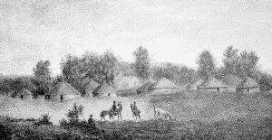
b. Dog dance within a Kansa lodge, August 23, 1819. Samuel Seymour
BUREAU OF AMERICAN ETHNOLOGY BULLETIN 77 PLATE 31
KANSA HABITATION
It is quite probable that during their journeys away from the permanent villages the Kansa, like other tribes of the Missouri Valley, made use of skin tipis as being easily transported from one place to another. It would also appear that in later years the earth and bark covered lodge ceased to be used, and that skin tipis were constructed to the exclusion of other forms of dwellings. A missionary who resided at the Kansa agency from 1865 to 1868 wrote: "The tribe at that time was divided into three bands, or villages, as they were generally called. Ish-tal-a-sa's village occupied the northern part of the reserve. He was not only village chief, but head chief of the whole tribe also. Fool Chief's village occupied the central part of the reserve, and Al-le-ga-wa-ho's the southern portion. The latter became head chief after Ish-tal-a-sa's death. There were probably about 300 in each band. Their custom was for the entire band to camp together in some desirable locality, where wood, water and grass for their ponies were accessible, and remain until the pasture was eaten down, and then move to another site. Another reason for moving was to get away from the filth that always accumulated in an Indian village. Their tents, or tepees, were made of buffalo skins.... The lodge, as they usually designated their tepees, was easily taken down and removed to another place." (Spencer, (1), p. 373.)
Of the numerous tribes mentioned at the present time no one appears to have erected a greater variety of dwellings than did the Kansa, whose habitations were of several distinct forms and were constructed of various materials.
The long mat-covered lodges described by Sibley in 1811, as at that time standing in the village at the mouth of the Republican, on the left bank of the Kansas River, may be accepted as being the typical or primitive form of structure erected by the tribe. Eight years later Say and his companions reached another village, a few miles eastward from the one preceding, and there found the circular earth lodges. Evidently the ruined towns mentioned by Lewis and Clark as being visible from the Missouri River were once groups of similar earth lodges. But all circular lodges were not covered with earth and sod; in some instances the walls and roofs were formed of sheets of bark.
During the month of May, 1834, many small dwellings were standing on both banks of the Kansas River which were formed by covering a frame composed "of saplings driven into the ground, bent over and tied at top," with sheets of bark and buffalo skins. And not far away was another village of the same tribe but presenting a very different appearance. The structures were described as being "made of large and strong timbers, a ridge pole runs along the top, and the different pieces are fastened together by leathern thongs. The roofs, which are single, make but one angle, are of stout poplar bark." Whether this was of circular or quadrangular base is difficult to determine, but probably the latter, resembling the example shown in plate 19. And in addition to the various structures already noted, the conical skin tipis were extensively used by the Kansa, probably serving in early days when the people were away from their more permanent villages, but later they were more generally utilized.
Osage.
From the earliest historical times the habitat of the Osage was among the hills and valleys of the Ozarks, south of the Missouri, in the present State of Missouri, and here they continued to dwell until their removal during the early part of the last century.
When Père Marquette passed down the Mississippi, late in the month of June, 1673, he learned of the Osage, and on his map, prepared soon afterwards, indicated the villages of that tribe near a stream which was evidently the river bearing their tribal name. They continued to occupy rather permanent villages until the beginning of the nineteenth century.
The tribe included three bands, two of which may be rather old; the third more recently created. These are: (1) Pahatsi or Great Osage, (2) Utsehta or Little Osage, (3) Santsukhdhi or Arkansas band. The latter dates from the year 1802 or thereabouts, when a large part of the Great Osage, under the leadership of the chief Big Track, removed to the vicinity of the Arkansas.
The Osage, unlike certain other members of the Siouan group to which they belong, continued to erect and occupy the mat or bark covered habitations so characteristic of the forest tribes. Their villages which stood among the Ozarks were probably similar in appearance to the ancient settlements of their ancestors which once occupied a part of the upper valley of the Ohio, whence they migrated to the region beyond the Mississippi. But the country which served as their new home was one well suited to the wants and requirements of the tribe. Game was plentiful, the streams teemed with fish, and wild fruits were to be had in vast quantities. Thus food was easily obtained.
The expedition under the command of Captains Lewis and Clark began ascending the Missouri May 14, 1804, and just one month later, on June 15, arrived at the site of an earlier settlement of the Little Osage. In the journal the entry for that day states that: "We passed several islands and one creek on the south side, and encamped on the north opposite a beautiful plain, which extends as far back as the Osage river, and some miles up the Missouri. In front of our encampment are the remains of an old village of the Little Osage, situated at some distance from the river, and at the foot of a small hill. About three miles above them, in view of our camp is the situation of the old village of the Missouris after they fled from the Sauks. The inroads of the same tribe compelled the Little Osage to retire from the Missouri a few years ago, and establish themselves near the Great Osages." And two days later, at a place about 20 miles above their camp, on the 15th, they reached "the crossing place for the Sauks, Ayauways, and Sioux, in their excursions against the Osage." (Lewis and Clark, (1), I, p. 15.)
The ruined or deserted village of the Little Osage seen by the party stood on the right or south bank of the Missouri, in the western part of the present Saline County, Missouri, not far from the village of Malta. The structures which had stood at this old site were probably similar to those later erected by the people in their new village near the town of the Great Osage, both of which were visited two years later. They were situated far south of the Missouri, in the northern part of the present Vernon County, in the valley of the Little Osage River.
During the latter part of August, 1806, Pike arrived at the two villages of the Osage, having departed from Fort Bellefontain a short time before on his journey to the far west. But, unfortunately, his accounts of the native tribes and their villages which he encountered during his travels are neither full nor clear, and so it is with the description of the habitations of the Osage. To quote from the narrative: "The Osage lodges are generally constructed with upright posts, put firmly in the ground, of about 20 feet in height, with a crotch at the top; they are generally about 12 feet distant from each other; in the crotch of those posts, are put the ridge poles, over which are bent small poles, the ends of which are brought down and fastened to a row of stakes of about 5 feet in height; these stakes are fastened together with three horizontal bars, and form the flank walls of the lodge. The gable ends are generally broad slabs and rounded off to the ridge pole. The whole of the building and sides are covered with matting made of rushes, of two or three feet in length, and four feet in width, which are joined together, and entirely exclude the rain. The doors are in the side of the building, and generally are one on each side. The fires are made in holes in the centre of the lodge; the smoke ascending through apertures left in the roof for the purpose; at one end of the dwelling is a raised platform, about three feet from the ground, which is covered with bear skins, and generally holds all the little choice furniture of the master, and on which repose his honorable guests.... They vary in length from 36 to 100 feet." (Pike, (1), App., pp. 11-12.)
Fort Osage, soon to be named Fort Clark, stood on the right bank of the Missouri, a short distance northeast of Independence, in Jackson County, Missouri. During the early years of the last century it was a gathering place for the Osage and neighboring tribes, and several interesting accounts are preserved of the appearance of the Indian lodges clustered about the post. Both Bradbury and Brackenridge made mention of the fort in their journals. The former wrote on April 8, 1811, and told of his arrival: "About ten o'clock we came in sight of the fort, about six miles distant. We had not been long in sight before we saw the flag was hoisted, and at noon we arrived, saluting with a volley as we passed on to the landing place, where we met Mr. Crooks, who had come down from the wintering station at the mouth of the river Naduet to meet us. There were also collected at the landing place about 200 Indians, men, women, and children, of the Petit Osage nation, whose village was then about 300 yards from the fort." And continuing: "At evening Dr. Murray proposed that we should walk into the village, and I found it to consist of about one hundred lodges of an oblong form, the frame of timber, and the covering mats, made of the leaves of flag, or Typha palustris. On our return through the town, we called at the lodge belonging to a chief named Waubuschon, with whom Dr. Murray was particularly acquainted. The floor was covered with mats, on which they sat; but as I was a stranger, I was offered a cushion. A wooden bowl was now handed round, containing square pieces of cake, in taste resembling ginger-bread. On enquiry I found it was made of the pulp of the persimon, mixed with pounded corn. This bread they called staninca." (Bradbury, (1), pp. 35-37.)
Less than three weeks elapsed before Brackenridge reached the fort in the company of Manuel Lisa. April 25, 1811, "About eleven, came in sight of Fort Osage, situate on a bluff, three miles off, on a commanding eminence.... A number of Indians of the Osage nation, of all ages, and sexes, were scattered along the bank, attracted by curiosity, some with old buffalo robes thrown over their shoulders, others dressed out in the gayest manner.... On landing at the fort, on a very rocky shore, a soldier under arms, who waited for us at the water's side, escorted Mr. Lisa and myself to the fort, where we were politely received by the commanding officer. While Mr. Lisa was transacting some business, accompanied by Mr. Sibley, the factor, and an interpreter, I went to deliver a pipe to Sans Oreille, (a warrior, and head man of this tribe) sent to him by gen. Clark....
"The lodges of the Little Osage, are sixty in number, and within gun shot of the fort; but they are about to remove their village to a prairie, three miles off. Their lodges are of a circular form, not more than ten or fifteen feet in diameter, constructed by placing mats, made of coarse rushes, over forks and poles.
"All three of the Osage bands, together with some Kansas, were lately encamped here for the purpose of trading, to the number of fifteen hundred warriors." (Brackenridge, (1), pp. 216-217.)
It is more than probable the Little Osage were then returning to their distant villages. Within less than three weeks the group of dwellings in the vicinity of the post had been reduced in number from about 100 to 60, and undoubtedly before the lapse of many days all would have begun their homeward journey. But the structures as described would have resembled the dwellings in their permanent villages, differing from the more temporary lodges discovered by Schoolcraft a few years later.
When Schoolcraft traversed the southern part of the State of Missouri a century ago, crossing the Ozarks and following the deep valleys which separated the ridges, he encountered many deserted camps of the Osages and frames of one or more habitations, the mat or bark covers often having been removed, thus allowing the bare frames to remain. These had been the temporary shelters occupied by small parties hunting away from their home villages. On November 27, 1818, so he wrote, "night overtook us, and we encamped in an Indian bark tent on the bank of the river, which had not been occupied for one or two years." (Schoolcraft, (1), p. 28.) The river mentioned was the Great North Fork of White River, and the latter was soon reached. Continuing their journey over the rough and rugged hills, through tangled masses of vegetation, often advancing only a few miles each day, and that with the greatest exertion, they arrived December 30, 1818, in the region a short distance east of James River, possibly in the present Christian County, Missouri. Here they encountered several deserted camps, of which, fortunately, interesting accounts are preserved in the narrative: "In pursuing up the valley of Swan Creek, about nine miles, we fell into the Osage trace, a horse-path beaten by the Osages in their hunting excursions along this river, and passing successively three of their camps, now deserted, all very large, arranged with much order and neatness, and capable of quartering probably 100 men each. Both the method of building camps, and the order of encampment observed by this singular nation of savages, are different from any thing of the kind I have noticed among the various tribes of aboriginal Americans, through whose territories I have had occasion to travel. The form of the tent or camp may be compared to an inverted bird's nest, or hemisphere, with a small aperture left in the top, for the escape of smoke; and a similar, but larger one, at one side, for passing in and out. It is formed by cutting a number of slender flexible green-poles of equal length, sharpened at each end, stuck in the ground like a bow, and, crossing at right angles at the top, the points of entrance into the ground forming a circle. Small twigs are then wove in, mixed with the leaves of cane, moss, and grass, until it is perfectly tight and warm. These tents are arranged in large circles, one within another, according to the number of men intended to be accommodated. In the centre is a scaffolding for meat, from which all are supplied every morning, under the inspection of a chief, whose tent is conspicuously situated at the head of the encampment, and differs from all the rest, resembling a half cylinder inverted. Their women and children generally accompany them on these excursions, which often occupy three months." Schoolcraft soon crossed the ridge separating Swan Creek from Findley's River, the latter "running from the north-east, and tributary to James' river, the main north-western branch of White River." (Op. cit., pp. 52-53.)
It must be understood that this description applies to a temporary encampment of the Osage, not to a permanent village, although they would probably not have differed greatly in appearance. The structures in a camp were rather smaller than those in the villages, and the latter were covered with mats or sheets of bark instead of the walls being composed of the crude wattlework, as mentioned in the preceding account.
Throughout the region traversed by Schoolcraft are to be found traces of ancient camps, some quite large, others small. The innumerable caves and caverns occurring in the limestone formations through which the many streams have cut deep valleys show evidence of long occupancy by the natives. Great masses of wood ashes, intermingled with broken and lost implements of bone and stone, fragments of pottery vessels, and charred or broken bones of animals which had served as food, are to be found accumulated near the opening, beneath the overhanging strata. The great majority of such material should undoubtedly be attributed to the Osage, whose hunters penetrated all parts of the Ozarks.
A beautiful example of a frame for an Osage habitation is shown in plate 32, a, a reproduction of a photograph made near Hominy, Oklahoma, in 1911. This was probably the form of structure seen by the early travelers, which is more clearly described on the following pages. It is interesting, showing as it does the manner in which the uprights were placed in the ground, then bent over and bound in place. As the Osage undoubtedly lived, generations ago, in the Ohio Valley, it is possible the ancient village sites discovered in Ross County, Ohio, belonged either to this or a related tribe, and the ground plan of the structures revealed during the exploration of a certain site would agree with the typical Osage habitation of recent years. A ground plan was prepared by the discoverer of the ancient village site (Mills, (1)) and was reproduced on page 139, Bulletin 71, of this Bureau.
BUREAU OF AMERICAN ETHNOLOGY BULLETIN 77 PLATE 32
a. Frame of an Osage habitation, near Hominy, Okla., 1911
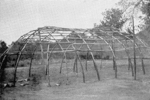
b. An Iowa structure
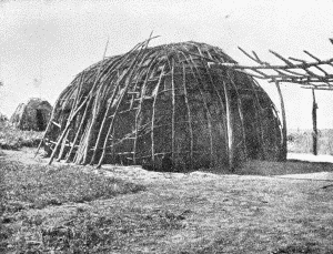
BUREAU OF AMERICAN ETHNOLOGY BULLETIN 77 PLATE 33
"OTO ENCAMPMENT, NEAR THE PLATTE, 1819" Samuel Seymour
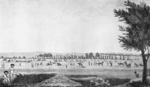
On the plan of the ancient settlement which stood many generations ago are several interesting features in addition to the outline of the oval habitation. North of the space once occupied by the dwelling are many comparatively large caches, with fireplaces between. On the opposite side of the structure were encountered 30 burials, representing children and adults. It would be of the greatest interest at the present time to discover the exact location of one of the Osage villages of a century ago, and to determine the position of the caches and burials, if any exist, in relation to the sites of the habitations.
About the time of Schoolcraft's journey through the Ozarks another traveler went up the valley of the Arkansas, and when far west of the Mississippi came in contact with the Osage. Nuttall, on July 15, 1819, wrote: "The first village of the Osages lies about 60 miles from the mouth of the Verdigris, and is said to contain 7 or 800 men and their families. About 60 miles further, on the Osage River, is situated the village of the chief called White Hair. The whole of the Osages are now, by governor Clark, enumerated at about 8000 souls. At this time nearly the whole town, men, and women, were engaged in their summer hunt, collecting bison tallow and meat. The principal chief is called by the French Clarmont, although his proper name is the Iron bird, a species of Eagle." (Nuttall, (1), p. 173.) Under date of August 5, 1819, he referred to the women of the tribe, saying: "It is to their industry and ingenuity, that the men owe every manufactured article of their dress, as well as every utensil in their huts. The Osage women appear to excel in these employments. Before the Cherokees burnt down their town on the Verdigris, their houses were chiefly covered with hand-wove matts of bulrushes. Their baskets and bed matts of this material were parti-coloured and very handsome. This manufacture, I am told, is done with the assistance of three sticks, arranged in some way so as to answer the purpose of a loom, and the strands are inlaid diagonally. They, as well as the Cherokees and others, frequently take the pains to unravel old blankets and cloths, and reweave the yarn into belts and garters." (Op. cit., pp. 192-193.)
Evidently it was not the custom of the Osage to entirely abandon their villages when they went on their periodical hunts. Some remained, either through choice or necessity. In the above quotation Nuttall spoke of "nearly the whole town" being absent on their summer hunt, and one very familiar with the habits of the tribe said: "The Osages and Kansas live in villages, which, even during the hunting seasons, are never wholly abandoned, as in the case with several tribes settled on the Missouri." (Hunter, (1), p. 334.) Regarding the general appearance of the villages: "Their lodges are built promiscuously, in situations to please their respective proprietors: they are arranged to neither streets nor alleys, and are sometimes so crowded, as to render the passage between them difficult."
That some of the Osage constructed very long structures is told by Morse, but if the dimensions given in his account are accurate they refer to the unusual rather than to the usual form of habitation erected by members of that tribe. He said: "The Osages of the Arkansaw occupy several villages. The principal village contains about three hundred lodges or huts, and about three thousand souls. The lodges are generally from fifty to a hundred feet in length; and irregularly arranged, they cover a surface of about half a mile square. They are constructed of posts, matting, bark and skins. They have neither floors nor chimneys. The fire is built on the ground, in the centre of the lodge, and the family, and the guests, sit around in a circle, upon skins or mats." (Morse, (1), p. 219.) These various statements appear grossly exaggerated, and on page 225 of the same work appears the statement that "Their villages are nothing more than what they can remove on the shortest notice, one horse being capable of carrying house, household furniture, and children all at one load." Morse included in his notes on the Osage several letters written by missionaries then working among the tribe. One communication from Dr. Palmer, dated at Union, March 18, 1820, contained a note on their habitations: "Their houses are made of poles, arched from fifteen to twenty feet, covered by matting made of flags. At the sides they set up rived planks, lining the inside with neatly made flagg matting. They build several fires in the lodge, according to its size, or the number of wives the owner has. For a fire-place, they dig a hole about as big as a bushel-basket, leaving the smoke to ascend through a hole in the roof. Around the fire they spread their mats to sit or eat." And when visiting the settlement, "Having entered the lodge, and had our horses turned out, we took a humble seat around the fire. Presently there was brought to us a wooden bowl, filled with food made of corn. In a short time we were invited to eat at another lodge, and before we had finished, at another, and another." And another letter, from W. C. Requa, dated February 3, 1822, told of the native dwellings. He wrote at that time: "I live at present among the Osages, at one of their villages about fifty miles from Union. This unhappy people live in low huts, covered with long grass or flag, but so badly put together that they leak considerably in a storm of rain. They have very little furniture, merely a few pots or kettles in which they boil their provisions. The art of cooking their meat in any other way than boiling is unknown among them, except roasting it on a stick before the fire. They have very little variety in their food. Wild game, corn, dried pumpkins, and beans constitute about all on which they subsist. With this, however, they are contented. They have wooden bowls, out of which they eat, drink, wash themselves." (Op. cit., pp. 227-233.) Union, where the two communications were written, was probably Union Agency, which stood on the right bank of the Arkansas River, just southwest of Fort Gibson, in the present Muskogee County, Oklahoma. The settlement "about fifty miles from Union" may have been on the Verdigris, near the center of the present Rogers County, Oklahoma.