Front matter (continued 5)
Reading edition
So fully has the experience of the past quarter century confirmed the wisdom of setting apart this region for public uses, that it ought no longer to be necessary to say a word in favor of its continued preservation. To most people it will seem impossible that there should be any one who would seek the mutilation or destruction of this important reservation. Unfortunately there are many such. No session of Congress for twenty years has been free from attempted legislation hostile to the Park. The schemes to convert it into an instrument of private greed have been many, and strange as it may seem, they are invariably put forward by those very communities to whom the Park is, and must ever remain, the chief glory of their section. It is a lamentable proof of the dearth of patriotic spirit that always betrays itself whenever the interests of individuals and of the public come into collision. Nevertheless it is a great satisfaction to know that this spirit of hostility is confined to an infinitesimal portion of the whole people. Excepting a few mine owners and their following, a handful of poachers, one or two railroad corporations, and a few greedy applicants for special franchises, the people of the country are a unit in favor of the strictest preservation of this great national pleasure ground. No better proof of this can be had than the fact that the Park has successfully withstood for so long a period every attack that has been made upon it.
It will not do, however, to assume that, because these schemes have hitherto failed, they will always continue to fail. Since they have their origin in speculative ventures, they will be put forward so long as they offer the least pecuniary inducement. The certainty of this, and the danger of their ultimate success, justify the assignment of a brief space to a consideration of this subject.
CHAPTER II.
RAILROAD ENCROACHMENT AND CHANGE OF BOUNDARY.
Nearly all of the enterprises that have been put forward in opposition to the true interests of the Reservation partake of the nature of railroad encroachment. Without entering into the merits of particular projects, it will be sufficient to explain in general terms the reasons why the government has always opposed them.
Railroads in the Yellowstone Park are objectionable because:
(1.) They will mar, and in places destroy, that natural condition which is one of its greatest charms. From the first it has been the wish of those who know any thing of the Yellowstone that it should remain as nature made it. The instructions of the Interior Department to the first Superintendent of the Park, two months after the Act of Dedication became a law, thus announced the policy of the government upon this subject:
“It is not the desire of the Department that any attempts shall be made to beautify or adorn this reservation, but merely to preserve from injury or spoliation the timber, mineral deposits, and various curiosities of that region, so far as possible, in their natural condition.”
It requires no argument to show that nothing would so interfere with this natural condition as the construction of a railroad through that country; and the danger involved in these projects early became apparent to all who were well acquainted with the situation. As early as 1883, Lieutenant Kingman thus refers to this subject in his annual report, wherein he describes his proposed road system for the Park:
"The plan for improvement which I have submitted is given in the earnest hope and upon the supposition that it [the Park] will be preserved as nearly as may be as the hand of nature left it—a source of pleasure to all who visit it, and a source of wealth to no one. If the Park ever becomes truly popular and national, it will be when the people come to know and appreciate its delightful summer climate, the wonderful efficiency of its baths and its mineral waters, as well as the natural wonders, beauties and curiosities to be seen there. Then, if there are numerous small, quiet hotels scattered here and there throughout the Park, where visitors can have plain and simple accommodations at moderate prices, the overworked and the sick, as well as the curious, will come here, not to be awed by the great falls and astounded by the geysers, and then to go away, but will come here and will remain for weeks and months, and will find what they seek, rest, recreation and health. But if it ever becomes the resort of fashion, if its forests are stripped to rear mammoth hotels, if the race-course, the drinking saloon and gambling-table invade it, if its valleys are scarred by railroads, and its hills pierced by tunnels, if its purity and quiet are destroyed and broken by the noise and smoke of the locomotive; … then it will cease to belong to the whole people, and will interest only those that it helps to enrich, and will be unworthy the care and protection of the National Government."
The history of the twelve years since the above was written confirms in every point this forcible presentation of the case.
(2.) Railroads will unavoidably seriously cripple the present tourist routes. They must of necessity occupy the valleys. But it is through these that the tourist route passes, and it is frequently the case that they are not wide enough for both. In many cases the roadway would be forced back upon the hills, and in others its present location would have to be changed. It is certain that the admirable system of roads, which the government is slowly working out, would receive irreparable injury at the hands of any railroad which might be built through that region.
(3.) Railroads would mean the inevitable destruction of the large game. The winter snows are too deep among the hills for game to subsist there. It is necessary to come down into the valleys, where there is more grass and less snow. But, as already stated, it is through these valleys that railroads must pass if at all. The trains would frighten the animals back into the hills, where starvation would await them. Moreover, the loss of game from poaching would be greatly aggravated by the increased facility of clandestine access to that region.
(4.) Railroads would destroy the Park forests. During July, August, and September, there are always long periods of dry weather when the dense bodies of fallen timber, the impenetrable tangles of underbrush, and the luxuriant prairie grass are a mass of inflammable tinder. A spark converts it into a conflagration. A railroad winding its way through this country would render protection against fires, even now a matter of great difficulty, wholly out of the question. Referring to this subject in his annual report for 1894, the Superintendent of the Park says:
“Six months from the entrance of the first locomotive within the limits of the Park, there will not be one acre of its magnificent forests left unburned.”
What such a catastrophe would mean to the future development of the surrounding country may be appreciated by a perusal of our chapter on the Flora of the Yellowstone.
(5.) As a matter of public policy, the granting of a railway franchise in the Park is objectionable because it necessarily creates a perpetual monopoly of a public privilege. There is no practicable way to avoid it. It has been proposed to compel the railroad to share the advantage of this monopoly with the public, by paying a certain percentage of earnings on its Park business to constitute an improvement fund. With Union Pacific history fresh in the public mind, the government will not be likely to enter into a partnership of that precarious nature.
From the foregoing exposition, it is clear that only the most cogent reasons should ever sanction the construction of railroads in the Yellowstone Park. These reasons, from the standpoint of the railroad companies, as set forth by the promoters of a recent bill before Congress, fall under two heads.
In the first place, it is speciously urged that a railroad would render the Park more accessible, cheapen the cost of visiting it, and make it fulfill more perfectly its original design as a park for the people. To all this it may be replied that the people do not want the improvement at the price they must pay for it. By an almost unanimous voice they oppose it. It is true that the Park is not as accessible as one might wish it to be, or as it soon will be. But to make it easily accessible, it is by no means necessary that a railroad should pass through it. A line touching the southern boundary and communicating with the central portions of the country would answer every practical purpose. The pretext that a railroad across the Reservation will greatly aid the tourist is erroneous. The points of interest are so scattered about that a coach would be in any case a necessity, and all the railroad would really save to the tourist would be the distance from the boundary to the belt line.
Neither will such a railroad materially lessen the cost of a visit, which has always been, and will always be, in the main, getting to that region. The Reservation is 1,500 miles from the center of population of the country, and it is this remote location that makes visiting it cost. The outlay after getting there is trifling in comparison with that of coming and going. Whether a railroad pass though the Park, or simply touch its southern border, will not appreciably affect this principal item.
In the second place, it is urged that the Park stands directly in the path of the railroads and so “acts as a blockade to the development of three large states.” As this will always form the staple argument for granting a right-of-way for railroads across the Reservation, it will be well to scrutinize it somewhat carefully.
It is not at all a question of whether the country about the Park is at present sufficiently supplied with railroads. The important question is: Will any portion of this territory be better served by a railroad that may be built across the Reservation than by one coming from another direction? The most superficial examination of the map, even by one not personally acquainted with the country, will answer this question in the negative. The Yellowstone Valley on the north, the Bighorn Valley on the east, the Jackson Lake country on the south, and the Madison and Henry Fork Valleys on the west, find their natural outlets by routes not passing through the Yellowstone Park. A railroad entering the Park on one side through a lofty wall of mountains, and leaving it on the other through a similar wall, after traversing the inclosed plateau for a distance of perhaps seventy-five or one hundred miles, would be almost as much lost to the country outside as if for this whole distance it were built through a tunnel. In fact, the true welfare both of the Park and of the surrounding country would be best served by a line passing through the Wind River Valley, across one of the easy passes into the Valley of the Snake, and thence along the southern border of the Park, past Jackson Lake and the northern spur of the Teton Range, into the valleys of Idaho and Montana. This would give the Park a needed southern approach, and would directly serve a vast tract of territory. Tributary either to this line, or to one north of the Park, or to both, another would soon be built along the extensive Valley of the Bighorn. No imaginable route across the National Park could so well subserve both local and public interests.
From an engineering point of view, the Yellowstone Park is poor railroad country. It could be crossed, to be sure, but not easily, and not at all except by monopolizing portions of the tourist route. The long winter season of nearly seven months would interpose an almost insuperable obstacle to the successful operation of any line which might be built. We quote again from the report of the Park Superintendent for the year 1894:
“The great amount of moisture furnished by the lake and its numerous tributaries gives a mantle of snow that will average fifteen feet in depth, and with the strong winds prevailing in this mountainous country no railroad could be kept running during the six months of winter without being entirely inclosed in snow sheds, which would prove destructive to the natural beauty of the Park.”
In short, it is certain that, were it not for the special inducements which a monopoly of Park travel offers, no railroad could afford to locate its line across that territory.
Closely related to this general subject is that of building an electric line for tourist transportation within the Park. It is at once apparent that the objections to such a railroad are much less formidable than to one operated by steam locomotives. The danger of fire is eliminated. The unsightly character of an ordinary railway outfit is exchanged for attractive tourist cars. The power plant, being located in cañons and operated by water, would give no outward evidence of its existence. There being no long trains of cars, no smoke, no screeching of locomotives, the game would not be much more frightened by it than by the stage coaches. In winter, traffic would be suspended and the game would be undisturbed on the ranges. The line, by its greater speed, would be a convenience to tourists having but a short time at their disposal, and also to those, infirm in health, who find the long stage rides fatiguing.
Such are the merits of an electric railway for tourist transportation in this country. If the people really desired it, and if it could be built and operated by the government, so as to exclude as far as possible all corporate management of Park business, there would be no serious objection to the project. Of course it should never be permitted, as some times proposed, to use the present wagon roads. These must not in any event be interfered with.
The question then is, Do the people desire this kind of transportation? Fortunately we can answer this question with authority. In 1892, a vote upon it was obtained from the tourists of that season. The result was a majority of more than five to one against it. In giving their votes, tourists frequently went beyond the specific question at issue to express their emphatic disapproval of the construction of any kind of railroad in the Park. The whole result was a gratifying proof of the deep-seated interest of the people in this Reservation, and of their unalterable wish that it remain forever free from the handiwork of man. In fact, to almost every body in these days, a coaching tour like that through the Yellowstone, is a decided novelty. There is no other place in this country, probably not in the world, where one approaching it can be had. The people enjoy it. They would prefer to see it developed and perfected, rather than replaced by the noisy car, to get away from which they have come so far.
In the long and fruitless struggle to secure rights-of-way for railroads, the promoters of these projects have resorted to various indirect methods the most noteworthy of which is a proposal to change the boundary line of the Park. We have elsewhere explained how this boundary was originally determined. For a random line, which of necessity it largely was, it was a most excellent one. No one would have been dissatisfied with it were it not that it was subsequently found to stand in the way of certain private enterprises.
When it became apparent that the government would never consent to the construction of a railroad within the Park, it was sought to compass the same end by cutting off all that portion of the Reservation lying outside of, and including, the proposed right-of-way.
In accordance with the proverbial policy of indirection which characterizes schemes of this sort, the real purpose of this proposition is always veiled under a beneficent guise, intended to make its promoters appear as zealous guardians of the Park, rather than what they really are—conspirators for its destruction. The proposed change of boundary is ostensibly based upon the alleged necessity of having a natural boundary—that is, a boundary along the courses of streams. The present line, it is urged, is unmarked and no one knows where it is. A stream is a definite, visible line, seen and known by every one. [BV]
The pernicious fallacy that lurks in this argument is plainly visible if we look a little beneath the surface. Never permit the boundaries of the Yellowstone Park to be brought down into the valleys. Nature has indeed built the proper boundaries; but they are mountain ranges, not valleys. A thousand Chinese walls heaped together would not form a barrier like the Absarokas on the east, the Snowy Range on the north, the Gallatin Range on the west, and the Tetons and the Big Game Ridge on the south. Along the present boundary line there are very few places where it is possible to build human habitations. No poacher or law breaker can there fix his stealthy abode ready at a favorable opportunity to dash across it. But if it were in the bottom of the valleys, a whole colony of these dangerous individuals would soon infest every border of the Park. Police surveillance, in any case extremely difficult, would then be well-nigh impossible. No! Whatever changes may be made in the boundary of the Park, let it always be kept among the mountain tops.
What the success of any of these projects to cut off, or segregate, portions of the Park would mean, may be judged from a single instance—that, namely, of the north-east corner of the Park. In this strip of territory are some of the finest scenery and most interesting scientific curiosities to be found upon the Reservation. It is the great winter grazing ground for the elk, and by estimate based upon actual count no fewer than 20,000 of these noble animals find their winter subsistence here. That all of this game would be almost instantly annihilated by the segregation of this strip goes without saying. More than this, the admission to the very heart of the Park of that class of reckless characters, who even now are its greatest source of danger, would vastly enhance the difficulty of protecting the remaining portions.
It is well to emphasize by repetition the few important facts pertaining to this question:
(1.) There are no private interests on the borders of the Park whose development is jeopardized by the refusal of the government to give access to them by a railroad across the Reservation. They can all be reached from the outside without encountering greater obstacles than have been overcome in scores of other places throughout the West.
(2.) There is no need of a railroad in the Park so far as the comfort or advantage of the tourists is concerned. A line along the southern border would answer quite as well, and would serve the surrounding country better.
(3.) There is no occasion to construct an electric line in the Park. Nearly all of those who visit that region oppose it.
(4.) There is no necessity for changing the present boundaries of the Reservation.
CHAPTER III.
CONCLUSION.
It is in respect of the foregoing matters that the Yellowstone National Park has most to fear. The general public, although always in favor of its preservation, knows nothing of the merit of these various projects. A bill is introduced in Congress in the interest of some private enterprise. It is supported by representations and statistics gotten up for the occasion. There may be no one at hand to refute them, and they are the only information upon which Congress can act. More than once these bills have been reported favorably from committee, when every essential statement in the committee’s report was contrary to fact. Unless some friend of the Park is present, ready and willing to devote time, and perhaps money, to its defense, there is only too much danger that these measures will eventually prove successful.
Thus far, the Park has never been lacking in such friends; and there is no more encouraging fact in its history than this, that some one has always been on guard against any thing which might work to its injury. Men like Senator Vest in official position, or William Hallett Phillips in private life, and journals like Forest and Stream, have stood for years, in a purely public-spirited manner, without remunerative inducement of any sort, and often in face of the bitterest vituperation and abuse, against the designs of selfish and unscrupulous schemers. In like manner, government officials connected with the Park have always, with one or two exceptions, earnestly opposed these dangerous projects. It is plain to any one who is familiar with its inside history, that, but for the agencies just mentioned, there would not be to-day any Yellowstone Park at all. It is equally plain, that so long as friends like these are forthcoming, the Park has little to fear from its enemies.
In still another respect, the Park has been unfortunate where it had a right to expect better things. Prior to the admission of Montana, Wyoming, and Idaho into the Union of States, its interests were looked after in Congress, particularly in the Senate, by a few members who took great pride in promoting its welfare. But when the above territories were admitted to the Union, these gentlemen very naturally turned over the charge, which they had voluntarily assumed, to the members from the new States, as being thereafter its proper guardians. It was, of course, believed that in them, if in any one, the Park would find needed championship and protection. It is a matter of great regret that these very reasonable expectations have not been realized. A glance at the list of bills pertaining to the Yellowstone National Park, which have been presented to Congress in the past six years, will show that nearly every objectionable measure has been fathered by the very men whose first duty would seem to have been to oppose them. In a speech opposing the Segregation Project, delivered in the Senate in the winter of 1892-3, Senator Vest referred to this subject with justifiable indignation. He said:
"When those States [Montana, Wyoming, and Idaho] were territories, and not represented in the Senate, I considered it the duty of every Senator, as this Park belonged to all the people of the United States, … to defend its integrity, and to keep it for the purposes for which it was originally designed. Since Senators have come from those States, who, of course, must be supposed to know more about that Park than those of us who live at a distance, and since they have manifested a disposition to mutilate it, I must confess that my interest in it has rather flagged, and I feel very much disposed, in plain language, to wash my hands of the whole business. If the constituencies, who are more benefited than any others can possibly be in the Park, are willing to see it cut off, the best disposition of the matter would be to turn it open to the public, let the full greed and avarice of the country have their scope, let the geysers be divided out and taken for the purpose of washing clothes, … let the water of that splendid water-fall in the Yellowstone River be used to turn machinery, let the timber be cut off; in other words, destroy the Park, and make it a sacrifice to the greed of this advanced age in which we live."
It is only fair to say that generally these members do not personally favor the measures to which they lend official countenance and comfort. One can find a practical, if not a morally justifiable, excuse for their course in the exigencies of political life which too often constrain men to official action not in accordance with their private judgment. Unquestionably, a majority of the people of these young and enterprising states are immovably opposed to any thing which may tend to mutilate or destroy this important reservation; and it is not believed that their broader patriotism will ever be overridden by the narrow and perverted wishes of a few straggling constituencies. [BW]
Finally, the effect of a single evil precedent upon the future of the Park must be kept constantly in mind. The door once opened, though by never so small a degree, can not again be closed; but will sooner or later be thrown wide open. A privilege granted to one can not be denied to another. If one corner of the Park is cut off, other portions will share the same fate. If one railroad is granted a right of way across the reservation, another can not be refused. The only way to avoid these dangers is to keep the door entirely closed.
There is now but little real need of further positive legislation. Some provision should of course be made for an adequate police force, and ample means should be provided to perfect the system of roads. Happily this duty involves no appreciable burden. It requires no continuing outlay to “beautify and adorn.” And when it is done, the further policy of the government toward the Park should be strictly negative, designed solely to preserve it unimpaired, as its founders intended, for the “benefit and enjoyment” of succeeding generations.
APPENDIX A.
GEOGRAPHICAL NAMES IN THE YELLOWSTONE NATIONAL PARK.
I.
INTRODUCTORY.
In common experience, the importance of geographical names lies in their use as a means of identification. To describe an object there must be a name, and for this purpose one name is as good as another. But if the reason be sought why a particular name happened to be selected, it will generally be found to arise, not from this practical necessity, but from some primary fact or tradition, or from some distinguished character, in the annals of the community where it occurs. In its mountains and valleys, its lakes and streams, and in its civil divisions, the cradle history of a country may always be found recorded.
In newly-discovered countries, the naming of geographical features is the dearest prerogative of the explorer, as it is also the one most liable to abuse from personal vanity or egotism. The desire to attach his name, or those of his personal friends, to the prominent landmarks of the globe, where the eye of posterity may never escape them, is a weakness from which no discoverer has yet shown himself free.
In a region like the Yellowstone National Park, destined for all time to be a resort for the lovers of science and pleasure, this temptation was quite irresistible; so much so, that, when the expeditions of 1870 and 1871 left the field, they left little worth naming behind them. And yet the honor thus gained has not, we venture to say, been all that its votaries desired. Small is the number of tourists who stop to inquire for whom Mary Lake, DeLacy Creek, or Stevenson Island was named. Fewer still are aware that Mt. Everts was not christened in honor of a distinguished American statesman of similar name, but in commemoration of one of the most thrilling individual experiences in American history. So with all these personal names. The lively satisfaction with which they were given finds no counterpart in the languid indifference with which the modern visitor mechanically repeats them.
In as much as it fell to the lot of the United States Geological Survey to originate a great many of the names in our western geography, it is interesting to know from official sources the principles which governed in this important work. Writing upon this point, Dr. Hayden says: [BX]
“In attaching names to the many mountain peaks, new streams, and other geographical localities, the discovery of which falls to the pleasant lot of the explorer in the untrodden wilds of the West, I have followed the rigid law of priority, and given the one by which they have been generally known among the people of the country, whether whites or Indians; but if, as is often the case, no suitable descriptive name can be secured from the surroundings, a personal one may then be attached, and the names of eminent men who have identified themselves with the great cause, either in the fields of science or legislation, naturally rise first in the mind.”
In the more recent and thorough survey of the Park by the United States Geological Survey, it became necessary to provide names for those subordinate features which, in a less restricted field, the early explorers had thought unworthy of notice. Professor Arnold Hague, upon whom this work has principally fallen, thus states the rule which he has followed: [BY]
“In consultation with Mr. Henry Gannett, geologist in charge of geography, it was agreed that the necessary new names to designate the unnamed mountains, valleys, and streams should be mainly selected from the beasts, birds, fishes, trees, flowers, and minerals found within the Park or the adjacent country.”
The christening of the hot springs and geysers of the Park has been singularly fortunate. The names are in all cases characteristic. They are not studied efforts, but are simply the spontaneous utterances from first impressions by those who had never seen, and had heard but little of, similar phenomena. It is doubtful if the most careful study could improve them, and tourists will agree with General Poe who referred as follows to this subject when he visited the Park in 1877: [BZ]
“The region of these geysers has been rightly named Fire Hole, and one almost wonders that in this country, where the tendency is to name natural objects after men who have a temporary prominence, this interesting place and its assemblage of wonders should have so completely escaped, and in general and in particular received names so very appropriate.”
In the race for the geographical honors of the Park, the prize fell neither to the United States Geological Survey nor even to Colonel Norris, though each was a close competitor. It was won by that mythical potentate of whose sulphurous empire this region is thought by some to be simply an outlying province. Starting with “Colter’s Hell,” the list grew until it contained “Hell Roaring Creek,” "Hell Broth Springs," “Hell’s Half Acre,” “Satan’s Arbor,” and the Devil’s “Den,” “Workshop,” “Kitchen,” “Stairway,” “Slide,” “Caldron,” “Punch Bowl,” “Frying Pan,” “Well,” “Elbow,” “Thumb,” “Inkstand,” etc., etc. It is some satisfaction to know that this rude and fiery nomenclature is gradually falling into disuse.
In a measure from sympathy with the purpose of the early name-givers, and to help those who take an interest in such matters to know when, by whom, and why the geographical names of the Park were given, a complete list of these names, with a few from adjacent territory, has been prepared. The letters and numbers immediately after the names (except those in parentheses) give marginal references on the map to facilitate identification. The date of christening and the name of the christening party next follow. When these can not now be determined with precision, the work is credited to the authors of the map upon which they first appear. Next comes whatever account is discoverable of the origin of the names, authority being quoted, as far as possible, from the writings of whoever bestowed them. Wherever an object was named from some natural characteristic, as its form, color, composition, or other peculiarity, or from the birds, beasts, fishes, insects, trees, flowers, shrubs or minerals of the Park, the single word “characteristic” denotes the fact. The abbreviation “U. S. G. S.” is for “United States Geological Survey.”
APPENDIX A.
II.
MOUNTAIN RANGES, PEAKS, BUTTES, RIDGES, HILLS.
[The numbers in parentheses denote elevations. These are taken from the latest map by the United States Geological Survey, and are the same as that of the one hundred foot contour nearest the summit. The true elevation of the ultimate peak is in each case slightly greater, lying somewhere between the figure given and an altitude one hundred feet higher.]
Abiathar Peak (10,800)—C: 14—1885—U. S. G. S.—For Charles Abiathar White, Paleontologist, U. S. Geological Survey.
Absaroka Range, A-X: 12-16—1885—U. S. G. S.—This range of mountains has had an unfortunate christening history. It was first known as the Yellowstone Range, from its close relation to the Yellowstone River, of which it is the source. The original name dates from as far back as 1863, and was adopted by the first explorers of the Park country. It was officially recognized in 1871, by both the Corps of Engineers and the United States Geological Survey. When the Park was created this range became its real eastern boundary, and many of its peaks were named for those who had borne prominent parts in its history. The name had thus an added claim to perpetuity. It passed into general use, and appears in all the writings of the United States Geological Survey down to 1883.
In 1873, Captain W. A. Jones, of the Corps of Engineers, led an expedition through these mountains—the first that ever crossed them. He gave them a new name, “Sierra Shoshone.” Except for the fact that he was violating the rule of priority, his action in giving this name, as well as his judgment in its selection, were of unquestionable propriety. It was a tribe of the Shoshonean family who alone dwelt in the Park, or among these mountains, and it was entirely fitting to commemorate this fact in a distinct and permanent manner. The name passed rapidly into public use, and by 1880 had practically supplanted the original name.
For reasons that can hardly be made to appear satisfactory, the United States Geological Survey, in 1883, or soon after, rejected both these names and adopted in their place Absaroka, “the Indian name of the Crow nation” (Hague). Of course this action can have no pretense of justification from the standpoint of the “rigid law of priority.” There are very few instances in American geography of a similar disregard for the rights of previous explorers. Unfortunately, not even the argument of appropriateness can be urged in its defense. These mountains, except that portion north of the Park, were never properly Crow territory, and the name is thus distinctly an importation. Its future use is now unhappily assured, on account of its formal adoption (for reasons wholly inadequate, it is true,) by the United States Board on Geographical Names. Against the influence of the government, with its extensive series of publications, even though committed to the perpetuation of an error, it is idle to contend; but it is greatly to be deplored that a feature of the Park scenery of such commanding prominence should not bear a name at least remotely suggestive of some natural or historical association.
Amethyst Mountain (9,423)—F: 11—1872—U. S. G. S.—Characteristic.
Antler Peak (10,200)—E: 4—1885—U. S. G. S.—Characteristic.
Atkins Peak (10,900)—N: 14—1885—U. S. G. S.—For John D. C. Atkins, Indian Commissioner, 1885-1888.
Avalanche Peak (10,500)—L: 13—1885—U. S. G. S.—Characteristic.
Bannock Peak (10,400)—D: 4—1885—U. S. G. S.—From the name of a tribe of Indians who inhabited the country to the south-west of the Park, and were finally settled on a reservation in southern Idaho. What is known as the Great Bannock Trail, passed along the valley of Indian Creek, some distance south of this mountain. The spelling here given is that which custom seems finally to have settled upon; but Bannack would more nearly express the original pronunciation. The various spellings, some sixteen in number, come from the original Panai’hti, or Bannai’hti, meaning southern people.
Barlow Peak (9,500)—Q: 10—1895—U. S. G. S.—For Captain (now Colonel) J. W. Barlow, Corps of Engineers, U. S. A., leader of the military expedition which entered the Park region in 1871. His name was first applied to the upper course of the Snake River, but was recently transferred to a neighboring mountain peak.
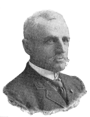
COLONEL J. W. BARLOW.
Baronett Peak (10,300)—C: 13—1878—U. S. G. S.—For C. J. Baronett, “Yellowstone Jack,” a famous scout and guide, closely connected with the history of the National Park, and builder of the first bridge across the Yellowstone River.
Baronett’s career was adventurous beyond the average man of his class. He was born in Glencoe, Scotland, in 1829. His father was in the British naval service, and he early began to follow the sea. In his multitudinous wanderings we find him on the coast of Mexico during the Mexican War; on the Chinese coast in 1850, where he deserted his ship and fled to San Francisco; in 1852, in Australia after gold; the next year in Africa, still on a gold hunt; then in Australia again and in San Francisco; next in the Arctic seas as second mate on a whaling vessel; back in California in 1855; courier for Albert Sidney Johnston in the Mormon War; later in Colorado and California searching for gold; scout in the Confederate service until 1863; then in Mexico with the French under Maximilian, who made him a captain; back in California in 1864, and in Montana in September of the same year, where he at once set out on a prospecting trip which took him entirely through the region of the Yellowstone Park; later in the service of Gen. Custer as scout in the Indian territory; then in Mexico and finally back in Montana in 1870; finder of the lost Everts; builder of his celebrated bridge in 1871; in the Black Hills in 1875, where he slew a local editor who had unjustly reflected upon him in his paper; scout in the Sioux, Nez Percé, and Bannock Wars, 1876-8; Indian trader for many years; engaged in innumerable prospecting ventures; and still, at the age of sixty-six, searching with his old time ardor for the elusive yellow metal.
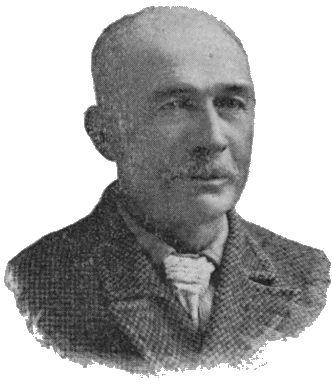
C. J. BARONETT.
Big Game Ridge—Q-T: 9-11—1895—U. S. G. S.—Characteristic.
Birch Mils (7,300)—R: 4—1885—U. S. G. S.—Characteristic.
Bison Peak (8,800)—D: 12—1878—U. S. G. S.—Characteristic.
Bobcat Ridge (9,500)—T: 9—1895—U. S. G. S.—Characteristic.
Bunsen Peak (9,100)—D: 6—1872—U. S. G. S.—For the eminent chemist and physicist, Robert Wilhelm Bunsen; inventor of the Bunsen electric cell and of the Bunsen Gas Burner; co-discoverer with Kirchoff of the principle of Spectrum Analysis; and the first thorough investigator of the phenomena of geyser action. (See Chapter III, Part II.)
Cathedral Peak (10,600)—J: 13—1885—U. S. G. S.—Characteristic.
Chittenden, Mt. (10,100)—K: 12—1878—U. S. G. S.—“Of the prominent peaks of this [the Absaroka] range may be mentioned Mount Chittenden, named for Mr. George B. Chittenden, whose name has long been identified with this survey.”—Gannett.[CA]
Cinnabar Mountain (7,000)—A: 5—Named prior to 1870.—“So named from the color of its rocks, which have been mistaken for Cinnabar, although the red color is due to iron.”—Hayden. The Devil’s Slide (also named before 1870) is on this mountain.
Colter Peak (10,500)—O: 13—1885—U. S. G. S.—For John Colter. (See Part I, Chapter III.)
Crags, The (9,000)—E: 3—1885—U. S. G. S.—Characteristic.
Crescent Hill (7,900)—D: 9—1885—U. S. G. S.—Characteristic.
Crow Foot Ridge (9,700)—D-E: 3—1885—U. S. G. S.—Characteristic.
Doane, Mt. (10,500)—M: 13—1870—Washburn Party—For Lieutenant Gustavus C. Doane, 2d Cavalry, U. S. Army, commander of the military escort to the celebrated Wasburn Expedition of 1870.
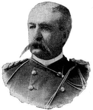
CAPTAIN GUSTAVUS C. DOANE.
Lieutenant Doane was born in Illinois, May 29, 1840, and died in Bozeman, Mont., May 5, 1892. At the age of five he went with his parents, in wake of an ox team, to Oregon. In 1849 his family went to California at the outbreak of the gold excitement. He remained there ten years, in the meanwhile working his way through school. In 1862 he entered the Union service, went east with the California Hundred, and then joined a Massachusetts cavalry regiment. He was mustered out in 1865 as a First Lieutenant. He joined the Carpet-baggers and is said to have become mayor of Yazoo City, Mississippi. He was appointed a Second Lieutenant in the Regular Army in 1868, and continued in the service until his death, attaining the rank of Captain.
Doane’s whole career was actuated by a love of adventure. He had at various times planned a voyage to the Polar regions, or an expedition of discovery into Africa. But fate assigned him a middle ground, and he became prominently connected with the discovery of the Upper Yellowstone country. His part in the Expedition of 1870 is second to none. He made the first official report upon the wonders of the Yellowstone, and his fine descriptions have never been surpassed by any subsequent writer. Although suffering intense physical torture during the greater portion of the trip, it did not extinguish in him the truly poetic ardor with which those strange phenomena seem to have inspired him. Dr. Hayden says of this report: "I venture to state, as my opinion, that for graphic description and thrilling interest it has not been surpassed by any official report made to our government since the times of Lewis and Clark." [CB]
Lieutenant Doane and Mr. Langford were the first white men known to have ascended any of the higher peaks of the Absaroka Range. From the summit of the mountain so ascended, Mr. Langford made the first known authentic sketch of Yellowstone Lake. This sketch was used soon after by General Washburn in compiling an official map of that section of country, and he was so much pleased with it that he named the mountain from which it was taken, Mt. Langford. At Mr. Langford’s request, he named a neighboring peak, Mt. Doane.
Dome, The (9,900)—E: 4—1885—U. S. G. S.—Characteristic.
Druid Peak (9,600)—D: 12—1885—U. S. G. S.—Characteristic.
Dunraven Peak (9,700)—F: 9—1878—U. S. G. S.—“This I have named Dunraven Peak in honor of the Earl of Dunraven, whose travels and writings have done so much toward making this region known to our cousins across the water.”—Gannett. [CC]
Dunraven visited the Park in 1874. In 1876, he published his “Great Divide,” describing his travels in the West. The irrepressible Colonel Norris named this peak after himself, and coupled it with Mt. Washburn in a characteristic poem. But the United States Geological Survey decided otherwise, and transferred the colonel’s name to the north-east corner of the Park. (See "Mt. Norris.")
Eagle Peak (10,800)—O: 14—1885—U. S. G. S.—Characteristic.
Echo Peak (9,600)—E: 4—1885—U. S. G. S.—Characteristic.
Electric Peak (11,155)—B: 4-5—1872—U. S. G. S.—From the following circumstance, described by Mr. Henry Gannett, who ascended the mountain with surveying instruments, July 26, 1872: [CD]
“A thunder-shower was approaching as we neared the summit of the mountain. I was above the others of the party, and, when about fifty feet below the summit, the electric current began to pass through my body. At first I felt nothing, but heard a crackling noise, similar to a rapid discharge of sparks from a friction machine. Immediately after, I began to feel a tingling or pricking sensation in my head and the ends of my fingers, which, as well as the noise, increased rapidly, until, when I reached the top, the noise, which had not changed its character, was deafening, and my hair stood completely on end, while the tingling, pricking sensation was absolutely painful. Taking off my hat partially relieved it. I started down again, and met the others twenty-five or thirty feet below the summit. They were affected similarly, but in a less degree. One of them attempted to go to the top, but had proceeded but a few feet when he received quite a severe shock, which felled him as if he had stumbled. We then returned down the mountain about three hundred feet, and to this point we still heard and felt the electricity.”
Elephant Back (8,600)—J: 9—1871—U. S. G. S.—Characteristic. “On account of the almost vertical sides of this mountain, and the rounded form of the summit, it has received the name of the Elephant’s Back.”—Hayden. [CE]
This name, as now applied, refers to a different feature from that originally designated by it. Many years before the Park was discovered, it was used to denote the long ridge of which Mt. Washburn is the commanding summit, and which was distinctly visible from beyond the present limits of the Park, both north and south. It so appears upon Raynolds' map of 1860, and was so used by the Washburn Expedition (1870), by Captain Barlow (1871), and by Captain Jones (1873). The United States Geological Survey, however, in 1871, transferred the name to an inconspicuous ridge more than a thousand feet lower than the surrounding mountains. Whether the change was made by accident or design does not appear. Captain Ludlow, as late as 1875, refers to it and deplores the fact that it had taken place.
Everts, Mt. (7,900)—C: 7—1870—Washburn Party.—For Hon. Truman C. Everts, member of the Expedition of 1870, whose terrible experience is elsewhere alluded to. The following succinct account is from the pen of Lieutenant Doane, and is in the main correct: [CF]
"On the first day of his absence, he had left his horse standing unfastened, with all his arms and equipments strapped upon his saddle; the animal became frightened, ran away into the woods, and he was left without even a pocket knife as a means of defense. Being very near-sighted, and totally unused to traveling in a wild country without guides, he became completely bewildered. He wandered down to the Snake River Lake [Hart Lake], where he remained twelve days, sleeping near the hot springs to keep from freezing at night, and climbing to the summits each day in the endeavor to trace out his proper course. Here he subsisted on thistle-roots, boiled in the springs, and was kept up a tree the greater part of one night by a California lion. After gathering and cooking a supply of thistle-roots, he managed to strike the south-west point of the [Yellowstone] Lake, and followed around the north side to the Yellowstone [River], finally reaching our [old] camp opposite the Grand Cañon. He was twelve days out before he thought to kindle a fire by using the lenses of his field-glass, but afterward carried a burning brand with him in all his wanderings. Herds of game passed by him during the night, on many occasions when he was on the verge of starvation. In addition to a tolerable supply of thistle-roots, he had nothing for over thirty days but a handful of minnows and a couple of snow-birds. Twice he went five days without food, and three days without water, in that country which is a net-work of streams and springs. He was found on the verge of the great plateau, above the mouth of Gardiner’s River. A heavy snow-storm had extinguished his fire; his supply of thistle-roots was exhausted; he was partially deranged, and perishing with cold. A large lion was killed near him, on the trail, which he said had followed him at a short distance for several days previously. It was a miraculous escape, considering the utter helplessness of the man, lost in a forest wilderness, and with the storms of winter at hand."
On the thirty-seventh day of his wanderings (September 9th to October 16th), he was discovered by Jack Baronett and George A. Pritchett, near the great trail on a high mountain a few miles west of Yancey’s. Baronett threw up a mound of stones to mark the spot. He carried Everts in his arms the rest of that day, and passed the night on a small tributary of Black-tail Deer Creek. The next day he was taken on a saddle to near the mouth of the Gardiner.
The commemoration of this adventure in the naming of Mt. Everts was an awkward mischance. The mountain which should bear the name is Mt. Sheridan. It was named for Everts by the Washburn Party the night before he was lost, in recognition of his having been the first white man (except Mr. Hedges, who was with him) known to have visited its summit. In the writings of the Washburn Party after their return, it is so used; one very interesting article, by Mr. Hedges, with this name as a title, being published in the Helena Herald before it was known that Mr. Everts had been found. But the name, Mt. Everts, was finally given to the broad plateau between the Gardiner and the Yellowstone, a feature which is not a mountain at all, and which is ten miles from where Everts was found. The actual locality of the finding was erroneously supposed to be near “Rescue Creek.”
In 1871, Captain Barlow ascended the mountain which should have borne the name of Everts, and called it Mt. Sheridan, in ignorance of its former christening.
Factory Hill (9,500)—O: 8—1885—U. S. G. S.—The term “factory” has at various times been applied to several different localities in the Park, because of their striking resemblance on frosty mornings to an active factory town. The resemblance was noted as far back as 1829. The name has now become fixed, as above indicated.
Flat Mountain (9,000)—N: 9—1871—U. S. G. S.—Characteristic.—This mountain had already been named by the Washburn Party Yellow Mountain, from its color.
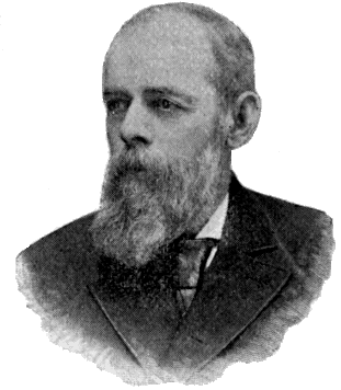
DAVID E. FOLSOM.
Folsom Peak (9,300)—E: 8—1895—U. S. G. S.—For David E. Folsom, leader of the Expedition of 1869, and author of the first general description of the valley of the Upper Yellowstone.
Forellen Peak (9,700)—T: 5—1885—U. S. G. S.—From the German name for Trout.
Gallatin Range—A-F: 1-4—Name in use prior to 1870. Raynolds has “Mt. Gallatin” on his map. Gallatin River (see name) rises in this range.
Garnet Hill (7,000)—C: 9—1878—U. S. G. S.—Characteristic.
Giant Castle (10,000)—K: 14-15—1873—Jones—Characteristic.
Gibbon Hill (8,600)—H: 6—1885—U. S. G. S.—From the Gibbon River.
Gravel Peak (9,600)—T: 11—U. S. G. S.—Characteristic.
Gray Peak (10,300)—C-D: 4—1885—U. S. G. S.—Characteristic.
Grizzly Peak (9,700)—L: 12—1885—U. S. G. S.—Characteristic.
Hancock, Mt. (10,100)—R: 10—1871—Barlow—For General W. S. Hancock, U. S. Army, who, as commanding officer of the Department of Dakota, had lent his active aid in the prosecution of the Yellowstone Explorations.
Hawk’s Rest (9,800)—R: 14—1885—U. S. G. S.—Characteristic.
Hedges Peak (9,500)—G: 9—1895—U. S. G. S.—For Cornelius Hedges, a prominent member of the Washburn Expedition, author of a series of descriptive articles upon the trip, and first to advance and publicly advocate the idea of setting apart that region as a National Park.
Holmes, Mt. (10,300)—F: 4—1878—U. S. G. S.—For W. H. Holmes, Geologist, U. S. Geological Survey. This peak had been previously called Mt. Madison.
Horseshoe Hill (8,200)—E: 6—1885—U. S. G. S.—Characteristic.
Hoyt, Mt. (10,400)—L: 13—1881—Norris—For the Hon. John W. Hoyt, then Governor of Wyoming.
Huckleberry Mountain (9,700)—S: 7—1885—U. S. G. S.—Characteristic.
Humphreys, Mt. (11,000)—N: 14—1871—Barlow—For General A. A. Humphreys, then Chief of Engineers, U. S. A.
Index Peak (11,740)—C: 16—This mountain, and Pilot Knob near it, received their names from unknown sources prior to 1870.
"One of them [the peaks] derives its name from its shape, like a closed hand with the index-finger extending upward, while the other is visible from so great a distance on every side that it forms an excellent landmark for the wandering miner, and thus its appropriate name of Pilot Knob."—Hayden. [CG]
Joseph Peak (10,300)—C: 4—1885—U. S. G. S.—For Chief Joseph, the famous Nez Percé leader in the war of 1877. He deservedly ranks among the most noted of the North American Indians. His remarkable conduct of the campaign of 1877 and his uniform abstinence from those barbarous practices which have always characterized Indian warfare, were a marvel to all who were familiar with the facts. No Indian chief ever commanded to such a degree the respect and even friendship of his enemies.
Junction Butte (6,500)—D: 10—When or by whom given not known. The name arose, of course, from the fact that this butte stands at the junction of the two important streams, the Yellowstone and Lamar Rivers. Barlow records that the Butte was known as “Square Butte” at the time of his visit in 1871.
Lake Butte (8,600)—K: 11—1878—Characteristic.
Landmark, The (8,800)—F: 6—1885—U. S. G. S.—Characteristic.
Langford, Mt. (10,600)—M: 13—1870—Washburn Party—For the Hon. Nathaniel Pitt Langford, first Superintendent of the Yellowstone National Park.
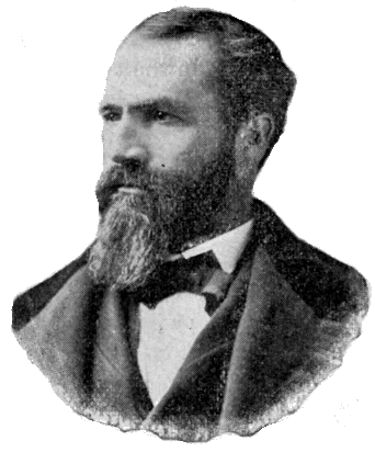
NATHANIEL PITT LANGFORD.
Mr. Langford was born August 9, 1832, in Westmoreland, Oneida County, New York. His early life was spent on his father’s farm, and his education was obtained by winter attendance at district school. At nineteen, he became clerk in the Oneida Bank of Utica. In 1854, he went to St. Paul, where we find him, in 1855, cashier of the banking house of Marshall & Co., and in 1858, cashier of the Bank of the State of Minnesota. In 1862, he went to Montana as second in command of the Northern Overland Expedition, consisting of 130 men and 53 wagons drawn by oxen. In 1864, he was made Collector of Internal Revenue for the new territory. In 1868, he was appointed by President Johnson Governor of Montana, but as this was after the Senate’s imbroglio with the President and its refusal to confirm any more presidential appointments, he did not reach this office. He was one of the famous Montana Vigilantes, a member of the Yellowstone Expedition of 1870, and first Superintendent of the newly created Park. In 1872, he was appointed National Bank Examiner for the Pacific States and Territories, and held the office for thirteen years. He now resides in St. Paul, Minnesota. He is author of a series of articles in Scribner’s for 1871, describing the newly-discovered wonders of the Yellowstone, and of the important work, “Vigilante Days and Ways,” the most complete history in existence of that critical period in Montana history.
The notable part which Mr. Langford bore in the discovery of the Upper Yellowstone country, and in the creation of the Yellowstone National Park, has been fully set forth elsewhere. He has always been its ardent friend, and his enthusiasm upon the subject in the earlier days of its history drew upon him the mild raillery of his friends, who were wont to call him, “National Park” Langford—a soubriquet to which the initials of his real name readily lent themselves.
For the circumstance of naming Mt. Langford, see “Mt. Doane.”
Mary Mountain (8,500)—J: 7—Probably so named by tourists from Mary Lake, which rests on the summit.
Moran, Mt. (12,800)—W: 5—1872—U. S. G. S.—For the artist, Thomas Moran, who produced the picture of the Grand Cañon now in the Capitol at Washington.
Needles, The (9,600)—E: 14—1885—U. S. G. S.—Characteristic.
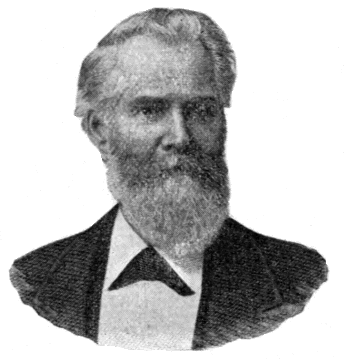
PHILETUS W. NORRIS.
Norris, Mt. (9,900)—E: 13—1878—U. S. G. S.—For Philetus W. Norris, second Superintendent of the Park, and the most conspicuous figure in its history.
He was born at Palmyra, New York, August 17, 1821. At the age of eight, he was tourist guide at Portage Falls on the Genesee River, New York, and at seventeen he was in Manitoba in the service of British fur traders. In 1842, he settled in Williams County, Ohio, where he founded the village of Pioneer. Between 1850 and 1860 he visited the Far West. At the outbreak of the Civil War, he entered the army and served a short time as spy and captain of scouts. He was then placed in charge of Rebel prisoners on Johnson’s Island. He next entered politics as member of the Ohio House of Representatives, but being later defeated for the State Senate, he joined the United States Sanitary Commission and went again to the front. He soon returned and became trustee of certain landed property near the City of Detroit belonging to officers and soldiers of both armies. These lands he reclaimed at great expense from their original swampy condition, and built thereon the village of Norris, now part of Detroit. In 1770, he went west again and undertook to enter the Park region in June of that year, but permitted the swollen condition of the streams to defeat his project. He thus missed the honor which a few months later fell to the Washburn Party—a misfortune which he never ceased to deplore. In 1875, he again visited the Park, and in 1877, became its second Superintendent. In 1882, he returned to Detroit, after which he was employed by the government to explore old Indian mounds, forts, villages, and tombs, and to collect relics for the National Museum. He died at Rocky Hill, Kentucky, January 14, 1885. He is author of the following works: Five Annual Reports as Superintendent of the Park; “The Calumet of the Coteau,” a volume of verse, with much additional matter relating to the Park; and a long series of articles on “The Great West,” published in the Norris Suburban in 1876-8.
The above sketch sufficiently discloses the salient characteristic of Norris' career. His life was that of the pioneer, and was spent in dealing first blows in the subjugation of a primeval wilderness. He was “blazing trails,” literally and figuratively, all his days, leaving to others the building of the finished highway. It is therefore not surprising that his work lacks the element of completeness, which comes only from patient attention to details. Nowhere is this defect more apparent than in his writings. A distinct literary talent, and something of the poet’s inspiration, were, to use his own words, “well nigh strangled” by the “stern realities of border life.” His prose abounds in aggregations of more than one hundred words between periods, so ill arranged and barbarously punctuated as utterly to bewilder the reader. His verse—we have searched in vain for a single quatrain that would justify reproduction. Nevertheless, his writings, like his works, were always to some good purpose. They contained much useful information, and, being widely read throughout the West, had a large and beneficial influence.
Perhaps no better or more generous estimate of his character can be found than in the following words of Mr. Langford who knew him well: “He was a good man, a true man, faithful to his friends, of very kind heart, grateful for kindnesses, of more than ordinary personal courage, rather vain of his poetical genius, and fond of perpetuating his name in prominent features of scenery.”
Concerning which last characteristic it may be noted that three mountain peaks, one geyser basin, one pass, and an uncertain number of other features of the Park, were thought by Colonel Norris deserving of this distinction. With inimitable fidelity to this trait of his character, he had even selected as his final resting-place the beautiful open glade on the south side of the Grand Cañon, just below the Lower Falls.
Observation Peak (9,300)—G: 8—1885—U. S. G. S.—Characteristic.
Obsidian Cliff (7,800)—F: 6—1878—Norris—Characteristic.
Paint Pot Hill (7,900)—H: 6—1885—U. S. G. S.—Characteristic.
Pelican Cone (9,580)—I: 12—1885—U. S. G. S.—Near source of Pelican Creek.
Pilot Knob (11,977)—C: 16—See "Index Peak."
Piñon Peak (9,600)—S: 10—1885—U. S. G. S.—Characteristic.
Prospect Peak (9,300)—D-E: 8—1885—U. S. G. S.—Characteristic.
Pyramid Peak (10,300)—J: 14—1895—U. S. G. S.—Characteristic.
Quadrant Mountain (10,200)—D: 4—1878—U. S. G. S.—Characteristic.
Red Mountain Range—P: 7-8—U. S. G. S.—Characteristic.
Reservation Peak (10,600)—M: 14—1895—U. S. G. S.—Characteristic.
Roaring Mountain (8,000)—F: 6—1885—U. S. G. S.—“It takes its name from the shrill, penetrating sound of the steam constantly escaping from one or more vents near the summit.”—Hague.
Saddle Mountain (11,100)—H: 15—1880—Norris—Characteristic.
Schurz Mt. (10,900)—N: 14—1885—U. S. G. S.—For Carl Schurz, Secretary of the Interior during President Hayes' administration. This name was first given by Colonel Norris to the prominent ridge on the west side of the Gibbon Cañon.
Sepulcher Mountain (9,500)—B-C: 5-6—The origin of this name is unknown. The following remarks concerning it are from the pen of Prof. Wm. H. Holmes: [CH]
“Why this mountain received such a melancholy appellation I have not been able to discover. So far as I know, the most important thing buried beneath its dark mass is the secret of its structure. It is possible that the form suggested the name.”
Sheepeater Cliffs (7,500)—D: 7—1879—Norris—From the name of a tribe of Indians, the only known aboriginal occupants of what is now the Yellowstone Park. (See Chapter II, Part II.) It was upon one of the “ancient and but recently deserted, secluded, unknown haunts” of these Indians, that Colonel Norris, “in rapt astonishment,” stumbled one day, and was so impressed by what he saw, that he gave the neighboring cliff its present name. He thus describes this retreat: [CI]
“It is mainly carpeted with soft grass, dotted, fringed, and overhung with small pines, firs and cedars, and, with the subdued and mingled murmur of the rapids and cataracts above and below it, and the laughing ripple of the gliding stream, is truly an enchanting dell—a wind and storm sheltered refuge for the feeble remnant of a fading race.”
Sheridan Mt. (10,250)—P: 8—1871—Barlow—For Gen. P. H. Sheridan, who actively forwarded all the early exploring expeditions in this region, and, at a later day, twice visited the Park. His public warnings at this time of the danger to which the Park was exposed from vandals, poachers, and railroad promoters, and his vigorous appeal for its protection, had great influence in bringing about a more efficient and enlightened policy in regard to that reservation. (See "Mt. Everts.")
Signal Hills (9,500)—M: 12—1871—U. S. G. S.—A ridge extending back from Signal Point on the Yellowstone Lake.
Silver Tip Peak (10,400)—K: 13—1885—U. S. G. S.—Characteristic.
Specimen Ridge (8,700)—E: 11—Name known prior to 1870.—Characteristic. (See Chapter V, Part II.)
Stevenson, Mt. (10,300)—M: 13—1871—U. S. G. S.—For James Stevenson, long prominently connected with the U. S. Geological Survey.
“In honor of his great services not only during the past season, but for over twelve years of unremitting toil as my assistant, oftentimes without pecuniary reward, and with but little of the scientific recognition that usually comes to the original explorer, I have desired that one of the principal islands of the lake and one of the noble peaks reflected in its clear waters should bear his name forever.”—Hayden. [CJ]
Mr. Stevenson was born in Maysville, Ky., December 24, 1840. He early displayed a taste for exploration and natural history, and such reading as his limited education permitted was devoted to books treating of these subjects. At the age of thirteen he ran away from home and joined a party of Hudson’s Bay Fur Company’s traders, bound up the Missouri River. On the same boat was Dr. F. V. Hayden, then on his way to explore the fossiliferous region of the Upper Missouri and Yellowstone Rivers. Noticing Stevenson’s taste for natural history he invited him to join him in his work. Stevenson accepted; and thus began a relation which lasted for more than a quarter of a century, and which gave direction to the rest of his life.
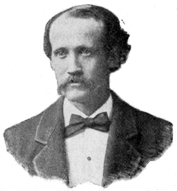
JAMES STEVENSON.
He was engaged in several explorations between 1850 and 1860, connected with the Pacific railroad surveys, and with others under Lieutenants G. K. Warren and W. F. Raynolds. In 1861 he entered the Union service as a private soldier, and left it in 1865 with an officer’s commission. After the war he resumed his connection with Dr. Hayden. He was mainly instrumental in the organization of the United States Geological Survey of the Territories in 1867, and during the next twelve years he was constantly engaged in promoting its welfare. When the consolidation of the various geographical and geological surveys took place in 1879, under the name of the United States Geological Survey, he became associated with the United States Bureau of Ethnology. He had always shown a taste for ethnological investigations and his scientific work during the rest of his life was in this direction, principally among the races of New Mexico and Arizona. He died in New York City July 25, 1888.
In the paragraph quoted above from Dr. Hayden there is more than any but the few who are familiar with the early history of the geological surveys will understand. It rarely happens that a master is so far indebted to a servant for his success, as was true of the relation of Dr. Hayden and James Stevenson. Stevenson’s great talent lay in the organization and management of men. His administrative ability in the field was invaluable to the Survey of which Hayden was chief, and his extraordinary influence with Congressmen was a vital element in its early growth. His part in the Yellowstone Explorations of 1871 and 1872 is second to none in importance. It will not be forgotten that he was the first to build and launch a boat upon the Yellowstone Lake, nor that he, and Mr. Langford who was with him, were the first white men to reach the summit of the Grand Teton.
Storm Peak (9,500)—E: 8—1885—U. S. G. S.—Characteristic.
Survey Peak (9,200)—T: 4—1885—U. S. G. S. This mountain was a prominent signaling point for the Indians. It was first named Monument Peak by Richard Leigh who built a stone mound on its summit.
Table Mountain (10,800)—O: 14—1885—U. S. G. S.—Characteristic.
Terrace Mountain (8,100)—C: 6—1878—U. S. G. S.—Characteristic.
Teton, Grand (13,691)—Not on Map.—This mountain has borne its present name for upward of four score years. Through more than half a century it was a cynosure to the wandering trapper, miner and explorer. The name has passed into all the literature of that period, which will ever remain one of the most fascinating in our western history. Indeed, it has become the classic designation of the most interesting historic summit of the Rocky Mountains. That it should always retain this designation in memory of the nameless pioneers who have been guided by it across the wilderness, and thousands of whom have perished beneath its shadow, would seem to be a self-evident proposition. Individual merit, no matter how great, can never justify the usurpation of its place by any personal name whatever. An attempt to do this was made in 1872 by the United States Geological Survey who rechristened it Mt. Hayden. The new name has never gained any local standing, and although it has crept into many maps its continued use ought to be discouraged. It is greatly to the credit of Dr. Hayden that he personally disapproved the change, so far at least, as very rarely, if ever, to refer to the mountain by its new name.
Three Rivers Peak (9,900)—E: 4—1885—U. S. G. S.—Branches of the Madison, Gallatin and Gardiner Rivers take their rise from its slopes.
Thunderer, The (10,400)—D: 14—1885—U. S. G. S.—Seemingly a great focus for thunder storms.
Top Notch Peak (10,000)—L: 13—1895—U. S. G. S.—Characteristic.
Trident, The (10,000)—Q-R: 14—1885—U. S. G. S.—Characteristic.
Trilobite Point (9,900)—F: 4—1885—U. S. G. S.—Characteristic.
Turret Mountain (10,400)—P: 14—1878—Characteristic.—Called by Captain Jones “Round-head or Watch Tower.”
Twin Buttes (8,400)—K: 14—1870—Washburn Party.—Characteristic.
Washburn, Mt. (10,000)—F: 9—1870—Washburn Party.—For General Henry Dana Washburn, chief of the Yellowstone Expedition of 1870.
General Washburn was born in Windsor, Vt., March 28, 1832. His parents moved to Ohio during his infancy. He received a common school education and at fourteen began teaching school. He entered Oberlin College, but did not complete his course. At eighteen he went to Indiana where he resumed school-teaching. At twenty-one he entered the New York State and National Law School, from which he graduated. At twenty-three he was elected auditor of Vermilion county, Indiana.
His war record was a highly honorable one. He entered the army as private in 1861 and left it as brevet brigadier-general in 1865. His service was mainly identified with the Eighteenth Indiana, of which he became colonel. He was in several of the western campaigns, notably in that of Vicksburg, in which he bore a prominent part. In the last year of the war he was with Sherman’s army, and for a short time after its close was in command of a military district in southern Georgia. In 1864, he was elected to Congress over the Hon. Daniel W. Voorhees, and again, in 1866, over the Hon. Solomon W. Claypool. At the expiration of his second term he was appointed by President Grant, surveyor-general of Montana, which office he held until his death.
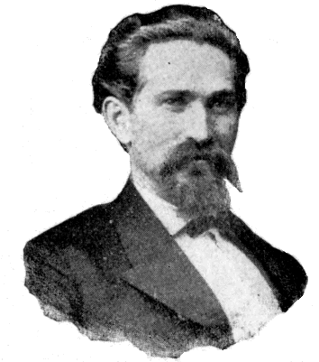
GEN. HENRY DANA WASHBURN.
It was during his residence in Montana that the famous Yellowstone Expedition of 1870 took place. His part in that important work is perhaps the most notable feature of his career. As leader of the expedition he won the admiration and affection of its members. He was the first to send to Washington specimens from the geyser formations. He ardently espoused the project of setting apart this region as a public park and was on his way to Washington in its interest when his career was cut short by death. The hardship and exposure of the expedition had precipitated the catastrophe to which he had long been tending. He left Helena in November, 1870, and died of consumption at his home in Clinton, Indiana, January 26, 1871.
General Washburn’s name was given to this mountain by a unanimous vote of the party on the evening of August 28, 1870, as a result of the following incident related by Mr. Langford:
“Our first Sunday in camp was at Tower Creek. The forest around us was very dense, and we were somewhat at a loss in deciding what course we needed to follow in order to reach Yellowstone Lake. We had that day crossed a fresh Indian trail, a circumstance which admonished us of the necessity of watchfulness so as to avoid disaster. While we were resting in camp, General Washburn, without our knowledge, and unattended, made his way to the mountain, from the summit of which, overlooking the dense forest which environed us, he saw Yellowstone Lake, our objective point, and carefully noted its direction from our camp. This intelligence was most joyfully received by us, for it relieved our minds of all anxiety concerning our course of travel, and dispelled the fears of some of our party lest we should become inextricably involved in that wooded labyrinth.”
White Peaks (9,800)—F : 4—1895—U. S. G. S.—Characteristic.
Wild Cat Peak (9,800)—T : 8—1885—U. S. G. S.—Characteristic.
Yount Peak (Hayden, 11,700; Hague, 12,250)—Not on map.—1878—U. S. G. S.—Source of the Yellowstone.—Named for an old trapper and guide of that region.
APPENDIX A.
III.
STREAMS.
[Map locations refer only to outlets, or to points where streams pass off the limits of the map. Altitudes refer to the same points, but are given only in the most important cases.]
Agate Creek—E : 10—1878—U. S. G. S.—Characteristic.
Alum Creek—H : 9—Name known prior to 1870—Characteristic.
Amethyst Greek—E : 12—1878—U. S. G. S.—Flows from Amethyst Mountain.
Amphitheater Creek—D : 13—1885—U. S. G. S.—From form of valley near its mouth.
Antelope Creek—E : 10—1870—Washburn Party—Characteristic.—This name is often applied locally to a tributary of the Yellowstone just above Trout Creek.
Arnica Creek—L : 8—1885—U. S. G. S.—Characteristic.
Aster Creek—P : 7—1885—U. S. G. S.—Characteristic.
Astrigent Creek—J : 12—1885—U. S. G. S.—Characteristic.
Atlantic Creek—S : 13—1873—Jones—Flows from Two-Ocean-Pass down the Atlantic slope.
Badger Creek—P : 13—1885—U. S. G. S.—Characteristic.
Basin Creek—Q : 9—1885—U. S. G. S.—Characteristic.
Bear Creek—B : 7—1863—Party of prospectors under one Austin. On the way they found fair prospects in a creek on the east side of the Yellowstone, and finding also a hairless cub, called the gulch “Bear.”—Topping.
Bear Creek—K : 11—1885—U. S. G. S.—Characteristic.
Beaver Creek—O : 9—1885—U. S. G. S.—Characteristic.
Beaver Dam Creek—O : 12—1871—U. S. G. S.—Characteristic.
Bechler River—R : 1—1872—U. S. G. S.—For Gustavus R. Bechler, topographer on the Snake River Division of the Hayden Expedition of 1872.
Berry Creek—U : 6—1885—U. S. G. S.—Characteristic.
Black-tail Deer Creek—B : 8—Named prior to 1870—Characteristic.
Bluff Creek—H : 10—1885—U. S. G. S.—Characteristic.
Bog Creek—H : 10—1885—U. S. G. S.—Characteristic.
Boone Creek—T : 1—Named prior to 1870—For Robert Withrow, an eccentric pioneer of Irish descent, who used to call himself “Daniel Boone the Second.”
Bridge Creek—K : 9—1871—U. S. G. S.—Characteristic.
“At one point, soon after leaving camp, we found a most singular natural bridge of the trachyte, which gives passage to a small stream, which we called Bridge Creek.”—Hayden.
“Natural Bridge” is really over a branch of Bridge Creek.
Broad Creek—F : 10—1871—Barlow—Characteristic.
Buffalo Creek—D : 11—Prior to 1870—Naming party unknown—Characteristic.
Burnt Creek—E : 10—1885—U. S. G. S.—Characteristic.
Cache Creek—F : 13—1863—Prospecting party under one Austin were in camp on this stream when they were surprised by Indians, and all their stock stolen except one or two mules. Being unable to carry all their baggage from this point, they cached what they could not place on the mules, or could not themselves carry. From this circumstance arose the name.
Calfee Creek—F : 13—1880—Norris—For H. B. Calfee, a photographer of note.
"Some seven miles above Cache Creek we passed the mouth of another stream in a deep, narrow, timbered valley, which we named Calfee Creek, after the famous photographer of the Park. Five miles further on, we reached the creek which Miller recognized as the one he descended in retreating from the Indians in 1870, and which, on this account, we called Miller’s Creek."—Norris.[CK]
Cañon Creek—1 : 5—1885—U. S. G. S.—Characteristic.
Carnelian Creek—E : 9—1885—U. S. G. S.—Characteristic.
Cascade Creek—G : 8—1870—Washburn Party—Characteristic.
Chalcedony Creek—E : 12—1885—U. S. G. S.—Characteristic.
Chipmunk Creek—O : 11—1885—U. S. G. S.—Characteristic.
Clear Creek—L : 11—1878—U. S. G. S.—Characteristic.
Cliff Creek—Q : 13—1885—U. S. G. S.—Characteristic.
Clover Creek—G : 13—1885—U. S. G. S.—Characteristic.
Cold Creek—H : 14—1885—U. S. G. S.—Characteristic.
Columbine Creek—M : 11—1885—U. S. G. S.—Characteristic.
Conant Creek—T : 1—Prior to 1870—By Richard Leigh for one All Conant, who went to the mountains in 1865, and who came near losing his life on this stream.
Cotton Grass Creek—H : 9—1885—U. S. G. S.—Characteristic.
Cougar Creek—G : 2—1885—U. S. G. S.—Characteristic.
Coulter Creek—R : 8—1885—U. S. G. S.—For John M. Coulter, botanist in the Hayden Expedition of 1872.
Crawfish Creek—R : 6—1885—U. S. G. S—Characteristic.
Crevice Creek—C : 7—1867—Prospecting party under one Lou Anderson.
“They found gold in a crevice at the mouth of the first Stream above Bear, and named it, in consequence, Crevice Gulch. Hubbel went ahead the next day for a hunt, and upon his return he was asked what kind of a stream the next creek was. ‘It’s a hell roarer,’ was his reply, and Hell Roaring is its name to this day. The second day after this, he was again ahead, and, the same question being asked him, he said: “‘Twas but a slough.” When the party came to it, they found a rushing torrent, and, in crossing, a pack horse and his load were swept away, but the name of Slough Creek remains.”—Topping.
Crooked Creek—R : 10—1885—U. S. G. S.—Characteristic.
Crow Creek—K : 15—1885—U. S. G. S.—Characteristic.
Crystal Creek—D : 11—1885—U. S. G. S.—Characteristic.
Cub Creek—L : 11—1885—U. S. G. S.—Characteristic.
Deep Creek—E : 10—1873—Jones—Characteristic.
De Lacy Creek—M : 6—1880—Norris—For Walter W. De Lacy, first white man known to have passed along the valley. (See "Shoshone Lake.") First named Madison Creek by the Hayden party in 1871.
Duck Creek—G : 3—1895—U. S. G. S.—Characteristic.
Elk Creek—D : 9—Named prior to 1870—Characteristic.
Elk Tongue Creek—C : 12—U. S. G. S.—Characteristic.
Escarpment Creek—Q : 13—1885—U. S. G. S.—Characteristic.
Fairy Creek—J : 4—1871—Barlow—From “Fairy Falls,” which see.
Falcon Creek—R : 13—1885—U. S. G. S.—Characteristic.
Falls River—S : 1—1872—U. S. G. S.—Characteristic.
Fan Creek—C : 2—1885—U. S. G. S.—Characteristic.
Fawn Creek—C : 5—1878—U. S. G. S.—Characteristic.
Firehole River—I : 4—This name and “Burnt Hole” have been used to designate the geyser basins and the stream flowing through them since at least as far back as 1830. Captain Bonneville says it was well known to his men. The term “Hole” is a relic of the early days when the open valleys or parks among the mountains were called “holes.” The descriptive “fire, naturally arose from the peculiar character of that region.”
Firehole, Little—L : 4—1878—U. S. G. S.—From main stream.
Flint Creek—F : 13—1885—U. S. G. S.—Characteristic.
Forest Creek—Q : 7—1885—U. S. G. S—Characteristic.
Fox Creek—R : 11—1885—U. S. G. S.—Characteristic.
Gallatin River—A : 1—1805—Lewis and Clark—For Albert Gallatin, Secretary of War under President Jefferson.
Gardiner River (5360)—B : 6—This name, which, after “Yellowstone,” is the most familiar and important name in the Park, is the most difficult to account for. The first authentic use of the name occurs in 1870, in the writings of the Washburn party. In Mr. Langford’s journal, kept during the expedition, is the following entry for August 25, 1870: “At nineteen miles from our morning camp we came to Gardiner River, at the mouth of which we camped.” As the party did not originate the name, and as they make no special reference to it in any of their writings, it seems clear that it must already have been known to them at the time of their arrival at the stream. None of the surviving members has the least recollection concerning it. The stream had been known to prospectors during the preceding few years as Warm Spring Creek, and the many “old timers” consulted on the subject erroneously think that the present name was given by the Washburn Party or by the Hayden Party of 1871. What is its real origin is therefore a good deal of a mystery.
The only clue, and that not a satisfactory one, which has come under our observation, is to be found in the book “River of the West,” already quoted. Reference is there made to a trapper by the name of Gardiner, who lived in the Upper Yellowstone country as far back as 1830, and was at one time a companion of Joseph Meek, the hero of the book. In another place it is stated that in 1838, Meek started alone from Missouri Lake (probably Red Rock Lake) "for the Gallatin Fork of the Missouri, trapping in a mountain basin called Gardiner’s Hole…. On his return, in another basin called Burnt Hole, he found a buffalo skull, etc." As is well known, the sources of the Gallatin and Gardiner are interlaced with each other, and this reference strongly points to the present Gardiner Valley as “Gardiner’s Hole.” The route across the Gallatin Range to Mammoth Hot Springs, and thence back by way of the Firehole Basin, was doubtless a natural one then as it is now. It is therefore reasonable to suppose that this name came from an old hunter in the early years of the century, and that the Washburn Party received it from some surviving descendant of those times.
Geode Creek—C : 8—1878—U. S. G. S.—Characteristic.
Geyser Creek—H : 6—1878—U. S. G. S.—Characteristic.
Gibbon River—I : 4—1872—U. S. G. S.—For Gen. John Gibbon, U. S. A., who first explored it.
“We have named this stream in honor of Gen. John Gibbon, United States Army, who has been in military command of Montana for some years, and has, on many occasions, rendered the survey most important services.”—Hayden.[CL]
Glade Creek—S : 6—1885—U. S. G. S.—Characteristic.
Glen Creek—C : 6—1885—U. S. G. S.—Characteristic.
Gneiss Creek—G : 1—1885—U. S. G. S.—Characteristic.
Gravel Creek—U : 10—1895—U. S. G. S.—Characteristic.
Grayling Creek—F : 1—1885—U. S. G. S.—Characteristic.
Grouse Creek—O : 10—1885—U. S. G. S.—Characteristic.
Harebell Creek—R : 8—1885—U. S. G. S.—Characteristic.
Hart River—Q : 9—1872—U. S. G. S.—From Hart Lake, of which it is the outlet. (See “Hart Lake.”)
Hell Roaring Creek—C : 9—1867—See “Crevice Creek.”
Indian Creek—E : 6—1878—U. S. G. S.—See “Bannock Peak.”
Iron Creek—L : 4—1871—U. S. G. S.—Characteristic.
Jasper Creek—D : 11—1885—U. S. G. S.—Characteristic.
Jay Creek—S : 13—1885—U. S. G. S.—Characteristic.
Jones Creek—K : 15—1880—Norris—For Captain (now Lieutenant-Colonel) W. A. Jones, Corps of Engineers, U. S. A., who first explored it. Captain Jones was leader of an important expedition through the Park in 1873, and has since been largely identified with the development of the Park road system.
Jumper Creek—J : 6—1885—U. S. G. S.—Characteristic.
Lamar River (5,970)—D : 10—1885—U. S. G. S.—For the Hon. L. Q. C. Lamar, Secretary of the Interior during the first administration of President Cleveland. The stream is locally known only by its original designation, the “East Fork of the Yellowstone.”
Lava Creek—D : 7—1885—U. S. G. S.—Characteristic.
Lewis River—R : 7—1872—U. S. G. S.—From “Lewis Lake,” which see.
Lizard Creek—U : 6—1885—U. S. G. S.—Characteristic.
Lost Creek—D : 9—1885—U. S. G. S.—Characteristic.
Lupine Creek—D : 7—1885—U. S. G. S.—Characteristic.
Lynx Creek—Q : 13—1885—U. S. G. S.—Characteristic.
Madison River—G : 1—1805—Lewis and Clark—For James Madison, Secretary of State to Thomas Jefferson.
Magpie Creek—J : 6—1885—U. S. G. S.—Characteristic.
Maple Creek—G : 2—1885—U. S. G. S.—Characteristic.
Mason Creek—L : 16—1881—Norris—For Major Julius W. Mason, U. S. A., commander of escort to Gov. Hoyt, of Wyoming, on the latter’s reconnaissance for a wagon road to the Park in 1881.
Meadow Creek—M : 11—1885—U. S. G. S.—Characteristic.
Middle Creek—L : 15—1885—U. S. G. S.—Characteristic.
Miller Creek—G : 13—1880—Norris—For a mountaineer named Miller. See "Calfee Creek."
Mink Creek—T : 11—1885—U. S. G. S.—Characteristic.
Mist Creek—I : 14—1885—U. S. G. S.—Characteristic.
Moose Creek—N : 6—1885—U. S. G. S.—Characteristic.
Moss Creek—G : 10—1885—U. S. G. S.—Characteristic.
Mountain Creek—P : 13—1885—U. S. G. S.—Characteristic.
Mountain Ash Creek—R : 3—1885—U. S. G. S.—Characteristic.
Nez Percé Creek (7,237)—J : 4—1878—U. S. G. S.—The Nez Percé Indians passed up this stream on their raid through the Park in 1877. It had previously been called “East Fork of the Firehole.” Prof. Bradley, of the U. S. Geological Survey, christened it Hayden’s Fork in 1872. (See Chapter XIII, Part I.)
Obsidian Creek—E : 6—1879—Norris—Characteristic.
Opal Creek—E : 12—1885—U. S. G. S.—Characteristic.
Otter Creek—H : 8—1885—U. S. G. S.—Characteristic.
Outlet Creek—P : 9—1895—U. S. G. S.—Characteristic.
Owl Creek—T : 5—1885—U. S. G. S.—Characteristic.
Pacific Creek—W : 11—1873—Jones—Flows from Two-Ocean Pass down the Pacific slope.
Panther Creek—D : 5—1878—U. S. G. S.—Characteristic.
Pebble Creek—D : 13—1885—U. S. G. S.—Characteristic.
Pelican Creek—K : 10—Probably named by the Washburn Party in 1870. Hayden and Barlow, in 1871, use the name as though it were already a fixture. Mr. Hedges says of this stream:
“About the mouth of the little stream that we had just crossed were numerous shallows and bars, which were covered by the acre with ducks, geese, huge white-breasted cranes, and long-beaked pelicans, while the solitary albatross, or sea-gull, circled above our heads with a saucy look that drew many a random shot, and cost one, at least, its life.”
Phlox Creek—Q : 13—1885—U. S. G. S.—Characteristic.
Plateau Creek—C : 12—1885—U. S. G. S.—Characteristic.
Polecat Creek—S : 6—1885—U. S. G. S.—Characteristic.
Quartz Creek—E : 10—1885—U. S. G. S.—Characteristic.
Rabbit Creek—K : 4—1885—U. S. G. S.—Characteristic.
Raven Creek—J: 12—1885—U. S. G. S.—Characteristic.
Red Creek—Q: 8—1885—U. S. G. S.—Characteristic.
Rescue Creek—C: 7—1878—U. S. G. S.—Where Everts was not found. (See “Mt. Everts.”)
Rocky Creek—O: 12—1885—U. S. G. S.—Characteristic.
Rose Creek—D: 12—1885—U. S. G. S.—Characteristic.
Sedge Creek—K: 11—1885—U. S. G. S.—Characteristic.
Senecio Creek—S: 13—1885—U. S. G. S.—Characteristic.
Sentinel Creek—J: 4—1872—U. S. G. S.—“The two central ones [geyser mounds] are the highest, and appear so much as if they were guarding the Upper Valley, that this stream was called Sentinel Branch.” Bradley.
Shallow Creek—F: 11—1895—U. S. G. S.—Characteristic.
Sickle Creek—Q: 10—1885—U. S. G. S.—Characteristic.
Slough Creek—D: 10—1867—See “Crevice Creek.”
Snake River (6,808)—W: 8—1805—Lewis and Clark—From the Snake or Shoshone Indians, who dwelt in its valley.
Soda Butte Creek—E: 12—Probably named by miners prior to 1870. From an extinct geyser or hot spring cone near the mouth of the stream.
Solfatara Creek—G: 6—1885—U. S. G. S.—Characteristic.
Solution Creek—M: 8—1885—U. S. G. S.—The outlet of Riddle Lake.
Sour Creek—H: 9—1871—Barlow—Characteristic.
Spirea Creek—R: 6—1885—U. S. G. S.—Characteristic.
Spring Creek—M: 5—1885—U. S. G. S.—Characteristic.
Spruce Creek—J: 6—1885—U. S. G. S.—Characteristic.
Squirrel Creek—N: 5—1878—U. S. G. S.—Characteristic.
Stellaria Creek—C: 3—1885—U. S. G. S.—Characteristic.
Stinkingwater River—L: 16—1807—John Colter—From an offensive hot spring near the junction of the principal forks of the stream. A most interesting fact, to which attention was first publicly called by Prof. Arnold Hague, is the occurrence on the map, which Lewis and Clark sent to President Jefferson in the spring of 1805, of the name “Stinking Cabin Creek,” very nearly in the locality of the river Stinkingwater. Prof. Hague, who published an interesting paper concerning this map in Science for November 4, 1877, thinks that possibly some trapper had penetrated this region even before 1804. But with Lewis and Clark’s repeated statements that no white man had reached the Yellowstone prior to 1805, it seems more likely that the name was derived from the Indians.
Straight Creek—E: 5—1885—U. S. G. S.—Characteristic.
Sulphur Creek—G: 9—1878—U. S. G. S.—Characteristic.—Locally this name is applied to a stream which flows from the hot springs at the base of Sulphur Mountain.
Surface Creek—G: 9—1885—U. S. G. S.—Characteristic.
Surprise Creek—P: 9—1885—U. S. G. S.—Its course, as made known by recent explorations, was surprisingly different from that which earlier explorations had indicated.
Tangled Creek—J: 4—1885—U. S. G. S.—Characteristic.—A hot water stream which flows in numberless interlaced channels.
Thistle Creek—J: 10—1885—U. S. G. S.—Characteristic.
Thoroughfare Creek—R: 13—1885—U. S. G. S.—Its valley forms part of a very practicable route across the Yellowstone Range.
Timothy Creek—G: 13—1885—U. S. G. S.—Characteristic.
Tower Creek—D: 10—1870—Washburn Party—From “Tower Falls,” which see.
Trail Creek—O: 12—1873—Jones—From an elk trail along it.
Trappers' Creek—P: 13—1885—U. S. G. S.—A great beaver resort.
Trout Greek—I: 9—1885—U. S. G. S.—Characteristic.
Violet Creek—I: 8—1872—U. S. G. S.—Characteristic.—“We named the small stream Violet Creek, from the profusion of violets growing upon its banks.” Peale.
Weasel Creek—K: 9—1895—U. S. G. S.—Characteristic.
Willow Creek—H: 14—1885—U. S. G. S.—Characteristic.
Winter Creek—E: 6—1885—U. S. G. S.—Characteristic.
Witch Creek—O: 8—1878—U. S. G. S.—Probably from the prevalence of hot springs phenomena along its entire course.
Wolverine Creek—R: 8—1885—U. S. G. S.—Characteristic.
Yellowstone River (8,100 and 5,360)—U: 16 (enters map); A: 5 (leaves map).—See Part I, Chapter I.
APPENDIX A.
IV.
WATER-FALLS.
[Figures in parentheses indicate approximate heights of falls in feet. These in most cases are not to be relied upon as strictly accurate, there having been no published record of actual measurements, except in the case of the Yellowstone Falls.]
Collonade Falls—F: 3—1885—U. S. G. S.—Characteristic.
Crystal Falls (129)—G: 8—1870—Washburn Party.—Characteristic.—The total fall includes three cascades.
Fairy Fall (250)—K: 4—1871—Barlow.—Characteristic.
Firehole Falls (60)—I: 4—Takes name from river.
Gibbon Falls (80)—I: 5—Takes name from river.
Iris Falls—P: 3—1885—U. S. G. S.—Characteristic.
Kepler Cascade (80)—L: 5—1881—Norris.—For the son of Hon. John W. Hoyt, Ex-Governor of Wyoming, who accompanied his father on a reconnaissance for a wagon road to the Park in 1881. Norris speaks of him as “an intrepid twelve-year old” boy who “unflinchingly shared in all the hardships, privations, and dangers of the explorations of his father,” which included many hundred miles of travel on horseback through that difficult country; and in admiration for the lad’s pluck, he named this cascade in his honor.
Lewis Falls, Upper (80)—P: 7—Takes name from river.
Lewis Falls, Lower (50)—Q: 7—Takes name from river.
Moose Falls—R: 6—1885—U. S. G. S.—Characteristic.
Mystic Falls—L: 4—1885—U. S. G. S.—Characteristic.
Osprey Falls (150)—D: 6—1885—U. S. G. S.
Ouzel Falls—P: 3—1885—U. S. G. S.—Characteristic.
Rainbow Falls (140)—R: 4—1885—U. S. G. S.—Characteristic.—Height includes total of three falls.
Rustic Falls (70)—D: 6—1878—Norris—Characteristic.
Silver Cord Cascade—G: 9—1885—U. S. G. S.—Characteristic.
Terraced Falls—R: 4—1885—U. S. G. S.—Characteristic.
Tower Falls (132)—D: 10—1870—Washburn Party—Characteristic.
“By a vote of a majority of the party this fall was called Tower Fall.”—Washburn.
“At the crest of the fall the stream has cut its way through amygdaloid masses, leaving tall spires of rock from 50 to 100 feet in height, and worn in every conceivable shape…. Several of them stand like sentinels on the very brink of the fall.”—Doane.
Undine Falls (60)—D: 7—1885—U. S. G. S.—Characteristic.
Union Falls—Q: 4—1885—U. S. G. S.—Characteristic.
Virginia Cascade (60)—H: 7—1886—By E. Lamartine, at that time foreman in charge of government work in Park.—For the wife of the Hon. Chas. Gibson, President of the Yellowstone Park Association.
Wraith Falls (100)—D: 7—1885—U. S. G. S.—Characteristic.
Yellowstone Falls (Upper 112; Lower 310)—H: 9—From the river which flows over them. [CM]
Folsom (1869) Upper Fall, 115 feet. Method not stated. Lower Fall, 350 feet. Method not stated. Doane (1870) Upper Fall, 115 feet. Line. Langford (1870) Lower Fall, 350 feet. Line stretched on an incline. Moore’s Sketch (1870) Lower Fall, 365 feet. Method not stated. Hayden (1871) Upper Fall, 140 feet. Method not stated. Lower Fall, 350 feet. Method not stated. Gannett (1872) Upper Fall, 140 feet. Barometer. Lower Fall, 395 feet. Comparison of angles subtended by Falls and by a tree of known height. Jones (1873) Upper Fall, 150 feet. Barometer. Lower Fall, 329 feet. Barometer. Ludlow (1875) Upper Fall, 110 feet. Line. Lower Fall, 310 feet. Line. Gannett (1878) Upper Fall, 112 feet. Line. Lower Fall, 297 feet. Line stretched on an incline. U. S. G. S. (Recent) Upper Fall, 109 feet. Method not stated. Lower Fall, 308 feet. Method not stated. Chittenden (1892) Upper Fall, 112 feet between point of first descent and level of pool below. Measured by means of a transit instrument. Width of gorge at brink of fall, and a few feet above water surface, 48 feet.
APPENDIX A.
V.
LAKES.
[Figures in parentheses denote elevations.]
Beach Lake (8,150)—K: 8—1885—U. S. G. S.—Characteristic.
Beaver Lake (7,415)—F: 6—1879—Norris—Characteristic.
Beula Lake (7,530)—R: 5—1872—U. S. G. S.—Characteristic.
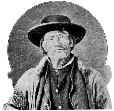
JAMES BRIDGER.
Bridger Lake (7,900)—R: 13—Name a fixture prior to 1870.—For James Bridger, the Daniel Boone of the Rockies, and one of the most remarkable products of the trapping and gold-seeking eras.
He was born in Richmond, Va., in March, 1804, and died in Washington, Jackson Co., Mo., July 17, 1881. He must have gone west at a very early age for he is known to have been in the mountains in 1820. Niles Register for 1822 speaks of him as associated with Fitzpatrick in the Rocky Mountain Fur Company. Another record of this period reveals him as leader of a band of whites sent to retake stolen horses from the hostile Bannocks. In 1832, he had become a resident partner in the Rocky Mountain Fur Company. That he was a recognized leader among the early mountaineers while yet in his minority seems beyond question. He became “The Old Man of the Mountains” before he was thirty years of age.
Among the more prominent achievements of Bridger’s life may be noted the following: He was long a leading spirit in the great Rocky Mountain Fur Company. He discovered Great Salt Lake and the noted Pass that bears his name. He built Fort Bridger in the lovely valley of Black Fork of Green River, where transpired many thrilling events connected with the history of the Mormons and “Forty-niners.” He had explored, and could accurately describe, the wonders of the Yellowstone fully a quarter of a century before their final discovery.
In person he was tall and spare, straight and agile, eyes gray, hair brown and long, and abundant even in old age; expression mild, and manners agreeable. He was hospitable and generous, and was always trusted and respected. He possessed to a high degree the confidence of the Indians, one of whom, a Shoshone woman, he made his wife.
Unquestionably Bridger’s chief claim to remembrance by posterity rests upon the extraordinary part he bore in the exploration of the West. The common verdict of his many employers, from Robert Campbell down to Captain Raynolds, is that as a guide he was without an equal. He was a born topographer. The whole West was mapped out in his mind as in an exhaustive atlas. Such was his instinctive sense of locality and direction that it used to be said that he could “smell his way” where he could not see it. He was not only a good topographer in the field, but he could reproduce his impressions in sketches. “With a buffalo skin and a piece of charcoal,” says Captain Gunnison, “he will map out any portion of this immense region, and delineate mountains, streams, and the circular valleys, called ‘holes,’ with wonderful accuracy.” His ability in this line caused him always to be in demand as guide to exploring parties, and his name is connected with scores of prominent government and private expeditions.
His lifetime measures that period of our history during which the West was changed from a trackless wilderness to a settled and civilized country. He was among the first who went to the mountains, and he lived to see all that had made a life like his possible swept away forever. His name survives in many a feature of our western geography, but in none with greater honor than in this little lake among the mountains that he knew so well; and near the source of that majestic stream with which so much of his eventful life was identified.
Delusion Lake (7,850)—M: 9—1878—U. S. G. S.—This lake was long supposed to be an arm of the Yellowstone Lake, and, in the fanciful comparison of the main lake to the form of the human hand, occupied the position of the index finger. The delusion consisted in this mistaken notion of a permanent connection between the two lakes.
Dryad Lake (8,250)—K: 8—1885—U. S. G. S.—Characteristic.
Duck Lake (7,850)—M: 7—1885—U. S. G. S.—Characteristic.
Fern Lake (8,150)—H: 11—1885—U. S. G. S.—Characteristic.
Frost Lake—(7,350)—I: 14—Unknown-Characteristic.
Gallatin Lake (9,000)—E: 4—1885—U. S. G. S.—Source of the Gallatin River.
Goose Lake (7,100)—K: 4—1885—U. S. G. S.—Characteristic.
Grassy Lake (7,150)—R: 5—1885—U. S. G. S.—Characteristic.
Grebe Lake (7,950)—G: 8—1885—U. S. G. S.—Characteristic.
Grizzly Lake (7,490)—F: 5—1885—U. S. G. S.—Characteristic.
Hart Lake (7,469)—P: 9—According to Hayden, “long known to the hunters of the region as Heart Lake.” Named prior to 1870 for an old hunter by the name of Hart Hunney who in early times plied his trade in this vicinity. He was possibly one of Bonneville’s men, for he seems to have known the General well and to have been familiar with his operations. He was killed by a war party of Crows in 1852.
The spelling, Heart, dates from the expeditions of 1871. The notion that the name arose from the shape of the lake seems to have originated with Captain Barlow. It has generally been accepted although there is really no similarity between the form of the lake and that of a heart. Lewis Lake is the only heart-shaped lake in that locality.
Everts named Hart Lake, Bessie Lake, after his daughter.
Henry Lake (6,443)—A noted lake outside the limits of the Park passed by tourists entering the park from the west. It is named for a celebrated fur trader, Andrew Henry, who built a trading post in that vicinity in 1809.
Hering Lake (7,530)—R: 5—1878—U. S. G. S.—For Rudolph Hering, Topographer on the Snake River Division of the Hayden Survey for 1872.
Indian Pond—J: 11—1880—Norris.—An ancient, much-used camping-ground of Indians. “My favorite camp on the Yellowstone Lake (and it evidently has been a favorite one for the Indian) has ever been upon the grove-dotted bluff, elevated thirty or forty feet above the lake, directly fronting Indian Pond.”—Norris.
Isa Lake (8,250)—L: 6—1893—N. P. R. R.—For Miss Isabel Jelke, of Cincinnati.
Jackson Lake (6,000)—U-W: 6—Date unknown.—For David Jackson, a noted mountaineer and fur trader, and one of the first three partners of the Rocky Mountain Fur Company. This lake was discovered by John Colter and was named by Clark Lake Biddle, in honor of Nicholas Biddle, who first gave to the world an authentic edition of the journal of the celebrated Lewis and Clark Expedition.
Jenny Lake—South of Leigh Lake and off the map.—1872—U. S. G. S.—For the wife of Richard Leigh. She was a Shoshone Indian.
Leigh Lake—W: 5—1872—U. S. G. S.—For Richard Leigh (“Beaver Dick”), a noted hunter, trapper, and guide in the country around the Teton Mountains. The nickname “Beaver Dick” arose, not from the fact that Leigh was an expert beaver trapper, but on account of the striking resemblance of two abnormally large front teeth in his upper jaw to the teeth of a beaver. The Indians called him “The Beaver.”