Front matter (continued 4)
Reading edition
The mountain grasses are generally abundant in the open country and even in many places among the forests. The writer just quoted says:
"The pasturage on the many open spaces is excellent, the mountain meadows being covered with a mat of nutritious grasses. The predominating variety is the bunch grass, upon which the horses of tourists generally subsist, keeping in good condition without the need of oats. Among other kinds, are the blue joint, fescue, and beard grasses, as well as Alpine timothy, all of which grow luxuriantly."
The early autumns tinge the foliage of the willow parks and other groups of shrubbery with a wealth of color not often seen elsewhere. Even the frost on the grass upon sharp mornings seems to have a peculiar beauty, and one may trace terrestrial rainbows in all the perfection of those set in the sky.
CHAPTER VIII.
THE PARK IN WINTER.
From the end of September to the end of May the Park is closed to the tourist; that is, the hotels do not receive guests, and camping is too precarious to be attempted. It is generally possible, however, to get into the Park as late as the middle or end of November, very rarely as late as Christmas. In May, the snowfalls are light, but the accumulations of the previous winter render traveling out of the question. With great difficulty the hotel company reaches its nearest hotels as early as May 16. Some of the roads remain impassable fully a month later.
What the fall of snow is in the upper Park has never been determined; but at Mammoth Hot Springs, altitude 6,200 feet, an average for six years, from November to April inclusive, is ten feet per year, with a maximum of fifteen feet and a minimum of five. But on the Park Plateau, 1,000 to 1,500 feet higher, the fall is certainly much greater. No doubt its light depth aggregates twenty feet. The weight of this snow often destroys the railing of bridges and injures the buildings of the Park.
The drifts accumulate in phenomenal magnitude. No matter how deep a ravine may be, the wind will pile the snow up in it until it is level with the surrounding country. Some of these drifts on the mountain sides are hundreds of feet deep and never entirely melt away. Even on the general plateau they last until the middle of July. The Cañon Hotel is almost buried every winter. The snow actually reaches the second story windows, and the drift behind the hotel would last throughout the summer were its melting not facilitated by cutting it in pieces with shovels. It verily seems that all the conditions of climate here conspire to make this region one of the snowiest in the world.
Of course, general access to the Park under such conditions is wholly out of the question. Only on snow-shoes is it possible at all. The hotel company has a watchman at each of its buildings, who drags out a lonely existence through the two hundred days from November to May. He can talk over the telephone line with Mammoth Hot Springs, and at long intervals he receives a call, and perhaps mail, from “Telephone Pete,” who travels the line to keep it in order. In some places, also, small squads of soldiers are stationed for the winter.
The art of traveling by snow-shoe is a thoroughly interesting one, notwithstanding the fact that it is about the most difficult method of travel known and is rarely resorted to except from sheer necessity.
The instrument used in the Park for this purpose is called a ski (pronounced skee). It is a long slender strip of wood—ash, Norway pine, or hickory—some twelve feet long, four or five inches wide, and just thick enough to give needed strength. About midway of its length is a strap through which the toe is slipped and by which the foot pulls the ski along. The bearing surface of the two skis is about eight square feet, and holds the weight of the body even in soft snow without sinking more than a few inches. The bottom surface is polished smooth and then rubbed with a mixture of tallow and beeswax to make it free from friction. A pole is an important accompaniment, aiding to slide the traveler along and steady him on the skis. It also serves as a brake in descending steep hills, the traveler sitting astride it and bearing the rear end into the snow.
Down hill work is indeed glorious. No express train can rival the ski for speed. Its only drawback is danger of accident. On level country ski traveling is simply walking on a board walk, except that the pedestrian carries the board with him, and makes and unmakes the road as fast as he goes. This is hard enough, especially if the snow is sticky, but when it comes to up hill traveling it is a truly laborious matter. If the hill is steep, there is danger of losing one’s grip on the snow and sliding backward down the hill. Where the ascent is too steep to work up by direct forward movement, “corduroying” is resorted to. The traveler works up sidewise, stepping up a foot or so with the upper ski and following with the lower. Generally this sidewise movement is combined with a slight forward movement, the skis being pointed up hill at as steep an inclination as they will hold.
The dress and equipment of the snow-shoe traveler are reduced to a minimum consistent with protection from the climate. This protection is really needed only at camping places, for the extraordinary exertion of traveling keeps the body in a continuous glow of warmth. Generally, warm woolen underwear, with canvas surface garments to keep out the wind and to shed snow, are the essential features of the dress. No overcoat is worn, but a tightly drawn belt takes its place. The feet are the weak point. “Natural wool socks, then a pair of Indian moccasins, then a pair of heavy gray army socks, then Arctic overshoes and leggings,” is the description of an equipment actually used. A broad hat is frequently worn to keep snow out of the neck, and colored glasses are indispensable to prevent snow blindness.
Baggage is limited to the strictest necessities, and is so packed that it will rest uniformly on the back from the shoulders to the hips.
No eating of snow or drinking of water can be safely indulged in while en route. The traveler must go strictly “dry” between meals.
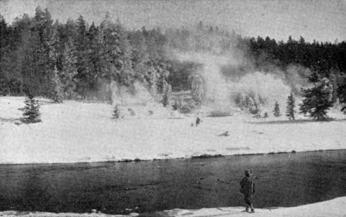
Terry Engr. Co. Haynes, Photo., St. Paul.
Geyser Basins in Winter.
Of course traveling of this sort is attended with much peril. A man must rely wholly on himself. No wagon or saddle is available if he is injured or sick. Heavy storms may blind him and cause him to lose his way. In short, a snow-shoe trip through the Park is an undertaking which requires a vigorous physique, a determined will, and a good fund of courage. Very few, except those whose duty has required it, have ever made the attempt. But it is the unanimous verdict of those who have, that, glorious as the Park is in summer, it is even more glorious in winter. One can readily understand this to be so. Evergreen forests never appear to better advantage than when laden with snow. Ice formations always enhance the beauty of water-falls. [AX] The rolling open valleys of the Park must be doubly beautiful when robed in drifted snow. It is a pity that this silvery landscape should forever remain excluded from the general view.
CHAPTER IX.
THE PARK AS A HEALTH RESORT.
The climate of the Yellowstone National Park, to any one with a fair reserve of health, is of the most beneficial kind. The general public will be interested in the subject only as it relates to that season when it is possible to visit the Park.
For the six months beginning with May, the average temperature will not vary much from the following figures, Fahrenheit:
Maximum. Minimum. Mean.
May 77° 25° 49°
June 87° 30° 55°
July 91° 36° 64°
August 90° 36° 61°
September 85° 25° 54°
October 72° 18° 41°
These temperatures are for Mammoth Hot Springs. For the Park Plateau they should be diminished by not less than ten degrees. No month of the year in that region passes without ice-forming frosts. It will be seen that during June, July, August, and September, the thermometer makes excursions to the neighborhood of the nineties. This, however, is only in the middle of the day, and is due to the direct intensity of the sun’s rays. No such heat pervades the general atmosphere. As soon as the sun is near setting, the temperature falls rapidly. The night temperature rarely gets above 55° or 60°, and averages scarcely half as much. The Park is noted for its delightful sleep-giving qualities, which constitute no small part of its claim as a health resort.
Summer in the Park is comparatively short. It may not be strictly true that “the Park has only three seasons, July, August, and Winter,” but it is true that July and August are the only two months free from the ordinary characteristics of winter. Snows are frequent in June and September, while May and October are well on the snowy side of the year. July and August are the Park summer. The weather is settled. The air is pure and bracing and not too cold. The long imprisoned vegetation bursts suddenly into full life and beauty, and in a short period take place all the changes which require months in lower altitudes.
That there is life and health in that summer atmosphere, no one who has breathed it will deny. At the same time, as has already been hinted, it is healthful only for those who have some foundation to build upon. Persons suffering from any form of heart disease or advanced pulmonary trouble, or those greatly reduced in strength from any cause, would better stay away. The altitude and sharp air might prove too severe.
A matter which has naturally attracted considerable inquiry is the therapeutic value of the mineral springs of the Park. The superstitious faith in the efficacy of mineral waters to restore health, which has characterized mankind in all ages, caused the physically afflicted to hail the discovery of that region as the promised fountain of new life. The first explorers to ascend the Gardiner in 1871 found “numbers of invalids” encamped on its banks, where the hot waters from Mammoth Hot Springs enter the stream; and it is recorded that “they were most emphatic in their favorable expressions in regard to their sanitary effects.”
But this impression was very evanescent. No one now goes to the Park because of its mineral waters. Nevertheless, it would be wholly premature to assume that there is no medicinal virtue in them. Certainly there is in the Park almost every variety of mineral spring; there are abundant and luxurious waters for bathing; and it is not at all improbable that the opportunities afforded in this region may yet be utilized to the great advantage of the public.
But for health-giving qualities, the Park will never be dependent on its mineral waters. Its true value lies in other and more potent influences. The pure water of its snow-fed streams, the exhilarating atmosphere, the bracing effect of altitude, the wholesome fatigue of daily rambles over the rough, mountainous country, the fragrant odor of the pine boughs which every-where pervades the atmosphere, and, above all, the beautiful and varied scenery, which exalts the mind and diverts the attention from cares that are too often the real cause of physical ills—these are the true virtues of the Yellowstone Park as a health resort.
CHAPTER X.
ROADS, HOTELS, TRANSPORTATION.
The Park, as is well known, is a very extensive tract of country, and its various points of interest are widely separated from each other. The question of ways and means for getting comfortably through it is an all-important one. If the roads are bad, the hotels ill-kept, or the transportation uncomfortable, no amount of grandeur of natural scenery can compensate for these defects. In making a tour of the Park, the visitor travels not less than 150 miles, sometimes considerably more, and remains in the Park about one week. He is thus quite at the mercy of those who have the management and control of those matters which form the subject of this chapter.
The road system of the Park, when completed, will comprise a belt line, connecting the principal centers of interest; approaches, by which access may be had to the Park from different directions; side roads, leading from the main route to isolated points of interest; and trails, by which pack outfits can reach desired points to which regular roads will never be built.
The belt line includes Mammoth Hot Springs, Norris Geyser Basin, Lower Geyser Basin, Upper Geyser Basin, the Yellowstone Lake, the Grand Cañon, and Junction Valley. A cross-road passes from Norris to the Grand Cañon.
The approaches are not all yet selected, but in time there will be at least one on each side of the Park.
Trails are important adjuncts of the Park road system. They were long ago selected and opened up, and they are of great importance in patroling the Park. They are also much used by those tourists who remain for a considerable time.
The mileage of the completed road system will be about as follows:
Belt line 163 miles.
Approaches 105 "
Side roads 22 "
Total mileage of Park system, exclusive of trails 290 "
In regard to construction, it is hardly necessary to say that nothing but the best macadamized roads should be built. The inherent difficulties of the work are great. The soil in many places is of the most wretched character. The country is exceedingly rough. The streams are almost without number. The snow lies on some of the roads until the middle of June. The mud in the wet season is bad, and the dust of the dry season is worse. The soft volcanic rocks, which so generally prevail, make poor road metal. But all these difficulties can be overcome, if Congress will but provide for a systematic completion of the project. At present, the annual allowance is too small to promise any thing like good work, and it will be many years before the hopes of the government engineers in the matter will be realized.
The work itself is as attractive as ever falls to the lot of the road engineer, and it is doubtful if another opportunity exists to develop a road system which, if properly done, will reflect so much credit upon the government building it. It is used by visitors from all lands. It passes through every variety of scenery. It presents every known problem of road engineering. In short, it combines all the elements to make it, when complete, one of the noted highways of the world.
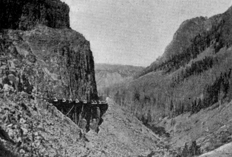
Terry Engr. Co.
Gandy.
Kingman Pass. (Showing roadway along side of cliff.)
It is not impossible that the tourist may yet be carried by boat from the west shore of the Lake to near the head of the Falls, nor that a bridge worthy of its surroundings—an arch of the native rock so studied as to simulate a natural bridge—will span the river near the Upper Falls and give access to the many splendid views from the right bank of the Grand Cañon.
The tourist transportation of the Park is done mostly by coach, ordinarily with four horses each. Surreys and saddle horses are also provided when desired. The present system is the result of long development, and is very satisfactory. With proper roads, it would be all that could be desired.
Electric transportation in the Park has often been suggested, but there are certain grave objections, to be discussed in a later chapter, which will probably always prevent its introduction.
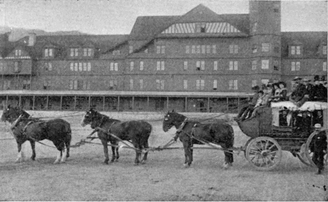
Terry Engr. Co.
Haynes, Photo., St. Paul.
Yellowstone Park Coach.
When the hotel system of the Park is complete, there will be no fewer than seven good houses and three lunch stations along the belt line and approaches. The hotels will be at Mammoth Hot Springs, Norris Geyser Basin, Lower Geyser Basin, Upper Geyser Basin, Yellowstone Lake, Grand Cañon, and Junction Valley. The present management of the hotels has developed into a very efficient system. It is conducted by a single company whose business headquarters is at Mammoth Hot Springs, from which point all supplies are shipped. A telegraph line connects it with points in the interior and with the outside world. The manager of each hotel knows in advance the number of guests he must provide for, and the convenience of the tourist is thus carefully arranged beforehand. With a reasonable extension and development of the present system, the Park will be admirably equipped in this respect.
Besides the regular tourists—those who make the usual trip, stopping at the hotels—there are hundreds who pass through the Park with camping outfits. During the months of July and August and early September, this is by no means an undesirable method. It is less comfortable, to be sure, than the ordinary method, but at the same time it is less expensive and more independent. In the latter part of August, the Park fairly swarms with these camping parties. They give the authorities plenty to do, for the danger of forest conflagrations from their camp fires is very great.
CHAPTER XI.
ADMINISTRATION OF THE PARK.
The administration of the Park is assigned by law to the Secretary of the Interior, who delegates his authority to a local Superintendent. By statute, also, the Secretary of the Interior is authorized to call upon the Secretary of War for such details of troops as may be necessary to protect the Park. Owing to the failure of Congress to provide for a civilian Superintendent and police force, since 1886, the Secretary of the Interior has found it necessary to avail himself of this second statute, so that the present working of the Park administration is on this wise:
An army officer, commanding the troops of the Park, is the representative of the Secretary of the Interior, and is called the Acting Superintendent of the Park, on the assumption that the old régime of civilian Superintendents is only temporarily suspended. The Superintendent is charged with the enforcement of the rules and regulations provided for the government of the Park. As to all such matters, he receives his instructions direct from the Secretary of the Interior, and he annually submits to that official a report upon the condition of the Park. For a police force, he has two troops of cavalry, which he stations throughout the Park as necessity requires. He has also one civilian scout, paid for from the appropriation for the army, whose duty it is to patrol the 5,000 square miles, more or less, in the original reservation and the forest reserve! [AY]
The specific duties which form the burden of the Superintendent’s work are:
1. To see that all leases and privileges granted by the Secretary of the Interior to private parties are strictly observed, and that all business conducted in the Park is in pursuance of government authority and in accordance with specific conditions and limitations.
2. The protection of the Park from vandalism. This is a very important matter. The pardonable desire to carry off specimens from the beautiful formations, and the unpardonable craze to cover them with individual names, would, if unrestrained, soon quite destroy what nature, through long ages, has so laboriously produced.
3. The protection of game. All around the Park are hordes of law-breakers, who let pass no opportunity to destroy the surviving species. To avert this calamity requires the utmost vigilance of the Park police.
4. The preservation of forests. This has always been the most onerous and trying duty of Park officials. The importance of the forests is so far-reaching that their destruction would be a public calamity. No exertion can be considered too great which may prevent it.
5. The construction of roads and bridges in the Park.
Other functions which the Superintendent fills are the social duties of his position, which at certain seasons exact much of his attention. Official visitors depend upon him entirely for pilotage through the Park. Private parties bring letters soliciting favors, and on the whole he finds his time well occupied with these pleasant, though sometimes onerous, duties.
The office building of the Superintendent, who is also commanding officer of Fort Yellowstone, is at Mammoth Hot Springs. A pretty little garrison is built upon the white formation opposite the hotel, and in winter, the whole military force, except small detachments in various places, is gathered at that point.
At Mammoth Hot Springs are also located the post-office and jail, and at this point the judicial officers of the Park hold court to try offenses against the Park statutes and regulations.
CHAPTER XII.
A TOUR OF THE PARK. Preliminary.
In the following description there will be mentioned in succinct outline all the notable features of interest in the Yellowstone National Park. For more detailed information, the reader is referred to the list of names in "Appendix A."
The necessary limit of space forbids any thing like extended description, even if the inherent difficulties of such a task would permit. Captain Ludlow has well stated the nature of these difficulties:
“The Park scenery, as a whole,” he says, “is too grand, its scope too immense, its details too varied and minute, to admit of adequate description, save by some great writer, who, with mind and pen equally trained, can seize upon the salient points, and, with just discrimination, throw into proper relief the varied features of mingled grandeur, wonder, and beauty.”
Of the many who have attempted, with pen or pencil, to reproduce the wonders of the Yellowstone, no one has yet completely satisfied these important requirements. The writer, for his part, will modestly decline any such undertaking, and, like that pioneer explorer, Folsom, will confine his descriptions “to the bare facts.” He will, however, occasionally call to aid those who have seen and written of these wonders. To the early explorers, in particular, who entered this region before it became generally known, its strange phenomena appealed with an imaginative force which the guide-book tourist of to-day can hardly realize. This may account for the fact that some of these explorers, who have never, before or since, put pen to paper with any literary purpose in view, have left in their narratives strokes of word painting which the most gifted writer would find it difficult to excel.
The season selected for the tour will be the early days of July. The rain and snow and chilly air, not uncommon in June, are gone. The drought and smoke of August and September are still remote. Even mosquitoes, so amazingly plentiful at certain seasons (Langford found them on the very summit of the Grand Teton), have not yet made their appearance. It is late enough, however, to call forth in their richest glory the magnificent profusion of flowers which every-where abound in the Park. The air is at its best, full of life and energy, and so clear that it confounds distances and gives to objects, though far away, a distinctness quite unknown in lower altitudes. The skies, as they appear at this season, surpass the sunny skies of Italy, and the tourist will find in their empyreal depths a beauty and fascination forever lacking in the dingy air of civilization. In short, the open air stage trips through that rich mountain atmosphere will form one of the most attractive and invigorating features of the tour.
Without further preliminary, the rôle of guide will now be assumed, and the tourist will be conducted through the wonders of this celebrated country, following, over most of the distance, the present general route.
CHAPTER XIII.
A TOUR OF THE PARK. North Boundary to Mammoth Hot Springs.
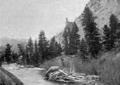
Terry Engr. Co.
Gandy.
Gardiner River.
Distance five miles. The road for most of the way lies in the valley of the Gardiner. The principal points of interest en route are:
The Junction of the Yellowstone and Gardiner Rivers which determines the north boundary of the Park. It lies in the State of Montana, the state line being two miles further south. The old prospector’s route bore off at this point and kept up the valley of the Yellowstone. Folsom took this route in 1869; so did the Wasburn party in 1870. Hayden and Barlow in 1871 kept along the Gardiner and thus saw the Mammoth Hot Springs.
The Gardiner Cañon is a precipitous valley of loose gray walls suggestive of danger from falling rocks. The nests of fish-hawks here and there crown detached pinnacles. The most striking feature of the cañon is the river, a typical mountain torrent of such rapid fall over its rocky bed that it is a continuous succession of foaming cascades.
Some four miles up the river, at the point where the road leaves it, the tourist gets his first sight of any indication of subterranean heat. This is a large stream of hot water, in early times called the Boiling River, issuing from an opening in the rocks and emptying directly into the river. It is formed of the collected waters of Mammoth Hot Springs which find their way to this point through underground passages. It was here that “numbers of invalids” were encamped when Hayden and Barlow saw the spot in 1871.
From the last crossing of the Gardiner a winding road, which rises 600 feet in its length of one mile, brings the tourist to the world-renowned Mammoth Hot Springs, and to the administrative and business headquarters of the Park.
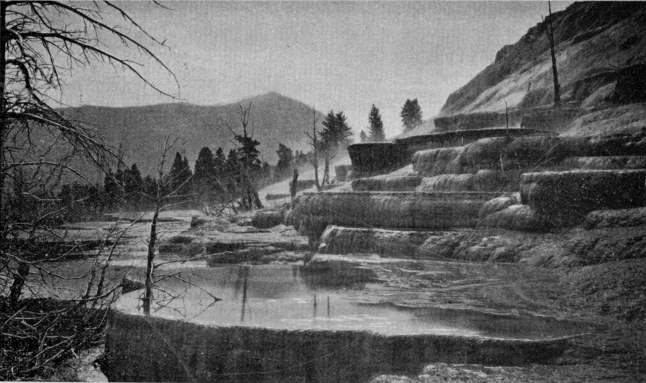
Terry Engr. Co.
U. S. Geological Survey of the Territories.
Mammoth Hot Springs. Bunsen Peak in the distance.
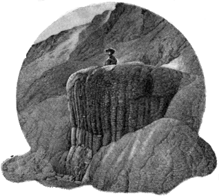
U. S. Geological Survey of the Territories.
Pulpit Terrace.
First in importance, among the many points of interest accessible from this locality, are the Hot Springs Terraces. These have been built one upon another until the present active portion constitutes a hill rising 300 feet above the site of the Mammoth Hot Springs Hotel. The formation about these springs, it will be remembered, is calcareous, and to this fact is due its distinctive character, so different from the silica formations which prevail nearly every-where else in the Park. The overhanging bowls which these deposits build up are among the finest specimens of Nature’s work in the world, while the water which fills them is of that peculiar beauty to be found only in thermal springs. Speaking of this feature Dr. Hayden says:
"The wonderful transparency of the water surpasses any thing of the kind I have ever seen in any other portion of the world. The sky, with the smallest cloud that flits across it, is reflected in its clear depths, and the ultramarine colors, more vivid than the sea, are greatly heightened by constant, gentle vibrations. One can look down into the clear depths and see, with perfect distinctness, the minutest ornament on the inner sides of the basins; and the exquisite beauty of the coloring and the variety of forms baffle any attempt to portray them either with pen or pencil." [AZ]
Cleopatra Spring, Jupiter Terrace, Pulpit Terrace, Minerva Terrace, the Narrow Gauge Terrace—an incongruous name for a long fissure spring—the White Elephant, another fissure spring, and the Orange Geyser, a very pretty formation, dome-shaped, with a pulsating spring in the top, are among the most interesting of the active springs.
Liberty Cap is the cone of an extinct spring and stands forty-five feet high and twenty feet through at the base.
Bath Lake is a warm pool of considerable size, much used in bathing.
Scattered over the formation in every direction are caves, springs, steam-vents, handsome deposits, and curiosities without number to attract and detain the visitor. Many of them, like Cupid’s Cave, the Devil’s Kitchen, and McCartney’s Cave, are of much interest. In the last-mentioned cave, or, more properly, crater, an elk fell one winter when the crater was level full with light snow. His antlers caught between the sides of the crater, holding him in a suspended position until he perished. He was found the following spring by Mr. McCartney.
Besides the hot springs features, there are other important objects of interest in this neighborhood.
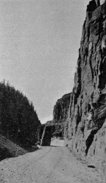
Terry Engr. Co.
Haynes, Photo., St. Paul.
Golden Gate.
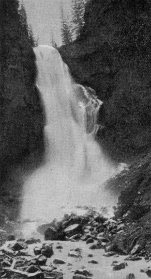
Terry Engr. Co.
Ingersoll.
Osprey Falls.
Lookout Hill is a prominent rounded elevation opposite the hotel. Upon its summit is a block-house, built by Colonel Norris, in 1879, as a headquarters building for the Superintendent. The awkward and inconvenient location was selected for its defensible qualities. It will be remembered that the two previous years, 1877 and 1878, had witnessed the Nez Percé and Bannock incursions into the Park.
The Falls and Cañon of the Middle Gardiner, distant four miles from the hotel, are the finest scenery of the kind in the Park, excepting only the Grand Cañon of the Yellowstone.
Bunsen Peak is a conspicuous summit located between the Middle and West Forks of the Gardiner. Its western face terminates in Cathedral Rock, a bold cliff that overhangs the valley of Glen Creek.
Golden Gate and Kingman Pass are names applied to the picturesque cañon of Glen Creek. It is justly considered one of the gems of the Park scenery. The skillful engineering feat of carrying the tourist route through this difficult cañon was performed by Lieutenant D. C. Kingman, of the Corps of Engineers, U. S. A., in 1884-5. Rustic Falls is a handsome cataract near the head of the pass. The best view in this vicinity is to be had from above the pass, looking through it toward Mt. Everts.
Besides Bunsen Peak, the tourist will find Terrace Mountain, Sepulcher Mountain, and Electric Peak ever ready to satisfy whatever ambition for mountain climbing he may possess.
The East Gardiner Cañon affords some fine views, and the falls and rapids at its head are extremely beautiful. It is through this cañon that access can most easily be had to the summit of Mt. Everts. This last name is given to a feature which bears almost no resemblance to the ordinary conception of a mountain. It is simply a broad table-land extending from the Yellowstone south and terminating in the lofty and conspicuous bluff just across the Gardiner from Mammoth Hot Springs. The mountain derives its chief popular interest from the Everts episode, which is described in the Appendix under “Mt. Everts.” It is also of great interest to scientific inquirers. The view from the prominent point opposite the forks of the Gardiner is very fine. The whole Mammoth Hot Springs formation and the group of buildings near it; the cañons and falls of the three Gardiners; and the array of mountain peaks across the valley, form a rare and attractive landscape.
Mt. Everts and the surrounding country are the home of the Park antelope and mountain sheep.
As explained elsewhere, Mammoth Hot Springs is the official and business headquarters of the Park. The handsome garrison of Fort Yellowstone is built on the white formation, and with the hotel and transportation buildings, the post-office, and various other structures, gives the place a village appearance not to be seen in any other part of the Park.
CHAPTER XIV.
A TOUR OF THE PARK. Mammoth Hot Springs to Norris Geyser Basin.
Distance, twenty miles. The first object of interest, after ascending the long hill above the Springs (four miles), is the Gallatin Range of mountains, which bursts into full view upon emerging from Kingman Pass. Its various peaks—Joseph, Gray, Bannock, Quadrant, the Dome, Mt. Holmes, and others—still retain the heavy snow drifts of the previous winter. Some of these peaks remain in sight for thirty miles along the tourist route.
Swan Lake (4.5 miles) is a little pond on the right of the road.
Willow Park (8 miles) comprises the valley of the lower course of Obsidian Creek. It is a dense growth of willows, and forms an attractive sight, either in the fresh foliage of spring or in its autumnal coloring.
Apollinaris Spring (10 miles) is on the left of the roadway, in a pine forest. Tourists generally stop and try its water.
Obsidian Cliff (12 miles) is composed of a kind of volcanic glass, black as anthracite, which abounds at this point in enormous masses. The Indians once quarried implements of war and the chase here, and many fine arrowheads have been picked up by explorers. The building of the first road along the base of this cliff has some historic celebrity, owing to the novel method employed. It was done by Colonel Norris, who thus describes it:
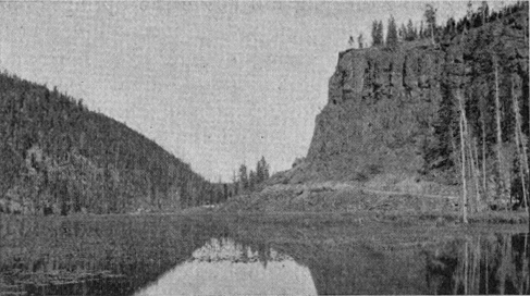
Terry Engr. Co.
Haynes, Photo., St. Paul.
Obsidian Cliff and Beaver Lake.
"Obsidian there rises like basalt in vertical columns many hundreds of feet high, and countless huge masses had fallen from this utterly impassable mountain into the hissing hot spring margin of an equally impassable lake, without either Indian or game trail over the glistering fragments of Nature’s glass, sure to severely lacerate. As this glass barricade sloped from some 200 or 300 feet high against the cliff at an angle of some 45° to the lake, we—with the slivered fragments of timber thrown from the heights—with huge fires, heated and expanded, and then men, well screened by blankets held by others, by dashing cold water, suddenly cooled and fractured the large masses. Then, with huge levers, steel bars, sledge, pick, and shovels, and severe laceration of at least the hands and faces of every member of the party, we rolled, slid, crushed, and shoveled one-fourth of a mile of good wagon road midway along the slope; it being, so far as I am aware, the only road of native glass upon the continent." [BA]
Beaver Lake has its outlet opposite the base of Obsidian Cliff. It is formed by ancient beaver dams, now entirely overgrown with vegetation. The old dam extends in a sinuous line entirely across the valley, and, although apparently less than a yard thick, is quite impervious to water. The lake is a great resort for water fowl later in the year.
Roaring Mountain (15.5 miles) is a high hill on the left of the road, with a powerful steam vent near the summit. Nothing which can now be heard from the road would suggest the name.
Twin Lakes (16 miles) are two exquisitely beautiful ponds, if only seen in a good sunlight and with a tranquil surface. The peculiar green of the water is perhaps to be seen nowhere except in the National Park. A most singular feature of these two lakes is that, although so close together, they never simultaneously exhibit the same colors.
The Frying Pan (17.75 miles) is a small basin of geyserite, on the right of the road, vigorously stewing away in a manner which reminds one of a kitchen spider in operation.
After passing Obsidian Cliff evidences of hot spring action constantly increase, until they reach their climax in the Norris Geyser Basin. There are but few other places in the Park where the odor of sulphur is so general and offensive as on this portion of the tourist route.
Norris Geyser Basin is clearly among the more recent volcanic developments of this region. Its rapid encroachment upon the forest growth, and the frequent appearance of new springs and the disappearance of others, indicate its relatively recent origin. Compared with the Firehole Geyser Basin it is of minor importance; but coming first to the notice of the tourist it receives a large amount of attention. It has only one prominent geyser, the Monarch, which throws a column about 100 feet high. The Constant is visible from the roadway in the bottom of a large tract of geyserite which is unsafe for pedestrians. It makes up in frequency of action what it lacks in power. The most noteworthy feature of the basin has received the appropriate name Hurricane. It is a prodigious steam vent whose violent gusts bear a striking resemblance to the driving blasts of a tempest. It also discharges a large amount of water. The Black Growler, close by the road side, is a similar phenomenon.
Among the less important features of this basin may be mentioned the Congress, Constant, Arsenic, Echinus, Fearless, Pearl, Vixen, Minute Man, and Mew Crater, all geysers; the Emerald Pool, a quiescent spring; and the Locomotive and Mud Geyser, boiling springs.
From the Norris Hotel a drive of three miles up the Gibbon River, on the cross road leading to the Grand Cañon, carries the tourist to Virginia Cascade, a unique and picturesque water-fall in a rocky cañon of considerable beauty.
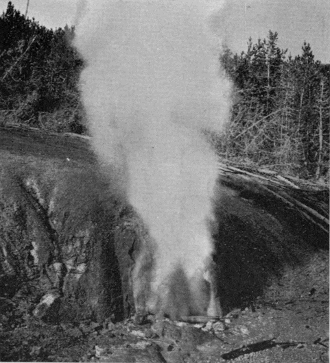
Terry Engr. Co.
Haynes, Photo., St. Paul.
Black Growler.
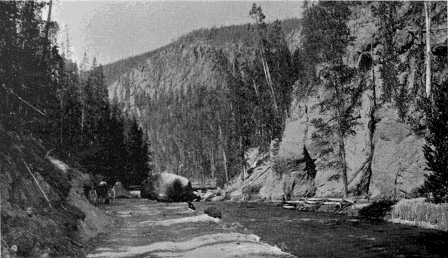
Terry Engr. Co.
Haynes, Photo., St. Paul.
Gibbon Cañon.
CHAPTER XV.
A TOUR OF THE PARK. Norris Geyser Basin to Lower Geyser Basin.
Distance, 20 miles. The road follows the Gibbon River to within three miles of its mouth, then crosses a point of land to the Firehole, and ascends the right bank of the latter stream to the Lower Basin.
Gibbon Meadows (3 miles) is a broad open bottom, sometimes called Elk Park, just at the head of Gibbon Cañon.
The Gibbon Paint Pots (4 miles) are on the left of the road, near the head of the cañon, and one-fourth of a mile away.
Monument Geyser Basin (4.5 miles) is on the high hill just west of the upper end of Gibbon Cañon. It is an interesting spot, but rarely visited owing to its inaccessibility. It was discovered and named by Col. Norris.
The Gibbon Cañon (4.5 to 10.5 miles) affords the tourist one of the pleasantest rides in the Park. The mountains rise boldly from the river on either side, and present several particularly fine views. The road lies close to the river’s edge, and the stream is an important adjunct to the scenery.
Beryl Spring (5 miles) is close to the road on the side opposite the river. It boils violently and discharges a large amount of water. The steam from it frequently obscures the roadway.
The Soda and Iron Spring (7.5 miles), like Apollinaris Spring already mentioned, is a frequent stopping-place for tourists.
Gibbon Falls (8 miles) is a water-fall of very irregular outline, but withal one of much beauty. The road hangs on the side of the cliff far above it, and affords a lovely view of the forest-covered valley below.
About half way between the point where the road leaves the Gibbon River and that where it touches the Firehole, is the junction of the belt line with the western approach which enters the Park by way of Madison Cañon. A beautiful cascade, some distance from the tourist route, may be found on the Firehole River about a mile above its mouth. Just as the road (the old Norris Road) commences to descend from the high plateau between the Gibbon and the Firehole, a glimpse is had of the Teton Mountains. They are among the most striking in the entire Rocky Mountain Region. For half a century after the overland journey of the Astorians, they were the chief landmarks in that trackless wilderness, and long bore the name of Pilot Knobs. They are distinctly visible from every important peak in the Park, although they are themselves outside its limits. As seen from the point, at which we have arrived, they are fifty miles away. They rise precipitously from the west shore of Jackson Lake (also outside of the Park) and with it form a scene of grandeur which ought to be included in the reservation. In 1872, Langford and Stevenson ascended the Grand Teton, being the first white men ever to reach the summit. [BB]
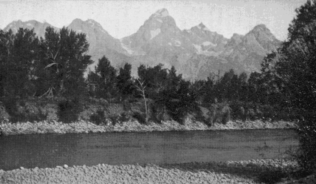
Terry Engr. Co.
Haynes, Photo., St. Paul.
The Teton Range. The Grand Teton in the center.
They were astonished to find, on a point but little lower than the main summit, a rude shelter of granite slabs evidently put in place by human hands ages ago.
Nez Percé Creek (18 miles) is the largest branch of the Firehole, and is of historic interest from its connection with the Indian campaign of 1877. It forms the north boundary of the Lower Geyser Basin. Two miles beyond it is the Fountain Hotel.
To attempt any thing like a detailed description of the Firehole Geyser regions would be intolerable alike to reader and author. Of the objects of interest, any one of which in other localities would attract marked attention, there are several thousand. In the present description, therefore, only the more important features will be noticed—those notable objects to see which is an indispensable part of any well ordered tour of the Park.
The Fountain Geyser is a typical example of the first class of geysers described in a previous chapter. Its proximity to the hotel (one-fourth mile) causes it to be much visited.
The Mammoth Paint Pots, a little way east of the Fountain, are probably the most prominent example of this class of phenomena in the Park.
The Great Fountain Geyser lies a mile and a half south-east of the Fountain. It is the chief wonder of the Lower Basin, and, in some respects, the most remarkable geyser in the Park. Its formation is quite unlike that of any other. At first sight the visitor is tempted to believe that some one has here placed a vast pedestal upon which to erect a monument. It is a broad, circular table about two feet high, composed entirely of hard siliceous deposit. In its surface are numerous pools molded and ornamented in a manner quite unapproached, at least on so large a scale, in any other part of the Park. In the center of the pedestal, where the monument ought to stand, is a large irregular pool of great depth, full of hot water, forming, to all appearances, a lovely quiescent spring. At times of eruption, the contents of this spring are hurled bodily upward to a height sometimes reaching 100 feet. The torrent of water which follows the prodigious down-pouring upon the face of the pedestal, flows away in all directions over the white geyserite plain. No visitor to the Yellowstone can afford to miss the Great Fountain Geyser.
In this vicinity are several of the handsomest springs in the Park. One in particular lies just across the hot stream which flows a little to the south of the Great Fountain. It is shaped like an egg set endwise in the ground with the upper part of the shell broken off. It is an exquisite trifle.
In a small valley, extending to the north-east from the Great Fountain, are several objects worthy of notice. One of these is an immense hot lake, by far the largest in the Park. Steady Geyser and Young Hopeful, near the head of the valley, are not remarkable in this land of geysers.
The principal attraction of the locality is what has come to be called the Firehole. It is at the extreme upper end of the valley, difficult to find, and unsatisfactory to visit when the wind agitates the water surface. It is a large hot spring from the bottom of which, to all appearances, a light colored flame is constantly issuing, only to be extinguished in the water before it reaches the surface. At times it has a distinct ruddy tinge and it always flickers back and forth like the lambent flame of a torch. When seen under favorable conditions, the illusion is perfect, and the beholder is sure that he has at last caught a glimpse of the hidden fires which produce the weird phenomena of this region. But it is only illusion. Through a fissure in the rock gas or superheated steam escapes and divides the water, just as bubbles do on a smaller scale. The reflection from the surface thus formed accounts for the appearance, which is intensified by the black background formed by the sides and bottom of the pool.
The Lower Geyser Basin has an area of thirty square miles. Conspicuous among its topographical features are the Twin Buttes, two prominent peaks west of the river which dominate the entire basin. A little way south of these is Fairy Fall, a pretty cascade 250 feet high.
There will be included in this chapter, as more properly belonging to it than to the next, a description of the Midway Geyser Basin. Its principal interest lies in the stupendous character of its phenomena.
Terry Engr. Co.
Haynes, Photo., St. Paul.
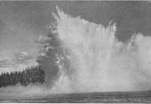
Excelsior Geyser.
Excelsior Geyser, as a dynamic agent, has no equal in the Park. It is really a water volcano, and its eruptions have nothing of the characteristic display of a genuine geyser. Its crater is a vast seething cauldron close by the brink of the Firehole River, into which, in non-eruptive periods even, it pours 4,000 gallons of water per minute. The shape of the crater is irregular. Its dimensions are about 330 by 200 feet, and 20 feet deep. It was not known to be a geyser until 1878, and did not really disclose its true character until the winter of 1881. During the remainder of that year and 1882, it gave continuous exhibitions of its power. Its water column was more than 50 feet in diameter, and at times rose to the enormous height of 250 feet. At such times, it doubled the volume of water in the Firehole River. Its eruptions were frequently accompanied by the ejection of large rocks. A second period of activity took place in 1888, since which time it has remained inactive.
Prismatic Lake is the most perfect spring of its kind in the world. It rests on the summit of a self-built mound, sloping very gently in all directions. Down this slope the overflow from the spring descends in tiny rivulets, every-where interlaced with each other. A map of the mound resembles a spider web, with the spider (the spring) in the center. The pool is 250 by 300 feet in size. Over the lake hangs an ever-present cloud of steam, which itself often bears a crimson tinge, reflected from the waters below. The steam unfortunately obscures the surface of the lake, and one involuntarily wishes for a row-boat, in which to explore its unseen portions. Wherever visible, there is a varied and wonderful play of colors, which fully justifies the name.
Turquoise Spring is another large pool, 100 feet in diameter, and rivals Prismatic Lake in the beauty of its coloring.
The Midway Geyser Basin contains hundreds of other springs, some of them very beautiful, but the Basin is mainly noted for the three features just described.
CHAPTER XVI.
A TOUR OF THE PARK. Lower Geyser Basin to Upper Geyser Basin.
Distance, nine miles. Road follows the Firehole River. Midway Geyser Basin, already described, is passed four miles out. No other object of interest is met until the visitor actually arrives at the Upper Basin.
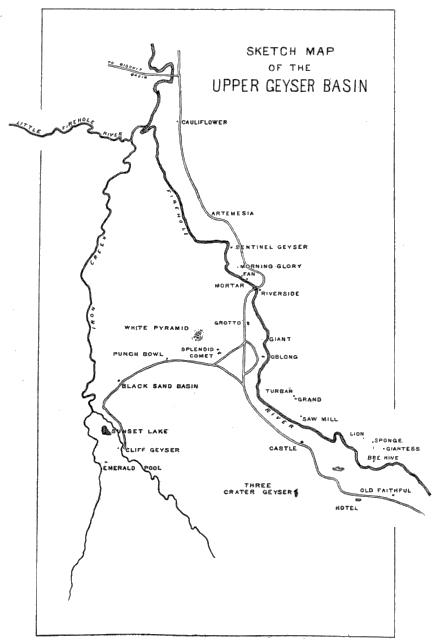
This locality is probably the most popular with the tourist of any in the Park. Its two rivals, the Grand Cañon and the Yellowstone Lake, are so unlike it as not to admit of any comparison. It is the home of the genus geyser, as seen in its highest development. There are fifteen examples of the first magnitude and scores of less important ones. [BC] The quiescent pools and springs are also numerous and of great beauty.
The first important feature en route is the Biscuit Basin, which is reached by a side road leading to the west bank of the Firehole River. It contains a fine geyser and several beautiful springs. The most interesting are the Jewell Geyser and the Sapphire Pool. Near this locality is the Mystic Falls, a fine cascade, on the Little Firehole River.
Artemesia Geyser comes next to the attention of the tourist. It has been known as a geyser only since 1886. It is on the right of the roadway, at a considerably lower level.
Opp. page 228.
The Morning Glory is a little further up stream. In this beautiful object the quiescent pool is at its best. Its exquisite bordering and the deep cerulean hue of its transparent waters make it, and others like it, objects of ceaseless admiration.
The Fan Geyser is close by the Firehole on the east bank, not far above the Morning Glory. The Riverside is also on the east bank at the point where the road crosses the river. It is an inconspicuous object when not in eruption, and one would scarcely suspect it of being a geyser. It spouts obliquely across the river, and not, like most geysers, vertically.
Gandy.
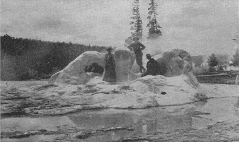
Grotto Geyser Cone.
Next in order, after crossing the river to the Westbank, is the Grotto, remarkable for its irregular and cavernous crater. A little further on, close to the river, stands the broken crater of one of the Park’s greatest geysers, the Giant. Lieutenant Doane compared its crater to a “huge shattered horn.”
A few hundred feet further up stream, still close to the river, is the Oblong. Directly across the road, but a short distance away, is the Splendid, well worthy of its name; and near it, sometimes playing simultaneously, is the Comet.
To the westward from the Firehole, nearly on the divide between it and Iron Creek, is a lovely spring, called the Punch-bowl. Across the divide in the Iron Creek valley is the Black Sand Basin, a unique but beautiful pool. Near it is another attraction, Specimen Lake, so named from an abundance of specimens of partly petrified wood. The limit of curiosities in this direction is Emerald Pool, which competent judges pronounce to be the finest quiescent spring in the Park.
Returning to the Firehole by a different route, we pass a large spring or geyser known as the Three Crater Spring. Its three craters are connected by narrow water ways, making one continuous pool, though fed from three sources.
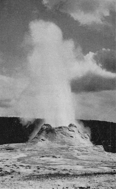
A thousand feet to the north, stands the most imposing crater in the Park, that of the Castle geyser. It is frequently seen in moderate eruption, but rarely when doing its best. As ordinarily seen, it throws a column of water only 50 or 60 feet, but at times it plays as high as 150 or 200 feet.
Terry Engr. Co.
Haynes, Photo., St. Paul.
Castle Geyser.
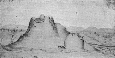
Terry Engr. Co.
First sketch ever made. [BD]
Castle Geyser Cone.
Crossing the river to its right bank, nearly opposite the Castle, there are found within a narrow compass three noted geysers, the Sawmill, Turban, and Grand. Of these, the last is by far the finest, and ranks among the very greatest geysers in the world. It was not seen by the Washburn Party, in 1870, but it seems to have been the first geyser to welcome to the Upper Basin the Hayden and Barlow parties in 1871. Captain Barlow says of its eruption: [BE]
"This grand fountain continued to play for several minutes. When dying down, I approached to obtain a closer view of the aperture whence had issued such a powerful stream. A sudden gush of steam drove me away, following which the water was again impelled upward and upward, far above the steam, till it seemed to have lost the controlling force of gravity, and that it would never cease to rise. The roar was like the sound of a tornado, but there was no apparent effort; a steady stream, very graceful and perfectly vertical, except as a slight breeze may have waved it to and fro. Strong and smooth, it continued to ascend like the stream from a powerful steam fire-engine. We were all lost in astonishment at the sudden and marvelous spectacle. The proportions of the fountain were perfect. The enthusiasm of the party was manifested in shouts of delight. Under the excitement of the moment, it was estimated to be from three to five hundred feet in height."
Further up the river on the same side and at some distance back, are the Lion, Lioness and the two Cubs, an interesting group, including one notable geyser. Half way up a high mound of geyserite which covers a large area on the north side of the river, is an exquisitely beautiful formation called, from its appearance, the Sponge.
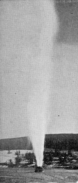
Terry Engr. Co.
Haynes, Photo., St. Paul.
The Bee Hive Geyser.
On the top of the mound is another of the great geysers, thought by the Washburn Party to be the greatest in the world, the Giantess. It belongs to the class of fountain geysers, and when not in action strongly resembles a quiescent spring. Its eruptions are infrequent and irregular, but when it does play it is a sight not to be forgotten. Mr. Langford thus describes the first eruption known to have been seen by white men: [BF]
"We were standing on the side of the geyser nearest the sun, the gleams of which filled the sparkling columns of water and spray with myriad rainbows, whose arches were constantly changing—dipping and fluttering hither and thither, and disappearing only to be succeeded by others, again and again, amid the aqueous column, while the minute globules, into which the spent jets were diffused when falling, sparkled like a shower of diamonds, and around every shadow which the denser clouds of vapor, interrupting the sun’s rays, cast upon the column, could be seen a luminous circle, radiant with all the colors of the prism, and resembling the halo of glory represented in paintings as encircling the head of Divinity. All that we had previously witnessed seemed tame in comparison with the perfect grandeur and beauty of this display."
Between the Giantess and the river is the Bee Hive, also one of the most prominent geysers. The symmetry of its cone is only surpassed by the regularity of its water column. From an artistic point of view it is the most perfect geyser in the Park. Its slender jet attains a great height and is vertical and symmetrical throughout.
Crossing again to the west bank of the stream and ascending to the very head of the basin, we come to the last and most important of the geysers, Old Faithful. Any other geyser, any five other geysers, could be erased from the list better than part with Old Faithful. The Giant, Giantess, Grand, Splendid, and Excelsior, have more powerful eruptions. The Bee Hive is more artistic. The Great Fountain has a more wonderful formation. But Old Faithful partakes in a high degree of all these characteristics, and, in addition, has the invaluable quality of uniform periodicity of action. It is in fact the most perfect of all known geysers.
To it fell the honor of welcoming civilized man to this region. It was the first geyser named. It stands at the head of the basin and has been happily called “The Guardian of the Valley.”
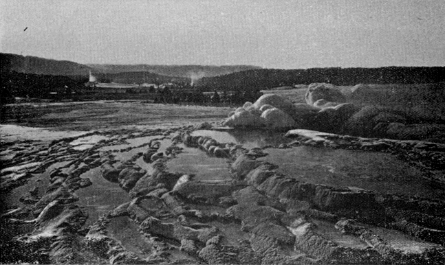
Terry Engr. Co.
U. S. Geological Survey of the Territories.
Castle Geyser. Geyser in action. Crater of Old Faithful.
Upper Geyser Basin.
It is located in the center of an oblong mound, 145 by 215 feet at the base, 20 by 54 feet at the summit, and about 12 feet high. The tube, which seems to have originated in a fissure in the rock, has an inside measurement of 2 by 6 feet.
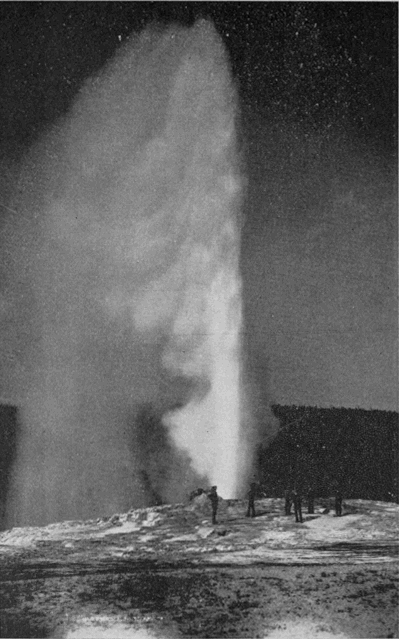
Terry Engr. Co.
U. S. Geological Survey of the Territories.
Old Faithful.
The ornamentation about the crater, though limited in extent, is nowhere surpassed for beauty of form and color. In particular, the three small pools on the north side of the crater and very close to it are specimens of the most remarkable handiwork which Nature has lavished upon this region. A singular fact is that the waters in these three pools, although so close together as apparently to be subject to the same conditions, are of different colors. Speaking of these marvelous appearances, Lieutenant Doane says: [BG]
“One instinctively touches the hot ledges with his hands, and sounds with a stick the depths of the cavities in the slope, in utter doubt of the evidence of his own eyes…. It is the most lovely inanimate object in existence.”
In its eruption this geyser is equally fascinating. It always gives ample warning, and visitors have time to station themselves where the view will be most perfect. The graceful column rises, at first with apparent effort, but later with evident ease, to a height of 150 feet. The noise is simply that of a jet of water from an ordinary hose, only in intensity corresponding to the greater flow. The steam, when carried laterally by a gentle breeze, unfurls itself like an enormous flag from its watery standard. The water is of crystal clearness and the myriad drops float in the air with all manner of brilliant effects. To quote Lieutenant Doane again:
"Rainbows play around the tremendous fountain, the waters of which fall about the basin in showers of brilliants, and then rush steaming down the slopes to the river."
The uniform periodicity of this geyser is its most wonderful and most useful characteristic. It never fails the tourist. With an average interval of sixty-five minutes, it varies but little either way. Night and day, winter and summer, seen or unseen, this “tremendous fountain” has been playing for untold ages. Only in thousands of years can its lifetime be reckoned; for the visible work it has wrought, and its present infinitely slow rate of progress, fairly appall the inquirer who seeks to learn its real age.
It is worth while, however, to note the enormous work which this geyser daily performs. A conservative estimate, based upon an extended series of observations made in 1878 by the United States Geological Survey, shows that the outpour for an average eruption is not less 1,500,000 gallons, which gives 33,225,000 gallons per day. This would supply a city of 300,000 inhabitants. The combination of conditions by which the supply of heat and water, and the form of tube, are so perfectly adapted to their work, that even a chronometer is scarcely more regular in its action, is one of the miracles of nature.
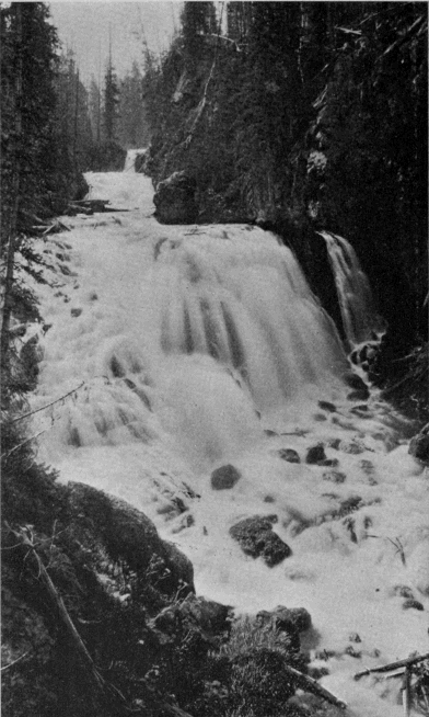
Terry Engr. Co.
U. S. Geological Survey of the Territories.
Kepler Cascade.
CHAPTER XVII.
A TOUR OF THE PARK. Upper Geyser Basin to the Yellowstone Lake.
Distance, nineteen miles. The route ascends the Firehole River to the mouth of Spring Creek, which stream it follows to the Continental Divide. For seven miles it then lies on the Pacific slope, after which it descends the mountains to the Yellowstone Lake. The drive is one of the most pleasant in the Park, and the scenery is unconventional and wild.
Kepler Cascade (1.25 miles) is a fascinating water-fall. Lieutenant Doane, who first wrote of it, says: [BH]
“These pretty little falls, if located on an eastern stream, would be celebrated in history and song; here, amid objects so grand as to strain conception and stagger belief, they were passed without a halt.”
We counsel the tourist not to so pass them.
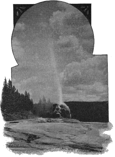
Half a mile up the Firehole, above the mouth of Spring Creek, is the Lone Star Geyser (4 miles). This geyser is conspicuous chiefly for its fine cone. It plays frequently to a height of 40 or 50 feet.
Madison Lake, ten miles further up the valley, is the ultimate lake source of the Madison River. This lake, with possibly the exception of Red Rock Lake, the source of the Jefferson, is further from the sea by direct water-course than any other lake on the globe.
Returning down the Firehole, we enter the mouth of Spring Creek Cañon (3.5 miles), which the road traverses for a distance of two and one-half miles. This narrow, winding, rocky cañon, under the shadow of the Continental Divide, is full of picturesque turns and surprises.
Terry Engr. Co.
Haynes, Photo., St. Paul.
Lone Star Geyser.
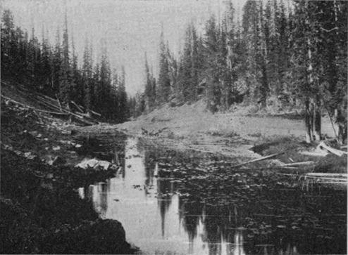
The first crossing of the Continental Divide (8.5 miles) is through a narrow cañon, Craig Pass, hemmed in by precipitous cliffs, inclosing a lily-covered pond, Isa Lake, which rests squarely upon the doubtful ground between the two oceans.
Terry Engr. Co.
Haynes, Photo., St. Paul.
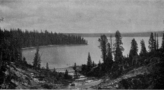
Shoshone Lake.
Shoshone Point (10.5 miles) is in the center of the large amphitheater-shaped tract which is drained by the branches of De Lacy Creek. It overlooks Shoshone Lake and the broad basin surrounding it, and gives a second glimpse of the Teton Mountains.
Terry Engr. Co.
Isa Lake and Craig Pass.
Shoshone Lake is a lovely body of water, with an area of twelve square miles and a most picturesque shore line. On its west shore is a geyser basin, second in importance only to those on the Firehole. Among its many interesting features may be mentioned the Union Geyser, of which the middle crater plays to a height of 100 feet; and the Bronze Geyser, very striking because of the perfect metallic luster of its formation.
From Shoshone Point, the road again ascends to the Continental Divide, and then drops down the Atlantic slope toward the Yellowstone Valley.
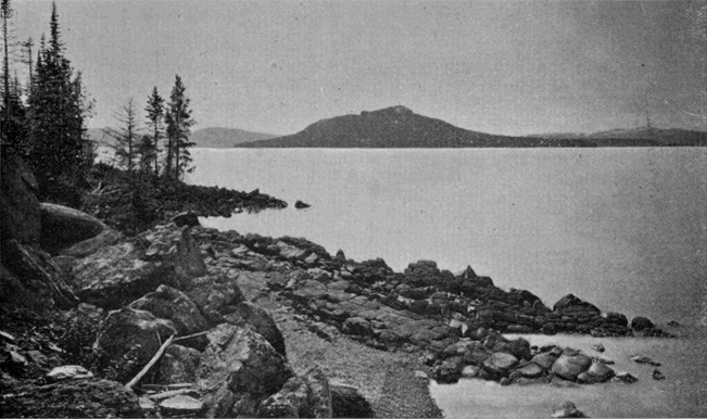
Lake View (18 miles) is at a point where a sudden turn in the forest road brings the tourist, quite without warning, in full view of one of the most striking water landscapes in the world. The whole vista of the Yellowstone Lake is spread out before him, still 300 feet below where he is standing. Far to the right and left, along the distant eastern shore, extends the Absaroka Range of mountains, many of its summits still capped with snow. Every-where the dark pine forests come down to the water’s edge, in fine contrast with the silver surface of the lake. The sparkling of the waves, the passage of the cloud shadows, and, in sheltered coves, the tranquil mirror of the waters, all combine to make the picture one to be long remembered.
The Yellowstone Lake is about 7,741 feet, nearly a mile and a half, above the level of the sea. It has a shore line of 100 miles, and an area of 139 square miles. Its maximum depth is 300 feet, and its average depth about 30 feet. It is fed almost entirely from the springs and snow drifts of the Absaroka Range. Its waters are icy cold, clear and transparent to great depths, and literally swarm with trout. It is subject to heavy south-west winds, and at times is lashed into tempestuous seas.
Terry Engr. Co.
U.S. Geological Survey of the Territories.
Yellowstone Lake.
The shape of the lake was compared by the early explorers to the form of the human hand. The resemblance is exceedingly remote, and one writer has well observed that only the hand of a base ball player who has stood for years behind the bat could satisfy the comparison. The “fingers” have now been generally dropped from the maps and replaced by the usual names; but “West Thumb” seems to have become a fixture.
Surpassing the Yellowstone Lake both in area and altitude there are but few lakes in the world. Lake Titticaca, in Peru, and one or two others in the less explored regions of the Andes; and also a few lakes on the lofty table-land of Thibet, comprise the number.
The Yellowstone Lake has been a theme of enthusiastic praise by all who have ever seen it; but what seems to us the most exquisite tribute it has ever received is to be found in the farewell words of Mr. Folsom, when, in 1869, he regretfully turned away from its western shore into the deep forests which surround it: [BI]
"As we were about departing on our homeward trip, we ascended the summit of a neighboring hill and took a final look at Yellowstone Lake. Nestled among the forest-crowned hills which bounded our visions, lay this inland sea, its crystal waves dancing and sparkling in the sunlight as if laughing with joy for their wild freedom. It is a scene of transcendent beauty which has been viewed by but few white men, and we felt glad to have looked upon it before its primeval solitude should be broken by the crowds of pleasure seekers which at no distant day will throng its shores."
Terry Engr. Co.
Gandy.
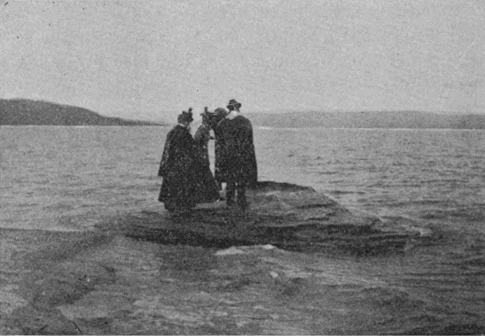
Fishing Cone.
On the west shore of the lake is an extensive and important hot springs basin. The principal features are the Paint Pots, not inferior to those near the Fountain Hotel; two of the largest and most beautiful quiescent springs in the Park; the Lake Shore Geyser, which plays frequently to a height of about 30 feet; an unnamed geyser of considerable power but of very infrequent action; and the celebrated Fishing Cone where unfortunate trout find catching and cooking painfully near together.
From the west shore of the lake a visit can be advantageously made to Hart Lake and Mount Sheridan. The lake is probably the prettiest in the Park. Near it, on the tributary Witch Creek, is a small but important geyser basin. The principal features are the Deluge, Spike and Rustic geysers, and the Fissure Group of springs. The Rustic Geyser is remarkable in having about it a cordon of logs, evidently placed there by the Indians or white men many years ago. The logs are completely incrusted with the deposits of the springs.
Mt. Sheridan would rank with Mt. Washburn as a popular peak for mountain climbers were it only more accessible. No summit in the Park affords a finer prospect.
From the west shore to the Lake Outlet the tourist may travel either by stage around the border of the lake, or by boat across it. If he does not want to miss one of the notable features of the tour he will not omit the boat ride. In fact, a steamboat ride, at an altitude more than a quarter of a mile greater than that of the summit of Mt. Washington is not an every day diversion. From near the center of the lake the view is surpassingly fine. To the south and south-west the long arms of the lake penetrate the dark forest-crowned hills, which are but stepping stones to the lofty mountains behind them. Far beyond these may again be seen for the third time the familiar peaks of the Tetons. All along the eastern shore stand the serried peaks of the Absaroka Range, the boundary which nature has so well established along the eastern border of the Park. A notable feature of this range is the profile of a human face formed by the superimposed contours of two mountains, one several miles behind the other. The best effect is had from points between Stevenson Island and the Lake Hotel. The face is looking directly upward. A similar profile, noted by the early explorers from the summit of Mt. Washburn, and nearly in the same locality as this, although of course not the same feature, was called by them the “Giant’s Face,” or the “Old Man of the Mountain.”
Terry Engr. Co.
Gandy.
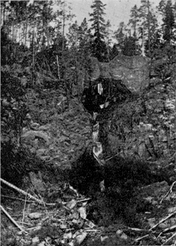
Natural Bridge.
On the north-east shore of the lake are Steamboat Spring, and other thermal phenomena worth visiting. From Bridge Bay at the north-west of the lake, a trip of a mile will take the tourist to an extremely interesting freak of nature in the form of a Natural Bridge over a small tributary of Bridge Creek. The arch is forty-one feet high with a thirty foot span. As seen from the down stream side it is very regular and symmetrical.
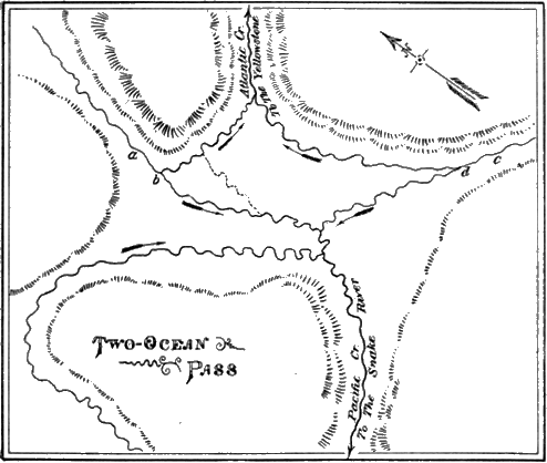
Some twenty miles above the head of the lake is the celebrated Two-Ocean Pass, long known to the early trappers. It is probably the most remarkable example of such a phenomenon in the world. Although the fact of its existence was asserted and stoutly maintained by Bridger for many years prior to the discovery of the Park region, it was generally disbelieved until Captain Jones crossed the pass in 1873. It has since been visited and described by Hayden in 1878, by Hague in 1884, and by Prof. Evermann of the United States Fish Commission in 1891. The following facts and map are taken from Prof. Evermann’s report:
Terry Engr. Co.
Sketch of Two-Ocean Pass.
The pass is in a nearly level grassy park hemmed in by the surrounding hills, and is 8,150 feet above the level of the sea. Its extreme length is about one mile and its extreme breadth about three-fourths of a mile. From the north a stream issues from a cañon, a, and divides at b, part flowing to Atlantic Creek and part to Pacific Creek. A similar stream, c, with a similar division, d, comes from the south. At extreme low water, these divisions may possibly disappear and all the water flow either one way or the other. But at ordinary and high stages the water flows both ways. These streams are by no means insignificant rivulets, but substantial water-courses capable of affording passage to fish of considerable size.
Here, then, we have the very interesting phenomenon of a single stream upon the summit of the continent dividing and flowing part one way and part the other, and forming a continuous water connection between the Atlantic and Pacific Oceans over a distance of nearly 6,000 miles.
A most singular and interesting acoustic phenomenon of this region, although rarely noticed by tourists, is the occurrence of strange and indefinable overhead sounds. They have long been noted by explorers, but only in the vicinity of Shoshone and Yellowstone Lakes. They seem to occur in the morning, and to last only for a moment. They have an apparent motion through the air, the general direction noted by writers being from north to south. The following descriptions are from the pens of those who have given some study to these strange sounds. Prof. S. A. Forbes says:
"It put me in mind of the vibrating clang of a harp lightly and rapidly touched high up above the tree tops, or the sound of many telegraph wires swinging regularly and rapidly in the wind, or, more rarely, of faintly heard voices answering each other overhead. It begins softly in the remote distance, draws rapidly near with louder and louder throbs of sound, and dies away in the opposite direction; or it may seem to wander irregularly about, the whole passage lasting from a few seconds to half a minute or more." [BJ]
Mr. Edwin Linton thus describes it:
“It seemed to begin at a distance, grow louder overhead where it filled the upper air, and suggested a medley of wind in the tops of pine trees, and in telegraph wires, the echo of bells after being repeated several times, the humming of a swarm of bees, and two or three other less definite sources of sound, making in all a composite which was not loud, but easily recognized, and not at all likely to be mistaken for any other sound in these mountain solitudes.” [BK]
No rational explanation has ever been advanced for this remarkable phenomenon. Its weird character is in keeping with its strange surroundings. In other lands and times it would have been an object of superstitious reverence or dread, and would have found a permanent place in the traditions of the people.
CHAPTER XVIII.
A TOUR OF THE PARK. The Yellowstone Lake to Grand Cañon of the Yellowstone.
Distance seventeen miles. The road follows the Yellowstone River along the west bank all the way.
Just after the tourist leaves the Lake Hotel, he will see on the right of the roadway a small monument. It was placed there, in 1893, by the United States Corps of Engineers to mark a position accurately determined from astronomical observations by the United States Coast and Geodetic Survey in 1892. It is of value as a point of reference in surveys and other similar work. [BL]
Mud Volcano (7.5 miles) is a weird, uncanny object, but, nevertheless, a very fascinating feature and one which the tourist should stop and examine. It is an immense funnel-shaped crater in the side of a considerable hill on the west bank of the river. The mud rises some distance above a large steam vent in the side of the crater next the hill, and chokes the vent until the steam has accumulated in sufficient force to lift the superincumbent mass. As the imprisoned steam bursts forth, it hurls the mud with great violence against the opposite side of the crater, making a heavy thud which is audible for half a mile. These outbursts take place every few seconds.
Terry Engr. Co.
Haynes, Photo., St. Paul.
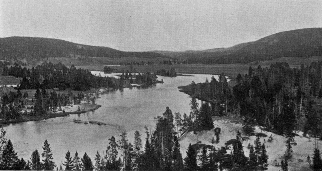
Yellowstone River, between Lake and Falls.
A striking example of the strange commingling of dissimilar features in the hot springs districts is found in the Grotto, a spring of perfectly clear water, not far from the Mud Volcano. It is acted upon by the steam in a manner precisely similar to that of the Mud Volcano, but its waters issue directly from the rock, and are entirely clear.
Mud Geyser, now rarely seen in action, was an important geyser twenty years ago. As it became infrequent in its eruptions, and tourists rarely saw them, the name was unconsciously, but mistakenly, transferred to the Mud Volcano, which has none of the characteristics of a geyser.
The locality where these objects are found has considerable historic interest. The ford just below the Mud Volcano was long used by the hunters and trappers who passed up and down the river. Folsom crossed it in 1869, and the Washburn party in 1870. The Nez Percés encamped here two days, in 1877, and here transpired a part of the episode elsewhere related. Hither came General Howard, in pursuit of the Indians, although he did not cross the river at this point.
Trout Creek (9.5 miles) has a most peculiar feature, where the tourist route crosses it, in the form of an extraordinary doubling of the channel upon itself. It was this stream which Mr. Hedges, in 1870, called “a lazy creek coiled up like a monster serpent under a sand bluff.”
Sulphur Mountain (11.5 miles) is half a mile back from the main route. At its base is a remarkable Sulphur Spring, always in a state of violent ebullition, although discharging only a small amount of water. This is highly impregnated with sulphur, and leaves a yellow border along the rivulet which carries it away. The best time to visit Sulphur Mountain is on a clear sharp morning. The myriad little steam vents which cover the surface of the hill are then very noticeable.
Hayden Valley is a broad grassy expanse extending several miles along the river and far back from it on the west side. It was once a vast arm of the lake. It comprises some fifty square miles, and is an important winter range for the Park buffalo and elk.
Terry Engr. Co.
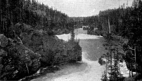
Gandy. Rapids Above Falls.
Terry Engr. Co.
U. S. Geological Survey of the Territories.
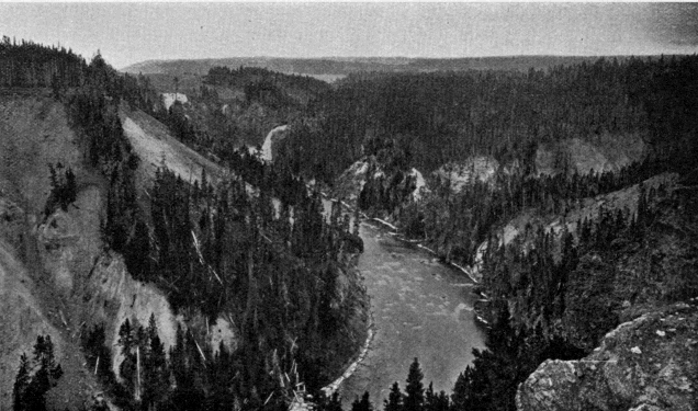
Upper Fall of the Yellowstone. Distant view.
The river along the lower portion of this valley is the most tranquil and lovely stream imaginable—broad, deep, transparent, flowing peacefully around its graceful curves, disturbed only by the splashing trout which inhabit it. There is little here to suggest the mad turmoil into which it is soon to plunge. At a point fifteen miles below the lake, the river and road are forced by the narrowing valley close together. The stream becomes suddenly broken into turbulent cascades as it dashes violently between precipitous banks and among massive boulders.
The road also becomes decidedly picturesque. Hung up on the almost vertical cliff overlooking the rapids, it forms a short drive unsurpassed for interest anywhere else in the Park. At one point it crosses a deep ravine over the highest bridge on the road system. Just to the left of this bridge, in the bottom of the ravine, still stands the tree upon which some white man carved his initials away back in 1819.
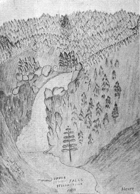
Half a mile below the head of the rapids, the river suddenly contracts its width to less than fifty feet, turns abruptly to the right, and disappears. It is the Upper Fall of the Yellowstone. In some respects, this cataract differs from almost any other. Although the ledge over which it falls is apparently perpendicular, the velocity of flow at the crest of the fall is so great that the water pours over as if on the surface of a wheel. Visitors at Niagara have noticed the difference in this respect between the almost vertical sheet of water on the American side and the well-rounded flow at the apex of the Horseshoe Fall. The height of the Upper Fall of the Yellowstone is 112 feet.
From this point, the character of the scenery is wild and rugged. A ride of a few hundred yards brings the tourist to a sharp bend in the road, which at once unfolds to him the whole vista of the Grand Cañon of the Yellowstone. The sight is so impressive and absorbing that the chances are he will cross the ravine of Cascade Creek without even noticing the lovely Crystal Falls almost beneath his feet.
Terry Engr. Co.
Original Sketch. [BM]
Terry Engr. Co.
U. S. Geological Survey of the Territories.
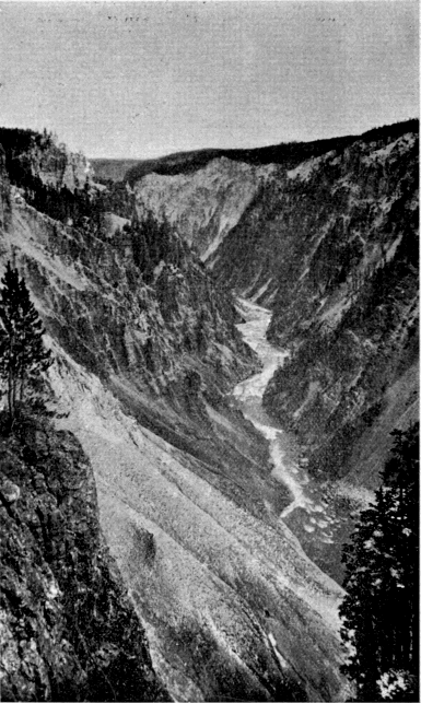
Grand Cañon of the Yellowstone. Looking down—probably from Lookout Point.
Terry Engr. Co.
Hanes, Photo., St. Paul.
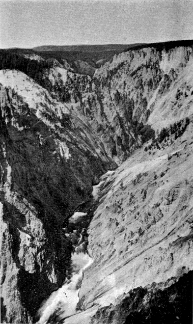
Grand Cañon of the Yellowstone. From Inspiration Point—looking up stream. Lower Fall in the distance.
The Cañon Hotel is half a mile beyond Cascade Creek, in an open park, a little way back from the brink of the Cañon. From its porch, the crest of the Upper Fall can be seen, and the roar of both cataracts is distinctly audible. This hotel and that at the lake are the most desirable in the Park for a protracted stay.
The Grand Cañon of the Yellowstone is acknowledged by all beholders to stand without parallel among the natural wonders of the globe. Other cañons, the Yosemite, for example, have greater depths and more imposing walls; but there are none which, in the words of Captain Ludlow, “unite more potently the two requisites of majesty and beauty.” The cañon itself is vast. A cross-section in the largest part measures 2,000 feet at the top, 200 feet at the bottom, and is 1,200 feet deep, giving an area of over three acres. But such a gorge in any other part of the world would not be what it is here. Its sides would soon be clothed with vegetation, and it would be simply an immense valley, beautiful, no doubt, but not what it is in the Yellowstone National Park.
There are three distinct features which unite their peculiar glories to enhance the beauty of this cañon. These are the cañon itself, the water-fall at its head, and the river below.
It is the volcanic rock through which the river has cut its way that gives the Grand Cañon its distinctive character. It is preëminently a cañon of color. The hue has no existence which can not be found there. "Hung up and let down and spread abroad are all the colors of the land, sea, and sky," says Talmage, without hyperbole. From the dark, forest-bordered brink, the sides descend for the most part with the natural slope of the loose rock, but frequently broken by vertical ledges and isolated pinnacles, which give a castellated and romantic air to the whole. Eagles build their nests here, and soar midway through the vast chasm, far below the beholder. The more prominent of the projecting ledges cause many turns in the general course of the cañon, and give numerous vantage places for sight-seeing. Lookout Point is one of these, half a mile below the Lower Falls. Inspiration Point, some two miles farther down, is another. The gorgeous coloring of the cañon walls does not extend through its entire length of twenty miles. In the lower portion, the forests have crept well down to the water’s edge. Still, it is every-where an extremely beautiful and impressive sight. Along the bottom of the cañon, numerous steam vents can be seen, one of which, it is said, exhibits geyseric action. In places, the cañon walls almost shut out the light of day from the extreme bottom. Lieutenant Doane, who made the dangerous descent several miles below the Falls, records that "it was about three o’clock P. M., and stars could be distinctly seen, so much of the sunlight was cut off from entering the chasm."
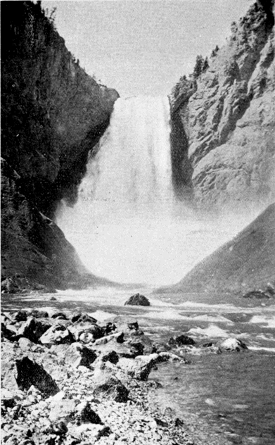
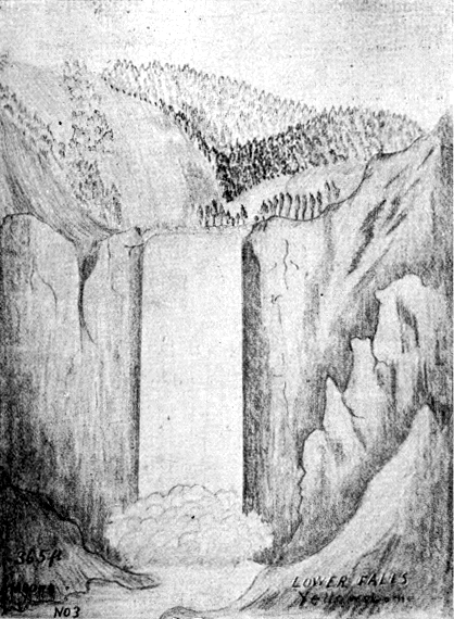
The Lower Fall of the Yellowstone must be placed in the front rank of similar phenomena. It carries not one-twentieth the water of Niagara, but Niagara is in no single part so beautiful. Its height is 310 feet. Its descent is very regular, slightly broken by a point of rock on the right bank. A third of the fall is hidden behind the vast cloud of spray which forever conceals the mad play of the waters beneath; but the mighty turmoil of that recess in the rocks may be judged from the deep-toned thunder which rises in ceaseless cadence and jars the air for miles around.
Terry Engr. Co.
Hanes, Photo., St. Paul.
Lower Fall of the Yellowstone—from below.
Terry Engr. Co.
Original Sketch. [BN]
To many visitors the stream far down in the bottom of the cañon is the crowning beauty of the whole scene. It is so distant that its rapid course is diminished to the gentlest movement, and its continuous roar to the subdued murmur of the pine forests. Its winding, hide-and-seek course, its dark surface when the shadows cover it, its bright limpid green under the play of the sunlight, its ever recurring foam-white patches, and particularly its display of life where all around is silent and motionless, make it a thing of entrancing beauty to all who behold it.
It is not strange that this cañon has been a theme for writer, painter, and photographer, from its discovery to the present time. But at first thought it is strange that all attempts to portray its beauties are less satisfactory than those pertaining to any other feature of the Park. The artist Moran acknowledged that “its beautiful tints were beyond the reach of human art;” and General Sherman said of this artist’s celebrated effort: “The painting by Moran in the Capitol is good, but painting and words are unequal to the subject.”
In photography, the number of pictures by professional and amateur artists, that have been made of this cañon is prodigious. But photography can only reproduce the form, it is powerless in the presence of such an array of colors as here exists.
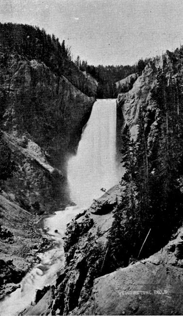
Terry Engr. Co.
Haynes, Photo., St. Paul.
Lower Fall of the Yellowstone—from above.
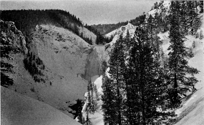
Terry Engr. Co.
Haynes, Photo., St. Paul.
Grand Cañon in Winter. Probably from Lookout Point.
The pen itself is scarcely more effective than the pencil or camera. Folsom, who first wrote of the cañon, frankly owned that “language is entirely inadequate to convey a just conception of the awful grandeur and sublimity of this masterpiece of nature’s handiwork.” Time has shown this confession to be substantially true. From the clumsy work of the casual newspaper scribe, to the giddy flight of that eminent clergyman, who fancied he saw in this cañon a suitable hall for the great judgment, with the nations of the earth filing along the bottom upon waters “congealed and transfixed with the agitations of that day,” all descriptions do injustice to their subject. They fall short of their mark or overreach it. They are not true to nature. We shall therefore pass them by, with one exception, and shall commend our readers to a study of this great wonderwork from the pine-clad verge of the Grand Cañon itself.
The exception to which reference is made relates to the Grand Cañon in winter. It has been explained in another place why it is that the winter scenery of the Park must ever remain a sealed book except to those few hardy adventurers who are willing to brave the perils of winter travel in that region. It is a pleasure, therefore, to give at first hand what one of those intrepid spirits felt as he stood upon Lookout Point less than two years ago, and saw the famous cañon clad in its annual mantle of white. He says: [BO]
"I suppose thousands have stood grasping the stem of that same sturdy, ragged tree, and have looked in silence as we did. They have seen the cañon in summer, and I wish they might all see it also in the depth of winter. Now the glorious colors of the walls were gone, but the peaks and crosses and pinnacles were there, free of all color, but done in clean, perfect white. It was “frozen music”—the diapason of nature’s mightiest and most mysterious anthem all congealed in white, visible, palpable, authentic. No thinking man could stand there and not feel the exalted and compelling theme go thrilling to his heart."
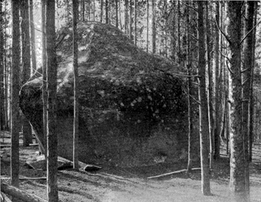
Terry Engr. Co.
U. S. Geological Survey.
Granite Block, near Inspiration Point.
Back perhaps a quarter of a mile from Inspiration Point, but within fifty yards of the brink of the cañon, is a huge rectangular block of granite which rests alone in the woods, a most singular and striking object. It is evidently an intruder in unfamiliar territory, for there is not a particle of granite outcrop known to exist within twenty miles. It must have been transported to this place from some distant quarry by the powerful agencies of the Glacial Epoch.
To the eastward from the Grand Cañon are several interesting hot springs districts, and there is one notable group at the southern base of Mount Washburn.
CHAPTER XIX.
A Tour of the Park. The Grand Cañon of the Yellowstone to Junction Valley.
Distance twenty-two miles. [BP] From the Grand Cañon north lies the true scenic portion of the tourist route. Hitherto, the main attractions have been the geyser basins, the Yellowstone Lake, and the Grand Cañon. The tourist has probably frequently expressed his disappointment at not finding as much rugged mountain scenery as he had expected. But from this point on he will have no cause to complain.
Mt. Washburn (12 miles) is the most celebrated peak in the Park, and the first to receive its present name. Its prominence justifies its notoriety, but the real cause of it is the fact that for eight years the main tourist route lay across it. From its summit the Washburn party received the first definite confirmation of the truth of the rumors that led them into this region. All reports and magazine articles which first gave a knowledge of the Park to the world were written by persons who had crossed this mountain. As the view from its summit is comprehensive and grand, covering almost the entire Park, it of course figured prominently in all narratives. Tourists fell into the custom established by the first explorers, of leaving their cards in a receptacle for the purpose on the summit. Many eminent names are to be seen there. It is a matter for congratulation that the progress upon the road system will soon restore this mountain to its former place in the tourist route.
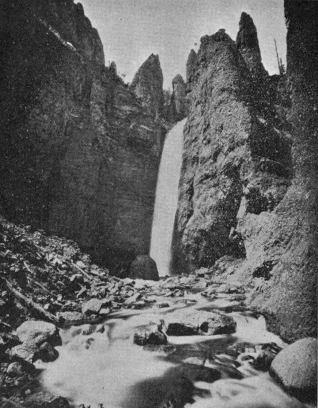
Terry Engr. Co.
U. S. Geological Survey.
Tower Falls.
Tower Falls (20 miles) is perhaps the most graceful cataract in the Park, and should never be passed without a visit. It is on Tower Creek only a short distance back from the Yellowstone. Lieutenant Doane says in his report: [BQ]
“Nothing can be more chastely beautiful than this lovely cascade, hidden away in the dim light of overshadowing rocks and woods, its very voice hushed to a low murmur, unheard at the distance of a few hundred yards. Thousands might pass by within a half mile and not dream of its existence; but once seen, it passes to the list of most pleasant memories.”
Near this point on both banks of the river are numerous sulphur fumaroles, the last evidence of subterraneous fire which the tourist will encounter on his trip. A little way above the mouth of the stream is the old Bannock Ford, the same by which Colter crossed in 1807. It is the only practicable ford within twenty miles in either direction.
Junction Butte (22 miles) is on the right bank of the Yellowstone in the angle between that stream and the East Fork. It stands not only near one of the most important stream junctions in the Park, but also near a not less important road junction. It is a very striking object. Its summit is nearly flat, and its sides near the summit are perpendicular. Below this is a steep slope composed of enormous masses of finely broken stone disengaged from the cliff by the force of the elements. It is a fitting landmark for its important situation.
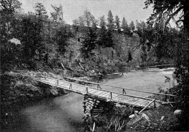
Terry Engr. Co.
U. S. Geological Survey.
First Bridge Over the Yellowstone.
Baronett’s Bridge crosses the river immediately opposite Junction Butte. It is the first and only bridge yet (1895) built across the Yellowstone within the limits of the Park. It was built by the well known mountaineer, J. H. Baronett, in the spring of 1871, for the convenience of Clark’s Fork miners. It was partially destroyed by the Nez Percés in 1877, but was repaired by Howard’s command, and still further repaired the following year by Baronett and Norris. In 1880, it was replaced by a more substantial structure. At present it enjoys the unique distinction of being a private toll bridge on a government reservation.
Junction Valley, [BR] described elsewhere, is a name properly applicable to the valley inclosed by Crescent Hill, Mt. Washburn, Specimen Ridge, and the mountains north of Lamar River. This valley, and those of tributary streams, form the largest treeless tract in the Park.
Amethyst Mountain, Specimen Ridge, and the Fossil Forests are names at once suggestive of the action of geological agencies which have been described in another chapter. Amethyst, limpid quartz, milky quartz, chalcedony, carnelian, prase, chrysoprase, banded agate, flint, jaspers of all colors, semi-opal, calcite, and many other varieties abound. The forest petrifactions present one of the most interesting scientific problems in the Park.
The Lamar River Cañon (7 miles above Junction Butte) is a gorge about half a mile long, the chief characteristic of which is the enormous number and size of boulders which have fallen into it. These are almost spherical in shape, and, in many instances, are as smooth as if from the hand of a stone glazier. They are piled up like billiard balls, to such a depth that the stream flows entirely out of sight beneath them. [BS]
Soda Butte (15 miles above Junction Butte) and Soda Butte Cañon, extending from Soda Butte to Cooke City, are worthy of much attention. The cañon in particular is as wonderful a bit of scenery as any mountains afford. It is every-where rugged, majestic and imposing, and there is no point in its twelve miles length that does not present a landscape deserving of the tourist’s careful study. Mr. W. H. Weed, who has done much work in the Park, and particularly in this section, says of this valley:
“To the eastward Soda Butte Valley penetrates the heart of the rugged Sierra, whose high peaks rise in castellated forms. The visitor, disappointed perhaps in the mountain scenery of the Park, after traveling the usual route over the dusty roads of the Park plateau, will here find mountain views that are sure to fulfill his expectations, while the neighborhood is not lacking in curiosities that in another land would attract visitors from far and wide.” [BT]
Cooke City is a small mining camp just outside the north-east corner of the Park in the midst of the Clark’s Fork mining district. It is of interest in this connection only on account of its notorious hostility to the Yellowstone National Park.
Death Gulch, reputed to exist in the valley of Cache Creek, is like Bridger’s Glass Mountain, mostly a product of the imagination. It seems that some animals were once poisoned there, and that later, certain explorers, finding them, attributed their death to an escape of carbonic acid gas from the earth. The name has found its way into maps and reports of highest authority, but the object itself has no existence.
The Hoodoo Region is near the head of Miller Creek just outside the original reservation, although within the Forest Reserve addition. This mysterious region furnishes probably the most striking example in existence of the effects of erosion and wind action upon masses of moderately soft rock. The region was discovered by miners in 1870, but was first explored and reported upon by Colonel Norris in 1880, who thus describes it: [BU]
“Nearly every form, animate or inanimate, real or chimerical, ever actually seen or conjured by the imagination, may here be observed. Language does not suffice to properly describe these peculiar formations; sketches may probably do something, and photographs more, to convey a conception of their remarkable character, but actual observation is absolutely necessary to adequately impress the mind with the wild, unearthly appearance of these eroded Hoodoos of the Goblin Land. These monuments are from fifty to two or three hundred feet in height, with narrow, tortuous passages between them, which sometimes are tunnels through permanent snow or ice fields, where the big-horn sheep hide in safety; while the ceaseless but ever changing moans of the wild winds seem to chant fitting requiems to these gnome-like monuments of the legendary Indian gods.”
Returning to Junction Valley, and following down the Yellowstone, the tourist soon arrives at the Third Cañon (the third above Livingston, the Grand Cañon being fourth), which extends from the eastern limit of Junction Valley to the north boundary of the Park. Located anywhere else, away from the overshadowing splendor of the Grand Cañon, it would become celebrated. Some of the views, particularly from the high ground north of Mt. Everts, overlooking by nearly 2,000 feet the vast chasm through which the turbulent river flows, are among the most impressive in the entire region.
From the immediate vicinity of the Third Cañon, the road crosses the plateau of Black Tail Deer Creek to the valley of the East Gardiner. The tour terminates at Mammoth Hot Springs.
PART III.—The Future.
CHAPTER I.
HOSTILITY TO THE PARK.
From what has been thus far set forth the reader can not have failed to observe how fortunate have been the events, both in prehistoric and in recent times, which have made the Yellowstone National Park what it is to-day. In the course of long ages Nature developed this region into its present attractive form, and filled it with wonders which will never fail to command the admiration of men. She placed it upon the very apex of the continent, and made of it an inexhaustible reservoir of water for a perennial supply to the parched and rainless desert around it. She interspersed among its forests an abundance of parks and valleys, where the native fauna of the continent, elsewhere fast passing away, may find protection in all future time. With infinite foresight she made it unfit for the gainful occupations of men, so that every motive to appropriate it for private use is removed.
For many years after the white man first looked within its borders, a rare combination of circumstances prevailed to keep it from becoming generally known until the time had arrived when the government could effectually reserve it from settlement. Finally, since its formal erection into a public park, the same good fortune has attended it, in spite of many adverse influences, until it has become thoroughly intrenched in the good opinion of the people.