TOURIST SECTION (continued 3)
Reading edition
Returning to the Place Saint-Ayoul, cross it on the right side, and at the far end take the Rue de la Cordonnerie, which is a continuation.
It was at No. 17 that the poet Hégésippe Moreau was brought up, and where he worked as a typographer. He has sung of Provins and the Voulzie in verses which are well-known:—
La Voulzie, est-ce un fleuve aux grandes iles? Non, Mais, avec un murmure aussi doux que son nom, Un tout petit ruisseau coulant, visible à peine: Un géant altéré le boirait d'une haleine, Le naiu vert Obéron, jouant au bord des flots, Sauterait par-dessus sads mouiller ses grelots.
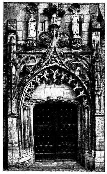
DOORWAY AT SAINTE-CROIX
Cross the Place de l'Hôtel-de-Ville, and following the Rue du Val, stop at the corner of the Rue Sainte-Croix in order to visit the church of this name a few steps further on.
Whilst the tourist continues his walk towards the Hospital-General and the ramparts, which are not accessible to motor-cars, the latter may go and wait at the Porte de Jouy. This is reached by following the Rue du Val and its continuation the Rue St.-Thibaut, which brings one to the upper town. Here cross diagonally the Place du Châtel, follow the Rue Couverte and the Rue de Jouy till the porte is reached.
Church of Sainte-Croix
This Church was originally the Chapel of Saint-Laurent-des-Ponts (it was impossible to enter it save by bridges thrown across the ditches, which are now covered in).
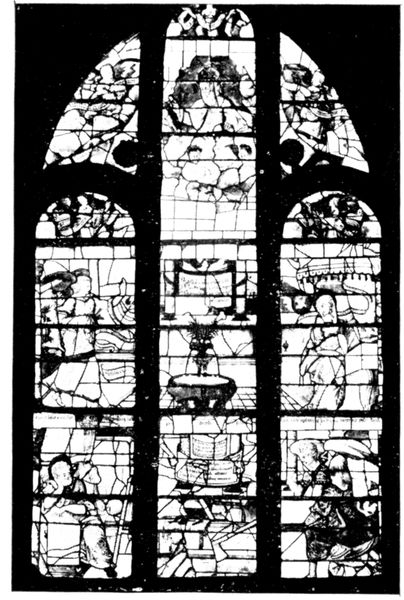
STAINED GLASS WINDOWS, SAINTE-CROIX CHURCH
It was enlarged in the thirteenth century, and took its present name on the return from the crusades of Count Thibaut IV. of Champagne, who presented it with a fragment of the Cross, which he had brought from Jerusalem.
The church was destroyed by fire in the fourteenth century, and rebuilt during the sixteenth. During the Revolution it became a saltpetre factory.
The most interesting part of the façade is the doorway of the side aisle (see p. 132) which is a beautiful specimen of sixteenth century art.
Above the transept rises a twelfth century tower, whose semi-circular belfry windows on the lower stage have been blocked up. The upper part is surmounted by a modern spire.
In the interior, the nave and side aisles date from the thirteenth century, but the vaulting has been restored in recent times. It is noticeable that the pillars have not their normal height. The reason is that the level of the ground had to be very much raised, in order to protect the church from the floods, which were so frequent before the construction of the "Fausse Rivière" which now drains the town.
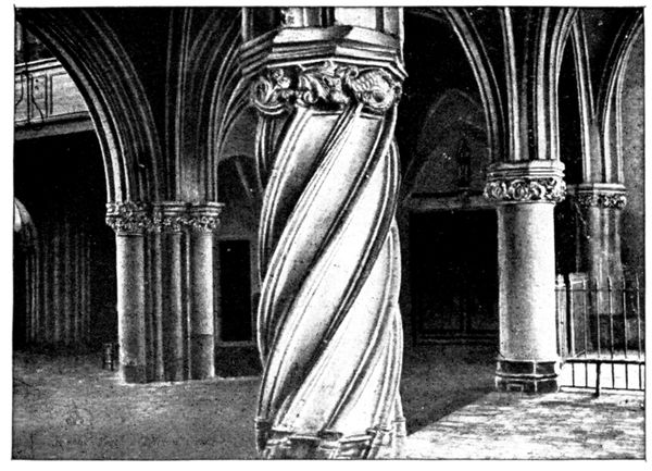
PILLAR, SAINTE-CROIX CHURCH
As at Saint-Ayoul, the north aisle was doubled in the sixteenth century. This part of the church is interesting on account of its moulded pillars whose carved capitals represent fantastic animals, as may be seen in the opposite photograph.
The choir, which was rebuilt towards the middle of the sixteenth century, is surrounded by a double ambulatory, and the screen which shuts it off is a beautiful piece of wrought-iron work.
A chapel terminates the apse, where are to be seen three windows of gray-toned stained glass, also dating from the sixteenth century. In the photograph above is the one on the left of the chapel; it represents the Annunciation.
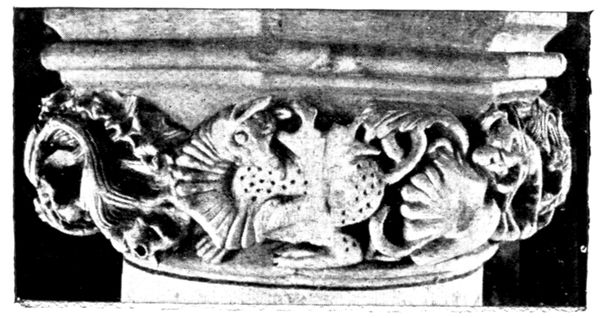
CAPITAL OF PILLAR, SAINTE-CROIX CHURCH
The baptistery (in the left angle of the church on entering) is closed off by a railing which may be perceived in the above view. It contains an interesting thirteenth century font, on which are carved a series of figures taking part in a baptismal procession (see p. 134).
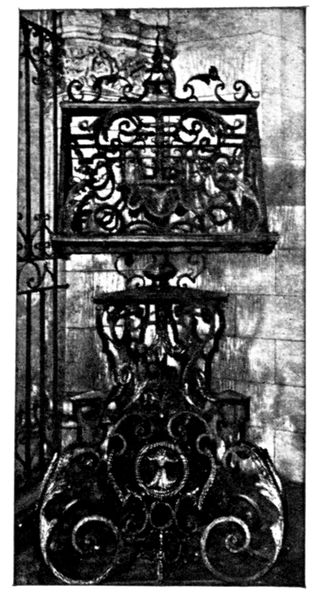
LECTERN, SAINTE-CROIX
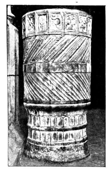
STOUP, SAINTE-CROIX
Beside the railing of the baptistery is a fine wrought iron lectern, dating from the seventeenth century and reproduced in the opposite photograph.
Worthy of notice also is a small stone stoup, dating from the twelfth century, which stands at the entrance to the south aisle (photograph opposite).
On leaving Sainte-Croix, turn to the right into the Rue Sainte-Croix; then take the first street on the left. At the end of this is the Rue de la Bibliothèque, on the right of which is the entrance to a public garden left to the town by M. Garnier. Before entering it, take a few steps to the left as far as the little river, le Durteint, which, flowing between houses, forms a picturesque sight.
Cross the garden, in the middle of which is the former residence of the donor, now transformed into a public library and museum. Passing alongside a monument to the memory of the sons of Provins killed in action, we leave the garden by the little entrance opening on to the Boulevard d'Aligre. This boulevard, constructed on the site of the ramparts, forms a pretty walk. On the other side of it, opposite the "Jardin Garnier," is the mineral water establishment. The ferruginous waters of Provins were discovered in 1646; they may be drunk or bathed in.
On taking the Boulevard d'Aligre to the left, we perceive, standing out on the right, the "Hôpital-Général." In order to reach it, cross the canal by the foot-bridge, and follow the path which leads to the foot of this building and to a gate giving access to the terraced gardens. Turn to the right in front of the gate, keeping to the wall; then take a steep path, half-way up which is the entrance door. Ring and ask permission to view the "hospital."
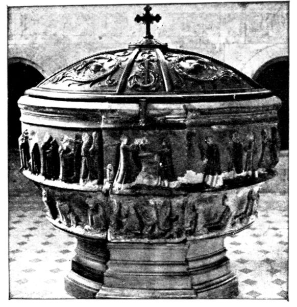
FONT, SAINTE-CROIX
Hôpital-Général
(classed as historical monument)
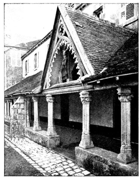
CLOISTER, HÔPITAL-GÉNÉRAL
We must climb a double staircase to reach the upper terrace where is the hospital proper.
The beautiful view of the whole town thus obtained is alone well worth this visit.
The hospital was originally a convent of the "Cordelières," founded in 1237 by Thibaut-le-Chansonnier, Count of Champagne. Tradition relates that he decided to build a convent because of a vision which came to him one night in his palace in the upper town: he saw St. Catherine on the hill opposite tracing the outlines of a building with her sword.
The convent was several times destroyed by fire.
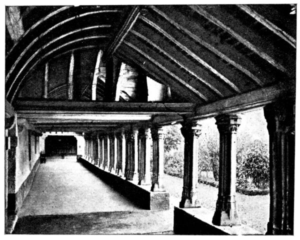
CLOISTER, HÔPITAL-GÉNÉRAL
Henry IV. made it his headquarters when he besieged Provins in 1592, and he narrowly escaped death by a cannon-ball, which killed several of his officers.
In 1748 Louis XV. turned the convent into a "Hôpital-Général." To-day it is a home for old people and orphan children, managed by nuns, who act as guides to tourists desirous of visiting the establishment.
The galleries of the cloisters, dating from the fourteenth and fifteenth centuries, are interesting as showing specimens of very fine timber-work. The foliage of the capitals of the pillars is also to be remarked (see opposite photograph).
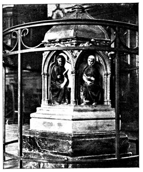
MONUMENT OF THIBAUT'S HEART
In the old chapter-room some handsome vaulting is still to be seen.
In the centre of the chapel is a little stone monument, of the thirteenth century (view opposite), which contains the heart of Thibaut, the founder of the monastery; that of his wife, Isabel of France, daughter of St. Louis; and that of her son. It consists of a carved and gilded metal cover surmounting six panels, each one containing, under a canopy, a monk reading a book.
The visit ended, we retrace our steps to the Boulevard d'Aligre and follow it to the right, crossing the Durteint. The city wall begins at this point.
The Ramparts
(historical monument)
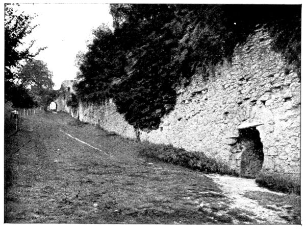
ENTRANCE TO THE TURRET, THE TROU-AU-CHAT
The line of the ramparts climbs upwards. At the summit is a doorway pierced in a part of the wall which juts off from the principal line of ramparts. It is the "Porte Faneron" and formed part of the original wall which surrounded the upper town.
Under the Counts of Champagne the ramparts were considerably developed, and in the thirteenth century were made to include the lower town. The opening in the wall on the right of the above view leads to a thirteenth century tower. The exit is by the "Trou-au-chat," so called because it was formed during a siege by a "cat" (a form of catapult for throwing heavy stones). The photograph below shows the picturesque view obtained from the interior of the turret.
Take the climbing path amidst the trees towards the top of the hill. It is a pretty walk, and affords a good opportunity to judge of the solidity of the walls, which are dotted here and there with towers. The path ends at the Porte de Jouy, where we shall find the car which we left in the lower town, and which has followed the directions on p. 132.
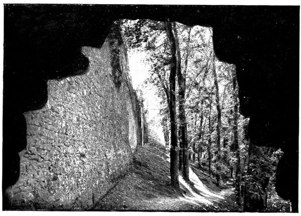
THE RAMPARTS SEEN FROM THE TROU-AU-CHAT
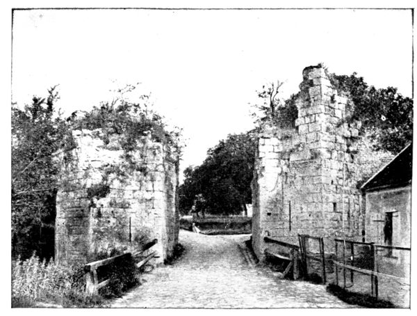
PORTE DE JOUY
La Porte de Jouy (the Jouy Gate) reproduced opposite was constructed in the twelfth century and demolished in the eighteenth, as its keep threatened to fall. It comprised two gates, two portcullises and a drawbridge. A subterranean passage united the two sides; its entrance is still to be seen on the interior of the left hand portion.
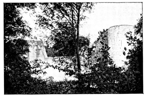
BRÈCHE DES ANGLAIS
Continue the visit of the walls by the outer "boulevard" which is accessible to motors. This part of the fortifications is being restored at present. The way leads past the "Brèche des Anglais" (the English Breach) (photograph opposite), by which the English are said to have effected an entrance in 1432. The great corner tower, the foremost on the photograph below, is the "Tour aux Engins"; it is 65 feet high and its walls are 8 feet thick.
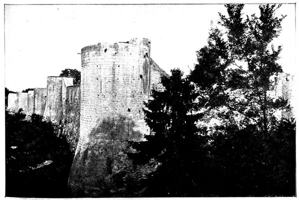
THE RAMPARTS
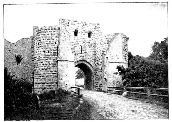
PORTE SAINT-JEAN
We arrive at the handsome Porte Saint-Jean by which we re-enter Provins.
The Porte Saint-Jean defended the old Paris road. It was built in the twelfth century, strengthened in the thirteenth, and was surmounted by a keep which has since disappeared. A drawbridge, a portcullis, and a double door presented successive obstacles to assailants. The masonry of the walls is worthy of note, the stones being dressed in embossment, that is to say, instead of being flat, they are protruding. This arrangement gave a greater force of resistance.
The guard rooms on the ground floor of the two towers communicate with each other by means of a subterranean passage; those of the first floor communicate by means of a gallery.
Re-enter Provins by passing through the gateway and take the Rue Saint-Jean.
La Grange-aux-Dîmes (Tithe Barn)
(historical monument)
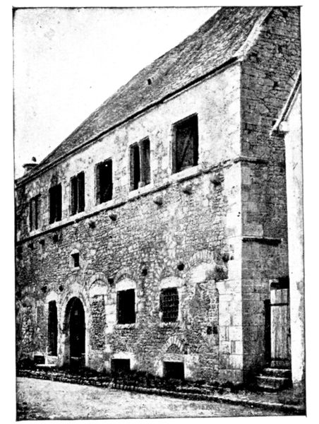
GRANGE-AUX-DÎMES (TITHES)
At the end of the street on the left is the "Grange-aux-Dîmes" (view opposite). An old military building, rebuilt before 1176, it became in turn a market and then an inn. It was afterwards a store-house for the tithes of the harvest, and it is to this last use that it owes its present name.
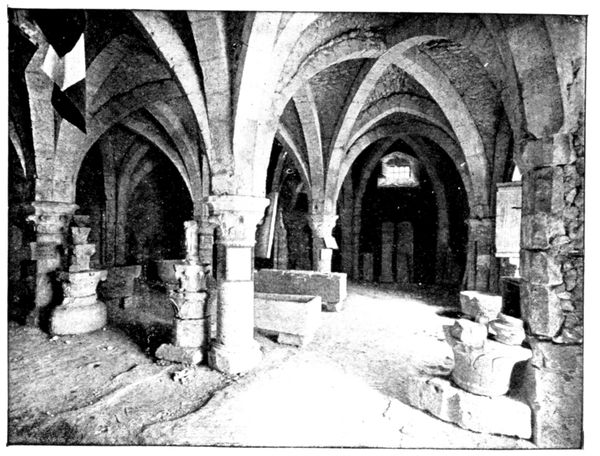
MUSEUM IN THE GRANGE-AUX-DÎMES
To visit it, ask for the key from the guardian who lives opposite, in the house at the corner of the Rue Saint-Jean and the Rue Couverte. There is an archæological museum on the ground floor (photograph on p. 138).
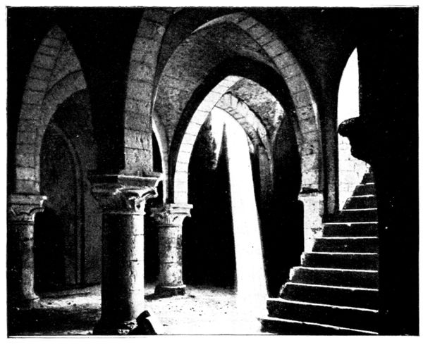
CRYPT OF THE GRANGE-AUX-DÎMES
We descend into the crypt, which resembles the ground floor in disposition (view opposite), by a stairway whose entrance is hidden by a sort of wooden trap-door. A great many of the houses in the upper town have somewhat similar basements or cellars, with subterranean passages giving access to the open country, for use in times of danger.
The upper hall, which is of no especial interest, is reached by an outer stair, visible on the right of the façade.
Place du Châtel
On leaving the Grange-aux-Dîmes, take on the right, at the end of the Rue Saint-Jean, the Rue Couverte leading to the picturesque Place du Châtel seen on the photograph below. The old feudal well on the left, with its wrought-iron top, is 120 feet deep. Beside it is the Crois-aux-Changes, dating from the fourteenth century, on which the "edicts and ordonnances" were posted up.
Beyond the Place may be seen the "Cæsar's Tower."
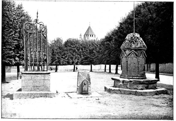
PLACE DU CHÂTEL
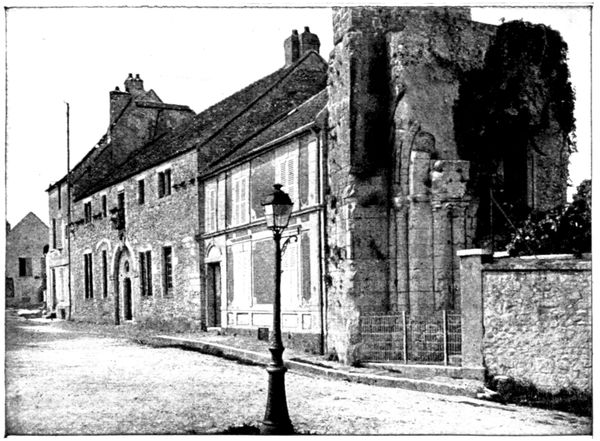
THE HÔTEL DE LA COQUILLE AND THE RUINS OF ST.-THIBAUT
Turning to the left on the Place we reach in the north-west corner, the old "Maison-des-Petits Plaids" where the provost meted out justice. It may be seen in part in the background of the opposite photograph. The curious low roof covers an interesting vaulted passage. The house is built over fine thirteenth century cellars in which the poet and songster Pierre Dupont (1821-1870) composed his "Chanson de la Vigne" (song of the Vine), during a vine-dressers' festival.
In the centre of the above view is the old "Hôtel de la Coquille," which derives its name from the shell carved above its entrance.
The neighbouring ruins are those of the twelfth century Church of Saint-Thibaut. Motorists are advised to send their car to wait for them in the lower part of the Rue Saint-Thibaut at the corner of the Rue Christophe-Opoix, whither they themselves will return after having visited the Cæsar's Tower and Saint-Quiriace. The beginning of the picturesque Rue Saint-Thibaut is to be seen in the photograph below.
Tourists should walk to the south-east corner of the Place and there take the Rue de l'Ormerie, then immediately on the right, the Rue Pierre-Lebrun. The house in which this writer lived is situated in a charming little square, opening off the street.
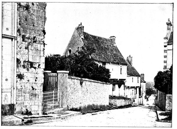
RUE SAINT-THIBAUT
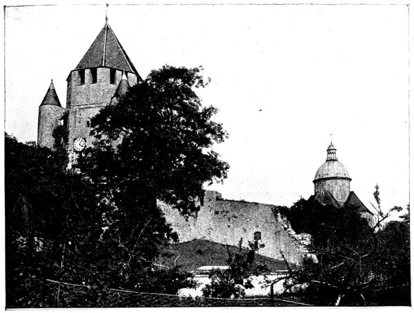
CÆSAR'S TOWER AND ST.-QUIRIACE
The Rue Pierre-Lebrun makes a bend in order to rejoin the Rue Jean-Desmare's, along which turn to the right. From this spot there is a fine view of Cæsar's Tower and of the Church of Saint-Quiriace (see the above photograph). The ruined wall seen in the centre jutting off from the tower belongs to the original fortifications. That piece breaking off from the "Porte Faneron" (p. 136) rejoined Cæsar's Tower.
Continue to descend, passing before the "Pinacle," the old palace of the mayors of Provins. It was there that Guillaume Pentecôte was murdered by the workmen of the town (see p. 129). Further remains of the city wall are encountered, which descend the slope of the hill to the right before rising to the east in order to enclose the lower town.
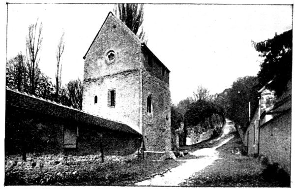
THE EXECUTIONER'S HOUSE
The steep path skirting the wall is called the "Chemin du Bourreau" because the executioners of Provins lived here. Their house still exists and may be seen at the foot of the slope, on the wall. Its last inhabitant was Charlemagne Sanson, who, together with his brother the executioner of Paris, guillotined King Louis XVI. in 1793. The opposite photograph of the Executioner's House was taken from the foot of the hill.
Tourists after descending as far as the "Maison die Bourreau" should remount the same steep path, then gain Cæsar's Tower by the path leading to it.
Cæsar's Tower
(historical monument)
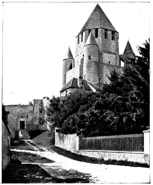
CÆSAR'S TOWER
This superb keep was built in the twelfth century on the site of a Roman fort. The lower battlemented portion was added in the fifteenth century by the English to serve for the installation of their artillery. The pyramidical roof was added in the sixteenth century. The entrance is on the left in the old city-wall, at the top of a little stone staircase. The guardian shows visitors the rooms, the prisons, and the bells which ring for the services in Saint-Quiriace. From the summit a splendid view is obtained.
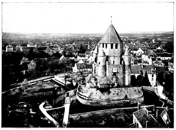
CÆSAR'S TOWER SEEN FROM ST.-QUIRIACE
Saint-Quiriace Church
(historical monument)
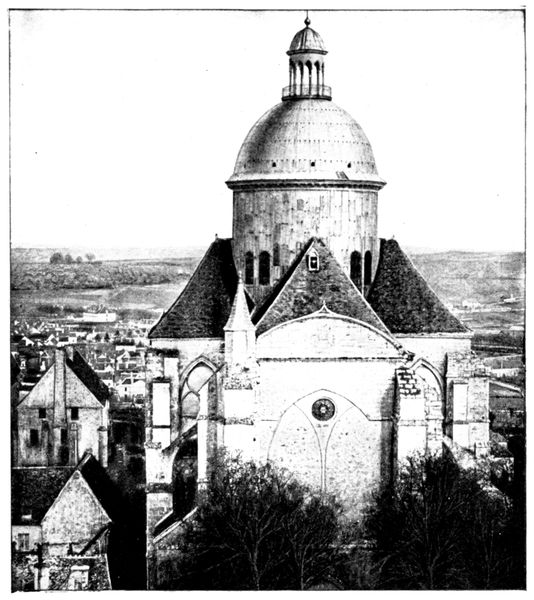
ST.-QUIRIACE SEEN FROM CÆSAR'S TOWER
A pagan temple dedicated to the goddess Isis existed in early times on the site of this church. It gave place in the third century to a wooden chapel, which in its turn was succeeded by the present building, erected in 1160 by Count Henri-le-Libéral.
Saint-Quiriace, a converted Jew, who became Bishop of Jerusalem in the fourth century, indicated to Saint Helena, mother of the Emperor Constantine, the spot where the three crosses of Calvary had been hidden. He suffered martyrdom in 363, and the basilica which crowns the upper town was built to receive the saint's skull.
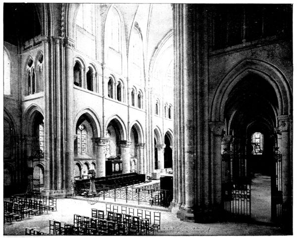
THE CHOIR OF ST.-QUIRIACE SEEN FROM THE TRANSEPT
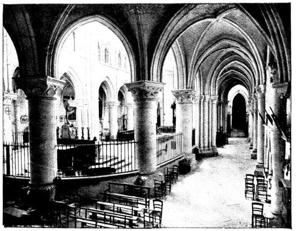
THE AMBULATORY, ST.-QUIRIACE
The original tower which rose above the centre of the transept, was burned in the seventeenth century. It has been replaced by a vast zinc-covered cupola, which, while giving the church a quaint appearance, harmonises little with its style of architecture.
Saint-Quiriace is full of historical memories. King Philippe-Auguste here stood godfather to Count Thibaut-le-Grand (1201); Jeanne d'Arc and Charles VII. heard Mass in it (1429); and Louis XI., Francois I. and Louis XIV. came to take part in "Te Deum."
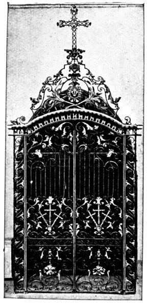
ENTRANCE-GATE, ST.-QUIRIACE
If the church had been finished it would be extremely large. Unfortunately, in the thirteenth century, the construction of the nave was interrupted at the second triforium, a fact which explains the very marked disproportion existing between the choir and the transept on one hand and the nave on the other.
The fabric of the choir is very imposing. It contains an elegant blind-storey gallery extending into the north and south transepts (view on p. 143), and is surrounded by an ambulatory (view above), terminated at the east end by three square chapels.
The greater part of the church furnishings was destroyed at the Revolution; but the fine Louis XV. gate of the principal doorway still exists (view opposite), as does the wood-panelling at the end of the church on the left (photograph below).
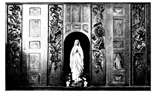
WOOD-PANELLING, SAINT-QUIRIACE
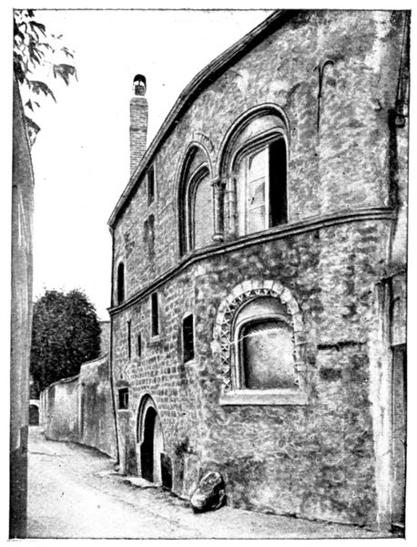
HOUSE IN THE ROMAN STYLE
On leaving Saint-Quiriace, take on the right the Rue des Beaux-Arts leading into the Rue du Palais.
Take a few steps to the left in order to glance at a house in the Roman style, dating from the tenth century (photograph opposite). The tourist will then retrace his steps in the direction of the College installed in the ancient palace of the Counts of Champagne; then descend the Rue du Collège, in which, on the right, are the ruins of St. Peter's Church, built in the thirteenth century and destroyed during the Revolution.
At the head of the flight of steps leading to the lower town, beside St. Peter's, was the "Hôtel des Monnaies" (the Mint), which was founded by Charlemagne. It was there that the "sous Provinois," so well known in the Middle Ages, were struck (see p. 129).
Descend St. Peter's steps, and the Rue des Petits-Lions, which lead to the Rue des Capucins. On entering the latter, one perceives the old "Hôtel de la Croix d'Or," dating from the thirteenth century (photograph below); whilst a little to the right, on the opposite side of the street, is the "Hôtel Vauluisant," also of the thirteenth century. Its front, pierced by four fine mullioned windows with trefoil tracery, may be seen in the photograph below and in that on p. 146.
Retracing our steps we rejoin the Rue St. Thibaut by way of the Rue Christophe Opoix, a continuation of the Rue des Capucins. Here motors coming directly from the Place du Châtel by the Rue Saint-Thibaut may wait.
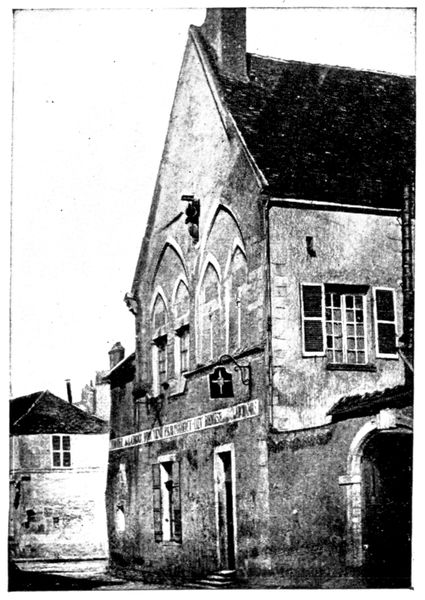
HÔTEL DE LA CROIX D'OR
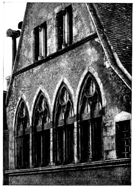
WINDOWS OF THE HÔTEL VAULUISANT
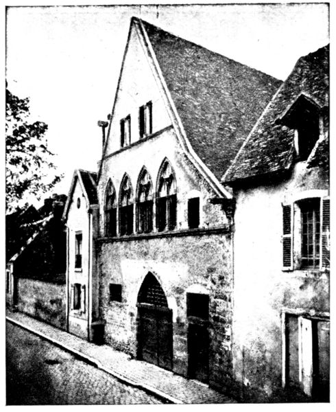
HÔTEL VAULUISANT
Before leaving, take a few steps up the Rue Saint-Thibaut to glance at the "Hôtel-Dieu," the former palace of the Countesses of Blois and of Champagne.
In the vestibule (view below), on the left is a Renaissance reredos in stone. The donatrice (the wife of a bailiff of Provins) is represented in the central panel kneeling to the Virgin.
The vaulted hall, which follows, is very large, and beneath is a crypt of the same dimensions.
This brief visit to Provins and its curiosities being over, regain the hotel for dinner and bed by taking the Rue du Val, the Place de l'Hôtel de Ville, and the Rue de la Cordonnerie. Turn to the right at Saint-Ayoul into the Rue Edmond-Nocard continued by the Rue Victor-Arnoul where stands the hotel.
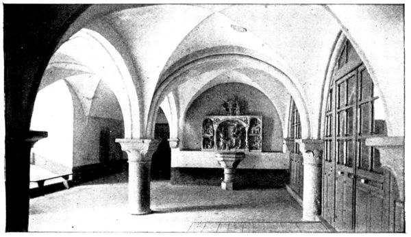
VESTIBULE OF THE HÔTEL-DIEU
Next morning in leaving Provins make for the Place Saint-Ayoul, and turn to the right into the Rue Abailard which skirts the church. Here take the Rue Courloison on the left. After crossing the Courloison Bridge, turn to the left into D. 4, which climbs in zig-zags the slope of the hill to the north of Provins. We entered the town by this same road.
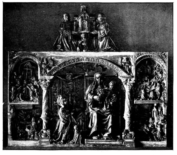
REREDOS HÔTEL-DIEU
During the morning we shall visit the field of operations of the Fifth French Army and arrive at Sézanne for lunch.
VISIT TO THE FIELD OF OPERATIONS OF THE FIFTH & NINTH FRENCH ARMIES FROM PROVINS TO CHÂLONS-SUR-MARNE
FROM PROVINS TO SÉZANNE
(80 km.)
(See map inserted between pp. 116-117)
via Voulton, Augers, Montceaux, Courgiveaux, Esternay, Champguyon, Charleville, and La Villeneuve.
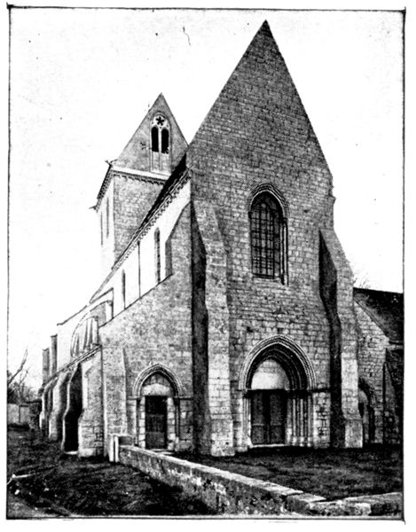
VOULTON CHURCH
At the top of the zig-zag hill at the exit of Provins is a fork in the road. Turn to the right; then take, on the left, the road not lined with trees (G. C. 71) going to Voulton (9 km.).
On the right of the road, in the village, is the church (historical monument) which dates from the twelfth and thirteenth centuries. The interior is worth a visit as the photographs opposite indicate. If the door of the church is locked, ask the "curé" for the key. (The "presbytère" (rectory) is the house with a little garden before it, lying to the left front of the church.)
When the battle of the Marne began on the morning of September 6 the 18th Corps was at Voulton and to the east of this village.
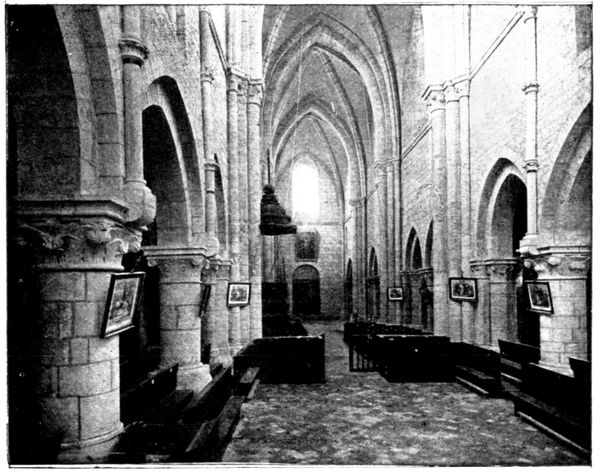
NAVE OF VOULTON CHURCH
After Voulton, cross through Rupéreux, when Augers may be seen in the distance, with its much damaged CHURCH (photograph p. 148). The heights which formed the principal German position shut in the horizon. The task of the left of the 18th French Corps was to push back the advance-guards of the Third German Corps between Voulton and Augers.
On the evening of the 6th, the French camped round Augers.
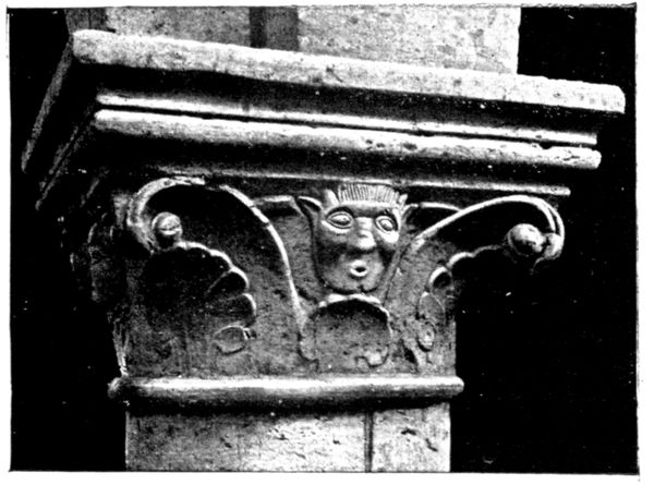
CAPITAL IN VOULTON CHURCH
Arriving in the village, pay a visit to the church, which is to the right of the road. Augers was bombarded in turn by the French and by the Germans, each believing the other to be in the village, whereas they were merely in the neighbourhood. The church suffered particularly, as may well be realised by passing through the breach in the wall shown in the photograph below. The interior presents a scene of desolation.
Returning to the road after visiting the church, turn to the right, then immediately afterwards to the left, and take the "Chêmin vicinal" leading to the main road from Courtacon to Sézanne (D. 8) in which turn to the right.
The tourist now finds himself on the principal German position during September 5 and 6. After a preparation by the artillery, the French troops left the shelter furnished by the undulations of the plateau, and attacked and carried the road on September 7. Following up the pursuit of the retreating Germans, they reached La Ferté-Gaucher on the same day, and crossed the Grand Morin, thus gaining more than 10 km.
2 km. after the cross-roads at Augers, the road leaves on its left the Village of Sancy.
Sancy was not bombarded, the fighting taking place some distance in advance of the locality; but its inhabitants were obliged to submit to the law of the conqueror during two days.
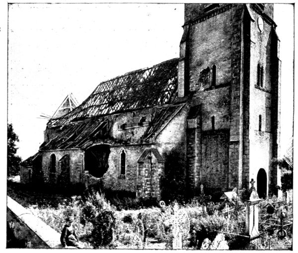
AUGURS CHURCH
The following is the account given by the "curé" of Sancy before the Enquiry Commission:—
"On Sunday, September 6, about 9 p.m., the Germans were carrying off the remaining bottles of wine from my cellar, and I was about to sit down to supper, when a non-commissioned officer announced to me and to my guests that we were to 'Hurry to the Place'. We were put into a sheep-fold to sleep. At 5 a.m. thirty of us were led as far as the barn at Perrelez (4 km. north of Sancy). We were given a little water and finally, to most of us, a small quantity of soup was doled out. The barn had been turned into a German ambulance. A doctor spoke a few words to the wounded who immediately loaded four rifles and two revolvers. A French hussar, wounded in the arm and a prisoner, said to me: 'Give me absolution, Sir; I am going to be shot. Afterwards it will be your turn.' I did as he wished, then unbuttoning my cassock, I placed myself against the wall between the mayor and my parishioner Frederic Gillet. But two French mounted soldiers arriving at this instant saved our lives, for the Germans surrendered to them."
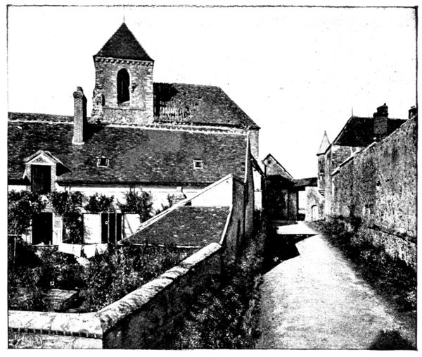
MONTCEAUX CHURCH AND FARM
Without entering Sancy, continue to follow D. 8 which leads to Montceaux. Turn to the left and go up the village as far as the church (23 km.).
Montceaux, on account of its dominating position, had been organised as a defensive position by the Germans. The French artillery bombarded the whole village vigorously and especially the large farm whose entrance is visible at the end of the street in the above photograph. The Germans had established a heavy battery there, directing its fire from the top of the church tower. The church therefore received numerous projectiles, whose effects may be seen in the photograph below, which represents the chapel in the apse. The right of the 18th French Corps attacked the village on September 6, on the south and on the west, and carried it after a violent combat which lasted from 4 p.m. until nightfall.
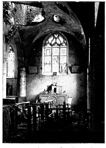
INTERIOR OF MONTCEAUX CHURCH
We retrace our steps and turn to the left into D. 8 in the direction of Courgivaux. On the right of the main road, the Germans, holding the heights where stands the hamlet of Les Châtaigniers, offered a desperate resistance to the efforts of the Sixth Division of the Third French Corps commanded by General Pétain, afterwards Commander-in-Chief. On September 6 this division succeeded in taking the hamlet, but was not able to advance beyond it, in spite of the fact that the 18th Corps held Montceaux. On the following morning, the Germans counter-attacked unsuccessfully, and in the afternoon the French (whose 123rd Regiment had particularly distinguished itself at Montceaux) hurled their adversaries back on to the farther side of the Grand Morin.
D. 8 becomes G. C. 46 on entering the Department of the Marne.
Before arriving at Courgivaux, pass over a level-crossing, then turn to the right by the drinking-pond, and ascend the village, bearing to the left towards the cemetery (29 km.). The latter occupies a dominating position and played an important part in the actions engaged in by the Fifth Division, commanded by General Mangin, for the possession of Courgivaux.
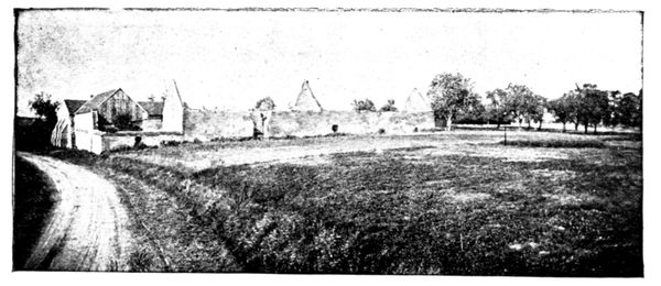
FARM AT COURGIVAUX
The German advanced defences around Escardes (about 2½ km. along this road) were carried after a stiff fight in which the two colonels of the Ninth Brigade were wounded. The Germans fell back on the line formed by the cemetery of Courgivaux and the farm of Bel-Air visible in the photograph above, and about 300 yards west towards the village.
After a bombardment by "75's," the troops of the Third Corps, leaving the woods, crossed the open ground at a run, and after several fruitless attempts dislodged the Germans from the cemetery, then from the farm, and finally from the village. The French held these positions in spite of a counter-attack at night, and on the 7th the Germans were in retreat towards the north.
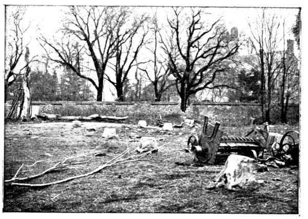
COURTYARD OF ESTERNAY CASTLE FARM
After having visited in the cemetery the graves of several officers of the 39th, 74th and 129th Regiments, who fell here, we retrace our steps and turn to the right into the G. C. 46 in the direction of Esternay. A long climb leads to Retourneloup where G. C. 46 rejoins N. 34 coming from La Ferté-Gaucher.
We are now entering the theatre of operations of the First French Corps. Retourneloup was bombarded, as a German battery had been established there to hold the road to the Esternay hollow. This battery was hammered by the French artillery. The "curé" of Esternay, who had been made prisoner at the very beginning of the German occupation, was led to Retourneloup, and passed an anxious time during the battles of the 6th and 7th. Each time that the French attacked—and they attacked ten times during the day of the 6th, the "curé" was placed at the head of the German column which advanced to resist them. He was also roughly handled and given nothing to eat, besides being frequently threatened with being placed against a wall and shot. The Germans took him with them in the retreat and continued to put him in an exposed position in all rearguard actions. They finally set him at liberty about ten kilometres from Esternay.
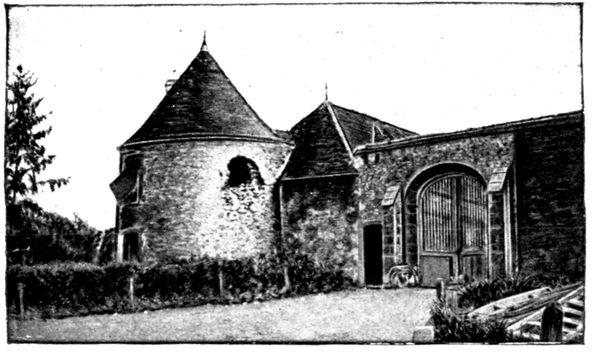
ENTRANCE TO THE ESTERNAY CASTLE
A zig-zag descent leads down to Esternay, in the hollow. Go straight on without entering, and gain the opposite slope. After crossing the railway line, take the road on the left leading to the castle (36 km.).
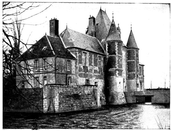
ESTERNAY CASTLE
This last is preceded by a farm which still bears traces of the bombardment which it suffered (view p. 150).
The castle, which belonged to Marshal Fabert, is now the property of the Marquis de la Roche-Lambert. The opposite view gives a good idea of its picturesqueness. It was occupied by a German staff, and its park defensively organised. The castle suffered less than the farm.
We retrace our steps over the 300 yards separating the entrance to the castle from N. 34, which we cross in order to take the opposite "Chêmin vicinal" leading down to Châtillon-sur-Morin. Pass over a level-crossing in order to enter the village, which was completely destroyed by the bombardment and by the fires lighted by the Germans before evacuation.
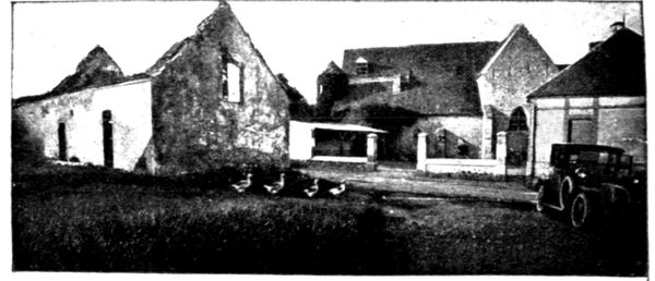
Turn to the left in the village to arrive at the little church (38½ km., view below), which by a curious chance alone remained untouched in the midst of ruins. The above view was taken from the church tower.
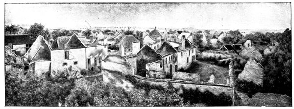
BURNT HOUSES AT CHÂTILLON
Châtillon formed the advanced position of the defences of Esternay. The troops of the First Division had the honour of being chosen to attack, and fierce was the fighting in the burning streets of the village. The 84th Infantry, many of whose officers and men are buried in the churchyard, gave a brilliant example of stubborn courage. On the evening of the 6th, Châtillon was in the hands of the French, who were, however, for that day unable to advance further towards Esternay, being held up by the defence works on N. 34 (see panorama on p. 152).
CHÂTILLON CHURCH
Return to the main road from Esternay to Sézanne (N. 34), stopping at the last houses of Châtillon, the spot from whence the above photograph was taken. The position which the French troops in possession of Châtillon had to carry was formed by the plateau seen on the horizon, along which passes D. 8 at the foot of Esternay castle.
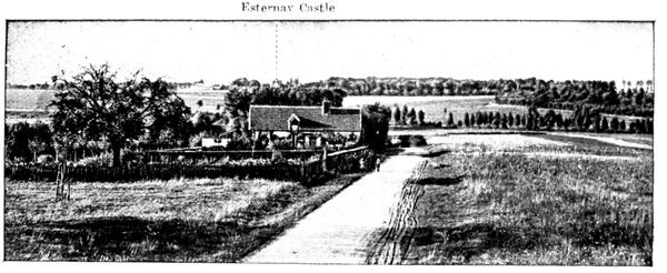
PANORAMA OF THE ESTERNAY POSITIONS
Esternay Castle
This frontal attack presented many difficulties, for even if the French arrived as far as the railway line which runs along the bottom of the valley, and were able to take cover under the embankment, they would be mown down when they attempted to scale the bare slopes. The woods which appear on the right in the above view afforded shelter to the troops up to the main road, but when they attempted to advance into the open they were met by a murderous fire. Being unable to force the frontal defences, the commandant of the First Corps ordered the Second Division to make a considerable detour to the east, under cover of the woods, in order to take the positions on Esternay Plateau in the flank. On the evening of the 6th, a first attack failed, but next morning the Second Division carried the position which covered the German flank, and combining its efforts with those of the First Division on the front, entered Esternay about 10 o'clock in the morning.
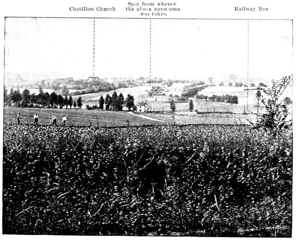
PANORAMA OF THE CHÂTILLON POSITIONS
Châtillon Church
Spot from whence the above panorama was taken
Railway line
Once more on the N. 34, turn to the right. The slope served as a protection for the Germans, who dug many individual shelters there. One of these may be seen in the foreground of the preceding photograph. We begin to realise the difficulties which the French had to surmount when we remember that after the battle, on the front of a single battalion, 11 officers and 4 non-commissioned officers lay dead, killed while leading their men.
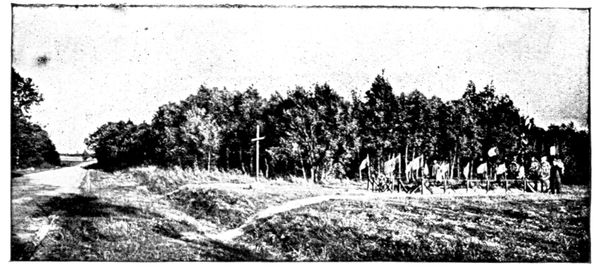
COMMON GRAVE AT ESTERNAY
Leaving behind, on the left, the park which adjoins the road, we perceive on the right the great common grave of Esternay (view above), where lie buried the heroes of the 73rd who fell during the attack. The turning movement mentioned on page 152 led across the road at about 3 km. from this spot, at the other extremity of the wood. The village of La Noue, to the north of the road, was carried, and the Second Division then turned back towards Esternay.
(Sézanne is only 10 km. from this point by N. 34, but the tour indicated hereafter, which leads across part of the line where the direct attack on this town was broken, makes a circuit of 34 km. The remainder of the line will be explored to-morrow.)
We retrace our steps. A little wood fringes the road on the right. The German machine-guns were installed there, and cut down the French who attempted to leave their shelter on the other side of the road. About 100 yards further on the wood gives place to a field, on the edge of which, at about 20 yards from the road, in the midst of the trees, is the grave of an unknown French soldier—a pathetic sight. A little further on, in the field, are to be seen the isolated graves of two German officers, one of them of the family of the Chief of the General Staff, Von Moltke (view below). Between these graves and the border of the castle park many Germans lie buried. The fighting was very violent here in the trenches which the enemy had dug at right angles to the road. Outflanked on the north by the turning movement we have spoken of, the castle and the farm, as well as the park, were carried at the point of the bayonet. From this moment, Esternay, situated in the hollow, could offer no serious resistance, and the French entered it without difficulty.
Re-cross the railway line and take the first road on the right, leading into Esternay and to the Place de l'Église (48 km.). The church was transformed into an ambulance station by the Germans.
The following evidence given by the deputy-mayor and other witnesses before the Official Enquiry Commission recalls painful incidents of the occupation by the enemy.
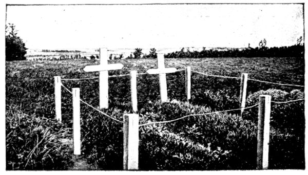
GRAVES OF GERMAN OFFICERS
"On September 6 the Germans pillaged nine-tenths of the houses in the town. This pillage was organised, objects of all kinds, linen and other belongings, being placed on carts."
Another witness declared: "About 3 o'clock in the afternoon, thirty-five or forty Germans came out of the church shouting, and leading with them M. Laurenceau, aged 52 years. The latter on arriving at the road made a movement as if to escape and was immediately felled to the ground. Then, although he lay quite still, he received three bullets."
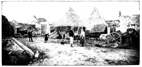
FARM SET ON FIRE AT CHAMPGUYON
A third witness declared: "On the night of September 6 I was with my two daughters and Mme. Lhomme in hiding under the stairs of the cellar of Mme. Macé, a widow. Groups of German soldiers kept passing round the house, and some had even come into the cellar without discovering us. Between 11 p.m. and midnight, one of these bands having found women's clothes in a cupboard, came towards our hiding-place. As they had seen us, Mme. Macé exclaimed: 'Do you wish to kill old women?' To which they replied: 'No, no harm to grandmother,' and pushed her on one side. They next tried to push me aside, crying 'Fraulein all naked,' but could not move me. One of them then shouldered his rifle. I raised my arm to strike up the muzzle, but he was too quick for me, and, taking advantage of the space thus disclosed between the young girls and myself, lowered his arm and fired. Mme. Lhomme was wounded in the left arm by a ball which then shattered the left arm of my daughter Marcelle, aged 27 years. She died between 4 and 5 o'clock on the afternoon of September 7."
In the Place de l'Église, turn to the right, then immediately afterwards to the left towards Champguyon. The road (G.C. 48) shortly afterwards traverses a level-crossing and passes alongside the cemetery which contains the remains of many French soldiers. This road was the one followed by the Germans when they fell back on Montmirail, before the French.
Traverse the long street of Champguyon (53 km.) which suffered much from the bombardment, but more from the fire started by the enemy. The view above was taken in the courtyard of a farm, which stands on the left of the road, a little this side of the church. The view below shows a ruined house, being one of a group about 1 km. further on.
Several of the inhabitants were murdered. The widow of one, Mme. Louvet, thus related the death of her husband:
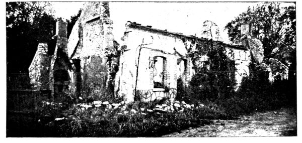
BURNT HOUSES, CHAMPGUYON
"About 5 p.m. on September 6, my husband, whom the Germans were dragging along and striking with sticks, called to me, exclaiming: 'My wife, my poor wife.' I ran and kissed him through our garden gate, but was roughly repulsed by his captors, and fell. My poor husband was in a piteous state, blood streaming from his ears. He begged for mercy and asked: 'What harm have I done you?' He also cried out: 'Colonel, colonel.' I could not help him, for the Germans who were torturing him were from ten to fifteen in number, and kept their rifles pointed at my throat. They bore off their victim to the end of the village, doubtless to put an end to him. The next evening about 5 p.m., I found the unfortunate Louvet. His head was horribly smashed, one eye was out of its socket, and one of his wrists was broken. He was almost unrecognisable."
Continue to follow G. C. 48, then take, on the right at the cross-roads, G. C. 46 leading to Morsains (56 km.). Arrived at the latter, turn to the right beyond the church. This road is the G.C. 47. Cross through the village, and before arriving at Perthuis, turn to the left at the cross-roads. At Perthuis (58 km.) turn to the right, and, traverse the locality, turning again to the right on leaving it. We thus leave the theatre of operations of the First French Corps and enter that of the Tenth Corps. On the right of the horizon may be seen the Forest du Gault, on the borders of which the Tenth Corps engaged furious combats with the Tenth German (Reserve) Corps.
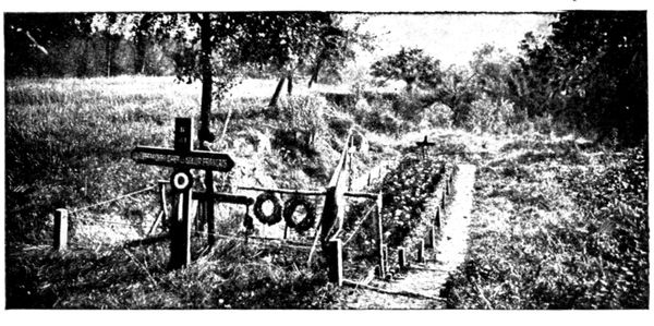
GRAVE IN A SAND-PIT
On reaching La Rue-le-Comte (59½ km.) traverse it throughout, as also a level-crossing, in order to arrive at Le Gault-la-Forêt (60½ km.). Pass through it. Several of its houses were burnt by the Germans, who also shot the old rural policeman.
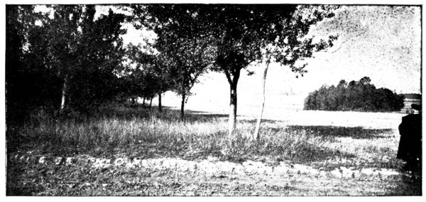
BATTLEFIELD OF CHARLEVILLE
At the cross roads at the end of the village, turn to the right, then immediately afterwards to the left, going round the church. After reaching the hamlet of Le Recoude (63 km.), the western portion of which was damaged by bombardment, turn to the left on entering and traverse the village from one end to the other.
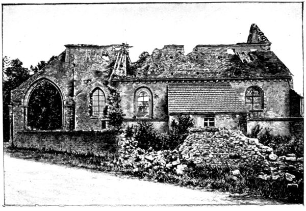
CHARLEVILLE CHURCH
During the morning, on September 6, the left of the Tenth French Corps, after penetrating the Forest du Gault, reached the road which the tourist has been following between La Rue-le-Comte and Le Recoude. In the afternoon it was obliged to retire into the forest, but on the following day it attacked again, took numerous prisoners in the forest, and carried the line which it had occupied the day before. It was from this line that it set off on the 8th to continue its advance to the north-east. G. C. 47 continues in the direction of Charleville. Before entering the village, stop the car at the mile-stone "6 km. 2," 20 yards before arriving at the first isolated house.
Take on foot the path on the left, which leads to the grave seen in the photograph on p. 155, and which is about 150 yards distant. This grave made in a sand-pit contains the bodies of 180 officers and men who fell in the engagements at Charleville. 50 yards further on may be seen from the path and to the left, the view shown in the photograph on p. 155.
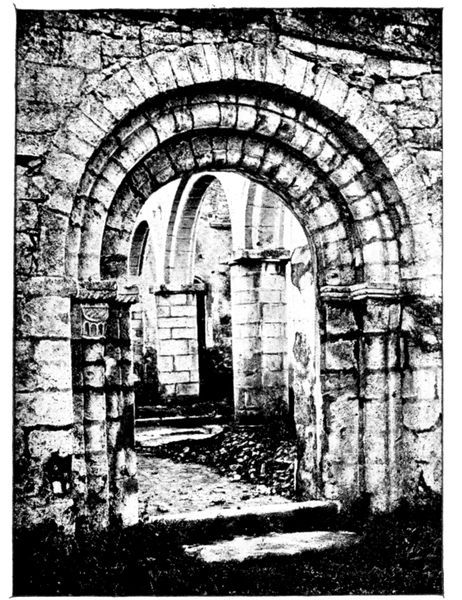
CHARLEVILLE CHURCH
The French occupied a trench dug under the line of trees seen on the left; the Germans were installed on the hills which shut in the horizon. It was only on September 8, after three days' fighting, that the 20th Division was able to dislodge the enemy from these slopes.
Return to the car and enter Charleville (66½ km.). The church, seen in the photographs on p. 155 and opposite, was much damaged by the German bombardment. Walk round it, then enter.
Although the neighbouring villages of La Villeneuve and Le Recoude changed hands several times, Charleville, which had been taken on the 6th by the 20th Division, remained in the possession of the French. The fighting was extremely fierce all round the village, and particularly on the spot indicated above where the 2nd Infantry Regiment distinguished itself.
Continue to follow G. C. 47, leaving on the right the road which leads through the village. At the next cross-roads bear to the right and continue until La Villeneuve (68½ km.) is reached.
Numerous houses were destroyed by the French and German bombardments. The church, as may be seen in the photograph below, is in ruins. La Villeneuve was where the Fifth and Ninth French Armies joined. It was occupied by the 42nd Division on the evening of September 5. On the 6th it passed from hand to hand: lost at 8 a.m., retaken at 9 a.m.; lost again towards midday, and finally re-conquered at nightfall by the French.
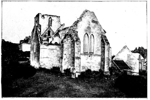
LA VILLENEUVE CHURCH
On the 7th the struggle was equally obstinate and violent. La Villeneuve was again taken and retaken. It was only on the 8th that the 42nd Division succeeded in breaking the German resistance, and advanced northwards. The principal obstacle had been a howitzer battery installed beyond the Morin, near Le Thoult (5 km. from La Villeneuve.) It rained shells on this locality and also prevented the Tenth Corps from advancing from Charleville.
This battery was marked down, thanks to the knowledge of the country possessed by the "curé" of La Villeneuve, l'Abbé Laplaige. From an attic window he discovered, by means of field-glasses, the spot from which the shots were fired, and pointed it out to the officer commanding the French batteries. The Germans were soon reduced to silence, and progress became possible for the 42nd Division at La Villeneuve and the Tenth Corps at Charleville.
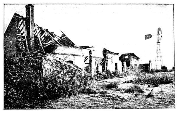
WINDMILL WATER-PUMP AT LA VILLENEUVE
Near the middle of the village, take on the left, skirting the drinking-pond, the "Chemin vicinal" leading to Corfélix and Le Thoult. The windmill pump, seen in the photograph above, will soon be perceived, near a group of ruined houses. It was from the upper platform of the pump that the officer commanding the French artillery, guided by the Abbé Laplaige, directed the fire which destroyed the German battery at Le Thoult, The rising ground of the left bank of the Morin, which attains a height of 670 ft. directly north of La Villeneuve, hid the whereabouts of the German guns on the right bank on Hill 189. The elevated structure of the pump made an ideal observatory and compensated for the height of the ground on the left bank of the river.
Return by the same path to the drinking-pond and take, on the left, G. C. 47, leading to Chapton. On the right of the road are the woods of Bois-de-la-Ville, on the left those of La Braule. The troops of the 42nd Division fought desperate engagements in these woods during the alternatives of retreat and advance from September 6 to 8. Pass through Chapton (72½ km.), which marked the utmost limit of the direct German advance on Sézanne.
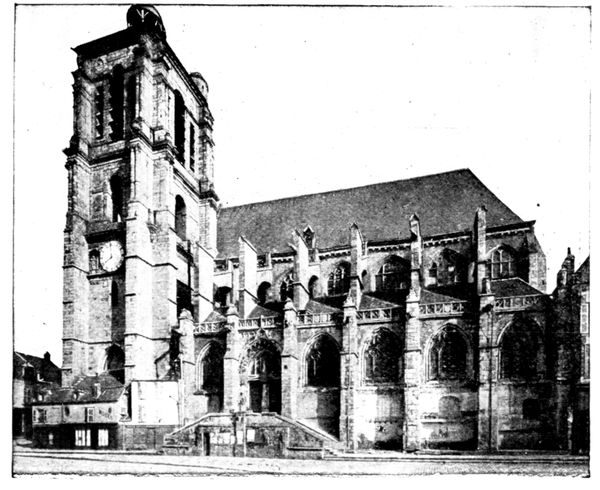
SÉZANNE CHURCH
Shortly afterwards, on arriving at the main road (N. 51), turn to the right and descend into Sézanne, which suddenly comes into view at the foot of the hill, and makes a pretty picture. It was to attain this edge of the plateau, which commands a wide horizon, that the Germans made such desperate efforts on either side of N. 51, efforts which were, however, rendered vain by the admirable resistance of the 42nd Division.
Enter Sézanne (80 km.) by the Rue d'Épernay, then turn to the right into the Rue de la Halle leading to the Place de la République. Here is the church (view opposite). From thence we seek out the hotel where we intend to dine and sleep (see plan, p. 158).
SÉZANNE
VISIT TO THE TOWN
The most interesting sight is the church (historical monument), a view of which is given on p. 157. It dates from the fifteenth and sixteenth centuries. To visit the interior, enter by the little door opening on to the Place de l'Hôtel-de-Ville, and opposite an old well enclosed within a wrought-iron railing.
The stone reredos, against the wall on the left on entering, is worthy of note. An interesting walk is to follow the line of the ancient fortifications now changed into a public promenade. The most interesting part is the "Mail des Cordeliers" to the north.
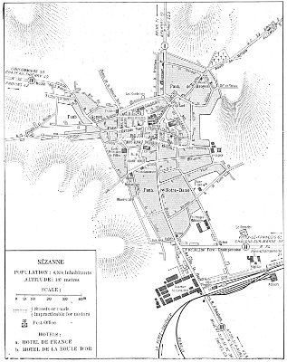
SÉZANNE
THE MARSHES OF SAINT-GOND
TOUR IN THE NEIGHBOURHOOD OF SÉZANNE
(65 km.)
via Broyes, Allemant, Broussy, Bannes, Coizard, Congy, Champaubert, Baye, Saint-Prix, Oyes, Reuves, Mondement.
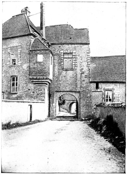
CHÂTEAU DES PUCELLES
This part of the tour should be done in the morning, for the region of the marshes is devoid of hotels, even of inns, and, tourists must therefore return to Sézanne for lunch. After lunch, we set out for Fère-Champenoise, ascend the valley of the Somme, to arrive at Châlons-sur-Marne for dinner and bed.
Leaving the hotel, re-cross the Place de la République and take on the left the Rue de la Halle, continued by the Rue de Broyes. The latter turns suddenly to the left (the street which continues in the former direction is the Rue de Châlons). The road (G. C. 39) skirts the cemetery and mounts towards Broyes, through which we pass, leaving the church on the left (5½ km.). On a level with the church, take the street on the right, and 300 yards further on we encounter the old "Castle des Pucelles," seen in the photograph above.
General Humbert, commanding the Moroccan Division, established his headquarters in this castle on September 7, Mondement Castle having become uninhabitable. It was from here, when Mondement had been taken by the Germans, that he directed the counter-attacks which drove them from it. The "Castle des Pucelles" is perched on the edge of the plateau dominating almost vertically the immense plain of the Aube. Mondement is only 3½ km. distant. One can easily realise how tragic was the situation during the days of September 8 and 9, 1914, of the troops standing at bay at Broyes, and understand the savage fury with which they attacked Mondement.
Quitting the "Castle des Pucelles," continue straight along G. C. 39, leaving on the left the "Chemin vicinal" leading to Mondement (we shall follow it in the opposite direction on our return).
Traverse Allemant Woods and the village of that name, through which we pass, leaving the church (9 km.) on the right. From its steeple in 1814 Napoléon watched the battle which was raging in the plain below. After the first group of houses comes a fork in the road; the one on the right descends into the plain, that on the left goes towards the marshes of Saint-Gond.
Before taking the latter, turn to the right on the crest for a few steps in order to contemplate in its entirety the beautiful view reproduced in the panoramas on pp. 160 to 163.
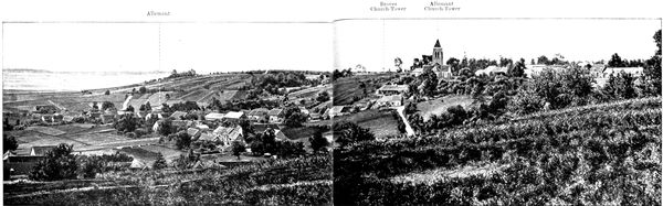
I. PANORAMA OF ALLEMANT
Allemant
Broyes Church-Tower
Allemant Church-Tower
This part of the panorama fits on to the right of panorama II (p. 161).
The plain which stretches at our feet, as far as the eye can reach, right up to the Aube, and of which the panoramas on pages 160 to 163 give a good idea, was the stake in the battle which for five days engaged the army of Foch and those of Von Bulow and Von Hausen. The heights whose crest we have been following since leaving Sézanne assured its control. From there the Germans with their powerful artillery would have been able to destroy the French Corps which had withdrawn to the plain. They would also have been able to manœuvre freely in order to fall on the rear of the army of Espérey on the west, and that of Langle de Cary on the east. The whole plan of the battle of the Marne would have collapsed. The nature of the ground permits us to understand the particular violence of the struggle at this point: the Germans ready to sacrifice everything in order to attain the heights, the French disputing fiercely every inch of the ground.
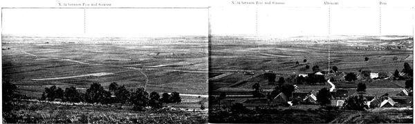
II. PANORAMA OF THE PLAIN OF THE AUBE.
N. 34 between Fère and Sézanne
N. 34 between Fère and Sézanne
Allemant
Péas
This part of the panorama fits on to the left of panorama I (p. 160).
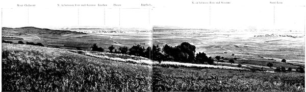
III. PANORAMA OF THE PLAIN OF FÈRE-CHAMPENOISE.
Mont Chalmont
N. 34 between
Fère and Sézanne
Linthes
Pleurs
Linthelles
N. 34 between Fère and Sézanne
Saint-Loup
This part of the panorama fits on to the left of panorama II (page 160).
While attacking the height on its front, from the south bank of the Marshes (see the panorama on pages 182-183), the Germans also tried to outflank it on the east.
We have seen in the general account of the battle how prodigious were their efforts to cross the Somme, which formed a covering line, and then to debouch from Fère-Champenoise. This locality is hidden behind Mont Chalmont, on the left of the panorama above. This manœuvre very nearly succeeded. During the day of September 9, the soldiers occupying the promontory, where stands the tourist, saw to the north in the direction of the Marshes, the advancing Germans arrive within firing distance of the farthest trench. If they turned their eyes eastwards, they saw the 17th Division falling back on Mont Chalmont (panorama above) and the artillery take up its position on the western slope. Further south, debouching from the screen formed by this ridge, the firing line came into view spreading towards Linthes and Pleurs. The terrible anxiety of these hours of waiting only ceased when the 42nd Division came into action.
The fine strategic movement of the 42nd (see p. 14) is easy to follow. The Division gained the plain from the plateau north of Sézanne which we traversed yesterday. The infantry descended the slopes of Broyes and Allemant. The military wagons followed the N. 34 and the railway which skirts this road. The batteries stopped on the way at Broyes, in order to take part in the bombardment of Mondement Castle. The division formed up between Linthes, Linthelles and Pleurs, and it was from this point that it began its attack. The tourist may picture to himself these red and blue columns marching eastwards under a violent artillery fire, and causing the German troops, bewildered by the arrival of these unexpected French reinforcements, to disappear again behind the ridge. The villages of Péas (panorama II) and Saint-Loup (panorama III) served as shelters for the reserves of the Ninth Corps. Much-tried companies withdrew there to reform. It was from Saint-Loup that the 77th Infantry Regiment started forth to take Mondement. Leaving their dinner which was warming, these gallant fellows stormed the slopes of Allemant and of Broyes in order to take in this action the heroic part explained on p. 117.
Rejoin G. C. 39. The long dike of the marshes of Saint-Gond becomes visible almost immediately. From this distance nothing indicates the marshes, whose reeds are lost to view among the crops; one can only distinguish the line of the Petit Morin, marked by poplar trees, which traverses the depression from one end to the other.
After passing a small group of houses, take, at the cross-roads, the road on the left descending towards the marshes. We can perceive Mont-Août first in front, then to the right. This solitary little hill played an important part in the battle. There, until September 9, the 17th Division resisted all attacks from the north and from the east.
Follow G. C. 39, and arriving at Broussy-le-Grand (16 km.), pass through it. Held first by the Moroccan Division, Broussy was carried by the Germans after a fierce struggle. The French troops were thrown back on the slopes of Allemant which we have just descended. There are still many ruined houses in Broussy.
The road now turns towards Bannes (19 km.). Across the plain which stretches south and east of Bannes, the 17th and 52nd Divisions fought desperate engagements to prevent the Germans from breaking through the marshes. On the 8th, the French front, which followed the boundary of the marshes from east to west, was pushed back with violence. The left remained in the neighbourhood of Bannes, but the centre drew back to Mont-Août, and the right to the south of this hill. On the 9th, Mont-Août fell in its turn. Between Bannes and Mont-Août, in a trench, numerous letters and telegrams and a box bearing the address of Prince Eitel, son of Wilheim II., were found.
Many new roofs are to be seen in Bannes, a proof of the violence of the bombardment.
At the cross-roads at the entrance to the village, turn to the left towards the Marshes and Coizard, to which G. C. 43 leads us.
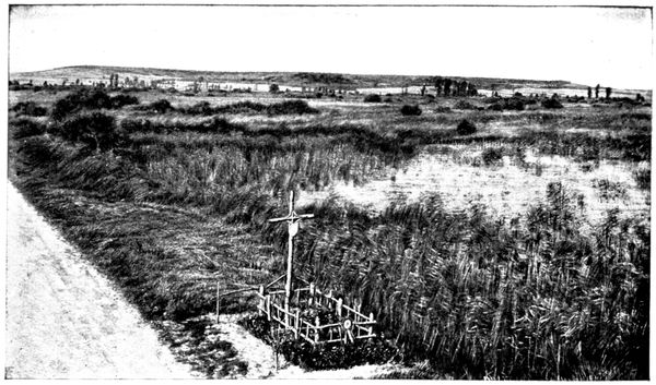
VIEW OF THE MARSHES
The above photograph gives an aspect of this marshy region. The line of poplars crossing it follows the course of the Morin. The heights on the horizon are those of Toulon-la-Montagne and Vert-la-Gravelle. They were occupied on September 6 by the outposts of the 17th Division, who, however, could not hold them. The Germans then installed batteries there which swept all the south-east portion of the marshes. In spite of this fact, on the same day a battalion of the 77th Line Regiment tried to retake the heights.
We are now following the course of the attacking troops who left Bannes under a murderous fire from the heavy artillery and machine-guns. When the road became too dangerous, they entered the marshes and advanced painfully up to their waists in water. Some disappeared suddenly, swallowed up by the bogs. They succeeded eventually in reaching Coizard and, after fighting in the streets and houses, drove off the Germans, and began to assail the slopes which dominate the village. But the enemy had here a crushing superiority, and after a seven-hours' fight the French were obliged to retire across the marshes, pursued by the dropping fire of the batteries on the northern bank which raked the narrow causeways. The Germans wished to push home their advantage and take foot on the southern bank, and accordingly began to cross the marshes by the Coizard-Bannes road. Their losses were heavy, for the machine-guns and "75's" directed a cross-fire on them. They came on nevertheless and reached Bannes, but when they endeavoured to advance on Mont-Août, they were met by so fierce a fire that they were obliged to draw back into the village. Mont-Août did not fall until September 9, having been outflanked on the south.
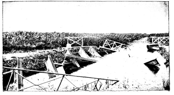
DESTROYED BRIDGE OVER THE MORIN
Cross the Morin, whose bridge was destroyed at the beginning of the battle (photograph opposite), then leaving the soft ground of the marshes, cross one of the drained parts whose number increases every year; thus reducing considerably the original swamp which comprised all the hollow.
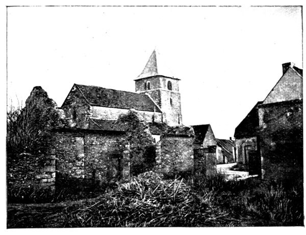
COIZARD CHURCH
On reaching Coizard, turn first to the left, then to the right in order to arrive at the church (24 km.).
The villages on the north of the marshes suffered less than those on the south, for the French bombardment was less intense than the German. A few houses were however destroyed in Coizard (view above).
Turn to the left this side of the church (the road, is visible in the above photograph) and continue to follow G. C. 43 for 1 km. as far as Joches. At the corner of the farm, of which the view below shows the interior, and which was burnt by the Germans, turn to the right towards Congy, thus leaving the marshes.
(If pressed for time, instead of turning to the right, continue on the road, along the marshes by Courjeonnet and Villevenard, thus reaching Saint-Prix. The distance by the direct road is about 6 km.; going round by Congy it is 16 km.).
In Congy (30 km.) follow the main street, turning to the right before reaching the town-hall, then to the left to cross the railway.
On September 5 and 6 the Ninth Corps, who still had outposts at Toulon and at Vert, tried to extend its line towards Congy. Blondlat's Brigade of the Moroccan Division crossed to the north bank and attempted to gain Congy by Joches and Courjeonnet. The difficulties were great, for the German artillery swept the slopes. The attack failed in the end and the brigade was obliged to re-cross the marshes. During the battle the German heavy guns on the heights commanding Congy pounded the French positions on the opposite side of the marshes.
About 2 km. beyond Congy we meet the "Route nationale" 33 and turn into it, to the left, towards Champaubert, which is 2.7 km. further on.
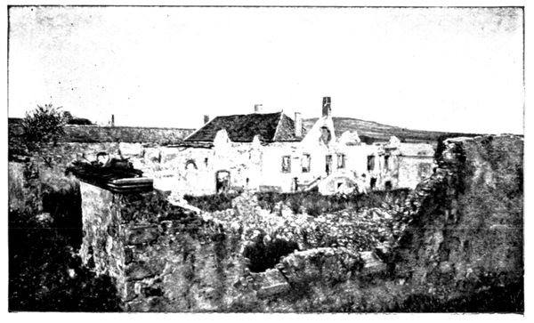
BURNT FARM AT JOCHES
On the left is the column commemorating Napoléon's victory in 1814. Champaubert Farm where he slept is a grey house with red-brick facings standing opposite the column on N. 33.
On arriving at the column, turn to the left into N. 51, in the direction of Baye.
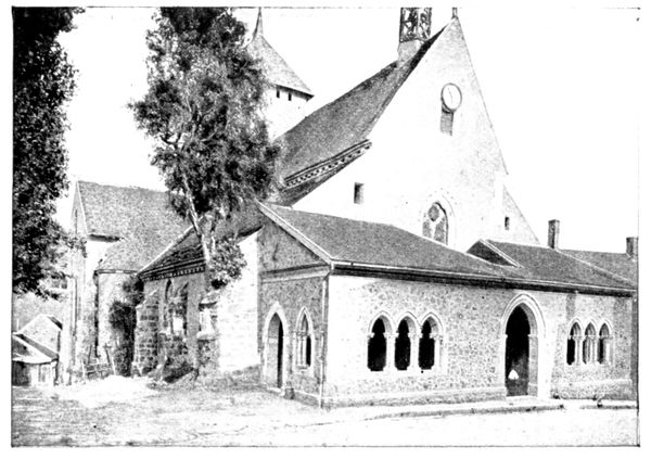
BAYE CHURCH
In Baye (37½ km.) on the left is to be seen the interesting thirteenth century church, which has recently been restored (photograph opposite), 900 yards further on is the castle, of which a view is given below. It was the birthplace of Marion Delorme, who there passed a tranquil childhood before becoming acquainted with the feverish life of the courtesan.
The castle is the property of the Baron de Baye, and contained many rich archæological and artistic treasures. It was inhabited by a member of the German Imperial family from September 5 to 9, and was pillaged methodically.
The following is the report of the Inquiry Commission:
"Having repaired to Baye Castle, we verified the traces of the pillage which this edifice has suffered. On the first floor, a door leading to a room which adjoins the gallery where the proprietor had amassed valuable works of art had been broken in; four glass cases had been broken, another opened. According to the declarations of the caretaker, who, in her master's absence, was not able to inform us of the full extent of the damage, the principal objects stolen were Russian gems and gold medals. We noticed that tablets covered with black velvet, belonging doubtless to the glass cases, had been dismantled of part of the jewels which they formerly bore.
"The Baron of Baye's room was in a state of great disorder. Numerous objects were strewn about on the floor and in drawers which had been left open. A flat-topped secrétaire had been broken into. A Louis XVI. 'commode' and round-topped desk of the same period had been rifled. This room was doubtless occupied by a person of high rank, for on the floor still remained chalked the following inscription: 'I. K. Hoheit.' Nobody could tell us exactly who was this 'Highness,' but a general who lodged in the house of M. Houillier, one of the town councillors, told his host that the castle had sheltered the Duke of Brunswick (William II.'s son-in law) and the staff of the Tenth Corps."
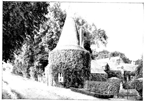
BAYE CASTLE
N. 51 now descends into the valley of the Petit Morin. From September 5 to 9, the German reserves followed closely on each other along this road, hastening to the attack on the Plateau of Sézanne.
After having passed the little station of Talus-Saint-Prix, we arrive at the bridge over the Morin.
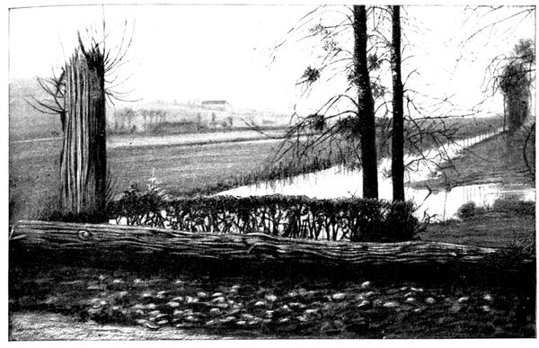
THE MORIN NEAR THE MARSHES
This bridge, forming the narrow bottle-neck in which the German attack was to be precipitated, constitutes one of the most interesting points of the battlefield. It is here that the marshes come to an end, and the Morin continues its course along a gradually narrowing valley. The view above, taken from the bridge eastwards, shows the river leaving the marshes. The tree stump in the foreground, which has now disappeared, recalls the successive bombardments, French and German, which the bridge experienced. The other view is taken westwards.
From the heights which form the background of the two photographs, the German cannon rained shells on the French positions on the southern edge of the marshes.
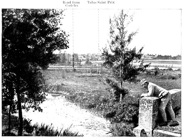
THE MORIN LEAVING THE MARSHES
Road from Corfélix
Talus-Saint-Prix
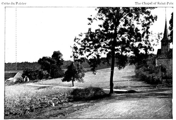
THE HEIGHTS OF SAINT-PRIX (to the west of the road)
Crête du Poirier
The Chapel of Saint-Prix
The heights of Saint-Prix form the northern edge of the Plateau of Sézanne, on which depended the liaison between the Fifth and Ninth French Armies. The Germans had bitten into the plateau on the west and on the north-west at Esternay, Charleville, and La Villeneuve, which we have already visited. They tried to complete their success by attacking also on the point now before us.
On the left of the road (view above) may be seen the little Chapel of Saint-Prix, below Botrait Woods. On the bare part of the summit are the remains of the trenches in which the Germans had placed machine-guns. Further to the left is the "Crête du Poirier" which was so bitterly disputed. To the right of the road (view below) appear the woods of the Grandes-Garennes which clothe the heights towards Corfélix.
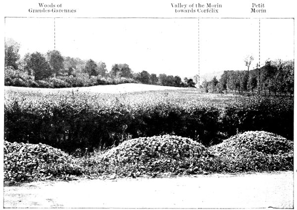
Woods of Grandes-Garennes
Valley of the Morin towards Corfélix
Petit Morin
THE HEIGHTS OF SAINT-PRIX (to the east of the road)
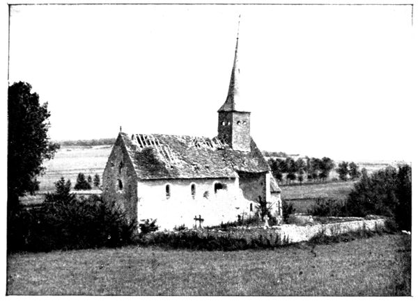
CHAPEL AT SAINT-PRIX.
On N. 51, in the Woods of Botrait and the Grandes-Garennes, attacks and counter-attacks followed each other during four days. The thickets were the scene of fierce hand-to-hand struggles. In the rare clearings the combatants sheltered themselves in hastily-dug trenches. This stubborn resistance exasperated the Germans; and after the battle witnesses found a company of Algerian sharp-shooters whose brains had been beaten out by blows from the butt-end of rifles. This fact is vouched for by the Inquiry Commission. Other corpses belonging to the same regiment had been placed in a ring round a fire which had burnt all the heads.
The battle continued until the French, after having silenced the German guns at Le Thoult and Corfélix (see p. 157), finally reached Corfélix and the Morin. Advancing along the valley (seen in the views at the foot of p. 167, and at the top of p. 168), they debouched on the flank of the enemy's troops deeply engaged in the interior of the Plateau of Sézanne.
The manœuvre of September 9 was decisive. Attacked on flank and front, and driven from the woods, the Germans re-crossed the Morin; while their rearguards fought desperate covering engagements, of which the chapel and its little cemetery (seen in the view above), the machine-gun trench (seen in the photograph at the top of p. 167), and the neighbourhood of the station of Talus-Saint-Prix were, in particular, witnesses. The retreat however continued briskly, and on September 10 the Tenth Corps, which had performed the outflanking movement, was able, setting forth from the Champaubert-Saint-Prix front, to sweep the whole of the north of the marshes.
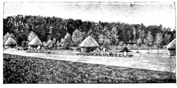
GRAVES AT SOIZY.
Follow the zig-zags which N. 51 makes to climb the slope and continue towards Soizy-aux-Bois (45 km.). On this road, and in the woods which border it, the 42nd Division met with a repulse at the hands of the German troops who, on the 7th, took Soizy and even pushed on to Chapton (we passed through this village before arriving at Sézanne). On the 8th, the 162nd Line Regiment counter-attacked and carried Soizy at the point of the bayonet; and on the 9th, as we have seen above, the Germans were driven back across the Morin.
Soizy still shows the ruins of houses destroyed by bombardment or fire. After glancing at them return to the entrance to the village and take (on the left looking towards Soizy) G. C. 44 in the direction of Oyes.
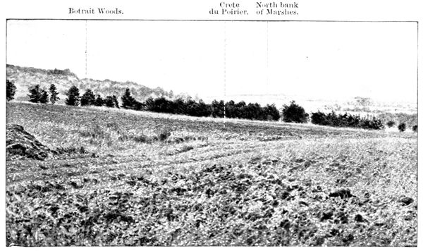
I. PANORAMA OF THE "CRÊTE DU POIRIER" AND BOTRAIT WOODS
Botrait Woods.
Crête du Poirier.
North bank of Marshes.
Almost immediately after, on the left, below the level of the road, may be seen two large graves, where the French soldiers who fell during the combats at Soizy were buried (view p. 169). The Germans were buried to the right of these graves.
Cross through the woods of Saint-Gond. Sign-posts indicate that military graves exist in the thickets, and recall the hand-to-hand struggles which took place here during the fluctuations of the battle round Soizy.
Descend again towards the marshes between the "Crête du Poirier" on the left and the heights on Montgivroux on the right. Before arriving at Oyes there appears on the left a chalky road with a quarry on its right, leading to the top of a hill.
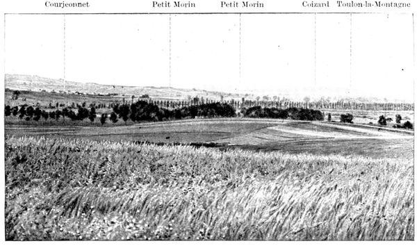
II. PANORAMA OF THE MARSHES AND THEIR NORTH BANK
Courjeonnet
Petit Morin
Petit Morin
Coizard
Toulon-la-Montagne
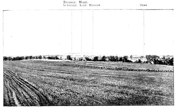
III. PANORAMA OF THE MARSHES AND THEIR SOUTH BANK
Broussy-le-Grand
Mont-Août
Reuves
Oyes
Follow this road, on the left of which are remains of trenches. 150 yards from its commencement may be seen an interesting view, of which the photographs on pp. 170-171 give fragments.
The summit on which we now stand is connected by a little valley with the summit of the Poirier seen on panorama I. These two heights constituted on the north the advanced line of defence of the heights of Mondement. Panorama IV. shows the position of Mondement which will be visited in due course. The castle and the church may be perceived. The road in the foreground, in the centre of this panorama, is the one which we took to climb the hill.
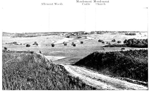
IV. PANORAMA OF MONDEMENT
Allemant Woods
Mondement Castle
Mondement Church
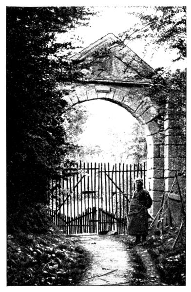
ENTRANCE TO THE PRIORY OF SAINT-GOND
The line of the Poirier was the object of furious combats. The "tirailleurs" of the Moroccan Division had dug trenches there in order to protect themselves against the withering fire of heavy and light artillery which the Germans directed from the north of the marshes. When the Germans had succeeded in crossing the Morin by the bridge at Saint-Prix, they penetrated into Botrait woods (panorama I.) and attacked the Poirier. They drove the sharp-shooters from the summit, and then from the southern slopes where the latter had made a stand. On September 8 a bayonet charge brought the Poirier again into the possession of the sharp-shooters, but the German artillery rendered the position untenable, and they were obliged to evacuate it and fall back on the heights of Mondement-Montgivroux. At the same time Blondlat's Brigade which held Oyes and Reuves (panorama III.), was thrown back on the Allemant Woods by superior forces which had managed to cross the marshes.
The position of Mondement had thus lost all advanced protection and so fell on the following day, but the same evening it was retaken (see pp. 176-178), and from this moment the battle was lost for the Germans. The Tenth Corps, by means of its outflanking movement described on p. 169, obliged them to re-cross the Morin at Saint-Prix (below Botrait Woods, panorama I.). The flank of the marshes was thus turned. During the night of the 9th-10th, the German troops hurriedly regained the northern edge by the causeways running from Oyes, Reuves, and Broussy (panorama III.).
Rejoin G. C. 44 and turn to the left towards Oyes (50 km.). The village still bears traces of the bombardment during its heroic defence by Blondlat's Brigade. Turn to the right, thus leaving the church on the left, and, passing through the village, turn to the left to regain the marshes, in the middle of which stands the old Priory of Saint-Gond. The entrance, seen in the photograph above, is on the right of the road (51 km.).
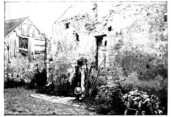
INTERIOR OF THE PRIORY OF SAINT-GOND
Saint-Gond, who gave his name to the marshes, was a seventh century hermit. Charmed by the solitude of the spot, he there founded a little monastery. Destroyed during the barbaric invasions, then rebuilt, it became an abbey and later a priory, after which its decline was rapid. All that remains to-day consists of the entrance (view above), and in the interior, a door (seen on the opposite view behind the Abbé Millard). The Abbé Millard who occupied the priory is an elderly ecclesiastic who divides his time between studies and rural tasks. In the photographs on this page he is seen in the simple apparel which he prefers. He is a distinguished historian and member of several learned societies.
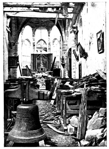
REUVES CHURCH AFTER THE BOMBARDMENT
The Abbé Millard, who was recovering from a long illness, reluctantly left his hermitage a little before the arrival of the Germans. The sharp-shooters had established on the road opposite his house a barricade flanked by machine-guns behind which they tried to stem the German advance; but the latter surmounted this obstacle and advanced on Oyes.
Leaving the priory, we come across the road which runs from Villevenard, on the right of the marshes, to Oyes and Reuves, on the left. This was the road taken by the Germans who attacked Oyes and Reuves for three days. They suffered heavy losses from the fire of the French artillery which swept Villevenard and the causeways, but came resolutely on and carried the two villages on September 8, in spite of the heroic defence of Blondlat's Brigade.
At the cross-roads turn to the right towards Reuves (53 km.) and traverse its length. It suffered terribly. The views on this page show the state of the church after the bombardment.
Turn to the right at the end of the village, leaving on the left the road which continues to follow the edge of the marshes in the direction of Broussy. This village fell at the same time as Oyes and Reuves, having been attacked by the German troops coming down from Joches and Coizard. Immediately on leaving the village, take, on the left, G. C. 45 and make towards Mondement.
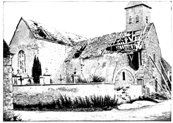
REUVES CHURCH AFTER THE BOMBARDMENT
We are following the last stage of the German advance. On the morning of September 9, the troops which had taken Oyes and Reuves, after having been reinforced during the night, assailed the Heights of Mondement and wrenched from the grasp of the few remaining Zouaves and sharp-shooters the castle, the church and the village.
The road passes before the castle (56 km.) whose fame since the war has become worldwide.
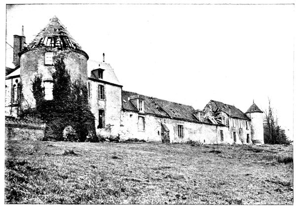
THE CASTLE, NORTH FRONT
On September 6, 1914, the owners, Mme. Jacob and one of her sons, were still at Mondement. The bombardment by the German big guns on the north of the marshes began on the morning of the 7th. The inhabitants of the castle, together with the "curé" of Reuves, who had come to join them, passed many anxious hours. The cellar, in which they had taken shelter, almost fell in on them. It was useless to think of seeking refuge in the neighbourhood of the castle, for the shells fell like hail. Their motor-car had been destroyed (as may be seen in the photograph at the foot of p. 178) and the only horse in the stable had been killed.
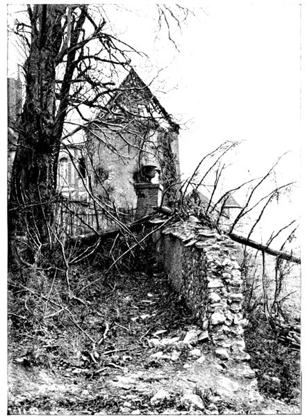
A CORNER OF THE CASTLE PARK
There was nothing left for it but, at night, to set out on foot along the road to Broyes, in spite of the feeble state of M. Jacob, who was suffering from heart-disease.
They were picked up fortunately by a motor-car sent by General Humbert, but M. Jacob died a few days afterwards, as a result of the shock and of the fatigues which he had experienced.
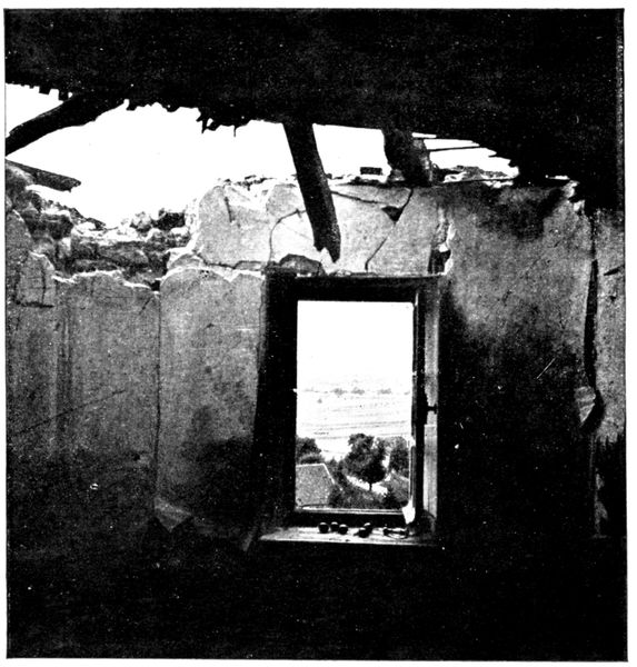
THE MARSHES SEEN FROM A WINDOW IN THE NORTH-EAST TOWER
On the 7th, General Humbert established his headquarters in the castle, which made a splendid observation post. He followed the course of the battle through his field-glasses from the foot of the towers.
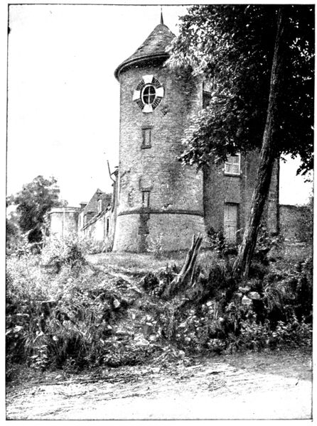
NORTHWESTERN ANGLE OF THE CASTLE
When the shells fell too thickly on the castle, he gained the little church near at hand (from which the panorama on pp. 182-183 is taken), and came back to the castle when the Germans began to direct their fire on the church-tower. During these comings and goings, a shell fell among his escort and killed several horsemen. As the bombardment continued to increase in violence, the headquarters were transported to the "Castle des Pucelles" at Broyes, which we have already seen (p. 159).
The road goes round the castle. The opposite photograph gives a side view of the façade. The tower at the end has been cleared of the ivy which covers it (in the photograph on p. 174), and completely restored. The ruined roof has been removed, in order to give place to a new one. In the foreground is a tree which has been felled by a shell. Shells from the '105's' and '150's' laid low many others, sometimes killing at the same time the persons who had sought shelter under them.
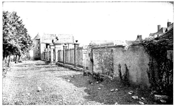
THE CASTLE, WESTERN FRONT
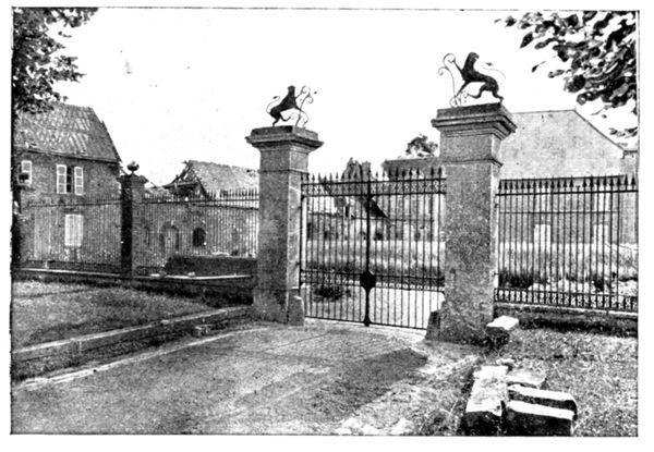
PRINCIPAL ENTRANCE
Take the Broyes road which passes before the principal entrance (photograph opposite). The two heraldic lions surmounting the pillars of the gateway are worthy of notice. The roofs of the buildings were destroyed by shells, and the main-building opposite the gate has a temporary zinc covering.
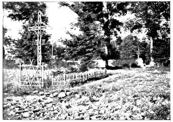
GRAVE AT MONDEMENT
In the field on the other side of the Broyes road is the grave where the Zouaves and other foot soldiers, who fell during the attack on the castle, were buried (photograph opposite). After the entrance gate come the out-buildings, and then the kitchen-garden, whose wall we skirt.
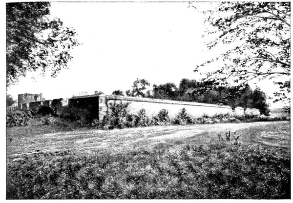
THE CASTLE AS IT APPEARED TO THE ATTACKING TROOPS
The above view shows the two sides on which the French attacked on the afternoon of September 9. The trees behind the kitchen-garden are those of the park. On the right of the horizon, and separated from Mondement by a hollow, are Allemant Woods.
The castle was taken by the Germans at daybreak on the 9th, and was immediately put into a state of defence. Loop-holes were made in the walls, and machine-guns placed on the towers and at prominent windows. The 77th line Regiment which was reforming at Saint-Loup (see pp. 162-163) was directed in all haste to Mondement to counter-attack. Colonel Lestoquoi placed a battalion on either side of the Broyes Road in the woods which come to an end a few hundred yards from the south side of the kitchen-garden. The Zouaves and sharp-shooters of the Moroccan Division, also hidden among the trees, were to attack on the other side, by the principal entrance.
The artillery preparation was entrusted to the guns of the Moroccan Division, aided by the batteries of the 42nd Division, which had halted at Broyes before descending into the plain (see pp. 162-163).
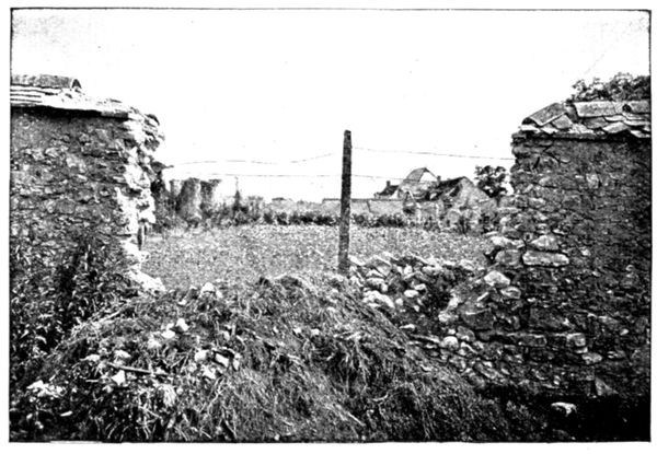
BREACH IN THE SOUTHERN WALL OF THE CASTLE
The attack began at 2.30 p.m. Major de Beaufort's battalion, composed of Bretons, to whom one of their comrades, a soldier-priest, had just given the absolution, left the woods, their bugles sounding the charge. A murderous fire met them from the castle, but could not stop them. A breach had been made in the wall by one of the French "75's," and towards this Major de Beaufort rushed, only to fall struck by a ball in the forehead. Officers and men succeeded him, but as soon as they appeared in the opening the fire of the machine-guns and rifles, hidden in the out-buildings (photograph above) was concentrated upon them, and they succumbed before even reaching the garden. A few, hoisting themselves on the shoulders of their fellows, gained the summit of the wall, but an entry in mass, which alone could have ensured success, was impossible.
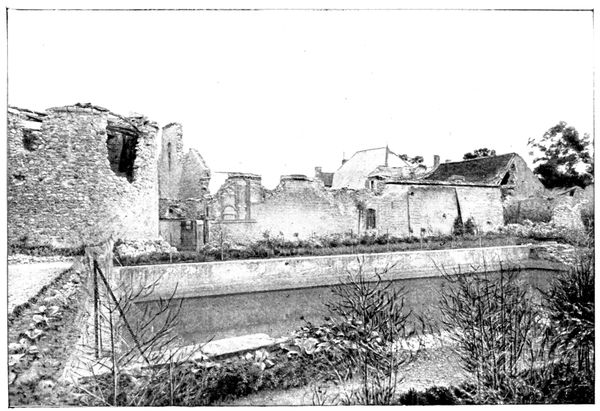
THE CASTLE OUTBUILDINGS
On the other side, the attack of the Zouaves and sharp-shooters had met with equally great difficulties. Sheltering themselves behind the trees on the road and the pillars of the railings, they sniped at the occupants of the castle without being able to advance.
At the end of an hour of costly efforts, orders were given to fall back, and the troops retired into the woods from which they had set out.
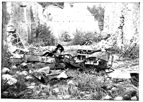
DÉBRIS OF THE CASTLE MOTOR-CAR
Pieces of artillery were then dragged by the men to within three or four hundred yards of the castle. The breaches in the wall increased, the railing collapsed in parts, and the interior of the castle became untenable. When the French renewed the attack at nightfall, they no longer met with resistance, for the garrison had fallen back on the marshes. The retreat had become general on the front of Von Hausen's and Yon Bulow's armies.
The bombardments devastated the interior of the Castle. The views on this page show to what a state were reduced the out-buildings from which came the terrible fire rendering the passage of the breach so difficult.
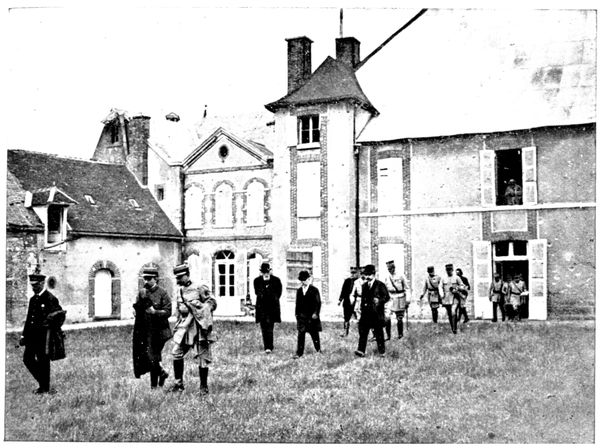
VISIT OF THE PRESIDENT OF THE REPUBLIC
On September 6, 1917, the third anniversary of the Battle of the Marne was celebrated at the castle of Mondement. The President of the Republic, accompanied by the President of the Council and several ministers, as well as by Field-Marshal Joffre, General Foch, and General Pétain, stopped at Mondement on his way from Fère to Sézanne, after having visited the Plateau of Rochelle near Fère-Champenoise (see p. 188).
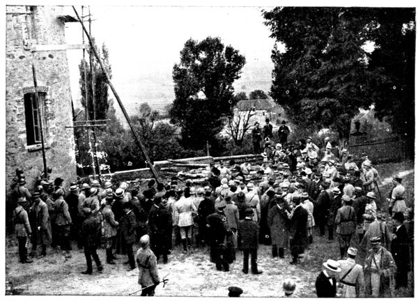
VISIT OF THE PRESIDENT OF THE REPUBLIC
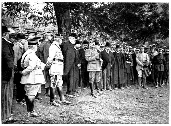
GENERAL FOCH DESCRIBING THE BATTLE OF THE MARNE
In the photograph at the top of p. 179 we see the group leaving the castle by the principal entrance. The walls, under their temporary roof, still show traces of shot and shell. M. Poincaré may be seen between M. Ribot, President of the Council, and M. Painlevé, War Minister. Field-Marshal Joffre is behind.
The photograph at the foot of p. 179 was also taken during the official visit of September 6, 1917. The tower on the left is the one seen on p. 174 from the exterior. On comparing the two photographs, we realise that the signs of war are fast disappearing at this point. In the middle, near the wall, the group formed by M. Poincaré, M. Ribot, M. Bourgeois, Field-Marshal Joffre and Generals Foch and Pétain, may be distinguished.
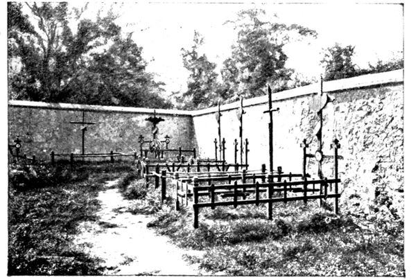
MONDEMENT CEMETERY
Those who took part in this pilgrimage had the good fortune to hear an account of the events of September, 1914, from the lips of General Foch. The above photograph was taken whilst, in quiet but moving terms, he described the different phases of the desperate battle fought by the Ninth Army from September 6 to 10. This extempore military lecture took place at the foot of a walnut-tree which stands in the meadow before the castle. On pp. 182-183 may be seen the view of the marshes which appeared to the eyes of the audience.
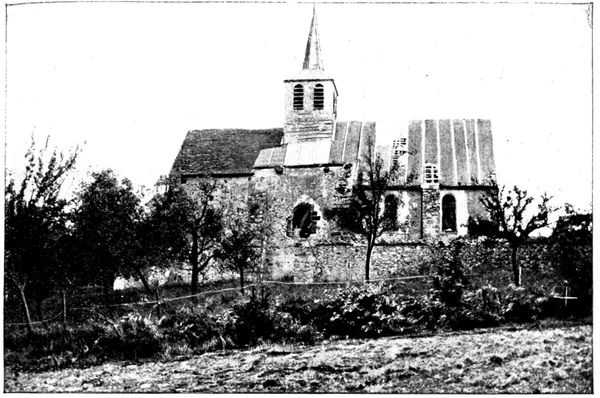
MONDEMENT CHURCH
Opposite the turret seen in the photograph at the foot of p. 175 take a path leading to the church, which suffered much from the bombardments, but whose breaches have now been repaired.
In the little graveyard (photograph p. 180) which surrounds it are buried the officers who fell at Mondement; among them Major de Beaufort, who commanded the attack, and Dr. Baur, killed by a shell which at the same time split the tree against which he was leaning.
General Humbert followed the march of events from the foot of the church, on the side facing the marshes (view above), when the castle became untenable. It is from this point that the panorama on pp. 182-183 was taken, and which will now be described.
In the foreground of panorama I (pp. 182-183) may be seen the houses of Mondement, which village was carried by the Germans at the same time as the castle and church, at daybreak on September 9. The French on their victorious return the same evening, drove out the remaining occupants, firing on them as they hastened down the slopes to the Marshes.
On the right may be seen Reuves and the road connecting it with Mondement. Oyes is visible on panorama II. We can easily follow the course of the German attack. After having crossed the marshes, the Germans drove Blondlat's Brigade of the Moroccan Division from these villages on the 8th. The following day the handful of Zouaves and sharp-shooters remaining in the castle, church and village, were forced to retire into the woods near Broyes.
On panorama II, the hill-top from which the panorama on pp. 170-171 was taken may be distinguished, as also the "Crête du Poirier" which carries it to the left towards Botrait Woods. This advanced line was, as we have seen, fiercely disputed, the bombardment being terrible. In his fine work on the Marshes of Saint-Gond, in which he relates the memoirs of M. Roland, schoolmaster at Villevenard, M. Le Goffie tells us that the percentage of German shells as compared with the French, was five to one, and he cites a detail which illustrates the German character. "The great '150' shells made a noise like a siren, and drew shrieks of joy from those assembled. 'Oh, Germany,' bleated an old doctor, lifting his eyes to heaven each time that one of these steel monsters went bellowing forth."
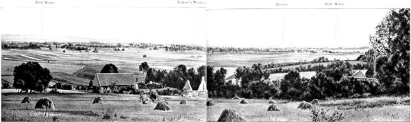
I. PANORAMA OF THE MARSHES OF SAINT-GOND.
Petit Morin
Toulon-la-Montagne
Reuves
Petit Morin
This portion of the panorama fits on to the right of panorama II (p. 183).
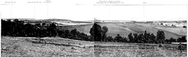
I. PANORAMA OF THE MARSHES OF SAINT-GOND.
Botrait Woods
Saint-Gond Woods
"Crête du Poirier"
Point from which was taken the panorama of Mondement (p. 171)
Oyes
This portion of the panorama fits on to the left of panorama I (p. 182).
When the Germans had taken "Le Poirier," they advanced on the Woods of Saint-Gond, in whose thickets violent combats took place. A final effort carried them on September 9 on to the plateau at Montgivroux (see p. 184), a little to the west of Mondement, which fell likewise in its turn, under the direct attack from the marshes. This important success, however, came two days too late. The Tenth Corps was menacing Mondement on the flank, and the intervention of the 42nd Division (see p. 14) destroyed the Germans' hope of taking the plateau on the Broyes-Allemant side. The counter-attack of the 77th (see p. 177-178) precipitated their retreat. Driven from the castle, the Germans re-crossed in haste during the night of September 9-10 the great dike of Saint-Gond. They left baggage and numerous wounded along the causeways. The Germans of 1914 were more fortunate than the conscripts of 1814, for whom the marshes formed a grave. In the darkness they escaped the fire which the French batteries at Mondement and Allemant would have poured on them in daylight. When the Tenth Corps began its march eastwards on September 10, starting from the Champaubert-Saint-Prix front, it was able to sweep the north of the marshes and pick up the laggards and heavy beer-drinkers, to whom the champagne had rendered bad service.
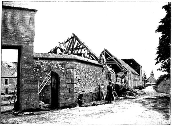
MONDEMENT FARM
After having examined the panorama of the marshes, return to the road which leads to the church and continue it in the direction of the farm, seen in the photograph above. It suffered much from successive French and German bombardments. As may be observed, the work of reparation has begun.
The French, when driven from the farm, took shelter in the wood a few hundred yards away on the other side of the road. It was from the wood that they began the counter-attack which gave them back the farm, as well as the castle and the church.
We retrace our steps to the castle, leaving the road which continues to follow the edge of the plateau in the direction of Montgivroux, and rejoins No. 51, below Soizy. This part of the plateau was carried by the German attacks coming from the Poirier and the Woods of Saint-Gond (see p. 170). The "tirailleurs" fought heavy engagements at this point.
On returning to the castle take the Broyes road (G. C. 45) which passes before the gates, then pass through the woods in which the 77th and the troops of the Moroccan Division which took Mondement found shelter, and so on to Broyes and the Castle des Pucelles which we saw at the beginning of our excursion.
Turn to the right into G. C. 39 and cross the village. At the cross-roads beyond Broyes, turn to the left and return to Sézanne, down a long slope which offer a fine view of the plain and of the heights surrounding it. At the crossing beyond the cemetery take the Rue de Broyes. In the middle, turn to the right and regain the hotel (65 km.) for lunch, by way of the Rue de la Halle and the Place de la République.
FROM SÉZANNE TO CHÂLONS-SUR-MARNE
(106 km.)
via Connantre, Fère-Champenoise, Connantray, Sommesous, Haussimont, Vassimont, Lenharrée, Normée.
Return to the Place de la République and descend towards the lower part of the town by the Rue des Lombards; without crossing the railway turn to the left along a road planted with trees. This is N. 34, which traverses the plain in a perfectly straight line, and which is to be seen in the panorama on pp. 160-163. On the left, on the horizon the heights of Sézanne, Broyes, Allemant, and Mont-Chalmont are once more visible.
After a run of 10 km. we reach the villages of Linthes and Linthelles, from which the counter-attack of the 42nd Division started on September 9.
At that time, in the plain stretching to the left of the road, the French troops, which had been driven from the edge of the marshes and even from Mont-Août, were falling back southwards. With them, too, were those who had been pushed back from the line of the Somme on to Fère-Champenoise, Connantre, and still further beyond. These troops, although worn out by four days' fighting, and exposed to violent artillery fire from the north, east, and south, would not give in, and took every opportunity for rearguard actions.
The coming into the line of the 42nd Division braced up their forces for the supreme effort asked by Foch.
We are following the axis of the French march during this counter offensive, the first result of which was the relief of Connantre. This village may be seen from the road, on the right, before traversing the level crossing. 100 yards further on is the entrance to Connantre Castle, in which the Light Infantrymen took prisoner several hundred Guards.
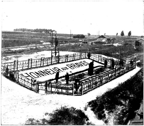
GRAVES IN FÈRE STATION
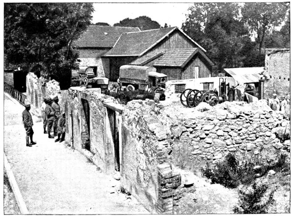
RUINS OF THE ELECTRIC POWER STATION
The road goes straight towards Fère-Champenoise across the plain, which is dotted here and there with clumps of trees. At Fère-Champenoise (21 km.) turn to the left into the "Grand-Place" in order to reach the station, which is about 900 yards away. This was much damaged by bombardment. About 300 yards on the right, by following the railway lines, may be seen the grave in the photograph below.
The fighting around the station was very violent.
We retrace our steps to the Grand-Place Square, turn to the left before the town-hall, and, passing it, take the first street on the right in the direction of Sommesous and Vitry-le-François. In this street, on the left, are the ruins of the electric power station (view above), and on the right a few burnt houses.
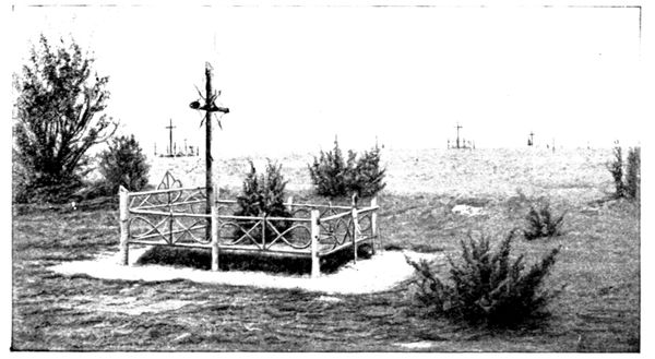
PLATEAU OF ROCHELLE SEEN FROM THE ROAD
Fère-Champenoise fell into the hands of the Germans on September 8 when the heroic defence of the Eleventh Corps had been broken on the line of the Somme, over which we are about to travel. The reserve of the guards pillaged as a matter of course, and celebrated noisily the German victory. Near the town-hall a piano was brought into the street to accompany the dance of the soldiers, attired in all sorts of headgear, taken from the window of a neighbouring hatter. Wine flowed, and the streets were strewn with empty bottles. It was in the midst of these rejoicings that the order to retreat arrived like a thunderbolt on September 9. On the 10th, General Foch made Fère his headquarters.
On leaving the town we come across fan-shaped cross-roads and take the road farthest to the left. 200 yards along this, take the lane on the right, following the edge of the hill which dominates the Vaure.
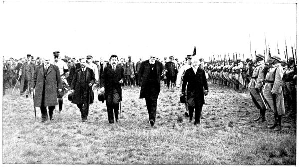
REVIEW ON THE PLATEAU OF ROCHELLE
After climbing 2½ km. the summit of the hill is reached. On the right of the road stretches the plateau of Rochelle, dotted with clumps of pine and covered with graves. Leave the car at the spot indicated in the photograph at foot of p. 186 and set out on foot towards the centre of the plateau.
The third anniversary of the victory of the Marne was celebrated on the plateau on September 7, 1917. In the photograph above may be seen (from right to left) the President of the Republic, General Pétain (half hidden by M. Poincaré); M. Ribot, President of the Council; M. Painlevé, War Minister; M. Chaumet, Marine; M. Bourgeois, Public Works. Field-Marshal Joffre is in the background.
The tourist who, during the tour of the Ourcq, visited the plateau of Barcy-Chambry, will experience with even greater intensity the impression of sadness which is evoked by the calm landscape and the numerous graves, signs of the fierceness and obstinacy of the battle.
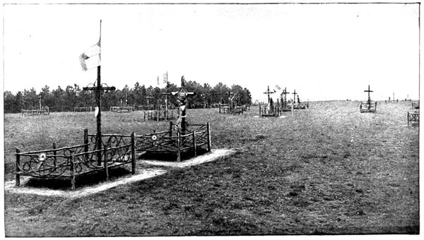
VIEW OF THE PLATEAU OF ROCHELLE
A remnant of the Eleventh Corps, which had been driven on the 8th from the woods to the west of Normée (see p. 194), made a gallant stand on the summit and sides of the plateau in the pine thickets and in improvised trenches which still exist here and there.
One of the most moving incidents was the defence of the standard of the 32nd. Two hundred men belonging to the 66th and the 32nd Regiments were hemmed in a little wood near the Vaure, having with them the standard of the 32nd, whose bearer had been killed. All the officers were dead or missing, only a few adjutants and sergeants remained. These asked Sergeant-major Guerre of the 66th, a man of energy and resource, to take command. The handful of heroes then formed a square and succeeded in repulsing the attacks of the enemy, until the arrival of a field-piece rendered the position in the wood untenable. Guerre divided his remaining troops into small companies, then charged with the bayonet where the enemy was strongest. A machine-gun soon laid the brave fellow low. The other companies took advantage of this diversion to rejoin the French lines. Thirty men in all were able to do so. Private Malvau and his comrade Bourgoin brought back the standard. They lost themselves in the German lines, but were put on the right path by an officer of the guards, suffering from a bad wound which they dressed for him.
After visiting the Rochelle plateau we retrace our steps towards Fère and at the entrance to the village take, on the left, N. 34 in the direction of Sommesous.
Pass straight through Connantray (33½ km.) to arrive, after traversing a level-crossing, at Sommesous (44½ km.).
The station is on the left of the level-crossing. It changed hands several times during the desperate encounters which took place here. Graves were dug in the little station garden on the left to receive the bodies of the soldiers of the 60th (reserve) Division who fell on this spot.
Follow N. 34 for about 200 yards in Sommesous, then turn to the left into N. 77. The combats were particularly violent at the junction of these two roads. Next, take the second street on the left, seen in the photograph below, in order to reach the centre of the village. Sommesous was entirely destroyed by bombardment and by fire, but is slowly rising again from its ashes.
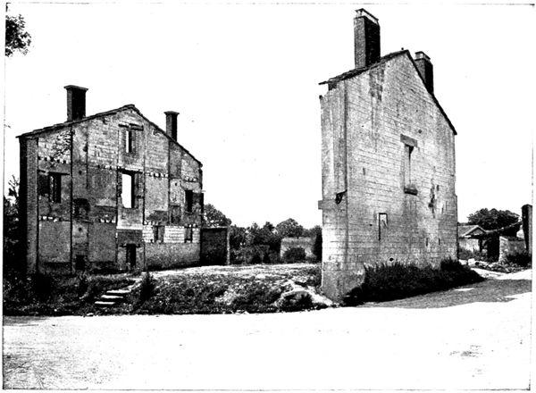
RUINED HOUSE AT SOMMESOUS
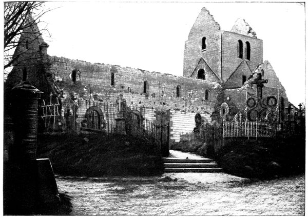
THE CHURCH AFTER THE BOMBARDMENT
The church, of which the photographs on this page show the state after the bombardment, is on the right of the street, towards the end of the village. It is now being restored.
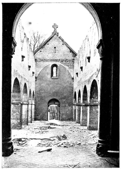
THE CHURCH AFTER THE BOMBARDMENT
In going from Sommesous to Écury-le-Repos we traverse the line of the Somme which the Eleventh Corps and the 60th (reserve) Division defended so energetically. This line was formed by the river, and by the railway which follows it at a little distance, along the plateau of the left bank. On September 6 and 7 this position was held by the French against furious attacks by Saxons and Guards supported by artillery. On the 8th the French troops, heavily outnumbered, were obliged to withdraw to Connantray and Fère-Champenoise.
September 9 witnessed Foch's counter-attack, which reached the Somme on the 10th and crossed it, on the 11th, in pursuit of the enemy.
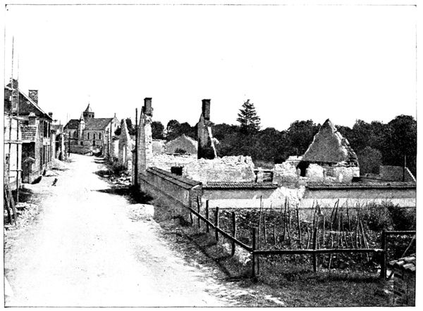
VASSIMONT
Naturally at the bridge-heads of Sommesous, Haussimont, Vassimont, Lenharrée, Normée, and Ecury some of the most obstinate fighting took place; thus the ruins there are numerous.
On leaving Sommesous, the road crosses the railway on the level and goes towards Haussimont, skirting the Somme, the valley of which lies to the left. At Haussimont, cross the Somme and turn to the right into G. C. 18 in order to enter and pass through the village. A few houses are still in ruins, but many have been rebuilt.
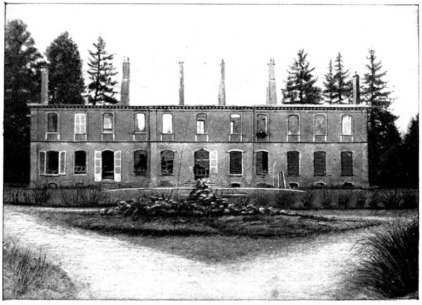
CASTLE OF CHAPELAINE
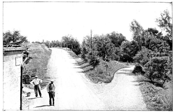
ROAD IN HOLLOW, LENHARRÉE
G. C. 18 continues between the Somme and the railway towards Vassimont (where we cross the river again). Turn to the left in order to traverse this locality, which was much damaged, as may be seen in the view on p. 190.
Leaving the village, take the first road on the left and cross the Somme. 500 yards further on is the hamlet of Chapelaine, with its castle of the same name (photograph p. 190). The fighting was intense at this point.
Return to G. C. 18 and turn to the left towards Lenharrée (54 km.). Arriving there, we have on the left (on the right in the view above) the road, which descends to the river. The many graves around indicate the fierce struggle for the possession of the ford.
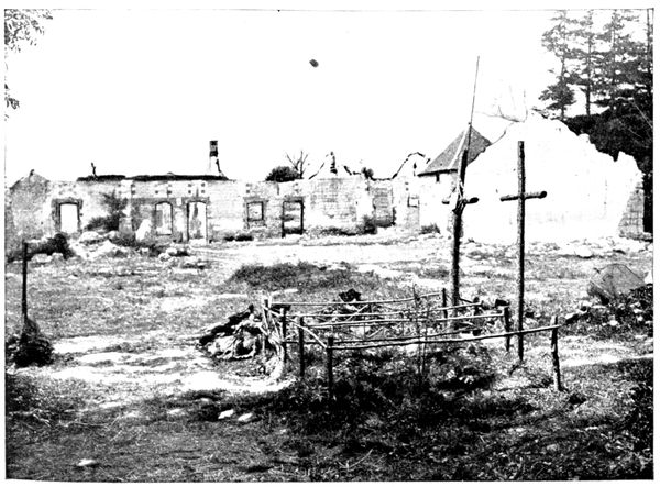
GRAVE IN A FARM-YARD, LENHARRÉE
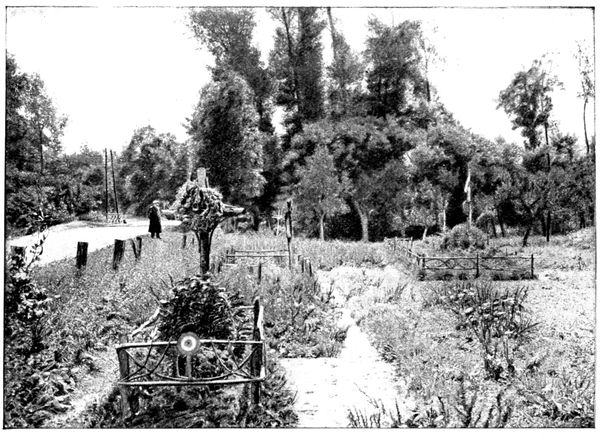
GRAVES NEAR THE SOMME
Lenharrée formed a bridgehead on the right bank. The French held it on September 6 and 7 under a heavy fire, but on the morning of the 8th the two companies of the 225th, who, by good shooting and frequent bayonet charges, had held at a respectable distance a much superior German force, were obliged to withdraw towards Connantray. The Saxons and the Guards, holding Normée, had managed to advance down the left bank and thus threatened to take the defenders of Lenharrée in the rear. Of this small force all the officers and non-commissioned officers were lying dead or wounded around Captain de Saint-Bon, who himself fell as he gave the order to retire. "Never mind me," he said to his soldiers, who wanted to carry him away with them, "Don't be killed trying to save me."