TOURIST SECTION (continued 2)
Reading edition
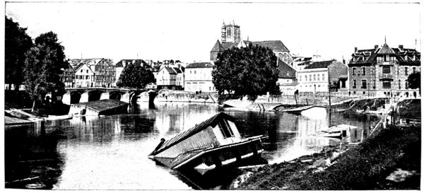
THE MARNE AT MEAUX
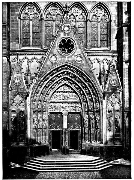
THE LIONS' DOORWAY (Cathedral)
After having viewed the west façade, the tourist, keeping to the right of the cathedral, should go and look at the Lions' Doorway, which is on the south front.
This thirteenth century doorway, restored in the nineteenth by Viollet-le-Duc, takes its name from the gargoyles, representing lions, which flank it. It is a reproduction of the southern doorway of Notre-Dame de Paris.
Entering the Cathedral by the Lions' Doorway, the tourist will be struck by the lightness and richness of the decoration of the interior, which has been subjected to extensive restoration.
The great height of the aisles is noticeable. It is explained by the existence, in the original church, of vaulted galleries which were raised above the aisles, as in Senlis and Notre-Dame de Paris. These galleries disappeared in the great transformations which took place at the end of the twelfth century and the aisles therefore remained notably super-elevated.
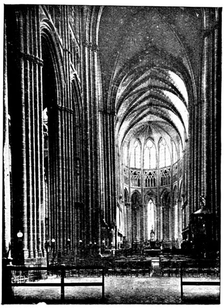
VIEW OF THE NAVE OF THE CATHEDRAL
The Tomb of the "Eagle of Meaux" is in the choir, on the right, marked by a tablet of black marble.
The PULPIT (see on the right in the opposite view) was made from some of the panels from the old pulpit where preached the great Bossuet. The bishop of Meaux, in spite of his cares at court, worked very energetically in his diocese and preached in the cathedral many sermons with that same inspiration that shone through the magnificent discourses delivered, during his career as a preacher, before the royal audience.
He maintained strict discipline among the clergy and religious orders under his jurisdiction. His contests with the Abbess of Jouarre went as far as a forcible seizure of the abbey buildings.
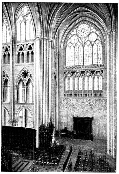
TRANSEPT AND CHOIR OF CATHEDRAL
The opposite view shows the further end of the TRANSEPT, to which corresponds the Lions' Door on the exterior. The decoration here is particularly rich.
Above the transept rose a beautiful spire in timber-work covered with lead, but as it was in a very precarious condition it was found necessary to demolish it in 1640.
On the left of the view one sees the commencement of the CHOIR, the execution of which shows to what heights of lightness and boldness of construction Gothic architecture had arrived. The walls between the piers are hollowed out by piercings and mouldings; it is a miracle of equilibrium.
Originally the choir had only three chapels, but two intermediary chapels were added in the fourteenth century.
When making the tour of the choir the visitor will see opening on the north into the courtyard of the old chapter house the beautiful Porte Maugarni, dating from the fifteenth century. The name of Maugarni (a gaolbird hanged on this spot in 1372, by order of the bailiff of Meaux) came down to posterity by reason of the long lawsuit that the chapter of the cathedral brought against the bailiff because of this execution, carried out in ecclesiastical precincts.
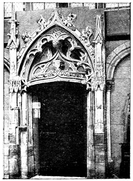
PORTE MAUGARNI (Cathedral)
Almost directly in front of the Porte Maugarni, with its back to the choir, is a white marble statue representing the kneeling figure of a young knight, Philippe de Castille. In 1603 his father founded the barefoot order of Notre-Dame-de-la-Merci. The statue comes from the church belonging to the convent of that order.
Beside the door is a stone figure of Christ, of the sixteenth century.
One can also see in the second chapel, beyond the great doorway in the north aisle of the nave, the group (in high relief) of the Visitation (seventeenth century) and the picture of the Adoration of the Wise Men, attributed to Philippe de Champaigne. The symmetrical chapel, on the south, contains the tombstone of Jean Rose and his wife. Jean Rose was one of the great bourgeois of Meaux in the fourteenth century. His name was given to one of the boulevards of the town.
At the entrance to the nave the seventeenth century organ is supported by beautiful arcading.
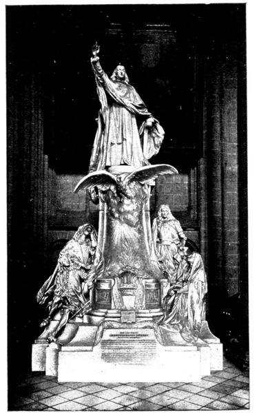
BOSSUET'S MONUMENT (Cathedral)
Bossuet's Monument, the work of the sculptor Dubois (1907), stands in the north aisle, near the main entrance.
At the foot of the pedestal, on the right, are represented Turenne and Mlle. de Lavallière, converted by Bossuet: Mlle. de Lavallière appears in the garb of a nun. It will be remembered how, after Mme. de Montespan had replaced her in the favour of the king, Louis XIV., she withdrew to the convent of the Carmelites, under the name of Sister Louise de la Miséricorde. On the left are Henrietta of France, queen of England, whose funeral oration was delivered by the "Eagle of Meaux," and the Dauphin, whose tutor Bossuet had been.
Behind the pedestal is a bust of the Great Condé. Bossuet was his friend, and frequently visited him in his beautiful castle of Chantilly, and often received him at the Bishop's Palace. His death inspired the "Eagle of Meaux" with one of his most magnificent funeral orations.
The Old Chapter House
(historical monument)
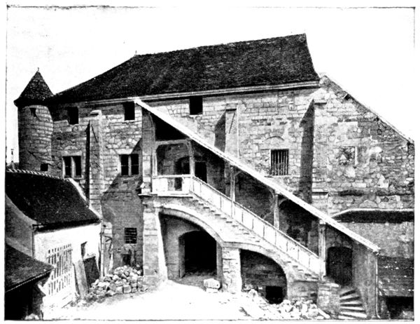
THE OLD CHAPTER HOUSE
Leaving the cathedral by the west door one walks into the courtyard of the bishop's palace, the entrance to which is on the right of the square. At the further end of the courtyard is the old Chapter House.
This old dwelling-place of the canons of the cathedral dates from the thirteenth century, and is in course of restoration. Its curious, covered outside staircase, which is well seen in the opposite view, is well known to archæologists.
We have seen already, in the case of the Porte Maugarni, how vehemently the canons defended their prerogatives.
The Old Bishop's Palace
The old bishop's palace, the courtyard front of which faces the cathedral, dates from the twelfth century, and was altered in the sixteenth and seventeenth. On the ground floor are two fine vaulted twelfth century rooms. An inclined plane leads to the second floor. According to tradition, one of the bishops had it made that he might go up to his rooms without dismounting from his mule.
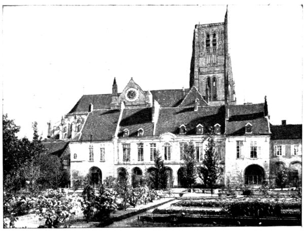
THE OLD BISHOP'S PALACE
Amongst the first-floor rooms are those of Marie-Antoinette and the king. Meaux was in fact a halting place for Louis XVI. and the royal family on their return from Varennes.
The king's room was also occupied by Napoléon I. when he came back from the Russian campaign.
The town of Meaux is now establishing a museum in the buildings of the bishop's palace.
The north front looks over a pretty garden, laid out by Le Nôtre (to be seen on Thursdays and Sundays. On other days apply to the lodge-keeper in the entrance courtyard. Gratuity.)
At the end of the garden, on the ramparts dating from the Middle Ages, is a terrace. It is reached by a covered staircase placed at the north-east angle. From there one has a beautiful view of the garden, the bishop's palace and the cathedral (view above).
On the terrace stands a little pavilion known as Bossuet's Study. The great bishop liked to work there, and often, by way of relaxation, took a walk along an avenue of fine yew trees on the ramparts near by.
The Old Mills
After visiting the bishop's palace we go through the Rue Martimprey to the banks of the Marne.
The view is extremely picturesque; on one side are the mills which dam the river; on the other, is the beautiful Promenade des Trinitaires, with its old poplars. The mills shown in the view below were rebuilt in the sixteenth century. The other side of the buildings looks on to the market bridge (view p. 74). These buildings, in spite of their age, withstood the blowing up of the bridge in 1914.
Slightly downstream are the modern mills of l'Échelle, which replaced mills similar to those of the market bridge, burnt in 1843.
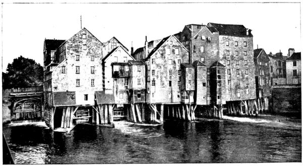
OLD MILLS
VISIT to the OURCQ BATTLEFIELD (September 5 to 9, 1914)
FROM MEAUX TO MARCILLY
(28 km.)
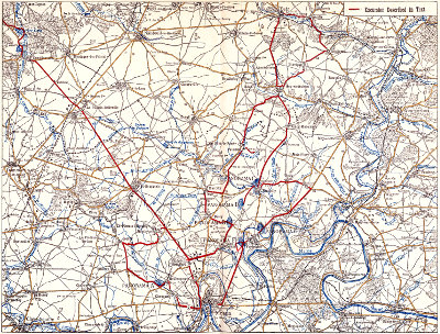
(See plan inserted between pp. 78-79)
via Chauconin, Neufmontiers, Monthyon, Penchard, Chambry, Barcy.
Start from Meaux in front of the cathedral. Go down the Rue Saint-Rémy, pass under the railway bridge, then turn to the left and take the N 3 for about 2 km. Turn to the right in front of a beetroot factory and follow the road planted with plane trees which leads to Chauconin (4 km.).
After having a peep at the little country church, we take a few steps along the path shown in the view below. The houses which border it still show traces of the incendiary fires of September, 1914. The Germans occupied the village for a few hours on the 5th, just long enough to pillage the dwellings and partly burn them by means of grenades flung on to the roofs, and sticks of resin thrust under the doors.
Having crossed the village, we have before us the buildings and high chimney of Proffit Farm, situated at Neufmontiers. Take the road which leads to it. On reaching the level of the farm, some French and German graves (of which a view is given on p. 81) will be seen to the right of the road.
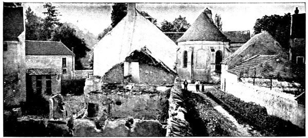
BURNT HOUSES AT CHAUCONIN
The German grave is on the left, isolated. It is marked by a black cross on which is painted the letter A. In the background can be distinguished the wooded heights of Penchard, in the conquest of which fell the French and Moroccan soldiers here buried.
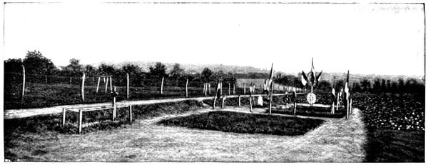
GRAVES AT NEUFMONTIERS
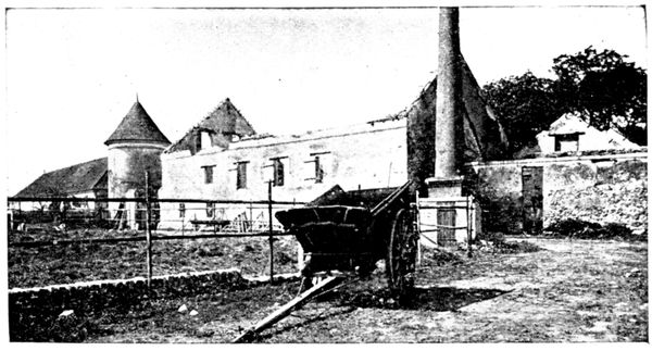
PROFFIT FARM BURNT BY THE GERMANS
In front of the graves is one of the entrances of Proffit Farm. The view opposite shows a part of the courtyard. This fine farmstead had been marked down and condemned in advance.
The Germans had themselves specially guided there from Chauconin. They looted the farmer's house: near the safe was found one of the skeleton keys with which they tried to force it.
They then fired the stables and barns, where nearly 20,000 bundles of straw made a gigantic blaze.
Skirting the walls of the farm, the road leads to the Church, where the Germans installed an ambulance during their short occupation of September 5. The inhabitants who remained in the village were commandeered and had to carry in the German wounded, on ladders, from the surrounding neighbourhood.
On the morning of the 6th the French re-occupied Neufmontiers and captured the ambulance (view below).
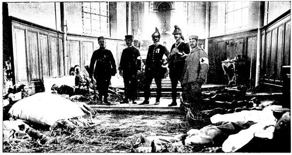
GERMAN AMBULANCE IN THE CHURCH
Running between Proffit Farm and the church, the road slopes down to the brook le Rutel, which it crosses. At the fork of the road, turn to the right. A hundred yards further on is the spot from which the Panorama A seen below (6½ km.) was taken, embracing the field of action of September 5.

A. PANORAMA OF MONTHYON PENCHARD. NEUFMONTIERS
Road to Villeroy Iverny
Heights of Cuisy
Le Rutel
Monthyon
Road from Neufmontiers to Iverny Le Rutel
Heights of Penchard
Castle Park
Neufmontiers
The advance guard of the Fourth German reserve corps had placed its artillery in the declivities of the heights of Monthyon and Penchard; the infantry troops and machine-guns had advanced into the plain, utilising le Rutel and the Neufmontiers to Iverny road as entrenchments. The first cannon shot of the battle of the Marne was fired on the 5th of September, at noon, from Monthyon at a French battery which was coming out of Iverny, and killed the captain. The fight was sanguinary all that day. The troops of the 55th division tried their hardest to push the Germans back beyond Monthyon but were stopped on the plain by the terrible fire of the machine-guns. At the same time the Moroccan brigade attacked the heights of Penchard and carried them with the bayonet, but it could not maintain its position there and was forced back behind Neufmontiers and Chauconin, which the Germans occupied. This occupation only lasted a few hours for, during the night, the German troops, threatened with being outflanked by the Seventh Corps further north, abandoned their formidable positions at Monthyon—Penchard and the outposts at Neufmontiers—Chauconin. The next morning the French took possession.
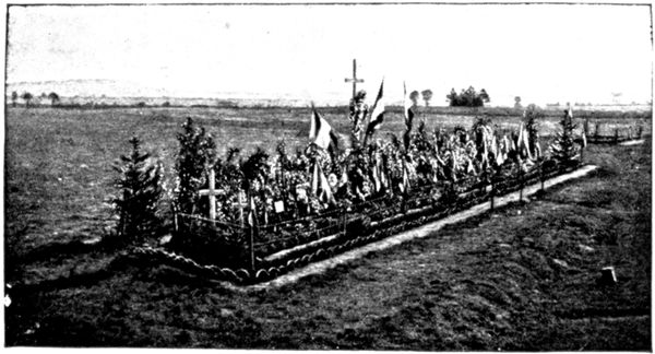
GREAT GRAVE OF VILLEROY
Continuing along the road to Villeroy we come, after about 2 km. to the GREAT GRAVE of which a view is given opposite. It contains the bodies of numerous officers and men who fell in the surrounding fields. At the extreme end of the grave on the right is buried the well-known writer, Charles Péguy, whose death seems to have been the one he desired when writing the following lines, now famous:
Heureux ceux qui sont morts dans les grandes batailles Couchés dessus le sol à la face de Dieu.... Heureux ceux qui sont morts pour leur âtre et leur feu Et les pauvres honneurs des maisons paternelles.... Heureux ceux qui sont morts, car ils sont retournés Dans la première argile et la première terre. Heureux ceux qui sont morts dans une juste guerre, Heureux les épis mûrs et les blés moissonnés.
At the fork of the road beyond the grave, go to the right towards Iverny. It is within 200 yards of these cross-roads, in the field on the left of the road, that Lieutenant Péguy was killed, shot through the head while standing amidst his soldiers of the 276th, whom he had ordered to lie down. On arriving at Iverny, turn to the right towards Monthyon. At the entrance to this village, near the farm de l'Hôpital, there is a little pond where the cases of shells abandoned by the Germans were emptied (view on following page).
These cases belonged to the three batteries of 77's which were established on the right of the road behind the farm buildings, in a depression of the ground. We have seen above that these batteries started the cannonade which began the battle of the Marne. Marked down by the French batteries they hastily abandoned the position.
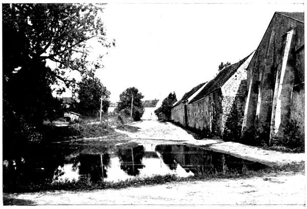
POND WHERE THE GERMANS THREW THEIR SHELLS
Leaving the pond on the right we follow the road to the left which brings us to the picturesque village of Monthyon (15 km.).
Despite the difference in spelling, it was the patrimonial fief of the celebrated philanthropist Baron de Montyon (1733-1820), founder of several prizes for good conduct and literature awarded yearly in solemn session by the "Institut de France."
We have seen that Monthyon, attacked without success on the 5th by the French, was on the 6th abandoned by the Germans. General de Lamaze established his headquarters there.
On arriving at the church turn to the right and descend towards the highway from Saint-Soupplets to Penchard.
Half-way down the slope will be seen on the left a villa which overlooks all the countryside, and where the French staff had a first-rate observatory during those hard days of September.
The view below, taken from the upper balcony, shows a corner of the vast panorama seen from there.
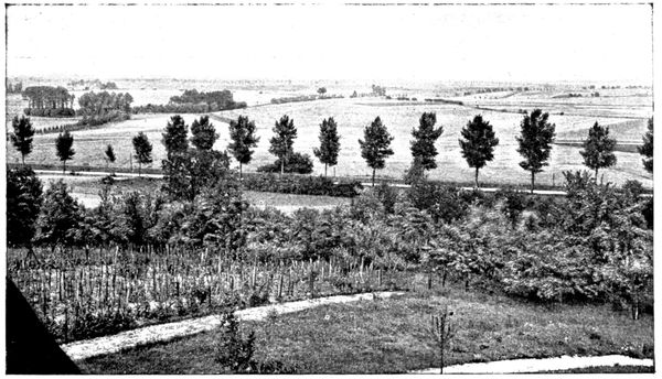
THE PLAIN AT THE FOOT OF MONTHYON
At the foot of the slope turn to the right towards Penchard and follow the railway lines on the road.
Two kilometres further, on the left, an avenue planted with trees leads to the Villa Automne, belonging to M. Charles Benoist, member of the "Institut" and deputy of Paris.
There the Germans installed an ambulance which received the wounded of the first battles with the Moroccans at Penchard.
Those who succumbed, among them several officers, were buried in the garden of the estate.
The Moroccans captured the ambulance when they re-took possession of Penchard.
The villa had been ransacked; the most highly appreciated trophy being the owner's peaceful academician's sword.
At the entrance to Penchard (19 km.), keep to the right as far as the town-hall square, where the motor can be left.
By the road which borders the town-hall on the right (about 150 yards from there and going past the church) we reach the edge of the Penchard woods where the view on the following page was taken. The tourist who enters these woods for a walk, or a rest, will find graves here and there, the last traces of the furious battles that were fought around.
Penchard was attacked the first time on September 5 by the Moroccan brigade, which came from the Chauconin-Neufmontiersline, over which the tourist has already travelled. The struggle was a desperate and particularly bloody one on the edge of the wood now before us, as also in the gardens of the neighbouring houses. The Moroccans had the advantage in this hand-to-hand fight and towards noon succeeded in taking the village, which they held for several hours under a violent bombardment.
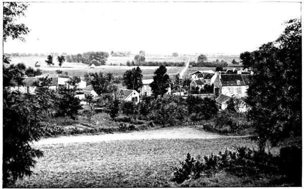
THE PLAIN AT THE FOOT OF PENCHARD
But we know that during this time the 55th division's attack on Monthyon had failed, and the Moroccans, unsupported on their left, had to withdraw beyond Chauconin-Neufmontiers.
On the 6th the brigade, renewing its efforts, found Penchard evacuated and went on to the village of Chambry, towards which we will now direct our steps.
When leaving Penchard the Germans posted several spies in the woods, their mission being to signal the positions of the French troops and artillery to the aviators.
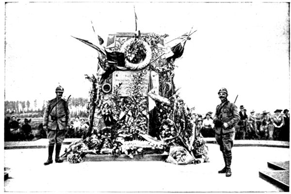
MONUMENT OF THE FOUR ROADS
One of them was caught and shot at the entrance to the wood in the evening of the 8th. He wore the red-cross armlet and on him were found pennons and rockets which he used for signalling.
We must retrace our steps as far as the fork of the road at the entrance to the village and take the road that runs to the right.
Immediately after this we come to the crossways of three roads; we follow the middle one which goes towards Chambry.
We arrive at the Monument des Quatre-routes, so called because it is placed at the crossing of the Barcy to Meaux road with that from Penchard to Chambry.
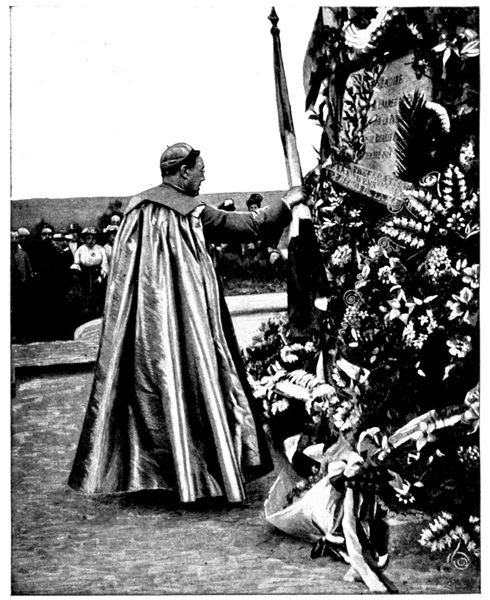
PATRIOTIC CEREMONY AT CHAMBRY (Photo from l'Illustration)
This monument was raised by the engineers, by order of General Gallieni, to the memory of the Army of Paris.
Every year, commemorative ceremonies take place at Meaux and on the neighbouring battlefields, particularly at the monument of the Quatre-Routes. The view opposite was taken in September 1916. The bishop of Arras Mgr. Lobbedey, who some hours earlier preached a touching sermon from Bossuet's pulpit in the Cathedral of Meaux, is here seen placing the tricolour flag at the foot of the monument.
At the crossing of the Quatre-Routes, the tourist coming from Penchard continues straight on to Chambry, which is seen a little further on in a hollow (see photograph below).
Chambry (22 km.) is one of the points of the French right where the fighting was fiercest. It was taken and retaken during the days of September 6, 7 and 8. Alternately bombarded by the French 75's (which at Penchard and Monthyon had taken the place of the German 77's, driven from their first line), and by the light and heavy artillery that the Germans had established on the heights of Vareddes and Gué-à-Tresmes, Chambry, as shown by the great number of new roofs, suffered heavily.
The Germans were thrown back from the western ridge of the hollow into the village, which they were forced to abandon after violent hand-to-hand fighting in the streets. They then entrenched themselves on the east flank and particularly in the cemetery, which is seen in the view below.
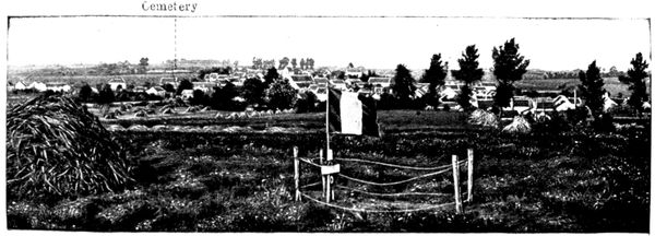
Cemetery
CHAMBRY
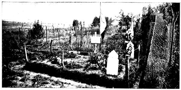
TOMB AT CHAMBRY
Driven from the cemetery they fell back on their chief position, visible on the panorama B (pp. 90-91), whence they made obstinate counter-attacks. The soldiers of the 45th and 55th divisions fought for the ground foot by foot, and finally remained masters of it at the cost of heavy losses. Zouaves, Algerian sharp-shooters, and foot-soldiers of the line vied with each other in heroism during these terrible days.
Having entered Chambry we cross the square, leaving the main street on the left, and go straight on. We thus turn round the village by the east—that is to say, on the front that had to withstand all the German onslaught.
The gardens which border the road contain several graves of soldiers who were killed in battle and buried where they fell. The upper photograph shows one of these graves. Some Algerian sharp-shooters fell there, as is indicated by the crescent drawn on the tombstone placed at the head of the grave. The tricolour cockade pinned below is that of "l'Œuvre du Souvenir."
On the slope of the road, to the right, the French troops had established a trench and some precarious shelters (see photograph below).
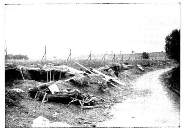
SHELTERS DURING THE BATTLE
This chance installation at the beginning of the war contrasts oddly with the scientific work that the struggle on fixed positions has now made common. It seems as though it could not have afforded anything more than moral protection against the German artillery, which for three days riddled the position with shells of 77, 105, and even 150 calibre.
The road followed by the tourist rejoins the main street which lay on his left as he entered the village.
400 yards from here, on the right, lies the CEMETERY of Chambry. Near the entrance, on the left, is a little chapel, whose doors were riddled with bullets. It served as a temporary infirmary but was very quickly filled up.
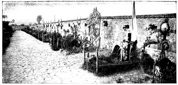
CHAMBRY CEMETERY
We have seen already the importance of the position held by the Germans in the cemetery.
Through embrasures pierced in the walls, rifles and machine-guns directed a fierce fire on the French troops as they advanced to attack from the direction of Chambry and Barcy. When the latter had taken the cemetery they, in turn, made use of its defences. The bombardment growing too violent, Zouaves and foot-soldiers took shelter in the trench outside the cemetery walls, visible in the photograph on the following page. A goodly number of these brave men remained there and took up the space that would have sufficed for the dead of that small parish for many long years.
The cemetery of Chambry has become a pilgrimage centre. Every year, in the month of September, numerous delegations come to cover the little graves with flowers. The photograph below was taken in 1915. In the middle of the crowd can be distinguished in the foreground, kneeling and leaning against the wire, Mgr. Chesnelong, Archbishop of Sens; behind him Mgr. Marbeau, Bishop of Meaux. The lieutenant seen on the left is the Abbé Dugoux, who had just celebrated mass in the Cathedral of Meaux.
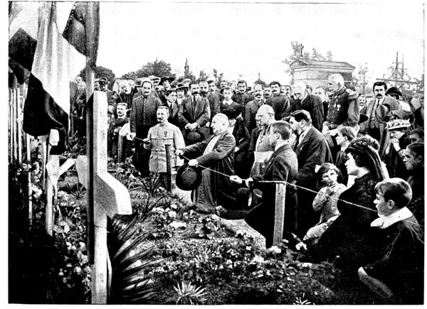
PATRIOTIC CEREMONY AT CHAMBRY (Photo from l'Illustration)
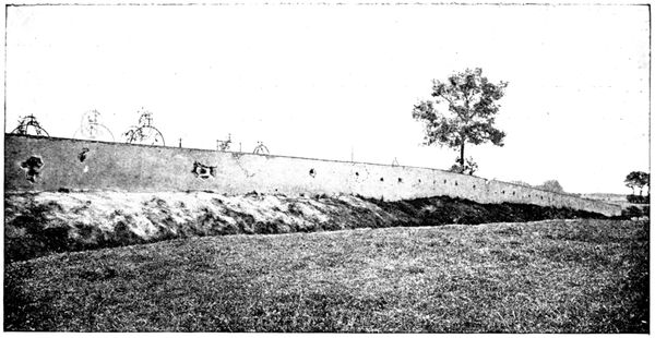
CHAMBRY CEMETERY
On leaving the cemetery one sees in front, on the slope of the road, the remains of the trenches dug by the French to protect themselves against counter-attacks from the heights of Varreddes.
Following the road, one soon sees the harrowing sight of the Plateau of Chambry-Barcy, covered with graves. To the right especially, in the fields which were crossed by the troops rushing to the attack from the hill visible in the photograph below, one can reconstruct the progression of the lines under fire by glancing along the succession of graves.
The principal line of the German defence during the days of September 7, 8 and 9 was established on a position leading from Étrépilly to Varreddes, plainly visible on panorama B (pp. 90-91). The height shown in the photograph below formed its southern extremity and its most salient point. Trenches had been made there, supplied with machine-guns and supported by batteries of 77's.
One realises what energy the French troops needed to advance thus, over absolutely uncovered ground, under dropping fire. Several attacks were unavailing; one of them reached the trenches, but the Germans, who had every facility for bringing up their reserves, which were kept sheltered in the declivity on the other side of the hill, thrust the French back on Chambry.
At last, on September 9, the Germans having begun their retreating movement, Zouaves, Moroccans, and foot-soldiers hustled their rearguards and descended in pursuit of them into the hollow of Varreddes.
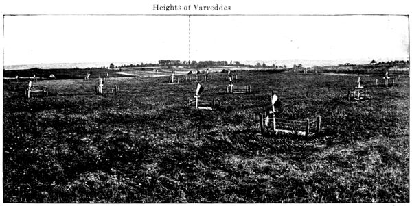
GRAVES ON THE CHAMBRY PLATEAU
Continuing along the same road the tourist comes to a fork. Here he turns to the left towards Barcy and soon comes to a group of poplars, whence the panorama B (below) was taken.
This PANORAMA shows the objective of the French right during the days of September 7, 8, and 9. This was the little ridge which runs between Étrépilly and Varreddes, followed by a road bordered here and there with poplars. This road was filled with trenches and machine guns which easily swept the uncovered ground that had to be crossed before they could be reached.
The supporting artillery was in the middle distance, on the Trocy Plateau and the sides of the Varreddes hollow.

B. PANORAMA OF THE ÉTRÉPILLY-VARREDDES LINE
Plateau north of Étrépilly
Ridge from Étrépilly to Varreddes
Torcy
Ridge from Étrépilly to Varreddes
Varreddes Road
Heights of Varreddes
The 55th (Reserve) Division, the 45th Algerian Division, and the Moroccan Brigade hurled themselves against this redoubtable position for three days, while the 56th (Reserve) Division attacked Étrépilly and the plateau which stretches to the north. The line fell on the 9th, but over the whole surface of this plain (which has been called "the Calvary of the Reserve Divisions") lay numbers of dead who were buried, some where they fell, others in common graves. These graves, with their flags waving in the wind, give a veritable grandeur to this landscape of gentle undulations.
In the view below, taken in front of one of these common graves on the plateau, appears the then English premier, Mr. Asquith, who was anxious to make the Ourcq pilgrimage during one of his visits to Paris. He is seen standing on the right of the road, near the spot from where panorama B was taken.
Arriving at Barcy (26 km.) the tourist will see the site of the great commemorative monument which is to be raised by subscription after the war. At the cross-roads near the entrance to the village, take the middle road which goes through Barcy and leads to the church.
It was in the little square, opening out in front of the belfry and the town-hall, that the second photograph (reproduced on the following page) was taken, showing Mr. Asquith interrogating a little village girl come to fetch water from the fountain.
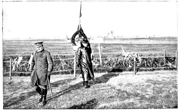
MR. ASQUITH VISITING THE BATTLEFIELD
Behind the fountain stands Colonel Hankey, secretary of the Allies' War Council; beside him is the French officer who directed and expounded the visit; Mr. Asquith is in the middle; to the right his son-in-law, and on the extreme right Mr. O'Brien, Sir Edward Grey's colleague.
On September 4 Barcy was the headquarters of a German division. A few people, among them the brother of the Bishop of Meaux, had been arrested near Varreddes, in Mgr. Marbeau's car, and taken before the general. The latter, announcing that he meant to keep their car, told them to inform the inhabitants of Meaux that on the morrow, at the same hour, his troops would be before Paris. But on the morrow Maunoury's army had begun its flank attack, and on the morning of the following day Barcy was carried by the French troops arriving from Monthyon.
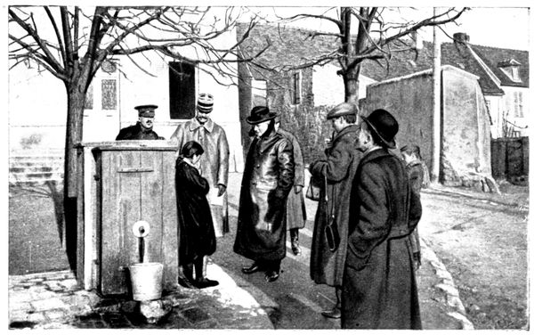
MR. ASQUITH QUESTIONING A LITTLE GIRL
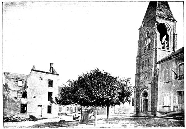
BARCY CHURCH
Barcy served as starting point for the assaults on Chambry and on the line of defence of Étrépilly-Varreddes; very often also as a place for defensive withdrawals. The fighting was desperate; on September 6 the 246th had nearly twenty officers, including the colonel, out of action, whilst the 289th found it necessary to attack three times during the day.
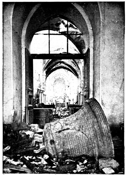
BARCY CHURCH
For three days the bombardment was terrific: the batteries of Étrépilly, Varreddes, and Gué-à-Tresmes rained shells on the village and its approaches.
The church suffered heavily, as shown by the photographs on this page. In the upper one is seen the hole made by the heavy projectile which brought down the bell seen in the foreground of the second photograph. Many houses, like those in the church square, still bear traces of the cannonade.
Others, less heavily damaged, have been repaired. Indeed, to look at the farm sleeping in the sunshine (see following page), one would never dream that it had lived through such tragic days.
The new roofing of the building on the left is all there is to remind one that it was not spared by the shells.
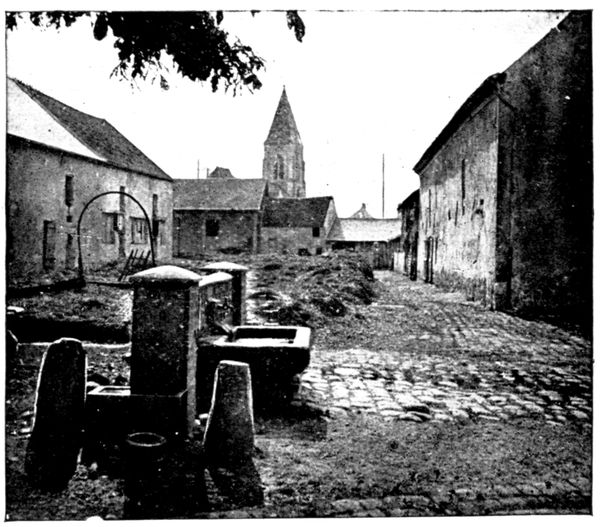
FARM AT BARCY
Following the road by which we arrived at the church, we go towards Marcilly.
Before leaving Barcy, we pass the cemetery where lie buried many officers and men who fell in the neighbourhood of the village.
The Germans entered Marcilly on the evening of September 4, and abandoned it on the 6th, fearing the outflanking movement of the Seventh Corps towards the north.
The village was the centre of operations for the 56th (Reserve) Division. The photograph below shows General de Dartein's temporary headquarters beside a haystack, not far from the village, whose church can be seen in the background.
The tourist will have an opportunity of seeing in detail the objectives of the division when passing through Champfleury, Poligny, and Étrépilly. The struggle was very fierce and the bombardment incessant for three days.
The road crosses Marcilly but we do not go beyond the church, which is a very curious one, with its squat tower and rustic porch (see following page). Beside it is the school where a light infantry sergeant, mortally wounded, still found strength enough to write on the blackboard: "The 23rd battalion Light Infantry, the 350th Infantry, and the 361st Infantry have beaten the Prussians here. Vive la France!"
The few inhabitants who remained in the village also remember one of the prisoners brought to the Pernet Farm, whose torn tunic gave glimpses of a woman's chemise, trimmed with lace and little blue ribbons.
From the church square we turn back about 100 yards and take, on the left, the road to Étrépilly.
At the end of the village is a GRAVE where foot-soldiers, light infantry and artillerymen lie buried (see photograph overleaf).
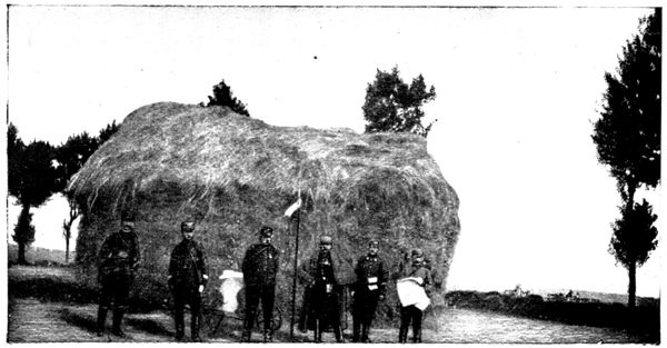
GENERAL DE DARTEIN'S TEMPORARY HEADQUARTERS AT MARCILLY
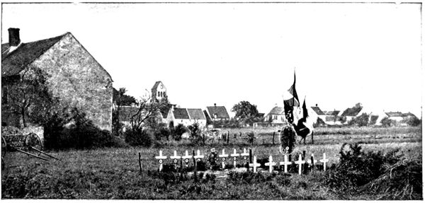
GRAVES AT MARCILLY (1917)
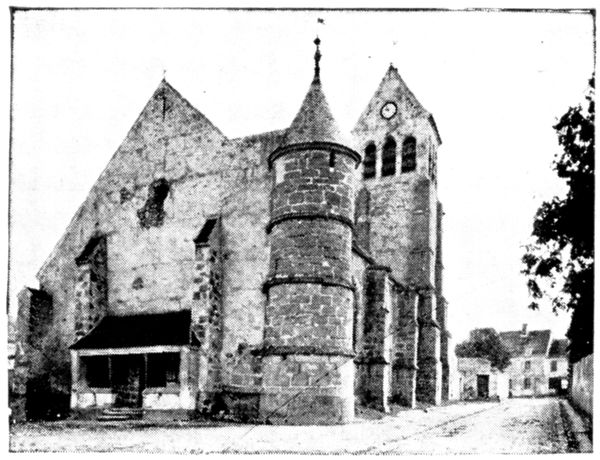
MARCILLY CHURCH
We soon arrive at the top of the ridge which dominates Marcilly.
Turning round, the tourist will have a wide view of Barcy, Monthyon, and Penchard; passing to the other side of the ridge he will see, on the left, the prominent farms of Champfleury and Nongloire.
The view below was taken during the battles of September in a field on the right of the road. We see a whole section, which thought itself in safety behind a haystack, destroyed by the explosion of a shell.
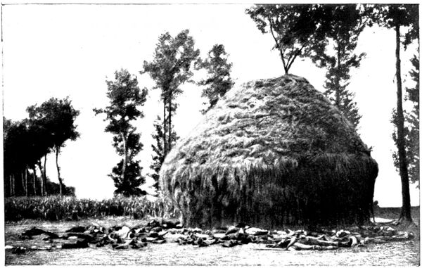
SECTION DECIMATED BY A SHELL
FROM MARCILLY TO ÉTRÉPILLY
(45 km.)
via Puisieux, Nogeon, Acy, Étavigny, Betz, Acy, Vincy
Étrépilly is 4 km. from Marcilly by the direct route, but we take the tourist round a loop of 45 km. before reaching Étrépilly, so that he may visit the front of the French left wing.
Arriving at a beetroot factory we come to a fork in the road and take the left branch. Around this factory desperate battles were fought between the troops of the 56th (Reserve) Division (who, having taken Marcilly, were trying to take Étrépilly) and the Germans, who defended this advance guard of their main position foot by foot.
The road crosses the Thérouanne; 50 yards further on, at the cross-roads, we take the road on the right which rises towards the Farm of Champfleury (5 km.). From this front, extending from the factory to the Champfleury farm, the 56th Division made many attacks on the strong line formed by Étrépilly and the plateau which spreads out north of the village, being also successful in shattering all the German counter-attacks.
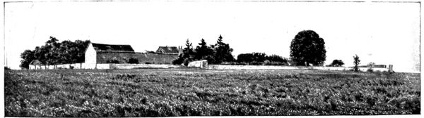
CHAMPFLEURY FARM
Champfleury, very important by reason of its dominating position (as shown in the above photograph), was vigorously defended, but after two unsuccessful assaults it was finally carried by the French. There they were subjected for two days to a violent bombardment from Étrépilly, Vincy, and Trocy, which made all their attempts to debouch both difficult and costly.
The farm buildings suffered badly and the rooms of the farm-house were reduced to ruins by shell-fire.
The view below shows the façade; the officers seen in the photograph belonged to the staff of the 56th Division which took the farm. The owners had evacuated Champfleury at the beginning of September; when they returned they found in the billiard-room (which was smashed to pieces) a jeering inscription signed by a German officer, regretting that they (the owners) had not been there to take part in the cannoning performed on their table.
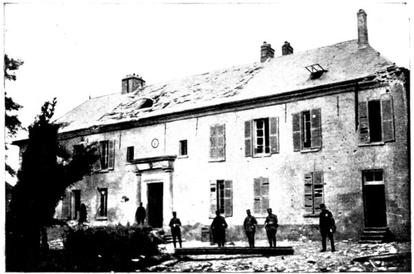
CHAMPFLEURY FARM
To enter the farm follow a little lane on the right for about 100 yards. Very likely it is still possible to see the various seats hidden in the trees in the garden, which were used by the look-out men.
From Champfleury the road descends towards Puisieux. The view below shows the situation of this village, in a fold of the ground. In the background, at the summit of the plateau, is seen the farm of Nogeon, which will be visited in the course of the excursion.
On the tourist's left, and outside the limits of the photograph, is a depression beyond which, in a position similar to Champfleury (see panorama D, pp. 106-107), appears the farm of Nongloire.
From the plateau on which stands this farm the French artillery hammered Champfleury and the Étrépilly position.
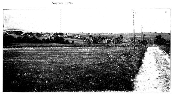
PUISIEUX SEEN FROM CHAMPFLEURY
On the right, also outside the photograph, is the farm of Poligny, towards which we go, turning to the right, in Puisieux, into the Rue de Poligny. The view below was taken from the Poligny road in September, 1914. In it are seen guns, cartridges, and machine-gun belts abandoned on the battlefield, and a French drum, which latter doubtless sounded the charge when the troops of the Seventh Corps, starting from Puisieux, and supported by the 56th Division coming down from Champfleury, went to attack the farm.
The struggle was desperate, for Poligny, like Champfleury, was an advanced position of the Vincy-Étrépilly line, and the Germans defended it to the utmost. Before leaving they set it on fire.
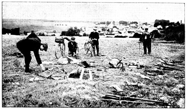
DÉBRIS OF THE BATTLE IN FRONT OF PUISIEUX
The view below shows to what a lamentable condition this large farm was reduced by bombardment and incendiarism.
Only a part of the courtyard can be seen here, but all the buildings belonging to the farm, including the beetroot factory, are in the same state.
From Poligny the Germans fell back on their positions on the Étrépilly Plateau, which is in the background of the photograph, and the farm became a valuable point of support for the Seventh French Corps.
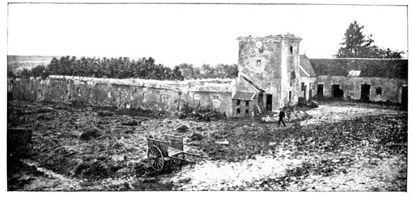
POLIGNY FARM
The German battery defending Poligny could not withdraw in its entirety, the fire of the French 75's having destroyed at least one of the field-pieces, of which a photograph is given below.
After this visit the tourist will return to the Puisieux Road (8½ km.) following the road, he came by, and crossing the village by an S-shaped route, leave the church on the right.
On the French front Puisieux formed the connecting point between the right (group Lamaze) and the centre (Seventh Corps). It received many shells from the batteries of 77's established on the Vincy-Étrépilly line and from the heavy howitzers of the Trocy Plateau.
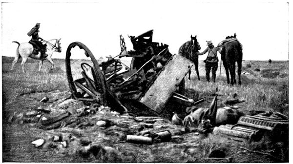
GERMAN FIELD-PIECE DESTROYED NEAR POLIGNY
Having passed the church, the tourist arrives at a little square, with several roads opening into it. He takes the one on the right, which leads him to the plateau that dominates Puisieux on the north. On the left can be seen the distillery of Fosse-Martin; straight ahead is the Nogeon Farm with its beetroot factory.
West of Fosse-Martin, in a room in the Castle of Brégy, the flag of the 72nd Thuringian regiment was found, abandoned.
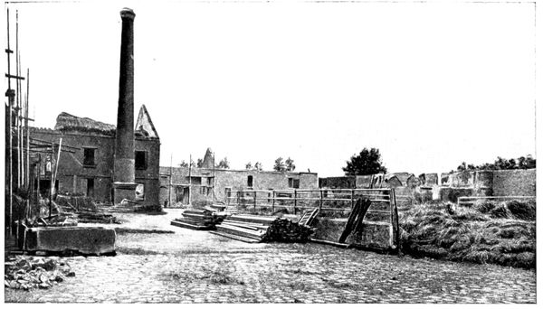
NOGEON FARM
The French artillery, installed between Fosse-Martin and Bovillancy, maintained a terrific fight against the German batteries at Étavigny, Vincy, and Trocy. Colonel Nivelle, future generalissimo, commanded the Fifth Artillery Regiment which had just done great deeds in Alsace, and whose daring and enthusiasm shone forth anew on the plateau of Multien.
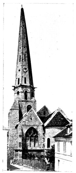
CHURCH OF ACY
Nogeon Farm was one of the principal centres of battle during the days of September 6 to 9. Taken by the French after a hand-to-hand fight, it was subjected to several counter-attacks which, supported by violent bombardments, completely destroyed it. But labour soon claims its rights, and the view above shows the rebuilding in progress.
From Nogeon, and the trenches around it, the troops of the Seventh Corps gained Acy and attempted to reach Vincy. The progression towards this last position, over open ground swept by an intense cannonade, was particularly difficult. Many actions took place at night. It was during one of these, in a bayonet charge on September 7, that the soldier Guillemard, having transfixed with his bayonet the officer standard-bearer, captured a flag belonging to the 36th Magdebourg Fusiliers, decorated with the Iron Cross in 1870. Guillemard received the Military Medal from the hands of General Gallieni.
The young fellow shook with emotion during the ceremony, and the general said good-humouredly: "Now then, embrace me and imagine I'm a pretty girl."
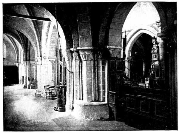
ACY CHURCH
From Nogeon the road descends to Acy-en-Multien (14½ km.) of which the slender steeple can be seen.
We cross the Gergogne and go through the village, following the High Street up to the twelfth and thirteenth century church, which is classed as an historical monument. This church came practically unscathed through the struggle which drenched the village with blood.
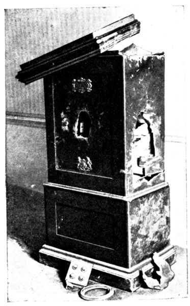
SAFE DYNAMITED BY THE GERMANS
Acy's situation in the hollow of a valley robbed its steeple of all value as an observatory; it was therefore respected by the artillery on both sides.
After glancing around the interior of the old church, with its squat pillars, shown in the above view, we go on along the High Street, passing the town-hall.
Opposite is a photograph of the town-hall safe, which was blown up by the Germans during their occupation of the place.
A little further on is the cemetery, in front of which is a big military grave.
Acy's churchyard was much too small to hold all the heroes who fell on the territory belonging to that parish.
In front of the cemetery, on the other side of the road, stands the castle where the Germans quartered themselves.
The view opposite gives but a slight idea of the state in which it was found by its owners.
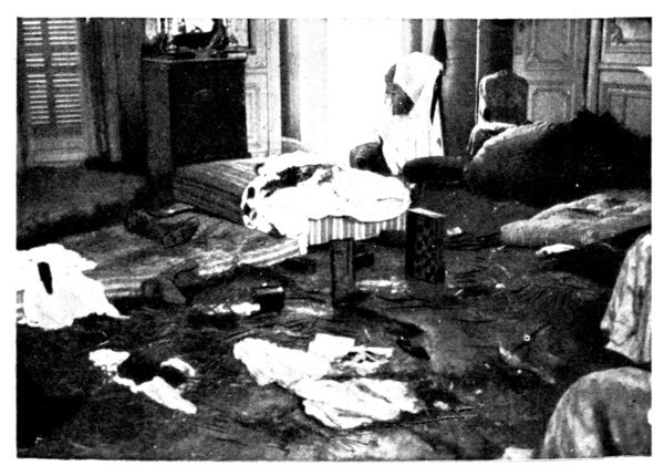
ROOM IN THE CASTLE WHERE THE GERMANS SLEPT
The park was placed in a state of defence and the Germans made a tenacious resistance there.
The tourist will now take the road in front of the cemetery which skirts the castle railings. Then turning to the left he will follow the zig-zag road which climbs the Étavigny Plateau.
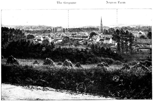
ACY SEEN FROM THE HEIGHTS OF ÉTAVIGNY
The above panorama was taken from the last turn of the climbing path and gives a good view of the valley in which Acy is built.
Here we can follow the course of the battle: the French held the Nogeon Plateau, the Germans the valley and the heights where the tourist stands. Troops belonging to the Seventh Corps descended on Acy from Nogeon and came up in front of the village, others slipped along the Gergogne and made a flank attack.
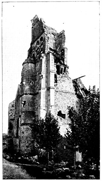
ÉTAVIGNY CHURCH
After furious fighting in the streets, in the castle grounds and in the little woods on the hillsides, the Germans were flung back from Acy to the heights of Étavigny. They returned to the charge, and in their turn drove the French back to the Nogeon Plateau.
The village thus changed hands several times, and this terrible beating backwards and forwards caused great losses on both sides.
Continuing his road to Étavigny, the tourist will go over the position that the Germans established on the plateau.
The infantry and the machine-guns were entrenched along the road itself; the light and heavy artillery were in the hollow on the right. They showered shells on the French positions at Nogeon, and in return received the fire of the batteries placed, as before mentioned, between Fosse-Martin and Bouillancy.
Arriving at Étavigny (18 km.) our attention is at once drawn to the church, which suffered terribly.
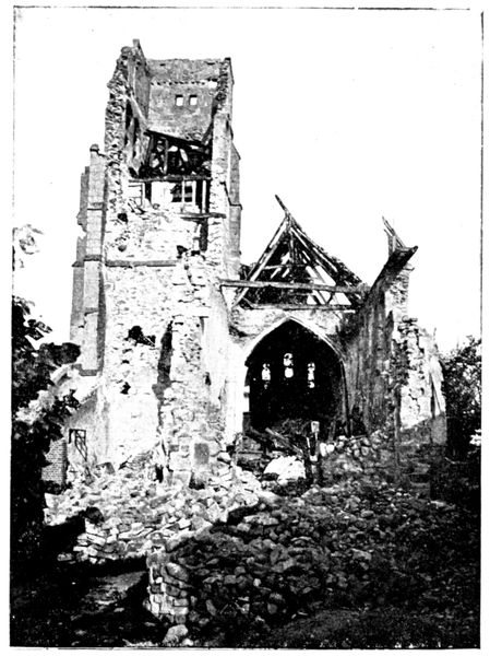
ÉTAVIGNY CHURCH
The part played in the battle by the church of Étavigny was very different from the passive one assigned to the church of Acy. Its dominating position afforded priceless views of the French lines to the observer installed in its steeple. It was therefore by shells from the 75's that the church was damaged (see pp. 100 and 101).
Étavigny was taken and retaken in the course of the Battle of the Ourcq. The struggle was hard, the Germans making a desperate resistance, as a serious French advance in this locality would have meant the outflanking of their whole line. They succeeded in forcing the troops of the Seventh Corps off the plateau.
Taking the road to the right, beside the church, and continuing about 200 yards we come to the cemetery, which is in a state of upheaval from the bombardment. The photograph below was taken through one of the gaps.
The windmill pump, on the left of the view, was riddled with bullets.
From Étavigny the tourist can either return to Acy by the same road, or follow the itinerary that we now give, which forms a loop around the northern part of the battlefield. In the first case, the distance to Acy is 3½ km., in the second 14 km.
Starting again from the church along the road which crosses the village, continue straight on towards Boullare. Here keep turning to the left and take the road to Betz. In the hollow on the left were placed the German batteries which joined in action with those of Étavigny.
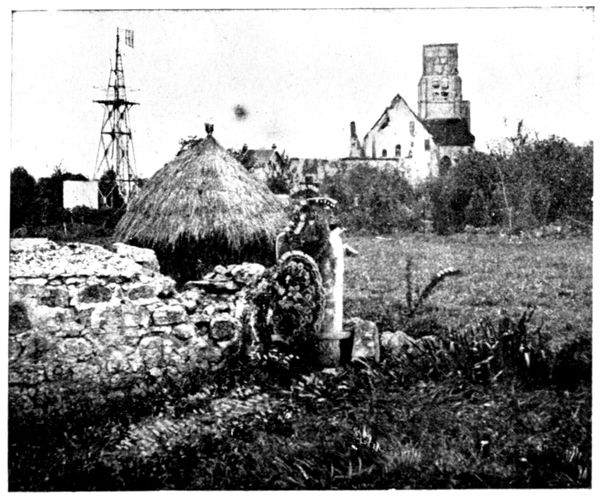
ÉTAVIGNY CHURCH SEEN FROM THE CEMETERY
The road descends into a rather picturesque valley. Through it runs a small river, the Grivelle, which we must cross, then go through Antilly, turning to the right on entering, and to the left at the fork in the road just after leaving the village.
We arrive at Betz (26 km.). Turn to the left near the church.
Betz did not suffer much from the guns, but some of its houses were burnt by the Germans, notably the Hôtel du Cheval Blanc (see p. 102), which can still be recognised by its signboard.
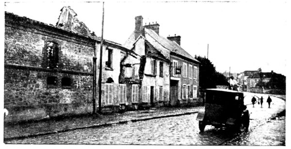
HÔTEL DU CHEVAL BLANC AFTER THE FIRE
The castle was occupied by a German headquarters-staff, who left it in a deplorable state.
During the pursuit the French officers had to abandon the idea of lodging there: one of them records in his notebook: "The German officers have left disgusting traces of their passage; we see slices of melon, bearing the marks of their teeth, in the wash-hand-basins, and enormous heaps of empty and broken wine bottles."
The tourist will cross Betz by the main street, which is seen in the above illustration, and at the further end of the village he will go straight on under the railway, leaving the road to Nanteuil-le-Haudouin on the right.
This last-named town has not been included in the itinerary, although it played an important part in the ultimate manœuvre attempted by Von Kluck—that of outflanking the French left wing. The paved road which leads to it is bad, and the other roads by which one could rejoin the planned route are extremely rough. Below we give a view of a corner of this battlefield. It gives some idea of the great plain which extends from Betz to Nanteuil, where the 7th and 61st French Divisions resisted with desperate energy the furious attacks of the Fourth German Corps. The dead horses seen in the photograph belonged to a French battery. The 75's, fully exposed, supported the foot-soldiers in their efforts until they came almost into actual contact with the enemy.
After passing under the railway the road rises to the plateau and soon brings us near a commemorative monument, on the right (view on following page).
Thence it passes through the Woods of Montrolles, where the 61st Division particularly distinguished itself on the evening of September 8. Worn out with fatigue, its reserve supplies exhausted two days before, it yet, by a supreme effort, succeeded in driving back the Germans.
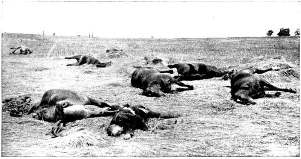
THE PLAIN OF NANTEUIL-LE-HAUDOUIN
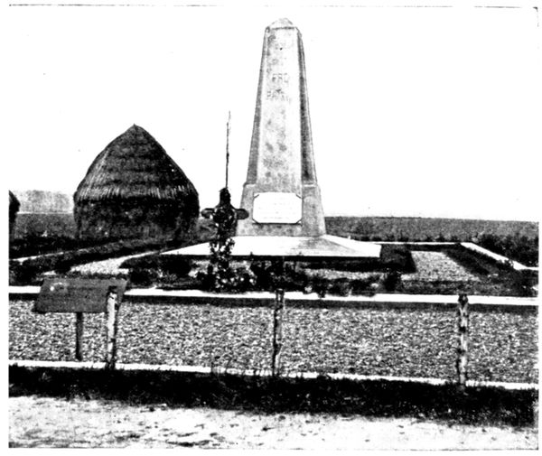
MONUMENT AT BETZ
Having passed through the Woods of Montrolles, we soon come to a fork. Here take the road on the left.
To the right are the Heights of Bouillancy, where the French artillery was placed; on the left the Plateau of Étavigny on which were the German batteries.
A hollow, where runs a river, separates the two positions, between which the artillery duel was intense, preparing and accompanying infantry assaults which succeeded one another from September 6 to 9, with alternate advances and retirements.
The road then returns to Acy, skirting the wall of the Castle park. We again pass the church and, on leaving the village, cross the Gergogne. Immediately after the bridge turn to the left towards Vincy (35½ km.). The photograph below shows that this village also suffered from incendiarism and bombardment.
After passing through Vincy, bear to the left in order to pass in front of the Manœuvre distillery, leaving the hamlet of that name on the left. Étrépilly (41 km.) will be reached by the middle road of the crossways, which are about 1 km. further on past the distillery.
This Vincy-Étrépilly line formed part of the defensive front established by the Germans west of the Ourcq, marked out further north by the localities of Betz, Étavigny, and Acy, which have just been visited, and more to the south, by the position seen on panorama B (pp. 90-91). The Germans had made trenches and machine-gun shelters over the whole plateau, which stretches on the right of the road towards the farms of Poligny and Champfleury. On the right slope of the road one can still see the dug-outs where the snipers sheltered themselves.
The position was attacked from September 6 to 9 by the 63rd Division of the Seventh Corps and the 56th of the Lamaze Group which carried the advance positions constituted by the farms of Nogeon, Poligny, and Champfleury. They were stopped, however, on the line itself until the general withdrawal of the German troops.
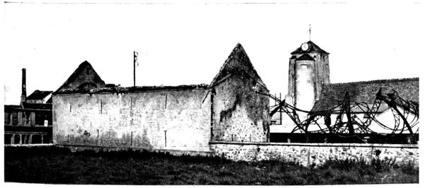
BURNT FARM AT VINCY
To reach the spot where the view below was taken, follow the track which branches off the road from Vincy to Étrépilly, between the memorial and the burnt hangar. This is the road we see across the middle of the panorama. The tourist finds himself at the southern extremity of the Vincy-Étrépilly position, on the site of a German battery which was severely treated by the French 75's.
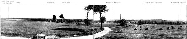
C. PANORAMA OF TROCY, ÉTRÉPILLY, LA THÉROUANNE.
Road from Vincy to Étrépilly
Trocy
Memorial
Burnt Shed
Church of Étrépilly
Valley of the Thérouanne
Heights of Penchard
In the background is seen the Trocy Plateau, separated from the road by a hollow, in which flows a tributary of the Thérouanne. On the Trocy Plateau, where this itinerary will in due course lead the reader, the Germans had established their powerful artillery, composed of heavy and light batteries, which swept the whole battlefield from Nogeon Farm to Barcy, taking in Puisieux and Marcilly. Beyond the valley of the Thérouanne, south of Étrépilly, stretches the position of which the details appear in panorama B (pp. 90-91). The view extends to the wooded Heights of Penchard, which are outlined against the horizon.
On the brow of the hill where stands the observer, fierce battles were fought at the time of the attacks on Étrépilly. The 350th Infantry did once, on the morning of the 7th, make their way into the village, following the valley of the Thérouanne, but violent counter-attacks forced them back. They returned to the charge at night and climbed from the river's edge to the plateau. They were greeted by the fire of a machine-gun section upon which two companies flung themselves with fixed bayonets. Two field-pieces were taken. The French troops maintained their position until ten o'clock in the evening, but finally, as the German reinforcements poured in, were obliged to descend the slope and cross back to the right bank of the Thérouanne.
Returning to the Étrépilly road we pass in front of the memorial raised by the engineers in front of the cemetery, at the place where the battles of Étrépilly reached their climax. A military grave has been made behind the memorial.
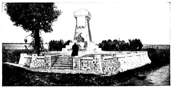
MEMORIAL AT ÉTRÉPILLY
The Germans had entrenched themselves in the cemetery, where they succeeded in checking the night attack of the Zouaves on September 7. The Second Regiment, coming from Barcy, reached the village and carried it at the point of the bayonet.
Without stopping, the Zouaves began to climb the height at the foot of which Étavigny is built.
Their rush carried them as far as the cemetery, and here, met by a terrific fire from the machine-guns, they tried to keep the position, but German reinforcements having come up, they were forced to abandon the plateau, evacuate the village, and return to their trenches at Barcy. Lieutenant-Colonel Dubujadoux, commanding the regiment, was killed; three-fourths of the officers and half the effective force fell in the course of this heroic charge.
In front of the memorial the twisted metal framework of a burnt shed is to be seen. According to certain accounts, the Germans, before evacuating the position on September 9, used this shed to burn the bodies of those of their soldiers who fell in the battles of Étrépilly. Some of the inhabitants say that to these were added the badly wounded, whose hurts were such that they could not be removed.
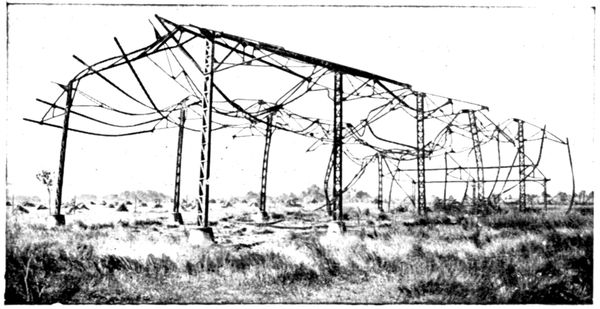
BURNT SHED
We believe, as a matter of fact, that a large pyre of corpses was set alight here by the Germans, who generally burn their dead when they cannot carry them away. But the hangar was destroyed by the French artillery which fired repeatedly on that side of the plateau at the battery of 77's installed there, at the cemetery, and at the German trenches.
In the cemetery lie the heroes who were killed in attempting to regain it.
From the cemetery the road descends towards Étrépilly.
Turn to the right at the foot of the slope into Étrépilly and on leaving the village take the road on the left; cross the river, turn again to the left and follow the track which climbs the plateau. After a few hundred yards the right slope disappears. It was at this point that panorama D was taken, showing, from the German side, the same battlefield seen from the French side in panorama B (pp. 90-91).
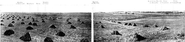
D. PANORAMA OF THE BATTLEFIELD OF THE FRENCH RIGHT
Heights of Penchard
Montheon
Barcy
Heights of Cuisy
Factory at Marcilly
Road from Marcilly to Étrépilly
Farm of Nongloire
Farm of Champfleury
The road on which the tourist now stands goes on to the heights of Varreddes. Bordered with trenches and machine guns, it constituted the principal line of the German defence south of Étrépilly, the advance lines resting thus: the first on Penchard—Monthyon—Heights of Cuisy; the second on Chambry—Barcy—Marcilly. In this theatre of operations fought, south of the Marcilly-en-Étrépilly road, the 55th (Reserve) Division, the 45th Division and the Moroccan Brigade; at Marcilly and on the plateau north of Étrépilly, which is outlined on the extreme right of the panorama and crowned by the Champfleury Farm the 56th (Reserve) Division.
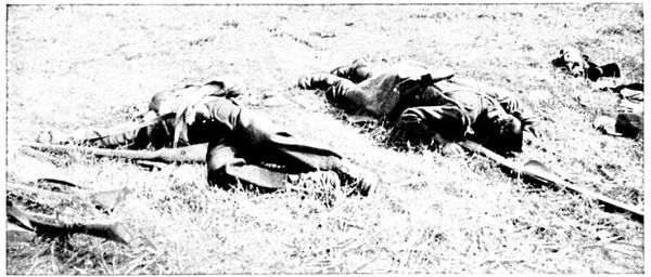
A CORNER OF THE BATTLEFIELD
Leaving the trenches hastily dug on the Chambry—Barcy—factory of Marcilly line, the troops of the Lamaze group, before getting up to the German trenches, had to cross two kilometres of uncovered ground, under terrible fire. It was in one of these attacks, starting from Barcy, that Major d'Urbal (brother of the general) fell at the head of his Zouaves as, waving his cane, he drew them along. He was brought back to the French lines, thanks to the devotion of one of the few officers who survived the attack, helped by two Chasseurs d'Afrique. Because of his great height the commander's body could not be carried back, and they were obliged to place it on a horse. The group returned thus to Barcy under a hailstorm of bullets, where a shell-hole in the cemetery served for a grave.
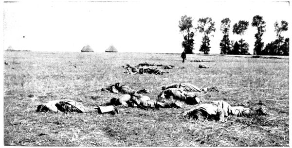
A CORNER OF THE BATTLEFIELD
In the counter-attacks, the Germans as they left their trenches also suffered serious losses, as one can judge from the preceding photograph, which was taken in front of the position.
The tourist will return to Étrépilly by the road he came, leaving the church (the roof of which was hit by several shells) on the right, and taking the Trocy Road on the left.
ÉTRÉPILLY TO MEAUX
(19 km.)
via Trocy, Gué-à-Tresmes, Varreddes.
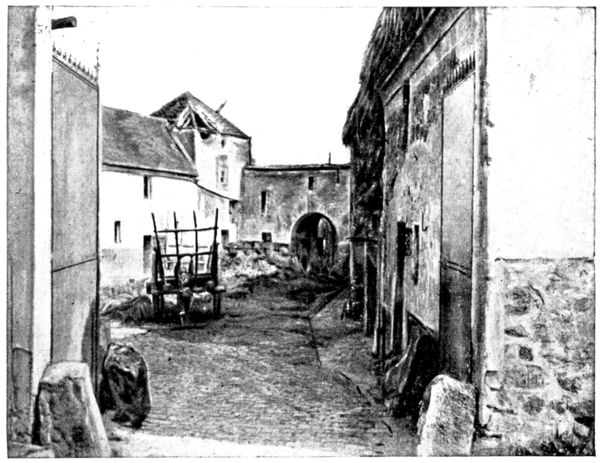
FARM THAT WAS SHELLED
The beautiful shady road that leads from, Étrépilly to Trocy first crosses a hollow, then winds up the hillside to the plateau on which Trocy is built (3 km.). On arriving, turn to the left and so enter the heart of the village.
Trocy did not actually suffer from the German attacks, but it was bombarded by the French artillery. In front of the horse-pond, on the left of the little church, stands a farm (view opposite) which in 1917 still showed traces of the "75" shell which damaged its roof. Other houses were completely destroyed.
The Germans had concentrated their chief artillery forces on the Trocy Plateau. Heavy and light batteries were in position north and south of the village, the greater part being north, between Manœuvre, Plessy-Placy, and Trocy.
The intense cannonade poured from this dominating platform very much hampered the progress of the French centre.
The position was evacuated by the Germans on the 9th, not without serious losses of light artillery, as shown by the photograph below and that at the top of the following page.
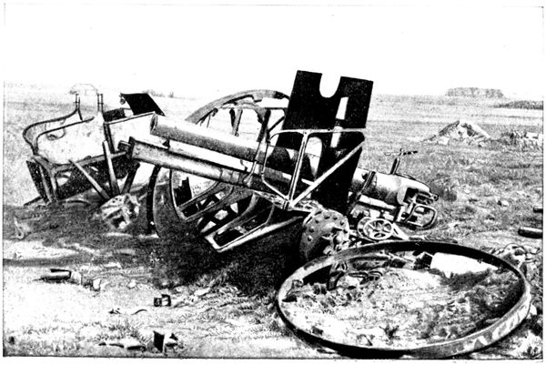
GERMAN GUN DESTROYED ON TROCY PLATEAU
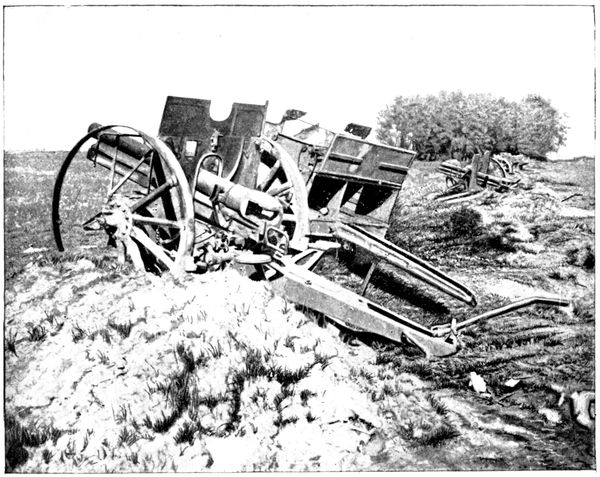
GERMAN GUNS DESTROYED ON TROCY PLATEAU
The limber (shown below), abandoned at the side of the road, is an infantry limber which contained rifle and machine-gun cartridges.
The French artillery which swept the plateau hit it in the course of the retreat.
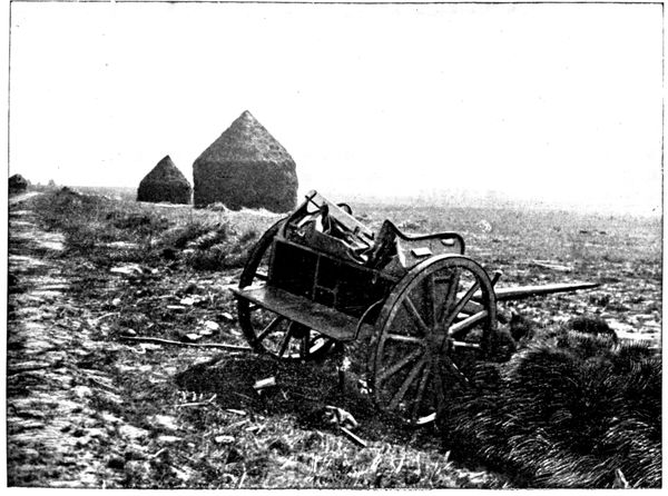
GERMAN LIMBER ON TROCY PLATEAU
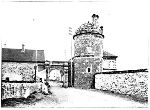
GATE OF TROCY
Rounding the horse-pond, we take the road which runs under the monumental gateway, a view of which is given above.
This gate is one of the chief remains of the fortifications which guarded Trocy in the Middle Ages.
It will be seen that the strategic importance of the position has at all times been appreciated at its full value.
Having passed through the gate, we take, 100 yards further on to the left, the road that dips into a hollow, on the opposite slope of which stands out the fine farm of Beauvoir.
We reach this farm by a zig-zag ascent which comes out on the Route Nationale (N. 36). We then turn to the right and go down towards Gué-à-Tresmes.
This little place played the part, in relation to the extreme German left, that Trocy played in the centre. It was a heavy artillery position supporting the advanced line of defence.
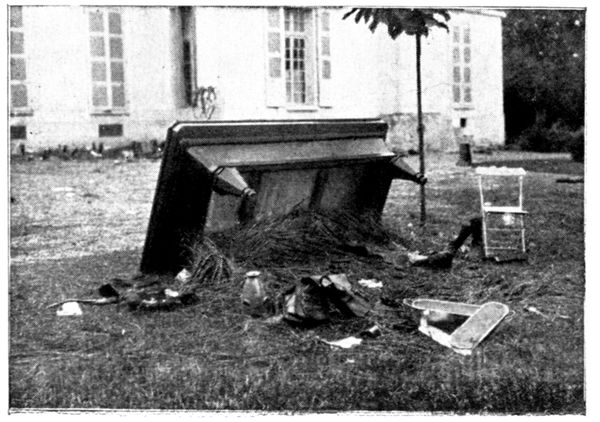
THE BILLIARD-TABLE OF THE CHÂTEAU
At the entrance to the village, on the left side of the road, is a large residence surrounded by a park. It was occupied by the Germans and converted into a field hospital. In order to make room rapidly, the furniture was flung outside. It was thus that the billiard-table was found in the park. A soldier who was evidently a lover of fresh air used it as a shelter. On the opposite photograph can be seen a fish-kettle which did duty as a basin: frequent washing being indispensable during those hot September days.
The façade shown in the view is the one which faces the road.
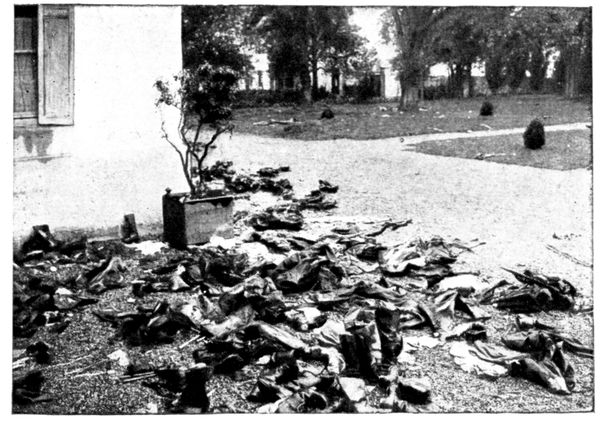
PERSONAL BELONGINGS LEFT AT GUÉ-À-TRESMES BY THE GERMANS
A certain number of German wounded died in the hospital and were buried in the garden; their belongings were left behind at the time of the retreat, as shown in the opposite photograph.
This retreat must have taken the occupants unawares, for a meal was on the officers' table when the French troops entered the château.
At the cross-roads, about 300 yards beyond the château, go to the left along the Thérouanne. 200 yards further along this road is seen (on the right) the place where a group of German artillery was hidden. Well-screened in the hollow shown in the view below, several heavy batteries, for a long time out of reach of the 75's, made extremely difficult the advance of the French right on the Plateau of Chambry-Barcy. They also hampered the left, of the British army and the 8th French Division on the left bank of the Marne. In the course of this tour, we have already seen several examples of the German battery positions. Wherever the ground allowed of it, the guns were placed in a hollow, visible only to aerial observers. Telephones linked them up with the posts established on the ridges whence the firing was directed.
Returning to the Route Nationale, turn to the left towards Varreddes. On both sides of the road, which was their main way of retreat, the Germans had made lines of defence: trenches were dug and furnished with machine-guns, and light batteries were established as supports.
The whole, which joined up with the defence works of Trocy, constituted a position of withdrawal for the Étrépilly-Varreddes line, seen in panorama B (pp. 90-91). This was the first stage of the retreat on September 9.
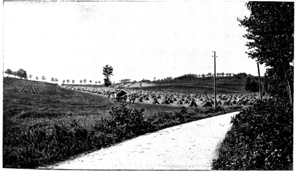
HOLLOW WHERE THE GERMAN ARTILLERY WAS PLACED.
This panorama was taken at the intersection of the Meaux-Soissons road (N 36) and a track which leads to Étrépilly, in the field bordering the road and where German machine-guns were established in order to sweep with their fire the Route Nationale and the bottom of the hollow.
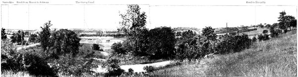
E. PANORAMA OF THE VARREDDES HOLLOW
Varreddes
Road from Meaux to Soissons
The Ourcq Canal
Road to Étrépilly
It is easy to understand why the Germans attached so much importance to the Varreddes position.
The slopes west of the hollow (they form the background on the left of the panorama) were protected from the blows of the French artillery, and by availing themselves of this protection the Germans could easily bring up supplies or relieve the defenders on the crests, facing Chambry-Barcy. This ensured their resistance until the moment when the general trend of the action forced them to fall back.
After having examined panorama E, continue the descent towards Varreddes (12 km.). Before crossing the canal one can see, on the right, a '75' shell which has remained fixed in the wall of an inn, of which the sign has now become: "A l'obus."
We now enter the High Street of Varreddes.
At the entrance of the village is a certain number of houses that were damaged by the bombardment.
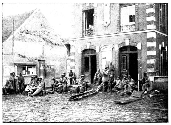
GERMAN WOUNDED IN FRONT OF VARREDDES TOWN-HALL
The German wounded, forsaken during the hasty retreat of September 9, were sheltered and nursed at the town-hall. They are seen in the opposite view. When leaving the village the Germans took twenty hostages with them, all very old, among them being the vicar. Three succeeded in escaping, but, for the others, the retreat proved (as will be seen) a veritable torture. Seven of them were murdered.
On the first day they were forced to march seventeen miles. M. Jourdain, aged 77, and M. Milliardet, aged 78, taken away with only slippers on their feet, were the first to fail from exhaustion: they were shot point-blank. Soon after, M. Vapaillé suffered the same fate.
The next day M. Terré, an invalid, fell, and was killed with revolver-shots; M. Croix and M. Llévin stumbled in their turn and were also shot.
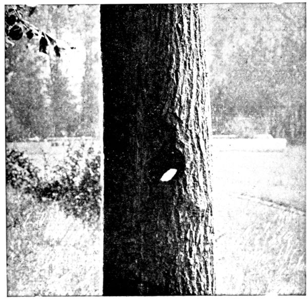
TREE PIERCED BY A 75 SHELL
All three were from 58 to 64 years of age. Finally, M. Mesnil, aged 67, utterly exhausted, gave in: his skull was smashed in with blows from the butt end of a rifle.
The other hostages, better able to endure, held on as far as Chauny and were sent to Germany by rail. They were repatriated five months later.
After having traversed Varreddes and before re-crossing the canal, a tree will be noticed on the left of the road (the 38th on the way out) which has been pierced by a '75' shell as if by a punching-press.
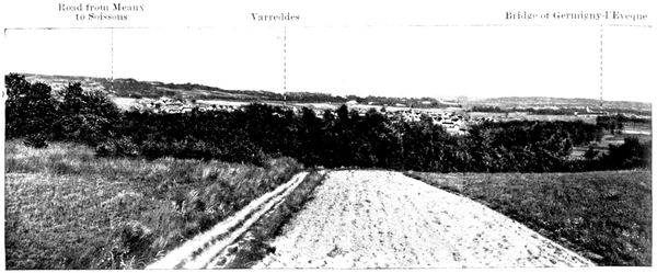
F. PANORAMA OF THE VARREDDES HOLLOW
Varreddes
Road from Meaux to Soissons
The Ourcq Canal
Road to Étrépilly
40 yards beyond the canal, on the right, are seen several tracks which scale the heights. We climb the one on the right up to the summit, where the above panorama was taken. This gives a view of the Varreddes hollow in the opposite direction to that of panorama E (pp. 112-113).
Germigny, seen on the right of the photograph, is known through having been Bossuet's summer residence. The Germans had a heavy battery there, which bombarded Meaux in the early days of September. On the 8th they re-crossed the Marne, blowing up the bridge behind them.
The appearance of a French reconnoitring party composed of a sergeant-major and nine men had sufficed to cause the evacuation of the position, which, with the river behind it, seemed a dangerous one. These ten heroes were killed in the course of the battle and buried at Germigny. On the 9th, the Marne was crossed on a pontoon bridge built by British engineers, under fire, whose heroic tenacity triumphed after seventeen fruitless attempts.
The Germans, attacked besides on the heights where the tourist now stands, were obliged to retire rapidly from the hollow by the Soissons Road, under fire from the French batteries.
On the crest of the hill a track crosses the ascending one, near two isolated walnut-trees. On the right this road goes to Étrépilly; it constituted the German line of defence which is the subject of panorama B (pp. 90-91).
The tourist will go to the left between the two walnut-trees and explore the crest which formed the redoubtable position occupying the background of the view on p. 89. It was well provided with trenches, machine-guns and light batteries, and all attacks against it failed, until September 9.
Turning again to the left 1 km. further on, at the first fork in the road, the reader will follow a little path which brings him back to the Route Nationale at the point where he left it. The walk takes about 30 minutes. The two paths, by which the ascent and descent have been made, served the Germans as channels for bringing up supplies. Their rearguard, which disputed the ground foot by foot, was routed there by a bayonet attack.
We now return towards Meaux. The retreating Germans followed this road, but in a contrary direction and pursued by the French shells.
At the highest point, on the right, is seen the trunk of a tree decapitated by artillery fire, at the top of which the workmen of the entrenched camp of Paris have fixed a branch to form a cross: humble and touching tribute to the brave men killed in going up to the attack.
Before arriving at Meaux we have a beautiful view of the town. We pass under the railway; then, on the right, take the N. 3 or Rue du Faubourg-Saint-Nicolas, which brings us back to the Cathedral (19 km.).
II THE MARSHES OF SAINT-GOND COULOMMIERS-PROVINS-SEZANNE
FROM MEAUX TO COULOMMIERS
(44 km.)
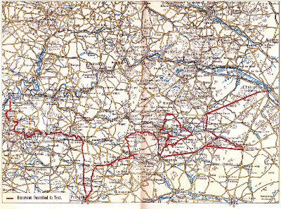
(See map opposite)
FROM MEAUX TO CRÉCY-EN-BRIE
Leaving Meaux Cathedral by the Rue Saint-Étienne, which skirts it and is continued by the Rue Saint-Nicolas, turn to the right 100 yards beyond the apse of the cathedral into the Rue du Grand-Cerf in order to gain the "Pont du Marché." After crossing it, keep straight on along the Rue du Marché, leaving on the right the market where the famous Brie cheeses are sold wholesale. Take the Rue Cornillon and the Rue du Faubourg-Cornillon, and at the top of the slope, look back in order to have a general view of Meaux, dominated by its cathedral. On leaving the town continue straight along N. 36 to Couilly (9 km.) where we reach the valley of the Grand-Morin.
(The quickest road from Couilly to Crécy-en-Brie is N. 34, which turns to the left into the paved street of Couilly before arriving at the bridge, but the prettiest road is that indicated to the tourist, on the opposite bank of the Morin.)
Make for Saint-Germain, traversing the bridge and the level-crossing, and turn to the left immediately beyond the railway into the Rue de la Gare. Turn to the left again into the Rue de Villiers, which is bordered by telegraph poles. The road follows the railway which is on the left.
On the other side of the valley are to be seen the red-tiled roofs of the modern buildings of the "Home" for actors, built on the site of the old Abbey of Pont-aux-Dames. This abbey, which was founded in the thirteenth century, was destroyed during the Revolution. Louis XIV. sent the abbess of Port-Royal-des-Champs to end her days there, after the destruction of the famous abbey of the Jansenists. Mme. du Barry, favourite of Louis XV., after an eventful life, became acquainted with the calm and self-denial of Pont-aux-Dames, when the king was no more.
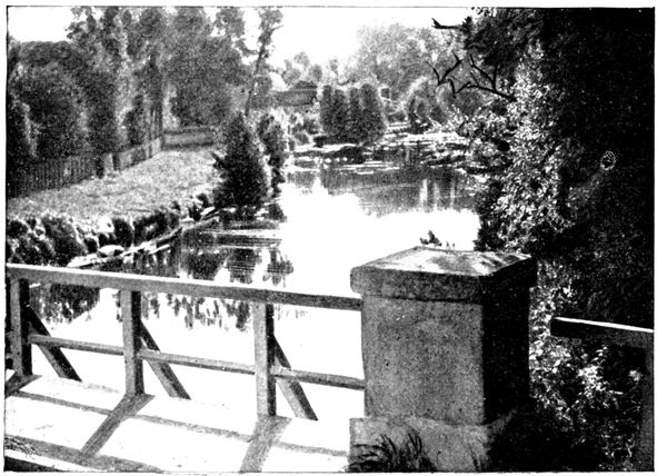
BRIDGE OVER THE MORIN
The "Home" was founded in 1903 by the comedian Coquelin aîné, who died there in 1909 while on one of his visits to it. He is buried in the grounds, where is also his statue. Pont-aux-Dames has room for eighty inmates. There is also an open-air theatre used for performances. It is open to visitors on Thursdays and Sundays from 2 p.m. to 5 p.m. (one franc each). The entrance is 1,200 yards from Couilly bridge on N. 34 which follows the right bank of the river.
The road draws nearer to the Morin, and the railway changes over to the right bank. One hundred yards beyond "La Picardie" (little rustic inn) we arrive at Villiers-sur-Morin and turn sharply to the left at the first street.
At this crossing, standing against the house on the right, is a pyramidical monument to the memory of the painter Amédée Servin, who died in 1884. His medallion was engraved by Falguière. It was Servin, together with the native poet Jules Grenier, who introduced the Valley of the Morin to the public. A little school of artists was formed there, which recalled that of Barbizon in the Forest of Fontainebleau, or that on the banks of the Yvette. The part known by the name of the "Morin des Peintres" (the artists' Morin) stretches from Couilly to Tigeaux (south of Crécy); many artists visit there each year.
Traverse the bridge over the Morin and the level-crossing. Immediately afterwards turn to the right (14½ km.) into N. 34 towards Crécy-en-Brie.
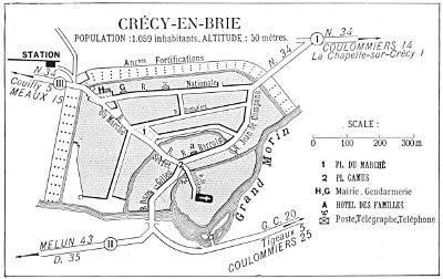
PLAN OF CRÉCY
The Grand Morin was crossed on September 6, 1914, at the beginning of the battle of the Marne by the British troops, who utilised the several bridges between Villiers-sur-Morin and Coulommiers. The Germans offered but a feeble resistance; their forces at this point consisting merely of a screen of cavalry supported by a few artillery and infantry units. Their task was to cover the retreat northwards of the two army corps recalled by Von Kluck to resist the flank attack of the Army of Paris, to the north-west of Meaux.
Shortly before arriving at Crécy, the road traverses, by means of a level-crossing, the little railway line already met with several times since Couilly and which has its terminus at Crécy.
CRÉCY-EN-BRIE
The entrance to the burgh (16½ km.) is marked by a little brick belfry surmounting a tower which belongs to the ancient fortifications. That part of the Morin which flows at its foot forms the boundary of the town, and also served as moat to the ramparts erected in the Middle Ages. Of these important defences only a few scattered towers remain of the original fifty-five.
From the bridge we have, on the right, a picturesque view of the tanneries shown in the photograph opposite.
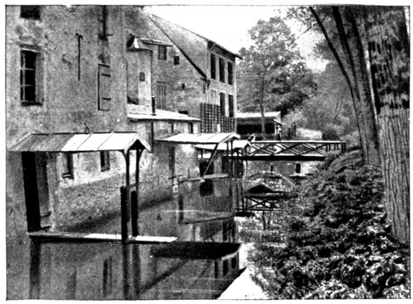
ARM OF THE MORIN
The tourist would be advised not to cross the bridge, but to follow on the left the pretty avenue, planted with trees, which encircles Crécy on the outside.
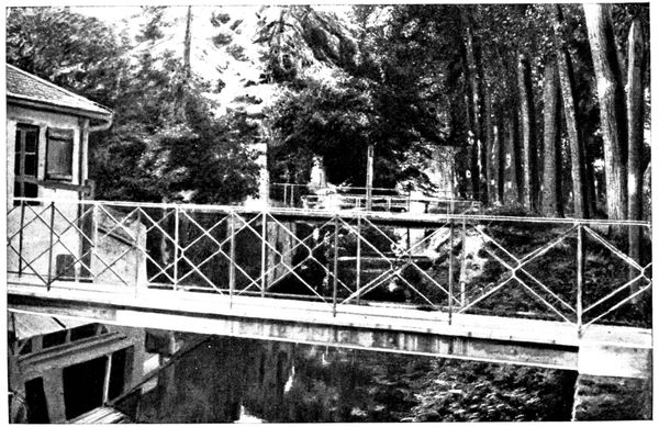
FOOT-BRIDGE OVER AN ARM OF THE MORIN
This avenue, however, is not accessible to motors. The latter may take the Rue du Marché, the Rue Serret, and on the left of the Place Camus, the Rue Barrois and its continuation, the Rue Jean-de-Compans. At the bridge over the Morin, at the extremity of the town (view opposite), the motor may await the tourists, who will rejoin it by the pretty shady walk beside the Morin shown in the photograph above.
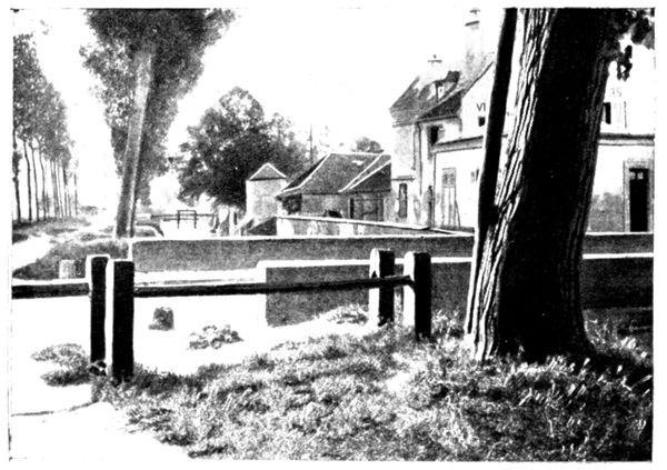
BRIDGE OVER AN ARM OF THE MORIN
Each one of the houses bordering the river has communication with the boulevard by means of a foot-bridge, some of which are also draw-bridges. The little wash-houses fitted up in the lower storeys of the houses add to the picturesqueness of this rustic corner.
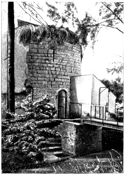
TOWER BELONGING TO THE OLD WALL
The ramparts, which in former times were reflected in the Morin, have almost disappeared; the opposite view depicts a remaining vestige: and during the walk others will be noticed.
Having returned to the car and if it is intended to visit the beautiful church of La Chapelle-sur-Crécy (see pp. 120-121), cross the bridge over the Morin and follow the Route Nationale (N. 34) for about 1 km.
(This is also the road to take if, instead of following the tour by the valley of the Grand Morin described hereafter, tourists prefer to go straight on to Coulommiers, 14 km. from Crécy. The tour is much prettier, but 11 km. longer.)
After visiting La Chapelle-sur-Crécy return to Crécy by the same road, cross the bridge over the Morin, follow the Rues Jean-de-Compans and Barrois and come to a halt at the Place Camus. Take a few steps towards the church in the Rue de Penthièvre and glance at the arm of the Morin which crosses the street. On the right is an old mill; on the left the charming scene reproduced below; in front is the tower of the church, and its most interesting part.
Returning to the car, take the Rue Dam-Gilles, immediately to the left of the Rue de Penthièvre.
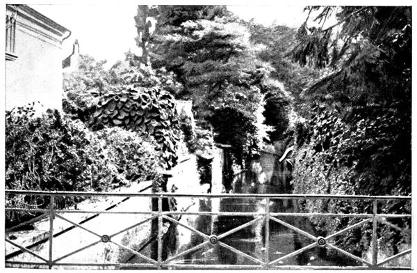
ARM OF THE MORIN
Cross the Morin (19½ km.), then at the fork in the road 50 yards beyond the bridge turn to the left into G. C. 20 towards Tigeaux and Dammartin.
La Chapelle-sur-Crécy
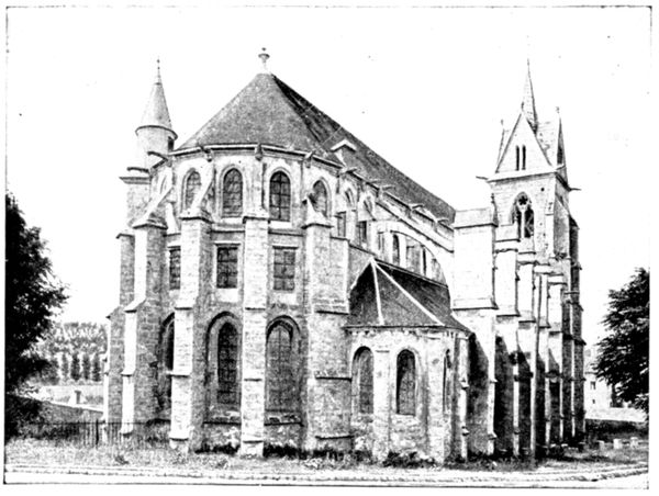
THE CHURCH SEEN FROM THE ROAD
This beautiful church, classed as an historical monument, dates from the thirteenth century and was restored in the fifteenth thanks to the generosity of Jeanne de Navarre, wife of Philippe de Bel.
Its situation, on a lower level than the Route Nationale, has necessitated the raising of the ground. At the present time, the height of the building is diminished by about ten feet, a fact which destroys the balance of its proportions.
This impression strikes us at once on entering, for the door is almost reduced to its ogival part. In the interior, as the view below shows, there is a flagrant disproportion between the height of the pillars and that of the arcades.
The triforium encircling the nave and choir is worthy of notice. The capitals of the pillars are finely carved; and the grimacing heads, which terminate the vaulting shafts of the choir supporting the ribs of the vault, show spirited workmanship. Before the window, at the end of the church and on the right on entering, is a group in painted stone dating from the Renaissance. It is reproduced in the photograph on p. 121.
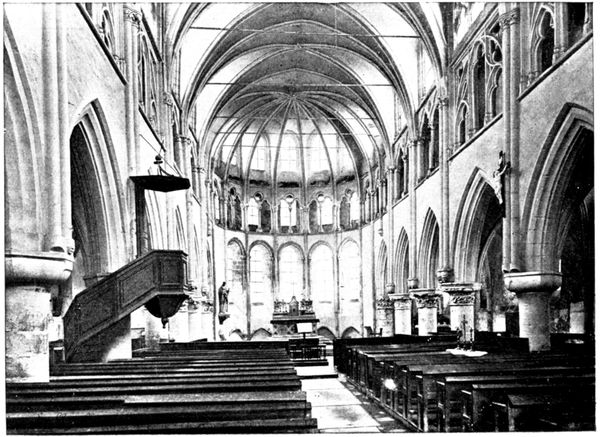
NAVE OF THE CHURCH
FROM CRÉCY-EN-BRIE TO COULOMMIERS VIA THE VALLEY OF THE GRAND MORIN
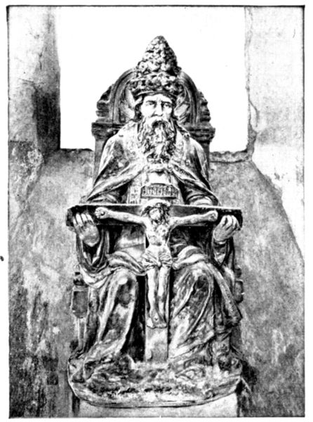
GROUP REPRESENTING THE TRINITY
Turning to the left on leaving Crécy into G. C. 20, beyond the bridge over the Morin, a mill is to be seen on an island in the middle of the river. Then, on the other bank, standing out boldly against the sky line, is the church of La Chapelle-sur-Crécy. Leaving the houses behind, telegraph posts begin to mark the road, and on following them we soon reach Tigeaux (24 km.), through which we pass to arrive at Dammartin. Enter the latter and turn to the left beyond the cemetery. Go up towards the church (26½ km.), but skirt it and leave to on the left hand. Take the first road to the left beyond the church, and follow the wall of the castle park. A little before the end of the wall, take on the right the "Chemin Vicinal" to Guérard, which dominates the Valley of the Morin. This road rejoins the railway, and fringes it, leaving it on the right. A pretty descent through woods leads down to the valley. When the road begins to mount, before arriving at Guérard, take the road which goes up on the right (31 km.), but without entering the village. 800 yards further on, at the cross roads, turn to the left towards La Celle, through which we pass (32 km.).
We leave on the left, in La Celle, the road which crosses the Morin, and which, after following the right bank, rejoins, by way of Tresmes and near Pommeuse (6 km. further on), D 16 coming from Faremoutiers. We advise tourists to take the latter (D. 16) in order to give more variety to the tour by climbing the height above the river.
After passing through the lower part of La Celle, the road begins to mount, traverses a level-crossing, and then by a series of zig-zags reaches the height on which the other part of the village of La Celle is built. Turn to the left in the Grand'rue (D. 16) towards Faremoutiers, whose church, surmounted by a tiny steeple, may be perceived in the distance. On arriving at the Place du Marché at Faremoutiers, turn to the left into the Rue de Moutiers, then to the right into the Avenue de Garenne, which runs between the church and the town-hall, and descend into the valley.
Faremoutiers was the "moûtiers" (monastery) of Sainte-Fare, who founded a convent there in the sixth century. Among its abbesses was a daughter of Charlemagne. The nuns, who were much talked of, belonged to the Order of St. Benedict. They had also many disputes with the bishops of Meaux. The monastic building was destroyed during the Revolution.
Still following D. 16, traverse a rather dangerous level-crossing, after which turn to the right towards Pommeuse. At the cross roads preceding the village, turn to the left, thus leaving the church on the right. Cross the Grand-Morin, and 50 yards farther on, turn to the right (38 km.). It is here that we once again meet the road which we crossed at La Celle, and which follows the right bank of the Morin.
At Pommeuse, during the short German occupation at the beginning of September, 1914, the inhabitants were obliged to erect a barricade which was destined to bar the passage of the Morin against the British. One of the workers not displaying sufficient ardour was tied to a cart-wheel.
D. 16 leaving Mouroux on the right joins N. 34 coming from Crécy; turn to the right towards Coulommiers (44 km.).
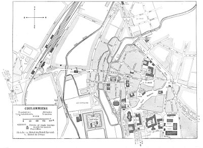
COULOMMIERS
COULOMMIERS
ORIGIN AND PRINCIPAL HISTORICAL FACTS
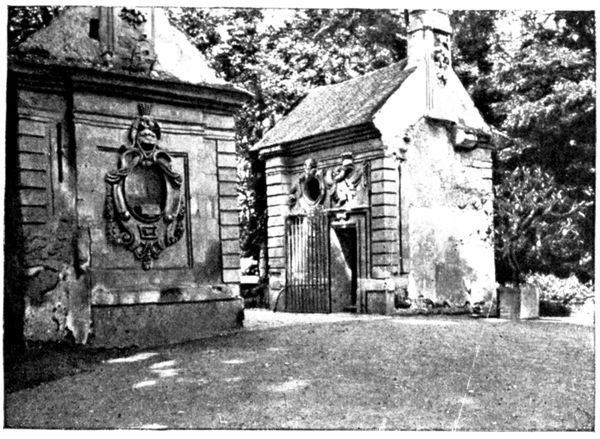
LODGE OF THE GUARDIAN OF THE CASTLE
The following is a poetical version of the origin of Coulommiers. When Julius Cæsar arrived in the region, a tower dominating a few huts stood on the site of the present town. A large number of doves had made their nests in this tower, and flew around it, a fact which caused the spot to be known as Castrum Columbarium, from which is derived Coulommiers (the inhabitants are called Columériens).
Coulommiers developed greatly under the Counts of Champagne. The tower was surrounded by ramparts, and protected by a moat fed by the waters of the Grand Morin. These fortifications have disappeared, only a few fragments, situated in the Avenue Victor-Hugo, remaining. Coulommiers was occupied by the English in the fifteenth century, by the Russians in 1814, and by the Germans in 1870.
On September 4, 1914, the retreating British army abandoned Coulommiers, from which the greater part of the population had fled, barely 600 inhabitants remaining in the town. The Germans entered on the 5th and remained until the morning of the 7th. During this short stay they pillaged methodically, and it was owing only to the energy of the mayor, M. Delsol, 77 years of age, and of the "Procureur de la République," M. Chatry, whose adventures are related below, that Coulommiers did not experience the horrors of Senlis.
VISIT TO THE TOWN
Enter Coulommiers by the Rue de Paris, which crosses the Rue de Melun opposite the Hôtel de l'Ours. Cross this street in order to follow the Rue des Capucins, which forms the continuation of the Rue de Paris.
We arrive before a gateway, on the right, opening into the picturesque grounds of the old castle. Enter by the gateway on the left of the principal building. A German Staff established itself here during the occupation of September, 1914.
Of the eighteenth century castle, built by the Duchess of Longueville, only the large moat and a few quaint ruins remain.
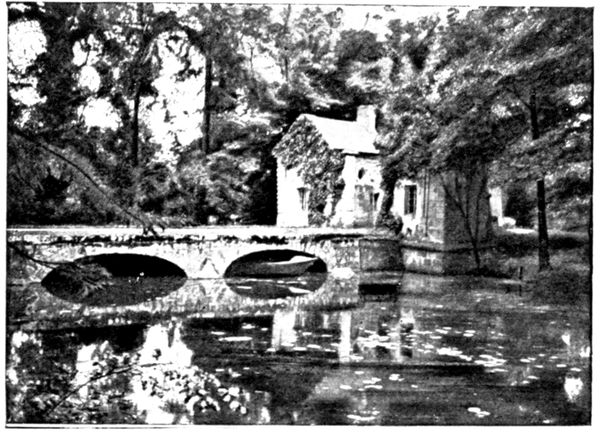
BRIDGE OVER THE CASTLE MOAT
We cross the moat by the bridge shown in the photograph opposite, and pass in between two little lodges, on which some curious carving is still to be seen (view above). Enter the inner courtyard of the castle, now transformed into a garden. On the right and on the left a few ruins are to be seen. The view on p. 124 is of those on the left. After having re-crossed the bridge turn to the left in order to take a glance at the ancient chapel of the Capucins dating from the seventeenth century. At the far end is a rood-loft whose rich wood carvings contrast with the dismantled walls of the chapel.
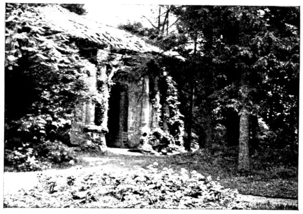
RUINS OF THE CASTLE
Leaving the grounds, take the Rue des Capucins again, and on arriving at the Hôtel de l'Ours (where the Germans held orgies as well as at the Hôtel du Soleil Levant, a little lower down, in the Rue de la Pêcherie,) turn to the right into the Rue de Melun.
We arrive at the bridge from which the photograph below was taken. The building on the left, of which only a corner is to be seen, is the town-hall. Further to the right, in the background and half-hidden by the trees, is a large house, which lodged a German staff during the occupation. Behind the trees is the theatre.
A little beyond the bridge is a green painted house, 7. Rue de la Pêcherie, where M. Chatry, Procureur de la République, was held prisoner. The latter, in his account before the Enquiry Commission, recalled the incidents of his arrest and of his imprisonment.
"In the evening I was at the town-hall, when a rough-looking Staff Officer came up to me in the secretary's office, saying: 'Take your casque (the magistrate's "toque") and follow me,' continuing: 'You said you did not know where to find any oats; we have just found some, so you lied; you are a liar and a swine. Come with me and see.' I accompanied him to the granary of the town-mill, which had been broken into and pillaged by the Germans. I remarked that after all there were oats there, and I became again the object of redoubled insults: 'Swine, you will be shot.' And when I protested, declaring my ignorance of this provision of oats, the officer shouted repeatedly: 'Swine, shut your mouth'; at the same time, I was roughly handled and my arm and shoulder bruised.
"He then forced me to go round the town looking for more oats. I was again insulted and roughly used in a shop where the officer kicked those who were there. 'If, within an hour,' he told me, 'you have not found more oats, you will be shot.'
"After a fresh search, I returned to the Place de l'Hôtel-de-Ville, to be again insulted by the same officer, with whom was another, tall, pale, and bareheaded, with a monocle in his right eye, who said mockingly: 'You are responsible for this; it is all your fault.'
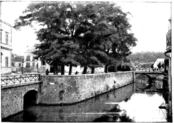
THE MORIN
"The first officer then complained that the gas gave a bad light, and it was in vain that I explained to him that all the men from the gasworks had left us. He continued: 'We know that the town is rich, we could ask for one million or even two million francs here, but if at eight o'clock to-morrow morning you have not found 100,000 francs, you will be shot, and the town bombarded and set on fire' I replied: 'You can do what you like with me, but I cannot possibly find you this sum, all the inhabitants having left and taken their money with them.' I was then arrested, hungry and dinnerless.
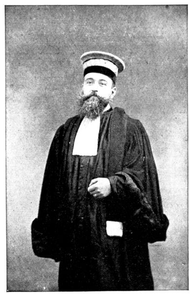
M. CHATRY, PROCUREUR DE LA RÉPUBLIQUE
"Shortly after, the mayor, M. Delsol, and the town-clerk, M. Bard, came to join me. Armed soldiers then conducted the three of us to the Rue de la Pêcherie, to the house (No. 7) of a druggist named Couesnon. This house had been broken into by the Germans, and served them as a lock-up. We were led into the dressing room.
"During the night I overheard the following conversation which took place in German between the soldiers guarding us. I repeat it word for word: 'The Procureur de la République will be shot; the "gay brothers" of the Company have been fetched to kill him; and the street has been swept to look nice.' Another soldier replied: 'Be careful, he understands German and is listening to all you say, for he is awake.'
"About 2 a.m. the platoon came to fetch us, and we descended the stairs. Below, in the dining-room, a German soldier played Chopin's 'Funeral March,' and other pieces of music for our benefit. We were ordered out into the street, and made to stand on the pavement, all three of us on the same side, whilst the platoon, with arms ready, stood on the opposite pavement facing us. We waited, thus for fully twenty minutes, after which we were ordered to join the main body of the army. At about 300 yards beyond Montanglaust (the hill overlooking the town to the north) a superior officer of the Death's Head Hussars said to us: 'You are free.'"
The preceding minute account shows how heavy and painful was the task of the civil authorities in the occupied towns.
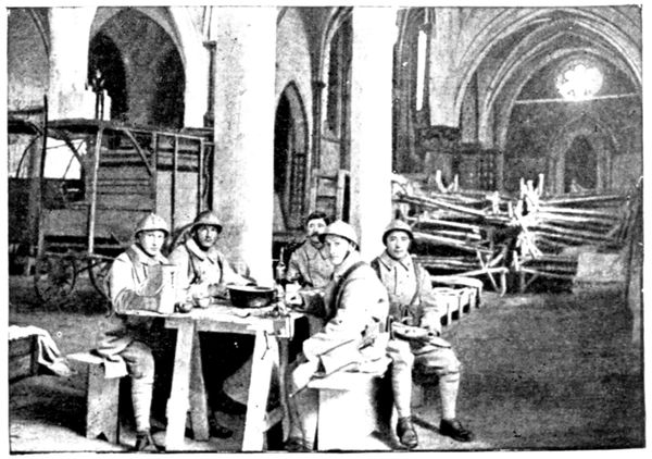
CHURCH OF SAINT-DENIS
(Leave M. Couesnon's house, and on coming to the Rue le Valentin, turn to the right and continue for a few steps towards the Place de l'Hôtel-de-Ville, in order to have a view of an arm of the Morin bordered by picturesque old houses. Return to the Rue de la Pêcherie.) We arrive at the Place Saint-Denis, where is the old thirteenth and seventeenth century church of that name, transformed into barracks during the war (view opposite).
Turn to the right in front of the church and take the Rue du Palais-de-Justice which leads to the Place Beaurepaire, on which is the statue to the hero of Verdun of 1792. (Major de Beaurepaire killed himself rather than sign the capitulation of the town decided upon by the communal council.)
FROM COULOMMIERS TO PROVINS
(44 km.)
Leave Coulommiers by the Avenue de Rebais skirting the new church, and passing it on the right. Cross a little bridge after about 2 km., and 1,500 yards further on take the road on the right (G. C. 66), which follows the Morin in the direction of La Ferté-Gaucher.
This part of the river was crossed by the Franco-British forces only on September 7, the British crossing at Coulommiers and in the neighbourhood, the 2nd French Cavalry Corps at La Ferté-Gaucher.
Pass through Chauffry (8 km.) then Jouy-sur-Morin (17 km.). Turn to the right in the latter village, and leaving the church on the left, cross the Morin before turning to the left. Here the road passes over the railway, then skirts it to rejoin N. 34, in which turn to the left (19 km.) in order to descend towards La Ferté-Gaucher. At 400 yards from this crossing, turn to the right into D. 4 in the direction of Courtacon and Provins (a line of telegraph-poles breaks off from N. 34 to follow D. 4). The road ascends and gives a pretty view of La Ferté-Gaucher shown in the photograph below.
An anecdote relating to the passage of the Grand Morin has been recalled by Professor Delbet, whose mother's estate contains a bridge over that river. A German general obliged Mme. Delbet, aged 77 years, to be present at the passage of the troops over the bridge, a spectacle which lasted seven hours. "Madame," said he, "when you become German, for German you are going to be, you will feel very proud to have seen my army pass through your gates. I have, besides, the intention to order a handsome memorial tablet to be fixed here mentioning this fact." As Mme. Delbet protested at the idea of becoming German, he continued: "The French race is degenerate and worn out. As you belong to a family of doctors, you must know that this is a fact. The French are done for. I may as well tell you what we mean to do. We shall keep the finest men and marry them to solid German girls; in this way, they may be able to have healthy children. As for the other survivors, we shall ship them off to America."
A few days after, Mme. Delbet had the pleasure of seeing the German troops re-crossing the river in haste, pursued by French cavalry.
At the "Château de la Masure," at 3½ km. south of La Ferté-Gaucher, much more tragic events took place, as the Enquiry Commission has established. The occupants were M. Quenescourt, late mayor of Sézanne, aged 77 years, with an old servant, and a lady from a neighbouring hamlet who had come to seek refuge.
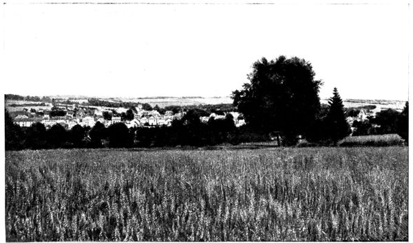
LA FERTÉ-GAUCHER SEEN FROM THE PROVINS ROAD
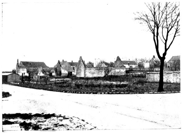
BURNT HOUSES
On September 5 several German soldiers and a non-commissioned officer took possession of the estate. In order to protect one of the women from the brutal attentions of the latter, M. Quenescourt sent her to hide in the farm near by. The German hastened to look for her, found her, brought her back to the castle and took her to an attic. The old gentleman, wishing to save her, fired his revolver up the stairs. He was killed point blank by the German officer who then ordered the woman out of the attic, and handed her over to two soldiers who outraged her in the room where lay the dead man; during this time the first brute fell upon the old servant.
At the cross roads, about 1 km. beyond the spot where the view was taken, turn to the left, abandoning the line of telegraph poles.
On arriving at Courtacon, we cross D. 8 (27½ km.) at the spot where the view above was taken (the photographer standing before the police station which was burned in September, 1914, but has since been rebuilt).
Continue straight on along D. 4, towards Provins; on the left is the group of burnt houses shown in the view below.
The Germans occupied Courtacon on September 6, and immediately set fire to it, after having drenched the houses with paraffin oil. The inhabitants were obliged to furnish the faggots of wood and the matches. The mayor and five other hostages were led away, and guarded in the midst of the troops during the combats which took place around the village. After having pretended to shoot them, the Germans sent them home again.
A young man named Rousseau, a conscript of the 1914 class, was torn from his house with blows from the butt-end of rifles, and led with his hands tied behind his back after the other hostages. Although the mayor declared that the youth's "class" had not yet been called up, he was shot at 50 yards from the village as a spy.
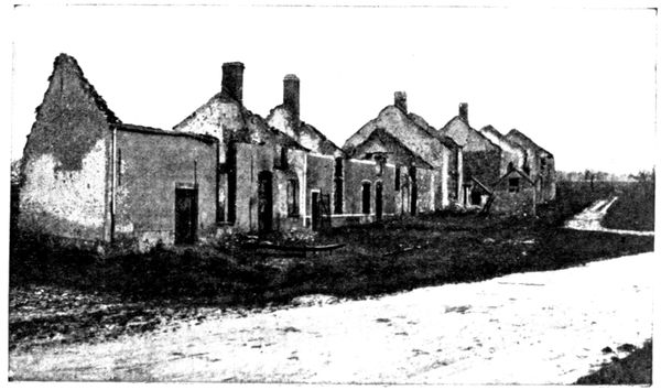
BURNT HOUSES
On leaving we may see, if we look behind us, the line of heights running eastwards from Courtacon to Esternay, and on which were established the German positions when Franchet d'Esperey's army began its offensive.
We arrive without difficulty at Provins (44 km.) after a zigzagging descent, which gives us a charming view of the town (see pp. 128-129).
PROVINS
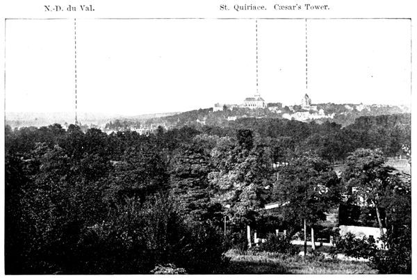
N.-D. du Val.
St. Quiriace.
Cæsar's Tower.
GENERAL VIEW OF PROVINS
The Upper Town of Provins dates from the Gallo-Roman period. In the third century a "castrum" was established there on the hill. The Roman general Probus, afterwards emperor, halted there about the year 271, and caused the walls of the fortress to be repaired. Domitien had forbidden the cultivation of the vine in Gaul, but Probus, during his sojourn at Provins, abolished this prohibition, and thus won the gratitude of the inhabitants. This fact has given rise to one of the versions of the origin of the word "Provins," which is supposed to mean "the vine of Probus."
ORIGIN AND PRINCIPAL HISTORICAL FACTS
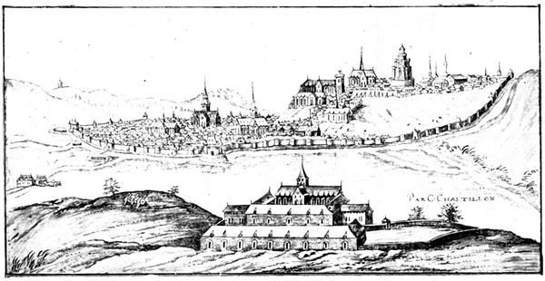
PROVINS IN THE SIXTEENTH CENTURY
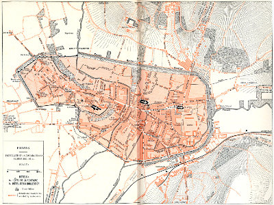
PROVINS
The lower town is of monastic origin. In the seventh century some monks, flying before the Norman invasion, took refuge in the forest which stretched at the foot of the fortress, and there buried the remains of the martyr St. Ayoul. The body was discovered in 996, and a church was erected on the spot. The church was followed by a large monastery of the Cistercian Order, around which grew up the lower town.
In the tenth century Provins passed from the royal domain into the hands of the Counts of Champagne, under whose rule it flourished exceedingly. Many buildings were erected—abbeys, churches, palaces, and a hospital; also a new wall enclosed the town. Commerce and industry flourished. Dye-works, tanneries, weaving, and the manufacture of cutlery occupied thousands of workmen, and the town counted, we are told, 80,000 inhabitants (there are now only 9,000). Its fairs were famous and were visited by strangers from all parts of Europe; even the silks and carpets of the East were to be found there. Business was carried on by means of money struck at Provins. The "sou provinois" was accepted far beyond the borders of France.
This brilliant period did not outlast the thirteenth century. In 1270 Count Henri-le-Gros established heavy taxes on commerce and industries which the principal citizens refused to pay. The mayor, Guillaume Pentecôte, to calm them, lengthened the hours of the workmen, who revolted and put him to death. The English Prince, Edmund of Lancaster, who had married the widow of Henri-le-Gros, cruelly repressed these troubles. Provins finally lost its independence by the marriage of the daughter of Henri-le-Gros with the King of France. Philippe-le-Bel (1284).
In 1870 Provins was occupied by the Prussians and suffered many requisitions, but in 1914 the German wave stopped at its gates.
Provins is also known under the poetical name of the "City of Roses," because of the profusion of these flowers, which formerly constituted its beauty and its wealth. According to tradition, the red rose of Provins was brought back from the Crusades by Thibaut IV. The Earl of Lancaster introduced it into his coat-of-arms, and thus it became the rival of the white rose of York during the War of the Roses which, in the fifteenth century, drenched England with blood.
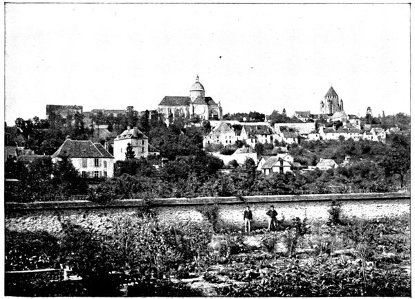
THE UPPER TOWN OF PROVINS
VISIT TO THE TOWN
(See plan inserted between pp. 128-129)
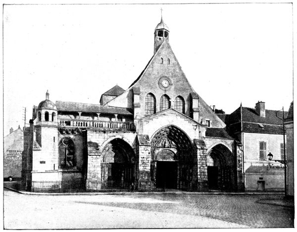
SAINT-AYOUL
Enter Provins by the Courloison Gate and Bridge, and, take the Rue Courloison which follows. At the end of the street, turn to the right into the Rue Abailard in order to arrive at the Place St-Ayoul, on to which fronts the façade of the church of that name. If it is considered desirable to take lunch before visiting the town, go directly to one of the hotels indicated, returning later to the Place St.-Ayoul.
CHURCH OF SAINT AYOUL
(classed as historical monument)
We have seen on p. 129 that a monastery was erected on the spot where the body of the Martyr Saint Ayoul was found.
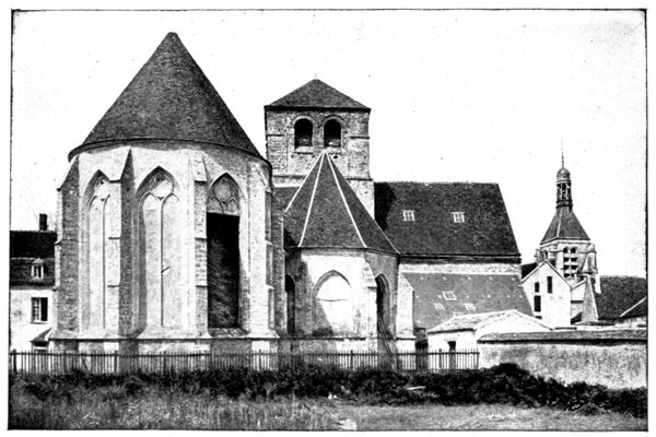
APSE OF SAINT-AYOUL
About 1122, the great theologian Abailard, cruelly mutilated by the vengeance of Canon Fulbert, uncle of Heloïse, and persecuted on account of the boldness of his views, took refuge in the monastery adjoining the church of Saint-Ayoul. He continued to teach there, and gathered round him as many as 2,000 students.
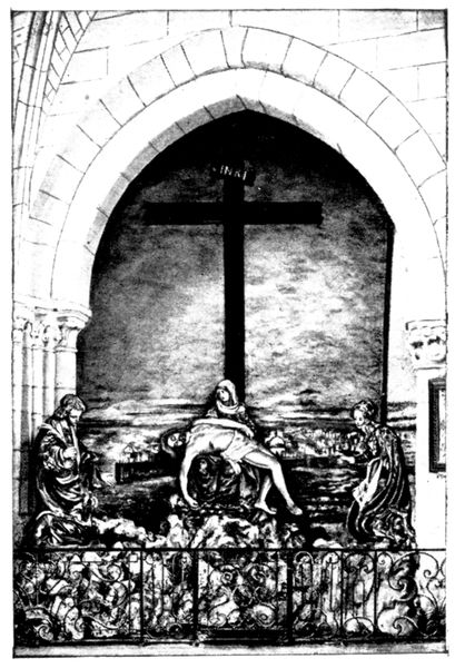
THE CRUCIFIXION AT SAINT-AYOUL
Saint-Ayoul was burned, then rebuilt in the twelfth century, and restored in the fourteenth and sixteenth centuries.
The façade is reproduced in the photograph on p. 130. In spite of mutilations suffered during the Revolution, and the inclemencies of the weather, the great doorway is still worthy of interest.
A Renaissance gallery, terminated by a lantern, flanks on the left the great bare gable pierced by three windows which surmount the gate. The whole has thus a very original appearance.
In order to see the choir (thirteenth and fourteenth centuries), the chapel (fourteenth century) which adjoins it, and the transept (twelfth century), go round the church to the left of the façade. This part of the building, which appears in the view at the foot of the preceding page, is now used by the military authorities as a fodder store.
The Roman tower, which rises at the intersection of the transept, no longer possesses its belfry, which was destroyed by fire, The bells now used are those of the Tower of Notre-Dame-du-Val (visible on the right of the photograph on p. 130).
In the interior, in the part reserved for worship, the central nave and the side aisles of the thirteenth century may be visited. The north aisle was doubled in the sixteenth century by a second nave.
The most interesting objects are the seventeenth century pulpit, and a fine reredos, also of the seventeenth century, in carved wood, above the high altar. It contains a picture, Jesus in the Temple, painted in 1654 by the artist Stella, of Lyons, who, falling ill whilst passing through Provins, had been cared for in one of the convents in the town.
ANGEL MUSICIAN
ANGEL MUSICIAN
RENAISSANCE VIRGIN
In the lady chapel, on the right of the high altar, is some beautiful wood-panelling, dating also from the seventeenth century. It is by the same hand as the carved reredos, and is the work of Pierre Blasser of Amiens. Standing against the panelling is a delicate Virgin in ivory, of the sixteenth century, reproduced on p. 131.
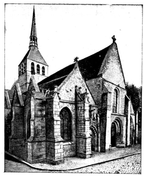
SAINTE-CROIX
To the left of the high altar is a group representing the Virgin and Christ crucified, between Mary Magdalene and St. John. These statues belong to the sixteenth century; as do also the smaller ones in white marble, representing angel-musicians, which ornament the altar placed in the angle of the church, to be found on the left on entering (see photo, p. 131).
On leaving Saint-Ayoul take a few steps along the first street on the right in order to glance at the tower of Notre-Dame-du-Val (classed as historical monument). The tower may be seen in the view at the foot of p. 130. It was built in the sixteenth century on the site of an ancient gate. Its construction occupied four years and cost only 1,400 "livres" (about £56), the workmen at this period receiving 2 sous (one penny) a day. The church and the cloister belonging to the tower disappeared during the Revolution.