Volume 2 — CHAP. XVI. WE RETURN TO UNYANYEMBE. (continued 2)
Reading edition
Bowdich (“Discoveries of the Portuguese,” pp. 131, 132), when speaking of the Maravi Lake (the Nyassa), mentions that the “negroes or the Moors of Melinde” have mentioned a great water which is known to reach Mombaca, which the Jesuit missionaries conjectured to communicate with Abyssinia, and of which Father Lewis Marianna, who formerly resided at Tete, recommended a discovery, in a letter addressed to the government at Goa, which is still preserved among the public archives of that city. Here the confusion of the Nyanza, to which there was of old a route from Mombasah with the Nyassa, is apparent.
At the southern point, where the Muingwira River falls into the tortuous creek, whose surface is a little archipelago of brown rocky islets crowned with trees, and emerging from the blue waters, the observed latitude of the Nyanza Lake, is 2° 24′ S.; the longitude by dead reckoning from Kazeh is E. long. 33° and nearly due north, and the altitude by B. P. thermometer 3750 feet above sea-level. Its extent to the north is unknown to the people of the southern regions, which rather denotes some difficulty in travelling than any great extent. They informed my companion that from Mwanza to the southern frontier of Karagwah is a land journey of one month, or a sea voyage of five days towards the N. N. W. and then to the north. They also pointed out the direction of Unyoro N. 20° W. The Arab merchants of Kazeh have seen the Nyanza opposite Weranhanja, the capital district of Armanika, King of Karagwah, and declare that it receives the Kitangure River, whose mouth has been placed about the equator. Beyond that point all is doubtful. The merchants have heard that Suna, the late despot of Uganda, built matumbi, or undecked vessels, capable of containing forty or fifty men, in order to attack his enemies, the Wasoga, upon the creeks which indent the western shores of the Nyanza. This, if true, would protract the lake to between 1° and 1° 30′ of N. lat., and give it a total length of about 4° or 250 miles. This point, however, is still involved in the deepest obscurity. Its breadth was estimated as follows. A hill, about 200 feet above the water-level, shows a conspicuous landmark on the eastern shore, which was set down as forty miles distant. On the south-western angle of the line from the same point ground appeared; it was not, however, perceptible on the north-west. The total breadth, therefore, has been assumed at eighty miles,—a figure which approaches the traditions unconsciously chronicled by European geographers. In the vicinity of Usoga the lake, according to the Arabs, broadens out: of this, however, and in fact of all the formation north of the equator, it is at present impossible to arrive at certainty.
The Nyanza is an elevated basin or reservoir, the recipient of the surplus monsoon-rain which falls in the extensive regions of the Wamasai and their kinsmen to the east, the Karagwah line of the Lunar Mountains to the west, and to the south Usukuma or Northern Unyamwezi. Extending to the equator in the central length of the African peninsula, and elevated above the limits of the depression in the heart of the continent, it appears to be a gap in the irregular chain which, running from Usumbara and Kilima-ngao to Karagwah, represents the formation anciently termed the Mountains of the Moon. The physical features, as far as they were observed, suggest this view. The shores are low and flat, dotted here and there with little hills; the smaller islands also are hill-tops, and any part of the country immediately on the south would, if inundated to the same extent, present a similar aspect. The lake lies open and elevated, rather like the drainage and the temporary deposit of extensive floods than a volcanic creation like the Tanganyika, a long narrow mountain-girt basin. The waters are said to be deep, and the extent of the inundation about the southern creek proves that they receive during the season an important accession. The colour was observed to be clear and blue, especially from afar in the early morning; after 9 a.m., when the prevalent south-east wind arose, the surface appeared greyish, or of a dull milky white, probably the effect of atmospheric reflection. The tint, however, does not, according to travellers, ever become red or green like the waters of the Nile. But the produce of the lake resembles that of the river in its purity; the people living on the shores prefer it, unlike that of the Tanganyika, to the highest, and clearest springs; all visitors agree in commending its lightness and sweetness, and declare that the taste is rather of river or of rain-water than resembling the soft slimy produce of stagnant muddy bottoms, or the rough harsh flavour of melted ice and snow.
From the southern creek of the Nyanza, and beyond the archipelago of neighbouring islets, appear the two features which have given to this lake the name of Ukerewe. The Arabs call them “Jezirah”—an ambiguous term, meaning equally insula and peninsula—but they can scarcely be called islands. The high and rocky Mazita to the east, and the comparatively flat Ukerewe on the west, are described by the Arabs as points terminating seawards in bluffs, and connected with the eastern shore by a low neck of land, probably a continuous reef, flooded during the rains, but never so deeply as to prevent cattle fording the isthmus. The northern and western extremities front deep water, and a broad channel separates them from the southern shore, Usukuma. The Arabs, when visiting Ukerewe or its neighbour, prefer hiring the canoes of the Wasukuma, and paddling round the south-eastern extremity of the Nyanza, to exposing their property and lives by marching through the dangerous tribes of the coast.
Mazita belongs to a people called Makwiya. Ukerewe is inhabited, according to some informants, by Wasukuma; according to others, the Wakerewe are marked by their language as ancient emigrants from the highlands of Karagwah. In Ukerewe, which is exceedingly populous, are two brother Sultans: the chief is “Machunda;” the second, “Ibanda,” rules at Wiru, the headland on the western limit. The people collect ivory from the races on the eastern mainland, and store it, awaiting an Arab caravan. Beads are in most request; as in Usukuma generally, not half a dozen cloths of native and foreign manufacture will be found upon a hundred men. The women are especially badly clad; even the adult maidens wear only the languti of India, or the Nubian apron of aloe-fibre, strung with the pipe-stem bead called sofi, and blackened, like India-rubber, by use; it is fastened round the waist, and depends about one foot by six or seven inches in breadth.
The Arabs who traffic in these regions generally establish themselves with Sultan Machunda, and send their slaves in canoes round the south-east angle of the lake to trade with the coast people. These races are successively from the south; the Washaki, at a distance of three marches, and their inland neighbours the Wataturu; then the Warudi, a wild tribe, rich in ivory, lying about a fortnight’s distance; and beyond them the Wahumba, or Wamasai. Commercial transactions extend along the eastern shore as far as T’hiri, or Ut’hiri, a district between Ururu and Uhumba. This is possibly the origin of the island of Tiri or Kittiri, placed in my companion’s map near the north-west extremity of the Nyanza Lake, off the coast of Uganda, where there is a province called Kittara, peculiarly rich in coffee. The explorer heard from the untrustworthy country people that, after a long coasting voyage, they arrived at an island where the inhabitants, a poor and naked race, live on fish, and cultivate coffee for sale. The information appears suspicious. The Arabs know of no islands upon the Nyanza which produce coffee. Moreover, if the people had any traffic, they would not be without clothing.
The savagery of the races adjacent to the Nyanza has caused accidents amongst travelling traders. About five years ago a large caravan from Tanga, on the eastern coast, consisting of 400 or 500 guns, and led by Arab merchants, at the end of a journey which had lasted nearly two years, happened to quarrel with the Wahumba or Wamasai near the lake. The subject was the burning down of some grass required for pasture by the wild men. Words led to blows; the caravan, having but two or three pounds of gunpowder, was soon dispersed; seven or eight merchants lost their lives, and a few made their escape to Unyanyembe. Before our departure from Kazeh, the slaves of Salim bin Rashid, having rescued one of the wounded survivors, who had been allowed by the Wamasai to wander into Urudi, brought him back to Kazeh. He described the country as no longer practicable. In 1858 also the same trading party, the principal authority for these statements, were relieved of several bales of cloth, during their sleep, when bivouacking upon an inhabited island near the eastern shore.
The altitude, the conformation of the Nyanza Lake, the argilaceous colour and the sweetness of its waters, combine to suggest that it may be one of the feeders of the White Nile. In the map appended to M. Brun-Rollet’s volume, before alluded to, the large water west of the Padongo tribe, which clearly represents the Nyanza or Ukerewe, is, I have observed, made to drain northwards into the Fitri Lake, and eventually to swell the main stream of the White River. The details supplied by the Egyptian Expedition, which, about twenty years ago, ascended the White River to 3° 22′ N. lat., and 31° 30′ E. long., and gave the general bearing of the river from that point to its source as south-east, with a distance of one month’s journey, or from 300 to 350 miles, would place the actual sources 2° S. lat., and 35° E. long., or in 2° eastward of the southern creek of the Nyanza Lake. This position would occupy the northern counterslope of the Lunar Mountains, the upper water-shed of the high region whose culminating apices are Kilima-Ngao, Kenia, and Doengo Engai. The distance of these peaks from the coast, as given by Dr. Krapf, must be considerably reduced, and little authority can be attached to his river Tumbiri.[13] The site, supposed by Mr. Macqueen (“Proceedings of the Geographical Society of London,” January 24th, 1859), to be at least 21,000 feet above the level of the sea, and consequently 3000 or 4000 feet above the line of perpetual congelation, would admirably explain the two most ancient theories concerning the source of the White River, namely, that it arises in a snowy region, and that its inundation is the result of tropical rains.
It is impossible not to suspect that between the upper portion of the Nyanza and the watershed of the White Nile there exists a longitudinal range of elevated ground, running from east to west—a “furca” draining northwards into the Nile and southwards into the Nyanza Lake—like that which separates the Tanganyika from the Maravi or Nyassa of Kilwa. According to Don Angelo Vinco, who visited Loquéck in 1852, beyond the cataract of Garbo—supposed to be in N. lat. 2° 40′—at a distance of sixty miles lie Robego, the capital of Kuenda, and Lokoya (Logoja), of which the latter receives an affluent from the east. Beyond Lokoya the White Nile is described as a small and rocky mountain-river, presenting none of the features of a stream flowing from a broad expanse of water like the great Nyanza reservoir.
The periodical swelling of the Nyanza Lake, which, flooding a considerable tract of land on the south, may be supposed—as it lies flush with the basal surface of the country—to inundate extensively all the low lands that form its periphery, forbids belief in the possibility of its being the head-stream of the Nile, or the reservoir of its periodical inundation. In Karagwah, upon the western shore, the masika or monsoon lasts from October to May or June, after which the dry season sets in. The Egyptian Expedition found the river falling fast at the end of January, and they learned from the people that it would again rise about the end of March, at which season the sun is vertical over the equator. About the summer solstice (June), when the rains cease in the regions south of and upon the equator, the White Nile begins to flood. From March to the autumnal equinox (September) it continues to overflow its banks till it attains its magnitude, and from that time it shrinks through the winter solstice (December) till March. The Nile is, therefore, full during the dry season and low during the rainy season south of and immediately upon the equator. And as the northern counterslope of Kenia will, to a certain extent, be a lee-land, like Ugogo, it cannot have the superfluity of moisture necessary to send forth a first-class stream. The inundation is synchronous with the great falls of the northern equatorial regions, which extend from July to September, and is dependent solely upon the tropical rains. It is, therefore, probable that the true sources of the “Holy River” will be found to be a network of runnels and rivulets of scanty dimensions, filled by monsoon torrents, and perhaps a little swollen by melted snow on the northern water-parting of the Eastern Lunar Mountains.
Of the tribes dwelling about the Nyanza, the western have been already described. The Washaki and the Warudi are plundering races on the east, concerning whom little is known. Remain the Wahinda, a clan or class alluded to in this and a former chapter, and the Wataturu, an extensive and once powerful tribe, mentioned when treating of the regions about Tura.
The Wahinda (in the singular Muhinda) are, according to some Arabs, a foreign and ruling family, who coming from a distant country, probably in the neighbourhood of Somaliland, conquered the lands, and became Sultans. This opinion seems to rest upon physical peculiarities,—the superiority of the Wahinda in figure, stature, and complexion to their subjects suggesting a difference of origin. Others explain the word Muhinda to mean a cadet of royal family, and call the class Bayt el Saltanah, or the Kingly House. Thus, whilst Armanika is the Mkámá or Sovereign of Karagwah, his brother simply takes the title of Muhinda. These conflicting statements may be reconciled by the belief general in the country that the families of the Sultans are a foreign and a nobler race, the date of whose immigration has long fallen into oblivion. This may be credited without difficulty; the physique of the rulers—approximating more to the northern races of Africa—is markedly less negroid than that of their subjects, and the difference is too great to be explained by the effects of climate or of superior diet, comfort, and luxury.
The Wahinda are found in the regions of Usui, Karagwah, Uhha, Uvinza, Uyungu, Ujiji, and Urundi, where they live in boma—stockades—and scattered villages. Of this race are the Sultans Suwarora of the Wasui, Armanika of Karagwah, Kanoni of Uhha, Kanze of Uyungu, Mzogera of Uvinza, Rusimba of Ujiji, Mwezi of Urundi, Mnyamurunde of Uyofo, Gaetawa of Uhayya, and Mutawazi of Utumbara. The Wahinda affect a milk diet which is exceedingly fattening, and anoint themselves plentifully with butter and ghee, to soften and polish the skin. They never sell their fellow clansmen, are hospitable and civil to strangers, seldom carry arms, fear nothing from the people, and may not be slain even in battle. Where the Wahinda reign, their ministers are the Watosi, a race which has been described when treating of their head-quarters Karagwah.
The Wataturu extend from the Mángewá district, two marches northward of Tura in a north-north-westerly diagonal, to Usmáo, a district of Usukuma, at the south-east angle of the Nyanza Lake. On the north and east they are limited by the Wahumba, on the south by the people of Iramba, and there is said to be a connection between these three tribes. This wild pastoral people were formerly rich in flocks and herds; they still have the best asses in the country. About five years ago, however, they were persuaded by Msimbira, a chief of Usukuma, to aid him against his rival Mpagamo, who had called in the Arabs to his assistance. During the long and bitter contest which ensued, the Arabs, as has been related, were worsted in the field, and the Wataturu suffered severe losses in cattle. Shortly before the arrival of the Expedition at Kazeh the foreign merchants had despatched to Utaturu a plundering party of sixty slave-musketeers, who, however, suddenly attacked by the people, were obliged to fly, leaving behind eighteen of their number. This event was followed by a truce, and the Wataturu resumed their commerce with Tura and Unyanyembe, where, in 1858, a caravan, numbering about 300 men, came in. Two small parties of this people were also met at Tura; they were small, dark, and ugly savages, almost beardless, and not unlike the “Thakur” people in Maharatta-land. Their asses, provided with neat saddle-bags of zebra skin, were better dressed than the men, who wore no clothing except the simplest hide-sandals. According to the Arabs this clan affects nudity: even adult maidens dispense with the usual skin-kilt. The men ignored bows and arrows, but they were efficiently armed with long spears, double-edged sime, and heavy hide shields. They brought calabash or monkey-bread flour—in this country, as in Ugogo, a favourite article of consumption—and a little coarse salt, collected from the dried mud of a Mbuga or swamp in the land of Iramba, to be bartered for holcus and beads. Their language sounded to the unpractised ear peculiarly barbarous, and their savage suspiciousness rendered it impossible to collect any specimens.
At Kazeh, sorely to my disappointment, it was finally settled, in a full conclave of Arabs, that we must return to the coast by the tedious path with which we were already painfully familiar. At Ujiji the state of our finances had been the sole, though the sufficient obstacle to our traversing Africa from east to west; we might—had we possessed the means—by navigating the Tanganyika southwards, have debouched, after a journey of three months, at Kilwa. The same cause prevented us from visiting the northern kingdoms of Karagwah and Uganda; to effect this exploration, however, we should have required not only funds but time. The rains there setting in about September render travelling impossible; our two years’ leave of absence were drawing to a close, and even had we commanded a sufficient outfit, we were not disposed to risk the consequences of taking an extra twelve months. No course, therefore, remained but to regain the coast. We did not, however, give up hopes of making our return useful to geography, by tracing the course of the Rwaha or Rufijí River, and of visiting the coast between the Usagara Mountains and Kilwa, an unknown line not likely to attract future travellers.
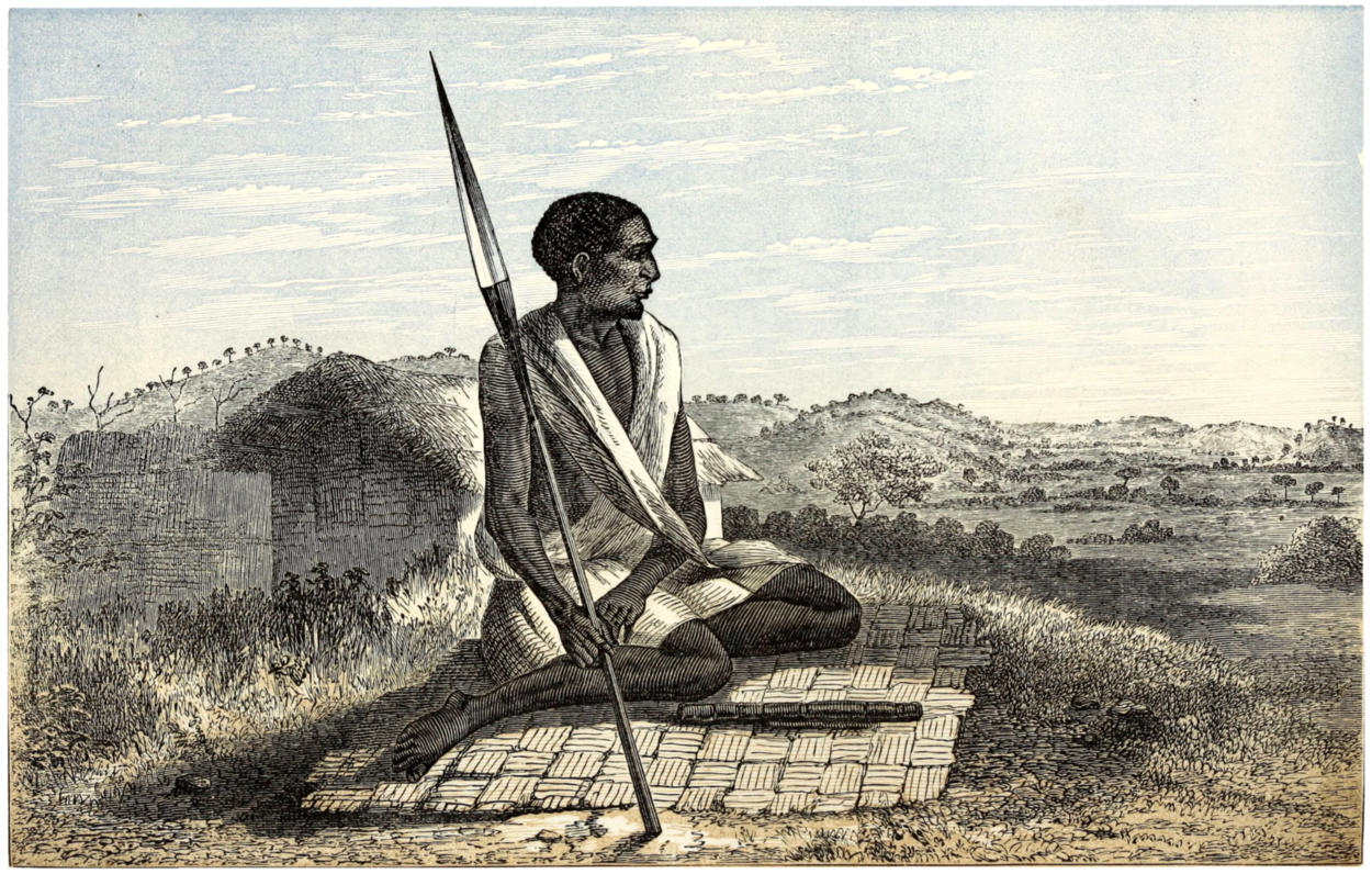
SAYDUMI, A NATIVE OF UGANDA.
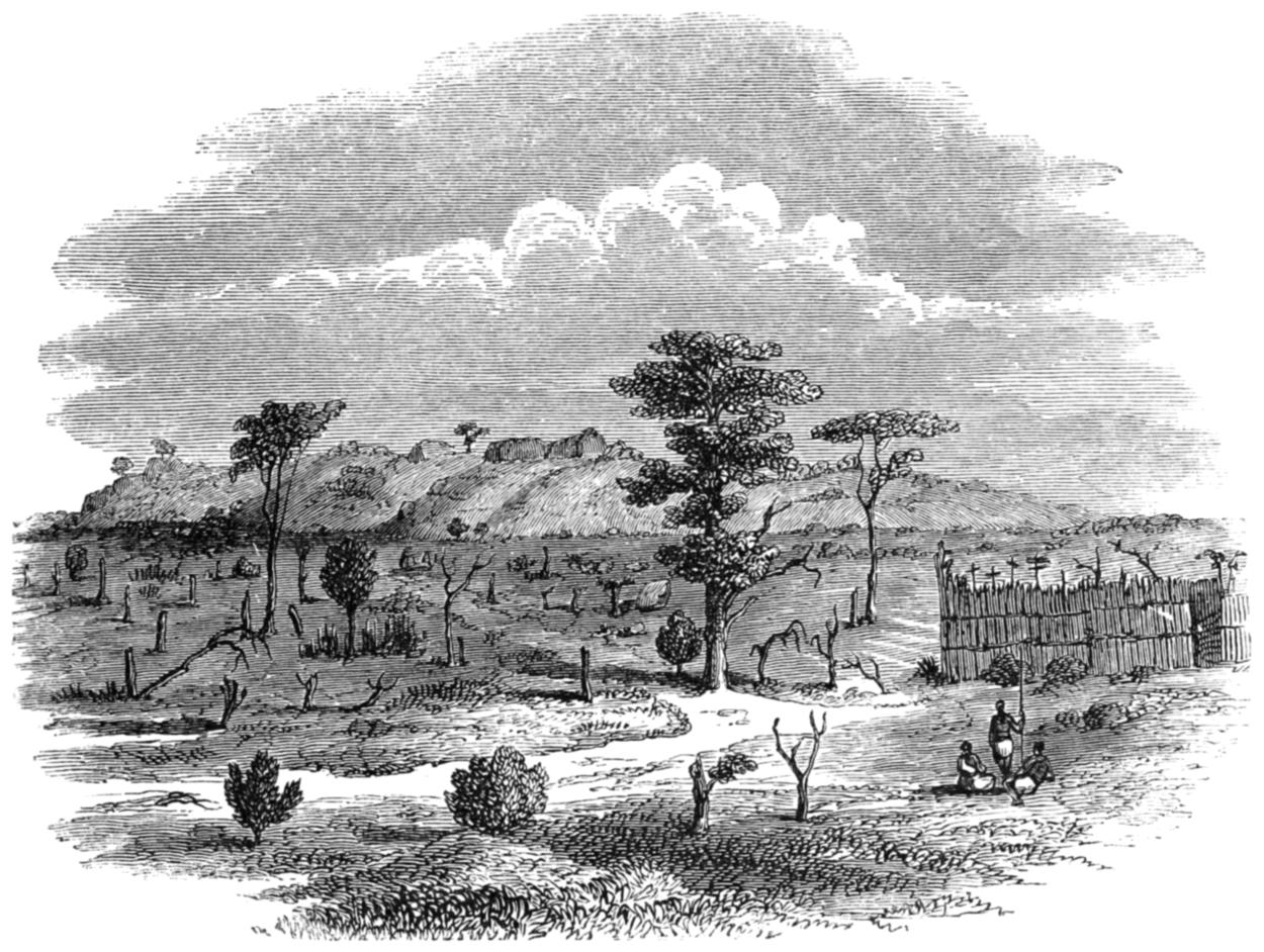
Mgongo Thembo, or the Elephant’s Back.