LIST OF MAPS AND OTHER PLATES.
Reading edition
VOLUME I.
Portrait of Zebulon M. Pike, Frontispiece
Facsimile Letter of Zebulon M. Pike, Facing Page lx
VOLUME III.
Falls of St. Anthony.
Map of the Mississippi River from its Source to the Mouth of the Missouri.
First Part of Captain Pike's Chart of the Internal Part of Louisiana.
Chart of the Internal Part of Louisiana.
Map of the Internal Provinces of New Spain.
Sketch of the Vice Royalty of New Spain.
(The above six maps are reproduced in facsimile from the Philadelphia edition of 1810.)
Historico-Geographical Chart of the Upper Mississippi River, Compiled and Drawn under the Direction of Dr. Elliott Coues, by Daniel W. Cronin, 1895.
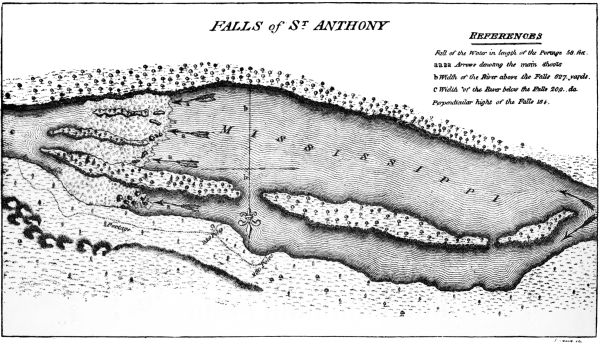
FALLS of ST ANTHONY
View larger image.