A DAY’S TRIP THROUGH HISTORIC BOSTON ★
Reading edition
The Start: Leaving the Providence Street side of the Hotel Statler, walk directly ahead on Arlington Street one block to Boylston Street. Turn right, proceed on Boylston Street to Charles Street, at which point we cross to the
Boston Common
The Boston Common is a tract of land, containing nearly fifty acres, bought in 1634 by Governor Winthrop and others from William Blaxton, who held his title by right of possession gained prior to the settlement of Boston in 1630. It was set apart for common use as a cow pasture and training field, and amusingly still retains that status. As you enter the Common, pause for a moment at the little cemetery on the Boylston Street side for here lies buried Gilbert Stuart, the noted portrait painter, and also a number of prominent Boston citizens.
Proceeding through the Common, we view the Soldiers’ Monument which crowns Flagstaff Hill where British Artillery was stationed during the siege of Boston, when troops were quartered and entrenched there. From what is now Park Square, the British embarked for Lexington on April 18, 1775. On the Common, the British mustered before the Battle of Bunker Hill and here also gathered contingents for Colonial expeditions against Louisburg and Quebec. Many Massachusetts regiments assembled here prior to going to the front in the Civil War. On Beacon Street Mall, opposite the State House, stands the Shaw monument by Augustus 5 St. Gaudens, a memorial to Colonel Robert G. Shaw and the Fifty-fourth Massachusetts Infantry.
Continuing our stroll, we come to the Park and Tremont Street side of the Common and directly across the street we find the old
Park Street Church
The Park Street Church was erected in 1810 on the site of the Granary where the sails of the “Constitution” were made. Brimstone was stored in the basement in 1812, giving the church the name of “Brimstone Corner.” Here, on July 4, 1832, “America” was first publicly sung.
Leaving the Park Street Church, we turn left on Tremont Street and move on to the
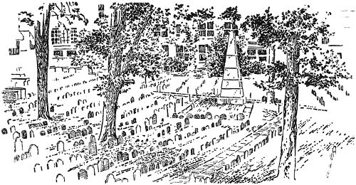
OLD GRANARY BURYING GROUND
Granary Cemetery
Here lie buried most of the personages of Historic Boston. Nine early governors—Bellingham, Dummer, Hancock, Bowdoin, Eustis, Sumner, Adams, Sullivan and Gore. Also Peter Faneuil, Paul Revere, the parents of Benjamin Franklin, Robert Treat Paine, who was one of the signers of the Declaration of Independence, Mary Goose (Mother Goose), and Thomas Fleet, who arranged and published the Mother Goose Rhymes. Here also lie 6 buried in one grave Crispus Attucks, Patrick Carr, James Caldwell, Samuel Maverick and Samuel Gray, who were the victims of the Boston Massacre. Buried in the same grave with these men is Christopher Snyder, a twelve year old boy, the only person to lose his life at the famous Boston Tea Party.
Leaving the Granary Cemetery, we cross Tremont Street and turn left toward School Street, on the corner of which stands
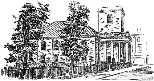
KING’S CHAPEL
King’s Chapel
King’s Chapel was founded in 1686. The first chapel was built in 1688 the present one in 1749 of old English architecture. Here the British worshipped during the siege. By a strange turn of events, this Tory Church became the First Unitarian Church in the United States in 1785. Although it is still considered Unitarian, it retains many of its Episcopal symbols such as the cross, communion table, Apostle’s Creed and Ten Commandments on the altar. This Chapel is open daily to the public from 9 a. m. to 4 p. m.
Leaving King’s Chapel, turn right on Tremont Street and enter the
King’s Chapel Burying Ground
This was the first burial ground in Boston. A stone bearing the inscription “Captain Welden, February 18, 1630” proves this statement. 7 Here lie buried Governor John Winthrop, Lady Andros, wife of Governor Andros, John Cotton, John Davenport, the founder of New Haven, Conn., William Dawes, who made the famous ride on another route with Paul Revere, Mary Chilton, who, according to tradition, was the first woman of the Mayflower’s little band to touch the American soil. It is interesting to know that Charles Dawes, the former Vice-President of the United States, may be buried in the same grave as William Dawes, if he so desires. Few burials have been made in King’s Chapel since 1796. This very interesting spot is open to the public from 9 a. m. to 5 p. m., daily.
Leaving the burial ground, we turn right on Tremont Street and proceed to Court Street where we turn right and walk down to the City Hall Annex, across from which is a tablet on the East corner of Franklin Avenue which marks the
Franklin Printing Office
It was here that young Benjamin Franklin learned the printer’s trade in the office of James Franklin, his brother, where the “New England Courant” was published.
We turn right, following the narrow alley and walk along the City Hall Annex to School Street, where, if you will face to the right, you will see a statue of Benjamin Franklin which marks the first location of
The Boston Public Latin School
This gave the street its name. Here Franklin, Hancock, Samuel Adams, Cotton Mather, Henry Ward Beecher, Edward Everett Hale and many others received their early education.
Proceeding left on School Street, we come to Washington Street, on the north corner of which stood the Old Corner Book Store building, erected in 1712 and known far and wide as a center of literature and a meeting place for book lovers.
Cross Washington Street, turn right and we come to the
Old South Meeting House
Here the men of Boston gathered to protest against forcing Massachusetts citizens into the English Navy, to demand the withdrawal of British troops and to decide the fate of the hated tax on tea. It was used by the British as a riding school during the siege 8 of Boston. The present building, erected in 1789, is open from 9 a. m. to 4 p. m., daily. Admission, twenty-five cents.
Leaving the Meeting House, turn left to Milk Street. Almost across the street, 17 Milk Street, was
The Birthplace of Benjamin Franklin
It is occupied today by a building housing the Boston Transcript. Here is a bust of Franklin on the front of the building above the second floor windows.
Retracing our steps, we turn right on Washington Street and proceed to
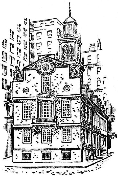
THE OLD STATE HOUSE
The Old State House
Here the first Town House was built in 1657 in the earliest market place of Boston. The present building was built in 1713, burned in 1747, and immediately rebuilt with walls of the former building being utilized. Here met Colonial Courts and Legislators, town and city governments and the General Court of the Commonwealth. It was used as a City Hall from 1830 to 1840. It is open to the public from 9 a. m. to 4 p. m., daily. From the windows, one may look out on the Washington Street side and see the site of Paul Revere’s Silver Shop.
Leaving the old State House, pause for a moment at Number 28 9 State Street. Here is another historic site where stood the Royal Exchange Tavern, from which the first stage coach started to New York on September 7, 1772, “to go once every fourteen days.” Across the street, at 27 State Street, stood the first meeting house, built by the Colonists in 1632. The church was a rude but substantial edifice of mud walls with a thatched roof. The first pastor was John Wilson, who had for his associate the Reverend John Cotton, the former pastor of old St. Botolph’s, Boston, England.
Proceeding down State Street to Number 30, we come to the site of
The Boston Massacre
A tablet on the wall tells the story. A circle in the pavement marks the place where fell the first martyrs in the cause of American freedom. Continuing down State Street, we come to the
Custom House
For the minute, let us forget historic Boston and take a rapid trip in the elevator to the tower 490 feet high where we may obtain a wonderful panorama of the city and take a splendid aerial photograph on a clear day.
Leaving the building, we turn right on Milk Street and proceed to Oliver Street. Turn left on Oliver and follow to Atlantic Avenue where you then turn right to Pearl Street. Here on a building is a marker to the
Boston Tea Party
The marker reads “Here formerly stood Griffin’s Wharf at which lay moored December 16, 1773, three British ships with cargoes of tea. To defeat King George’s trivial but tyrannical tax of three pence per pound, about ninety citizens of Boston, partly disguised as Indians, boarded the ships, threw the cargoes, three hundred and forty-two chests in all, into the sea and made the world ring with the patriotic exploit of The Boston Tea Party.”
Leaving this most historic point, we retrace our steps back over Atlantic Avenue for some distance to Market Street. There we turn left and proceed along until we come to the Quincy Market where we turn right and then left to North Market Street where we find
10
The Durgin & Park Restaurant
Let us enter this old place. For over one hundred and fifty years it has been used as a restaurant. Your grandfather or even your great grandfather may have eaten here. We are met by a most gracious host and food is served to us fresh from the market. When you have eaten enough and absorbed a satisfying amount of the atmosphere of this fascinating spot, you will find almost diagonally across the street the famous old
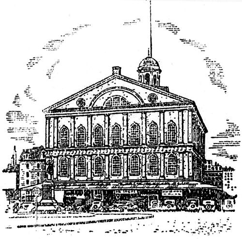
FANEUIL HALL
Faneuil Hall
Faneuil Hall, affectionately called “The Cradle of Liberty,” was built in 1742 by Peter Faneuil. It was given to Boston as a Town Hall. Burned in 1761, it was rebuilt in 1763. This is one of the few buildings in Boston which is in the same condition today as it originally was, with the exception perhaps of steel staircases, electricity, and steam heat. The Hall is still used for public meetings. This was the center of Revolutionary movements in Boston and the Colonies, and was used by the British officers as a playhouse during the siege of Boston. The Hall has many historic paintings and portraits. Don’t fail to see the Military Museum and Library of the Ancient and Honorable Artillery Company. It is well worth the walk up to the third floor. Open week days from 9 a. m. to 5 p. m.
11
Leaving Faneuil Hall, proceed down North Street, passing the AMOCO Service Station on your right. Directly across the street and to the left we pass by the Sumner Tunnel which was opened to the public in 1934. Continuing on down North Street, crossing Cross Street and Richmond, we come to North Square where the little boys will not let you miss the famous
Paul Revere House
The oldest house in the City of Boston, built in 1660 and purchased by Paul Revere in 1770; here he resided until 1800. The immense fireplaces, the ancient wallpaper and many other features from the Colonial period make it a most interesting house to visit. Admission twenty-five cents. Open from 10 a. m. to 4 p. m., daily.
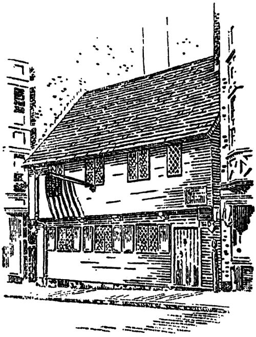
PAUL REVERE’S HOUSE
Leaving the Paul Revere House, we turn left at North Bennett Street and proceed to Salem Street where we turn right on our way to the
Old North Church
This is the oldest church edifice in Boston. It was built in 1723. The signal lanterns of Paul Revere displayed in the steeple of this church on April 18, 1775, warned the people of the march of the 12 British to Concord and Lexington. Don’t fail to ask the sexton to show you the old communion chest recently found, and the statues which are reported to have been seized from a French ship, bound for a monastery in Montreal. Illustrated history of the church and admission to the steeple will cost fifty cents. Otherwise, admission is free from 9 a. m. until 5 p. m. Regular services Sunday.
Leaving the church, follow down Hull Street to
Copp’s Hill Burying Ground
Here is the tomb of Edmund Hartt, builder of “Old Ironsides,” Robert Newman, the patriot who displayed the signal lanterns in the tower of the Old North Church, and many other men of Colonial times.
Leaving Copp’s Hill Burying Ground, turn right on Charter Street and proceed to Commercial Street. Then turn left, following Commercial Street around to the Charlestown bridge, turning right on Chelsea Street, on the Charlestown side of the bridge, and right again at Navy Street, leading to the entrance gate of the
Boston Navy Yard
The Boston Navy Yard has been in continuous operation since 1800. It covers approximately 123½ acres and has nearly one and one-half miles of waterfront, three dry docks, a marine railway, ten ship piers, and about one hundred and fifty buildings within its enclosure. It is designated as a building yard. All rope used in the United States Navy is manufactured here. Another interesting fact is that the chains used overseas in planting mines that formed a net against German U boats were made at the forge shop. You will be asked to leave your camera with the guard at the gate who will also direct you to the famous
United States Frigate Constitution
Built by Edmund Hartt and launched September 20, 1797, “Old Ironsides,” as she is familiarly known, was in about forty engagements and never suffered defeat. She has been rebuilt and restored to her former condition by the school children of the United States. Leaving the “Constitution,” we travel back to the main gate and 13 out on to Chelsea Street once more. Here we turn right on Chelsea Street and left on Tremont Street to the
Bunker Hill Monument
Here you will see a granite obelisk, two hundred and twenty-one feet high on Breed’s Hill, within the lines of the American Redoubt which was the center of the Battle of Bunker Hill on June 17, 1775. Open to the public daily from 9 a. m. to 4 p. m., the admission fee being ten cents.
Leaving the monument, we go down Lexington Street to City Square where we take the elevated train to North Station. Arriving at North Station, go downstairs and take the subway back to Arlington Street where we leave the subway and return to our starting point.
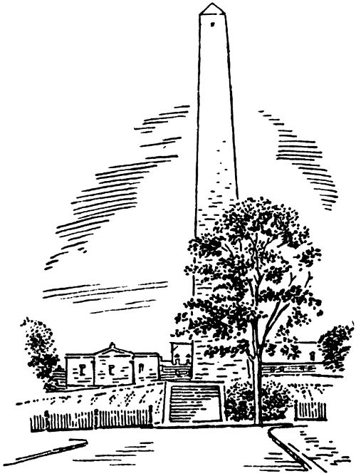
BUNKER HILL
14