VII.
Reading edition
LONDON, SOUTH-WEST TO LAND'S END.
Virginia Water—Sunninghill—Ascot—Wokingham—Bearwood—The London Times—White Horse Hill—Box Tunnel—Salisbury—Salisbury Plain—Old Sarum—Stonehenge—Amesbury—Wilton House—The Earls of Pembroke—Carpet-making—Bath—William Beckford—Fonthill—Bristol—William Canynge—Chatterton—Clifton—Brandon Hill—Wells—The Mendips—Jocelyn—Beckington—Ralph of Shrewsbury—Thomas Ken—The Cheddar Cliffs—The Wookey Hole—The Black Down—The Isle of Avelon-Glastonbury—Weary-all Hill—Sedgemoor—The Isle of Athelney—Bridgewater—Oldmixon—Monmouth's Rebellion—Weston Zoyland—King Alfred—Sherborne—Sir Walter Raleigh—The Coast of Dorset—Poole—Wareham—Isle of Purbeck—Corfe Castle—The Foreland—Swanage—St. Aldhelm's Head—Weymouth—Portland Isle and Bill—The Channel Islands—Jersey—Corbière Promontory—Mount Orgueil—Alderney—Guernsey—Castle Cornet—The Southern Coast of Devon—Abbotsbury—Lyme Regis—Axminster—Sidmouth—Exmouth—Exeter—William, Prince of Orange—Exeter Cathedral—Bishop Trelawney—Dawlish—Teignmouth—Hope's Nose—Babbicombe Bay—Anstis Cove—Torbay—Torquay—Brixham—Dartmoor—The River Dart—Totnes—Berry Pomeroy Castle—Dartmouth—The River Plym—The Dewerstone—Plympton Priory—Sir Joshua Reynolds—Catwater Haven—Plymouth—Stonehouse—Devonport—Eddystone Lighthouse—Tavistock Abbey—Buckland Abbey—Lydford Castle—The Northern Coast of Devon—Exmoor—Minehead—Dunster—Dunkery Beacon—Porlock Bay—The River Lyn—Oare—Lorna Doone—Jan Ridd—Lynton—Lynmouth—Castle Rock—The Devil's Cheese-Ring—Combe Martin—Ilfracombe—Morte Point—Morthoe—Barnstaple—Bideford—Clovelly—Lundy Island—Cornwall—Tintagel—Launceston—Liskeard—Fowey—Lizard Peninsula—Falmouth—Pendennis Castle—Helston—Mullyon Cove—Smuggling—Kynance Cove—The Post-Office—Old Lizard Head—Polpeor—St. Michael's Mount—Penzance—Pilchard Fishery—Penwith—Land's End.
ASCOT AND BEARWOOD.
Leaving London by the South-western Railway, and skirting along the edge of Windsor Park, we pass Virginia Water, the largest artificial lake in England. Upon its bosom float miniature frigates, and its banks are bordered by a Chinese fishing temple, and a colonnade which was brought from the African coast near Tunis. Here also are a hermitage overlooking the lake, and the triangular turreted building known as the Belvedere, where a battery of guns is kept that was used in the wars of the last century. Not far beyond is Sunninghill, near which was Pope's early home, and in the garden of the vicarage are three trees planted by Burke, Chesterfield, and Bolingbroke. Farther westward is the famous Ascot race-course on Ascot Heath, where the races are run in June upon a circular course of about two miles, the neighborhood containing many handsome villas. Still journeying westward, the route passes Wokingham, where Gay, Swift, Pope, and Arbuthnot were on one occasion detained at the Rose Inn in wet weather, and whiled away the time by composing the song of "Molly Mog."
BEARWOOD.
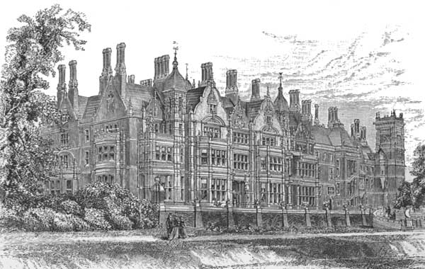
Just beyond Wokingham is the fine estate of Bearwood, the seat of John Walter, Esq., the proprietor of the London Times, one of the stately rural homes of England. Here, in a large and beautiful park which retains much of its original forest character, and standing upon the terraced bank of a lovely lake, Bearwood House has within a few years been entirely rebuilt, its feature being the central picture-gallery containing a fine collection of paintings, around which clusters a suite of grand apartments. The estate includes several thousand acres, and in the many pleasant cottages scattered over it and the homes at Bearwood village many of the aged and infirm employés of the Times pass their declining years. The Times, which was founded January 1, 1788, by the grandfather of the present proprietor, has steadily grown in commanding influence until it occupies the front rank in English journalism and is the leading newspaper of the kingdom. Its proprietor has recently entirely rebuilt its publication-offices in Printing-House Square and on Queen Victoria Street in London, adapting all the modern appliances of improved machinery and methods to its publication. It is at Bearwood, however, that his philanthropic ideas also find a broad field of usefulness in caring for those who have grown gray in the service of the Times, and thither every year go the entire corps of employés to enjoy an annual picnic under the spreading foliage of the park, while no home in England is more frequented by Americans or extends to kin from across sea a more generous hospitality.
KING ALFRED'S WHITE HORSE.
In the chalk hills of Berkshire, beyond Reading and north of Hungerford, there rises an eminence over nine hundred feet high, known as the White Horse Hill. It is a famous place; upon the summit, covering a dozen acres, and from which eleven counties can be seen, there is a magnificent Roman camp, with gates, ditch, and mound as complete as when the legions left it. To the westward of the hill, and under its shadow, was the battlefield of Ashdown, where Alfred defeated the Danes and broke their power in 871. He fought eight other battles against the Danes that year, but they were mere skirmishes compared with the decisive victory of Ashdown, and in memory of it he ordered his army to carve the White Horse on the hillside as the emblem of the standard of Hengist. It is cut out of the turf, and can be seen to a great distance, being three hundred and seventy-four feet long. After a spell of bad weather it gets out of condition, and can only be restored to proper form by being scoured, this ceremony bringing a large concourse of people from all the neighboring villages. The festival was held in 1857, and the old White Horse was then brought back into proper form with much pomp and great rejoicing. The ancient balladist thus quaintly describes the festivity on these memorable occasions:
"The owld White Harse wants zettin to rights, and the squire hev promised good cheer, Zo we'll gee un a scrape to kip un in zhape, and a'll last for many a year. A was made a lang, lang time ago, wi a good dale o' labor and pains. By King Alferd the Great, when he spwiled their consate and caddled[B] thay wosbirds[C] the Danes. The Bleawin Stwun in days gone by wur King Alferd's bugle harn, And the tharnin tree you med plainly zee as is called King Alferd's tharn. There'll be backsword play, and climmin the powl, and a race for a peg, and a cheese. And us thenks as hisn's a dummell[D] zowl as dwont care for zich spwoorts as theze."
Leaving London by the Great Western Railway, and passing beyond Berkshire, we cross the boundary into Wiltshire, and go through the longest railway-tunnel in England, the noted Box Tunnel, which is a mile and three-quarters in length and cost over $2,500,000 to construct. It goes through a ridge of great-oolite, from which the valuable bath-stone is quarried, and the railway ultimately brings us to the cathedral city that boasts the tallest church-spire in England—Salisbury, the county-town of Wiltshire, standing in the valley formed by the confluence of three rivers, the Avon, Bourne, and Wiley.
SALISBURY.
SALISBURY CATHEDRAL.
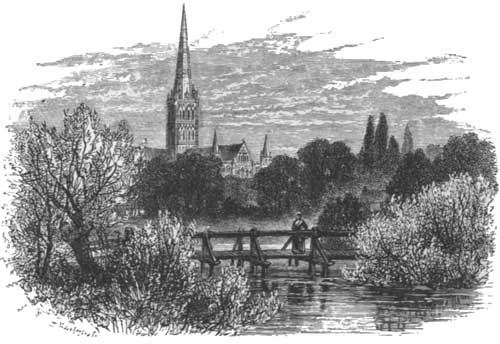
The celebrated cathedral, which in some respects may be considered the earliest in England, is the chief object at Salisbury, and was founded by Bishop Poore in 1220. It was the first great church built in the Early English style, and its spire is among the most imposing Gothic constructions in existence. The city of Salisbury is unique in having nothing Roman, Saxon, or Norman in its origin, and in being even without the remains of a baronial fortress. It is a purely English city, and, though it was surrounded by walls, they were merely boundaries of the dominions of the ecclesiastics. The see of Salisbury in 1215 was removed from Old Sarum to its present location in consequence of the frequent contests between the clergy and the castellans, and soon afterwards the construction of the cathedral began. King Henry III. granted the church a weekly market and an annual fair lasting eight days, and the symmetrical arrangement of the streets is said to have been caused by the original laying out of the city in spaces "seven perches each in length and three in breadth," as the historian tells us. The cathedral close, which is surrounded by a wall, has four gateways, and the best view of the cathedral is from the north-eastern side of the close, but a more distant view—say from a mile away—brings out the proportions of the universally admired spire to much greater advantage. The chief cathedral entrance is by the north porch, which is a fine and lofty structure, lined with a double arcade and having an upper chamber. The nave is beautiful, though it suffers somewhat in warmth of coloring from lacking stained glass, and the cloisters, which are entered from the south-western transept, are admirable, being of later date and exhibiting a more developed style than the remainder of the cathedral. Their graceful windows and long gray arcades contrast splendidly with the greensward of the cloister-garth. They include an octagonal chapter-house, fifty-eight feet in diameter and fifty-two feet high, which has been restored in memory of a recent bishop at a cost of $260,000. The restoration has enriched the house with magnificent sculptures representing Old-Testament history, and the restoration of the cathedral is also progressing. The adjoining episcopal palace is an irregular but picturesque pile of buildings, with a gateway tower that is a prominent feature.
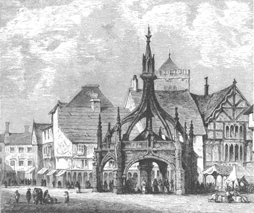
Salisbury has plenty of old houses, like most English towns, and it also has a large square market-place, containing the Gothic Poultry Cross, a most graceful stone structure, and also the council-house of modern erection, in front of which is a statue of Sidney Herbert. Its ancient banquet-hall, built four hundred years ago by John Halle, and having a lofty timber roof and an elaborately-carved oak screen, is now used as the show-room for a shop.
SALISBURY MARKET.
To the northward of Salisbury is that region filled with prehistoric relics known as Salisbury Plain. Here are ancient fortresses, barrows, and sepulchral mounds, earthworks, dykes, and trenches, roadways of the Roman and the Briton, and the great British stronghold, guarding the southern entrance to the plain, which became the Old Sarum of later times. Until within a century this plain was a solitary and almost abandoned region, but now there are good roads crossing it and much of the land is cultivated. It is a great triangular chalk-measure, each side roughly estimated at twenty miles long. The Bourne, Wiley, and Avon flow through it to meet near Salisbury, and all the bolder heights between their valleys are marked by ancient fortifications. Wiltshire is thus said to be divided between chalk and cheese, for the northern district beyond the plain is a great dairy region. Let us journey northward from Salisbury across the plain, and as we enter its southern border there rises up almost at the edge the conical hill of Old Sarum, crowned by intrenchments. When they were made is not known, but in 552 they were a British defence against the Saxons, who captured them after a bitter fight and overran the plain. Five centuries later William the Norman reviewed his army here, and after the first Domesday survey summoned all the landholders of England to the number of sixty thousand, who here swore fealty to him. The Normans strengthened it with a castle, and soon a cathedral also rose at Old Sarum, while a town grew around them. But all have disappeared, though now there can be traced the outlines of streets and houses and the foundations of the old cathedral. When the clergy removed to Salisbury it is said they determined the new site by an arrow shot from the ramparts of Old Sarum, and moving the cathedral soon attracted the people. Old Sarum for some time remained a strong fortress with many houses, but the cathedral was taken down in 1331 and its materials used for building the famous spire at Salisbury. The castle decayed, the town was gradually deserted, and as long ago as the sixteenth century we are told there was not a single house left there. And such it is to this day. Climbing the steep face of the hill, the summit is found fenced by a vast earthen rampart and ditch enclosing twenty-seven acres with an irregular circle, the height from the bottom of the ditch to the top of the rampart being over one hundred feet. A smaller inner rampart as high as the outer one made the central citadel. Nearly all the stone has long ago been carried off to build Salisbury, and weeds and brushwood have overrun the remarkable fortress that has come down to us from such venerable antiquity. Under the English "rotten-borough" system Old Sarum enjoyed the privilege of sending two members to Parliament for three centuries after it ceased to be inhabited. The old tree under which the election was held still exists, and the elder Pitt, who lived near by, was first sent to Parliament as a representative of Old Sarum's vacant mounds.
STONEHENGE.
A few miles' farther journey to the northward over the hills and valleys, and among the sheep that also wander on Salisbury Plain, brings us to that remarkable relic of earlier ages which is probably the greatest curiosity in England—Stonehenge. When the gigantic stones were put there, and what for, no man knows. Many are the unanswered questions asked about them, for the poet says:
"Thou noblest monument of Albion's isle! Whether by Merlin's aid from Scythia's shore To Amber's fatal plain Pendragon bore, Huge frame of giant hands, the mighty pile, To entomb his Britons slain by Hengist's guile: Or Druid priests, sprinkled with human gore, Taught 'mid thy massy maze their mystic lore; Or Danish chiefs, enriched by savage spoil, To Victory's idol vast, an unhewn shrine, Reared the huge heap; or, in thy hallowed round, Repose the kings of Brutus' genuine line; Or here those kings in solemn state were crowned; Studious to trace thy wondrous origin, We muse on many an ancient tale renowned."
STONEHENGE, FROM THE NORTH.
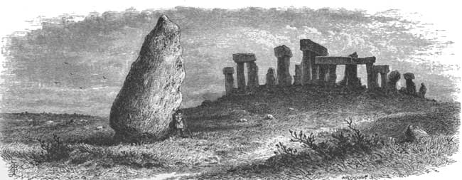
Stonehenge is about nine miles north of Salisbury, near the town of Amesbury, where another ancient camp, known as "The Ramparts," crowns a wooded hill, around which the Avon flows, the camp enclosing nearly forty acres. Stonehenge stands in a bleak, bare situation on Salisbury Plain, and in its original perfection, as nearly as can now be judged, consisted of two concentric circles and two ellipses of upright stones, surrounded by a bank and ditch, outside of which is a single upright stone and traces of a hippodrome. The entrance to the cluster of circles was from the north-east, and the avenue to it is still traceable by the banks of earth. The outer circle at Stonehenge originally consisted of thirty upright stones fixed in the ground at intervals of about three and a half feet. On the top of them thirty other stones formed a continuous ring about sixteen feet above the ground. Within this circle, and leaving a space about nine feet wide between, was another circle of thirty or forty unhewn stones about four to seven feet high. Within this, again, was the grandest part of the structure—a great ellipse formed of five triplets of stones or trilithons, each composed of two uprights and one placed crosswise. Within these was the inner ellipse of nineteen obelisks surrounding the altar-stone. Such was Stonehenge originally, but its ruins now appear very differently, and are only a confused pile of huge stones, for the most part such as are found on the neighboring plain and known as sarsens (a siliceous sandstone), though some of the smaller ones may be boulders brought from a distance. The diameter of the enclosure is three hundred and thirty-six feet. On the outer circle sixteen of the uprights and six of the surmounting stones forming the ring remain in their original positions. Two of the inner trilithons, the highest rising twenty-five feet, remain perfect, and there are two single uprights, which lean considerably. The flat slab or altar-stone is lying on the ground. The avenue of approach opens in front of the inner ellipse and in a line with the altar-stone. In the avenue, outside the enclosure, is a block sixteen feet high in a leaning position, and known as the Friar's Heel. The legend tells us that when the great Enemy of the human race was raising Stonehenge he muttered to himself that no one would ever know how it was done. A passing friar, hearing him, exclaimed, "That's more than thee can tell," and then fled. The Enemy flung this great stone after him, but hit only the friar's heel. The investigators of Stonehenge say that when standing on the altar-stone the midsummer sun is seen to rise to the north-east directly over the "Friar's Heel." The traces of the avenue in which it stands are, however, soon found to divide into two smaller avenues, one running south-east and the other north, and the latter is connected beyond with a long enclosure called the Cursus, and marked by banks of earth stretching east and west for about a mile and a half: there is nothing known of its use. The whole country about Stonehenge is dotted with groups of sepulchral barrows, and at the western end of the Cursus is a cluster of them more prominent than the others, and known as the "Seven Burrows." Stonehenge itself inspires with mystery and awe, the blocks being gray with lichens and worn by centuries of storms. Reference to them is found in the earliest chronicles of Britain, and countless legends are told of their origin and history, they usually being traced to mythical hands. In James I.'s reign Stonehenge was said to be a Roman temple, dedicated to Cœlus; subsequently, it was attributed to the Danes, the Phœnicians, the Britons, and the Druids by various writers. Sir Richard Hoare, who has studied the mystery most closely, declines all these theories, and says the monument is grand but "voiceless." Horace Walpole shrewdly observes that whoever examines Stonehenge attributes it to that class of antiquity of which he is himself most fond; and thus it remains an insoluble problem to puzzle the investigator and impress the tourist. Michael Drayton plaintively and quaintly confesses that no one has yet solved the mystery:
"Dull heape, that thus thy head above the rest doest reare, Precisely yet not know'st who first did place thee there. Ill did those mightie men to trust thee with their storie; Thou hast forgot their names who rear'd thee for their glorie; For all their wondrous cost, thou that hast serv'd them so, What 'tis to trust to tombes by thee we easily know."
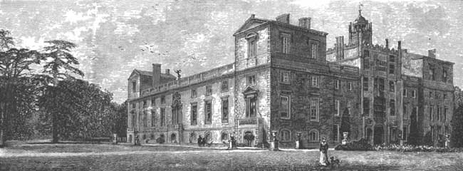
WILTON HOUSE.
SOUTH-EAST VIEW OF WILTON HOUSE.
FIRE-PLACE IN DOUBLE-CUBE ROOM.
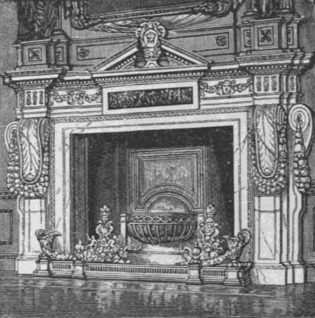
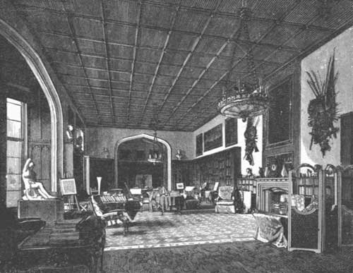
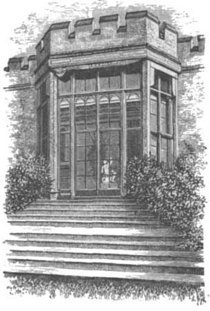
Returning along the valley of the Avon past the almost lifeless town of Amesbury, where there formerly was a grand Benedictine monastery long since gone to decay, we cross over to the Wiley Vale, and at about three miles distance from Salisbury come to the Earl of Pembroke's seat at Wilton House. The ancient town of Wilton—or, as it was originally called, Willytown—stands at the confluence of the rivers Nadder and Wiley. The Britons established it, and it was one of the capitals of the West Saxons. It was famous long before the Norman Conquest, and it afterwards obtained renown from the number and importance of its monastic establishments, having had no less than twelve parish churches, though not a trace of its abbey now remains. Henry VIII. dissolved it, and gave the site and buildings to Sir William Herbert, who was afterwards created Earl of Pembroke, and from its relics Wilton House was largely constructed. The town is now chiefly noted as the manufactory of Axminster and Wilton carpets, dextrously woven by operatives who use most primitive machinery. The Earl's Park adjoins the town, and in it is Wilton House, one of the grandest palaces in England, standing upon the site of the abbey. The buildings were designed by Holbein, and the garden front being burned in 1648, was rebuilt soon afterwards, while the entire structure was enlarged and remodelled during the present century, the cloisters being then added for the display of the fine collection of sculptures. The plan of the house is a quadrangle, with a glazed cloister occupying the central square. Within this cloister and the hall leading to it are the well-known Pembroke Marbles—statues, busts, urns, vases, bassi-relievi, and fragments of great value from Grecian and Roman works. This collection was formed during the last century, being gathered by the then earl from various sources. In the hall are statues, but its chief interest comes from the numerous suits of armor with which it is adorned, chiefly memorials of the battle of St. Quentin, fought in 1557, when the Earl of Pembroke commanded the British forces. One of the suits was worn by the earl himself, and two others by the Constable of France and the Duc de Montpensier, both being taken prisoner. On either side are entrances to various apartments containing valuable paintings. The chief of these is the "Family Picture," regarded as Vandyke's masterpiece—seventeen feet long and eleven feet high, and filling one end of the drawing-room. It contains ten full-length figures—Philip, Earl of Pembroke, and his countess and their children. Above them, hovering in the clouds, are three other children, who died in early life. In the Double Cube-room, which is regarded as a gem in its way and has a most magnificent fireplace, there are some thirteen other paintings by Vandyke. Other paintings by Italian masters are also distributed on the walls of the various apartments, but the Vandykes are regarded as the gems of the collection. The library is a large and lofty apartment, with an oak-panelled ceiling, and a fine collection of volumes with appropriate furnishing. Out of the library window the western view over the terrace discloses charming pleasure-grounds, laid out in the Italian style from designs by a former Countess of Pembroke, while in the background is a beautiful porch constructed by Holbein. To the gardens, summer-houses and conservatories add their attractions, while beyond is the valley of the Nadder, over which a picturesque bridge leads to the park. This bridge has an Ionic colonnade, and in the park are some of the finest cedars to be seen in the kingdom. Here, it is said, Sir Philip Sidney wrote Arcadia, and the work shows that he drew much inspiration from these gardens and grounds, for it abounds in lifelike descriptions of Nature.
THE LIBRARY, WILTON HOUSE.
LIBRARY WINDOW.
At Wilton also lived George Herbert the poet, and later Sidney Herbert, who was afterwards made Lord Herbert of Lea, and whose son is now the thirteenth Earl of Pembroke. A statue of Sidney Herbert has already been referred to as standing in Pall Mall, London, and another is in Salisbury. He was secretary of war, yet was the gentle and genial advocate of peace and charity to all mankind, and his premature death was regarded as a public calamity. He erected in 1844 the graceful New Church at Wilton. It was the Earls of Pembroke in the last century who were chiefly instrumental in bringing the manufacturers of fine carpets over from France and Flanders and laying the foundation of that trade, in which England now far surpasses those countries. The factory at Axminster, on the southern coast, was also afterwards transferred to Wilton. These carpets are all hand-made, and the higher class, which are an inch or more in thickness and of the softness of down when trod upon, are also of the most gorgeous design and brilliancy of colors.
BATH.
Crossing over the hills to the north-west of Salisbury Plain, we descend to the attractive valley of another river Avon, and come to the "Queen of all the Spas in the World," the city of Bath. It is the chief town of Somersetshire, and is surrounded by an amphitheatre of hills. The abbey and principal streets are in the valley, while above, on its northern slope, rise terraces and crescents, tier upon tier, to a height of nearly eight hundred feet, the most conspicuous being the Royal and the Lansdowne Crescents. Many of the buildings are handsome, and are constructed of the white great-oolite, known as bath-stone. To its waters this famous resort owes its importance, but from an insignificant place Bath has risen to the highest point of popularity as a fashionable watering-place and in architectural magnificence through the genius of Architect Wood and Master-of-Ceremonies Beau Nash. The legendary king Bladud is said to have first discovered the Bath waters twenty-seven hundred years ago, and to have built a town there and dedicated the medicinal springs to Minerva, so that "Bladud's Well" has passed into a proverb of sparkling inexhaustibility. The Romans, passionately attached to the luxury of the hot springs, made Bath one of their chief stations, and here and in the neighborhood the foundations of their extensive buildings have been traced, with the remains of altars, baths, tessellated pavements, and ornaments, and few British towns can produce such a collection of Roman relics. In the height of the Roman power in the fifth century the city extended nearly three miles along the valley, and was surrounded by a wall twenty feet high and nine feet thick. Such a fascinating spot was naturally selected for the foundation of a religious house at an early period, and we consequently find that the abbey of Bath was built by King Offa in the eighth century, and refounded by King Edgar in the tenth century. It existed until the dissolution in 1539. The church fell into decay in the reign of Henry VII., and the present abbey-church was then built, being for a long time unfinished. It has recently been restored. It stands at the southern extremity of High Street, and is a fine specimen of Perpendicular Gothic, the plan being a cross, with a tower at the intersection rising one hundred and sixty-two feet and flanked by octagonal turrets. The church is two hundred and ten feet long, and has a fan-traced, stone-vaulted roof seventy-eight feet high, while the western front contains a magnificent window flanked by turrets carved with angels, who are ascending and descending, but have, unfortunately, all lost their heads. The Pump Room, which is one of the chief buildings, is a classical structure with a Corinthian portico bearing the motto, "Water, best of elements!" A band plays in the spacious saloon, which also contains a statue of the genius of Bath, Beau Nash, whose monument is in the abbey-church. Here the waters, which are the hottest in England, reaching a temperature of 120°, tumble continually from a drinking-fountain into a serpentine basin beneath. There are numerous other baths replete with comforts for the invalid, for this is essentially a hospital town, and the city also contains many stately public and private buildings, and its Victoria Park and Sydney Gardens are beautiful and popular resorts. The wild scenery of the neighborhood provides myriads of attractive drives and walks, while on top of Lansdowne Hill, where Beckford is buried, is his tower, one hundred and fifty feet high and commanding extensive views. The Bath waters, which are alkaline-sulphurous with a slight proportion of iron, are considered beneficial for palsy, rheumatism, gout, and scrofulous and cutaneous affections. The chief spring discharges one hundred and twenty-eight gallons a minute. While a hundred years ago Bath was at the height of its celebrity, the German spas have since diverted part of the stream of visitors.
FONTHILL AND BECKFORD.
It was at Bath that Pitt and Sheridan lived, but its most eccentric resident was William Beckford, the author of Vathek, who came to Bath from Fonthill, not far from Salisbury. His father, a London alderman, owned Fonthill, and died in 1770, leaving his son William, aged ten, with $5,000,000 ready money and $500,000 annual income. He wrote Vathek in early life after extensive travels, but founded its scenes and characters upon places and people at Fonthill. He then began building Fonthill Abbey, shrouding his proceedings in the greatest mystery and surrounding his estate with a wall twelve feet high and seven miles long, guarded by chevaux-de-frise to keep out intruders. The building of the abbey was to him a romance pursued with wild enthusiasm. So anxious was he to get it finished that he employed relays of men, working day and night and throughout Sunday, keeping them liberally supplied with liquor. The first tower was built of wood, four hundred feet high, to see its effect, and it was then taken down and the same form put up in wood covered with cement. This fell down, and the third tower was built of masonry. When the idea of the abbey occurred to Beckford he was extending a small summer-house, but he was in such a hurry that he would not remove the summer-house to make a proper foundation for the tower, but carried it up on the walls already standing, the work being done in wretched style and chiefly by semi-drunken men. He employed five hundred men day and night at the work, and once the torches used set fire to the tower at the top, a sight that he greatly enjoyed. Beckford lived at the abbey, practically a hermit, for nearly twenty years, but his fortunes being impaired he removed to Bath in 1822. Preparatory to selling Fonthill, he opened the long-sealed place to public exhibition at a guinea a ticket, and sold seventy-two hundred tickets. Then for thirty-seven days he conducted an auction-sale of the treasures at Fonthill, charging a half-guinea admission. He ultimately sold the estate for $1,750,000. In 1825 the tower, which had been insecurely built, fell with a great crash, and so frightened the new owner, who was an invalid, that, though unhurt by the disaster, he died soon afterwards. The estate was again sold and the abbey taken down, so that now only the foundations can be traced.
BRISTOL.
Proceeding about twelve miles down the beautiful valley of the Avon, we come to its junction with the Frome, where is located the ancient city and port of Bristol, the capital of the west of England. A magnificent suspension-bridge spans the gorge of the Avon, connecting Bristol with its suburb of Clifton, and it is believed that the earliest settlements by the Romans were on the heights of Clifton and the adjoining Brandon Hill. The Saxons called it Bright-stow, or the "Illustrious City;" from this the name changed to Bristow, as it was known in the twelfth century, and Bristold in the reign of Henry III. When the original owners concluded that it was time to come down from the hills, they founded the city in the valley at the junction of the two rivers. A market-cross was erected where the main streets joined, and Bristow Castle was built at the eastern extremity, where the Avon makes a right-angled bend. The town was surrounded with walls, and in the thirteenth century the course of the Frome was diverted in order to make a longer quay and get more room for buildings. Few traces remain of the old castle, but portions of the ancient walls can still be seen. In the fifteenth century the city-walls were described as lofty and massive and protected by twenty-five embattled towers, some round and some square. The abbey of St. Augustine was also then flourishing, having been founded in the twelfth century. Bristol was in the Middle Ages the second port of England, enjoying lucrative trade with all parts of the world, and in the fifteenth century a Bristol ship carrying nine hundred tons was looked upon with awe as a leviathan of the ocean. Sebastian Cabot, the great explorer, was a native of Bristol, and his expeditions were fitted out there, and it was Bristol that in 1838 built and sent out the first English steamer that crossed the Atlantic, the Great Western. It still enjoys a lucrative trade, and has recently opened new docks at the mouth of the Avon, seven miles below the city, so that this venerable port may be considered as renewing its prosperous career. It has over two hundred thousand population, and in past times had the honor of being represented in Parliament by Edmund Burke. When ancient Bristol was in its heyday, Macaulay says the streets were so narrow that a coach or cart was in danger of getting wedged between the buildings or falling into the cellars. Therefore, goods were conveyed about the town almost exclusively in trucks drawn by dogs, and the wealthy inhabitants exhibited their riches not by riding in gilded carriages, but by walking about the streets followed by a train of servants in gorgeous liveries and by keeping tables laden with good cheer. The pomp of christenings and funerals then far exceeded anything seen in any other part of England, and the hospitality of the city was widely renowned. This was especially the case with the banquets given by the guild of sugar-refiners, where the drink was a rich beverage made of Spanish wine and known as "Bristol milk." In 1831 the opposition of the Recorder of Bristol to the Reform Bill resulted in serious riots, causing a great fire that burned the Mansion House and a large number of other prominent buildings. The troops suppressed the riots after shooting several rioters, and four were afterwards hanged and twenty-six transported. The city has since enjoyed a tranquil history.
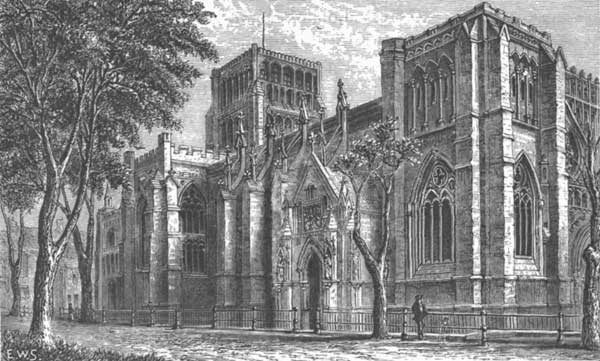
BRISTOL CATHEDRAL, FROM COLLEGE GREEN.
NORMAN DOORWAY, COLLEGE GREEN.
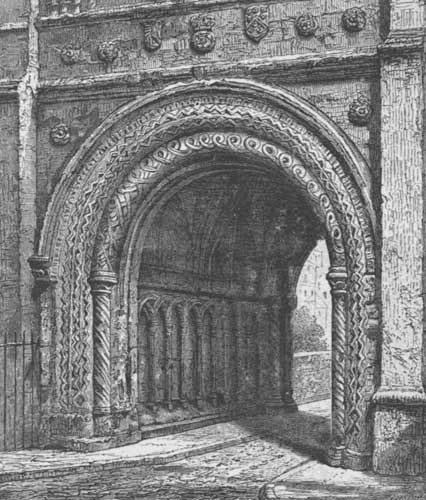
Bristol Cathedral was the convent-church of St. Augustine's Abbey, and was begun in the twelfth century. It formerly consisted only of the choir and transepts, the nave having been destroyed in the fifteenth century, but the nave was rebuilt in uniform style with the remainder of the church in 1876. The cathedral presents a mixture of architectural styles, and in it are the tombs of the Earls of Berkeley, who were its benefactors for generations. Among them was Maurice, Lord Berkeley, who died in 1368 from wounds received at Poictiers. The abbot, John Newland, or Nail-heart, was also a benefactor of the abbey, and is said to have erected the magnificent Norman doorway to the west of it leading to the college green. The most attractive portion of the interior of the cathedral is the north aisle of the choir, known as the Berkeley Chapel, a beautiful specimen of Early English style. The side-aisles of the choir are of the same height as the central aisle, and in the transepts are monuments to Bishop Butler, author of the Analogy, and to Robert Southey, who was a native of Bristol. This cathedral is not yet complete, the external ornamentation of the nave and the upper portions of the western towers being unfinished. Forty-seven bishops have sat upon the episcopal throne of Bristol. The old market-cross, which stood for four centuries in Bristol, was removed in the last century, but in 1860 it was replaced by a modern one erected upon the college green. The church of St. Mary Redcliffe, standing upon a red sandstone rock on the south side of the Avon, is the finest church in Bristol, and Chatterton calls it the "Pride of Bristowe and Western Londe." It is an Early Perpendicular structure, two hundred and thirty-one feet long, with a steeple rising over two hundred feet, founded in the twelfth century, but enlarged and rebuilt in the fifteenth century by William Canynge, who was then described as "the richest merchant of Bristow, and chosen five times mayor of the said town." He and his wife Joan have their monuments in the church, and upon his tomb is inscribed the list of his ships. He entered holy orders in his declining years, and founded a college at Westbury, whither he retired. It has for many years been the custom for the mayor and corporation of Bristol to attend this church on Whitsunday in state, when the pavement is strewn with rushes and the building decorated with flowers. In the western entrance is suspended a bone of a large whale, which, according to tradition, is the rib of the dun cow that anciently supplied Bristol with her milk. Sebastian Cabot, in all probability, presented the city with this bone after his discovery of Newfoundland. The chief popular interest in St. Mary Redcliffe, however, is its connection with Thomas Chatterton, born in a neighboring street in 1752, the son of a humble schoolmaster, who ultimately went up to London to write for the booksellers, and there committed suicide at the early age of seventeen. A monument to this precocious genius, who claimed to have recovered ancient manuscripts from the church-archives, stands in the churchyard. Bristol is full of old and quaint churches and narrow yet picturesque streets, with lofty gabled timber-houses.
CLIFTON SUSPENSION-BRIDGE, BRISTOL.
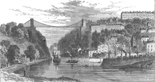
The great gorge of the Avon, five hundred feet deep, is, however, its most attractive possession. The suspension-bridge, erected by the munificence of a citizen, spans this gorge at the height of two hundred and eighty-seven feet, and cost nearly $500,000. It is twelve hundred and twenty feet long, and has a single span of seven hundred and three feet crossing the ravine between St. Vincent's Rocks and the Leigh Woods. Alongside this gorge rises Brandon Hill, which Queen Elizabeth sold to two citizens of Bristol, who in turn sold it to the city, with a proviso that the corporation should there "admit the drying of clothes by the townswomen, as had been accustomed;" and to this day its western slope is still used as a clothes-drying ground. From this the tradition arose—which, however, Bristol denounces as a libel—"that the queen gave the use of this hill to poor freemen's daughters as a dowry, because she took compassion on the many plain faces which she saw in one of her visits." Some hot springs issue out of St. Vincent's Rocks, and these give Clifton fame as a watering-place. A fine pump-house has been built there, and the waters are said to be useful in pulmonary complaints. From this beginning large and ornamental suburbs have been terraced on the rocks and hills above the springs, while on the summit is an observatory. There is a hermitage cave of great antiquity carved in the perpendicular face of the rock just above the river, and known as the "Giant's Hole." The entire neighborhood is full of charming scenery, and thus the ancient port presents varied attractions, combining business profit with recreation, while from the hilltops there are glorious views extending far down Bristol Channel to the dim hills of South Wales.
WELLS.
WELLS CATHEDRAL, FROM THE BISHOP'S GARDEN.
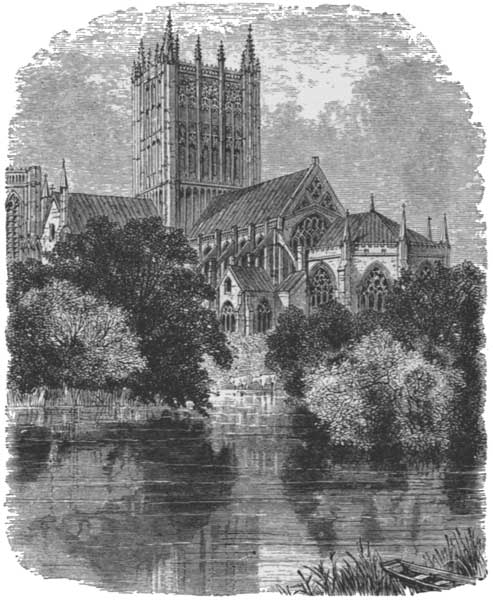
WELLS CATHEDRAL, FROM THE SWAN POOL.
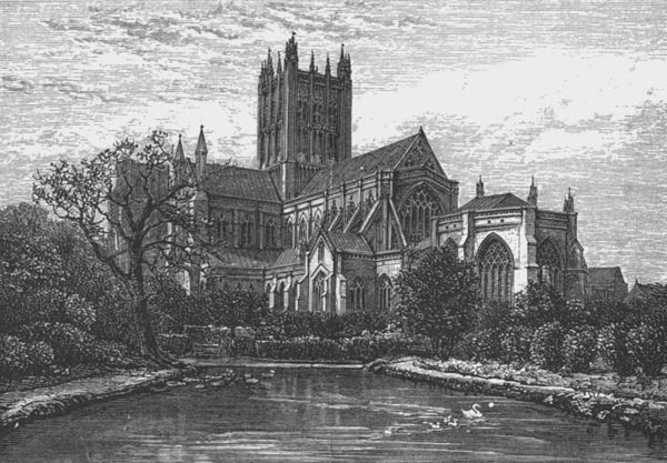
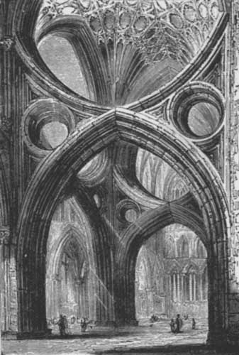
Proceeding southward into Somersetshire, we arrive at the cathedral city of Wells, which is united with Bath in the well-known bishopric of Bath and Wells, and is considered the most completely representative ecclesiastical city in England. It gets its name from its numerous springs, taking their rise from the wells in the Bishop's Garden, where they form a lake of great beauty, while bright, clear water runs through various streets of the town. After leaving the edge of the Bristol Channel the plain of the Somersetshire lowlands is bordered by rocky uplands, of which the most important is the elevated plateau known as the Mendip Hills, carved on the outside with winding valleys having precipitous sides. Wells nestles in a wide grassy basin at the foot of the Mendips, its entire history being ecclesiastical, and that not very eventful. It never had a castle, and no defensive works beyond the wall and moat enclosing the bishop's palace. It seems to have had its origin from the Romans, who worked lead-mines among the Mendips, but the first fact actually known about it is that the Saxon king Ina established here a house of secular canons "near a spring dedicated to St. Andrew." It grew in importance and privileges until it became a bishopric, there having been fifteen bishops prior to the Norman Conquest. The double title of Bishop of Bath and Wells was first assumed in the days of King Stephen. In looking at the town from a distance two buildings rise conspicuously—the belfry of St. Cuthbert's Church and the group of triple towers crowning the cathedral. There are few aggregations of ecclesiastical buildings in England that surpass those of Wells, with the attractive gateways and antique houses of the close, the grand façade of the cathedral, and the episcopal palace with its ruined banquet-hall and surrounding moat. From the ancient market-square of the city, stone gateways surmounted by gray towers give access, one to the close and the other to the enclosure of the palace. Entering the close, the western front of the cathedral is seen, the most beautiful façade of its kind in Britain—an exquisite piece of Early English architecture, with Perpendicular towers and unrivalled sculptures rising tier upon tier, with architectural accompaniments such as are only to be found at Chartres or Rheims. The old Saxon cathedral lasted until Bishop Jocelyn's time in the thirteenth century, when he began a systematic rebuilding, which was not finished until the days of Bishop Beckington in the fifteenth century, who completed the gateways and cloisters. Entering the cathedral, the strange spectacle is at once seen of singular inverted arches under the central tower, forming a cross of St. Andrew, to whom the building is dedicated. These arches were inserted subsequently to the erection of the tower to strengthen its supports—an ingenious contrivance not without a certain beauty. The choir is peculiar and beautiful, and produces a wonderful effect, due to its groups of arches, the Lady Chapel and retro-choir, and the rich splendors of the stained glass. The chapter-house, north-east of the northern transept, is built over a crypt, and is octagonal in plan, the roof supported by a central column, while the crypt beneath has an additional ring of columns. The cloisters are south of the cathedral, having three walks, with galleries above the eastern and western walks, the former being the library. Through the eastern wall of the cloisters a door leads to a private garden, in which and in the Bishop's Garden adjoining are the wells that name the city. The most important of these is St. Andrew's Well, whence a spring issues into a large pool. The water from the wells falls by two cascades into the surrounding moat, and a conduit also takes away some of it to supply the town. From the edge of the pool is the most striking view of the cathedral.
VIEW UNDER CENTRAL TOWER, WELLS CATHEDRAL.
RUINS OF THE OLD BANQUET-HALL.
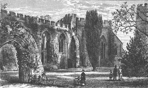
The close is surrounded by various ancient houses, and the embattled wall with its bastioned towers and moat encloses about fifteen acres. Here is the gateway known as the "Bishop's Eye," and another called the "Dean's Eye," the deanery where Henry VII. was entertained in 1497, the archdeanery, coming down from the thirteenth century, and the beautiful Chain Gate in the north-east corner that connects the cathedral with the Vicar's Close. The latter, one of the most peculiar features of Wells, is a long and narrow court entered through an archway, and having ancient houses with modernized fittings on either hand. Bishop Ralph of Shrewsbury erected this close in the fourteenth century, and his monumental inscription in the cathedral tells us he was a great sportsman, who "destroyed by hunting all the wild beasts of the great forest of Cheddar." The moat and wall completely surround the bishop's palace, and its northern front overhangs the moat, where an oriel window is pointed out as the room where Bishop Kidder and his wife were killed by the falling of a stack of chimneys upon their bed, blown down by the terrible gale of 1703 that swept away the Eddystone Lighthouse. It was Bishop Ralph who made the walls and moat as a defence against the monks of Bath, who had threatened to kill him; Bishop Jocelyn built the palace. Adjoining it is the great banquet-hall, of which only the northern and western walls remain, in ruins. It was a magnificent hall, destroyed from mere greed. After the alienation of the monasteries it fell into the hands of Sir John Gates, who tore it partly down to sell the materials; but happily, as the antiquarian relates, Gates was beheaded in 1553 for complicity in Lady Jane Grey's attempt to reach the throne, and the desecration was stopped. Afterwards, Parliament sold Wells for a nominal price to Dr. Burgess, and he renewed the spoliation, but, fortunately again, the Restoration came; he had to give up his spoils, and died in jail. Thus was the remnant of the ruin saved. It was in this hall that Whiting, the last abbot of Glastonbury, was condemned, and hanged on Tor Hill above his own abbey. The great bishops of Wells were the episcopal Nimrod Ralph, and Beckington, who left his mark so strongly on the cathedral and town. He was a weaver's son, born at the village of Beckington, near the town of Frome, and from it got his name. Hadrian de Castello, who had a romantic history, became Bishop of Wells in 1504. Pope Alexander VI. made him a cardinal, and afterwards tried to poison him with some others at a banquet; by mistake the pope himself drank of the poisoned wine, and died. The bishop afterwards entered into a conspiracy against Leo X., but, being detected, escaped from Rome in disguise and disappeared. Wolsey was Bishop of Wells at one time, but the most illustrious prelate who held the see after the Reformation was Thomas Ken. He was educated at Winchester, and afterwards became a prebend of the cathedral there. Charles II. paid a visit to Winchester, and, bringing Nell Gwynne with him, Ken was asked to allow her to occupy his house. He flatly refused, which had just the opposite effect upon the king to that which would be supposed, for he actually respected Ken for it, and when the see of Wells became vacant he offered it to "the little fellow who would not give poor Nelly a lodging." Ken attended the king's deathbed shortly afterwards. He was very popular in the diocese, and after the Sedgemoor battle he succored the fugitives, and with the Bishop of Ely gave spiritual consolation to the unfortunate Duke of Monmouth on the scaffold. Ken was one of the six bishops committed by James II. to the Tower, but, strangely enough, he declined to take the oaths of allegiance to William III., and, being deprived of preferment, retired to the home of his nephew, Izaak Walton. All reverence his sanctity and courage, and admire his morning and evening hymns, written in a summer-house in the Bishop's Garden.
ENTRANCE TO THE CHEDDAR CLIFFS.
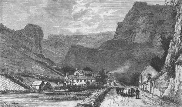
HIGH ROCKS AT CHEDDAR.
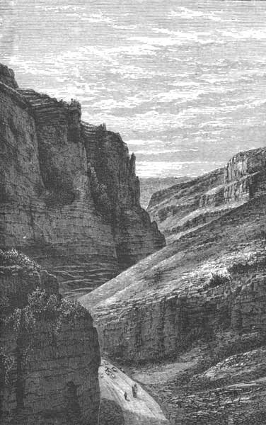
The Mendip Hills, with their picturesque gorges and winding valleys, were formerly a royal forest. It was here that King Edmund was hunting the red deer when his horse took fright and galloped towards the brow of the highest part of the Cheddar Cliffs. Shortly before, the king had quarrelled with Dunstan, and expelled the holy man from his court. As the horse galloped with him to destruction, he vowed if preserved to make amends. The horse halted on the brink as if checked by an unseen hand, and the king immediately sought Dunstan and made him abbot of Glastonbury. These hills were the haunt of the fiercest wild beasts in England, and their caves still furnish relics of lions to a larger extent than any other part of the kingdom. The most remarkable deposit of these bones is in the Wookey Hole, on the southern edge of the Mendips, about two miles from Wells. At the head of a short and picturesque glen, beneath an ivy-festooned cliff, is a cavern whence the river Axe issues and flows down the glen. The cave that disclosed the animal bones is on the left bank of the glen, and was but recently discovered in making a mill-race. It also contained about three hundred old Roman coins, rude flint implements, and skeletons of a mammoth and woolly rhinoceros. The larger cave, which is hung with fine stalactites, can be explored for some distance. Near the entrance is a mass of rock known as the Witch of Wookey, who was turned into stone there by a timely prayer from a monk who opportunely arrived from Glastonbury. The underground course of the Axe in and beyond this cave is traced for at least two miles. The Mendips contain other pretty glens and gorges, and from the summit of their cliffs can be seen the valley of the Axe winding away southward, while to the westward the scene broadens into the level plains that border the Bristol Channel, guarded on either side by the hills of Exmoor and of Wales. Little villages cluster around the bases of the hills, the most noted being Cheddar, famous for its cheese, straggling about the entrance to a gorge in which caves are numerous, each closed by a door, where an admission-fee is charged. Some of them are lighted with gas and entered upon paved paths. Lead-and zinc-mines are worked in the glens, and above Cheddar rises the Black Down to a height of eleven hundred feet, the most elevated summit of the Mendips.
GLASTONBURY.
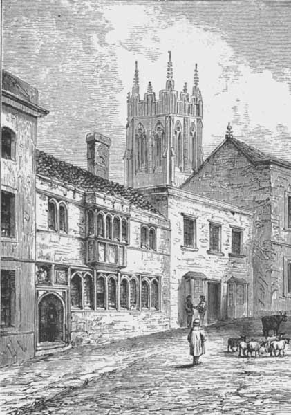
About six miles south-west of Wells is the ancient Isle of Avelon, where St. Patrick is said to have spent the closing years of his life, and where are the ruins of one of the earliest and most extensive religious houses in England—Glastonbury Abbey. A sixpence is charged to visit the ruins, which adjoin the chief street, but the remnants of the vast church, that was nearly six hundred feet long, are scanty. Of the attendant buildings there only remain the abbot's kitchen and an adjoining gateway, now converted into an inn. This kitchen is about thirty-four feet square within the walls and seventy-two feet high. The church ruins include some of the walls and tower-foundations, with a well-preserved and exceedingly rich chapel dedicated to St. Joseph. On the High Street is the old George Inn, which was the hostelrie for the pilgrims, built in the reign of Edward IV. and still used. It is fronted by a splendid mass of panelling, and the central gateway has a bay-window alongside rising the entire height of the house. The church of St. John the Baptist in Glastonbury has a fine tower, elevated one hundred and forty feet and richly adorned with canopied niches, being crowned by an open-work parapet and slender pinnacles. Almost the entire town of Glastonbury is either constructed from spoils of the abbey or else is made up of parts of its buildings. One of the most characteristic of the preserved buildings is the Tribunal, now a suite of lawyers' offices. Its deeply-recessed lower windows and the oriel above have a venerable appearance, while beyond rises the tower of St. John the Baptist. Behind the town is the "Weary-all Hill," from which arose the foundation of the monastery. Tradition tells that Joseph of Arimathea, toiling up the steep ascent, drove his thorn staff into the ground and said to his followers that they would rest there. The thorn budded, and still flowers, it is said, in winter. This was regarded as an omen, and they constructed the abbey there around the chapel of St. Joseph. The ponderous abbot's kitchen, we are told, was built by the last abbot, who boasted, when Henry VIII. threatened to burn the monastery, that he would have a kitchen that all the wood in Mendip Forest could not burn down. King Arthur was buried at Glastonbury, and a veracious historian in the twelfth century wrote that he was present at the disinterment of the remains of the king and his wife. "The shin-bone of the king," he says, "when placed side by side with that of a tall man, reached three fingers above his knee, and his skull was fearfully wounded." The remains of King Arthur's wife, which were quite perfect, fell into dust upon exposure to the air.
GLASTONBURY TRIBUNAL.
SEDGEMOOR BATTLEFIELD.
Proceeding westward towards the Bristol Channel, the low and marshy plain of Sedgemoor is reached. Much of it is reclaimed from the sea, and here and there the surface is broken by isolated knolls, there being some two hundred square miles of this region, with the range of Polden Hills extending through it and rising in some places three hundred feet high. In earlier times this was an exact reproduction of the Cambridgeshire fenland, and then, we are told,
"The flood of the Severn Sea flowed over half the plain, And a hundred capes, with huts and trees, above the flood remain; 'Tis water here and water there, and the lordly Parrett's way Hath never a trace on its pathless face, as in the former day."
It is changed now, being thoroughly drained, but in the days of the Saxons the river Parrett was the frontier of Wessex, and one of its districts sheltered Alfred from the first onset of the Danish invasion when he retreated to the fastnesses of the Isle of Athelney. In the epoch of the Normans and in the Civil War there was fighting all along the Parrett. After the defeat at Naseby the Royalists, under Lord Goring, on July 10, 1645, met their foes on the bank of the Parrett, near Langport, were defeated and put to flight, losing fourteen thousand prisoners, and the king's troops never made a stand afterwards. Bridgwater is a quiet town of about twelve thousand people on the Parrett, a half dozen miles from the sea, and in its churchyard reposes Oldmixon, who was made collector of customs here as a reward for his abusive writings, in the course of which he virulently attacked Pope. The poet retorted by giving Oldmixon a prominent place in the Dunciad, where at a diving-match in the putrid waters of Fleet Ditch, which "rolls the large tribute of dead dogs to the Thames," the heroes are bidden to "prove who best can dash through thick and thin, and who the most in love of dirt excel." And thus the Bridgwater collector:
"In naked majesty Oldmixon stands, And Milo-like surveys his arms and hands, Then sighing thus, 'And am I now threescore? And why ye gods should two and two make four?' He said, and climbed a stranded lighter's height. Shot to the black abyss, and plunged downright."
In the Market Inn at Bridgwater Admiral Blake was born, who never held a naval command until past the age of fifty, and then triumphed over the Dutch and the Spaniards, disputing Van Tromp's right to hoist a broom at his masthead, and burned the Spanish fleet in the harbor of Santa Cruz. He was buried in Westminster Abbey, but Charles II. ejected his bones. Bridgwater is now chiefly noted for its bath bricks, made of a mixture of clay and sand deposited near there by the tidal currents.
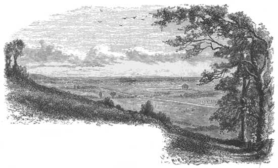
SEDGEMOOR, FROM COCK HILL.
WESTON ZOYLAND CHURCH.
It was from the Bridgwater church tower that the unfortunate son of Charles II. and Lucy Walters, who had been proclaimed "King Monmouth," looked out upon the grassy plains towards the eastward before venturing the last contest for the kingdom. This view is over Sedgemoor, the scene of the last fight deserving the name of a battle that has been fought on British ground. It is a long tract of morass lying between the foot of the Polden Hills and the Parrett River, but with a fringe of somewhat higher ground along the latter, where are Weston Zoyland, Chedzoy, and Middlezoy, each a hamlet clustering around its old church, that at Weston Zoyland being surmounted by an attractive square tower over one hundred feet high. Monmouth had been proclaimed king by the mayor and corporation of Bridgwater June 21, 1685, but had been checked at Bath, and fell back again to Bridgwater, where his army was encamped on the Castle Field. He had been three weeks in the kingdom without marked success, and the royal army was closing in upon him. Four thousand troops under Lord Feversham marched westward, and on the Sunday evening of July 5th, when Monmouth looked out from the tower, had encamped upon Sedgemoor about three miles from Bridgwater. Monmouth had seven thousand men to oppose them, but his forces were mostly undisciplined and badly armed, some having only scythes fastened on poles. The moor was then partly reclaimed and intersected by trenches, and Feversham's headquarters was at Weston Zoyland, where the royal cavalry were encamped, with the other troops at Middlezoy and Chedzoy beyond. Monmouth saw that their divisions were somewhat separated, and that his only hope was a night-attack. At midnight he started, marching his army by a circuitous route to the royal camp, strict silence being observed and not a drum beaten or a shot fired. Three ditches had to be crossed to reach the camp, two of which Monmouth knew of, but he was unfortunately ignorant of the third, called the Bussex Rhine, behind which the camp had been made. A fog came down over the moor; the first ditch was crossed successfully, but the guide missing his way caused some confusion before the second was reached, during which a pistol was discharged that aroused a sentinel, who rode off and gave the alarm. As the royal drums beat to arms Monmouth rapidly advanced, when he suddenly found himself checked by the Bussex Rhine, behind which the royal army was forming in line of battle in the fog. "For whom are you?" demanded a royal officer. "For the king," replied a voice from the rebel cavalry. "For what king?" was demanded. The answer was a shout for "King Monmouth," mingled with Cromwell's old war-cry of "God with us!" Immediately the royal troops replied with a terrific volley of musketry that sent the rebel cavalry flying in all directions. Monmouth, then coming up with the infantry, was startled to find the broad ditch in front of him. His troops halted on the edge, and for three quarters of an hour the opposing forces fired volleys at each other across the ditch. But the end was not far off. John Churchill was a subordinate in the royal army and formed its line of battle, thus indicating the future triumphs of the Duke of Marlborough. Then the royal cavalry came up, and in a few minutes the rebels were routed, and Monmouth, seeing all was lost, rode from the field. His foot-soldiers, with their scythes and butt-ends of muskets, made a gallant stand, fighting like old soldiers, though their ammunition was all gone. To conquer them the artillery were brought up, for which service the Bishop of Winchester loaned his coach-horses. The cannon were ill served, but routed the rebels, and then the infantry poured over the ditch and put them to flight. The king lost three hundred killed and wounded; the rebel loss was at least a thousand slain, while there was little mercy for the survivors. The sun rose over a field of carnage, with the king's cavalry hacking and hewing among their fleeing foes. Monmouth, with one or two followers, was by this time far away among the hills, but was afterwards captured in the New Forest, and ended his life on the scaffold. The Sedgemoor carnage went on all the morning; the fugitives poured into Bridgwater with the pursuers at their heels; five hundred prisoners were crowded into Weston Zoyland Church, and the next day a long row of gibbets appeared on the road between the town and the church. Bridgwater suffered under a reign of terror from Colonel Kirke and his "Lambs," who put a hundred prisoners to death during the week following the battle, and treated the others with great cruelty. Then Judge Jeffreys came there to execute judicial tortures, and by his harsh and terrible administration of the law, and his horrible cruelties and injustice, gained the reputation that has ever since been execrated.
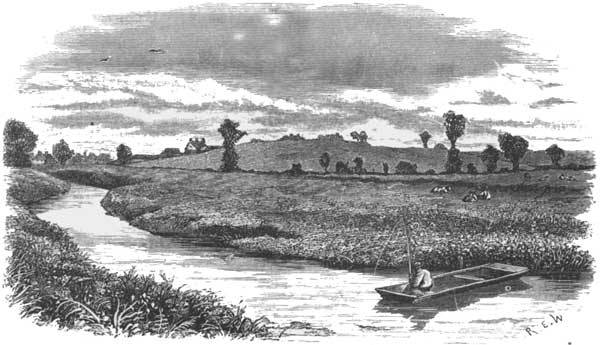
Six miles south-east of Bridgwater is the Isle of Athelney, a peninsula in the marsh between the Parrett and the Tone. Here King Alfred sought refuge from the Danes until he could get time to mature the plans that ultimately drove them from his kingdom. It was while here that the incident of the burned cakes occurred. The king was disguised as a peasant, and, living in a swineherd's cottage, performed various menial offices. The good wife left him in charge of some cakes that were baking, with instructions to turn them at the proper time. His mind wandered in thought and he forgot his trust. The good wife returned, found the cakes burning, and the guest dreaming by the fireside; she lost her temper, and expressed a decided opinion about the lazy lout who was ready enough to eat, but less ready to work. In the seventeenth century there was found in the marshes here a jewel that Alfred had lost: it is of gold and enamel, bearing words signifying, "Alfred had me wrought." The following spring (878) he sallied forth, defeated the Danes in Wiltshire, and captured their king Guthram, who was afterwards baptized near Athelney by the name of Æthelstan; they still show his baptismal font in Aller Church, near by.
THE ISLE OF ATHELNEY.
SHERBORNE.
SHERBORNE.
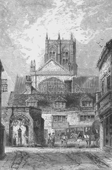
Crossing over from Somersetshire into Dorsetshire, we arrive in the northern part of that county at Sherborne, which was one of the earliest religious establishments in this part of England, having been founded by King Ina in the eighth century. Here was the see that was removed to Old Sarum in the eleventh century, and subsequently to Salisbury. After the removal, Sherborne became an abbey, and its remains are to be seen in the parish church, which still exists, of Norman architecture, and having a low central tower supported by massive piers. The porch is almost all that survives of the original structure, the remainder having been burned in 1436, but afterwards restored. Within this church are buried the Saxon kings, Æthelbald and Æthelbert, the brothers of King Alfred. Such of the domestic buildings of the abbey as have been preserved are now the well-known Sherborne Grammar-School. The great bell of the abbey was given it by Cardinal Wolsey, and weighed sixty thousand pounds. It bears this motto:
"By Wolsey's gift I measure time for all; To mirth, to grief, to church, I serve to call."
It was unfortunately cracked in 1858, but has been recast. The chief fame of Sherborne, however, is as the home of Sir Walter Raleigh, of whom Napier says that his "fortunes were alike remarkable for enviable success and pitiable reverses. Raised to eminent station through the favor of the greatest female sovereign of England, he perished on the scaffold through the dislike and cowardly policy of the meanest of her kings." The original castle of Sherborne was built in the reign of Henry I., and its owner bestowed it upon the bishopric of Old Sarum with certain lands, accompanying the gift with a perpetual curse "that whosoever should take these lands from the bishopric, or diminish them in great or small, should be accursed, not only in this world, but in the world to come, unless in his lifetime he made restitution thereof." Herein tradition says was the seed of Raleigh's misfortunes. King Stephen dispossessed the lands, and gave them to the Montagues, who met with grievous disasters, the estate ultimately reverting to the Church. In Edward VI.'s reign Sherborne was conveyed to the Duke of Somerset, but he was beheaded. Again they reverted to the Church, until one day Raleigh, journeying from Plymouth to London, the ancient historian says, "the castle being right in the way, he cast such an eye upon it as Ahab did upon Naboth's vineyard, and once, above the rest, being talking of it, of the commodiousness of the place, and of the great strength of the seat, and how easily it might be got from the bishopric, suddenly over and over came his horse, that his very face (which was then thought a very good one) ploughed up the earth where he fell. This fall was ominous, and no question he was apt to consider it so." But Raleigh did not falter, notwithstanding the omen. He begged and obtained the grant of the castle from Queen Elizabeth, and then married Elizabeth Throgmorton and returned there, building himself a new house surrounded by ornamental gardens and orchards. He settled the estate ultimately upon his son, but his enemies got King James to take it away and give it to a young Scotch favorite, Robert Carr, afterwards Earl of Somerset. Lady Raleigh upon her knees, with her children, appealed to James not to do this, but it was of no avail. The king only answered, "I mun have the land; I mun have it for Carr." She was a woman of high spirit, and while still on her knees she prayed God to punish those who had wrongfully exposed her and her children to ruin. Carr met with constant misfortunes, being ultimately implicated in a murder and imprisoned. James's son Charles, afterwards king, aided to bring Raleigh to the block, while the widow had the satisfaction of living long enough to be assured that Charles would meet the same fate. The remains of the castle are at the east end of Sherborne, covering about four acres on a rocky eminence surrounded by a ditch. The gate-tower and portions of the walls and buildings still exist. The house that Raleigh built is now called the "Castle," and has since had extensive wings added to it, with a fine lake between it and the old castle-ruins, surrounded by attractive pleasure-grounds and a park. This famous estate fell into possession of the Earl of Digby, and is now a home of G. D. Wingfield Digby, Esq., being a popular resort in the hunting-season.
THE COAST OF DORSET.
CORFE CASTLE.
The river Avon upon which Salisbury stands—for there are several of these Avon Rivers in England—flows southward between Dorsetshire and Hampshire, and falls into the Channel. Westward from its mouth extends a line of sandy cliffs, broken by occasional ravines or chines, past Bournemouth to Poole Harbor, a broad estuary surrounded by low hills which is protected by a high ridge of chalk rocks on its south-western side running out into the sea. The sleepy town of Poole stands on the shore, having dim recollections of its ships and commerce of centuries ago. It was a nursery for privateersmen, and many are the exploits recorded of them. It was also, from the intricacy of its creeks and the roving character of its people, a notorious place for smuggling. Poole is an old-fashioned, brick-built town, with a picturesque gateway yet remaining as a specimen of its ancient defences. In the vale of the Stour, which here debouches, is the ancient minster of Wimborne, founded in the reign of King Ina by his sister, and containing the grave of the Saxon king Æthelred. It is not remarkable excepting for its age, and for having had for its dean Reginald Pole before he became a cardinal. The ancient and shrunken town of Wareham is also near by, having had quite a military history, but being almost destroyed by fire in 1762, from which it never recovered. It has now but three churches out of the eight it originally possessed, and of these only one is in regular use. But the great memory of this part of the coast is connected with Corfe Castle.
The so-called Isle of Purbeck is near Poole Harbor, and the ruined castle of Corfe stands in a narrow gap in the hills, guarding the entrance to the southern part of this island, its name being derived from ceorfan, meaning "to cut," so that it refers to the cut or gap in the hills. Queen Ælfrida in the tenth century had a hunting-lodge here. According to the legend, her stepson, King Edward, was hunting in the neighborhood and stopped at the door to ask for a drink. It was brought, and as he raised the cup to his lips he was stabbed in the back—it is said by the queen's own hand. He put spurs to his horse, galloped off, fell, and was dragged along the road, the battered corpse being buried at Wareham. The queen had committed this murder for the benefit of her youngest son, and hearing him bewail his brother's death, she flew into a passion, and, no cudgel being at hand, belabored him so stoutly with a large wax candle that he could never afterwards bear the sight of one. The king's remains were then translated to Shaftesbury, miracles were wrought, and the queen, finding affairs becoming serious, founded two nunneries in expiation of the murder, to one of which she retired. This began the fame of the Isle of Purbeck, although the present Corfe Castle was not built till the twelfth century. It was attacked by, but baffled, Stephen, and King John used it as a royal residence, prison, and treasure-house. Here he starved to death twenty-two French knights who had been partisans of his nephew Arthur; and he also hanged a hermit named Peter who had made rash prophecies of his downfall, this being intended as a wholesome warning to other unwelcome prophets. Its subsequent history was uneventful until the Civil War, when it was greatly enlarged and strengthened, occupying the upper part of the hill overlooking the village. Now it is ruined in every part: the entrance-gateway leans over and is insecure, the walls are rent, and the towers shattered, while the keep is but a broken shell, with one side entirely gone. This destruction was done in the Civil War, when Corfe was held for King Charles. In 1643, when the owner, Sir John Bankes, was absent, the castle was attacked, and his lady hastily collected the tenantry and some provisions and made the best defence she could. The besiegers melted down the roof of the village church for bullets, and approached the castle-walls under cover of two pent-houses called, respectively, "the Boar" and "the Sow." So galling a fire, however, was kept up by the defenders that they were driven off, and their commander with difficulty rallied them for another attack, being well fortified with "Dutch courage." This time the brave little garrison, even the women and children taking part, hurled down upon them hot embers, paving-stones, and whatever else came handiest, and again drove them off when the effect of the liquor was spent; then, the king's forces coming to the rescue, they decamped. But the fortunes of Charles waned: he was defeated at Naseby, Sir John Bankes died, and Corfe was the only stronghold left him between London and Exeter. Again it was attacked, and, through treachery, captured. It was afterwards dismantled and blown up by gunpowder, while its heroic defender, Lady Bankes, was deprived of her dowry as penalty for her "malignity." She received it again, however, and had the satisfaction of living until after the Restoration.
1. STUDLAND CHURCH. 2. RUINS OF OLD CROSS IN THE CHURCHYARD.
Beyond the range of chalk-cliffs that here cross Dorsetshire the coast runs several miles southward from Poole Harbor, the promontory of the Foreland protruding into the sea and dividing the shore into two bays. The northern one is Studland Bay, alongside which is the singular rock of the Agglestone. The devil, we are told, was sitting one day upon one of the Needles off the neighboring coast of the Isle of Wight, looking about him to see what the world was doing, when he espied the towers of Corfe Castle just rising towards completion; he seized a huge rock and hurled it at the castle, but it fell short, and remains to this day upon the moor. Nestling under the slopes of this moor, in a ravine leading down to the shore, is Studland village, with its little Norman church embosomed in foliage and surrounded by ancient gravestones and memorial crosses. South of the Foreland, and protected by the chalk range from the northern blasts, is Swanage Bay, bordered by its little town, which in past times has been variously called Swanwich, Sandwich, and Swanage. It is a quiet watering-place at the east end of Purbeck Isle, landlocked from every rough wind, a pleasant spot for summer sea-bathing, with huge elms growing on its beach and garden-flowers basking in the sunshine. The Purbeck marble, which was so extensively used for church-building a few centuries ago, and which may be seen in Westminster Abbey, Canterbury, Salisbury, Ely, and other cathedrals, was quarried here, though other quarries of it exist in Britain. It is an aggregate of freshwater shells, which polishes handsomely, but is liable to crumble, and has in later years been generally superseded by other building-stone. The coast southward is lined with quarries, and the lofty promontory of St. Aldhelm's Head projects into the sea, a conspicuous headland seen from afar. It was named for the first Bishop of Sherborne, and its summit rises nearly five hundred feet, being crowned by an ancient chapel, where in former days a priest trimmed the beacon-light and prayed for the mariners' safety. This cliff exhibits sections of Portland stone, and the view is unusually fine, the entire coast displaying vast walls of cream-colored limestone. These rocks extend westward past Encombe, where Chancellor Eldon closed his life, and the Vale of Kimmeridge, where they dig a dark blue clay, and Worbarrow Bay, with its amphitheatre of crags composed of Portland stone and breached here and there to form the gateways into interior coves. Here are the Barndoor Cove, entered through a natural archway; the Man-of-War Cove, its guardian rock representing a vessel; and Lulworth Cove, with its castle-ruins, most of which have been worked into the modern structure near by where the exiled French king, Charles X., once lived.
ST. ALDHELM'S HEAD.
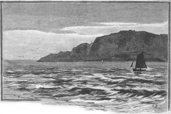
WEYMOUTH AND PORTLAND.
The coast next sweeps around to the southward, forming the broad expanse of Weymouth Bay, with the precipitous headland of the White Nore on the one hand, and the crags of Portland Isle spreading on the other far out to sea, with the breakwater extending to the northward enclosing the bay and making a harbor under the lee of which vast fleets can anchor in safety. Weymouth is a popular watering-place and the point of departure for steamers for the Channel Islands, and it was George III.'s favorite resort. He had a house there, and on the cliffs behind the town an ingenious soldier, by cutting away the turf and exposing the white chalk beneath, has made a gigantic figure of the king on horseback, of clever execution and said to be a good likeness. Weymouth has a steamboat-pier and an attractive esplanade, and on the cliffs west of the town and overlooking the sea are the ruins of Sandsfoot Castle, erected for coast-defence by Henry VIII. They are of little interest, however, and south of them is the estuary of the Fleet, which divides Portland Isle from the mainland, but these are linked together by the Chesil Bank, a huge mound of pebbles forming a natural breakwater. At the lower end it is an embankment forty feet high, composed of large pebbles, some reaching a foot in diameter. As it stretches northward it decreases gradually in height and in the size of its pebbles, till it becomes a low shingly beach. To this great natural embankment the value of Portland Harbor is chiefly due, and many are the theories to account for its formation. Near the estuary of the Fleet is Abbotsbury, where are the ruins of an ancient church and the Earl of Ilchester's famous swannery, where he has twelve hundred swans.
PORTLAND ISLE.
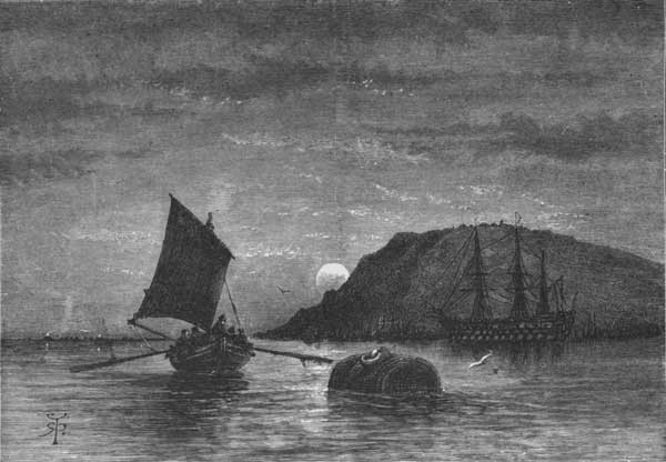
The Isle of Portland, thus strangely linked to the mainland, is an elevated limestone plateau guarded on all sides by steep cliffs and about nine miles in circumference. Not far from the end of the Chesil Bank is Portland Castle, another coast-defence erected by Henry VIII. Near by, on the western slope, is the village of Chesilton. The highest part of the isle is Verne Hill, four hundred and ninety-five feet high, where there is a strong fort with casemated barracks that can accommodate three thousand men. Other works also defend the island, which is regarded of great strategic importance, and in the neighborhood are the famous quarries whence the Portland stone has been excavated for two centuries. The most esteemed is the hard, pale, cream-colored oolite, which was introduced to the notice of London by Inigo Jones, and has been popular ever since. With it have been built St. Paul's Cathedral, Somerset House, the towers of Westminster Abbey, and Whitehall, with other London buildings. Here also was quarried the stone for the great breakwater, of which the late Prince Consort deposited the first stone in 1849, and the Prince of Wales the last one in 1872, making the largest artificial harbor in the world. The first portion of this breakwater runs east from the shore eighteen hundred feet. There is an opening four hundred feet wide, and the outer breakwater thence extends north-east six thousand feet, terminated by a strong circular fort guarding the harbor entrance. It cost over $5,000,000, and about one thousand convicts were employed in its construction, which took nearly six million tons of stone. The materials, quarried and laden on cars by the convicts, were sent down an inclined plane and out to the appointed place, where they were emptied into the sea. The prison of the convicts is on the east side of the island adjoining the quarries, and is almost a town of itself, having twenty-five hundred inmates. The prison-garb is blue and white stripes in summer, and a brownish-gray jacket and oilskin cap in winter. The convicts have built their own chapels and schools, and on the Cove of Church Hope near by are the ruins of Bow and Arrow Castle, constructed by William Rufus on a cliff overhanging the sea, and also a modern building known as Pennsylvania Castle, built by William Penn's grandson in a sheltered nook. The views here are of great beauty, while at the southern end of the promontory is the castellated mass of rocks projecting far into the sea, and supporting two lighthouses, known as the Portland Bill. Below is the dangerous surf called the Race of Portland, where the tide flows with unusual swiftness, and in the bordering cliffs are many romantic caves where the restless waves make a constant plashing.
THE CHANNEL ISLANDS.
CORBIÈRE LIGHTHOUSE, JERSEY.
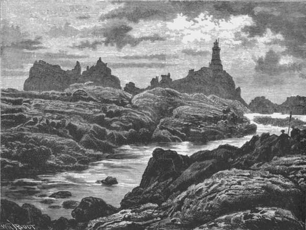
From the harbor of Portland we will make a steamer-excursion almost across the English Channel, going about one hundred and fifteen miles to the Channel Islands, off the north-western coast of France and within a few miles of the shores of Normandy and Brittany. They are Jersey, Guernsey, Alderney, and Sark, standing in a picturesque situation, with a mild climate and fertile soil, and devoted mainly to dairying and to fishing. These islands were known to the Romans, and their strategic position is so valuable that England, while getting but $100,000 revenue from them, has expended two or three millions annually in maintaining their fortifications. It was upon the dangerous cluster of rocks west of Alderney, and known as the Caskets, that Henry I.'s only son, Prince William, perished in the twelfth century, and here the man-of-war Victory was lost with eleven hundred men in 1744. Jersey is the most remarkable of these islands for its castles and forts, and has seen many fierce attacks. Both Henry VII. and Charles II. when in exile found refuge in Jersey. In approaching this island the fantastic outline of the Corbière Promontory on the western side is striking. When first seen through the morning haze it resembles a huge elephant supporting an embattled tower, but the apparition vanishes on closer approach. A lighthouse crowns the rock, and the bay of St. Aubin spreads a grand crescent of smiling shores, in the centre of which is Elizabeth Castle, standing on a lofty insulated rock whose jagged pinnacles are reared in grotesque array around the battlements. Within the bay is a safe harbor, with the villages of St. Helier and St. Aubin on the shores. Here is the hermitage once occupied by Jersey's patron saint Elericus, and an abbey dedicated to him anciently occupied the site of the castle. The impregnable works of the great Regent Fort are upon a precipitous hill commanding the harbor and castle. Upon the eastern side of the island is another huge fortress, called the castle of Mont Orgueil, upon a lofty conical rock forming the northern headland of Grouville Bay. The apex of the mountain shoots up in the centre of the fortifications as high as the flagstaff which is planted upon them. Here lived Charles II. when in exile, and this is the most interesting part of Jersey, historically. A part of the fortifications is said to date from Cæsar's incursion into Gaul, and the Romans in honor of their leader called the island Cæsarea, describing it at that time as a stronghold of the Druids, of whose worship many monuments remain. It was first attached to the British Crown at the Norman Conquest, and, though the French in the many wars since then have sent frequent expeditions against the island, they have never been able to hold it. The Channel Islands altogether cover about seventy-five square miles. Alderney, which is within seven miles of the French coast, now has an extensive harbor of refuge. Guernsey contains the remains of two Norman castles—one almost entirely gone, and the other called Ivy Castle, from its ruins being mantled with shrubbery. Its great defensive work, Fort George, built in the last century, stands in a commanding position and is of enormous strength. Upon a rocky islet off St. Peter's Port is the chief defensive fort of that harbor, located about a mile to seaward—Castle Cornet, a work of venerable antiquity, parts of which were built by the Romans. In 1672, Viscount Christopher Hatton was governor of Guernsey, and was blown up with his family in Castle Cornet, the powder-magazine being struck by lightning at midnight. He was in bed, was blown out of the window, and lay for some time on the ramparts unhurt. Most of the family and attendants perished, but his infant daughter Anne was found next day alive, and sleeping in her cradle under a beam in the ruins, uninjured by the explosion. She lived to marry the Earl of Winchelsea and have thirty children, of whom thirteen survived her.
VIEW FROM THE DEVIL'S HOLE, NEAR CORBIÈRE, JERSEY.
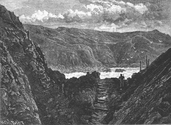
THE SOUTHERN COAST OF DEVON.
Westward of Portland Isle, on the southern coast near Abbotsbury, are the ruins of a monastery built by Canute, and St. Catharine's Chapel, perched on a steep hill overlooking the sea, while in the neighborhood is the Earl of Ilchester's castle, surrounded by attractive gardens. Beyond this the little river Lym flows into the sea from among grand yet broken crags mantled with woods, and in a deep valley at the foot of the hills is the romantic town of Lyme Regis, with a pleasant beach and good bathing, the force of the waves being broken by a pier called the Cobb, frequently washed away and as often restored, sometimes at great cost. This is a semicircular breakwater eleven hundred and seventy-nine feet long, protecting the harbor. There are grand cliffs around this little harbor, the Golden Cap and the Rhodehorn rearing their heads on high, the summit of the latter being cut by a passage called the Devil's Bellows. It was near Lyme Regis that on Christmas, 1839, the Dowlands landslip took place, an area of forty acres sliding down the cliff to a lower level, roughly removing two cottages and an orchard in the descent. Five miles farther west the pretty river Axe, which flows down from the Mendips, enters the sea, and on an eminence overlooking the stream is the town of Axminster, formerly a Saxon stronghold, and afterwards famous for the carpet manufacture, which some time ago was removed to Wilton. Its minster was founded in the days of Æthelstan, but the remains are Norman work. Still farther west the little river Sid flows down past Sidbury and Sidford, and enters the sea through a valley in which nestles the charming watering-place of Sidmouth, celebrated for its pebbles found among the green sand. Salcombe Hill and High Peak, towering five hundred feet, guard the valley-entrance on either hand, and in the church of St. Nicholas is a memorial window erected by Queen Victoria in memory of her father, the Duke of Kent, who died here in 1820. The esplanade in front of the town is protected by a sea-wall seventeen hundred feet long. Near here, at Hayes Barton, now an Elizabethan farm-house, Sir Walter Raleigh was born, the room in which he first saw the light being still shown. Beyond this, to the westward, the river Exe falls into the sea through a broad estuary at Exmouth, also a favorite watering-place, over which the lofty Haldon Hills keep guard at a height of eight hundred feet, the Beacon Walks being cut on their sloping face and tastefully planted with trees, while a broad esplanade protected by a sea-wall fronts the town. The shores all along are dotted with villas, and this coast is a popular resort, the villages gradually expanding into towns as their populations increase.
EXETER.
EXETER CATHEDRAL, WEST FRONT.
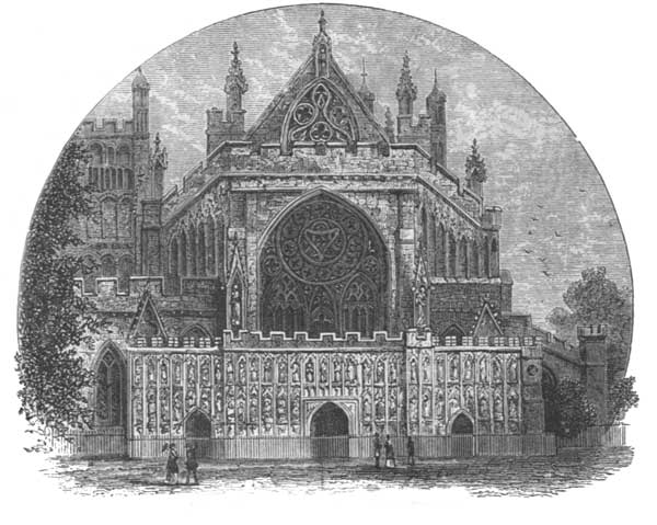
RUINS OF ROUGEMONT CASTLE.
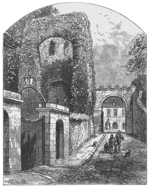
OLD HOUSES IN THE CATHEDRAL CLOSE.
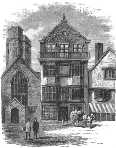
About eleven miles up the river Exe, before it has broadened out into the estuary, but where it flows through a well-marked valley and washes the bases of the cliffs, stands Exeter, a city set upon a hill. Here was an ancient "dun," or British hill-fort, succeeded by a Roman, and then by a Norman, castle, with the town descending upon the slope towards the river and spreading into the suburb of St. Thomas on the other side. The growing city now covers several neighboring hills and tributary valleys, one of the flourishing new suburbs being named Pennsylvania. Upon the ridge, where was located the old hill-fort, there still remain in a grove of trees some scanty ruins of the Norman castle, while well up the slope of the hill rise the bold and massive towers of Exeter Cathedral. Unique among English municipalities, this is essentially a hill-city, the ancient British name of Caerwise having been Latinized by the Romans into Isca, and then changed to Exanceaster, which was afterwards shortened into the modern Exeter. Nobody knows when it was founded: the Romans almost at the beginning of the Christian era found a flourishing British city alongside the Exe, and it is claimed to have been "a walled city before the incarnation of Christ." Isca makes its appearance in the Roman records without giving the date of its capture, while it is also uncertain when the Saxons superseded the Romans and developed its name into Exanceaster. They enclosed its hill of Rougemont, however, with a wall of masonry, and encircled the city with ramparts built of square stones and strengthened by towers. Here the Saxon king Æthelstan held a meeting of the Witan of the whole realm and proclaimed his laws, and in the first year of the eleventh century the Danes sailed up to the town and attacked it, being, however, beaten off after a desperate struggle. Two years later they made another attack, captured and despoiled it; but it rose from its ruins, and the townsmen afterwards defied the Norman as they had the Dane. William attacked and breached the walls, the city surrendered, and then he built Rougemont Castle, whose venerable ruins remain, to curb the stout-hearted city. It was repeatedly besieged—in the days of Stephen, Henry VII., and Henry VIII., the last siege during the quarrels preceding the Reformation lasting thirty four days, the defenders being reduced to eating horse-flesh. In the Civil War the Royalists captured it from the Parliamentarians, who held it, and it remained in the king's possession until after the defeat at Naseby, when Cromwell recaptured it. Charles II. was proclaimed at Exeter with special rejoicings. When William, Prince of Orange, first landed in England, he came to the valley of the Teign, near Newton Abbot, where the block of granite is still preserved from which his proclamation was read to the people. Three days later he entered Exeter, escorted by a great crowd of the townspeople. He went in military state to the cathedral and mounted the bishop's throne, with its lofty spire-like canopy, rich with the carving of the fifteenth century, while the choir sang the Te Deum, after which Bishop Burnet read his proclamation. He remained several days in Exeter, while events ripened elsewhere for his reception. Here many Englishmen of rank and influence joined him, and his quarters began to display the appearance of a court. The daily show of rich liveries and of coaches drawn by six horses among the old houses in the cathedral close, with their protruding bow-windows and balconies, gave the usually quiet place a palatial appearance, the king's audience-chamber being in the deanery. He remained here two weeks, and then left for London, the entire kingdom having risen in his favor and James having deserted the capital for Salisbury. This ended Exeter's stirring history. It afterwards grew in fame as a manufactory of woollens, but this has declined, and the chief industries now consist in the making of gloves and agricultural implements.
EXETER CATHEDRAL, FROM THE NORTH-WEST.
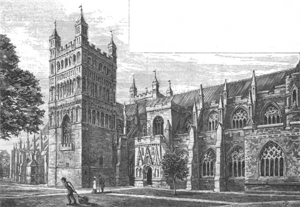
1. STUDLAND CHURCH. 2. RUINS OF OLD CROSS IN THE CHURCHYARD.
Exeter Cathedral is the most conspicuous feature in the view upon approaching the city, rising well above the surrounding houses, its two massive gray towers giving it something of the appearance of a fortress. This feature makes it unique among English cathedrals, especially as the towers form its transepts. The close is contracted, and around it are business edifices instead of ecclesiastical buildings. The exterior is plain and simple in outline, excepting the western front, which is a very rich example of fourteenth-century Gothic. A church is said to have been standing on its site and dedicated to the Benedictines as early as the seventh century, and it lasted until after the Norman Conquest. The Normans built a new church in the twelfth century, which contained the present towers, but the remainder of the structure was afterwards transformed as we now see it. The rich western façade consists of three stages, receding one behind the other; the lower is the porch, subdivided into three enriched arcades containing figures and pierced by three doorways. The second stage is formed above this by the ends of the nave and side-aisles, being terminated with a battlement flanked by small pinnacles about halfway up the nave gable. A fine window pierces this stage, and above it the remainder of the gable forms the third stage, also pierced by a window which opens over the battlement. The figures in the lower stage represent the kings of England, apostles, and saints. The interior of the nave discloses stone vaulting and Decorated architecture, with large clerestory windows, but a small triforium. The bosses of the roof, which presents an unbroken line, are seventy feet above the floor. One of the bays on the north side of the triforium is a beautiful minstrels' gallery, communicating with a chamber above the porch. The inner walls of the towers have been cut away, completely adapting them for transepts, the towers being supported on great pointed arches. In the large east window the stained glass commemorates St. Sidwell, a lady murdered in the eighth century at a well near Exeter by a blow from a scythe at the instigation of her stepmother, who coveted her property. The cathedral is rich in monumental relics, and it has recently been thoroughly restored. Little remains of the ancient convent-buildings beyond the chapter-house, which adjoins the south transept.
THE THRONE, EXETER CATHEDRAL.
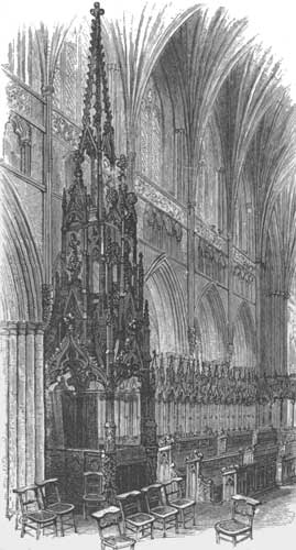
The older parts of Exeter present a quaint and picturesque appearance, especially along the High Street, where is located the old Guild Hall, a ponderous stone building, with a curious front projecting over the footway and supported by columns; it was built in the sixteenth century. Sir Thomas Bodley, who founded the Bodleian Library of Oxford, was born in Exeter, and also Richard Hooker the theologian. Among its famous bishops was Trelawney (then the Bishop of Bristol), who was one of the seven bishops committed by King James to the Tower, and whose memory still lives in the West-Country refrain, the singing of which had so much to do with raising the English revolt in favor of the Prince of Orange:
"And shall Trelawney die? And shall Trelawney die? There's twenty thousand Cornish lads Will know the reason why."
THE MINSTRELS' GALLERY, EXETER CATHEDRAL.
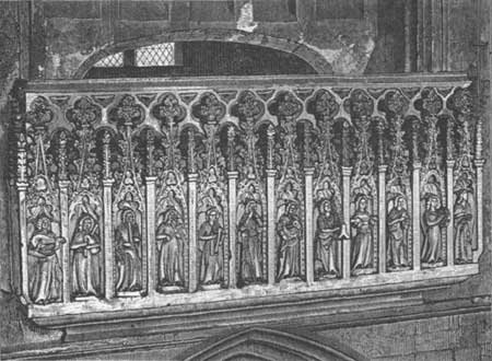
THE GUILD HALL.
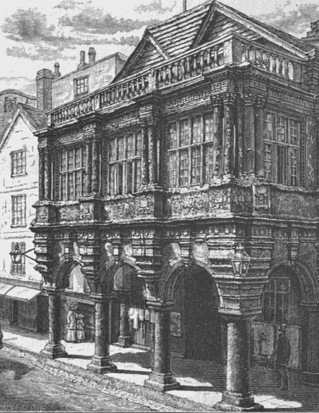
TEIGNMOUTH AND TORBAY.
BABBICOMBE BAY.
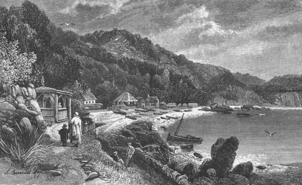
ANSTIS COVE.
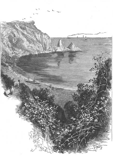
From the estuary of the Exe the Devonshire coast trends almost southward towards the mouth of the Dart, being everywhere bordered by picturesque cliffs. Nestling in a gap among the crags, under the protecting shelter of the headlands, is the little watering-place of Dawlish, fronted by villas and flower-gardens, and having to the southward strange pinnacles of red rock rising from the edge of the sea, two of them forming a fanciful resemblance to the human figure, being named the Parson and the Clerk. A storm recently knocked off a considerable part of the Parson's head. Upon their sides, piercing through tunnel after tunnel, runs the railway almost over the water's edge. Soon the cliffs are breached with a wider opening, and here flows out the river Teign, where is the larger watering-place of Teignmouth, which has frequently suffered from Danish and French invasions, but is now best known by having the longest wooden bridge in England spanning the river-estuary and extending seventeen hundred feet, with a swing-draw to permit vessels to pass. The valley is broad, with picturesque villas on either bank. Below Teignmouth the shores project into the sea at the bold promontory of Hope's Nose, which has Torbay on one side and Babbicombe Bay on the other. Here, around the shores of the bay on the southern side of the projecting cape, is the renowned watering-place of Torquay, which has grown enormously since it has become such a fashionable resort in recent years. Its beautiful scenery and sheltered position have made it a favorite home for invalids. Its name is derived from the neighboring hill of Mohun's Tor, where there are ruins of an abbey. To the north of the headland is the fine sweep of Babbicombe Bay, with a border of smooth sand beach backed by steep cliffs, above which is the plateau where most of its villas are built. To the south of the headland Torquay spreads around a fine park, with highlands protecting it on almost all sides, while farther to the southward the limestone cliffs are bold and lofty, one of them presenting the singular feature of a natural arch called London Bridge, where the sea has pierced the extremity of a headland. Upon the eastern face of the promontory of Hope's Nose, and just below Babbicombe Bay, another pretty cove has been hollowed out by the action of the waves, its sides being densely clothed with foliage, while a pebbly beach fringes the shore. This is Anstis Cove, its northern border guarded by limestone cliffs that have been broken at their outer verge into pointed reefs. Compton Castle, about two miles from Torbay, is a specimen, though in ruins, of the ancient fortified mansion of the reign of Edward III. It is of massive construction, built of the native limestone, and part of it is now used as a farm-house. Following around the deeply-recessed curve of Torbay, its southern boundary is found to be the bold promontory of Berry Head, and here on the northern side is the old fishing-port of Brixham, having Church Brixham built up on the cliffs and Brixham Quay down on the beach. It was here that the Prince of Orange landed in 1688, and a monument in the market-place commemorates the event, the identical block of stone on which he first stepped being preserved.