SCHOFIELD The Flower Garden of the Rockies
Reading edition
(Elevation Approximately 10,000 feet)
Schofield has been called “The flower garden of the Rockies” and rightly so. It is carpetted with multifarious species of flowers, ranging from the delicate snow flowers and Alpine mosses through several shades of Indian paint brushes, blue and purple lupines, and wild roses to the lusty sunflowers. It is especially beautiful in July and August when there are literally hundreds of acres of blue, purple, lavender, gold, and brown columbines.
In the early 1870s gold, silver, copper, lead, zinc, and galina were found in this region, so naturally a mining camp mushroomed over night into a village of 50 or 60 houses. These were the regular camp-style buildings with no foundations, resembling huge packing boxes. There was also a store, hotel, concentration mill, and several saloons. While its population sometimes soared into the thousands, it was a transit, moving people, living mostly in tents and always looking for better prospects.
Frank Hall’s “State of Colorado,” Vol. IV, page 150, date 1895, has this to say about this mining camp:
“Schofield was surveyed and platted August 24, 1879, by J. Evans for a company composed of Daniel Haines, S. H. Baker, B. F. Schofield (for whom it was named), H. G. Ferris, Wm. Agee, E. D. Baker, A. H. 10 Slossen, and G. Edwards. It is located on Rock Creek (now called Crystal River) between Elko Basin and Crystal City, eight miles northwest of Gothic, and some 40 miles west of Gunnison. It never was a camp of much importance, though a central station for a number of prospectors.”
General Grant is supposed to have ridden into Schofield on a white mule when he was campaigning for the U. S. presidency. Some of the prospectors tried to sell him some mining claims; being unsuccessful in that, they attempted to get him into a poker game and lose a claim to him so they could boast, “The President of the United States owns mining property in Schofield.” But they weren’t proficient enough in “stacking the cards” to deal him a winning hand. Wishing to show him the grandeur of the canyon they took him where he could look down into the Devil’s Punch Bowls and told him it was called the “SOB Canyon.” He agreed it was appropriately named but suggested a name that would be even harder to beat, “The Schultz Canyon.” Schultz being his political opponent at the time.
Schofield flourished for 12 or 14 years, then they decided the cost of transportation was far more than the mineral mined warranted, so in 1886 practically the entire town was moved down the valley four miles and Crystal City was started. Schofield became truly a “ghost town.”
It has always been easier to enter Schofield from Crested Butte than from Crystal, but now with the opening of a jeep road between Schofield and Crystal City all that has been changed and today a new Schofield is in the making. This time it is to be a 40-acre tract of modern buildings containing a 24-housing unit, a motel, and a store. None of the over-night constructed mining shacks this time, but modern log cabins built to withstand the elements at this nearly 10,000 foot elevation.
Leaving Schofield, the Crystal River goes through some of the most spectacular scenery in the world. It runs down a ravine 50 feet below the road, over boulders, through crevices, always in a hurry, it plunges over a ledge into the Little Devils Punch Bowl, then it cascades over another ledge making an impressive waterfall as it drops into the Big Devils Punch Bowl many feet below, where it seethes and swirls trying to find a way out to go on down the canyon.
The trail above the river was used as a wagon road from the early 1880s to about 1917. John A. Williams drove a team of mules over it in 1911 hauling supplies for the Williams General 11 Store in Crystal. Anton Danni drove a supply wagon over it in 1916. The following item was taken from the Marble Booster newspaper, Aug. 12, 1916:
“Tom Boughton, John J. Walsh, D. E. Dever, and Chas. Sisteg, elected at a caucus to represent Marble as delegates to the Democratic County Convention which convened at Gunnison Monday, left here early last Sunday morning, via Crystal (Schofield Pass) driving (horses) most of the distance and enjoying a motor ride the rest of the way.”
These are the last authentic accounts of this wagon road being used I can find; so presume it was closed by rock slides shortly after this date. Over 40 years passed before this scenic part of Colorado was again made available to travel, mainly through the efforts of Gunnison County Commissioner Anton Danni and his road overseer who made several trips from Schofield to Crystal City, on foot, to see if it were possible, and feasible, to open a jeep road. They decided it was and on Aug. 5, 1958, after many months of hard work, the first jeeps came through from Crested Butte to Marble. In 1959 they hope to improve the road enough to permit passenger cars to come down; but no vehicle without a 4-wheel drive could make the trip up the canyon.
The first group to make the trip over the new road was composed of the following people:
Mr. and Mrs. W. P. Cain Almont, Colo.
Mr. and Mrs. Bart Cox Almont, Colo.
Mr. and Mrs. John Ramsey Almont, Colo.
Mr. and Mrs. R. A. Gauby Santa Monica, Calif.
Mrs. Jane Schmidt Almont, Colo.
Mrs. C. Haase Almont, Colo.
Mr. and Mrs. I. Fifer Lake Forest, Ill.
Mr. and Mrs. O. W. Shumate Milwaukee, Wis.
Leaving the punch bowls the river runs another mile and a half before the North Fork from Lead King Basin joins it. This tributary drains another scenic valley. Snowmass Peak (14,077 ft. El.), Maroon Peak (14,158 ft.) and Hagerman Peak can be seen in the background. Beautiful trails wind through the various draws leading to Geneva Lake and the Maroon Belles where fishing is at its best. This is also a highly mineralized valley: silver, copper, lead, and zinc predominating. The Copper King, 20th Century, Winchester, El Negroero and half of the Richardson, all located in this basin, belong to Lee Sperry of the Ragged Mountain district.
12
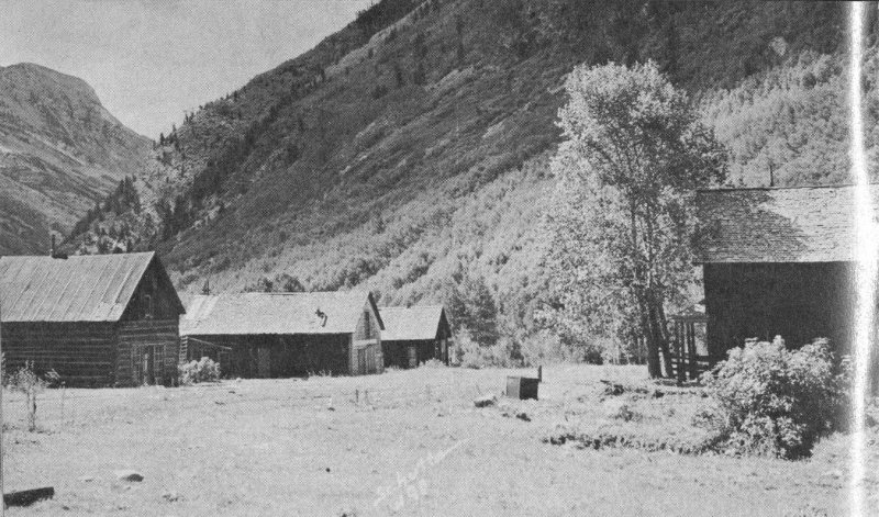
CRYSTAL CITY MAIN STREET—Crystal Club, printing office, and hotel are some of the buildings still standing. —Photo courtesy John B. Schutte, Glenwood Spgs., Colo.