CHAP. III.
Reading edition
Eastern rivers — Misselad or Gir, source and course — Dar Saley — Wara — Other rivers — Gir turns west — Lake Fittre — Magnitude of River; Junction with the Shary — Bahr-el-Feydh — Bahr Djad — Course of Gir west — Gambarou — Birney — Bornou — River Tzad — Face of the country — Cano or Ghana — Kashna — Gulbe, supposed course of ditto — Position of Kashna — Junction of eastern and western rivers — Vancara or Owencara; what it is — Bito — Temian — Cannibals — Junction of Gir and Bahr Kulla, source and course of ditto — Mount Thala — Miri — Junchor and Bahr Salamat Rivers — Lake Haimat — Island at the Junction of Gir and Niger — Lybia Palus — Lake of Jackson, or Sea of Sudan; what that is — Robertson — River Loro — Fillanee — Water communication between the sea coast and north-east parts of Africa — Course of the Niger to the sea in the Bights of Benin and Biafra — Boundary of Benin — Bahr Kulha; what it is.
Before examining more particularly the accounts of the country from Wassanah to the sea, and the outlets of the Niger from other authorities, it is necessary to turn our attention to the immense supply of waters which it receives from the eastern and the north-eastern parts of Africa. With our present information, it is not easy to fix with accuracy the points where these waters form a junction with the Niger. Nevertheless, it is hoped that this may be done with sufficient accuracy, to shew the great geographical outlines of the rivers of northern Africa, which are the object of the present research. Let us take the chief or parent stream first.
On the north side of the chain, which gives birth to the Bahr-el-Abiad, or chief branch of the Egyptian Nile, springs the Misselad of Browne, the Abou Teymam, or Om Teymam of Burkhardt, and the Gir of Ptolemy. It is satisfactory to learn, from the authority of Burkhardt, the discovery of this long lost name. It is called by the natives of these parts Djyr, which, in the Egyptian pronunciation, sounds Gir. Mr. Beaufoy was informed, that the river of Bornou rose “from the same source,” or, in other words, in the vicinity of the Egyptian Nile. Leo also heard the same thing reported. Edrisi states the matter distinctly; and Ptolemy evidently brings it from the southernmost point of his Garamantican rampart, in 10° north latitude. The Gir flows first in a north-north-west direction towards the kingdom of Dar Saley or Borgo. Inclining more to the north-west, it passes the parallel of Wara, the capital of Dar Saley, three days’ journey to the west of that city; and, according to the accounts obtained by Dr. Seibzen, it is in this part of its course as large as the Nile in Egypt, or near half a mile broad. From the eastward, according to Burkhardt, it must have previously received the Oul Rashid, Abou Redjeyle, and Om Ettyman, besides other streams, which flow from the kingdom of Darfur. The country between Wara and Darfur is mountainous and rocky. Deep lakes are formed by the rains which remain throughout the year, and afford retreats for the crocodiles and Hippopotami. The natives of Dar Saley use canoes in passing their rivers, a proof of the magnitude of the same. The country about the sources of the Misselad, is represented as extremely mountainous, and giving birth to numerous streams. Westward of Wara is several very high mountains.
Running northerly from the parallel of Wara, the river soon after turns west, and, flowing in that direction a distance of 11 days’ journey, (Browne,) it falls into lake Fittre, certainly the Nuba Palus of Ptolemy. The coincidence is very remarkable. Lake Fittre is two days journey south-east of the Bahr-el-Gazalle. The size of this lake varies in the relations given by different travellers. Some make it four days’ journey in circumference, others 15. The difference may proceed from the one account relating to the magnitude in the dry, and the other in the rainy season, and estimating by different scales. This lake is also called by the Arabs Caudee and Bahr-el-Noëh. According to a tradition, the waters of the deluge were absorbed in it. A very high mountain is situate near it. (Bowditch, p. 203.) It is evidently the same lake as that mentioned by Leo, as lying 150 miles east of Bornou. From Dar Saley to lake Fittre, the country, it would appear, is rather flat than mountainous, and much flooded during the rains. (Burk. p. 484.) Towards the Bahr-el-Gazalle the land is woody, and the soil clayey. (Browne.)
Issuing from lake Fittre, the river takes a western course. According to the accounts obtained by Ritchie, it is hereabouts one mile broad, and very deep. (Quart. Rev. May, 1820.) At the distance of 12 days’ journey from the lake, (Bowditch, p. 203,) the river is joined by a large stream descending from the north-east, and called the Sharee or Shary. Burkhardt also was informed that it flowed from north-east to south-west, and was as large as the Nile in Egypt, (2000 feet broad,) full of fish, and abounding in crocodiles. This stream, there is reason to believe, is also called the river of Baghermee. From its magnitude at its junction with the Gir, the sources must be remote, and towards the eastern parts of the mountains of Tibbou of Bilmah. In these parts, according to Burkhardt, (p. 488,) the country is flat, flooded during the rains, and fine water is abundant found even during the dry season, upon slightly digging the sands. Therefore it is called Bahr. The sweetness of the water shews that it is entirely free from the saline particles of the desert, and, therefore, on the confines of those countries where rivers spring forth. Perhaps this is the stream which forms the Chelonidæ Paludes of Ptolemy. A considerable river, called the Bahr Djad, runs into the Shary on its western side, before the junction of the latter with the great river. Also, on the eastern side, the Shary, in like manner, receives a still more considerable stream, called Bahr-el-Feydh, or inundating river. (Burk. p. 478 and 479.) On this river, or near it, according to the same authority, is situated Kanem in the Bahr-el-Gazalle. Edrisi mentions a river called the Nile, three days’ journey from the town of Angimi, in the province of Kanem. According to Bowditch, (p. 213,) six days’ journey east of the confines of Bornou, and close to Aweeac, travellers pass a very large river, called by the negro merchants Zerookoo Kerooboobie. It is evidently the Shary, which is said to be 15 days’ slow march eastward of the confines of Bornou. (Burkhardt.)
From the junction of the Shary the great river continues a westerly course, and, it is probable, under different names. The exact course is not readily delineated. Nevertheless we cannot err far in the chief features. At no great distance from the junction of the Shary, the mighty stream approaches within half a day’s journey of the capital of Bornou, and passes the port of this city named Gambarou. Here it is joined by another river from the northward; but whether this river is called Kamadkoo, (the same as the Kammadoo mentioned to Mr. Hutchison, Bowd. p. 213,) and the great river, Tshadi or Tzad; or, that the great river bears the former name, and the river from the north the latter, it is difficult in the present state of our information to determine. Hornemann was informed that the river of Bornou was called Zad, and that it was a mile broad. Burkhardt was also informed, that the river was called Tzad, and he was told that it flowed at a short distance from the capital; therefore, the Tzad may be taken as the proper name of the great river, particularly as we find it bears that name in its lower course. The river, coming from the northward, as conjectured by Burkhardt, probably springs from Mount Dirka, in the great range of hills south of the desert of Bilmah. These mountains lie nearly under the tropic of Cancer, and in about 21° east longitude, corresponding with the chain Girgiris of Ptolemy. The river that he mentions springing from Mount Girgiris in two places, 5° of longitude separate, may be the river we have mentioned, or the Shary. The resemblance is very striking. Across a desert 200 miles broad, and south-east from Fezzan, lies the country of Tibesti, full of fertile vales and mountains, affording excellent pasturage. Though it never rains in this country, still springs are abundant. In this country, therefore, and to the southward and eastward of it, in all probability, rise all the rivers which flow south from the river, which passes the capital of Bornou to the Shary. From the extent of country through which these flow, it is evident that they must be powerful streams.
A native of Bornou informed Dr. Seitzen, that the river, within a mile of the city, was as large as the Nile in Egypt, abounding with hippopotami and fish. It was navigated by vessels having sails and oars. It overflowed its banks, and, during the inundation, a virgin female slave, richly dressed, is thrown into the river by order of the king. Bowditch, (p. 218,) was informed, that a small river, called Gaboöa, ran southwards near Bornou; and Burkhardt was told, that the river formed a lake of a considerable size, on the west side of which stood Birney, the capital of Bornou, a city of such magnitude, that travellers, in describing it, state, “Cairo was a trifle to it.” Other authorities, however, deny the existence of any lake; and, whether the river Gaboöa mentioned to Bowditch, is the same as that alluded to by Burkhardt, it is difficult to determine. They may be the same; and the smallness of the Gaboöa may be estimated in comparison with the great river.
All the countries through which the rivers we have mentioned flow are very mountainous and woody, and greatly inundated by the tropical rains. They are also populous, powerful, and well cultivated. The inhabitants are great traders. Bornou is a mighty empire. Its authority is acknowledged to the banks of the Niger. The sovereign is represented as more powerful than the emperor of Morocco. Wangara and Kashna are subject to him. This country is situated a great deal farther to the southward and the westward than has hitherto been allowed. Burkhardt is of opinion that it lies not much to the eastward of south from Fezzan. According to Browne, (p. 448,) from Cubcabea in Darfur, by Wara to Bornou, is 60 days’ journey. This places it much to the westward. Two things prove its southern position: First, its territories are said to extend to within 20 days’ journey of the Bahr-el-Abiad. Second, elephants are found there, which animals, it is well known, cannot live in the dry countries to the northward. The country of Bornou is, in general, level, and very rich and fertile. It produces maize, rice, beans, cotton, hemp, indigo in abundance, grapes, apricots, pomegranates, lemons, limes, melons, &c. and plenty of sheep, goats, camels, horses, buffaloes, and horned cattle. There are also lions, leopards, wolves, foxes, elephants, and the rivers abound with fish, crocodiles, and hippopotami. This country is what was known to the early Arabian geographers as the land of Kanem, a very extensive region and powerful state, ruled by the Beni Wayl, one of the most ancient and powerful of all the Arabian tribes.
From the port of Bornou, the Gir (for we shall retain the ancient name) continues its course west, declining southward; and, from the accounts received by Ritchie, at a distance of 12 days’ journey, reaches Cano, no doubt the ancient Ghana. Bowditch calls it Kano, or Kanoo, and makes the distance 24 days’ journey. Ritchie’s informant, however, might mean the frontier of the kingdom, while the distance given to Bowditch, extends from capital to capital. The river here, according to Ritchie, is called Tshadi. Bowditch, (p. 211,) says he was informed that the river skirted Kano and Oongooroo, or Vancara. In the Geography of Joannes Bleav, (p. 105,) it is particularly mentioned that the kingdom of Cano extends, for a part only, along the channel of the Nile on the right hand. This would serve to shew, if correct, that the course of the stream turned more to the southward, leaving the territories of Cano. This is by no means improbable. A difficulty, however, here occurs, as we shall see presently. Ritchie’s informant appears to make the river continue westward to Kassena, which he stated was only 5 days’ journey from Cano; here again he seems to mean the frontier of the former kingdom, for Bowditch was informed that the distance was 10 days’ journey. Ritchie’s informant, Hadji Hamet, states that Kassena, (Cassena, or Cashna) was upon the river here called Gulbe; and as broad as from the gate of Tripoli to the Bazaar on the sands, or one-third of a mile. It would appear, however, that when speaking of the Gulbe, he is speaking of a different river to the great river. The name of the latter above Kashna, is Tshadi. The name far from and below it is Tshadi also. It is not at all probable that he would mention the river in Kashna under a different name to that which the same stream bore, both above and below that city. Besides, the magnitude of the Gulbe, only one-third of a mile, would shew it to be a different river from the Tshadi, which, and much nearer its source, is represented by various authorities as three times the breadth of the Gulbe. Hornemann also heard that in the country of Houssa and Kashna, there was a river called Gulbe.
Mr. Lucas was informed that Kashna was 5 days’ journey, about 65 miles north of the great river. Bowditch, (pages 207 and 211,) gives it the same distance; for he states that, three days’ journey from Goobur, and 13 from the Niger, travellers, in their route to Kashna, pass “a large river.” The point to be determined here is, what river is it that is here mentioned? It is not the Niger. If it was the Gir continuing to flow westward, then that stream would join the Niger at the place where the ferry mentioned by Sidi Hamed is placed: but, on the other hand, it may be a stream descending from the north, and which, passing Kashna under the name of Gulbe, flows south to join the Gir, the latter river having previously bent its course in that direction. Sheeref Imhammed says that the Nile, or the great river, flows west through the kingdom of Kashna with a rapidity no vessel can stem; and that its breadth at the island called Gongoo, where the ferry men reside, is so great, that the sound of the loudest voice from the northern shore can scarcely be heard. Its depth is 24 feet. Still, however, this river may be said to run westward through the kingdom of Kashna, and not reach the Niger at the point supposed. It may also there join the Niger, and yet, previous to its doing so, receive the waters of the Gulbe from the northward. Whoever casts his eye upon the map, and considers the nature and extent of the country to the northward of Kashna, must perceive that it is not at all probable such a great space can be destitute of rivers. The cultivated country commences from the Tropic, 450 miles to the northward. A river descends from the Tropic of Cancer, and passes Agadez. D’Anville calls it Wad-el-Mezzeran, and makes it rise in about 26° north latitude. He says the caravans from Tripoli to Nigritia (perhaps kingdom of Kashna,) perform seven days’ journey along its banks. The authors of the Encyclopedia Britannica affirm, that this river joins the Niger. In the French maps of 1757, drawn by Robert de Vagondy for the king of France, this river is laid down as joining the Niger about 250 miles below Timbuctoo. It is also curious, that in all the old maps of Africa, (particularly that by Ortelius, in 1570, and that by Joannis Bleav, 1662.) various rivers are laid down as flowing from the northward and joining the Niger. Cassena, in particular, is laid down by Ortelius on a river; and the river of Agadez is laid down as running into lake Guber. For these things, these authors certainly had positive, though not perfectly accurate information. Upon the whole, however, comparing their accounts with those of the most recent date, there seems the best reason to believe that Kashna does stand upon a river descending from the north, but whether it is the same with that which passes Agadez or not, I cannot take upon me to determine. The probability is, that it is the same.
Kashna, it would appear, stands in 15° north latitude, and 11° 30′ east longitude. At this rate Cano, 130 miles, or 2° farther east, will stand very nearly where Ptolemy has placed his Gira metropolis. This city stood in 18° north latitude, and 36° east longitude, which, corrected as before mentioned, is about 13° east of Greenwich. This correction agrees very well with what Ptolemy says in another place, namely, that this city was in time 1⅛ hour, (or 17° nearly) west of Alexandria, which is exactly 13° east of Greenwich.
Though, from the reasons mentioned, there is a very great probability that a river, or the great river from the east, does join the Niger above or near Yaoora, still the silence of Sidi Hamed and Bowditch, with others, upon that important point, leaves a doubt on the subject. That junction, perhaps, takes place lower down, and if so, must be below Wassanah. That such a junction does take place, must be self-evident, and is, moreover, positively stated. Bowditch was informed that the Moors call the Niger Quolla at Jinnë, and Sansanding, &c. and describes the Joliba as falling into the Quolla, east of Timbuctoo (p. 191.) Here the names are evidently misplaced, no uncommon thing with Arab travellers. (Burkhardt, p. 489,) states that the Tzad of Bornou, and the Joliba were connected together. Leo Africanus also states the same thing, when he says that, during the inundation, “a man in a bark may pass over all the land of the Negroes.” (Purchas, lib. 6. c. 1. p. 765.) In the present state of our information, the greatest difficulty is to determine the exact point where that junction takes place. The accounts concerning this portion of Africa are, as regards these more minute points, very confused and unsatisfactory. The grand features, however, we are still enabled to trace with considerable precision.
It is quite common for the Moors, the Arabs, and the Negroes, in their descriptions of countries through which they pass, to reverse the course of rivers, by placing the geographical line, or bearing, of the bed of each as the course of the stream. It is also very common for them to describe, as one, different rivers which may in their course approach near each other, and to state as a continuation of a river, any stream that joins another coming from an opposite direction. Of these, numerous instances might be given from the narratives of all their authors and travellers. A few may here suffice. Abulfeda says “the Egyptian Nile goes on to the land of the Zingians (Ethiopians;”) and Scheabeddin states, that “many rivers derived from this great river, water Nubia, &c.” Now the Nile does not go to these countries, but is formed by various streams flowing from them. Three Moors described to Bowditch the course of the Niger to Egypt thus: One began it, or made it rise at the mouth of the Senegal,—one in Bambouk, and continuing it along the Senegal, came to the Niger above Sego,—where the third made it rise, and then all three carried the course of the stream down to Yaoora, thence to Noofee, thence to Rakah, thence to Bornou, thence to Dar Saley, thence to Darfur, thence to Sennaar, and thence to Egypt; thus embracing and marking as one, four distinct rivers, all running in different directions. In short, they identify the course of the rivers with the direction of their journey: But having one or more sure points to direct us, such as the course of the Niger east, and the course of the Gir west, it will enable us to decypher with ease, many apparent inconsistencies in accounts given by the Moors, Arabs, or Negroes; and explain their meaning about the Joliba and the river of Bornou being one stream, as well as other things of a similar description.
The eastern parts of Sudan, or Central Africa, which we have been considering, exhibit features very different to what has hitherto been believed. The mountains are numerous, and, as in Zegzeg, of a stupendous height. Around Agadez, the country is delightful, fruitful, and populous. Kashna is beautifully diversified with hill and dale, delightfully wooded, and well cultivated. Here and there to the northward, strips of desert countries, and a bare ridge intervenes, but the fruitful land prevails. The rivers, which are found in almost every part, are of great magnitude. Ritchie was informed that, in that part of its course due south of Fezzan, the great river is so broad, that people can scarcely see an object on the opposite bank. Cities of very considerable magnitude rear their heads on every side, and at short distances from each other. Commerce is active; cultivated fields, flocks and herds, every where meet the eye. None of these things could be found in a country wild or full of sandy deserts, or inhabited by mere savages.
In this part of Africa, all accounts agree, the streams bend their course to the southward. Amadou Fatouma, “who was the greatest traveller in this part of Africa, told Park that he was certain that the Niger did not terminate either in Kashna or Bornou, as he had been in both these places; but that, after passing Kashna, the river turned, and ran to the right hand (south.”) Its further course was to him unknown. Hornemann was informed that the Niger flowed southward from Houssa. Park was informed (so was Hornemann) that the Niger declined south, till it joined the Bahr Kulla. Scheabeddin evidently points out the southerly course of the Niger, when he says, that, except the Nile of Egypt, which runs north, all the other “rivers of Africa have their direction to the east, to the west, and to the south.” There could be no other great river known to the Arabs in his days that flowed south but the Niger.
Taking it as certain that the Gir, or Tshadi, joins the Niger below Wassanah, we will return to that part of its course where it must turn to the south-west. This will be between Cano and Kashna. This necessarily leads us to consider the kingdom or province of Guangara, mentioned by Leo, and, no doubt, the same as the Vancara of Edrisi, and the Owencara of Ibn-al-Vardi. This country is certainly not only situated upon a river, but at the junction of one or more rivers. Bowditch, (page 212,) informs us that it is called Oongooroo, being a negro corruption of the Arabic name. It lay between Kano and Bornou, and was skirted by a river on the north: at present, it seems much reduced in its opulence and extent. According to Leo, it extended westward as far as Zamfra or Zamfara, which, we learn from Bowditch, adjoins Guber on the north-west. On the east it is bounded by Bornou, to which power it is subject. Edrisi calls it an “empire,” which shews its former extent; formerly it was subject to Ghana. It was then a very rich country, and carried on a great traffic with the neighbouring and distant countries in gold dust, found in the country itself, and also brought from mountainous districts to the southward. This district is much flooded in August, when the inundation is highest. According to Edrisi, it is “most famous for its excellency and abundance of gold;” and, according to Ibn-al-Vardi, it is “the country of gold and aromatics.” The gold, they inform us, is collected after the flood retires; then the inhabitants “slightly dig the earth, and not one of them is disappointed in his labour.”
These Arabian authors call this district an island, and say it was 300 (Arabic) miles long, and 150 miles broad, surrounded by the Nile all the year, says Edrisi—but only on three sides, says Ibn-al-Vardi. The former calls it an “island,” the latter an “isle or peninsula.” It has been already noticed that these writers use the words isle, or peninsula, or lands lying about and between the junction of rivers, as synonymous terms. Two examples may suffice. Ibn Selym, the old Arabian traveller already quoted, says, regarding the Egyptian Nile, that “an island is enclosed between the Bahr-el-Abiad and Bahr-el-Azreek, the upper end of which is unknown, as is likewise the extremity of these rivers;” and again, concerning the branches of the Bahr-el-Azreek, “they have fewer side-channels and islands” than the other rivers. (Burk. p. 499.) This affords us a complete elucidation of what the Arabian geographers meant by the Island of Vancara. With this explanation also we unriddle much of the Arabian geography. Edrisi says the frontier of Vancara lay south-west of Ghanah about 8 days’ journey. Ibn-al-Vardi says this country was situate “on the shore of the great Bahr,” (river or lake,) which would seem to point out the lake into which the Gir, or Tshadi, enters. Vancara therefore seems to comprehend the country in the middle course of the Gir to the lake, and may also be intended to include the country betwixt the Gulbe and the Gir, the Gir and the Niger, and might extend to another large river about to be mentioned. The land betwixt them is, in the oriental style, denominated an island.
East of Bito, and south of Guangara, is the large district of Temian, inhabited, according to Leo and others, by a wild savage people, who are represented as cannibals. I notice this here for two reasons; first, because it is said that this country is bounded south by the Niger, which shews how much both it and the Gir decline south even according to ancient authorities. It is uncertain which river is meant; but as Bito is represented as being east of Guber, and Temian east of Bito, the river which bounds Temian on the south is more probably the Bahr Kulla than the Niger. Second, I notice this kingdom because various other authorities mention a nation of cannibals in this part of Africa, and also that they are near the Quolla or Niger. Mr. Bowditch, (page 202,) was informed that their country was called Canna, Dall and Yum-Yum, and subject to Quollaliffa, or Quollaraba, a powerful kingdom on the Niger, below Noofee or Nyffe. Hornemann was informed they were called Yem-Yems, and that their country lay to the south of Cano. Yam-yam was also heard of by Burkhardt, as a Pagan country very far distant from Dar Saley. Browne also was told of this Pagan country very remote from Darfur, and called by the Arabs Gnum-Gnum, whose inhabitants eat their prisoners taken in war. (Browne, p. 310.) This is no doubt the country called Temian by Leo and others, and which is said to be bounded south by the Niger.
Descending south-west, the Gir approaches its confluence with the Niger, and near which it is probably joined by a very large river called Bahr Kulla. The proper name of it however is perhaps different. This must be a very large river. It may take its name from the country from whence it flows, and in which it takes its rise, namely, Dar Kulla. All accounts agree in placing this country nearly south-west of Darfur. The branches which form the river in question rise on the west side of the mountains of El Komri, which give birth to the Bahr-el-Abiad, or Egyptian Nile. The country hereabouts is extremely mountainous and woody; large rivers must consequently soon be formed. Browne informs us that in this part of Africa the rivers were numerous and large, and that they were crossed in ferry-boats hollowed out of a single tree, and managed partly by poles and partly by double oars. Burkhardt also informs us, from good authority, that Dar Kulla, and the countries around, “were throughout mountainous, and that several very large rivers flowed through them, which were never dry,” a strong Arabic expression, denoting rivers of the first magnitude. The rivers, according to Browne and others, take courses first north-westerly; in this point corroborating the earliest authors, and corresponding very accurately with the features of the country as delineated by Ptolemy. The sources are east of his Thala mountain, north of his Aranga mountain, and west of that chain which intervenes between these springs and the Misselad. The Bahr Kulla is perhaps the branch which Ptolemy mentions joins the Niger from the east above the Lybian Lake.
Bounding the range of Mount Thala, in a westerly course, the Bahr Kulla declines southerly till its junction with the Gir, where the united stream soon after joins the Niger, if the two streams do not join it at the same place. Many Moors and Arabs who travel in the interior of Africa, state, that the Niger joins the Bahr Kulla, and flows to form the Bahr-el-Abiad. Bowditch, Park, and Hornemann, were each told this; and an Arab pilgrim, in the suite of the Morocco Princes, told Captain Dundas of the Tagus frigate, that the Niger communicated with the Nile of Egypt, through the sea of Sudan. All these accounts only tend to prove the course of a river in the direction already mentioned, and its subsequent junction with the Niger. Better authority enables us to shew the junction of the Bahr Kulla and Bahr-el-Abiad to be a misapprehension, arising from the manner in which the Arabs frequently express themselves on these matters. Of the junction of the river which comes from Dar Kulla with the Niger, there is no doubt; but it is probable that the words Bahr Kulla, or Kûlha, have a very different signification than this particular river.
Betwixt the river of Kulla and the Misselad there is a great extent of country where rivers rise, and flow to join the Gir in its middle course. Of these, however, we are imperfectly informed. The chief seems to be that called Bahr Salamat, which runs north-west, and passes through Lake Haimat. Numerous other streams, however, spring in those parts, and pursue their course in a westerly direction, but which no traveller has yet completely explored. The chief of these streams are the Miri, the Junchor, and the Terruge, the latter between the Miri and the Salamat. The two first are certainly large streams; in their upper parts their courses are north-westerly, and there is little doubt but, as Major Rennel supposes, they join the great river in Vancara. Hence it is easy to see that this country must be greatly flooded during the height of the floods in August. It is curious that, carrying their lower courses on the bearings mentioned, that the positions and bearings, and distances of Reghebil and Ghanara, (both situated on fresh water streams or seas,) as given by Edrisi from Ghana, and from each other, should correspond so very exactly.
Browne mentions a singular circumstance, that merchants from Darfur, who go to Dar Kulla across the Misselad to trade, do not return till the end of two years, and that they occupy from 80 to 90 days in going there, and as much on returning. This would indicate that the country was at a much greater distance than in the immediate vicinity of the Mountains of the Moon. In fact, at ten miles per day, it would reach almost to the flat country near Benin. There may, however, be some error even in the reckoning, or some particular obstructions to travelling, which indeed must necessarily be very slow through such a woody, hilly, and well watered country as intervenes. He mentions also that the inhabitants are partly copper-coloured, which would indicate a mixture of Arabs; and that this country was towards the west and centre of Africa. On the other hand, the kingdom being invaded by the arms of Dar Saley, would shew that the distance from the latter is not very great.
The junction of the Gir with the Niger, I suppose, takes place in about 10° east longitude, and 9° north latitude. Jackson, in his favourite theory, that a water communication exists between the Nile of Sudan and the Nile of Egypt by means of the Bahr Kulla and the Bahr-el-Abiad, states the belief to be, that such a union of waters takes place in Bahr Kulla, Wangara, or the Sea of Sudan. That this union, by the junction of the streams about these parts of Africa, does take place, there is little room to doubt. But Mr. Jackson seems at length to have renounced the idea that the Bahr-el-Abiad is a continuation of the Niger. (Jackson’s Shabeeny, p. 443.) Almost all accounts, ancient and modern, speak of a large lake in the central parts of Africa, but its exact position it is very difficult to fix; indeed, it would seem that there are more than one lake in these southern parts of Africa. Some authorities, however, by identifying the ocean with the lake, or lakes with the ocean, may thus create the apparent uncertainty. In the map by Ortellius, in 1570, this lake is called the Lake of Guber, which would lead us to look for it about the place where that kingdom is placed. There can be no doubt that the lake in question is the Lybian Lake laid down by Ptolemy in 16° 30′ north latitude, and 35° east longitude, or, when corrected, from 11° to 12° east of Greenwich. This is east of the course of the Niger at Yaoora, above 3° 30′, which would bring the position of this lake directly in the course of the Gir to the southward. Ptolemy has placed it in 16° 30′ north latitude; but we have seen that he was 3° wrong in the position of the Nigrites Palus, and a similar allowance may fairly be made for the position of his Lybia Palus. This would place it in about 13° north latitude. It is remarkable that Hadji Hamet informed Mr. Ritchie that “at Nyffe there was a large sea, not salt but sweet, and that the river Tshadi (river of Bornou or Gir,) came out of that sea and flowed to the Egyptian Nile. He could not tell whether the river of Timbuctoo flowed into that sea or not.” (Quart. Rev. May, 1820.) The misapprehension concerning the true course of the Tshadi is here so obvious, that it scarcely requires pointing out; the fact, however, of the Gir flowing into this lake, and the coincidence with the Lybia Palus of Ptolemy, is very remarkable and important. The lake being formed by the Gir, and not by the Niger, sufficiently accounts for no notice being taken of it by Sidi Hamed in his journey to Wassanah.
Jackson states that this lake, which he takes for the Sea of Sudan, is 450 miles eastward of Timbuctoo, and that “the Neel-el-Abeed (Niger) passes through it.” (Jack. Shab. p. 486.) This, supposing that city to be in 3° east longitude, would bring the position of the lake to be in 10° 30′ east longitude, 1° or more to the west of the point mentioned. It must however be observed, that, in tracing the course of the Niger below Timbuctoo, I have followed the bearings given by Sidi Hamed. It is possible that it may be carried 1° too far east, and the course of the Gir not carried sufficiently to the westward. Perfect accuracy in these things at present is impossible, nor does the want materially alter the grand features it is my chief object to delineate. Jackson says that “a lake is formed by the waters of the Neel-el-Abeed, of which the opposite shore is not visible. It is navigated by large vessels, which sometimes come to Timbuctoo, manned by a particular kind of people. On its eastern bank begins the territory of white people, denominated by the Arabs N’sareth,” (Christians.) From this description it is quite evident that the “lake” here mentioned is a different lake to that represented as being situated 450 miles east of Timbuctoo. It is clearly the sea on the Gold coast, and Bights of Benin and Biafra—“a lake whose opposite shore is not visible,” and on the eastern or north-eastern bank of which “is the territory of Christians.” The fact of large vessels coming up from this lake to Timbuctoo, “manned by a particular kind of people,” is an additional proof that the navigation of the Niger is unobstructed from the ocean to Timbuctoo.
The Sea of Sudan, however, or this interior lake, if it really bears that name, is certainly a different expanse of water from the Bahar Sefeena of Park, which Jackson labours to prove is the same. His Bahar Sudan, he asserts, is east of Timbuctoo 450 miles. From Sego to Bœdoo, according to Park, is 30 days journey, in a southerly direction. “One month’s travel,” says he, “south of Bœdoo, through the kingdom of Gotto, (Moosee) will bring the traveller to the country of the Christians, who have their houses on the banks of the Ba-Se-Feena. This water is incomparably larger than the Lake Dibbie, and the water sometimes ran one way and sometimes another.” (Park, vol. ii. p. 229, 8vo. ed.) The words Ba-se-Feena are very properly shewn, by Jackson, to be a corruption of the Arabic words Bahar Sefeena, signifying literally “the sea of ships,” or the sea where ships are seen. The direction, the distance, and every other particular mentioned, however, clearly point out the European settlements on the Gold coast. The water running sometimes one way and sometimes another, obviously relates to the flux and reflux of the sea, a phenomenon which could not fail to arrest the attention of a negro from the interior. The water here mentioned never can be taken as a lake in the interior to the eastward of Timbuctoo; and it is strange that a person of Mr. Jackson’s discrimination in African affairs should attempt to confound two things so clearly distinct. The Bahar Sefeena and Bahar Sudan may be the same; but, if they are so, it is certainly the Gulph of Guinea which is represented under the appellation.
But to return to the junction of the Niger with the rivers from the eastward. From Robertson’s Notes in Africa, lately published, we learn, by information which he received on the coast at Greghwee, from people belonging to the interior, that, forty days’ journey from Greghwee, and in a north-east direction, lay the country of Fillanee, on the river Kakoa, which flowed into a lake called Issebee, near the sea. Still farther, in the same direction, and betwixt the Fillanee and another people called Boolamas, lay the great river Loro, which, descending from the north-west, was at this point joined by several other great rivers, coming from the north-east. At this position there is a large island called Wadamsera, the capital of which is called Oendera, or Wandera. The inhabitants were great traders, and carried on a brisk trade with the opposite banks of the river: what is more remarkable, they were partly Negroes and partly Arabs, but all Mahommedans. It is impossible not to recognize in this account the junction of the Gir and the Niger. The Fillanee country lay 400 miles north-east of Greghwee; between it and the Boolamas lay the river Loro. This term Boolamas does not apply to any particular nation, but it is evidently of the same signification as Boolas, which, according to Bowditch, is a term of reproach which the inhabitants of the sea-coasts, who account themselves more civilized, apply to the slaves brought from these interior parts, as well as to the population thereof in general. One hundred miles farther to the north-east of Fillanee would bring us to the river in question, beyond which are these Boolamas, or savage people, which will correspond with that country already mentioned where it is said they devour their prisoners. The direction and distance from Greghwee, as given to Robertson, would thus agree very accurately with the point where the junction is supposed to take place, and where, it is extremely probable, that an island may be formed. The fact also mentioned, that the population of this island are all Mahommedans, a circumstance unknown in the middle course of the Niger, proves the existence of an easy communication between this place and the north-east parts of Africa, which could only be by water. Park’s guide distinctly informed him, that, on going down the Niger, as far as he knew it, they would touch on the Moors no where else but at Timbuctoo. Shabeeny also distinctly states that “no Arabs are found on the banks of the Nile.” (Jack. Shabeeny.) Sidi Hamed shews this to be correct, when he laments so pathetically, that the population of Wassanah were ignorant of the true faith. The fact of a water communication with the distant N.E. parts of Africa, is otherwise clearly established. Robertson met on the coast, two intelligent Arabs, who came from a country which lay five moons journey distant, in a N.E. direction from Lagos. These men stated that “they came a great part of the way by water, in canoes hired from the chiefs of the country through which they passed.” From the description which they gave of their country, where “all the gentlemen could read and write, and where camels, horses, and cattle of all descriptions were plenty,” (Robertson, p. 288, 289.) it is evident their country must be Bornou. Other authorities, from accounts similarly obtained, give us the like information.
Descending southward from its junction with the Gir and other rivers, the Niger, pursuing his course first south, and then south-west, approaches the low lands in the country of Benin. Here the stream separates, as is the case with other large rivers, into several large branches, which take their course to the sea in different directions. Those again divide into numerous small branches, which intersect the coast in every direction. The inhabitants of Bonny or Bannee river, who traded into the interior by means of that river, state, that the Bonny “came out of a large river in the interior, which made all the rivers in that country.” (Robertson, p. 298.) This is positive testimony to an important circumstance, which the natural features of the country rendered probable. From other accounts which Robertson obtained, it would appear that the Niger, before it approaches the sea, forms a lake called Issebee, from whence the river issues in three streams, which bend their course south-easterly to the sea, and a fourth which flows westerly to Lagos. This lake may be 200 miles east from the latter place, considering the time the travellers took to descend from it to the sea in August when “the water ran fast.” Of its magnitude we are wholly ignorant. It is well known that the same term in Arabic denotes both a lake and a large river, and the Arabs use the same often without discrimination. From a circumstance regarding this lake, namely, that, during the night, the canoes near the shore were carried backwards almost as far as these had advanced down the middle of the stream during the day, (an occurrence which was believed to be the work of some evil spirit,) it would appear that it is merely the reach of a great river. Such a phenomenon Tuckey found at every reach in the Congo. The lake Issebee, therefore, may only be the undivided trunk of the mighty Niger. If the accounts is correct, this lake, or separation of the stream, will be in about 7° 20′ north latitude, and 6° 40′ east longitude.
The country through which the Niger here flows is very level. The mountains, however, are at no very great distance northward from Benin. These mountains are represented by the natives as stretching eastward from the Kong range, and forming a kind of amphitheatre to the northward. Encircling Benin, they descend south-easterly, till they are merged in the high land, stretching north from Cameroons. This is particularly mentioned by Joannes Bleav[7], and also by Robertson. The general features of the country render this very probable. A small stream joins the Niger at Wauwa. Near Goodeberry, we are informed by Bowditch, there runs a river called Leeäsa, but what course it takes we are uncertain. It is possible it may be the Kakoa, on which is situated the Fillanee, as mentioned by Robertson. There is, however, no certainty on this point, and the Kakoa may be a branch of the Niger, or even the Niger itself, though different circumstances lead me to suppose that it is a distinct river, which joins the Niger in or near the territories of Benin.
Before turning our attention to the coast, it is of consequence to consider the explanation which Mr. Jackson gives of the Arabic words Bahr Kulla. The term, he says, in proper Arabic, is Bahar Kûlha, which term signifies the Ocean; and also, an alluvial country. If this explanation is correct, and which there seems little reason to doubt, we have the clearest account of the termination of the Niger. Numerous authorities state, that, in its middle course, it turns to the southward, and flows till it joins the Bahr Kulha, the sea, or the alluvial country. This it certainly does do at the points we have mentioned, and which we are about to consider. It may be necessary further to observe, on what Mr. Bowditch was informed, namely, that, close to the northward of Houssa, were two large lakes; “one called Balahar Sudan, and the other Girrigee Marragassee.” (Bowditch, p. 198.) The first, as Mr. Jackson distinctly states, is clearly a negro corruption of the words Bahar Sudan, and the other, he supposes, is a negro name for the same sea. Bowditch, there is the greatest reason to believe, has completely mistaken the information concerning the position of this lake, or lakes, which must be to the southward of the country of Houssa, and not to the northward of the city of that name. He has been led into the error by taking the city for the country of Houssa, and from not adverting to the misapprehension which both negroes and Arabs are so apt to entertain on these subjects. The greatest care is necessary in order to make them state bearings and positions of places conformably to our mode of expressing these things. They very frequently, in their figures of speech, reverse them. Thus, the shores of the Atlantic Ocean which bound Africa, are called by them the western shores of that sea. “The western border of the ambient sea,” says Abulfeda, “namely, that which washes Africa and Spain, is the Ocean,” &c. We call it the eastern. Here they seem to look to the land, and we to the sea. By applying this rule to Bowditch’s account of the lake north of Houssa, we will see more satisfactorily that he has just reversed its position. Situate to the south of the country of Houssa, it may be either the Lybia Palus of Ptolemy, or else the gulf of Guinea, which, after all, there is reason to believe, will turn out to be the true sea of Sudan.
Before proceeding further, it may be observed, that the Niger, about Yaoora and Boussa, is called Kood, Kaoda, and Coudha, a term of similar import as Quolla. It is not easy to determine, whether the Arabs apply the term Coudha to the Niger, or to the eastern river, or to both streams indiscriminately. It is evident, from the manuscript which gives the account of Park’s death, that the term is applied to the Niger, because he was on the Niger. But to whichever of the rivers it is applied, or, if applied to both, it is clear they communicate with each other. Shereef Brahima, an intelligent Arab, informed Mr. Bowditch, that the water of the Coudha goes to lake Caudee, or Fittre; but he enables us to understand distinctly what he means by that expression, when he says that lake Caudee is “the mother of Coudha,” or, in other words, that the Coudha flows westward from the lake, instead of eastward into it. From the same authority, we learn, that between Gamba and the extremity of Coudha at Yaoora, the traveller passes four rivers, namely, Kadarkoo, Doodirba, Shawanka, and Wada rivers, at the distances as marked on the map. Of their course and magnitude we have no information; but it is probable that the former is to the south or south-east, and that one of them, namely, the Wada, is the same as the Leeäsa river. The distance from Yahndi to each corresponds very accurately. By this information we are enabled to fill up another blank in the geography of Africa, and to fix, with considerable accuracy, the features of the country, and the course which the various rivers take in those parts of that continent.
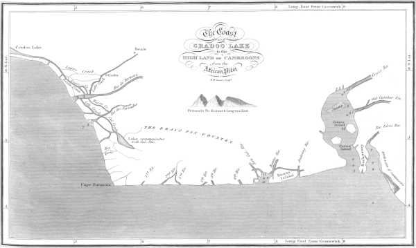
The Coast FROM CRADOO LAKE to the HIGHLAND OF CAMEROONS from the African Pilot W. H. Lizars Sculpt. Page 128.