Volume 2 / Part 2 — CHAPTER XI. TO HEKLA AND THE GEYSIR IN HAUKADALR.[87] (continued 2)
Reading edition
Evidently the several theories require reconciling. A friend wrote to me: “Your suggestion of emptying the Geysir can be done only by a force pump. The long arm of a syphon would require to measure upwards of a hundred yards to find a lower level than the bottom of the tube, which lies eighty-six feet below the upper basin-rim. And even if you succeed, we shall learn very little more than what we already know, or we have reason to assume.” I rejoin that the position of the spring which fills the Geysir after each explosion, and which keeps up the constant flow over its saucer, is a matter of the greatest importance.
Ólafsson produced a new “Gusher,” by simply piercing through eighteen feet of sulphur ground at Krísuvík; and in Tuscany there are artificial soffioni, one of which has been driven 168 metres into strata showing 145° (Centig.). In the present state of science we evidently need not despair of being able to create a Great Geysir upon the grandest scale: these eruptions come from earth’s skin not from her intestines; and the subterranean laboratories of metallic bases are readily opened to oxidation.
Remains now only to walk over the ground, which divides itself into four separate patches: the extinct, to the north-west, below and extending round the north of the Laugarfjall buttress; the Great Geysir; the Strokkr and the Thikku-hverar to the south.
In the first tract earth is uniformly red, oxidised by air, not as in poetical Syria by the blood of Adonis. The hot, coarse bolus, or trachytic clay, soft and unctuous, astringent, and adhering to the tongue, is deposited in horizontal layers: snowy-white, yellow-white, ruddy, light-blue, blue-grey, mauve, purple, violet, and pale-green, are the Protean tints; often mixed and mottled, the effect of alum, sulphuric acid, and the decomposition of bisulphide of iron. The saucer of the Great Geysir is lined with Geysirite (silica hydraté), beads or tubercles of grey-white silica; all the others want these fungi or coral-like ornaments. The dead and dying springs show only age-rusty moulds and broken-down piles, once chimneys and ovens, resembling those of Reykir, now degraded and deformed to couthless heaps of light and dark grey. Like most of the modern features, they drained to the cold rivulet on the east, and eventually to the south. The most interesting feature is the Blesi (pronounced Blese), which lies 160 feet north of the Great Geysir. This hot-water pond, a Grotta Azurra, where cooking is mostly done, lies on a mound, and runs in various directions. To the north it forms a dwarf river-valley flowing west of the Great Geysir; eastward it feeds a hole of bubbling water which trickles in a streak of white sinter to the eastern rivulet and a drip-hole, apparently communicating underground with an ugly little boiler of grey-brown, scum-streaked, bubbling mud, foul-looking as a drain. The “beautiful quiescent spring” measures forty feet by fifteen,[110] and is of reniform or insect shape, the waist being represented by a natural arch of stone spanning the hot blue depths below the stony ledges which edge them with scallops and corrugations. Hence the name; this bridge is the “blaze” streaking a pony’s face. Blesi was not sealed by deposition of silex; it suddenly ceased to erupt in A.D. 1784, the year after the Skaptár convulsion, a fact which suggests the origin of the Geysirs. It is Mackenzie’s “cave of blue water;” and travellers who have not enjoyed the lapis lazuli of the Capri grotto, indulge in raptures about its colouration. North-west of the Blesi, and distant 300 feet, is another ruin, situated on a much higher plane and showing the remains of a large silicious mound: it steams, but the breath of life comes feebly and irregularly. This is probably the “Roaring Geyser” or the “Old Geyser,” which maps and plans place eighty yards from the Great Geysir.
The Great Geysir was unpropitious to us, yet we worked hard to see one of its expiring efforts. An Englishman had set up a pyramid at the edge of the saucer, and we threw in several hundredweights, hoping that the silex, acted upon by the excessive heat, might take the effect of turf; the only effects were a borborygmus which sounded somewhat like B’rr’rr’t, and a shiver as if the Foul Fiend had stirred the depths. The last eruption was described to us as only a large segment of the tube, not exceeding six feet in diameter. About midnight the veteran suffered slightly from singultus. On Monday the experts mispredicted that he would exhibit between eight and nine A.M., and at one A.M. on Tuesday there was a trace of second-childhood life. After the usual eructation, a general bubble, half veiled in white vapour, rose like a gigantic glass-shade from the still surface, and the troubled water trickled down the basin sides in miniature boiling cascades. Thence it flowed eastwards by a single waste-channel which presently forms a delta of two arms, the base being the cold, rapid, and brawling rivulet: the northern fork has a dwarf “force,” used as a douche, and the southern exceeds it in length, measuring some 350 paces.
We were more fortunate with the irascible Strokkr, whose name has been generally misinterpreted. Dillon calls it the piston, or churning-staff; and Barrow the “shaker:” it is simply the “hand-churn” whose upright shaft is worked up and down—the churn-like column of water suggested the resemblance. This feature, perhaps the “New Geyser” of Sir John Stanley and Henderson, formerly erupted naturally, and had all the amiable eccentricity of youth: now it must be teased or coaxed. Stanley gave it 130 feet of jet, or 36 higher than the Great Geysir; Henderson, 50 to 80; Symington, 100 to 150 feet; Bryson, “upwards of a hundred;” and Baring-Gould, “rather higher than the Geysir.” We found it lying 275 feet (Mackenzie, 131 yards) south of the big brother, of which it is a mean replica. The outer diameter of the saucer is only 7 feet, the inner about 18; and it is too well drained by its silex-floored channel ever to remain full. A funnel or inverted cone, whereas the Great Geysir is a mound and a cylinder, it gives the popular idea of a crater: the upper bore is 8 feet 4 inches to 9 feet, the depth 44 to 49, and about half-way down it narrows to 11 inches. The surface is an ugly area of spluttering and even boiling water. A “fulminating dose” of twenty-four turfs and stones, with three by way of “bakhshísh,” brought on the usual tame display of “bouquets d’eau in sheaves, gerbes, lanceolations, and volutes,” the highest rising at most 40 feet: travellers give twelve minutes for the operation, others see it “almost instantaneously;” we had to wait more than an hour. Bryson explains (pp. 44, 45) the action of turf by its organic matter causing violent ebullition, like the mucus or albumen of eggs, which make the pot boil over, or like the vesicles in foam or custard-confining atmospheric oxygen. But a second experiment with stones only, and the want of suddenness in the outburst, made us fall back upon the homely old theory, namely, that stopping the narrow tube enables the water to overcome the pressure of the upper column. The French expedition, after duly “activising it,” fired a shotted gun at the surface of the Strokkr, which is said at once to have ceased boiling.
The most interesting part to us was the fourth or southern tract. It is known as Thikku-hverar, thick caldrons (hot springs), perhaps in the sense opposed to thin or clear water. Amongst its “eruptiones flatuum,” the traveller feels that he is walking
“Per ignes, Suppositos cineri doloso.”
There are at least fifty items in operation over this big lime-kiln; some without drains, others shedding either by sinter-crusted channels eastward or westward through turf and humus to the swampy stream. It shows an immense variety, from the infantine puff to the cold turf-puddle; from Jack-in-the-box to the cave of blue-green water, surrounded by ledges of silex and opalline sinter (hydrate of silica), more or less broad: the infernal concert of flip-flopping, spluttering, welling, fizzing, grunting, rumbling, and growling never ceases. The prevalent tints are green and white, but livelier hues are not wanting. One “gusherling” discharges red water; and there is a spring which spouts, like an escape pipe, brown, high and strong. The “Little Geysir,” which Mackenzie places 106 yards south of the Strokkr, and which has been very churlish of late years, was once seen to throw up 10 to 12 feet of clean water, like the jet of a fire-plug. The “Little Strokkr” of older travellers,[111] a “wonderfully amusing formation, which darts its waters in numerous diagonal columns every quarter of an hour,” is a stufa or steam-jet in the centre of the group, but it has long ceased its “funning.”
Here we tried our final experiment. The small spring farthest to the south-west, and about 310 feet from the Strokkr; raised upon a little platform of silicious laminæ, and draining southwards, has two distinct issues, one nearly circular (1 foot by 10 inches), and the other long-oval (1 foot by 6 inches), distant 2 feet 2 inches, but apparently communicating; the depth is 11 feet, after which soundings are prevented by irregularities. We blocked up both apertures with well-tamped turf. The northern remained closed. After forty minutes, the southern began to play; it threw up gerbes some 30 feet, which showed fragments of “Geysir rainbow,” and this lasted at least an hour and a half, after which it was completely exhausted; its earths were stopped next morning, but during six hours there were no results. Simultaneously with this eruption, and reminding us of Horrebow’s sympathetic water, the Red Mouth, a dwarf basin some 440 feet to the south-east, into which we had also thrown stones, began to play. This experiment suggested considerable doubts as to the general applicability of all existing theories. Another point which still remains for inquiry is that of the Salses or cones emitting slime and hydrogen. In the United States it is supposed that these “mud-puffs” begin as clear Geysirs, or as boiling springs, and that they become thicker and thicker till the heat dies out, when the fetid matter no longer appears. As far as I know, the theory has never been applied to Iceland.
I cannot but hold the Geysirs, in their present condition, to be like Hekla, gross humbugs; and if their decline continues so rapidly, in a few years there will be nothing save a vulgar solfatara, 440 by 150 yards in extent. But, luckily for the sight-seer, facilities of travel increase in still greater proportion. A few will visit the jetting boiling water near the beautiful Lake Roto-ma in New Zealand, made known to us by the Curse of Manaia. Many will picnic to the “Grand National Park” of the Yellowstone, where, as in the new hemisphere generally, every feature, lakes and cataracts, forest and cañon, is on a scale unknown to the old.[112] Here the Mud Geysir (Firehole Basin) is a greater Strokkr; the Mud Puffs are the Thikku-hverar en grand; and the silicious mound of the “Giant Geysir” is so broken that its sinuous orifices expose the boiling water forty feet below, and its paroxysms have lasted three hours.
After this depreciatory notice of another “Wonder of the World,” it is only fair to the reader that he should be supplied with a description of it by a more enthusiastic pen.
“I was particularly fortunate,” writes a friend from Edinburgh, “in witnessing two grand eruptions of this magnificent fountain: the first from its commencement till its close.
“By the favour of the Danish Government, the 18-gun ship ‘Thor’ received six travellers on board in Leith Roads on the 18th of June 1855. My friend the late Dr Robert Chambers, in his ‘Tracings of Iceland and the Faroe Islands,’ gives an interesting account of our voyage, of a boat trip with him and a friend through the Faroe group, and of our ride to the Geysers.
“We arrived at Reykjavik on the 27th, having difficulty in getting a pilot to come on board the monster that could sail against wind and tide, the ‘Thor’ being the first steamer that had appeared in Iceland waters.
“After a ball at the Governor’s on the evening of the 28th, we started in the morning for Thingvellir, accompanied by Captain Raffenberg, three officers of the ‘Thor,’ our kind host and entertainers, and by young Count Carl Trampe, son of the Governor, with forty-one horses, and arrived on the field of the Geysers in the evening of the 30th. Shortly before, as we were descending to the ford of the river, a column like smoke was observed in the distance before us; this, as we afterwards learnt, was from Geyser—one of his great displays.
“A little tent pitched near the great Geyser was not proof against the pelting rain, but I was glad to get a friend to share it, the rest of the party taking refuge at the neighbouring farm-house.
“The night was dark, with heavy rain. Geyser (as he is emphatically called by the Icelanders) gave no sign.
“The first of July was warm and bright.
“There were several eruptions during the day, making me familiar with his operations, but there were none of them to any great height, lasting only for two or three minutes: the basin not quite emptied.
“Several eruptions of Strokkr were witnessed, two of them by giving him a dose of turf: the prescription discovered by Henderson. These were a series of violent explosions, without any warning; the first burst went up like a rocket fifty or sixty feet, followed in such quick succession lower and higher that frequently the ascending mass passed through the descending waters, falling outwards on all sides. During the ten minutes they lasted, a stream of boiling water was given off only inferior to that of the Great Geyser.
“The last shoot into the air was generally the highest.
“It is not quite safe to be near this fellow in his spasmodic pranks, but they cannot be looked upon without amazement. The action is altogether different from that of the orderly majestic movements of the great King of all the Geysers, with whom he has evidently no connection.
“In his normal state, eight feet down from his not very pretty mouth, the water in Strokkr is always in violent ebullition.
“The estimate we formed of the extreme height of the sheaves of water was above 100 feet. In order to assist in the computation, we had measured that distance to the ground where we stood. The more practised eyes of the naval officers agreed in this estimate.
“It was now eleven P.M.; the sky as clear as day.
“With the exception of my tent friend and a companion, who had gone to visit the Little Geyser, the rest of the party had left for the night.
“Standing on the edge of the basin to windward, assisted by the Hoffmeister in measuring the line I had stretched across it at different points, several heavy thumps were felt under our feet, followed by earthquake movement, and the rolling sound, so often described, coming from a distance to the south. My assistant had thrown down the lines and fled.
“The water in the basin was as smooth as glass, the slight vapour rising being carried to the south-west, when suddenly in the centre of the basin over the well or pipe (10 feet 4 inches in diameter, as afterwards measured) the water rose, through the water in the basin, to the full circumference of the pipe (31 feet), to the height of about 3 feet.
“The column appeared for an instant as if a solid body, immediately falling into the basin, and ruffling its surface with a series of waves.
“Lord Dufferin, in his charming ‘Letters from High Latitudes,’ in happy illustration of this phenomenon adds in a foot-note:
‘As if an angel troubled the waters.’
“Again, the water rose 5 or 6 feet, falling as before, creating a little storm in the basin, and rushing out at the two openings in the rim, the one on the north-east, the other on the east. By the third and fourth rise of these columns, following each other with increasing rapidity, the boiling water came tumbling like a cataract over the basin and down the mound on all sides. Compelled to retire a little distance, columns of water were now dimly seen following each other with loud noise, as they rushed through the tube into the air, each succeeding column higher than the one before it. These were now a series of explosions, giving off enormous clouds of steam, black from their density.
“My two friends then joined me and witnessed this rare sight in all its grandeur. The display lasted for about seven minutes from the commencement.
“Immediately after the last and highest explosion, the flow down the sides of the mound suddenly ceased, and running up and into the basin, we found it empty, and the water standing some ten feet down, the tube gradually filling again.
“The Hoffmeister of the ‘Thor’ had returned, and throwing some stones into the well, myriads of steam bubbles were disengaged, and rose to the surface, making him run again for his life from the wrath of the demon he had thus provoked.
“2d of July.—Fast asleep in the tent at six in the morning. I was roused by the underground thundering to the south: my friend, who was up, had looked out and thought it was only an abortive attempt; the noise continued, accompanied by the sound of rushing waters near us. Following my friend, I lost him for a minute or two in the dense mass of steam, which smelt of sulphur, but he speedily joined me in my former position; and before the explosions had attained their highest elevation, the whole party were near us. Their opinion was, that the height the explosions had attained was quite as great as that of Strokkr on the previous day. I was much too near to form any adequate opinion. Rising above the dense clouds of vapour, the water in columns was distinctly seen opening out at the top into separate shoots at varying heights, the lower curving outwards, the higher shot up perpendicular, and shattered into diamond drops, sparkling in the sun. The well opens up trumpet-shape into the basin, the diameter of the curve being about 2 feet 6 inches. To this it appears to be due that most of the water falls outside its margin.
“From one of the last columns about a third broke off, and, bending between me and the sun, left his image quite black upon the retina.
“Prepared for the close, we had reached the basin in time to see the last portion of its contents running into the well, leaving the basin burning hot, and not a drop of water in it. The well was standing about 12 feet down, the water slowly rising, and taking about 15 minutes again to fill the basin.
“During these eruptions the rush of boiling water never ceased; but uniting to the east of the mound, it flowed down to the river in a continuous stream, in some places 20 yards in breadth.
“Taking the average height of the columns of water at 45 feet, and eight shoots in a minute during a period of eruption of 7½ minutes, the discharge is 1,410,600 gallons; or take one column 80 feet by 10 feet 4 inches diameter, gives 41,797 gallons at one discharge; a shot weighing 186 tons 11 cwts. 3 qrs. 17 lbs. from this great gun, to which the Woolwich Infant is but a babe.
“To the eye, so far as could be seen, the pipe was quite cylindrical; and, plumbed all round, no irregularity was discovered, except at the bottom, which was very irregular, giving to my line a depth of 80 feet on one side, 82 on the other. My tent companion and friend, the late Robert Allan, in a paper read at the meeting of the British Association at Glasgow in 1855, and published in its Transactions, gave the depth 83 feet 2 inches. The diameter of the basin from two points—72 feet 6 inches, 68 feet 1 inch: my four measurements taken twice on the surface of the water gives the average of 66 feet.
“Assembled round the basin, which had now filled, the water smooth and bright, with a thin screen of vapour carried to the south, a curious discovery was made. Standing with his back to the sun, and looking into the basin, the spectator saw his face and head clear as in a mirror, surrounded by a halo of bright prismatic colours. The coloured rays extended round the head to the distance of 2 or 3 feet, forming two-thirds to three-fourths of a circle, the lower portion wanting. The observer could only see his own likeness, not that of his neighbour.
“The temperature of Geyser at rest varied from 180° to 188°, but no perceptible difference was noticed before or after the explosions.
“The heat of the water may be ascertained very nearly by observing the amount of steam given off.
“During eruptions the water was expelled at a temperature far above the boiling point, as the dense masses of steam clearly showed.
“There was no steam from Geyser, which was not given out from the water itself, during the explosions.
“On examining the basin, little ripple markings were found all over its surface, similar to what are left on the sands of the sea by the retiring tide.
“It was unbroken by sacrilegious chisel and hammer, then busily employed by all three in collecting specimens.
“On my visit three years after, in 1858, some of these rejected specimens were found so firmly cemented in the place they were left that my hammer could not disengage them without tearing up a portion of the rock to which they adhered.
“In the little pools on the sides of the mound films of pure silica were discovered; and on the edge of the little falls of the stream towards the river I got some good specimens of calcedony in process of formation, but they were too brittle to carry safely away.
“On my second visit to the Geysers I was congratulated by Captain Verron of the ‘Artemise’ of being sure to witness a grand eruption, seeing he had been two days there without one; but, storm-stayed for four days, and never out of sight of my tent, I was disappointed. The incessant rain had so subdued the motive powers of action that the Great Geyser seldom rose near half his former height. Strokkr growled, making some praiseworthy efforts, and the smaller Geysers did their best under such adverse circumstances.
“Among the preparations made I had for ascertaining the temperature of the well of the Geyser:
“1. A cord repeatedly shrunk in hot water, then stretched, and marked every ten feet.
“2. Another to span the basin with a ring in the centre, through which No. 1 was passed.
“The thermometer being attached to No. 1, was let down into the tube every 10 feet successively, and with the help of two assistants on opposite sides of the basin, bringing it home to note the temperature.
“Unfortunately, a Negretti by Stevenson, though in a case, and well protected, got injured during the operation; one of the screws which fastened the glass tube to its case was out, and a bit at the upper end broken off. The injury I found, after all, would not have amounted to more than a difference of 5° to 6° Fahrenheit in temperature, but I had lost confidence in it.
“So far as observed, the temperature rose very nearly in proportion to the depth of the well, from about 188° at the top to about 260° at the bottom.”
The following are the temperature measurements at the Great Geyser, taken on August 6 and 7, 1874, and given on April 29, 1875, at the Royal Society of Edinburgh by Robert Walker, Esq., a Fellow of the Society:
Depth in feet from surface. Observed temperature (Fahr.).
0 =187°
10·5=190°
18 =197°
27 =211°
36 =243°
39 =247°
45 =250°·5
49·5=254°
54 =256°·5
58·5=254° (?)
67·5=259°·5
77·5=257°
“As an example of change in these springs: on the first visit, a pool was found near the Little Geyser, from which a stream ran eastwards, the temperature on the surface was 168°; adhering to the sides thick fleshy leaves of Algæ of a greenish-brown colour were floating. The spot was marked, and three years after, the Algæ were gone, all but a little on the sides, the temperature reduced to 139°, the water had sunk down, and the stream had ceased, leaving its former course quite discernible by the grass which covered it being of a lighter green tint than that on each side of its course. To the west, steam issued out of a minute hole: a stroke of the hammer disclosed a little pool in ebullition, but the temperature was only 184°. Is this little fellow destined at some future day to rival his companions?
“Between the Geyser and the beautiful caverns often described there is an ugly hole about 8 feet diameter, most dangerous, and horrible to look at; unlike all the rest, containing the purest water, it is filled to within 4 or 5 feet of its mouth with a silicious paste of a dark-brown colour, of the consistency of porridge, alternately popling and boiling furiously.
“Visiting Reykir in 1858, we were informed by the pastor that the period of its Geyser was just six hours, so we had but an hour to wait. True to time, the water gradually rose with a continuous flow, rising higher and higher during a space of twenty minutes, until it had reached a height of 38 feet. A little instrument, designed by the Astronomer Royal for Scotland, with the aid of a friend from Bo’ness, was sufficient to give this close approximation.
“The charm of the Geyser at Reykir could not be exceeded; the shafts, as they rose, curved outwards all round in perfect symmetry, a tree of live water, throwing off steam, but not sufficient to obscure its marvellous beauty, as the sun played and sparkled among its branches.
“It is difficult to account for these various phenomena.
“Place a glass tube half filled with water over a lamp or gas light. After the water is boiled, it will be ejected by successive spurts; and looking at the bottom of the tube, an air space will be seen, expanding as the water is ejected. This is the explosive material so often referred to, and it is upon this operation that the diminutive Geysers have been constructed to so far explain the action and time of these water volcanoes.
“The observations made upon these two visits led me to the following conclusions as to the phenomena accompanying the eruptions of the Great Geyser:
“The cavity of Sir George Mackenzie, or boiler, as I shall here term it, I would place from 200 to 230 yards to the south of it, not far from the little Strokkr, from which the sound of underground ‘artillery’ is heard to proceed. Here it is that the explosive force—highly superheated steam—is generated. Connected with it and the underground passage to Geyser is the reservoir of hot water.
“These underground caverns are numerous over Iceland, Surseitler being the most famous; in it the sides of the cave, a mile in length, are smooth and rounded to the ceiling, evidently formed when the lava was in a plastic state—blown out like the molten glass under the hands of the bottle-maker. From the roof large blocks had fallen, rendering the passage extremely difficult.
“It seems highly probable that the cause of the sharp rattling noise heard during eruption is due to such loose angular masses of lava rock being driven against each other with the force that propelled the rush of waters to the Geyser. The explosive force unequal at first to impel more than a portion of water up the tube, the resistance becomes less as the reservoir gets emptied by its escape up the tube, and so the water is propelled higher and higher to the last. The explosions cease by the steam in the boiler being suddenly condensed, and the vacuum thus created drawing back the water from the passage, and from the basin, and in part from the well. The premonitory thumps were probably caused by the first waves of the rushing mass of water striking against a wall of rock close to the bottom of the well.
“Numerous Geysers worthy of note are scattered all over Iceland, the joint production of water and the subterranean fires which underlie them.”
Section IV.—To Thingvellir and back to Reykjavik.
The next morning (July 16) saw our departure. The breeze had chopped round to the north, and, perhaps, this change of wind produced the general excitement which we noticed in the springs. Both yesterday and to-day several parties of Icelanders came to see the sights, the women shawled to the ears, despite the hot sun, and with bodices unpleasantly tight-laced by lines of eyelet-holes across the breast. Formerly the people “never passed the Geysir without spitting into it; or, as they say, utí Fjandans munn—into the Devil’s mouth.” We set off at eleven A.M., passing south-south-west to the Laug farm, where some travellers have slept and “lost the eruption,” and crossing the filthy swamp, where sheep graze and curlews scream, we forded the little stream which drains between the Laugarfjall and its trachytic outlier. The approach to the thermæ from the south is even meaner than the eastern, a dwarf slope of bright-coloured ground trending from the concave lump to the Túngufljót.
Most of this march is only fit for the itinerary. The path in places becomes like the hollow ways of the Brazil, whose gullies spread over a hundred yards of ground, and the “forest,” as on the Anti-Libanus, shows more root than hole, the tree hugging earth, as it were, to save itself from being blown away. The first chapel farm gives an extensive view of the coast features and of the highly picturesque formations, the Jarlhettur rampart, the twin bluffs and spines of Hagafell, and the grim, black isolated castellation of Hljóðufell, outlying the Lángjökull. At about half-past one P.M., warned by a rustling which was mistaken for that of the forest, we came “lickity, lickity, switch,” upon the planks of the Brúará or Bridgewater: in Perthshire there is also a Bruar, so called from its natural arch. Gaimard, carefully copied by later writers, shows a plank forty feet long, utterly undefended by “gardefou,” and “spanning the depths of a narrow cleft in a precipice,” where men “rush for their lives,” and where “the danger is at least a hundred feet.” Symington was reminded of the Mósi-wá-túnyá (Victoria) Falls, the Niagara of South Africa! The river, classical in Iceland story for the lynching of Jón Gerikson, the Swedish bishop, here washes over a rocky channel about 160 feet broad. There is a ferry below; higher up a gash, nearly 100 yards long, forms a wedge-shaped crevasse, opening down stream, and a drop of half-a-dozen feet in the bed combines to make a miniature horse-shoe, over which the blue water pours, foaming and mildly roaring. Over the gash is thrown a bridge of twelve planks,[113] some twelve feet broad, and well guarded by iron-cramped rails. Man must lately have suffered from “Dil. Tre.” to feel nervous in such a place, and we went our ways laughing.
Shortly after six P.M. we sighted Thingvallavatn, the “monarch of Iceland lakes,” an expanse of placid blue, ruffled by the pleasant south. Its two crater-islets are Nesjaey, small and green, near the western shore, and larger Sandey, a two-pronged lump of black stone and green turf, rising a little south of a “Lisán,” a dark foreland projected by the eastern shore. Shortly afterwards we came suddenly upon the Hrafnagjá, or Raven’s Geo,[114] whose “startling depths” extend from the snow-patched Hrafnabjörg, or Raven’s Crag, about four miles long to the Vellankatla, Bay of the Lake. This longitudinal crevasse is the facsimile of a “Ká’ah” in Hauránic Leja or the Refuge; the long parallel lines show corresponding angles, and there is little difference of level between the upper and lower lips of the barranco; in fact, it is the lateral rent to be found, in a smaller scale, upon every lava-field. The arched form is common to such streams, and where the sides find a soft and yielding foundation, and cold contracts the heated mass, it splits on both sides of the major axis, and thus forms chasms, often one or more, upon each flank. Here, at least, no “collapse theory” is wanted.
A fair causeway across the Raven’s Rift is made by the falling of many rocks. Upon the lower slopes we found “forest,” which does not exist on the sister formation. We then crossed the eastern or, as it is known in history, the “upper plain;” the surface on both sides of the path is streaked with “Geos,” mostly running parallel; we remarked one disposed obliquely to the lay, and the various names given to us were Háflagjá, Hólagjá, and Breðnigjá. At half-past nine P.M. we entered the Thingvellir church: the altar-piece, a Last Supper, is old; the pulpit dates from A.D. 1683; and the loft is not, as usual, a store-room for the farm, but a sleeping apartment for travellers, provided with pillows and mattresses, decently clean. Prófastr Bech was happily absent: his wife sent us forelles and Kaka,[115] thin rye cakes, but Icelandic modesty did not admit of our seeing the lady.
The next morning was spent in prospecting the humble wonders of Thingvellir; the Tingvold of Norway; the Dyngsted of Oldenburg;[116] the Dingwall of Ross-shire; the Tingwall of Hjaltland; and Tynwald of Dumfries and the Isle of Man. This assembly plain owes all its fame to history; its civilising influence upon the race reminds us of the annual reunions of the Greeks at Delphi, and the Hebrews at Jerusalem. Sentimentalists would restore the obsolete practice, and transfer the legislators from their comfortable hall at Reykjavik to this wild and savage spot—why not propose that the barons of England meet in parliament at Runnymede?
The lake is computed at thirty miles in circumference, and the depth in places to exceed a hundred fathoms. The aspect on a cloudless morning is that of the humble Scotch waters, wanting only gentlemen’s seats and a small steamer: here, however, we are in Snowland, and we see it. The depressed plain begins with the rugged delta of the Öxará,[117] or Axewater, and runs to the north-east about four miles each way: the limits north and south are mountains and hills, east and west run the twin “stone-streams.” Maps and plans make all the lava flow to the south-west from Skjaldbreið: this must be an error, as in parts it would flow upwards. I suspect a crater behind Hrafnabjörg, whence issued the double stream, which can be seen from Thingvellir: the two forks circled round that burnt red cone, anastomosed, and formed the Hrafnagjá and two shorter Geos in the eastern half of the same stone-torrent: the latter do not cut the road, but they are visible from every height. The fiery flood west of the plain which forms the Almannagjá (all-men or great rift),[118] is not so easily traced. A traveller might pass a satisfactory week to himself and others by journeying to Skjaldbreið, where a path leads, and by ascending the mountain high enough to map the lava-sources and the streams which form the two Geos.
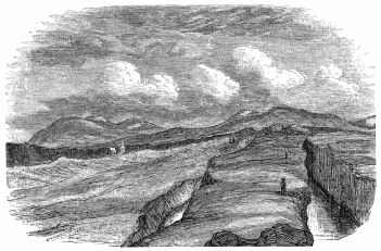
LÖGBERG AND ALMANNAGJA.
The popular theory is, that the whole plain, an item of the pyroxenic plateau from Reykjavik to Geysir, has bodily “dropped at once and subsided” to its present level, leaving exposed a section of the rent rocks on either side. It reposes solely on the evidence of the two parallel Geos, and I do not see that they bear it out. Both of the inner sides have sunk, not from subterraneous crevassing, but because the strips of ground which subtended them could not bear the weight. Mr Scrope would account for the fosses, not by vertical settlement of superficial lava into any cavity beneath, but by the “simple and usual process, the bulk of the semi-fluid lava-stream, upon the cessation of supply from above, having run out into the depths of the Thingvalla Lake.” The normal operation of this movement, however, is to form a tunnel, not an open trough, and this objection is one of the least.
The contrast of mountain and water, as usual, gives a certain picturesqueness to the site. South-east of the lake rises the Búrfell, here a goodly presence, and no longer the little cone seen from about Reykir; south lies familiar Ingólfsfjall, and south-west towers the “tall hanging hill,” Hengilshöfði, famed for sulphur springs; snow-streaked, blue-tinted, and shaped somewhat like an elephant’s head. Wheeling round to face north-west, we see the pinnacles of Súlarfell, bristled as with trees; the fretted peaks about Gagnheiði; the dull black heap of Ármannsfell, so called from Orman the Irish giant, who there lies in his grave; and the ridgelet of Jornkliff, crouching below it. There to north-east stands Skjaldbreið, shield-shaped as its name says, ending in a snow-flaked umbo which suggests a crater. The peaks of Tindaskagi at its foot apparently connect with the great Hrafnabjörg; and far behind them, but brought near by the surpassing atmospheric clearness, sparkle the snows of Lángjökull. The eastern view ends with the quaint serrations of Dímon, which may be either lava blisters, or the lips of a true crater, with the long buttress-like promontory of Arnarfell, and with the background heights of Miðfell.
Dasent’s “Topography of the Thingfield,”[119] will confine our notices of details to a narrow range. We inspected the Ell-stone or Fathom-stone, a block of vesicular lava, 4 feet 9 inches high, opposite the church door, and planted upon a rubble foundation. The six lines upon the east face measure 1 foot 9 inches, 11 (10·50), 8, 7, 5, and 4 inches; they may be standards, but they look like the work of nature. We then walked up to the grassy site of the Althing, and that local Sinai, the Lögberg or Moothill, the latter a natural stone-mound to the north. Parliament was formerly held on an island; it was for the best of reasons transferred here, where the public was railed off by deep chasms, and where hon. members could be attacked only by a single gateway. So the Shetland Tingwall (Thingvöllr) was held on a holm,[120] accessible only by stepping-stones, and the Thing-booths were on the lake-plain. East is the Hrossagjá, and 20 yards west, the Nikolásagjá,[121] with the smaller Brennrugjá below the latter. These miniatures of the two great rifts, distant about a mile and a half from the lake, are of crumbling subcolumnar black rock, varying from 16 to 40 feet in breadth, and falling sheer some 30 feet to clear blue-green water, whose depths show detached blocks of lava. The two former unite to the north, the second and third to the south, enclosing a long oval with a natural bridge, a few feet wide, to the south-east. We admired the leap, worthy of Morton and the Black Linn, by which Flosi escaped the “blood-stone;” this article was shown to us on the western bank of the Hrossagjá, a detached slice some 12 feet long, whence the victim would fall into the “Geo.” Below to the west lay the lower Öxará, which has probably changed all its features since Njál’s day. Yet the guides still point out the islet, where holm-gangs were fought in presence of the multitude;[122] and amongst the sand-banks formed by ankle-deep rivulets, the “Thorleifshólmr,” upon which criminals were beheaded.
I passed the greater part of the morning examining the Almannagjá, whose total length is about two miles,[123] and the average breadth 100 feet. Ascending the outer or eastern edge by a slope of 20°, I found the upper strata to be ropy, treacly, and scoriaceous lava, whilst below and inside the couches are hard and crystalline. There is a slip in the “Topography of the Thingfield” (p. cxxvii.), where it says, “about a mile and a half from where the great rift touches the lake, its inner lip ceases,” and the “Enlarged Plan” makes it break off where it is very distinctly marked. The sole was a mass of débris fallen from the sides, and good pasture streaked with many a path. Up the chasm there are rude dry walls of mortarless stone, the Makíl of the Syrian goat-herd, and serving as Sæters for sheep—the guides declare them to be the Búðir of the old Thingmen, but their booths did not extend north of the river. The upper or western wall, whose crest is weathered into pinnacles, varies from 80 to a maximum of 100 feet, whilst the lower ranges from 30 to 50; both are perpendicular and show stratifications which seem to proceed from a succession of discharges.
The Axewater, above the “Geo,” is a stream like an English rivulet, flowing through a wild and desolate Heiði. It tumbles over the western lip by a gap about 50 feet high; here the layers of lava are well defined on both sides, and it is easy to climb up either flank of the toy cascade. This fall was sighted during the last march, and suggested great expectations as the foot was hidden. M. Gaimard takes the liberty of removing the screen, and showing the whole height prodigiously exaggerated. It does not “explode in a cataract,” but falls decently into a font-like kieve, and threads the sand and boulders of the Geo. After a few yards it finds a gap in the inner lip, and here it dashes towards the plain with two falls, mere steps in the rock. In the lower basin, “sack-packed wretched females”—the author must have been dreaming of the Bosphorus—were let down by ropes and drowned as a punishment for infanticide. Farther on, witches were burned; less lucky than other travellers, I could not find their bones. After thus bisecting the Geo from north-west to south-east, the Axewater runs along its eastern base, and enters the Thingvallavatn. The latter is drained to the south-east by the Sog (inlet) outlet, which eventually feeds the Ölfusá or lower Hvítá; it may be reached in five hours’ sharp riding from Thingvellir, and in about double that time from Reykjavik. Here in July any quantity of salmon-trout may be caught; the fish lie above the first foss thick as water-plants. My informant had taken twenty-five in one day; the heaviest was 7 lbs., and only two weighed under 6 lbs.; but he had been almost blinded by the plagues of gnats and flies, which covered his pony with blood-points.
In the afternoon we rode merrily “home.” The road began by fording the Axewater, after which was a rude causeway of basalt, about thirty feet long, ascending the eastern lip. It crossed diagonally the grassy surface of the “Geo,” and climbed the western wall. A short ramp, paved for beasts, like a bad flight of steps, runs between the true rampart and a slice of rock which has been parted from it. Travellers usually sight it from above, hence we read of the “frightful dangerous chasm,” and we are told (N.B.—not by an Irishman) that “this is perhaps the most unique scene in the world.” The moderns compare it with the “Devil’s Staircase” in the Pass of Glencoe. The path would hardly startle the most nervous girl, and a Harfushi horseman would gallop his Arab up and down it.
Beaching the summit, we spurred across the Mossfellsheiði, which those fresh from home describe as a “horrible stony waste, bordered by lofty mountains.” But we had met with worse things than this “ever-to-be-avoided heiði,” where, moreover, labourers were working at the road. Seen in bad weather, it must be grim enough, as the many “stone-men” show; hence, doubtless, general complaints about the “mournful wail of the plover, and the wild scream of the curlew.”[124] We found a number of these birds, besides sandpipers, purple oyster-breakers, whimbrels, whose “soft fluid jug,” according to the “Oxonian,” “is not unlike the nightingale’s song,” and a fair scatter of ravens. I proposed a turkey-buzzard on a blasted tree, proper, as the arms of Dahome, and Grip on a lava pinnacle would suit Iceland passing well.
The only interest of this day’s ride is, that it crosses the “great trachytic band” opposed to the lesser trachytic band of Snæfellsjökull; the former made by old writers to stretch clean across Iceland from near Reykjanes (south-west) to Langanes (north-east). We examined a few veins of that rock, but the surface was mainly lava above and Palagonite below. The latter is said to be remarkably well developed in the Seljaland gorge,[125] and we dismounted to secure red specimens, and to find, if possible, an Irish rose. This feature, I suppose, is one writer’s “vast precipice, where there is only about sixteen inches to tread on,” and the “deep ravine, wild, horrid, and frightful,” of another pen, whose pencil supplies it with a herd of deer.
As we drew near Reykjavik the sun, after shimmering horizontally along the ground, obliged us by occasionally setting behind the hills, and when it
“Burned The old farm-gable, we thought it turned The milk that fell in a babbling flood Into the milk-pail, red as blood.”
The moon arose with a judicious repression of details: the silver light, the dark purple brooding at the hill-feet, and the gleam of the golden west gave more colour than usual to the view. The ponies, under boxes now empty, seemed to fly as they scented home. The only difference in the familiar scene was a vast eruption of peat-stacks, made, like hay, whilst the sun shines. Shortly before midnight we were again at home: in Iceland there are no hours, and kind-hearted Frú Jonassen did not keep us waiting either for supper or for bed.
ITINERARY FROM REYKJAVIK TO HEKLA AND THE GEYSIR VIA KRÍSUVÍK.
Reykjavik to Krísuvík.
Monday, July 8, 1872.
Left Reykjavik at A.M. 11.30. Rounded heads of two dwarf Fjörðs (1 P.M.), Fosvogr and Kópavogr (seal-cub voe); turf at valley-heads.
1.45 P.M.—Hafnafjörð = 2 hours 15 min. riding; path tolerable up torrent bed; crossed first divide of rugged ropy lava; path bad.
3.20 P.M. (= 3 hours 50 min.).—Changed horses in grassy cup-shaped hollow, under broken wall of lava.
3.30 P.M.—Started again; at 4 P.M. forded Kaldá (cold water) River.
4.45 P.M.—Short halt on grassy bottom at foot of Lángahlíð.
6.30 P.M. (=7 hours).—Kleifarvatn (cliff-water); path along western shore of lake.
7.15 P.M.—Left lake; over bog and up hill.
⊙ I. 8.30 P.M.—Reached Krísuvík (Bay of Krísa, proper name of woman), 5 hours + 3.50 = 8 hours 50 min. Frequent halts and delays with pack-saddles. At most 3 miles per hour by 9 = 27 indirect statute miles. People call the distance “10 to 15 miles.” Road upon map, 16 direct geographical miles from Reykjavik to Krísuvík. General direction, north to south with a little westing.
Good, grey, travelling day; no sun and no rain till night.
Paid at Krísuvík, $1, 3m. 0sk. (the cheapest).
Krísuvík to Litlaland.
July 9.
Left Krísuvík 10.45 A.M.; floundered over bog. Great arid plateau of Iceland to left.
11.45.—Crossed rocky divide. Short cut over livid plain of lava; sea to right; road along slopes.
12.45.—Entered great lava-field, which lasted with intermissions throughout day.
1.15 P.M.—Sweet-water lakelet (not shown on map) of Herdisarvík (Her-dís, proper name); first great lava-stream ends.
3.15 P.M.—Rode across Hlíðarvatn, at foot of Lángahlíð, now not open to sea as in map; water brackish. Halted 1 hour near Vogsósar (voe’s mouths) farm; gnats and flies. Rode 4 hours 30 min. = 13½ indirect statute miles.
4.15 P.M.—Left Vogsósar. Basaltic sands and shells; thin grass. Then loose sand and old flow of lava; domes, caves, and circular blow-holes, like those of the Haurán. Deep sand, black and red. Rocky divide; went gently over the stones.
7.30 P.M.—Passed Hlíðarendi (not the Lithe-end, or Ridge-end) to the left (north); farm under green slope.
Forded streamlet in swampy river-valley; rough causeway; should have crossed at the stone-man farther down.
⊙ II. 8 P.M.—Reached Litlaland; five-gabled farm of Magnús Magnússon. Rode 3 hours 30 min. = 11 indirect statute miles. Total, 8 hours = 24½ indirect statute miles; on map, 19 direct geographical miles. General direction, west to east.
Misty morn. Day like yesterday, but more sun. Wind ranged from south-east to north. At night cirri; show clear day to-morrow.
Paid $2, 0m. 0sk.
Litlaland to Reykir and Laugardælir Farm.
July 10.
Set out 10.30 A.M. Up rise over cindery lava.
11.30.—Road forks, right branch leading to big farm. Took path to left; reached old beach, water-worn galettes lying in long lines. Skálafell above to left (north-west).
11.35.—Right bank of Ölfusá (proper name) valley, higher up called the Sog. Ölfusvatn is the old name for Thingvallavatn.
11.45.—Hjalli (a hillock, much the same as “Hóll;” Cleasby says, “a shelf or ledge in a mountain-side”); chapel farm. Skirted tall Palagonite precipice on left.
1 P.M.—Passed through Níupat (?), filthy Bær, dunghill to pony’s knees. Up right bank of Varmá, influent of broad Ölfusá. Wet riding, water draining and sinking from above. Then white, smooth soil.
1.50 P.M.—Forded Varmá; easy descent and ascent; water to horses’ knees. Left baggage animals. Reached Reykir 2 P.M. Morning ride, 3 hours 40 min. by 4 miles = 16 indirect statute miles; on map, 9 direct geographical miles. Direction, south-west to north-east.
Left Reykir 3.40 P.M. Circled round south of hill spine dividing Varmá and Ölfusá. Forded two small streams and trotted over causeway (Brú), here common, with some dwarf bridges. After third stream fine riding along west and south walls of Ingólfsfjall. On slopes and at tongue-tip fallen masses of light, lavender-coloured Palagonite, water-worn to shape of volcanic bombs. Crossed two causeways, down slope of Ölfusá valley.
⊙ III. At 6.45, ferry of Laugardælir; spent 1 hour 20 min. in crossing. Reached farm of Sæmund Bjarnarson 8 P.M. Afternoon ride, 3 hours by 5 = 15 miles; on map, 6 direct geographical miles. Direction, north-north-west to south-south-east. Total ride, 6 hours 45 min. = 30 indirect statute miles; on map, 15 miles. General direction, south-south-west to north-north-east.
Weather charming; real enjoyment. Sun clear, not hot; high north-easter; lofty cirri and woolpack. Evening cloudy. Rain at night; wind changed to west and south-west; heat brought bad weather.
At ferry paid $1, and the bishop paid $2. Tariff, 10sk. Danish per horse, and 12sk. per man or load. Pays well at this season; travellers by day and night. Englishmen have been asked $20 and got off with $12 (rascality of guide?).
For lodging (church) and forage, coffee and biscuits, paid $3.
Laugardælir to Thjórsárholt Ferry.
July 11.
Horses strayed. Left at noon. Over delta-like flat between Hvítá and Thjórsá (bull’s water); to north of former, detached bills of Búrfell (a cabochon seen from north and south, and a hogsback elsewhere), Stóraborg, and Hestfjall, resembling dots. Bog on old lava: stone outcrops at places; wettest part often most solid base.
1.30 P.M.—Hraungerði (lava garth) chapel; two farms 8 miles from ferry; horses and neat cattle.
2 P.M.—Hill dividing Ölfusá and Thjórsá. Rough work; showed lake-country below, and Thjórsá line raised by refraction. Along natural lava-dyke to dismal, dreary moor, all knobs and hummocks. Even ravens avoid it in this weather.
4.30 P.M. (3 hours 30 min. = 18 indirect statute miles).—Halted thirty minutes and changed horses at Lángamýri; large farm-house, one of many; wire fence, two strands, and stripped branches for hedge.
5 P.M.—Remounted. Bad riding.
5.40.—Came upon Thjórsá. Ólafsvellir to left; ferry saves distance, but dangerous in fierce wind. Path along stream excellent, black basaltic sand, at times cut off corners, clay covering sand. Turned from north-east to east. Farms and cattle. Passed Sandlækr and tall riverine islet, Arnesthing. “Rústir,” or ruins, on right. Ponies tired; when leaving river often lost way.
7 P.M.—Country more thickly peopled.
⊙ IV. 8.30 P.M.—At Thjórsárholt ferry-house (3 hours 30 min. = 20 miles). Total 8 hours, varying pace = 46 indirect statute miles; map, 26 direct geographical miles. General direction, west-south-west to east-north-east.
Weather vile, unlike the finest month, July, as possible; forenoon cold; driving rain. At noon stopped. Furious in afternoon. At times drizzle, like hoar-frost on grass by decomposition of light. Rain again violent till end of march.
Paid $3 for night’s lodging and ferry. Tariff, 11sk. per man or pack; on return paid $1.
Thjórsárholt to Næfrholt Farm.
June 12.
Left Thjórsárholt 10 A.M.; up stream to ferry. Spent 1 hour 30 min. crossing Thjórsá.
11.30 A.M.—Over turf of left (east) valley, like a dwarf prairie; 50 min. Many farms; good land, grassy sward, two to three feet deep. Threads of lava, with dangerous holes and sinks, sometimes covered with grass-turf. In places lava bare and broken. Crossed rivulet.
12.55 P.M.—Stóruvellir parsonage, 1 hour 30 min. = 6 miles; map, 4 direct geographical miles. Direction, south with a little easting. Place afflicted by winds from Sprengisandur, distant two to three days’ ride.
2.30 P.M.—Left Stóruvellir with guide. Pastoral scene at foot of Hekla, a pampa. Sheep everywhere; ditto stinging flies throughout the inhabited part, few at Geysir.
3.45 P.M.—Leirubakki farm. Changed guides. After a few minutes reached Vestri (west) Rangá (“wrong” or crooked stream), at the mouth called Ytri (outer or uttermost) Rangá. Forded two preliminary brooks, and tethered horses together for third or main channel, girth deep. Dwarf forest, birch and willows. Then two streams, one a ditch, the other a “lavapés,” flowing, like lava, north-east to south-west.
⊙ V. 5 P.M.—Næfrholt (birch-bark copse), last cottage at foot of Bjólfell, western outlier of Hekla. Formerly travellers slept at Selsund farm, south-south-west of Næfrholt.
Afternoon march, 2 hours 30 min. = 12 indirect statute miles. Total of day’s ride, 4 hours = 18 indirect statute miles; map, 10 direct geographical miles.
Grey day, like the start; clouds had expended ammunition. Wind south-east. In evening weather doubtful, wind west. Hekla misted over, good sign; travellers often stopped by fogs, and even by snow, in July. Flies suddenly disappeared, wings wetted; not the case with the gnats and midges acting mosquitoes.
Instruments in evening.
Aneroid, 30·24; thermometer, 58° (F.).
Hygrometer, 4° (exceptionally dry).
At Næfrholt.
July 13.
Ascended Hekla.
Left Næfrholt 8.25 A.M.
Rode down the turf lane; crossed the dwarf stream (lavapés), up right grassy bank, and crossed again. Entered basin of “Unknown Lake”—thin strip of flat land with holes often marked by grass and willows. All “sinks” (sink-holes) and punchbowls, as if limestone country. Last thick vegetation 1500 feet high. Then into dreary region, sand and cinder; powdery red cone of fine cinder on left. Slabs of heat-altered trachyte. Obsidian of two kinds—(1.) Huge blocks of pitchstone found from top to bottom of cone, hard and flinty (Hrafntinnu proper); and (2.) Small pieces of “Samidin,” or obsidian with crystals of white jasper like that of Tenerife and other places. Bombs showed furious cannonade. Palagonite everywhere in situ and in scatters: some contained obsidian.
Made for big, rough lava-stream, rusty and in heaps; in places rapidly degrading, and leaving only core. Ponies sank to fetlock. Hugged left of Steiná (stone stream). After two hours’ ride, at 10.30 A.M. crossed hill, reached barren divide too steep for horses.
Aneroid in air, 28·18 (difference, 2·06); thermometer, 92° (in pocket); hygrometer, 2°.
Walked up slope of divide; descended very short pitch of stone and débris, steepest bit of whole march. Crossed vein of lava (Sept. 2, 1845) like pulled bread, all slag and clinker; pulverising above. Reached a kind of couloir, a rim on left of lava-stream. Black sand and two large tongues of ice-based snow, white and brown, ridged with dirty earth, and dotted with dwarf ice-tables, sable above and ermine below. More ice as we ascended, keeping on the earthy parts. Many halts.
12.20.—Reached crater of 1845. Observed instruments.
Aneroid in air, 26·33 (difference, 3·90); thermometer, 83° (in pocket).
Stiff ascent (15 min.) to First or Southern Crater. At 1.13 P.M. sat down upon its western lip. Walking lasted 2 hours 45 min. Total ascent, 4 hours 45 min.
Aneroid, 25·94 (difference, 3·30); thermometer, 68° (air); hygrometer, 0°.
Passed over ridge, and reached snow; thence to north-east lip of Second or Northern Crater, the apex. Reached highest point 1.53 P.M. Total, 3 hours 13 min. (included halts, not bad for difference 2·56 of aneroid).
Aneroid, 25·62 (difference, 4·84); thermometer, 67°; hygrometer, 0°.
2.30 P.M.—Began descent (walked 1 hour 25 min.).
3.28 P.M.—Lowest snow.
3.45 P.M.—Mounted horses (rode slowly 1 hour 45 min.).
5.30 P.M.—Næfrholt farm. Total descent, 3 hours 10 min.
Total of ascent and descent, 7 hours 55 min. (say 8 hours).
Day clear, sun very hot; air thirsty for man and beast.
Paid guide $1, 4m. 0sk. To house for forage, etc. (two days), $5.
Næfrholt to Geysir.
July 14.
Long, weary day.
Left Næfrholt 9.40 A.M. Wind drove away flies. Crossed Rangá and five other streams.
12.10 P.M.—Reached Thjórsá, 2 hours 30 min. of fast riding—five miles per hour. Ferried over at Thjórsárholt. This third of road good.
1.45 P.M.—Remounted; crossed flat land; two Kálfá; east fork big and west fork small. Bad mosses; rounding foul swamps; one furlong of good path to one mile of bad.
3.45 P.M.—Reached (Eastern) Laxá; reported bad ford; found it very good.
4.10 P.M.—Crossed Laxá valley to Sólheimar (sun-home) farm. Rounded fens and crossed morasses. Passed a made tank for washing sheep—rare luxury here. Foul bog of cotton-grass; deep vein along causeway.
5.20 P.M.—Hruni chapel; 4 hours 35 min. from Thjórsá, fast riding. This third of road moderate.
6.45 P.M.—Left Hruni; road to Geysir now very bad; five fast or seven slow hours; took guide ($1), or it would have been worse. Went north; road not on map. Crossed ugly wet swamp to Minni Laxá (lesser salmon-river); ford not bad.
Up divide of Palagonite running north-east to south-west. Rounded and crossed easiest part of another swamp. Causeway. Up another divide showed us valley of Hvítá. West of us smokes of Reykholt, Laugs everywhere. Avoided causeway, because it runs through tún of large farm, Gröf (the pit).
8 P.M.—Changed pack-horses. Ugly swamp and causeway to Hvítá River.
8.20 P.M.—Forded Hvítá stream; the heaviest, but not bad. Up right bank, a wild gorge; guide left us. Through swamps. Entered ugly system of broken ground, rock-walls, earth and stone, faults and dykes.
10 P.M.—Fell into long descent of birch “forest.” Long trot. Forded Túngufljót (Tongue, i.e., Mesopotamia or Doab) River.
10.50 P.M.—Beached Geir-hóll farm, then villainous swamp for tired nags. Crossed eastern three branches of the Árbrandsá (upper Túngufljót), all troublesome; and two other foul, flowing fast influents of the right or western bank.
⊙ VI. At 12 P.M. reached Geysir.
Total of this day’s ride, 12 hours 20 min., at least 50 indirect statute miles; map, 31 direct geographical miles. General direction, south-south-east to north-north-west.
Dew very heavy, yet plague of flies. Sweltering morn. At 9 A.M., thermometer 82° (F.). 9.30 A.M., good sea-breeze from south. Fine day. In evening cold; clouds from east gathering, 9 P.M.; thick at night, threatened rain.
Geysir to Thingvellir.
July 16.
Left Geysir 11 A.M. Passed Laug farm to south-west, and crossed spongy bog and swamp in rivulet-influent of Túngufljót, passing between Laugarfjall and the outlier. Rounded south end of Laugarfjall.
12 (noon).—Múli (muzzle, maul, mull) farm, one of the best; skirted southern Bjarnarfell, between ugly, black, bare hills and swamp over triangle (Biskupstúngur), formed by Túngufljót and Brúará.
12.20 P.M.—Chapel farm, Uptirhlíð (?); extensive view; sunk road. Two rivulets, second small and boulder-paved. Forest (birch and willow) begins and lasts with interruptions all day. See more wood in one hour than on all south coast.
1 P.M.—Passed to left chapel farm, Úthlið, at foot of Hraun of same name.
1.40 P.M.—Crossed bridge of Brúará (bridgewater), and entered lands of Laugardalr. Forded a fourth stream. On right, Efstidalr (uppermost dale), at foot of black plateau, ugly, bare, and gashed with many drains. Hognhöfð pyramid to north, rhinoceros head and horn. Left Miðdalr chapel on right, and rounded upper swamp of Apavatn (ape or fool water, from a settler in the ninth century).
3.15 P.M.—Crossed streamlet fed by many drains and trickles; first down, then up bed, sand-bars and islets; must be unfordable below. Rounded Laugarvatn (lake), large farm and hot spring.
4 P.M.—Halted Laugarvatnsvellir; fine pastures. Five hours tolerably fast = 20 indirect statute miles. Good view of Hekla. Saw two snow-fonds, up which we had walked.
5.20 P.M.—Left Laugarvatn by made road on “barmr” (edge) of low rolling ground and humus, confining big swamp on north; Bjarnarfell hill to right, then three peaks of Kálfstindar. Travellers and caravans.
6 P.M.—Entered old lava. Path rose to 600 feet, and showed Thingvellir Lake. Grim hill, Reyðarbarmr (red, i.e., salmon-trout edge), to right. Road rutty. Dimon or Tindhruni (Bryson’s Tintron), an extinct crater in shield form, rising at base of high hill on right.
7.30 P.M.—Gjábakki farm, close to Vellankatla (boiling kettle), north-eastern bay of lake (proper name of boiling well; Cleasby supposes it sank below water-level), along lake.
8.15 P.M.—Hrafnagjá; eastern crevasse.
9.15 P.M.—Middle crevasse, called Háflagjá, Hólagjá, or Breðnigjá (?).
⊙ VII. 9.30 P.M.—Chapel of Thingvellir.
Second march, 4 hours 10 min. = 20 miles. Total, 40 indirect statute miles; map, 26·5 direct geographical miles.
General direction, north-east and by north to south-west and south.
Glorious morning; cloudless; gentle breeze from north. At 11 A.M., chopped round to south-west. At noon west, blowing dust in face everywhere except on lava. Clouds. Few drops of rain. Presently weather recovered itself. Very fine evening and night.
Thingvellir to Reykjavik.
July 17.
3.35 P.M.—Left Thingvellir (paid $2, 3m. 0sk.).
Forded Öxará; up rude basaltic causeway, some ten yards long, a little south of where Öxará escapes into plain—site of Búðir. A few yards down grassy surface of Almannagjá. Up split in western wall. Dreary scene on summit; old lava, grassy and moss grown.
5.40 P.M.—Last sight of Thingvellir Lake, and first view of black buttressed Esja, with gleam of sea. Entered Mosfellsheiði; soil damp, sour, and barren; signs of road-making, and Varðas everywhere. Left to right two ponds, Leiruvogsvatn and Geldingatjörn, latter undrained; skirted east and south base of Grimmansfell (ugly man’s fell); to right, steaming spring (Reykjalaug).
7 P.M.—Descent to the far-famed Seljadalr (sallow = willow dale).
7.45 P.M.—Dwarf ravine on left. Its stream finds the Hrafnavatn reservoir of Reykjavik Laxá. Rode down grassy basin; forded stream twenty-five times, fetlock to knee-deep.
8 P.M.—Halted to graze ponies. First march, 4 hours 25 min. = 20 indirect statute miles.
8.45 P.M.—Remounted. Continued Seljaland valley; ponds on both sides with and without drains. View of Snæfellsjökull. On left porcupine-shaped Helgafell.
Hill and basins. Travellers camped where forage is not paid for. Then inhabited country.
10 P.M.—Causeway and made road to Reykir. Ponies dashed through two branches of Laxá.
⊙ VIII. 11.30 P.M.—Reykjavik. Home.
Second march, 3 hours = 15 indirect statute miles. Total, 8 hours= 35 miles; map, 24 direct geographical miles.
General direction, east and by north to west and by south.
Weather fine and clear like yesterday. Sun now sets at 10 P.M., and air grows cold. Find people strolling at midnight. Dust in Reykjavik very bad.
Expenses of Trip for Two Travellers.
Guide (10 days at $2, 3m. 0sk.),$25 0 0
Boy (10 days at $1, 3m. 0sk.),15 0 0
Returning horses to owners,4 3 0
Hire of pack-saddles and boxes,7 0 0
Twelve horses (at $1 per diem),120 0 0
Total,$171 3 0
The extras and minor expenses, $27, 2m. 0sk.
Share of each traveller, $104, 2m. 8sk., or £12 for ten days.