Chapter X · Globes and Globe Makers of the Early Seventeenth Century. The Dutch Scientific Masters and Their Preëminent Leadership (continued 2)
Reading edition
The sphere is covered with a world map engraved on twelve gores, truncated at latitude 70 degrees, the polar spaces being covered by the usual circular discs, each having in this case a radius of twenty degrees.
On his celestial globe, probably issued at the same time as the terrestrial just referred to, and intended as a companion of the same, having the same dimensions, we find the following legend: “In hac coelesti sphaera stellae affixae majore quam hactenus numero ac accuratiore industria delineantur. Novos Asterismos in philomathēom gratiam de integro addidi: quae omnia secundum Astronomorum Principis Tychonis Brahe, ac meam observationem verae suae Longitudinis ac Latitudinis ad annum Christi 1615 restitui. Petrus Plancius.” “In this celestial sphere the fixed stars to a greater number than previously and with more exactness are depicted. I have added for the use of the student some entirely new star readings according to the prince of astronomers Tycho Brahe, and also my own observations of their true latitude and longitude adapting these to the year of Christ 1615. Peter Plancius.” It then will be noted that the position of the stars located thereon is computed to the year 1615. In the southern hemisphere is a portrait of Tycho Brahe with the inscription “D. Tyco Brahe Summ. Mathematic,” below which is the legend “Tabula continens quantum quovis proposito anno vel addendum vel demendum sit Lōgitudini affixarum: nam hae 70 annorum et 5 mensis spacio unicum gradū secundū signorū ordinē, super Pol. Zod. progrediuntur.” “Table indicating how much for any given year is to be added to or to be subtracted from the longitude of the fixed stars. For these in the space of 70 years and 5 months move one degree reckoned on the signs of the zodiac.” But one pair of Plancius’ globes can now be located, this pair having been acquired a few years since for the Museo Astronomico of Rome (Fig. 100). They are reported to be in excellent condition. The spheres are of wood covered with plaster, having a diameter of about 21 cm., upon which the gores have been pasted. Wind roses are numerous, from which the usual direction or loxodromic lines radiate. Ships and sea monsters add to the decoration of the terrestrial globe map, and the figures of the several constellations have been artistically drawn. Each globe is furnished with a wooden base, having its horizon circle supported by four columns which are joined below by crossbars. Each has a brass meridian circle within which the globe is adjusted to revolve.
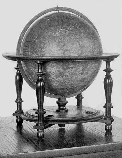
Fig. 100. Terrestrial Globe of Peter Plancius, 1614.
Fiorini reports information received from Gabriel Marcel of the Bibliothèque Nationale and Captain F. v. Ortroy that there may be found in the Stein Museum of Antwerp a terrestrial globe of copper, neither signed nor dated, but which is thought to be the work of Peter Plancius.52 Additional information concerning this globe has not been obtainable.
Isaac Habrecht (1589-1633), physician and mathematician, was a native of Strassburg, where he passed the greater part of his life.53 Incidental references to him assure that he was regarded in his day as a man of much ability. Among his publications, not numerous but scholarly, reference here may be made to his ‘Tractatum de planiglobio coelesti & terrestri,’ issued in Latin in the year 1628, and again in the year 1666 in both Latin and German, by Johann Christoph Sturm of Nürnberg.54 In this work Habrecht describes his terrestrial and celestial globes, constructed, it appears, a few years previous to the issue of the publication.
The Hispanic Society of America possesses a fine example of what appears to be his first terrestrial globe (Fig. 101). It is undated, but internal evidence assures us that it was not constructed prior to the year 1612. Near the Arctic circle and north of the representation of Hudson’s Bay we read “Huc usque retrocesserunt Amstelodamenses anno 1612.” “At this point the Amsterdam (explorers) turned about in the year 1612.” His first celestial globe, referred to below, seems clearly to be of the year 1619, and there is reason for placing his first terrestrial globe in the same year, since, in their size, and in many of their general features there is agreement. The globe ball of wood has a diameter of 20 cm. Its horizon circle, which has pasted on its upper surface the usual information relative to the names of the months, to the principal directions, and to the signs of the zodiac, is supported by four turned legs joined below by crossing bars, these bars in turn supporting a carved circular disc with a raised center through a slot in which the meridian circle is made to pass. The whole is indeed a remarkably well-preserved example of Habrecht’s work.
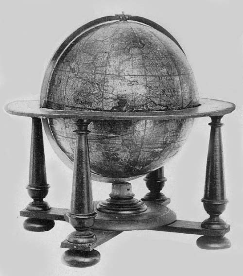
Fig. 101. Terrestrial Globe of Isaac Habrecht, 1625.
In an artistic cartouch to the south of the East Indian Islands and within “Terra Australis” is the following signed dedication: “Perillustri et Generossissimo Dno Dno Eberardo Dynaste in Rappolstein. Hohenaccio et Geroltzeccio ad Vogasinum Divi Mathiae II Imp. nec non Sereniss. Maximiliani Archiducis Austriae. P. M. Camerario et Citeriorum Ordinum Provincialium Praesidi Magnifico: ex antiqua Ducā Spoleti familia oriundo: Domino meo Clementissio Triplicem hunc globum: Coelestem scilicet: convexum et concavum et hunc terrestrem novissimae editionis et correctionis. D. D. D. Isaacus Habrect Phil. et med. d. Argentinensis.” “To the Most Illustrious and Most Generous Lord Eberhardt Ruler in Ruppelstein, Hohenau and Geroldseck in the Vosges, Divine Emperor Matties II and also the Most Serene Maximilian Archduke of Austria, the Exalted President of the Provincial Orders of the Cameria, and those on this side of the mountains, sprung from the Ancient Ducal Family of Spoleto, my Most Gracious Lord, this triple globe, that is celestial, convex and concave terrestrial, corrected according to the latest information, gives and dedicates Isaac Habrecht, philosopher and physician of Strassburg.” In the northern part of North America is a legend referring to the expeditions of Davis, Schouten, and Le Maire reading, “Versus Articum polum ulterior transgressus hactenus ab Herculis licet Davis Angli labore id examinatus fuerit sicut et circa antarcticum fretum noviter a Guilielmo Schout detectum Le Maire nuncupatum extremus adhuc navigationum est terminus. Quamvis nullus dubitet maxima totius orbis magnalia sub polis delitescere quorum detectionem forsitan summus Deus suo tempore reservat. Typis Jacop. ab Heyden Argentinae.” “Toward the Arctic pole the last voyage up to the present was made, with Herculean labors, by Davis an Englishman. Around the Antarctic a strait has lately been discovered by William Schouten and named Le Maire, and this, up to the present, is the extreme limit of navigation, although no one doubts that the greatest wonders of all the world lie hidden under the poles, the discovery of which, it may be that Almighty God reserves for his own time. Printed by Jacob von Heyden of Strassburg.” It is probable that the Jacob von Heyden here referred to was a relative of Christian Heyden of Nürnberg, mathematician and globe maker of renown.55 Below the legend last quoted is a brief one reading, “America septentrionalis a Christoforo Colombo 1492 detecta.” “North America discovered by Christopher Columbus in the year 1492.” This appears to have been quoted from the Hondius globe of the year 1618. The austral continent is referred to as “Terra Australis incognita,” and near New Guinea is inscribed the following, likewise quoted from Hondius: “Sic dicta quod ejus littora locorūqȝ Guineae Affricanae multum sint similia. Dicitur a nonnullis Terra de Piccinaculi; et sit ne insula an pars continentis Australis incertum est.” “So called because its shores are much like those of African Guinea. It is called by some the land of Piccinaculi: and it is uncertain whether it is an island or a part of the Australian continent.”
A considerable number of brief legends appear upon different parts of the globe map, each having a local significance. In coloring the map attention was given to the representation of territorial boundaries which gives an added interest to the globe. The “Meridianus Primus” is made to pass through the Island of Corvo, and other meridians are drawn at intervals of ten degrees. The loxodromic lines, as on the Hondius globes, are made a conspicuous feature of the map, having their crossing centers at longitudes 0°, 90°, 180°, and 270° on the equator, and on the prime meridian at latitude 35° both north and south, as well as at the same latitude on the opposite side of the sphere, where the prime meridian becomes the meridian of 180°. Habrecht appears to have followed somewhat closely the globes of Hondius for his geographical data.
In addition to the Habrecht terrestrial globe in The Hispanic Society’s collection, two other copies are known, which likewise are undated. One of these belongs to the Biblioteca Comunale of Sondrio, and the other to the Archivo Municipale of Asti.
Of the celestial globes of Habrecht four copies have been located; one being in the Biblioteca Comunale of Sondrio, in a good state of preservation; one in the Germanisches Nationalmuseum of Nürnberg, wanting, however, the original mounting, having its map engraved, as stated in a legend, by Jacob von Heyden et Johann Christoph Weigel; one in the Biblioteca Comunale of Asti; one in the Royal Museum of Cassel.
It is strikingly evident that Habrecht followed in the main the work of Willem Jansz. Blaeu, and Jodocus Hondius for his celestial globes. As the year 1619 was selected as the one in which star positions were to be recorded, it is probable, as intimated above, that these globes were constructed in that year. Each of the globes referred to is reported as retaining the brilliant coloring which had been laid on by hand.
Garcia de Céspedes, writing in 1606,56 calls attention to a globe, concerning which nothing farther is known, referring to it as a “Globillo que hizo en Portugal aquel grau Piloto que se emborrachana cuyo nombre no me acuerdo.” “A small globe constructed in Portugal by a great pilot, whose name is unknown, but who was a great drunkard.”
In the year 1893 Baron Nordenskiöld presented to the Royal Geographical Society a facsimile in gores of a globe map, which fact is noted in that society’s Journal. The globe is one of silver, bearing the author and date legend “Johann Hauer. 1620.” The record tells of its having been presented in the year 1632 to Gustavus Adolphus and that it is now one of the treasures of the National Museum of Stockholm. The engraved map is of the Hondius or the Mercator type presenting in the main the best geographical knowledge of the time. Its many legends are in the Latin language; the lettering, though small, is easily legible. The engraver has adorned the seas with ships and with such marine animals as are frequently to be found in the maps of the period.57
It has been previously noted that the employment of engraved gore maps in globe construction was not received with general favor in Italy in the sixteenth century, although Mercator’s globes were copied to some extent, as were those of De Mongenet. Toward the close of the century, the preference for manuscript globes, or for engraved bronze or copper globes seems gradually to have yielded to a belief in the more practical method of construction which had established itself in the North. Originality, however, does not appear to have been a striking feature of Italian endeavor in this method of globe making. There was an occasional manifestation of independence and individuality, it is true, but in general there was a disposition to copy, and the early seventeenth century furnishes us an example in the reissue by Giuseppe de Rossi of the work of Jodocus Hondius, but without credit, as has been previously observed.
Among those who attained distinction in Italy in the first half of the seventeenth century in the construction of globes having engraved gore maps, may be named Mattheus Greuter. He was born in Strassburg in the year 1556, where he learned designing and engraving. In early life he went to Lyons in France where he carried on his work, but later he removed to Avignon, adding to his art in this city that of type cutting. We next find him in Rome, busily engaged in the work of engraving, in which he had become exceedingly proficient, winning for himself a high place among the Italian artists of his day. Map engraving, we learn, early claimed his attention, and among his masterpieces in this field may be mentioned a large map of Italy. Of this work no copy is at present known, but it is thought that it probably served Magini as a model for his “Italia” which was published in the year 1620. It could not have been long after he had taken up his residence in Rome, where he became a naturalized citizen, that he began the preparation of his first terrestrial globe, which he issued in the year 1632. So well did he perform his work that he is entitled to rank with the leading globe makers of the Netherlands.
An excellent example of this first issue may be found in the Museum of The Hispanic Society of America (Fig. 102), this being one of the most valuable in its large collection. It has a diameter of 50 cm., and is mounted on a wooden base having four feet, which, though evidently very old, is clearly not the original base. It is furnished with a narrow wooden horizon circle which is not graduated, and the calendar and other representations, which one usually finds pasted on this circle in early globes, are entirely wanting. The meridian circle of iron, likewise, is not graduated, and like the wooden base is not a part of the original mounting. The sphere itself is remarkably well preserved, there being scarcely a noticeable injury to its surface save the slight discoloration of age. The engraved gore map covering the papier-mâché ball, which is of very light construction, is composed of twelve sections, or rather of twenty-four, since each of the sections is cut at the equator, and the poles are covered with small circular discs.
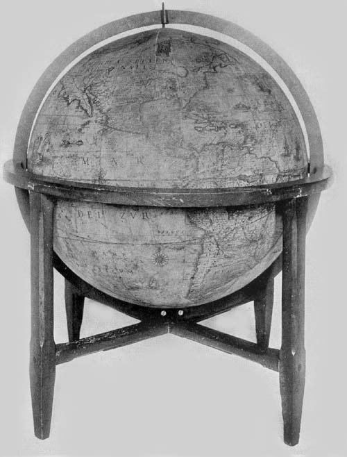
Fig. 102. Terrestrial Globe of Mattheus Greuter, 1632.
In the south Atlantic and near the great southern continent, in a neat cartouch surmounted by the coat of arms of the Boncompagni family of Bologna, is the following dedication: “Illustrissimo et Excellentissimo Principi D. Iacobo Boncompagno Sorae Arcisque Duci Marchioni Vignolae Aquini Comiti Dno suo colendissimo. Mattheus Greuter Humill. obseqii ergo. D. D.” “To the Most Illustrious and Excellent Prince Lord Jacob Boncompagni, Duke of Sora and Arce, Marquis of Vignola and Count of Aquino, his Most Worshipful Lord Mattheus Greuter with humble obedience dedicates (this globe).” Iacopo Boncompagni, to whom Greuter dedicated his work, belonged to a famous family of Bologna.58 He was born in Sora in the year 1613 and died in the year 1636. It was his great-grandfather, Hugo, who, in the year 1572, at the age of seventy, became Pope Gregory XIII, and who immortalized himself through his reform of the calendar. Iacopo, the grandfather of that member of the family to whom Greuter dedicated his globe, was in position, at the time of the elevation of his father to the Papacy, to have bestowed upon him great honors and riches. He was nominated Castellan of St. Angelo, and shortly thereafter, receiving the title General of the Holy Church, was sent to Ancona with a commission to defend the maritime regions of the papal states. He was soon thereafter admitted to the nobility of Rome, of the Kingdom of Naples, and of Venice. Through the riches of the Papacy he was able to purchase from Alfonso II of Este the Marquisate of Vignola for seventy-five thousand Roman scudi, the Duchy of Sora and of Arce from the Duke of Urbino for one hundred and ten thousand ducats, and the lands of Arpino and Roccasecca, together with the County of Aquino from Alfonso of Avalon, Marquis of Guasto, for one hundred and forty thousand ducats.
In the austral continent, and on the opposite side of the globe to that on which the dedication is placed is an address to the reader which is inscribed in a neat cartouch, reading “In ista quam exhibemus terreni globi descriptione omnium regionum iuxta et insularum quotquot hactenus ab Argonautis tam Lusitaniae quam aliarum gentium Naucleris visae et notatae loca in suo secundū longitudinem et latitudinem situ sum̄a sedulitate et industria disposita invenies quae res non solum Geographiae studiosis jucūda, verum etiam ijs, qui terras longe dissitas et sub alio sole calentes frequentent, maxime utilis futura est. Hūc igitur laborem nostrum ut tam gratis animis acceptatis sedulitate a nobis est obitus ex aequo omnes rogatos volo. Mattheus Greuter auctor. Excudit Roma Anno MDCXXXII.” “On this globe which we exhibit, you will find all the regions and islands as far as they have hitherto been seen and noted by navigators of Portugal and of other nations, set down in their proper positions of latitude and longitude with the greatest care and industry. This will be pleasing not only to students of geography but it will be especially useful to those who visit far distant lands (which are) warmed by another sun. I hope therefore that all those whom I ask will accept this labor of ours with as much gratitude as we have employed care upon it. Matthew Greuter maker. Made in Rome in the year 1632.” This address agrees with that on the Blaeu terrestrial globe of 1622 except that Blaeu wrote “vel etiam ab aliarum gentium ...,” whereas Greuter writes “tam Lusitaniae quam aliarum gentium ...,” and Blaeu inserted a reference to the loxodromes he had drawn on his map, which loxodromes Greuter, omitting, had therefore no occasion for such reference. In the inscription referring to the prime meridian, Greuter again borrowed from Blaeu with scarcely an alteration, as he did in his reference to recent discoveries made for the purpose of finding a way to the East by the North. Blaeu’s legend in the vicinity of the Tiborone Island, that near the Cape of Good Hope, and that near the Strait of Magellan were all copied literally by Greuter, and likewise that referring to the Le Maire Strait.
Greuter employed, in general, for the names of the regions of the Old World and for the seas, the Latin language, though he wrote “Mar del Nort” for the Atlantic and “Mar del Zur” for the Pacific. For the names of the New World he used the Spanish or the Portuguese, but occasionally the English, the French, the Dutch, or the language native to the region bearing the name. For the names of the cities he generally employed the language of the country or the Italian language.
Numerous ships are represented sailing the seas, and the pictures of sea monsters are many. A few wind roses adorn the map, but, as before stated, loxodrome lines, regarded in general at that time as of great importance to sailors who had occasion to make use of the chart or the globe, were omitted by Greuter.
Hudson Bay, which is left nameless, is represented without a definite coast line in the north, but through a wide and extended channel it opens into “Fretum Davis.” The St. Lawrence River appears to drain a lake, which may be taken from its location to be Lake Ontario; but the remaining four Great Lakes appear as one great inland sea with an outlet of somewhat uncertain character northward toward Hudson Bay. The geographical representations in this region are of special historical interest, as are indeed the geographical records in the several sections of North America, particularly in the South and the West.
As a companion to the terrestrial globe of the year 1632, Greuter prepared a celestial globe of the same dimensions, and with similar mountings, which he issued in the year 1636. He gives due credit, in one of his legends, to Tycho Brahe and to Willem Blaeu as sources of information for his representation of the stars and the several constellations, following, in particular, Blaeu’s globe of 1622. His explanatory legend reads “In hoc coelesti Globo notantur omnes stellae fixie an annum 1636 accom̄odatae q̄ iuxta observationē Nob. viri Tychonis Brahe, in max̄ illo Iansonii, an̄o 1622 edito, positae sunt additis stellis q̄ à peritisso nauclero Petro Theod: circa Pol. Aust. notatae sū novisque Asterismis et stellis min. apparētib’, ab aliis sum̄ studio observatis, omnia in Philomatico gratia copiosa delineata. Romae, 1636, M. Greuter.” “In this celestial globe are noted all the fixed stars accommodated to the year 1636, which are placed (on the map) according to the observations of the noble Tycho Brahe in that great (work) of Jansson (Blaeu), edited in the year 1622, to which are added the stars noted by the skilful navigator Peter Theodori around the south pole and the new and less apparent stars observed by others with great zeal. All these have been represented for the use of the student. At Rome, 1636. M. Greuter.” As to how much he thought should be added to or subtracted from the longitude of the fixed stars each year, to the end of taking due note of the precession of the equinoxes, he copied Plancius literally. The equatorial circle, the tropics, the polar circles, the equinoxes, the solstitial colures, the ecliptic, and twelve meridians are all represented. The constellations include the Ptolemaic, with the addition of those recently discovered and named in the southern hemisphere. The figures of the several constellations are well drawn, having their names in Latin or in Arabic, and are artistically colored in most of the copies of the globe known.
Greuter’s globes all appear to have been made in the same size, and they have the same general construction, with the exceptions noted below.
A pair of these globes, that is, of the terrestrial, of the year 1632 and the celestial of 1636, may be found in the following public and private libraries and museums in addition to those above mentioned: Scuole Comunale of Ancona; in the Biblioteca Comunale of Bologna; in the Biblioteca Comunale of Camarino; in the Seminario Vescovile of Carpi; in the Biblioteca Comunale and also in the Museo Agabiti of Fabriano; in the Biblioteca Comunale of Ferrara; in the Biblioteca di Santa Maria Nuova of Florence; in the Biblioteca Comunale of Gubbio; in the Biblioteca Governativo of Lucca; in the Biblioteca Capitolari of Reggio; in the Museo Astronomico, also in the Biblioteca Chigi and the Biblioteca Vittorio Emanuele of Rome; in the Biblioteca Comunale of Sanseverino; in the Biblioteca Gonzaga of Mantua; in the Biblioteca Universitario of Messina; in the Biblioteca Nazionale of Milan; in the Museo Civico of Modena; in the Museo di Fisica and also in the Seminario Vescovile of Padua; in the Biblioteca Palatina of Parma and a pair in the possession of Joseph Baer & Company of Frankfurt, 1914. A copy of the terrestrial globe of the year 1632, in addition to the one described above as belonging to The Hispanic Society of America, may be found in the Biblioteca Comunale of Bassano; in the Ateneo of Brescia; in the Museo di Fisica of Catania; in the Archivo di Stato of Venice. In private libraries copies of these globes may be found in the possession of the General Antonio Gandolfi of Bologna; of Sr. P. Marezio Bazolle, once belonging to the Counts of Piloni of Belluno; of Professor Luigi Bailo of Treviso; of Sr. D. Luigi Belli of Genga. A copy of the celestial globe of the year 1636 may be found in the Biblioteca Comunale of Serra S. Quirico, and also a copy in the library of Mr. W. B. Thompson of Yonkers, N. Y.
It does not appear that Greuter himself issued other editions of his globes. His death occurred in the year 1638, and in this same year what may be called a second edition of his globes of the years 1632 and 1636, having the same dimensions, was offered to the public. It has been noted above that one Giuseppe de Rossi of Milan reprinted in Rome, in the year 1615, the Hondius terrestrial and celestial globes of 1601, making but slight alterations in the same but giving the impression that he was the original author. It was perhaps a near relative of this Milanese engraver and printer, Giovanni Battista de Rossi, who in the year 1638 reprinted in Rome the Greuter globes with but few changes, none of which can be considered of special import save the introduction of his own name as printer instead of that of Greuter. It may, however, be noted that both globes are dated 1636, that below the Tropic of Capricorn on the terrestrial globe is the legend “Si stampa da Gio Bat̄ta de Rossi Milanese in Piazza Navona. Roma,” and that the title legend of the celestial reads “In hac coelesti sphaera stellae fixae majori quam hactenus numero et accuratiori industria delineantur novis Asterismis in Philomaticom̄ gratiam de integro additis: quae omnia secundum Astronomorum Principis Tychonis Brahe et aliorum observationem verae suae longitudini ac latitudini ad annum Christi 1636 restituta sunt. Romae Matteus Greuter exc. 1636.” “In this celestial globe are shown the fixed stars in greater number than previously, and with greater care and industry, the new constellations being added for the sake of the student. All these, according to the observations of the Prince of Astronomers, Tycho Brahe, and likewise the observations of others, have been assigned to their proper latitude and longitude for the year of Christ 1636. Made at Rome by Mattheus Greuter 1636.”
A pair of these globes of the second edition may be found in the private library of Cav. Giampieri-Carletti of Piticchio in the Marche; in a private library of Ancona (owner unknown); in the Seminario Vescovile of Toscanella. A copy of the terrestrial globe may be found in the Seminario Vescovile of Macerata; and of the celestial in the library of Count Francesco Conestabile of Perugia.
The Hispanic Society of America has in its collection a unique globe which is clearly the work of Mattheus Greuter (Fig. 103), although issued by Giovanni Battista de Rossi, as is attested by the legend, “Si Stampa da Gio Batta de Rossi Milanese in Piazza Navona Roma.” This legend, appearing in a neat cartouch, occupies the same position in the southern hemisphere, near the prime meridian, as that in which one finds the dedication of his first issue, but that part of the cartouch in the earlier issue showing the coat of arms of the Boncompagni family is here left blank. The title of the first issue is repeated save in the concluding words. Here we read “In iste quam exhibimus ... Mattheus Greuter auctor. Excudit Romae 1638.” Other legends, such as those in the northern part of North America beginning, “Post apertum a Lusitanis ...,” that southeast of Africa beginning, “Quam longitudinis initium ...,” and the briefer ones referring to the discovery of the Cape of Good Hope, to the expedition of Schouten, and to that of Magellan, are identical in the two editions. It, however, is to be noted that many of the briefer legends appearing in the first edition are wanting in this of the year 1638, and that in the latter the place names are greatly reduced in number. It is further particularly worthy of note that the North American continent in this later issue is very much altered in its outline. California appears as an island, “Insula California,” and is separated from the great northwestern section of North America, which is likewise represented, though somewhat doubtfully, as an island, by the “Stretto di Anian,” while the “Estreito de Jeso” separates the New World from Asia. The globe ball has a diameter of 26 cm. Its mounting is of wood. It has a broad horizon circle, on which are the representations of the signs of the zodiac, the calendar, the Roman and the Italian names of the winds or directions appearing in concentric circles, the whole being supported on a base consisting of four exquisitely carved and rather heavy support columns which are joined below by carved cross bracings. Its meridian circle is a comparatively recent and very clumsy substitute of wood for the original which doubtless was of brass. It is very seldom that one finds a globe of a date so early as is this which is so well preserved. The engraved map has the freshness of a new and unused print, excepting a very slight yellow tinge which is the contribution of age. On this globe map may be found one of the earliest attempts to give boundary lines to territorial divisions in the New World such as “Virginia,” “La Florida,” “Nuovo Mexico,” “N. Amsterdam,” “N. Suetia.”
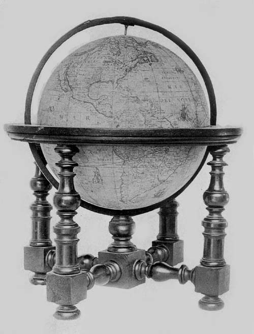
Fig. 103. Terrestrial Globe of Mattheus Greuter, 1638.
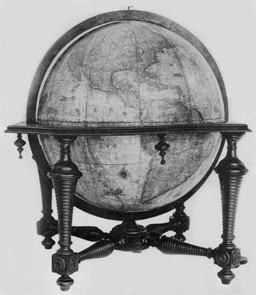
Fig. 103a. Terrestrial Globe of Dominico Rossi (Mattheus Greuter), 1695.
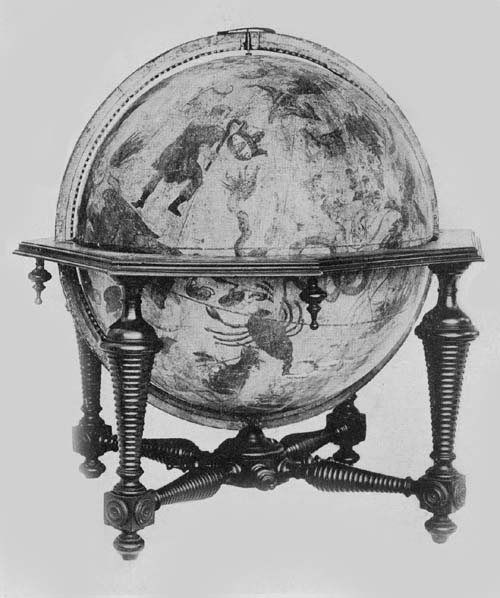
Fig. 103b. Celestial Globe of Dominico Rossi (Mattheus Greuter), 1695.
Attention has previously been called to the reproduction in Italy of the Hondius globes by Giuseppe de Rossi in the year 1615. It appears that to the Rossi family belonged a number of map engravers and art printers during the seventeenth century and particularly to that branch making its home in the city of Rome. As globe makers we however find them playing the rôle of copyists rather than that of independent producers.
In The Hispanic Society’s collection of old globes may be found a pair in an excellent state of preservation signed “Dominici de Rubeis (Rossi),” and dated “1695.” Each globe ball is composed of papier-mâché, having a diameter of 49 cm. and each is covered with a map printed on twelve gores, with a small circular disc for the polar space (Figs. 103a, 103b). In the List of Globe Makers other examples are noted.
In the South Pacific, on the terrestrial globe, one finds the inscription “Romae ex Chalcographia Dominici de Rubeis, heredis 70. Jacobi, ad templum S. Mariae de Pace, Anno 1695.” Dominico, whose name here appears, achieved considerable distinction as the publisher, with his relative Giovanni Giacomo de Rossi, of an atlas of one hundred and fifty-two maps, one of the finest examples of Italian cartography of the period. In a cartouch in the South Atlantic, on this globe, we find the name Mattheus Greuter given as the engraver, whose work has been referred to above, clearly suggesting that Rossi had merely reissued a globe of earlier date, since Greuter had died in the year 1638. A careful examination of the globe map confirms the suggestion, since no record is made of geographical discoveries after the year 1630. In the region of the North Pole the discoveries of the English and of the Dutch are recorded to the year 1628, and it may further be noted that in this same northern region the islands of “Frislanda” and “Brasil” are laid down, while in Greenland is a reference to the location of the fabled Monastery of St. Thomas.
References are made in legends to the discoveries of Magellan, Lemaire, Schouten, Frobisher, Davis, Hudson, and Drake. The region about New York is called “Nieu Nederland.” One can recognize the representation of the St. Lawrence, and the Mississippi. In the western region of the New World there appears to be considerable confusion as to the geography of the country, apparently the result of reading, without understanding, the records of the Spanish and of the English. One finds, for example, California represented as an island, and a double representation of the Strait of Anian.
The Spanish, French, English, Dutch, and Latin languages have been employed in names and legends.
The mounting of the globe is artistic and substantial, consisting of the usual horizon circle, octagonal on its outer edge, but circular on the inner edge to receive the globe ball, and having pasted on its upper surface the usual engraved paper strips and all that there is engraved thereon in the best examples of globe making. The meridian circle of wood, within which the sphere is made to revolve, is graduated. The supporting base consists of four exquisitely turned columns, braced at bottom with correspondingly well-turned crossbars.
The celestial globe has a mounting altogether like that of the terrestrial, and in the character of the map engraving there is agreement. The figures of the several constellations are copies of these drawn by Tycho Brahe, and all have been exquisitely colored. Stars from the first to the sixth magnitude are represented, while special attention is called to the new star in Cassiopeia first appearing in the year 1572, and to the comets of the years 1597 and 1616. Near Ursa Major is the author and date legend reading “In hoc Caelesto Globo notantur omnes stellae fixae, ad annum 1636 accommodatae, quae iuxta observationes Tychonis Brahae maximo illo Jansonii anno 1622 edito positae sunt, additis stellis quae a nauclero Petro Theod. circa Polum Australem notatae sunt ... Romae ex chalcographia Dominici de Rubeis, her. Jo. Jac. de Rubeis anno 1695.”
The twelve gores of the map have been mounted so as to join at the north and south poles of the ecliptic, there however being a small covering disc at each pole, so frequently employed since Mercator’s day, the globe itself being made to revolve on its equatorial axes.
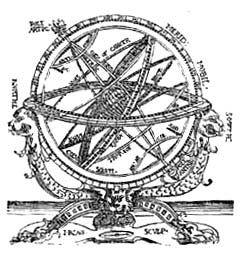
To the makers of armillary spheres in the first half of the seventeenth century there may be added the name of Adam Heroldt, a native of Germany. We know little, however, of the extent of his activities. One example of his work is known, which bears the simple inscription engraved near the south polar circle “Adam Heroldt fecit Romae anno dn̄i MDCIL.” “Made by Adam Heroldt in the year 1649.” This sphere once belonged to the astronomer De Gasparis of Naples, but passed some years since into the collection of the Museo Astronomico of Rome. It is constructed entirely of brass, the diameter of the largest circle being about 14 cm. Its several circles, including the polar, the equatorial, the zodiacal, and the horizon, are graduated, the last-named having engraved on its surface the names of the months and of the winds, and resting on two semicircles, which in turn are supported by an artistically designed foot. The entire height of the sphere is about 20 cm. At the north pole is an hour circle bearing the inscription “Index Hor: Italic.” Within and at the common center of the several circles is a small ball representing the terrestrial sphere, which has a diameter of but 1 cm., and within the circle of the ecliptic and coördinated with it is a ring carrying the sun, while within this is one for the moon. The piece may be referred to as a fine example of the armillary sphere of the period.
Manfredo Settàla (1600-1680)59, a nobleman of Italy, was in his day a distinguished promoter of science and art, and an intelligent collector of rare objects, which he brought together in a museum of his own founding. This he described in a work bearing title ‘Museum Septalianum,’ which was published in Italian in the year 1666 by Scarabelli. This museum later passed into the possession of the Ambrosiana of Milan, where it has been considered one of the choicest additions.
Settàla had included globes in his collection, among which there has previously been mentioned that made by the Cremonese Gianelli, in the year 1549. But not only was he a collector; he likewise became interested in the actual work of globe construction. Among the objects coming to the Ambrosiana from his museum is an armillary sphere bearing the inscription, “Manfredus Settalius fecit MDCXLVI.”60 It is described as a sphere having a base of brass, its several circles including those representing the zodiac, the equator, the meridians, and the horizon, all being movable on a common axis, on which axis at the common center of the circles is a small ball 4 cm. in diameter, representing the earth. To this sphere rather extravagant praise is given in the descriptive catalogue referred to above.
There is a third armillary sphere belonging to the Settàla collection, which is of silver and which probably was constructed near the middle of the seventeenth century, although it is neither signed nor dated. It is 40 cm. in height, having a circle representing the ecliptic 15 cm. in diameter, which is graduated, having on its upper surface engraved figures representing the twelve zodiacal constellations. The meridian circle has a diameter of 16 cm., the horizon a diameter of 16 cm. and a breadth of 3 cm., on the upper surface of which have been engraved the names of the months, and the signs of the zodiac. In addition to the parts mentioned it has two small polar circles, and at the common center a small silver ball 1 cm. in diameter representing the earth.
Attention has been previously called to the transfer of the business of Jodocus Hondius into the hands of the son-in-law, Johan Janssonius, and of Abraham Goos, by whom it was carried on after the year 1640. This firm continued to issue the Hondius globes, modifying them from issue to issue with the addition of some of the latest geographical information obtainable. In the year 1648, with Johan Janssonius as editor and Abraham Goos as author and engraver, there was issued a pair of these revised Hondius globes, each having a diameter of 87 cm. On the terrestrial globe we read “Amstelodami Edebat Joannes Jansonius Sculpebat magnoque studio componebat Abrahamus Goos Amstelodamensis.” “Amsterdam. Edited by Johan Jansonius. Composed with much study and engraved by Abraham Goos a native of Amsterdam.” Further details concerning this globe have not been obtainable, but it is very certain, although differing in size, it contains practically all the features common to the earlier editions of the Hondius terrestrial globes, and especially of the later ones.
The celestial globes have the following inscription: “Sphaera nova summo studio summaque diligentia atque industria Clarissimi viri D. Adriani Metii Watheseos apud Frunequeranos Professoris Ordinarii ad abacos Nobilissimi viri Thiconis Brahe configurata observationibus quamplurimis tum circa polum arcticum a discipulo suo Houtmanno adhibitis aucta et in annum 1620 reducta. Edente Joanne Jansonio 1648.” “A new globe constructed with the greatest industry, zeal and diligence accommodated to the tables of the most noble Tycho Brahe, enlarged by very many observations, those around the Arctic pole being made by myself, and those around the Antarctic by his disciple Houtmann. All, accommodated to the year 1630. Constructed by Johan Jansonius, 1648.” A pair of these globes may be found in the library of the Marquis Borromeo of Milan.
NOTES