WHAT TO DO
Reading edition
For most visitors, the park’s scenic splendors are the chief attraction. There is a choice of several auto drives; and miles of trails beckon those who prefer hiking or horseback riding. A few of the principal automobile and trail trips are described below.
The park ranger-naturalist activities are popular; so is fishing, a park sport for which a State license is required. All activities within the National Park are keyed to the natural scene.
50
The principal winter-use area in Rocky Mountain National Park is at Hidden Valley along Trail Ridge Road, 10 miles west of Estes Park. Skiing, ice skating, snowshoeing, and platter sliding are popular here. The area is designed for family winter use, not as a typical ski resort. There are down-mountain ski runs and several practice areas so that either the expert or the novice skier will find slopes to his liking. Ski tows service popular slopes. A lodge and a warming shelter are provided at two popular locations within the area for the use of winter sports enthusiasts. Rental equipment, food service, lounge, and other facilities are available at the visitor center. Cross-country skiing may be enjoyed by the experienced skier at numerous locations on the eastern side of Rocky Mountain National Park and on the western slope in the vicinity of Grand Lake.
Here are a few photo hints: the light is intense at high altitudes; many shots are made at half the exposure needed nearer sea level. Mornings are best for pictures; afternoons are often cloudy. Use side-light for depth, and break up the foreground on long shots. Color film will not register accurately the intense light of the sky and the dark green of the forest on the same exposure. Film, filters, and other supplies are available at the gateway towns. Color slides are sold at Moraine Park Visitor Center and nearby curio shops.
Automobile Trips
Mountain driving is different from ordinary automobile travel, and presents special problems. In most of the park a speed limit of 35 miles per hour is enforced (20 m.p.h. on curves). This permits leisurely sightseeing; but do not stop on the road. Stop in a parking area and walk back to a scenic spot, if necessary. Vapor lock, which often stalls cars, is caused, in part, by driving the car up steep grades in high gear; use lower gears and keep the motor cooler. Most cars stalled by vapor lock will start after cooling off for about 10 minutes. Keep your car in gear and use lower gears, if possible, on down grades, too; do not use overdrive. Drive carefully and courteously. Gateway towns have the usual auto services.
Trail Ridge Road. The 50-mile drive from Estes Park to Grand Lake across the Front Range in Rocky Mountain National Park is one of America’s most magnificent auto trips. Trail Ridge Road, a modern, hard-surfaced road, is usually open from late May to mid-October. For sheer scenic beauty, for easy access to the fantasies of treeline and tundra, and for a variety of natural landscapes within a few miles, Trail Ridge Road has few equals anywhere in the world.
Trail Ridge proper is a massive ridge extending easterly from the Continental Divide. In the early days an Indian trail crossed the mountains via this ridge—hence the name. The present road was built by the National Park Service in the early 1930’s on a route chosen for maximum scenic possibilities and minimum snow-clearance problems.
51
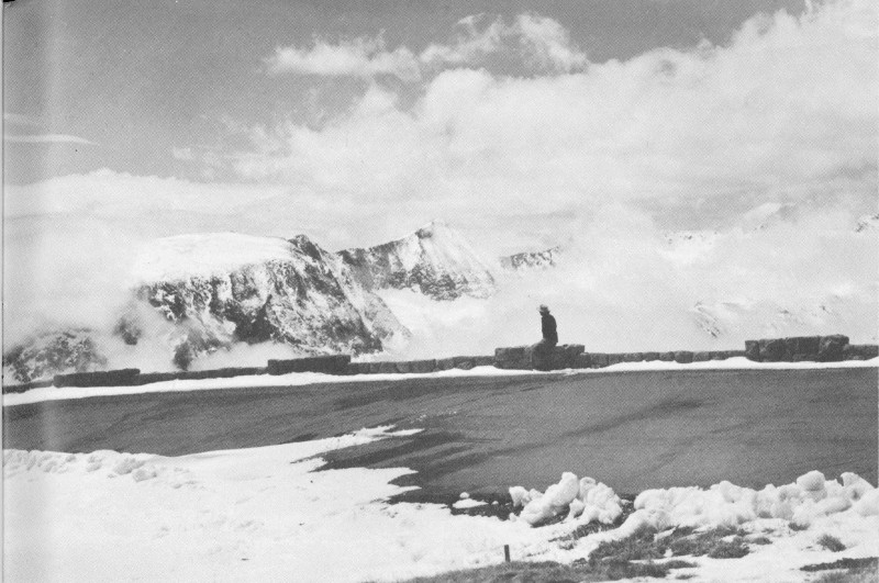
Trail Ridge Road, altitude more than 12,000 feet, experiences winter most of the year. It is open to motor travel in summer only.
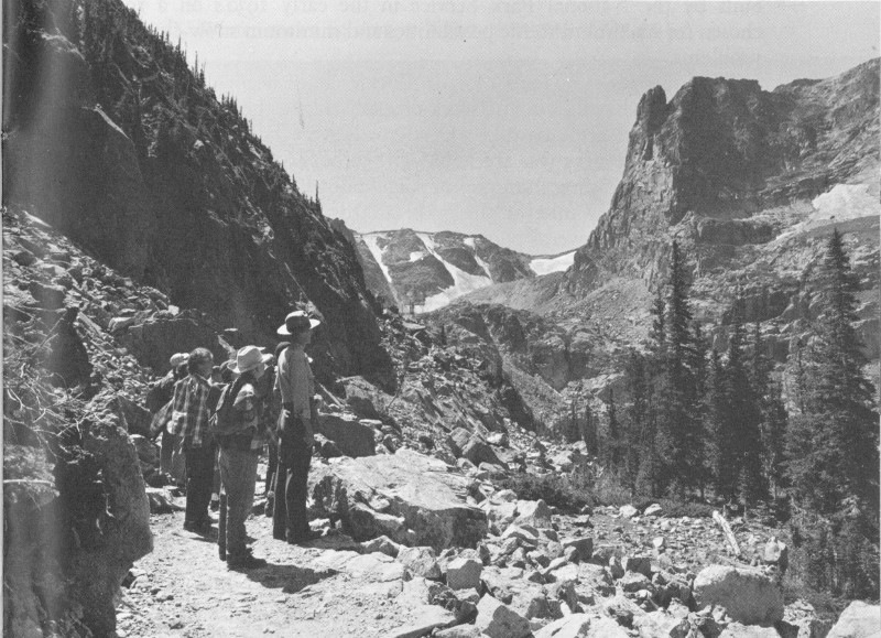
Park naturalists conduct field trips during the summer season.
52
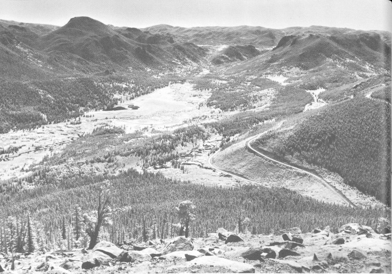
From Rainbow Curve, an extensive view to the east affords glimpses of the lower levels of Trail Ridge Road.
The lofty peaks of the Colorado Rockies have been sculptured by glaciers into a bewildering network of rocky ridges, sheer cliffs, needlelike crags, and great cirques. Until roads were built, much of this breathtaking scenery was accessible only to hardy mountain climbers. Now all can see choice samples of high country from a car.
Although every mile of this road affords scenes of great interest and rare beauty, several points deserve special attention: Many Parks Curve permits close observation of the chipmunk, golden-mantled ground squirrel, and Clark’s nutcracker, and excellent views of the meadows. To the north is Fall River Valley, and beyond, the towering peaks of the Mummy Range. This valley was the melting basin of a great glacier. The fine view to the south includes Longs Peak (14,256 feet), looming over the green flats of Beaver Meadows and Moraine Park. Several moraines—long, generally parallel ridges of broken rocks built up at the edges of glaciers and now heavily forested—stretch out before you, separating one park from the other.
53
Above Many Parks Curve, the road climbs along the north side of Trail Ridge, loops about the head of upper Hidden Valley (where skiing is in vogue during the winter), passes the 2-mile elevation sign, and reaches another parking area at Rainbow Curve, about 8 miles from Deer Ridge, and one-half mile higher in altitude. The view from Rainbow Curve is vast, open, and superb, with the Great Plains visible far to the east and forested canyons or glacial meadows nearer at hand. Many interesting geological features are pointed out on the roadside exhibit panels at this point.
Leaving Rainbow Curve, the road follows the rim of another deep canyon, passing through a ghost forest, scene of a devastating fire in the 1870’s. Grotesquely formed treeline trees reflect the harsh climate at this high altitude. As the Rock Cabins are passed, a superlative view opens up to the south across Forest Canyon. For several miles the road traverses the Alpine zone tundra, carpeted during July by low-growing, colorful flowers.
Glaciated mountains south of Trail Ridge Road can be seen to best advantage from Rock Cut (altitude 12,110). Gorge Lakes, Forest Canyon, and other landscape features are indicated in roadside exhibits. If time permits, a short hike can be made over a nature trail to the nearby Roger W. Toll Memorial Peakfinder. A walk along this trail provides a rare opportunity to become acquainted with the tundra; however, the high altitude affects some people adversely, so it may not be advisable for persons with heart ailments to attempt the trip.
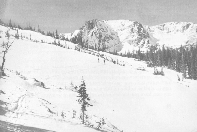
Winter snows lie deep at higher elevations of the park.
54
Iceberg Lake, which occupies a glacial cirque, was named from the presence of blocks of ice that remain on its surface even in late summer, except in extremely warm and dry years. The reddish cliffs at this point are made up of relatively recent lava, which is not common in the park. The highest point (12,183 feet, marked by a sign) is between Iceberg Lake and Fall River Pass. The pass is a popular stopping place, with restrooms, alpine exhibit room, and lunch counter.
Below Fall River Pass the road continues downhill all the way to Grand Lake. The Continental Divide is crossed at Milner Pass at an altitude of 10,758 feet, in the midst of a typical spruce-fir forest. As Far View Curve is approached, the valley of the Colorado River comes into view, and the rugged Never Summer Range looms up to the west. The road descends from this point in sharp switchback curves to reach the wide floor of the Colorado Valley. From here to Grand Lake, the route follows the valley. Deer and elk are often seen in this vicinity. The lake itself, over 250 feet deep, is one of Colorado’s scenic gems. The town of Grand Lake, outside the park, is a friendly western town with the usual resort accommodations.
Bear Lake Road. This is a short spur road, leaving from Beaver Meadows Entrance on one of the eastern approaches to Trail Ridge through Moraine Park and Glacier Basin to Bear Lake, nestled at the foot of the high mountains. Everyone should make this trip, if time permits—an extra hour or so will do it. The road traverses glaciated meadows and moraines; it affords splendid views of Longs Peak. Great stands of aspen on Bierstadt Ridge make this a colorful drive in autumn. Bear Lake, at the end of the road—the only high lake in the park accessible by auto—is a foreground for the view up Tyndall Gorge, with the sheer cliff of Hallett Peak making a dramatic backdrop to the alpine scene. A half-mile trail encircles the lake, giving different scenic effects with every step, and nature-trail labels aid in enjoyment of the rocks, wildflowers, and trees. A short hike—a mile or so—from Bear Lake to Dream Lake gives you an opportunity to escape auto traffic and see some of the park, without undertaking too arduous a climb.
Trail Trips
You are urged to take at least one trail trip, for only on the trails can you experience the real essence of the mountains. Everyone has his favorite trail; you can make your own selection. The first decision is whether to hike or ride a horse—or to try both methods. In any case, leave your car behind for at least 1 day of your visit.
55
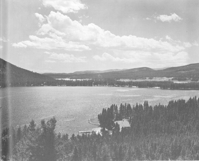
Although Grand Lake is outside the park, an excellent view of it can be obtained from within the park.
Certain rules covering trails should be observed:
To avoid getting lost stay on designated trails. Repeated short cuts damage the trails, necessitating repairs.
If you are hiking, yield right-of-way to horses by standing quietly off the trail as the riders pass.
Deposit trash in receptacles; keep trails free of litter.
If you plan to cook out, obtain a fire permit from a park ranger. This is a fire-protection regulation.
Leave dogs behind. Their presence on trails disturbs wildlife.
With some 200 miles of trails in the park, beginning at a dozen different points and ending at scores of destinations, you may have difficulty planning your trail trips before you arrive. Information on the various trail trips is best obtained after you get to the park. The park rangers, the museum attendants, the naturalists, and the saddle-horse operators can help you outline trips.
56
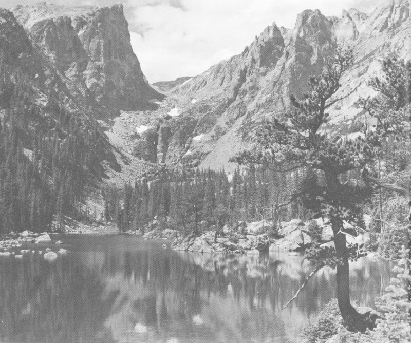
A short hike from Bear Lake takes you to Dream Lake, with its matchless view up Tyndall Gorge.
A brief description of a few of the popular trips follows:
Trails from Bear Lake.
One of the trail hubs of the park is Bear Lake. A “must” is the 1-mile hike to Dream Lake, near the foot of Hallett Peak. From Dream Lake you can take a primitive trail another mile to Emerald Lake in Tyndall Gorge or a developed trail to Lake Haiyaha in Chaos Canyon. Each trip is an excellent half-day hike. You may want to go along the big moraine to Bierstadt Lake, or to the top of Flattop Mountain from Bear Lake—a long, uphill climb, with a reward of marvelous views. The splendid all-day hike to Odessa and Fern Lakes begins here, too. This can be a loop trip, via Cub Lake, returning to Bear Lake; or, if you can arrange to be met in Moraine Park, an excellent 9-mile “through” hike with a minimum of uphill walking is possible.
Glacier Gorge Trails.
A mile below Bear Lake is a parking area from which trails lead in several directions. Two short hikes—about 57 4 hours each—are possible from here to Lake Mills in Glacier Gorge (at the foot of Longs Peak) and to The Loch, a lovely mountain lake. From these lakes, dim “fishermen’s” tracks lead on to higher and more remote lakes. From The Loch a primitive path leads to Andrews Glacier. These latter tracks are not really trails and, although easily followed, usually require some local specific information. There is also a seldom-used, constructed trail from Glacier Gorge parking area up to Boulderfield near the top of Longs Peak. This makes a good horseback trip but is not popular with hikers because the destination is so much more easily reached by the shorter trail from Longs Peak Campground. A spur from this trail leads, via Storm Pass, to Tahosa Valley.
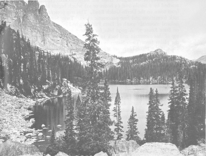
Only by trail can you reach such high-country lakes as this.
Fern Lake Trail.
At the end of the Moraine Park Road is a picnic area. A trail begins here which follows Big Thompson River, past beaver dams and The Pool, to Fern Falls and Fern Lake. From Fern Lake the trail continues to Odessa Lake and on to Bear Lake. Many people leave Bear Lake, reaching Moraine Park by this trail. The trip is about 9 miles; 6 hours gives ample time for a leisurely pace.
Wild Basin Trails.
Many persons consider Wild Basin the finest wilderness area in the park. Trails begin here at the road’s end and 58 lead up the branches of North St. Vrain Creek to many beautiful lakes. One popular hike (about 4 hours) is to Ouzel Falls, via Calypso Cascades, and return. Most of the other trips in Wild Basin are longer and make more suitable all-day hikes. Thunder Lake is one of these spots. Ouzel and Bluebird Lakes make another 1-day trip combination. There is no trail across the range here, but some fine, back-country hiking possibilities exist for the sturdy, seasoned hiker.
Western Slope Trails.
Many people hike or ride horseback from Bear Lake over Flattop Mountain to Grand Lake via either Big Meadows or North Inlet. This takes all day as compared with 2 or 3 hours by road. However, the trail trip is through much splendid scenic country which is not seen by the highway traveler between these two points. Hikes in the Grand Lake vicinity include one to Shadow Mountain Fire Lookout, with matchless panoramic views, and the interesting “trail to nowhere,” up Columbine Creek. The trail distances to major points of interest on the west slope are longer than on the east side of the park, and many people prefer to use horses. By riding, trips to Lake Verna in East Inlet and Lakes Nokoni and Nanita in North Inlet can be made in 1 day. A number of spectacular horseback trips in Never Summer Range are possible. Saddle-horse operators can help you plan such trips in this vicinity.
Trails in the Estes Park Vicinity.
Several interesting trail trips near Estes Park village and in the lower altitudes of the park are available. These are especially pleasant early or late in the season when many of the higher trails are snow-blocked. Gem Lake is reached by a 2-mile trail (3 hours or so) which begins about 1 mile from town on the Devils Gulch Road. This trip presents interesting rock formations and fine panoramic views. Twin Sisters is a high, isolated mountain south of Estes Park, reached by a trail beginning on State Route 7. A good hike for about 7 hours takes one to the top of this mountain and back in a leisurely manner. The view of the plains from Twin Sisters is extensive, and treeline flowers add color to the trip. There are several other hiking trails in this area.
Trails near Trail Ridge Road.
At Deer Ridge, a trail leads to the commanding summit of Deer Mountain, which is a fine, early-season hike although dry in midsummer. On the tundra, a trail leads from Rock Cut on the road to the Memorial Peakfinder. A trail also leads from Iceberg Lake to Fall River Pass. At Milner Pass a trail leaves the highway, passes through an especially beautiful forest, and reaches the top of Specimen Mountain. This hike affords matchless scenic views, particularly of the Never Summer Range, fine displays of wildflowers, and possible glimpses of bighorn. Near the spot where Trail Ridge Road begins the ascent of the western slope, a trail leads 59 up the Colorado River to the ghost town of Lulu City, and branches continue to Poudre Pass, Thunder Pass, and beyond.
Many of these trails—and others—can be covered by visitors on summer trips with the park ranger-naturalists. These escorted hikes help you to get your bearings in the park, as well as understand the natural features encountered along the route. If you are interested in hiking, you should join a few of these naturalist trips. In this way, you quickly realize the possibilities for your unescorted hikes, if you prefer to travel on your own. The park ranger-naturalists will help you plan other hikes and will do all they can to make your trail trips safe, interesting, and enjoyable.
This outline of trail-trip possibilities is only a beginning. There are also trips to Lawn Lake, Tyndall Glacier, Windy Gulch, the North Fork of the Thompson River, and Chasm Lake. Information on the far more difficult mountaintop trips is not included here. If you expect to ascend such mountains as Longs Peak or McHenry’s Peak, be sure to consult the park ranger at the nearest ranger station or go to the chief ranger’s office in Estes Park village. Routes to be followed may vary from week to week because of changes in snow conditions; ask park rangers for up-to-date information. Remember to get a fire permit if you plan to camp out on the trail.
60