PART III.
Reading edition
LIST OF GLACIÈRES.
LIST OF GLACIÈRES.[68]

NORTH AMERICA.
Buried or Fossil Glaciers, North Greenland. (W. E. Meehan, Philadelphia Ledger, 1896.)—On Robertson’s Bay is the plateau of the Verhoef Glacier, which is about 1500 meters long and 400 meters wide, and stands back only a few meters from the edge of the sea. This plateau, both top and sides, is a mass of flourishing vegetation, chiefly grass, which reaches above a man’s knee. From among this verdure buttercups, poppies, cinquefoils and dandelions thrust their golden heads in wild profusion. Similar buried glaciers are found in many places along the fiords of North Greenland.
Mr. Meehan gives a simple explanation in connection with the Verhoef Glacier. He says that this glacier formerly extended out into the sea, and that while it moved forward, the clump moss, which struggles for existence in Greenland gorges, could do little more than hold its own. In course of time, from some unknown cause, the glacier receded to the point where it now discharges, the part in the water floating away in the shape of icebergs, and the part on the shore remaining stationary. This was the opportunity for the clump mosses. Caring nothing for the cold they crept slowly over the quiet mass of ice and made their way first in thin net-like layers, later in thick masses, till they reached the rocky shore. Year after year the mosses grew, the young plants trampling underfoot the older; until the latter, rotting, turned into a rich mould. The seeds of grasses and flowers found their way to this, blown by the wind or carried on the feet of birds. The plateau now is a garden of green, gold and white. How long this will last it is impossible to say, as any time nature may unloose its hold, and the frozen river once more pour down into the bay.
Subsoil Ice in Alaska. (I. C. Russell, A Journey up the Yukon River, page 149, and Second Expedition to Mount Saint Elias, page 19.)—Professor Russell found ice covered by rocks and vegetation in several places in Alaska, especially along the southern edge of the Malaspina Glacier and on the Yukon River. He gives the following interesting account in 1890 of these ice sheets: "Throughout the length of the Yukon, one is frequently reminded of the high latitude drained by the great river, by seeing strata of ice in the recently cut banks, beneath the dense layer of moss and roots forming the surface on which the forests grow. One may frequently find ice even on a hot summer’s day, by scraping away the moss at his feet. In some instances the frozen layer has been penetrated to the depth of twenty-five feet, but its full depth has never been ascertained. In the banks of some of the streams to the north of the lower Yukon, strata of ice over a hundred feet thick have been observed, and the indications are that its total depth is considerably greater than the portion exposed. This subsoil ice is stagnant and without the characteristics of glaciers."
Subsoil Ice in the Klondike Region. (Philadelphia Ledger, December 30th, 1897.)—The Klondike mining country is covered with snow most of the year. The ground is frozen for ten or twelve meters in depth, down to bed rock. In some places the ground, which is protected by a thick moss, is not thawed out by the sun in summer. The miner cuts off the moss with a shovel, and then builds a fire, which thaws out the ground for five or ten centimeters. He digs this out, rebuilds a fire, and then continues this process.
Ice Cliffs on the Kowak River, Alaska. (Lieutenant J. C. Cantwell, National Geographic Magazine, October, 1896.)—On the shores of the Kowak River are a series of ice cliffs of from about 25 meters to 45 meters in height. On top of these ice cliffs is a layer of black silt-like soil some 2 meters in thickness, and from this springs a luxuriant growth of mosses, grass and Arctic shrubbery. The melted ice shows a residuum of fine dust, which while fresh emits a pungent odor.
Subterranean Ice Sheet on Kotzebue Sound. (Otto von Kotzebue, Entdeckungsreise in die Südsee, etc. Weimar, 1821. Vol. IV., page 140.)—Dr. Eschholz discovered near Kotzebue Sound, in 1816, a mass of ice more than 30 meters thick, and entirely covered with a layer at least 15 centimeters thick of clay, sand, and earth, on which heavy, long grass was growing. In the ice and in the soil overlaying it, were many remains of extinct animals. On the side towards the ocean the ice was entirely bare, exposed to sun and air, and much of it was melting away in streamlets.
Freezing Lava Caves, Washington. (R. W. Raymond, Overland Monthly, 3d November, 1869, page 421. Th. Kirchhoff, Reisebilder und Skizzen aus America, 1876, vol. II., page 211. Philadelphia Ledger, September 25th, 1899.)—These caves are distant about four hours from the foot of Mount Adams, and about 56 kilometers from the mouth of the White Salmon River, where it falls into the Columbia River. The caves are in basalt, and they are connected at both ends with the open air. Only a few of them contain any ice, which in the largest cave is about 6 meters below the entrance, from which one descends by a ladder. The cave opens on one side and is some 15 meters in depth, 6 meters or 8 meters in width and 3 meters or 4 meters in height. This part contains the most ice. The other side gradually narrows from the entrance, is longer, and reaches out through fallen rocks and rubbish to daylight. In the lower portion, there are a few ice stalactites and stalagmites: one a superb, transparent hillock, which rises nearly to the roof, is called the Iceberg. A strong draught flows into the cave in summer through the open arm.
The following paragraphs from the Philadelphia Ledger probably refer to the same locality:—
“Ice for the cutting, and that in August and early in September, is a novelty not often found in regions as far south as the Columbia River basin; but the novelty is enjoyed every year by people who visit the ice caves under the shadow of Mount Adams, about 100 miles northeast of Portland. It is a very extensive region. Frank McFarland, who has just returned from a six weeks’ vacation camping trip there, gives an interesting account of its general make up.
“At the ice caves, which are six miles from Trout Lake, the stalactites are more beautiful and wonderful this year than ever before, and this was Mr. McFarland’s fifteenth trip there. He broke off and took to camp chunks of ice weighing 100 pounds. Pleasure parties who come to the lake use considerable of the ice for packing their trout to take home. All you have to do is to take a torch of pitch pine or a lantern, and go into the big caves and pack off all the ice you want. It is a sure crop, and never fails.”
Ice Spring in the Rocky Mountains, Oregon. (G. Gibbs, American Journal of Science and Arts, 1853, Second Series, vol. XV., page 146.)—The Ice Spring is about 60 kilometers from the South Pass to the right of the Sweetwater River. It is situated in a low marshy swale, where the ground is filled with springs; and about 60 centimeters below the turf is a sheet of horizontal ice, some 10 centimeters to 30 centimeters thick, lasting throughout the year. The ice is clear and is disposed in hexagonal prisms; it has a slightly saline taste, the ground above it being impregnated with salt and the water near by tasting of sulphur.
Freezing Lava Caves in Modoc County, California. (Dispatch, Frankford, Pennsylvania, 22d January, 1897, reprinted from another paper.)—The lava beds, where the Modoc Indians made their last stand against the United States troops, are described as an immense field of lava covered with a beautiful forest of conifers. Numerous caves of varying shapes and dimensions are scattered throughout these lava beds. Some are mere covert ways, with an arch of stone thrown over them; others are immense chambers some meters from the surface; another kind sinks deeply and may be in a series of chambers united by a corridor that opens at the surface; while another kind seems to go directly to the centre of the earth without stopping. Some of these caves contain ice and from them the Modocs drew their water supply while besieged by the troops. Judging from what is reported of the caves the quantity of ice in them must be large. The thermometer in winter in the region is said to go as low as -30° C.
Freezing Lava Beds near Medicine Lake, Siskiyou County, Northern California. (M. S. Baker, Sierra Club Bulletin, 1899. Vol. II., page 318.)—"One other feature of the lava region must be mentioned—the ice caves. There are several of these known, and very likely many more remain undiscovered. Those located along the edge of the lava, near the cinder cone, I have known to contain ice and water as late as August. The largest I have seen is on the Mayfield Road, about twenty miles east of Bartles. It is situated in the barren lava, and in one of the warmest localities of the region,—and there are few cool spots in the lava anywhere. One enters the cave by crawling down a hole none too large. The instant the interior is reached the temperature falls in a surprising way. Not more than ten feet below the surface of the hot rocks is a bed of ice, covered by a foot or so of ice water. The body of ice was perhaps twelve or fifteen feet long, by five feet across in the widest places. This cave is formed by a fissure that extends a distance of twenty miles from the ice cave to Pittville, and nearly coincides with the 4000 foot level, as shown in the map. Along the southeastern half of this earth fissure the southwest wall has faulted, leaving a cliff, which, in places, must be nearly 200 feet high."
Freezing Shafts, Montana.—Mr. Robert Butler, of San José, Cal., has given me much information about glacières in Montana. He visited one miners’ shaft which is situated about 80 kilometers up the Rosebud River from Rosebud Station on the Northern Pacific R. R., and about 10 kilometers northeast of the Cheyenne Indian Agency. It is on the north slope of the Little Wolf Mountains, near the summit, at the head of Greenleaf Creek. The canyon and surrounding slopes are covered with a dense growth of pine. The rock has the appearance of scoriæ caused by the burning of immense beds of coal in recent geological times. The rock is broken into comparatively small pieces. The altitude is some 1200 meters. The forest, the volcanic ash and the altitude, besides the loose rock formation, makes this place a natural ice house. Ten or twelve years ago three prospectors, looking for silver, sunk a shaft here. At a depth of about 4 meters it began to grow cold, and at 6 meters they found ice and imagined they could feel an upward draught. Being ignorant and superstitious, they became frightened and abandoned the shaft. During the winter, the snow fills the shaft half full of ice, which then remains over through the summer. There is a general report and belief among those who have visited the well, that it freezes in summer and thaws in winter. There are thousands of mining shafts in Montana, and if they are on the north slope of a mountain of considerable altitude and under a dense forest and not too deep, they generally have ice at the bottom during the summer. It is also said to be nothing new for a miner in following crevices to find them filled with ice, especially if near the surface on the north slope of a mountain.
Freezing Cave, Fergus County, Montana.—Mr. Robert Butler, of San José, Cal., visited this place, which is about 35 kilometers southeast of Lewistown. It is on the north side of a butte. Masses of ice and great icicles form in some parts of the cave in such quantities during the latter part of winter that the cave furnishes ice for cooling the drinking water for several dozen families. During July and August the people come from some distance around to get the ice. The people in the neighborhood believe that the ice forms in summer and thaws away in winter. They also speak of the ever upward draught of cold air coming possibly from some great hidden cavern in the lower recesses of the mountain.
Freezing Well at Horse Plains, Montana. (Levi Allen, Scientific American. New Series, 27th October, 1883.)—The well is described as 13.60 meters deep. It is dug through solid gravel, and in sinking it there was encountered, at a depth of 10.60 meters, a current of air strong enough to blow out a candle. It began to freeze in September, 1882, and in November it was frozen solid.
Freezing Silver Mine, Bighorn County, Wyoming.—This place is in the Sunlight Basin of the Shoshone Mountains. Mr. William Worrell Wagner, of Philadelphia, informs me that he visited it in August, 1897. It is a silver mine or tunnel, running straight into the mountain for about 60 meters, at an altitude of about 3300 meters. The peaks of the Teton range were in sight from the mouth of the tunnel. For the first half of the way in, a good many icicles were hanging from the rocks. The last half of the tunnel was thickly coated with ice and looked like a cold storage plant. Snow disappears on the rocks outside about June, and begins to fall again in September, so that Mr. Wagner’s visit was at about the hottest time of the year. Mr. Wagner presented the meat of a bull wapiti he had shot to the miners, and they stored it in the mine as if it had been an artificial refrigerator.
Rifts of Ice, Mount McClellan, Colorado. (Edward L. Berthoud, American Journal of Science and Arts. Third Series, 1876, vol. XI., page 108.)—Near the summit of Mount McClellan, is the Centennial Lode, which runs into the mountain, at an altitude of about 3900 meters. Intercalated in the mineral vein are three or four well defined veins of solid ice parallel with the bedding of the rock and filling all its inner side-cracks and fissures. The same frozen substratum is found in two other lodes near by on the same mountain. Nothing of the kind is known on other Colorado mountains. The soil is loose and largely made up of rocky débris, which shows that the ice is probably due to local causes.
Freezing Tunnel on the Hagerman Pass, Colorado. (Philadelphia Press, October 16th, 1897.)—The Hagerman Pass Railroad line is said to have been abandoned after the completion of the Busk-Ivanhoe tunnel, but to have been rebuilt. The Hagerman tunnel for a distance of over 700 meters was filled with solid ice, and it required blasting with dynamite, and a month’s continuous labor, day and night, to dig the ice out.
Freezing Cavern in Cow Mountain, Colorado. (Post Dispatch, St. Louis, Mo., July 13th, 1897, and September 5th, 1897. Mail Order Monthly, St. Paul, Minn., October, 1899.)—The cave was discovered by parties doing assessment work on a group of claims. A man was picking in a three meter hole when he struck his pick into an opening, which was gradually enlarged and showed a deep pit underneath. The men got a rope and descended into an immense cavern full of ice. Later exploration led to a small hall, some 5 meters in diameter, full of icicles. From here a fissure led into a second rock chamber larger than the first. A small hole in the floor at an angle of some 45° gave access to a third and larger hall, about 25 meters by 40 meters. Great masses of ice were found in this, also a small lake, about 12 meters by 20 meters. “Some who have visited the wonderful discovery are of the opinion that it is a great cave or fissure in a glacier which for centuries has been slowly making its way down from Pike’s Peak and whose waters are now feeding the Arkansas River.”
Windhole, Arizona. (Christian Herald, March 24th, 1897.)—Mr. Cofman, while drilling a well on his place, is said to have opened a windhole from which the escaping air current was strong enough to blow off the hats of the men who were recovering the lost drill. Some days the air escapes with such force that pebbles the size of peas are thrown up, accompanied by a sound much like the distant bellowing of a fog horn. Again for days there will be a suction current, unaccompanied by sound, in which the current of air passes into the earth with somewhat less force than when escaping, and any light object, as a feather or a piece of paper, will be immediately sucked in. The account is probably exaggerated.
Freezing Lava Cave near Flagstaff, Arizona.—Professor W. B. Scott of Princeton University told me of this cave, which he had not visited himself. It lies 14.5 kilometers south of Flagstaff, on the Mesa table land, at an altitude of about 2000 meters. It was described to Professor Scott as a double cave, with two floors, one over the other, the lower containing the most ice. It is in lava, and can only be entered by crawling in on hands and knees.
Freezing Cave or Gorge, White Mountains, Arizona.—Mr. Frank Hamilton Cushing has told me of this place. It is a cleft among lava rock, which being roofed at the further end, might be described as a cave. In this the ice remains until June or July, much later than anywhere else in the neighborhood. The Zuni Indians worship before this, calling the ice the breath of the Gods, the snow they consider as a sort of down. The region is arid, which makes any water precious, and this fact has developed the element of mysticism about snow and ice among the Indians.
Freezing Cave near Galena, Black Hills, South Dakota. (Miss L. A. Owen, Cave Regions of the Ozarks and Black Hills. Cincinnati, 1898, page 209): “At Galena, a new mining town of golden promise, there is reported to be an Ice Cave, where ice forms at all seasons, and during the warm weather is a source of comfort and pleasure to the miners.”
Windholes in the Ozark Mountains, Missouri.—Mr. H. F. Brinckerhoff, of Aurora, Mo., informs me that there are a number of cold air current caves in the Ozark Mountain region. One of them is some 19 kilometers south of Aurora, Lawrence County, and is used for cold storage in summer. There is a cave in a limestone bluff about 15 meters above a river, and in the rear is this windhole, which is an opening about 30 centimeters high and 3 meters wide. A strong current of air comes out from it in summer, and the hotter the air outside, the stronger is the outward coming current. In winter the current is reversed. The outward current is so strong in very hot weather that a handkerchief held in it is straightened out to an angle of about 45°.
Freezing Cave and Well at Decorah, Iowa. Described in Part I. (Dr. C. A. White, Report of Geological Survey of State of Iowa, 1870, vol. I., page 80. A. F. Kovarik, Scientific American Supplement, No. 1195, November 26th, 1898, pages 19,158, 19,159).
On June 1st, 1869, Dr. White found the ice dry and well frozen, and he thought it was then accumulating. The cave was cool and apparently dry, and no strong air current was passing through.
Mr. Alois F. Kovarik, of the Decorah Institute, has made a valuable series of observations about the Decorah Cave. The temperatures he observed were the following:
IN THE VALLEY, SHADE. DIVISION. LOCUS GLACIALIS. END.
July 1, 1897 +33.3° +2.2° 0.0° 0.0°
” 27, ” +21.1° +5.0° 0.0° 0.0°
Aug. 14, ” +32.2° +5.8° +3.1° 0.0°
Sept. 3, ” +32.2° +7.2° +3.1° +8.3°
” 18, ” +33.9° +8.6° +6.1° +8.3°
Oct. 16, ” +24.0° +10.0° +8.3° +8.3°
” 30, ” +10.0° +7.2° +4.7° +5.0°
Dec. 11, ” -2.2° -2.7° -1.1° -2.0°
Jan. 8, 1898 -0.0° -2.7° -3.9° 0.0°
” 22, ” -5.0° -6.1° -3.9° -3.9°
Feb. 26, ” -0.0° -6.6° -6.6° -5.0°
March 12, ” +2.8° -1.6° -2.7° -2.7°
” 26, ” +8.8° -1.7° -1.6° -1.1°
April 16, ” +25.6° -1.4° +1.1° -1.1°
” 30, ” +13.9° +1.1° -1.1° -1.1°
May 28, ” +17.2° +1.7° -0.3° 0.0°
June 9, ” +25.0° +1.7° -0.3° 0.0°
” 18, ” +22.3° +1.7° -0.2° 0.0°
July 16, ” +35.0° +7.2° 0.0° +2.2°
On the 1st of July, 1897, a cold breeze was noticed coming from the cave to a distance of at least 30 meters. At the entrance the breeze was strong enough to blow out a candle. This breeze was not noticed at other times. From December to February inclusive, on the contrary, the breeze was reversed. From July to October, 1897, the walls of the cave were moist. From October to February they were dry. In February frost began to appear on the walls. On March 12th, 1898, the walls were covered with frost. The ice appeared at a spot nearly at the end of the cave on the 26th of March, 1898. At a place about 6.50 meters nearer the entrance, however, is where most ice forms. This place Mr. Kovarik calls Locus Glacialis. The ice appeared here about the 29th of May, 1898. It increased rapidly up to June 12th, when it was at its maximum, and was about two meters in width. It generally covers the north wall from top to base. The greatest thickness in 1898 was 29 centimeters.
The temperature which Mr. Kovarik recorded on the 16th of April at Locus Glacialis of +1.1 seems an anomalous one. On writing to him he sent me the following explanation: "April 16th, after I left the thermometer at Locus Glacialis the usual time, I noticed that it registered +1.1° C. It seemed singular, for at both the Division and the End, the thermometer registered considerably lower. I left the thermometer at its place for about an hour longer, and noticed then that it did not register differently. I would suggest this explanation: This is true about water that upon freezing it gives off its latent heat. Now on April 16th some water dripped into the cave on the wall near where the thermometer was, about 1.50 meters from the floor. The amount of water was very small, but as it came in contact with the cold wall it began to give out its latent heat which affected the close by thermometer. The temperature of the rock was without doubt between -1.° and -3°."
Freezing Cavern at Brainard, Iowa. (Alois F. Kovarik, Decorah Public Opinion, September 20th, 1899.)—This little cave is situated on the north side of a hill about 1.5 kilometers northwest of Brainard. It is about 4.50 meters deep. On June 10th, 1899, Mr. Kovarik found the floor and walls covered with ice. The temperature was 0° C. The owner claims to have taken enough ice out of it on July 4th, 1897, to freeze cream.
Freezing Cave near Elkinsville, Brown County, Indiana. (Clipping from a western newspaper, 1896.)—The entrance is said to be overlapped by trees and to resemble a mine shaft. The winding way leads to a hollow some 15 meters below the surface, resembling a broad vaulted corridor, which is known to the natives as the devil’s chamber and where the temperature is low. From this point several galleries lead further in, and from one of them comes a blast of icy cold air. This passage is similar to the one at the entrance to the cave, but after a few meters frost is visible, and further on it is thick on all sides, like the crust that is formed on the pipes of an ice plant. The narrow way leads to a big chamber, known as the ice vault. In this dome, which is fully 30 meters in width, the ice forms a large stalagmite and is of unknown depth.
Freezing Gully on Mount Abraham, Maine. (Jackson, Report of the Geology of Maine, 1839, III.)—Ice was found in June at an altitude of 1032 meters among the boulders in one of the gullies of Mount Abraham.
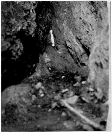
FREEZING CAVERN AT BRAINARD.
From a Photograph by Mr. A. F. Kovarik.
Subterranean Ice in King’s Ravine, Mount Adams, New Hampshire.—Described in Part I., page 1.
Ice Gulch on Crescent Mountain, Randolph, New Hampshire.—Described in Part I., page 83.
Ice in a Hole at Dixville Notch, New Hampshire.—Mr. John Ritchie, Jr., of Boston, has examined this place, which he is sure is a refrigerator. It is in a hole north of the cliff and near its top.
Ice on Mount Garfield, New Hampshire.—Mr. John Ritchie, Jr., informs me that ice was discovered among the boulders on the summit of Mount Garfield during the summer of 1897.
Freezing Talus near Rumney, New Hampshire.—Described in Part I., page 85.
Freezing Talus near North Woodstock, New Hampshire.—Mr. John Ritchie, Jr., has examined this locality. He thinks the ice was gone in July, but judges it to be on the level of an old talus and a couple of meters down.
Freezing Well at Lyman, Grafton County, New Hampshire. (Geology of Vermont, 1861, I., page 197.)—A well in that town is reported as having been frozen solid in June, 1816, at a depth of about 2.60 meters from the surface.
Icy Wells at the Foot of Mount Mansfield, Vermont. (N. M. Lowe, Science Observer, vol. II., page 58.)—These are described as being really “incipient caves.”
Freezing Cave near Manchester, Vermont.—Described in Part I., page 76.
Ice Bed of Wallingford, Rutland County, Vermont. Described in Part I., page 99. (S. Pearl Lathrop, American Journal of Science and Arts, 1844, XLVI., page 331.)—Dr. Lathrop says that ice has been found at the Ice Bed as late as September.
Freezing Wells at Brandon, Vermont. Described in Part I., page 77. (Geology of Vermont, 1861, vol. I., page 192.)—Mr. Hager says that the well was dug into a mass of sand and gravel, of the kind known as modified drift. The gravel was frozen at the time of digging. The Boston Natural History Society, in 1859, sank two wells, one 21 meters southeast of the original one, the other 21 meters northwest. The first was 10 meters in depth and did not reach ice; the second was 11 meters in depth, and came to the layer of frozen gravel.
Cave near Brandon, Vermont. (Geology of Vermont, 1861, vol. I., page 197.)—Mr. Hager heard that about 3 kilometers north of Brandon village was a cavern, in a hill, in which ice is found most of the summer.
Icy Gulf near Great Barrington, Massachusetts.—Mentioned in Part I., page 99.
Icy Glen near Stockbridge, Massachusetts.—Described in Part I., page 75.
The Snow Hole, New York: near Williamstown, Massachusetts. Described in Part I., page 98. (Dewey, American Journal of Science and Arts, 1819, vol. I., page 340; and 1822, vol. V., page 398.)—Mr. Dewey found, in June, snow 2 meters deep on ice of unknown depth. On his second visit he found less ice and snow than on his first visit, as the trees in the neighborhood had been cut down.
Glacière near Williamstown, Massachusetts.—Described in Part I., page 101.
Freezing Well near Ware, Massachusetts.—(Geology of Vermont, 1861, vol. I., page 197.)—Depth 11.5 meters. This is in a sand and gravel formation much like that at Brandon, except that there is less clay, and that none of the pebbles are limestone.
Wolfshollow near Salisbury, Connecticut. (C. A. Lee, American Journal of Science and Arts, 1824, vol. VIII., page 254.)—In the eastern portion of the township, at an altitude of about 800 meters, is a chasm about 100 meters long, 18 meters deep and 12 meters wide. It is in mica-slate, and is sheltered by large trees. At the bottom at one end is a spring of cold water and a cave of considerable extent, in which ice and snow is found the greater part of the year.
Natural Ice House, near Meriden, Connecticut. (Benjamin Silliman, American Journal of Science and Arts, 1822, vol. IV., page 174.)—It lies between New Haven and Hartford, about 32 kilometers from the sea, at an altitude of about 60 meters. The ice is found in a narrow defile of perpendicular trap rock, at the bottom filled with broken stones. The defile is so placed that in summer the sun only shines into it for about an hour each day; it is also well protected by surrounding trees, the leaves from which form beds at the bottom among the rocks and help to protect the ice.
Natural Ice House of Northford, Connecticut. (Benjamin Silliman, American Journal of Science and Arts, 1822, vol. IV., page 177.)—About 11 kilometers from New Haven on the Middletown road between Branford and Northford, is a gorge where ice remains throughout the year. In this case the ice is mixed with a considerable quantity of leaves and dirt; it has sometimes been brought to New Haven.
Ice in an Old Iron Mine, near Port Henry, Lake Champlain. (Geology of Vermont, 1861, vol. I., page 199.)—Ice was found during the summer at a depth of from 15 meters to 30 meters, and a current of cold air was issuing from the opening. There seems to be more than one opening to the mine.
Freezing Talus on Lower Ausable Pond, Essex County, New York.—Described in Part I., page 79.
Freezing Talus at the South Base of the Giant of the Valley, Essex County, New York.—Described in Part I., page 81.
Freezing Boulder Talus, Indian Pass, New York. See Part I., page 83.
Freezing Boulder Talus, Avalanche Pass, New York.—See Part I., page 83.
Freezing Cave near Carlisle, New York.—See Part I., page 93.
Ice among the Catskill Mountains, New York.—Mr. George Brinton Phillips informs me that he has seen subterranean ice in August among boulders in a gorge in the Catskills near the Stony Cloves road, starting out from Haines’ Falls. The people in the neighborhood speak of the place as an ice cave.
Gorge in the Shawangunk Mountains, near Ellenville, Ulster County, New York. Described in Part I., page 91. (Heilprin, Around the World, 1894, page 194.)—Professor Heilprin found in July a mass of ice measuring about thirty meters in length and 1 meter in depth. The thermometer near the ice read about 1° C. above freezing point, the day being hot. Icicles hung from the ledges on the side of the gorge.
Freezing Gorge at Sam’s Point, New York.—See Part I., page 93.
Ice Deposits and Windholes at Watertown, New York.—Described in Part I., page 86.
Freezing Well near Tioga, New York.—Depth, 23 meters. No information.
Freezing Well near Prattsburg, New York.—Depth, 6.5 meters. No information.
Freezing Well near Owego, New York. Described in Part I., page 74. (D. O. Macomber, American Journal of Arts and Sciences, 1839, vol. XXXVI., page 184. Well’s Annual of Scientific Discovery, 1856, page 190.)—The thermometer is said to have stood at—1.2° at the bottom of the biggest well when it registered—20° outside. When a candle was let down, the flame became agitated and was thrown in one direction at the depth of 9 meters; at the bottom the flame was still, but soon died out. Large masses of ice were found in the biggest well as late as July, and the men who made the well were forced to put on thick clothing in June, and even so could not work for more than two hours at a time.
Cave in the Panama Rocks, Chautauqua, New York. The Rev. Horace C. Hovey informs me that he has been in a small cave in this locality, and that he found ice in it.
Cave in Sussex County, New Jersey.—A clipping from a newspaper, with neither name nor date, says that new ice is found daily on the land of Peter Feather, in the mouth of an unexplored cavern. A small stream of water runs out of the cavern and forms a pool at the opening, and here it is that the ice forms. Enough has been taken in one day to freeze two cans of ice cream. A cold draught of air issues continuously from the cavern.
Hole Containing Ice on Blue Mountain, New Jersey. Reported; no information.
Gorge Containing Ice on Bald Eagle Mountain, Clinton County, Pennsylvania.—Mr. Henry Chapman Mercer, of Doylestown, learned of the existence of this gorge during the summer of 1897. It is near the village of McElhatten, in the neighborhood of Lock Haven, and is some 3 kilometers distant from the Susquehanna River. Ice is said to remain over during the entire summer.
Freezing Cave and Windholes near Farrandsville, Clinton County, Pennsylvania.—Described in Part I., page 93.
Underground Ice Formations, Sullivan County, Pennsylvania, on the southwestern borders of Lycoming County.—Mr. W. Coleman Hall of Philadelphia, about twenty years ago, found ice in two or three places, on Bear Creek, north of Muncy Creek, about 25 kilometers north of the Susquehanna River, and southwest of Eagles Mere. The ice was under rocks, in what may be described as limestone sinks. Since the destruction of the forest, the ice has become less abundant, if indeed any still forms.
Glacières in Abandoned Coal Mines near Summit, Carbon County, Pennsylvania.—Described in Part I., page 95.
Ice Cave Railroad Station, Luzerne County, Pennsylvania. On the Bowman Creek branch of the Lehigh Valley R. R.—Mr. F. Holschuh, agent at Luzerne, informs me that about 2 kilometers from Ice Cave Station is a little waterfall on the side of a mountain which was formerly covered with dense forest. A short distance below the fall, a large hollow place has been worn out of the rocks by the action of the water. The overhanging rocks give this almost the appearance of a cave. While the forest was still thick and when the winter was cold, ice would form under these rocks and would not disappear until summer was well advanced. The station was called Ice Cave on account of this place.
Hole Containing Ice at Millerstown, Pennsylvania.—Reported; no information.
Freezing Talus at Spruce Creek, Huntingdon County, Pennsylvania. Described in Part I., page 90. The Philadelphia Ledger of July 6th, 1896, states that around the boulders where the ice lies, there are found varieties of plants strongly arctic in character.
Ice Mountain, Hampshire County, Virginia. (C. B. Hayden, American Journal of Science and Arts, 1843, vol. XLV., page 78.)—It lies on the North River, near the road leading from Winchester to Romney, at an altitude of from about 220 meters to 240 meters. One side of the hill is entirely composed of loose stones, among which an abundance of ice is found at all times, although the sun shines on the upper surface of the stones from ten in the morning until sunset. The ice is regularly used in summer by the people near by. Constant and strong air currents issue from the crevices in the rocks. Similar, but smaller accumulations, are said to occur in the same county. Mrs. George B. Balch visited the Ice Mountain in August, 1878. She saw no ice, but the air under the stones was very cold.
Blowing Cave, Bath County, Virginia.—Mrs. Horace Jayne informs me that there is a blowing cave near the Cowpasture River, about half way on the old stage road between Millboro and Warm Springs. A draught flows out from it, strong enough to blow the grass about, three or four meters away. The draught is cold, perhaps abnormally so. The cave has not yet been explored.
SOUTH AMERICA.
Ice Sheets on Mount Chimborazo. (A. von Humboldt, Travels to the Equinoctial Regions, London, 1814, vol. I., page 156.)—“On Chimborazo, enormous heaps of ice are found covered with sand, and in the same manner as at the Peak [of Teneriffe] far below the inferior limit of the perpetual snows.”
Tierra del Fuego. (A. Winchel, Walks and Talks, 1898, page 122.)—“On Tierra del Fuego ice and lava are found interstratified for a great depth, each winter’s snow being covered by a new lava sheet.”
TENERIFFE.
La Cueva de la Nieve or del Hielo. (Humboldt, Travels to the Equinoctial Regions, 1814, vol. I., pages 154, 156. C. Piazzi Smyth, Teneriffe, an Astronomer’s Experiment, 1858, page 348.)—La Cueva de la Nieve lies at an altitude of 3267 meters in the Malpays on the Peak of Teneriffe, just below the snow line. It is in obsidian. The entrance is 3.6 meters high and 2.7 meters broad. The grotto is 36 meters long, 6 meters wide, and 4 meters high. The descent into the cave is so steep that it is necessary to be lowered by ropes. Professor Smyth found in July an ice floor about 60 centimeters thick which was covered with water. A good deal of snow was lying near the mouth of the cave. The walls were covered with ice and icicles and a few small ice cones rose on the ice floor.
ICELAND.
The Surtshellir or Cave of Surtur. (Olafsen and Povelsen, Voyage en Islande, Paris, 1802. Henderson, Iceland, 1819, 2d ed., page 420. Guimard, Voyage en Islande, page 481.)—The Surtshellir lies in the volcanic waste of Westisland, and is in lava which has flowed from the Bald Jokul. The approach is through an open chasm. The length of the cave is 1534 meters, with an average width of from 15 meters to 17 meters, and a nearly uniform height of from 9 meters to 11 meters. In four places the roof is broken and allows daylight to enter. A great deal of ice is sometimes found in the cave, in the shape of an ice floor, transparent icy pillars, hanging icy pendants, and columns and arches of ice along the walls. Some of the pillars have been found 2.50 meters high.
Kutlagaya. (A. Winchel, Walks and Talks, 1898, page 122.)—“In 1860 the crater of the mountain Kutlagaya, in Iceland, hurled out simultaneously into the air lumps of lava and ice, all intermingled together.”
SCANDINAVIA.
Ice in the Mines of Nordmark. (Jars, Voyages Métallurgiques, 1774, page 105.)—13 kilometers north of Philipstadt, Wermeland, Sweden, a number of holes were dug, some to a depth of 120 meters. Ice of some thickness formed in some of these towards the end of winter, and lasted until about September, despite the fires of the workmen.
Persberg Iron Mines, Sweden. (J. Prestwich, Collected papers, etc., on page 206, quotes Dr. Clark’s Travels in Scandinavia.)—Ice is said to have been found on the sides and bottom of the mine to a depth of about 135 meters.
Ice Caves Reported in Norway.—I was told in Norway that some of the caves in the mountains near the Swartisen ice field contained ice, but I do not know whether this is true. I suspect that there are glacier ice caves which have given rise to this report.
ENGLAND.
Helvellyn, Cumberland. (Wordsworth, Fidelity.)—The following verses were pointed out to me by Mr. Bunford Samuel. As far as I know they are the only poetry about glacières:—
“It was a cove, a huge recess That keeps, till June, December’s snow; A lofty precipice in front, A silent tarn below! Far in the bosom of Helvellyn, Remote from public road or dwelling Pathway or cultivated land From trace of human foot or hand."
Ice in an Old Copper Mine, Cumberland. (J. Clifford Ward, Nature, vol. XI., page 310.)—Ice reported as a rare occurrence.
Ludchurch Chasm, Staffordshire. (R. K. Dent and Joseph Hill’s Historic Staffordshire, quote Dr. Plot, 1686.)—Mr. Bunford Samuel called my attention to this book, in which Dr. Plot is quoted as saying that as late as the 17th of July, snow has been found in Ludchurch Chasm. Messrs. Dent and Hill do not mention anything of the kind as occurring now.
Blowing Cave in Denbighshire, Wales.—A newspaper cutting says that there are such strong eruptions of winds from a cave in this neighborhood as to toss back to a great height in the air any article of apparel thrown in.
Tin Croft Mine, Cornwall. (J. Prestwich, Collected papers, etc., page 206, quotes Mr. Moyle.)—Ice has been found in abundance in this mine at a depth of nearly 100 meters.
CENTRAL EUROPE.
Glacière de Chaux-les-Passavant. Described in Part I., page 8. (Poissenot, Nouvelles Histoires Tragiques de Benigne Poissenot, licencié aux lois. A Paris, chez Guillaume Bichon, rue S. Jacques, a l’enseigne du Bichot, 1586, avec privilege du Roy, pages 436-453. Gollut, Les Mémoires historiques de la Repub. Sequanoise, et des princes de la Franche Comté de Bourgogne, par M. Lois Gollut, Advocat au Parlement de Dôle; A Dôle, 1592. Trouillet, Mémoires de la Société d’Émulation du Doubs, 1885. Girardot, Mémoires de la Société d’Émulation du Doubs, 1886.)
The earliest notice of a glacière which I have been able to find is in the shape of a letter giving an account of a visit to the Glacière de Chaux-les-Passavant in 1584, by Benigne Poissenot, a French lawyer. The account, which I have translated as literally as possible, is in a special chapter, as follows:—
"Sir:—Since our separation, I have had this pleasure (heut) to hear news of you only once, having found your brother in Paris; who, having assured me of your good health (disposition), informed me of how since we had seen each other you had travelled to Italy, even as far as Greece, of which you had seen a large portion: and that sound and safe, after so long a journey, you had reappeared and landed at Havre de Grace where you wished to go, that is to say at home. All the pleasure which a friend can receive, knowing the affairs of another self, joined to such a happy result, seized my heart, at the recital of such agreeable news: and I did not fail shortly after, to write you amply all which had happened to me since I left you until my return to France: congratulating you at having escaped from marine abysses and perilous passages on land, on which travellers are often constrained to risk their life. From this time, I have always stayed in Paris or in the neighborhood, according to the good pleasure of dame fortune, who ruled me in her wise and fed me with her dishes the most common and ordinary until the first day of January of the year 1584, when I received my first gift in the shape of a strong and violent disease, which tormented me more than a month: from which, having become cured with the help of God, and having with time recovered my health and my strength at the arrival of spring, I was seized with the desire to smell the air of the country. And in fact having thrown away my pen and travelled about (battu l’estrade) through high and low Burgundy, I stopped at Bezenson, Imperial City, to spend the summer. This city is still to day just the same as Julius Cæsar describes it, in the notable mention he makes of it, in the first book of his commentaries of the war in Gaul, there remaining there all the vestiges of the most remarkable things, which he tells of in his description. There are also very fine fountains, from all of which water streams from the representation of some god of antiquity, as a Neptune, a Bacchus, a Pan, a Nereide or others: except before the state house, where the statue of Charles the Fifth, representing him in a most natural manner, is placed on an eagle, which from its beak, pours out such a great quantity of water that this is the most beautiful, among all the other fountains. And as I do not doubt that while traversing Italy, you both saw and examined with curiosity the most handsome singularities, which presented themselves to your eyes and that on your return, passing through Avignon and Dauphiné, as your brother informed me, you had the advantage over me of seeing the wonders of the country, of which you had heard me speak sometimes, regretting that the war, during the time I was in that quarter, had prevented my going to the spot, to see the burning fountain as in Dodone, and the fountain called Jupiter, which torches of fire light up and which grows less till midday and then grows till midnight, and then diminishes and fails at midday: and another in Epirus which we call to day Albania, the tower without venom and the inaccessible mountain: then as I said, since you have contemplated these things and several others not less admirable, I wish to entertain you about a marvel which I saw, during my sojourn in Bezenson, to know from you, whether in all your journey, you saw a similar thing. Know then that the day of the festival of St. John Baptist, a young man, provided with an honest knowledge, with whom I had made some little acquaintance, presented me with an icicle, to cool my wine at dinner, and which I admired greatly, on account of the time of the year in which we then were, begging him who gave it to me to tell me where he had discovered this rare present for that time. He answered me that every year, the day of the solemnity of the festival of St. John Baptist, the inhabitants of a village, which he named, were bound to come to offer the great church of St. John of Bezenson, a goodly quantity of ice, which they got in a wood, and brought to town at night on horses, for fear that by day it should melt, and that one of his cronies had given to him what he had given to me.
“Suddenly there flamed up in me a desire to see this place, where in the height of the summer, ice was to be found. When he who had presented me with the icicle saw this, he promised to accompany me, not having as yet, any more than myself, seen this marvel. I did not hatch very long this decision, all the more as all those, to whom I mentioned it, encouraged me to carry it out as soon as I could, assuring me that I should see a strange thing, and that even the Duke of Alva on his return from Flanders, passing through Franche Comté, had wished to see this novelty. Therefore calling on the promise of the one who was the cause of undertaking this journey, we went together to Versey, a fine town, distant five leagues from Bezenson, turning a little off our direct route, to go to see a literary man, at this said Versey, who having called on me at Bezenson, had extracted from me the promise of going to see him. There happened to me in this spot, what the poet du Bellay says happened to him, on his return from Italy, passing through the Grisons, to go into France: who, after having chanted the troubles there are in the passage, says that the Swiss made him drink so much, that he does not remember anything he saw in that country. Likewise, I can assure you that my host, following the custom of those of the country (who do not think they are treating a man properly if they do not make him drink a lot, taking that from the Germans, their neighbors) made us carouse so well, that when we went to bed, we were very gay boys. For although we had both made an agreement on the road, yet our host knew so well how to win us over, saying that those who would not drink, gave reason to think badly of them, and that they had committed, or wished to commit some great crime, which they feared to give away in drinking, that in the end we let ourselves go, passing the time in Pantagruelic fashion. The next morning having taken some “hair from the beast” and a guide which our host gave to us to conduct us to the Froidiere—we continued our wanderings, and arrived at a little village called Chaud, joining a large wood, where our guide told us, that although he had been more than six times to the Froidiere, yet the road was so tortuous and so cut up by small paths, that if we did not take a man from this village, to be more sure, we might spend more than half a day in the wood, before finding what we were seeking. Getting off our horses now, we added to our company a native of the place, who having led us by crooked roads, about a quarter of a league, through the forest, made us enter into a close thicket and by a little path led us to a pleasant meadow; where, looking down, we saw a hole, of difficult descent, at the bottom of which was the opening of a grotto, pretty big, and so awful and terrifying to see, that one would have said, it was the mouth of Hell. And in truth, I remembered then, the hole of St. Patrick, which is said to be in Hibernia. We were not brave enough knights, to try the adventure, my companion and I, if our guides had not taken the lead. After whom we descended as magnanimously as the Trojan Duke followed the Sybil to the Plutonic realms, the sword half drawn from the scabbard, and well determined to make test of the Platonic doctrine, which teaches that demons can be dissected, in case any shade or spook should have come to meet us. About the middle of the way, we began to feel in descending a very agreeable freshness; for it was the second day of July and the sun shone very warmly, which made us sweat drop by drop. But we had good opportunity to refresh ourselves and put ourselves to cool, having reached the grotto which we found of the length and breadth of a large hall, all paved with ice in the bottom, and where a crystalline water, colder than that of the mountains of Arcadia Nonacris, streamed from many small brooklets, which formed very clear fountains, with the water of which I washed myself and drank so eagerly, that I had wished the thirst of Tantalus, or else that I had been bitten by a Dipsas, in order to be always thirsty, amid such a pleasant beverage. A great lord, who in some pleasure resort, should have such a refrigerator in summer, could boast according to my judgment, to be better provided with drink, than the kings of Persia were with their river Coaspis, which engulphs itself into the Tigris, the water whereof was so sweet, that the use of it was allowed only to the great King, for the retinue and cronies of his household. Do not think, that among these delights, I was at all free from fear, for never did I raise my eyes above that from terror my whole body shivered and the hair stood up on my head, seeing the whole roof of the grotto, covered with big massive icicles, the least of which, falling on me, had been sufficient to scramble up my brains and knock me to pieces; so much so that I was like to that criminal, whom they say is punished in Hell, by the continual fear of a big stone, which seems as though it must suddenly fall on his ears. There are besides the large hall of the grotto, some rather roomy corners, where the gentlemen of the neighborhood, put their venison to cool in summer, and we saw the hooks, where they hang the wild fowl. It is true, that when we were there, we saw neither game nor wild fowl, and I think, that if we had found any of it, we were men to carry off some of it. We walked around for about a quarter of an hour, in this Froidiere and we should have staid there longer if the cold had not driven us out; which struck in to our backs, even to make our teeth crack; we reascended the slope, not forgetting, all of us as many as we were, to provide and load ourselves with ice, which served us at lunch in the little village mentioned above to drink most delightfully, assuring you that it is impossible to drink more freshly than we drank then. I thought of those old voluptuaries, who cooled their wine with snow, and it seemed to me, as though they might have had it much cheaper if in their time there had been many such Froidieres, to refresh it with ice, instead of with snow, as some of the gentlemen of the neighborhood of the Froidiere and some of the most notable persons of the neighborhood of Bezenson do; who by night, have a good supply brought on horses, which they keep in their caves, and use at their meals and banquets. Turning back towards the Imperial city of Bezenson, I carried for about two great leagues, a rather large icicle in my hands, which little by little melted and was a pleasant and agreeable cooler, on account of the great heat of the weather. After having thought over in my mind, the cause of this antiperistase, I could find none other but this: to wit, that as heat domineers in summer, the cold retires to places low and subterranean, such as is this one, to which the rays of the sun cannot approach, and that in such an aquatic and humid place, it operates the results, which we have shown above. Which seemed to me so much more likely, that on asking the peasants of the neighboring village, if in winter there was ice in this Froidiere, they answered me that there was none, and that on the contrary, it was very warm there. Whatever may be the cause, whether this or another, I can assure you, that I admired this singularity as much as any I have seen, since a large church, cut into a rock which I had seen a few years previously, in a little town of Gascony called St. Milion, distant seven leagues from Bordeaux; on the steeple of which is the cemetery, where they bury the dead; a thing to be marvelled at by him who has not seen it.
“I have made trial, to enrich this missive, with all the artifice which has come into my head, using the leisure, which the present time brings me: as the temple of Janus is open, the air beyond breathing nothing but war: which forces me, against my wish, to sojourn in this place longer than I had intended. If these troubles settle down, and if after the rain, God sends us fine weather as requires the calamitous state in which is now the flat country, I shall return to my Parnassus; from which if I go out hereafter, believe that it will be very much in spite of myself, or that my will will have very much changed. You will be able to let me hear from you there, and take your revenge for the prolixity of this letter, by sending me one still longer, which you will write to me with more pleasure, as I shall take much in reading it. However as it is becoming time to sound taps, I will pray the sovereign creator for my affectionate recommendations to your graces.
“Sir, and best friend, may you keep in health and have a long and happy life. From Sens this 20th of June 1585.
“Your obedient friend, BENIGNE POISSENOT.
“End of the description of the marvel, called the Froidiere.”
The next notice about the Glacière de Chaux-les-Passavant is by Gollut in 1592, as follows:—
“Ices in summer.”
“I do not wish however to omit (since I am in these waters) to bring to mind the commodity, which nature has given to some dainty men, since at the bottom of a mountain of Leugné ice is found in summer, for the pleasure of those who wish to drink cool. Nevertheless at this time, this is disappearing, for no other reason (as I think) except, that they have despoiled the top of the mountain, of a thick and high mass of woods, which did not permit that the rays of the sun came to warm the earth, and dry up the distillations, which slipped down to the lowest and coldest part of the mountain where (by antiperistase) the cold got thicker, and contracted itself against the heats surrounding and in the neighborhood during the whole summer, all the external circumference of the mountain.”
The ice at Chaux-les-Passavant is said to have been entirely cleared out, by the Duc de Lévi, in 1727, for the use of the Army of the Saone. In 1743, when de Cossigny visited the cave, the ice was formed again. There are no reports about the intervening time between 1727 and 1743. The ice probably all re-formed the winter after it was taken away.
Captain Trouillet in 1885 writes of Chaux-les-Passavant: "The following winter had shown itself unfavorable to the production of ice, the periods of humidity preceding too long ahead the periods of frost. Finally last summer, coming after a wet spring, was exceptionally warm. Such were the circumstances which brought about in the glacière the ruin which could be seen at the end of last October. * * * On the 11th of November, the first effects of frost are felt and the temperature falls in the glacière to -2°: outside the thermometer drops to -3°. On the morning of the 12th, same result, and ice makes its appearance in the grotto, as the report of the observer shows: but the quantity produced is so small that the internal thermometer soon goes above 0°. It is only on the 9th of December that the frost wins definitely; on the 11th, 12th and 13th the chill is intense and reaches -19° outside, stopping at -15° in the glacière. The water coming from the rains between the 5th and the 9th drip at this time through the roof and the big side crevasse: circumstances grow favorable and the ice accumulates. From the 17th, the entrance slope becomes almost impracticable; the icicles grow on the roof, as big as the body of a man. * * * From this time to the end of December, the ice sheet does not increase, for water only arrives by the rare drip of the roof, and only the stalactites increase slowly. Outside, however, the cold continues vigorously, the thermometer on the 31st of December dropping to -15° and to -13° in the glacière. If the production of the ice stops, it is not the cold which is wanting, but the other element, the one which as our former study showed, is the most rarely exact at the meeting. The winter is only favorable on condition that it offers alternating periods of freezing and thawing; so the observer writes in his report: 'it is the water which is wanting, otherwise the glacière would be magnificent.'"
Trouillet speaks of the difficulty of winter observations in the following words: “Mons. Briot, the present lessor of the glacière, has the unpaid mission of going every week to the bottom of the grotto to get and put in place the interior thermometer. It is a really hard piece of work at this time of the year: each journey takes about one hour. Besides the chance that a visitor has of receiving on his head one of those magnificent stalactites 1 meter or 2 meters long which fall continually from the roof, it is perfectly disagreeable to him to arrive at the base of the slope otherwise than on the sole of his boots, and to face thus the frequent and painful meeting with rocks whose angular edges dot the surface of the descent, smooth as a mirror set at an angle of 30°.”
Trouillet and Girardot obtained a series of observations with maxima and minima thermometers at Chaux-les-Passavant during the winter of 1885-1886. At the end of November the temperature inside was +2°. On the 2d of December it rose to +2.5°. On the 10th of December, it sank to -1°, and after this date, it remained below freezing point all winter. The observations were not continuous, but they showed that every time the temperature outside dropped considerably, the temperature inside immediately did likewise. For instance, on the 12th of January, the outside air dropped to -18°, and the inside air responded by falling to -15°. On the other hand, when the temperature outside rose above freezing point, the temperature inside remained stationary or fluctuated only gently. For instance, from the 24th of March to the 8th of April, the outside air went up and down perpetually, the extremes being -2° and +16°; while in the same time the inside air rose continuously from -2° to -0.5°.
Windholes and Ice Formations near Gérardmer, Vosges. (Rozet, in Encyclopédie Moderne, Didot Frères, Paris, 1853, vol. XVI., page 503.)
L’Abime du Creux-Percé or Glacière de Pasques. (Martel, Les Abimes, 1894, page 394; Annuaire du Club Alpin Français, vol. XIX., page 38.)—On the plateau of Langres, Côte d’Or. It lies 15 kilometers from Dijon, and is really a limestone rock gorge, of 55 meters in depth, which at the top is 40 meters long and 20 meters wide, and at the bottom is 15 meters long and 12 meters wide. In March 1892, Mons. Martel found the north side covered with large icicles 15 meters long. The ice seems to remain throughout the year. The bottom of the Abime has been reached only by means of two long rope ladders.
Creux de Chevroche or Roche Chèvre, Côte d’Or. (Clément Drioton, Mémoires de la Société de Spéléologie, 1897, vol. I., page 209.)—"In the woods of Mavilly, near Bligny-sur-Ouches, is a little cave, called Creux de Chevroche or Roche-Chèvre, where one can find ice until the month of July."
Freezing Well of Marolles, at La Ferté-Milon, Aisne. (Martel, Les Abimes, page 563, note 2.)—This well is 8.15 meters deep; the altitude is 70 meters. During the winter of 1892-93 the water in it froze for a thickness of 15 centimeters. The minimum outside temperature that year was -17°.
Windholes near Pontgibaud, Puy de Dome. (G. Poulett-Scrope, The Geology and Extinct Volcanoes of Central France, 1858, page 60.)—These windholes are in basalt. There are many cracks, whence cold air currents issue, and where ice has been found, sometimes in summer. There are cold storage huts over some of the cracks.
Le Creux-de-Souci, Puy de Dome. (Martel, Les Abimes, 1894, Page 387.)—This is situated 5 kilometers southeast of Besse-en-Chandesse. It is a large lava cavern with the entrance directly in the middle of the roof. The bottom is partly filled by a lake. The depth from the surface of the ground to the lake is 33 meters; from the smallest part of the opening to the lake the depth is 21.50 meters. Down this last portion one can descend only by means of a rope ladder. The temperature is extremely low; in general near freezing point. In June, July, August and November 1892, Monsieur Berthoule, maire of Besse, did not find any snow. On the 10th of August, 1893, on the contrary, he found at the bottom a heap of snow, which he thinks was formed in the cave itself, by the freezing during their descent of the drops of water which are constantly dripping from the roof. He reports landing on une montagne de neige, de neige blanche. On several visits, Mons. Berthoule noticed carbonic acid gas in dangerous quantities. There was none at the time he observed the snow heap, but ten days later he found it impossible to descend into the cave as the carbonic acid gas came up in puffs to the entrance. In the lake, Mons. Berthoule discovered a variety of Rotifer, Notholca longispina, and also several algæ and diatoms. The Asterionella formosa is the most remarkable from its abundance: it exists in some of the lakes of the Alps, but not in those of the Pyrenees.
Aven de Lou Cervi, Vaucluse. (Martel, Les Abimes, page 563.)—This is a cold cave. It belongs to the class which Mons. Martel calls avens à rétrécissement, or abimes à double orifice. In September, 1892, Mons. Martel noted a temperature of 6.5° at 53 meters; of 6.8° at 64 meters. Mean temperature of locality, 8.75°.
Igue de Biau, Lot. (Martel, Les Abimes, page 304.)—Cold cave. Temperature on 13th July, 1891: 5°.
Fosse Mobile, Charente. (Martel, Les Abimes, page 380.)—Cold cave. Temperature on 11th April, 1893: 7°.
Aven de Deidou, Causse Méjean. (Martel, Les Abimes, page 223.)—Cold cave. Temperatures on 14th October, 1892: outside air, 4°; at bottom, 6.5°.
Aven des Oules, Causse Méjean. (Martel, Les Abimes, page 227.)—Cold cave. Temperatures on 21st October, 1892: outside air, 2.5°; at bottom, 4°.
Windhole Cold Caves near Roquefort, Aveyron.—They lie 13 kilometers from Millau, at an altitude of about 600 meters, and are utilized in the manufacture of Roquefort cheese.
Aven de Carlet, near la Roche Giron, Basses Alpes. (Martel, Les Abimes, page 53.)—Lumps of ice are reported to have been taken from it.
La Poujade, Cévennes. (Martel, Les Abimes, pages 212-215.)—An intermittent spring in limestone rock. At the bottom of the first gallery, on the 18th of September, 1892, the temperature of the air was 12.3°, and that of a pool of water supplied by drip 11.5°. Mons. Martel thought that the drip brought to the pool the mean annual temperature of the ground through which it had come. A little further within and 5 meters lower, the temperature of the air was 7.3° and that of another pool of water 6.8°. This pool was not supplied by drip and must have been left over by the last flow of the spring. Mons. Martel thought that the lower temperatures at this spot were due to the cold air of winter dropping to the bottom of the cave and on account of its density not being able to get out.
Snow Preserved in Chasms in the Italian Mountains. (The Penny Magazine, London, August, 1834, page 335.)—Mr. Bunford Samuel called my attention to an article in which the Southern Italians are said to dig wells or cellars on the mountain sides, and to throw snow into them in winter. The snow is well pressed together and straw, dried leaves, etc., is thrown on top. By having a northern exposure for these pits, and seeing that they are in thick forest, or in rifts where the sun does not penetrate, these depots may be safely placed as low down the mountain as the snow falls and lies. Naples is largely supplied [1834] with snow in summer from such snow wells situated on Monte Angelo, the loftiest point of the promontory separating the Bay of Naples from the Bay of Salerno.
Cold Caves of San Marino, Apennines. (De Saussure, Voyages dans les Alpes, 1796, III., page 211.)—These are probably windholes.
La Bocche dei Venti di Cesi. (De Saussure, Voyages dans les Alpes, 1796, III., page 211.)—These windholes were in the cellar of the house of Don Giuseppe Cesi, in the town of Cesi. The cellar acted as a natural refrigerator. The air stream was so strong, that it nearly blew out the torches. In winter the wind rushed into the holes. De Saussure was shown the following Latin verses by the owner:—
“Abditus hic ludit vario discrimine ventus Et faciles miros exhibet aura jocos. Nam si bruma riget, quaecumque objeceris haurit. Evomit aestivo cum calet igne dies,"
Windholes or “Ventarole” on Monte Testaceo, near Rome. (De Saussure, Voyages dans les Alpes, 1796, III., page 209.)—There are a number here among heaps of broken pottery. The temperatures seem abnormally low.
Krypta Sorana. (Kircher, Mundus Subterraneus, 1664, page 118 and page 239.)—This has been spoken of as a glacière cave, but as there is much doubt in the matter, I quote the passages, on which the reports are based, in the original Latin: “Cryptae sunt naturales, quarum innumerae sunt species, juxta vires naturales iis inditas. Sunt nonnullae medicinali virtute praeditae, quaedam metallicis vaporibus, exhalationibus, aquis scatent, sunt et glaciales, plenae nivibus et crystallo, uti in Monte Sorano me vidisse memini.” And further: “Vidi ego in Monte Sorano cryptam veluti glacie incrustatam, ingentibus in fornice hinc inde stiriis dependentibus, e quibus vicini montis accolae pocula aestivo tempore conficiunt, aquae vinoque, quae iis infunduntur, refrigerandis aptissima, extremo rigore in summas bibentium delicias commutato.”
Subterranean Ice Sheet, Mount Etna, Sicily. (Lyell, Principles of Geology, 11th Edition, chapter XXVI.)—This ice sheet is near the Casa Inglese. Sir Charles Lyell ascertained the fact of its existence in 1828, and in 1858 he found the same mass of ice, of unknown extent and thickness, still unmelted. In the beginning of the winter of 1828, Lyell found the crevices in the interior of the summit of the highest cone of Etna encrusted with thick ice, and in some cases hot vapors actually streaming out between masses of ice and the rugged and steep walls of the crater. Lyell accounts for this ice sheet by the explanation that there must have been a great snow bank in existence at the time of an eruption of the volcano. This deep mass of snow must have been covered at the beginning of the eruption by volcanic sand showered on it, followed by a stream of lava. The sand is a bad conductor of heat and together with the solidified lava, preserved the snow from liquefaction.
Glacière on the Moncodine. (Fugger, Eishöhlen, page 13.)—The Moncodine is described as a Dolomite near the Lago di Como. The cave lies up the Val Sasina, two hours from Cortenuova, at an altitude of 1675 meters. The entrance faces north, and is 2.5 meters high and 1.5 meters wide. The average diameter of the cave is 16 meters. The floor is solid ice, which has been sometimes cut for use in the hotels on the Lago di Como and even been sent to Milan.
La Ghiacciaia del Mondole. (Fugger, Eishöhlen, page 8.)—The Mondole is a mountain 2375 meters high, near Mondovi, south of Turin. The cave lies on the eastern slope, at an altitude of about 2000 meters. It is hard to get at. The entrance is to the east, and is 2 meters wide and 1.5 meters high. A passageway some 25 meters long leads to a large chamber where there is plenty of ice. In hot summers ice is brought from the cave to Mondovi. Ghiacciaia means freezing cavern in Italian.
La Ghiacciaia del Val Séguret. (Fugger, Eishöhlen, page 8.)—It lies near Susa at the base of chalk cliffs, at an altitude of about 1500 meters. The cave is said to be about 40 meters deep, 50 meters wide and 50 meters high. Bonetti in May, 1874, found many icicles and ice cones.
La Borna de la Glace. (Chanoine Carrel, Bibliothèque Universelle de Genève, 1841, vol. XXXIV., page 196.)—It lies in the Duchy of Aosta, commune of La Salle, on the northern slope of the hills near Chabauday, in a spot called Plan Agex. The altitude is 1602 meters. The entrance opens to the east and is 60 centimeters wide and 80 centimeters high. One can descend for 4 meters. There are two branches in the rear of the entrance. Chanoine Carrel found an ice pillar 1 meter high in the western branch. He recorded these temperatures on the 15th of July, 1841: Outside +15°. Entrance +2.9°. East branch +0.9°. West branch +0.5°.
Windholes in the Italian Alps. (Fugger, Eishöhlen, pages 94-97.)—A number of these seem to have abnormally low temperatures. Some are in the mountains around Chiavenna, and are sometimes, by building small huts over them, utilized as refrigerators. Some are reported in the neighborhood of the Lago di Como near Dongo, near Menaggio, and in the villa Pliniana near Curino; in the neighborhood of the Lake of Lugano at the base of Monte Caprino, near Melide, near Mendrisio and near Sertellino; and in the Val Maggia near Cevio.
The Glacière de Font d’Urle, or Fondurle, Dauphiné. (Héricart de Thury, Annales des Mines, vol. XXXIII., page 157; G. F. Browne, Ice Caves, etc., page 212; E. A. Martel, Mémoires de la Société de Spéléologie, vol. I., page 37; L. Villard, Spélunca, 1896, vol. II., page 39.)—It lies on the Foire de Font d’Urle, 16 kilometers north of Dié, 48 kilometers east of Valence, and 80 kilometers south of Grenoble. The glacière consists of two large pits, lying east and west, and with underground communication. From this tunnel a long low archway leads to a broad slope of chaotic blocks of stone, which is 60 meters long and 42 meters in greatest width. The ice begins half way down this slope, fitfully at first and afterwards in a tolerably continuous sheet. Thury found many icicles hanging from the roof. Browne found four columns of ice, of which the largest was 5.80 meters across the base. On his visit, in the middle of August, the ice was strongly thawing. Both explorers noted the extremely prismatic character of the ice. Browne found a temperature of +0.5°. Martel gives a section and plan of Font d’Urle. Mons. Villard says about this cavern: “A curious thing: I found in this cave, motionless on a piece of rock, entirely surrounded by ice for a distance of several meters, a blind specimen of a coleoptera, Cytodromus dapsoïdes.”
The Chourun Clot. (E. A. Martel, Sous Terre. Annuaire du Club Alpin Français, vol. XXIII., 1896, pages 42, 43; Mémoires de la Société de Spéléologie, vol. I., page 31.)—In Dauphiné, half way between Agnières and the Pic Costebelle, at an altitude of 1,740 meters. There is first a pit 18 meters long, 4.50 meters wide and 25 meters deep. In the bottom of this is a vertical hole 15 meters deep and from 1 meter to 2 meters in diameter, in which there was much ice on the 31st of July, 1896. Then the pit changes to a sloping gallery which terminates in a little hall, full of ice, at a depth of 70 meters. Martel gives a cut and section of this glacière.
The Glacière du Trou de Glas. (E. A. Martel, La Géographie, 1900, vol. I., page 52.)—In the range of the Grande Chartreuse.
The Chourun Martin. (E. A. Martel, La Géographie, 1900, vol. I., page 53.)—In the range of the Dévoluy, Hautes-Alpes; altitude 1,580 meters. An extremely deep pit, which on July 31st, 1899, was much blocked up with snow.
The Chourun de la Parza. (E. A. Martel, La Géographie, 1900, vol. I., page 54.)—In the range of the Dévoluy, Hautes-Alpes; altitude 1,725 meters. A fine pit, 25 meters in diameter, and 74 meters in depth. Filled with snow or rather névé, in which are deep holes.
The Glacière de l’Haut-d’Aviernoz. Described in Part I., page 2. (C. Dunant, Le Parmelan et ses Lapiaz, page 26; Browne, Ice Caves, etc., page 157.)—Mons. Dunant calls this glacière l’Haut d’Aviernoz; Mr. Browne calls it the Glacière du Grand Anu. By a plumb line held from the edge of the larger pit, Browne found that the ice floor was about 35 meters from the surface, which would give a level for the ice floor closely identical to the one I found. In July, 1864, he recorded a temperature of +1.1°.
The Glacière de l’Enfer. (G. F. Browne, Good Words, November, 1866; T. G. Bonney, The Alpine Regions, 1868, pages 95, 96; C. Dunant, Le Parmelan et ses Lapiaz, page 25.)—On Mont Parmelan. A pit cave with a steep slope of broken rock leading to a rock portal in the face of a low cliff. This opens into a roughly circular hall about 22 meters in diameter and 3 meters to 4 meters in height. A chink between the rock and the ice permitted Mr. Browne to scramble down three or four meters to where a tunnel entered the ice mass. Throwing a log of wood down this tunnel, a crash was heard and then a splash of water, and then a strange gulping sound. "The tunnel obviously led to a subglacial reservoir and this was probably covered by a thin crust of ice; the log in falling had broken this and then disturbed the water below, which then commenced bubbling up and down through the hole, and making a gulping noise, just as it does sometimes when oscillating up and down in a pipe."
Mons. C. Dunant of the Club Alpin Français describes a visit to the Glacière de l’Enfer. He mentions also a legend of a witch from a neighboring village who would get the ice from these caves and bring it down in the shape of hail on the crops of the peasants who were inhospitable to her.
The Glacière de Chapuis. Described in Part I., page 5. (Browne, Ice Caves, etc., page 182, and Good Words, November, 1866.)—Mr. Browne calls it the Glacière de Chappet-Sur-Villaz. Mr. Browne and Professor T. G. Bonney found several flies in the Glacière de Chapuis. Three of them were specimens of Stenophylax, the largest being probably, but not certainly, S. hieroglyphicus of Stephens. Two smaller caddis flies were either S. testaceus of Pictet or some closely allied species. One other insect was an ichneumon of the genus Paniscus, of an unidentified species. It differed from all its congeners in the marking of the throat, resembling in this respect some species of Ophion. Mr. Browne thinks that the case flies may have been washed into the cave somehow or other in the larva form, and come to maturity on the ice where they had lodged. But this explanation will not hold in the case of the ichneumon, which is a parasitic genus on larvæ of terrestrial insects.
The Glacière de Le Brezon. (Pictet, Bibliothèque Universelle de Genève, 1822, vol. XX., page 270, and Thury, Bibliothèque Universelle de Genève, 1861, vol. X., pages 139 and 152.)—It lies southeast of Bonneville near the foot of Mount Lechaud, at an altitude of 1276 meters. The cave is 9.7 meters long, about 8 meters wide and the greatest height is about 4 meters. The entrance is small and is at the base of a cliff, in some places of which cold air currents issue. The ice lies on the floor. Some of it is probably winter snow.
The Glacière de Brisons.—Described in Part I., page 1.
The Grand Cave de Montarquis. Described in Part I., page 70. (Thury, Bibliothèque Universelle de Genève, vol. X., pages 135-153.)—Professor Thury describes two visits to this cave. On the 16th of August, 1859, he found no ice stalactites or stalagmites. On the 19th of January, 1861, he did not find a single drop of water in the cave, but many stalactites and stalagmites of beautiful clear ice, one of which resembled porcelain more than any other substance. In August, Thury found an air current streaming into the cave at the rear, but this did not, however, disturb the air of the interior, for in one part it was in perfect equilibrium: along the line of the draughts the ice was more melted than elsewhere in the cave. In January, the current was reversed and poured into the fissure, with the temperature varying between -1.5° and -2.5°. He observed the following temperatures at the Grand Cave:—
TIME. OUTSIDE. INSIDE.
16th August, 1859 +8.6° +2.5°
19th January, 1861 1.25 P. M. +2.6° -4.°
” ” ” 2.12 ” +2.1° -4.°
” ” ” 3.50 ” -1.1° -4.°
The Petite Cave de Montarquis. Mentioned in Part I., page 71. (Thury, Bibliothèque Universelle de Genève, 1861, vol. X., page 150. Also quotes Morin.)—At the end of a crooked fissure 10 meters deep, a passage 6 meters long, leads into a cave 8 meters high and 5 meters in diameter. In August, 1828, Morin found an ice stalagmite of 5 meters in height in the middle of the cave.
Cave Containing Ice on the Southern Shore of Lake Geneva.—Reported; no information.
The Glacière and Neigière d’Arc-Sous-Cicon. (Browne, Ice Caves, etc., page 118.)—These lie close together in the Jura about twenty kilometers from Pontarlier. The little glacière is formed by a number of fissures in the rock, disconnected slits in the surface opening into larger chambers where the ice lies. The neigière is a deep pit, with a collection of snow at the bottom, much sheltered by overhanging rocks and trees. A huge fallen rock covers a large part of the sloping bottom of the pit, which forms a small cave in the shape of a round soldier’s tent, with walls of rock and floor of ice.
The Glacière de la Genollière. Described in Part I., page 48. (Browne, Ice Caves, etc., page 1.)—Mr. Browne observed in 1864 a temperature of +1.1°, and two days later of +0.8°. He also found a number of flies running rapidly over the ice and stones. He was told in England, from the specimen he brought away, that it was the Stenophylax hieroglyphicus of Stephens or something very like that fly.
The Glacière de Saint-Georges. Described in Part I., page 62. (Thury, Bibliothèque Universelle de Genève, 1861, vol. X.)—Professor Thury obtained the following temperatures at the Glacière de Saint-Georges:—
OUTSIDE. INSIDE.
9th January, 1858 7.36 P. M., -4.5° 7.16 P. M., -0.6°
” ” ” 7.20 ” -1.2°
” ” ” 7.27 ” -2.5°
” ” ” 7.50 ” -2.9°
Minimum of night -5.8° -4.9°
10th January, 1858 10.53 A. M., -3.4° 10.12 A. M., -4.6°
” ” ” 11.14 ” -3.1° 10.30 ” -4.5°
” ” ” 11.45 ” -2.2° 11.20 ” -4.4°
” ” ” 12.32 P. M., -2.4° 12.14 P. M., -4.4°
” ” ” 1.12 ” -0.9° 1.30 ” -4.2°
” ” ” 3.03 ” -2.9° 2.30 ” -4.1°
” ” ” 3.56 ” -3.5° 3.14 ” -4.0°
” ” ” 4.26 ” -3.7° 4.00 ” -3.8°
Minimum of night -7.6° -6.8°
11th January, 1858 9.34 A. M., -5.6°
2d April, 1858 6.20 P. M., +0.7° -0.2°
Minimum of night + 1.1°
3d April, 1858 10.00 A. M., +4.0° 9.00 A. M., -1.0°
Professor Thury’s winter excursions caused him to accept as proved that part of the mountaineers’ belief, which holds that there is no ice formed in caves in winter. One of the main grounds for his opinion was the series of observations he made in the Glacière de Saint-Georges. He found no ice forming there in winter and the natives said it did not because the cavern was not cold enough. So he placed large dishes filled with water in the cave and found that they froze solid during the night, which he had been assured was impossible. Thury also found violent movements of the air at Saint-Georges in January, 1858. A candle burned steadily for some time, but at 7.16 P. M. it began to flicker and soon inclined downwards through an angle of about 45°; and in the entrance, the flame assumed an almost horizontal position. At 8 P. M., the current of air nearly disappeared. Thury thought that this violent and temporary disturbance of equilibrium was due to the fact that as the heavier air outside tended to pass into the cave, the less cold air within tended to pass out; and the narrow entrance confining the struggle to a small area, the weaker current was able for a while to hold its own.
The Glacière du Pré de Saint-Livres. Described in Part I., page 65. (Browne, Ice Caves, page 40.)—Mr. Browne found, in 1864, a temperature of 0°.
The Petite Glacière du Pré de Saint-Livres. (Browne, Ice Caves, page 46.)—This is near the last cave at a slightly higher altitude. There is first a small pit, then a little cave, in which there is an ice slope. This passes under a low arch in the rock wall, and leads down into another small cave. Mr. Browne descended this ice stream, which was itself practically a fissure column and spread into the fan shape at the base. The lower cave was 22 meters long and 11 meters wide, and contained an ice floor and several fissure columns.
The Glacière de Naye, above Montreux, Switzerland. (E. A. Martel, Les Abimes, page 397; Spélunca, 1895, vol. I., pages 107, 108; Mémoires de la Société de Spéléologie, vol. III., pages 246-254.)—This is called a glacier souterrain. It was discovered in 1893 by Professor Dutoit. There are fifty-four caves known among the Rochers de Naye, and only this one contains ice. It is a long narrow cave with two entrances and widest towards the base, which opens over a precipice. The altitude is high, the upper entrance being at an altitude of 1820 meters, and the lower of 1750 meters. The place is both a passage cave and a windhole. The snow falls into the upper entrance, and slides down, becoming ice in the lower portion. There are other connecting passages and hollows where the cold air cannot get in, and there ice does not form. Mons. Martel thinks that the ice formed during the winter is preserved by the draughts—due to the difference in level of the two openings—causing an evaporation and chill sufficient for the purpose.
The Creux Bourquin. (E. A. Martel, Les Abimes, page 397.)—At Mauberget, near Grandson. This is a rock gorge 25 meters deep. At the bottom, on the 9th of July, 1893, was a mass of ice 38 meters long and 8 meters wide.
The Glacière de Monthézy. (Browne, Ice Caves, page 97.)—This lies to the west of Neufchâtel, between the Val de Travers and the Val de Brévine, on the path between the villages of Couvet and Le Brévine, at an altitude of 1100 meters. The cave is nearly oval in shape, with a length of 34 meters and a width of 29 meters. The roof is from 1 meter to 3 meters high. There are three pits, about 20 meters deep, on different sides of the cave. The descent is made through the largest pit. On the 6th of July, 1864, Mr. Browne found the floor of the cave covered with ice, and icicles and columns in some places; he also saw a clump of cowslips (primula elatior) overhanging the snow at the bottom of the pit through which he descended.
Pertius Freiss. (T. G. Bonney, Nature, vol. XI., page 327.)—It lies on the way to the Pic d’Arzinol, near Evolène, in the Val d’Hérens. A slip or subsidence of part of a cliff has opened two joints in the rock, in both of which fissures Professor Bonney found ice on July 23d.
The Schafloch. Described in Part I., page 21. (Körber, Jahrbuch des Schweizer Alpen Club, 1885, vol. XX., pages 316, 343.)—Herr Körber gives some of the dimensions as follows: Entrance 14 meters wide and 4.70 meters high. Length of cave 206.8 meters: average width 20 meters and greatest width 23.5 meters. Height from 5 meters to 7 meters. Length of ice slope 29 meters and breadth 12.5 meters; for 16 meters the slope has an inclination of 32°. Körber made the following observations in the Schafloch:—
DATE. OUTSIDE. 14 METERS FROM ENTRANCE. 100 METERS FROM ENTRANCE. 160 METERS FROM ENTRANCE.
21 September, 1884, 10.5° 5.6° 0.2° 0.2°
18 January, 1885, 2.7° -1.0° -1.3° —
The Rev. G. F. Browne, in 1864, found a temperature of +0.5°.
The Eisloch of Unterfluh. (Baltzer, Jahrbuch des Schweizer Alpen Club, 1892-93, pages 358-362.)—Twenty minutes from Unterfluh near Meiringen. A long narrow rock crack, some 30 meters deep and running some distance underground.
Windholes and Milkhouses of Seelisberg.—Described in Part I., page 45.
Windholes on the Spitzfluh. (Fugger, Eishöhlen, page 92.)—These are situated between Oltingen and Zeylingen, Canton Bâle: they generally contain ice till the end of July.
Windholes on the Blummatt. (Fugger, Eishöhlen, page 93.)—On the northwestern slope of the Stanzerberg. Ice sometimes lies over in these windholes.
Windholes near Bozen. (Fugger, Eishöhlen, page 97.)—On the Mendel ranges in Eppan, southwest of Bozen, among porphyry rocks. There are strong wind-streams. Ice is said to remain till late in the summer.
Grotto on Monte Tofana, Dolomites. (T. G. Bonney, Nature, vol. XI., page 328.)—This is probably a rudimentary glacière.
Holes with Ice near Lienz. (Fugger, Eishöhlen, page 97.)—One hour and a half distant near Aineth, is a small cave containing ice, and further up the valley towards Huben, are several windholes.
Eishöhle am Birnhorn. (Fugger, Eishöhlen, page 131.)—Near Leogang in the Pinzgau. Altitude 2150 meters. There are two entrances, from which a slope 10 meters long, set at an angle of 25°, leads to an ice floor 12 meters long and 3 meters high. Then comes a small ice slope, and a little horizontal floor at the back. Explored by Fugger.
Glacières on the Eiskogel. (Fugger, Eishöhlen, page 19.)—The Eiskogel is in the Tennengebirge, a mountain mass lying east of Pass Lueg. At an altitude of about 1900 meters, are two small caves, about 30 meters to 40 meters apart. They are some 25 meters in length and get smaller towards the bottom.
Holes with Ice in the Tennengebirge, between the Schallwand and the Tauernkogel. (Fugger, Eishöhlen, page 20.)—In this gorge are some small holes at an altitude of about 2000 meters, which are said to contain ice in summer.
The Seeofen. (A. Posselt-Csorich, Zeitschrift des Deutschen und Oesterreichischen Alpen Verein, 1880, page 270.) On the Hean Krail in the Tennengebirge, at an altitude of about 1900 meters. The entrance faces southwest, and is 6 meters high and 4.5 meters wide. The cave is 25 meters long, and 8 meters wide. The floor of the cave is 13 meters below the entrance.
The Posselthöhle. (A. Posselt-Csorich, Zeitschrift des Deutschen und Osterreichischen Alpen Verein, 1880, page 273.)—Named after its discoverer. It lies on the Hochkogel in the Tennengebirge, at an altitude of about 1900 meters. The entrance faces southwest, and is about 8 meters high and 8 meters wide. From the entrance the cave first rises, then sinks again below the level of the entrance, where the ice begins. The cave is about 20 meters wide. About 180 meters were explored, to a point where a perpendicular ice wall, 6 meters high, barred the way. About 125 meters from the entrance, there was an ice cone about 7 meters high.
The Gamsloch or Diebshöhle. (Fugger, Eishöhlen, page 14.)—It lies on the Breithorn of the Steinernes Meer, near the Riemannhauss, at an altitude of about 2180 meters. The entrance faces south. There is first a small, then a larger chamber. The latter is some 40 meters long, by 5 meters or 6 meters wide. The ice is in the large chamber.
Eishöhle am Seilerer. (Fugger, Eishöhlen, page 15.)—On the eastern side of the Seilerer arête on the Ewigen Schneeberg, west of Bischofshofen, at an altitude of about 2400 meters, is a small glacière cave.
Cave in the Hagengebirge, West of Pass Lueg. (Fugger, Eishöhlen, page 15.)—It lies about 2 kilometers east of Kalbersberg, at an altitude of about 2000 meters. A snow slope, with an ice floor at the bottom, leads into a long cave, about which little is known.
The Nixloch. Described in Part I., page 57. (Fugger, Eishöhlen, page 98.)—Professor Fugger gathered some valuable data in connection with the Nixloch. In August, 1879, he found the air current entering downwards; on September 14th, 1879, there was no current either way. On Christmas day, 1878, on the contrary, the draughts were reversed, pouring out of the hole with a temperature of +7.4°: the outside air then being -7.4°. At this time the known lower opening was in existence.
The Kolowratshöhle. Described in Part I., page 18. (Fugger, Beobachtungen, etc., page 7.)—This cavern has been more carefully studied than any other glacière cave. Some of its dimensions are given by Professor Fugger as follows: From the entrance to the ice floor, 26.6 meters; surface covered by ice as measured on a plane, 2940 square meters; approximate cubical measure of entire cave, 92,000 cubic meters. The height of the entrance is 7 meters, with a width at the base of 2.7 meters, and at the top of 6.6 meters.
On the entrance slope occurred the only fatal accident I know of in glacières. In 1866, the Bavarian minister Freiherr von Lerchenfeld tried to descend; a wooden handrail which had been erected over the snow broke under his weight; von Lerchenfeld fell to the bottom of the cave and died a few days after from the injuries he received.
Of the Kolowratshöhle, we have numerous thermometric observations by Professor Fugger, of which I select a few.
DATE. OUTSIDE. ENTRANCE. INSIDE. REAR.
21 May 1876 +6.5° +0.7° +0.03° 0°& +0.08°
18 June 1876 +5.1° +1.6° +0.23° +0.4°
24 June 1876 +10.° +1.6° +0.4° —
5 July 1876 — — +0.4° —
22 July 1876 +11.3° +1.5° +0.4° +0.2°
29 July 1876 +15.2° +2.4° +0.3° +0.2°
22 Aug. 1876 +19.8° +4.0° +0.4° +0.25°
20 Sept. 1876 +7.2° +3.0° +0.45° +0.6°
22 Sept. 1876 — — +0.30° —
16 Oct. 1876 +14.8° +2.05° +0.2° +0.2°
22 Oct. 1876 +5.6° +2.5° +0.25° +0.4°
26 Nov. 1876 +4.4° +0.4° -1.0° —
6 Jan. 1877 +2.1° +1.2° -1.65° -0.6°
The Schellenberger Eisgrotte. (Fugger, Beobachtungen in den Eishöhlen des Untersberges, page 80.)—On the southeast slope of the Untersberg near Salzburg, at an altitude of 1580 meters. The path leads past the Kienbergalp over the Mitterkaser and the Sandkaser. In front of the entrance is a sort of rock dam, 30 meters long and 5 meters or 6 meters higher than the entrance. Masses of snow fill the space between the two. The entrance is about 20 meters wide and from 2 meters to 3 meters high. A snow slope of 25 meters in length, set at an angle of 25°, leads to the ice floor. The cave is 54 meters long, from 13 meters to 22 meters broad and from 4 meters to 10 meters high. The cave has been repeatedly examined by Fugger, who has always found most snow and ice in the beginning of the hot weather, after which it gradually dwindles away.
Of the Schellenberger Eisgrotte, we have the following thermometric observations by Professor Fugger:—
DATE. OUTSIDE. ENTRANCE. INSIDE.
29 June, 1877 +18° — +0.38°
24 ” 1881 +21° +2.3° +0.24°
28 Aug., 1878 +14.6° — +0.2°
12 ” 1879 +17.8° — +0.3°
4 Oct., 1876 +16.7° +1.4° +0.3°
9 ” 1880 +3.6° +3.5° +0.3°
2 ” 1887 +5.4° — +0.4°
9 ” 1887 +8.2° — +0.4°
11 Nov., 1877 +7.4° — +0.2°
The Grosser Eiskeller or Kaiser Karls Höhle. (Fugger, Beobachtungen, etc., page 58.)—On the Untersberg, between the Salzburger Hochthron and the Schweigmüller Alp. Altitude 1687 meters. A stony slope of 26 meters in length leads to an ice floor which is 26 meters long and 6 meters to 8 meters wide.
The Kleiner Eiskeller. (Fugger, Beobachtungen, etc., page 73.)—Near the last. A small cave 8 meters long, 6 meters wide, 8 meters high.
The Windlöcher on the Untersberg. (Fugger, Beobachtungen, etc., page 73.)—On the Klingersteig, at an altitude of 1300 meters. Four small caves of about 12 meters each in length and 8 meters in depth, and communicating at the bottom. There are strong draughts among them. In one of the caves is a small pit of great depth.