Front matter (continued 4)
Reading edition
With the closing of the war, and his retirement from active service, Wilkes returned to the scientific pursuits which had always engrossed his mind, and full of years and honor, died at Washington, February 8, 1877.
Of his early scientific labors it may be said that they had contributed in no small degree to the establishment of a national institution of international repute, the Naval Observatory.
For his important additions to the knowledge of the world, and especially for his ever-zealous war services, the memory and life of Charles Wilkes will ever abide fresh and honored in the hearts of his countrymen.
VIII.
JOHN CHARLES FRÉMONT,
The Pathfinder.
The discovery and exploration of the trans-Mississippi region had many phases, the outcome of different conditions and varying individual efforts to determine the extent, possibilities, and resources of the undeveloped half of the American continent. The seamanship of Gray, the enthusiasm of Lewis, the courage of Clarke, the assiduity of Pike, the enterprise of Ashley, Wyeth, Sublette, Bonneville, and other trappers and traders, had done much to make known to the pioneer and settler the advantages and promise of the great West, and had roughly delineated the routes of travel best suited for the emigrant in his westward march.
In time many urged that the government of the United States, so long shamefully negligent of its magnificent acquisitions by purchase, discovery, and settlement, should enter in and possess its own. This, however, necessitated, first, a systematic examination of the physical features of the West to such an extent as to render possible its general and authoritative description; second, the granting of lands or homesteads to such of its daring citizens as might be willing to venture their lives as settlers in these remote regions.
Among public men who urged most strongly such action was one of the most distinguished of our Western statesmen, Thomas H. Benton, first Senator from the new and growing State of Missouri. He persistently advocated the settlement of the lower Columbia by Americans, the enforcement of the title of the United States to the Pacific Coast region from California northward to the forty-ninth parallel, and in 1825 he presented in the Senate a bill authorizing the use of the army and navy to protect American interests in Oregon.
In season and out of season Benton opposed the joint occupation of Oregon by England and America, unfailingly supporting every measure which promised to fill its fertile valleys with American settlers. So dominant was this idea in Benton’s career that artistic skill has fittingly shaped his statue in St. Louis with its bronze hand pointing west, with his prophetic words carved on the pedestal, “There is the east. There is India.”
In his efforts to put his ideas into practical shape, Benton threw the great weight of his influence as a Senator toward the employment in such explorations of a member of his family by marriage, John Charles Frémont, whose ability and inclinations specially suited him for the scientific examination and exploration of the trans-Mississippi region.
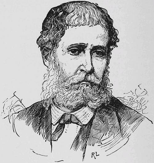
John Charles Frémont.
Born January 21, 1813, at Savannah, Ga., Frémont entered Charleston College, where his disregard of discipline prevented his graduating, although the faculty later honored him with the degrees of Bachelor and Master of Arts. Well grounded in the classics and familiar with the ordinary astronomical methods of determining latitude and longitude, Frémont visited South America on the United States ship Natchez, as a teacher. Later, appointed a professor of mathematics in the navy, he declined the position to accept more congenial service as assistant engineer of the United States Topographic Corps, where he had experience in preliminary surveys of railroads and also in a military reconnoissance among the Cherokees in Georgia. Commissioned in the United States Army, in 1838, as second lieutenant in the Topographic Corps, his initial service was fortunately as principal assistant to I. N. Nicolet, in the survey of the country between the Mississippi and the Missouri. Nicolet, an able and distinguished engineer, was the first explorer in America who made general use of the barometer for determining elevations of the great interior country, and his map of this region was one of the greatest contributions ever made to American geography.
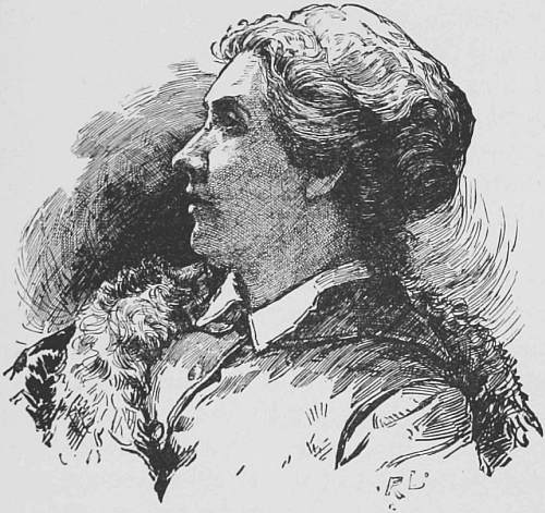
Jessie Benton Frémont.
In 1841 Frémont married Jessie Benton, a daughter of Senator Benton, through whose influence Frémont was assigned to the command of the expedition ordered to explore the country between the Missouri River and the Rocky Mountains on the line of the Kansas and Platte Rivers.
In May, 1842, while Frémont was on the frontier making preparations for the journey, there came, as Mrs. Frémont relates, an order recalling him to Washington. Mrs. Frémont sent a special messenger to her husband, advising him to move immediately for good and sufficient reasons, to be given later. Meanwhile, holding the letter, she wrote the colonel who had given the order for the recall that she had neither forwarded the order nor informed Frémont of it, as she knew that obedience thereto would ruin the expedition. On such a small thread of circumstances hung the fate of his first separate command, which brought Frémont into such great prominence in connection with the exploration and development of the Pacific Coast region.
The journey of Frémont lay up the North Fork of the Platte, through South Pass, into Wind River Valley, his march being marked by the usual experiences of hardship and suffering inseparable from the time and region. The most notable event of the journey was the ascent of the main and highest peak of the Wind River range, now known as Frémont’s Peak. Their first attempts were unsuccessful, the party suffering from great cold, excessive fatigue, and mountain fever resulting from the rarity of the air. Frémont, however, persevered and succeeded. He describes the final ascent as follows:
“We reached a point where the buttress was overhanging, and there was no other way of surmounting the difficulty than by passing around one side of it, which was the face of a vertical precipice of several hundred feet. Putting hands and feet in the crevices between the blocks I succeeded in getting over it, and when I reached the top found my companions in a small valley below. Descending to them, we continued climbing and in a short time reached the crest. I sprang upon the summit and another step would have precipitated me into an immense snow-field five hundred feet below. At the edge of this field was a sheer icy precipice, and then, with a gradual fall, the field sloped off for about a mile until it struck the foot of another lower ridge. I stood on a narrow crest about three feet in width. As soon as I had gratified the first feelings of curiosity I descended, and each man ascended in turn, for I would only allow one at a time to mount the unstable and precarious slab, which it seemed a breath would hurl into the abyss below. We mounted the barometer in the snow at the summit, and fixing a ramrod in the crevice, unfurled the national flag to wave in the breeze where never flag waved before.” The elevation of this summit, as determined by Frémont, was 13,570 feet.
His success on this expedition caused his most favorable reception by the War Department on his return to the States.
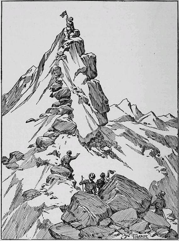
Ascending Frémont’s Peak.
Frémont’s second expedition contemplated the connection of his first explorations with those made by Captain Wilkes on the Pacific Coast, so as to give a connected survey across the interior of North America. The party, which left Kansas City May 29, 1843, consisted of forty men, equipped with twelve carts for transportation and a light wagon for scientific instruments. The route followed was up the valley of the Kansas River, thence by the South Fork of the Platte to the vicinity of the present city of Denver. After considerable hesitation a northerly route was taken, skirting the westerly limits of the great Laramie plain, which brought Frémont to the emigrant trail in the vicinity of the South Pass. The volume of travel toward the Pacific Coast even at that early date may be estimated from his description of the Oregon trail as “a broad smooth highway where the numerous heavy wagons of the emigrants have entirely beaten and crushed the mountain sage.”
Crossing Green River and following up Ham’s Fork, Frémont reached the valley of Bear River, the principal tributary of Great Salt Lake, which was filled with emigrants travelling to the lower Columbia River. Frémont expressed his surprise at the confidence and daring of the emigrants as he met in one place “a family of two men and women and several children travelling alone through such a country so remote from civilization.” Turning south from this point and quitting the travelled road Frémont visited the Great Salt Lake, of which he says: “Hitherto this lake had been seen only by trappers, who were wandering through the country in search of new beaver streams, caring very little for geography; its lands had never been visited, and none were to be found who had entirely made the circuit of its shores, and no instrumental observations or geographical survey of any description had ever been made anywhere in the neighboring region. It was generally supposed that the lake had no visible outlet, but among the trappers, including those in my own camp, were many who believed that somewhere on its surface was a terrible whirlpool, through which its waters found their way to the ocean by some subterranean communication.”
The lake was eventually reached from the lower part of Bear River in an india-rubber canoe, by means of which Frémont also landed on a mountainous island near the centre of the lake, where from an elevation of eight hundred feet he was able to determine with considerable accuracy the contours and extent of this remarkable body of water. Instead of a tangled wilderness of shrubbery teeming with an abundance of game, as the party expected, the island proved to be broken, rocky land, some twelve miles in circumference, on which there was neither water nor trees; a few saline shrubs and other hardy plants formed the only vegetation. The lake is described as being enclosed in a basin of rocky mountains, which sometimes leave grassy fields and extensive bottoms between them and the shore, while in other places they come directly down to the water in bold and precipitous bluffs. He speaks of the water of the lake being at a low stage and the probabilities that the marshes and low ground are overflowed in the season of high water. Frémont says that “we felt pleasure in knowing that we were the first who in the traditional annals of the country had visited the island and broke with joyful sounds the long solitude.” But in view of the dissipation of his dream of fertility he named it Disappointment Island.
Turning northward Frémont reached, on September 18, 1843, Fort Hall, Idaho, then a post under British control, whose original importance as an Indian trading-post had been greatly enhanced by its location on the emigrant route to Oregon, at a distance of over one thousand three hundred miles from the then frontier settlement of Westport, Mo. Following closely the emigrant trail Frémont, on October 8th, passed Fort Boisé, then occupied by the Hudson Bay Company, and on the 25th of the month arrived at another trading establishment of this company, at the junction of the Walla Walla and Columbia Rivers. This was considered by emigrants as the practical termination of their overland journey since navigation down the river was rapid and convenient.
Frémont found many American emigrants at Fort Vancouver on his visit to that post and also learned that others already occupied the adjacent lowlands of the Willamette Valley. Moreover, these pioneers were not confining their efforts to Oregon, for while small parties were pushing southward through that valley to settlements in Northern California, still others, making detours near Fort Hall, reached, by a more direct route through passes in the Sierra Nevada, the banks of the Sacramento.
On November 10, 1843, Frémont left Vancouver to return to the United States, having in view an entirely new route whereby he might be able to complete the exploration of the great interior basin between the Rocky Mountains and the Sierra Nevada. His party then consisted of twenty-five. Leaving the Columbia at a point above The Dalles, Frémont followed Des Chutes River to its source, and passing over to Lake Klamath, contemplated a journey to and a winter camp on either Mary’s Lake or the mythical Buenaventura River. His trail brought him to Lake Klamath, and later to Goose Lake, the source of the Sacramento. Winter had now commenced; the weather in the mountains proved to be extremely cold, snow-storms became frequent, and his search for Mary’s Lake and Buenaventura River proved fruitless and dangerous.
These mythical water-courses, which had been eliminated from the domain of geography by Bonneville’s map of 1837, proved indeed to be veritable waters of the desert, mere mirages that nearly led Frémont to an untimely fate. Frémont’s frequent allusions in his field journal to these imaginary streams show his then belief in their existence, which appears extraordinary in view of existing publications. In Bonneville’s maps are charted with general accuracy the great interior basins of the Great Salt, Mud, and Sevier Lakes, the Humboldt and Sevier Rivers. The general extent and direction of the Willamette, Sacramento, and San Joaquin Rivers are indicated, and the non-existence of the Buenaventura and other hypothetical streams was conclusively determined. The existence of these maps was generally known, and their absence from Frémont’s topographic outfit is remarkable; a most unfortunate omission, as Benton in his “Thirty Years’ View” describes Frémont’s charts and geographic information as “disastrously erroneous.”
Struggling along in the snow through a forest of unknown extent, Frémont halted, on December 16th, on the verge of a rocky precipice, from which the party looked down more than one thousand feet upon a broad lake, the most westerly waters of the great interior basin, which, from its pleasing contrast to the wintry weather of the Sierra Nevada, they called Summer Lake. Attempting to travel in an easterly direction Frémont found himself beaten back by an impassable country, there being rocky, sterile mountains on either side which obliged him to keep to the south through a wild, barren, and uninhabited region. Frémont, describing the country, says: “On both sides the mountains showed often stupendous and curious-looking rocks, which at several places so narrowed the valley that scarcely a pass was left for the camp. It was a singular place to travel through—shut up in the earth, a sort of chasm, the little strip of grass under our feet, the rough walls of bare rock on either hand, and the narrow strip of sky above.”
The year 1844 opened with the party in a forlorn and dispirited condition, as they were practically lost in the tangle of the valleys and mountains. The grass had become so scanty and unwholesome that the overtaxed animals fell ill; some died and others were stolen by Indians, so that the party lost fifteen head of stock by the time they reached Pyramid Lake, where they camped from the 10th to the 16th of January. Here they found grass abundant, fire-wood plentiful, and from an Indian village they obtained salmon trout, a feast to the famished men. The Indians indicated the general direction of the route out of the desolate country, but no one would consent to accompany the party as guide. The region traversed continued so rough and lamed the animals so badly that on the 18th Frémont determined to abandon the easterly course, thinking it advisable to cross the Sierra Nevada to the valley of the Sacramento by the first practicable pass. Now and then a few Indians were met, and finally a guide was obtained, who led them to the southward, over a low range of mountains through a snow-covered pass into what proved to be Carson Valley. The snow deepened and the country became so broken as to make progress difficult, long, tedious detours necessary, and soon travel was only possible along high and exposed ridges, which were comparatively snow free. Finally it became necessary to abandon their mountain howitzer at an impracticable cañon that led into a valley which Frémont at first erroneously supposed to be to the westward of the Sierra Nevada. Continuing on without a guide they met other Indians, who stated it was impossible to cross the mountains on account of the deep snow, but after much persuasion, and by means of large presents, an Indian guide was finally induced to undertake the journey. Frémont, fully conscious of the desperate conditions, which entailed the possible death of all, endeavored to encourage his men by reminding them of the contrast between the fast falling snow of the surrounding Sierra Nevada and the flower-clad meadows in the adjacent valley of the Sacramento, and informed them that his astronomical observations showed that they were only sixty miles distant from Sutter’s great establishment.
Their provisions were now practically exhausted; neither tallow, grease, nor salt remained, and even their hunting dogs were killed for food. Making the best of the situation their clothing and outfit were put in the best of order, and on February 2d, crossing the frozen river on the ice, the party commenced the ascent of the mountain, the men, Frémont relates, being unusually silent over the hazardous and doubtful enterprise. Ten men, mounted on the strongest horses, broke the road, each man in succession opening the path, either on foot or on horseback, until he and his horse became exhausted, when he dropped to the rear. The very deep snow made it impossible to follow the main valley, and they necessarily worked along steep and difficult mountain-sides. On the third day the snow had become so deep that their best horses gave out entirely, refusing to make further effort; the day ended with the party at a stand-still and the camp equipage strewed along the route. Too exhausted to make huts, they camped that night without shelter and suffered bitterly from the unusual cold, as the temperature fell to twenty-two degrees below freezing. Two Indians who had joined the party expatiated on the impossibility of crossing at this point, and the guide, influenced by them, deserted the party the next morning.
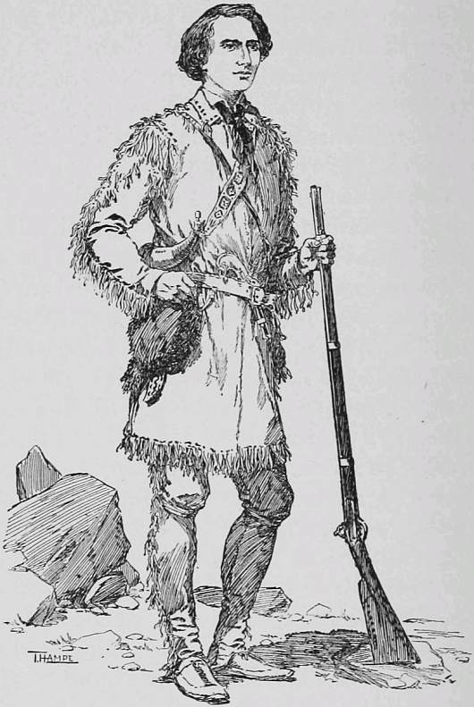
Kit Carson.
Having obtained snow-shoes from the Indians, on February 6th, Frémont, accompanied by Carson and Fitzpatrick, made a reconnoissance and reached a high peak, from which Carson saw a little mountain to the westward which he recognized as one seen by him fifteen years before, so that confidence was somewhat restored. On examining the general depth of the snow it was found to be five feet, but in places it proved to be twenty. As this snow was plainly impracticable for the pack-train, sledges were made for transporting the baggage, which was dragged forward by the men with the expectation that the horses without load could break a path for themselves. Unfortunately the weather turned bitterly cold, and the temperature falling thirty-five degrees below the freezing-point, a number of the men were frost-bitten.
Frémont, and indeed the whole party, now realized that the crossing of the mountains into the valley of the Sacramento was a struggle for life, but this in no wise disorganized the party. This desperate march lasted during the whole of February. Finally Frémont with the advance party reached Sutter’s ranch on March 6th in a state of complete exhaustion; help was immediately sent to the main party, which arrived a few days later. Frémont’s route across the mountains was practically through the pass now crossed by the Central Pacific Railway, the descent into the Sacramento being through the valley of the American River. In crossing the Sierras not less than thirty-four out of the sixty-seven horses died of exhaustion or were killed for food, the meat of these animals being the only resource against starvation.
One of the party, De Rossier, became insane on March 1st, and Frémont says: “Hunger and fatigue joined to weakness of body and fear of perishing in the mountains had crazed him. The times were severe when stout men lost their minds from extremity of suffering, when horses died, when mules and horses ready to die of starvation were killed for food, yet there was no murmuring or hesitation.”
Sutter’s Fort, on the Sacramento, was then the most important American establishment in California; the fort itself was an adobe structure defended by twelve pieces of artillery. Sutter had a large force in his employ engaged in farming his extensive wheat-fields, in milling operations, in blacksmith- and other work-shops.
One might have thought that Frémont would have delayed long in the delightful climate and conditions that obtained at Sutter’s, but such was not the nature of the man. The entire party were reunited at Sutter’s Fort on March 8th, and under Frémont’s well-directed efforts, in the short space of fourteen days the starving band was reorganized, remounted, and equipped fully for instant march. The return journey was to be through the pass at the head of the San Joaquin River, discovered by Walker, whose name was affixed to it by Frémont. Crossing the Sierra Nevada the party struck the Spanish trail, which was then followed by all wagon-trains or mounted parties travelling to and fro between Los Angeles and Santa Fé. The region over which they passed was desolate in the extreme, the road rough and rocky, grass scanty and poor, while water was found only in holes and at long distances, In pointing to it, Frémont’s Spanish guide well states: “There are the great plains; there is found neither water nor grass—nothing; every animal which goes upon them dies.”
The party had to undergo not only terrible discomforts arising from the physical conditions of the country, but was also harassed by hostile Indians, who stole some of their stock. The expedition fortunately escaped with the loss of only one man, although parties in advance and in their rear were plundered and slaughtered. Speaking of their travelling alone in twenty-seven days a distance of five hundred and fifty miles through this inhospitable region, Frémont comments, that although their lonely journey gave them the advantage of more grass, yet they “had the disadvantage of finding also the marauding savages who had gathered down upon the trail, waiting the approach of their prey. This greatly increased our labors, besides costing us the life of an excellent man. We had to move all day in a state of watch and prepare for combat, scouts and flankers out, a front and rear division of our men, and baggage animals in the centre. At night camp duty was severe; those who had toiled all day had to guard by turns the camp and horses all night. Frequently one-third of the whole party were on guard at once, and nothing but this vigilance saved us from attack. We were constantly dogged by bands and even whole tribes of the marauders.”
Reaching, in Southern Utah, the head-waters of the Virgin River, where Santa Fé trains usually halt to recruit the strength of their animals in its grassy meadows, Frémont was joined by the famous trapper, Joseph Walker, who consented to serve as guide in the departure to the northeastward, as they now quitted the Spanish trail. Frémont then skirted the eastern edge of the great interior basin and visiting Sevier and Utah Lakes, thus completed practically the circuit of the basin. He then turned eastward through the valleys of the Du Chesne and Green Rivers, tributaries to the Colorado, and pushing through the very heart of the Rocky Mountains, by the way of the pass near Leadville, at an elevation of eleven thousand two hundred feet, he reached the Arkansas Valley June 29, 1844.
His journey eastward across the great Kansas plains was of an easy character, and the 31st of July, 1844, saw his expedition safe at Independence, Mo. He had been absent fourteen months, during which time he had travelled some six thousand five hundred miles, the greater part of his journey being through the most barren and inhospitable regions of North America.
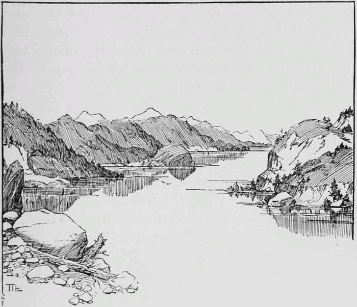
Lake Klamath.
The character and extent of Frémont’s astronomical and other physical observations on this long, arduous, and dangerous journey constituted the great value of his exploring work. In few instances did it fall to Frémont’s lot to first explore any section of the country, but it was his good fortune, as it was his intent, to first contribute systematic, extended, and reliable data as to climate, elevation, physical conditions, and geographical positions. The hypsometrical work begun by Frémont culminated, indeed, in the unparalleled collation of elevations by Gannett; his climatic observations have been perfected by the Signal Corps; his astronomical and geological data have been overwhelmed by the magnificent collections and field work of the United States Coast and Geodetic and Geological Surveys; but it is to be noted that Frémont’s observations, which he gave in detail, were so honest and good that they have withstood successfully the test of hostile examination. Frémont’s scientific spirit was strikingly exemplified in this terrible mid-winter journey through the mountains of Nevada, when observations for time, latitude, elevation, or temperature were daily and regularly made despite snow, extreme cold, and physical weakness from semi-starvation.
On the recommendation of General Winfield Scott, in a special report, the unprecedented honor of double brevets—of first lieutenant and captain—was conferred on Frémont for gallant and highly meritorious services in connection with these two expeditions.
Frémont’s third expedition consisted of sixty men. They left Bent’s Fort, on the Arkansas, August 16, 1845. Its object, as far as exploration was concerned, included a survey of the head-waters of the Arkansas, Rio Grande, and Rio Colorado, the basin of the Great Salt Lake and the practicable passes of the Cascade and southern Sierra Nevada.
It was during this journey that Frémont quite fully surveyed the southern shores of Salt Lake. The water was then at an unusually low—possibly at its lowest known—level, and having been informed by the Indians that it was fordable to Antelope Island, Frémont with Kit Carson rode to the island, the water nowhere reaching above the saddle-girths of their horses.
Dividing his party Frémont crossed the Utah desert between the thirty-eighth and thirty-ninth parallels, while his subordinate, Walker, explored the valley and sink of the Humboldt. Rendezvousing at Lake Walker and again separating, Frémont reached Sutter’s Fort through the American River route, while Walker and the main party crossed the Sierras into the extreme southern part of the San Joaquin Valley, opposite Tulare Lake. Of the survey and explorations made by the expedition it may be briefly said that they added very greatly to a knowledge of Upper California, and resulted in the publication in 1848 of the most accurate map of that region extant.
There was, however, another and more important phase to the third expedition than that of mere exploration. Frémont before leaving Washington was informed that war with Mexico was possible, and received general unwritten instructions looking to such a contingency. The forecast of trouble proved correct, and the preliminary and extensive disturbances in California interfered most materially with the progress of his surveys. Frémont’s explorations westward of the Arkansas River had been through and over Mexican territory. In order to place himself in proper position as a non-invader he proceeded to Monterey, Cal., at the earliest practicable moment and applied to the commanding general, Don José Castro, for permission to extend, in the interests of science and commerce, the geographical survey of the nearest route between the United States and the Pacific Ocean. The request was granted promptly and courteously. Scarcely had Frémont commenced his survey in Northern California than he was peremptorily ordered by General Castro, who later appears to have been acting under orders from the Mexican Government, to quit the department; the message being coupled with an intimation that non-compliance would result in expulsion by an armed force. The message was delivered in such manner and language as incensed Frémont and caused him to peremptorily refuse. Withdrawing a short distance he erected a stockade and awaited expulsion by arms. The Mexican force made several forward movements, but carefully avoided an attack. Frémont finally judged it advisable to quit Mexican territory, as his remaining might be detrimental to the United States. He consequently withdrew slowly toward Oregon, surveying and exploring as he moved northward.
On May 7, 1845, Frémont was overtaken in the valley of the upper Sacramento by Lieutenant Archibald H. Gillespie, of the marine corps, who brought from Washington important despatches which were destined to settle the fate of California as a Mexican state. Frémont was informed through Gillespie that war with Mexico had been declared, that the government counted upon him to ascertain and conciliate the disposition of the people of California toward the United States, and especially to conserve American interests by ascertaining and counteracting any scheme looking to the cession of California to Great Britain. Frémont was then surrounded by hostile Klamaths, who killed several of his party and with whom he had several engagements, which resulted in the destruction of the principal village, fishing appliances, etc., of the offending tribe.
Frémont, turning promptly southward, his heart set on the important mission intrusted to him, saved from ravage the American settlements in the valley of the Sacramento, which were in imminent danger of destruction between the proclamation of the Mexican authorities ordering confiscation and expulsion and the threatening attitude of the Indian allies, incited by unscrupulous officials to activity. Aided by volunteers from the American settlers Frémont freed California permanently from Mexican domination, his actions receiving mention and approval from the President in his Annual Message to Congress, in December, 1846.
Commodore Stockton, United States Navy, charged with the control of affairs on the Pacific Coast, appointed Frémont Governor and military commander of California. When controversies arose between Commodore Stockton, of the navy, and General Kearney, of the army, each having authority from Washington to conquer California and organize its government, Frémont adhered to Stockton, his first commander. In consequence serious complications arose, which finally resulted in the trial of Frémont, and, although the findings of the court were partly disapproved and the sentence remitted, he resigned from the army.
His courage, persistency, and success in these expeditions gained for Frémont world-wide reputation. At home he was named The Pathfinder; abroad he received the Founders’ Medal from the Royal Geographical Society of England and many other well-deserved marks of appreciation from geographers.
Devoted to California and to its exploration Frémont immediately fitted out, at his own expense, another expedition, the fourth. In October, 1848, with thirty-three men and a large train he crossed the Rocky Mountains, undeterred by his fearful experiences in 1844, and again attempted the passage of the snow-covered Sierras in mid-winter. The snow was deep, the guide inefficient, and the winter unusually cold. One-third of his men and all his animals perished after suffering cold, hunger, and fatigue of the most appalling character, and the remnant of the expedition returned to Santa Fé. Unappalled by this overwhelming disaster Frémont reorganized at Santa Fé a new party, and after a long, perilous journey reached Sacramento in the spring of 1849.
Frémont’s experiences during his surveys of the great valleys of the San Joaquin and Sacramento caused him to fall under the fascinating spell which California exercises over the greater number of its Eastern settlers. The vast domain of its virgin forests, the luxuriance of its vegetation, the extent and fertility of its valley lands, and its incomparable climate were speedily recognized by Frémont as so many physical conditions calculated to insure unparalleled prosperity when once it should be occupied by Americans. He saw this vast region practically a waste; its magnificent harbors unvexed, unbroken by the keels of commerce; its unrivalled valleys awaiting the hand of intelligent labor to transform them from mere pastures for scattered herds of cattle into fruitful granaries, orchards, and vineyards capable of feeding a continent. Imbued with these ideas he cast in his lot with California, and was a potent power in making it a free State, and was honored by election as its first Senator, unfortunately, however, drawing the short term in the United States Senate.
Failing, through the defeat of his party, of re-election, Frémont visited Europe for a brief and well-earned rest, which was broken by the authorization of Congress for a survey of a trans-continental railway, which awoke his dormant exploring spirit. Returning promptly to the United States he organized an expedition under private auspices, which started westward in September, 1853. He travelled by the central route through the mountains of Colorado, passing over the Sierra Blanca, through the Sandy Hill Pass and the valley of the Grand River. Turning southward into Utah and crossing the Sawatch Mountains, Frémont’s march brought him to the Sierra Nevada near the end of winter, and their passage was attempted near the thirty-seventh parallel. Thereof he writes: “I was prepared to find the Sierra here broad, rugged, and blocked with snow, and was not disappointed in my expectations.” The snow being impassable and food failing he made a detour of some seventy miles to the southward and reached the Kern River Valley through Walker Pass. The march entailed endless suffering and extreme privations on the party, which was pushed to the direst extremities to preserve life. They were often without food of any kind for an entire day and for many weeks had only the flesh of their emaciated and exhausted horses. The disastrous outcome of this expedition impaired Frémont’s reputation, it appearing, then as now, surprising that, aware by bitter experience of the impracticability of such a journey, he should have so timed his march as to be again overwhelmed by the dreadful winter snow of the Nevada range.
This sketch has in view the treatment neither of Frémont’s career as a soldier nor as a politician, which phases of his life, viewed by ordinary circumstances, may be considered as unsuccessful. It need not be here dwelt on that his name became a watchword of the ever-growing spirit of human freedom, and that as the standard-bearer of an idea he astonished the country and the world by obtaining the suffrages of nearly one and a half millions of his countrymen for the highest office in the gift of the people. His unwavering, if impractical, devotion to freedom was forcibly illustrated by his emancipation proclamation in Missouri, which he declined to recall, even at the request of the President who revoked it.
It is undoubted that Frémont’s non-success in business and political ventures has tended to diminish his reputation as an explorer, a reputation which, it is safe to say, must continue to grow steadily in the future with the development of the great trans-Rocky Mountain region to which he gave the enthusiasm of his youth, the maturity of his manhood, and for which he sacrificed his profession and his private fortune. While Frémont loved all the great West, it was to California especially that he gave the best he had of mind, heart, and body, never sparing himself in any effort for the upbuilding of her future. So it is that in the scene of his activities on the shores of the golden Pacific, rather than on the coast of the Atlantic, should be more appreciated the labors and ever grow brighter and brighter the name of John C. Frémont, the Pathfinder.
IX.
ELISHA KENT KANE,
Arctic Explorer.
Among the picturesque and striking figures of Arctic explorers none abides more firmly in the minds of Americans than that of Elisha Kent Kane, whose career and fame largely relate to the fate of the lost explorer, Sir John Franklin.
Kane was born in Philadelphia, February 3, 1820. In 1842 he graduated in medicine at the University of Pennsylvania, and the following year, while waiting for a vacancy in the medical corps of the navy, for which he had passed an examination, sailed on the frigate Brandywine, as physician to the embassy, to China, under Caleb Cushing, Minister Plenipotentiary. Later, commissioned as an officer of the medical corps of the United States Navy, he served on the west coast of Africa, in Brazil, in the Mediterranean, and on special duty with the army in Mexico. This brief statement of his duties conveys, however, no idea of the intense energy and restless activity of Kane in his eager efforts to acquire personal knowledge of the very ends of the earth.
Indeed, considering Kane’s very short life (he died at thirty-seven), there is no man of modern times to whom the words of Tennyson, in his strong poem of Ulysses, more fittingly apply:
“I cannot rest from travel, ... For always roaming with a hungry heart Much have I seen and known: cities of men And manners, climates, councils, governments, Myself not least but honored of them all.”
Suffice it here to say that before Kane was thirty he had visited in America the greater part of the eastern half of the United States, the city of Mexico, Cuba, and Brazil from Rio de Janeiro to the eastern Andes; in Africa, along the Gold and Slave Coasts, to Dahomey, Cape Colony, and up the Nile to the Second Cataract; in Europe, the eastern, southern, and central countries; in Asia, the coast of China, Ceylon, India from Bombay to the Himalayas, Persia, and Syria. Elsewhere he had travelled in the islands of Cape Verde, Singapore, Java, Sumatra, and Luzon of the Philippines. This incessant travel is the more remarkable as he was always sea-sick, was a man of delicate physique, and nowhere passed six months without being prostrated by severe illness. As to personal experiences, he had been wounded in Egypt by a Bedouin who strove to rob him, narrowly escaped death in saving captured Mexican officers from slaughter at the hands of renegade irregulars, and barely survived his unique experiences in the crater of a volcano.
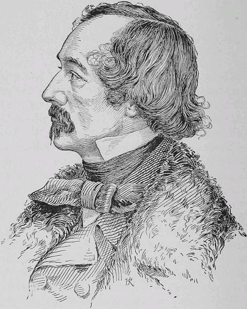
Elisha Kent Kane.
His descent into the volcano of Tael, in the Philippines, illustrates Kane’s utter disregard of dangers whenever he desired to investigate any phenomena. As related by Dr. Elder, Kane not only was lowered two hundred feet below the point usually visited, but descended to the very surface of the burning lake and dipped his specimen bottles into the steaming sulphur water. This feat nearly cost him his life, for although he was able to crawl to and fasten the bamboo ropes around his body, yet his boots were charred in pieces on his feet, sulphurous air-currents stifled him into insensibility, and he would have perished had it not been for the strenuous exertions of Baron Löe, his companion.
The turning-point in Kane’s life came in 1850, when, induced by the persistent petition of Lady Franklin, President Taylor recommended to Congress an appropriation for an expedition in search of Sir John Franklin and his missing ships. Kane immediately volunteered for Arctic service, pressing and urging his application by every means at his command. Congress acted tardily, so that the whole expedition was fitted out in eighteen days, and Kane at the last moment, when his hopes had failed, received orders as surgeon of the Advance, the flagship, which he joined May 20, 1850.
The expedition owed its existence to the enterprise and generosity of Henry Grinnell, whose philanthropic mind planned, practical energy equipped, and munificence endowed it. Without Grinnell’s action Congress would have failed to fit out the expedition, and the grateful chapter of American co-operation with England in its Franklin search would have been unwritten. Such practical displays of sympathy in matters of general and national interest, now considered the most hopeful signs of international fellowship, may be said to have been inaugurated by the despatch of the first Grinnell expedition on its errand of humanity.
Under a joint resolution of Congress, passed May 2, 1850, the President was authorized “to accept and attach to the navy two vessels offered by Henry Grinnell, Esq., to be sent to the Arctic seas in search of Sir John Franklin and his companions.” These vessels—two very small brigs, the flagship Advance and the Rescue—were placed under command of Lieutenant Edwin J. DeHaven, an officer of Antarctic service under Wilkes. The vessels had detachable rudders, modern fittings, were admirably strengthened and fully equipped; in short, they were thoroughly adapted to the difficult navigation in prospect. Where Grinnell’s forethought and liberality ended there was, says Kane, another tale: the strictly naval equipment could not be praised, and the “crews consisted of man-of-war’s-men of various climes and habitudes, with constitutions most of them impaired by disease or temporarily broken by the excesses of shore life;” but he commends them as ever brave, willing, and reliable.
The squadron touched at various Greenland ports and then entered the dreaded ice-pack of Melville Bay, in which the sailing vessels made slow progress; but in their besetment of three weeks the only dangerous experience was a “nip,” which nearly destroyed the Advance. The movement of the ice-floes is thus graphically told by Kane: “The momentum of the assailing floe was so irresistible that as it impinged against the solid margin of the land ice there was no recoil, no interruption to its progress. The elastic material corrugated before the enormous pressure, then cracked, then crumbled, and at last rose, the lesser over the greater, sliding up in great inclined planes, and these again, breaking by their weight and their continued impulse, toppled over in long lines of fragmentary ice.”
DeHaven entered Lancaster Sound, near the end of August, in company with half a dozen English ships bound on the same humane errand, and on the 24th Master Griffin, of the Rescue, participated in the search with Captain Ommaney, which resulted in the discovery, on Beechy Island, of vestiges of an encampment. Two days later DeHaven and Kane shared in the joint search, wherein Captain Penny discovered the graves of three of Franklin’s crew. These discoveries proved that Franklin’s expedition had wintered there during 1845-46, and later innumerable traces of their stay were noted, indicating the good condition and activity of the expedition. On September 10th DeHaven’s squadron was off Griffith Island in company with eight English search ships. Consulting with Griffin, DeHaven concluded that they had not attained such a position as promised advantageous operations in the season of 1851, and so decided to extricate the vessels from the ice and return home.
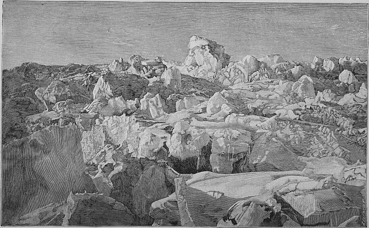
The Arctic Highway.
Strong gales and an unusually early advance of winter prevented such action and resulted in the ships being frozen up in the pack, where they drifted helplessly to and fro, a condition they were destined to undergo for many months. Beset in the middle of Wellington Channel, the American squadron, with varying movements to and fro, first drifted under the influence of southerly gales to the north-northwest, attaining latitude 75° 25´ N., longitude 93° 31´ W. In this northerly drift the expedition discovered Murdaugh Island and quite extensive masses of land to the northwest of North Devon, to which the name of Grinnell was given. This land was further extended the following year by the discoveries of Captain Penny, and most unwarrantable efforts were made by ungenerous and unappreciating officials in England to take from the American squadron its ewe lamb of 1850, an attempt that, properly refuted, failed of its purpose.
October 2, 1860, the direction of the drift changed to the south and later to the east. Their involuntary course lay through Wellington Channel, Barrow Strait, and Lancaster Sound into Baffin Bay, where release came, near Cape Walsingham, June 5, 1851. The drift covered ten hundred and fifty miles and lasted eight and a half months. The sun was absent twelve weeks. It is impossible to adequately describe the physical and mental sufferings of the party during this protracted ice imprisonment. It was a constant succession of harassing conditions, each, if possible, seeming worse than the former. Now the ships were so firmly imbedded in the cemented ice-pack that extrication appeared impossible; again the complete disruption of the pack threatened, or the instant destruction of their vessels impended, with prospects of a winter on the naked floe under such conditions of darkness, sickness, lack of shelter, and suitable nutrition as would render a lingering death unavoidable. No single week passed with a feeling of security; for days at a time there was no hour free from terrible suspense as to what fate might immediately befall, and four times in one day the entire party prepared to abandon ship at order. The cold became extreme, the mean of one week in March being thirty-one degrees below zero; seal and other fresh meat could be got only in small quantities, and scurvy, the bane of Arctic explorers, affected all save six of the crew, DeHaven being put off duty by this disease. In all these terrible experiences, which were borne with a fortitude, courage, and patience most creditable, Kane was first and foremost in sustaining the heroic efforts of Griffin, master of the Rescue, on whom the executive duties devolved during DeHaven’s illness. It may be said that not only Kane’s medical skill, but also his cheeriness, activity, and ingenious devices contributed largely to conserve the health, spirits, and morale of the crew in these dark hours when despair seemed justified.
Released from the pack, DeHaven patched up his injured ships and attempted to return and prosecute further the Franklin search; but, stopped in his return journey by ice in the upper part of Melville Bay, he judiciously decided to return to the United States, which was safely reached September 30, 1851.
The following extracts from Kane’s very vivid account of the expedition illustrate some of the most striking phases of their experiences as recorded in his journal.
Of the conditions and experience of the Advance in the moving ice-pack he says:
“We were yet to be familiarized with the strife of the ice-tables, now broken into tumbling masses and piling themselves in angry confusion against our sides; now fixed in chaotic disarray by the fields of new ice that imbedded them in a single night; again, perhaps, opening in treacherous pools, only to close around us with a force that threatened to grind our brig to powder.”
“A level snow-covered surface was rising up in inclined planes or rudely undulating curves. These, breaking at their summits, fell off on each side in masses of twenty tons’ weight. Tables of six feet in thickness by twenty of perpendicular height, and some of them fifteen yards in length, surging up into the misty air, heaving, rolling, tottering, and falling with a majestic deliberation worthy of the forces that impelled them.”
The following descriptions indicate the narrow escapes of the ships from destruction during disruptions of the ice-pack:
“The separated sides would come together with an explosion like a mortar, craunching the newly formed field and driving it headlong in fragments for fifty feet upon the floe till it piled up against our bulwarks. Everything betokened a crisis. Sledges, boats, packages of all sorts were disposed in order; contingencies were met as they approached by new delegations of duty; every man was at work, officers and seamen alike. The Rescue, crippled and thrown away from us to the further side of a chasm, was deserted, and her company consolidated with ours. Our own brig groaned and quivered under the pressure against her sides.”
“The ice came in with the momentum before mentioned as irresistible, progressive, and grand. All expected to betake ourselves sledgeless to the ice, for the open space around the vessel barely admits of a foot-board. The timbers and even cross-beams protected by shores vibrated so as to communicate to you the peculiar tremor of a cotton-factory. Presently the stern of the brig, by a succession of jerking leaps, began to rise, while her bows dipped toward the last night’s ice ahead. Everybody looked to see her fall upon her beam-ends and rushed out upon the ice.”
“On the 13th the hummock ridge astern advanced with a steady march upon the vessel. Twice it rested and advanced again—a dense wall of ice, thirty feet broad at the base and twelve feet high, tumbling huge fragments from its crest, yet increasing in mass at every new effort. We had ceased to hope, when a merciful interposition arrested it, so close against our counter that there was scarcely room for a man to pass between. Half a minute of progress more and it would have buried us all. As we drifted along five months afterward this stupendous memento of controlling power was still hanging over our stern.”
The discomfort of the prescribed out-of-door exercise in extreme cold appears from the following:
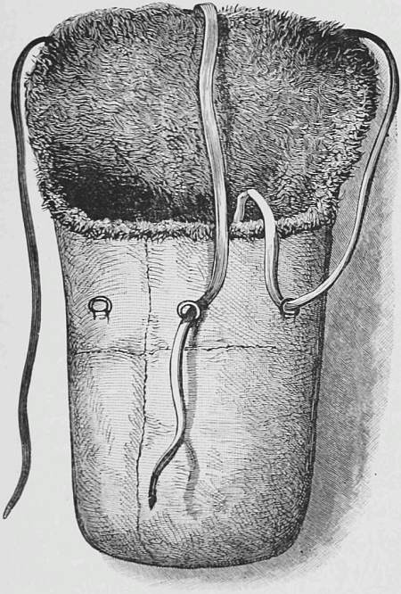
A Sleeping-bag for Three Men.
“Close the lips for the first minute or two and admit the air suspiciously through nostril and mustache. Presently you breathe in a dry, pungent but gracious and agreeable atmosphere. The beard, eyebrows, eyelashes, and the downy pubescence of the ears acquire a delicate white and perfectly enveloped cover of venerable hoar-frost. The mustache and under lip form pendulous beads of dangling ice. Put out your tongue and it instantly freezes to this icy crusting, and a rapid effort and some hand aid will be required to liberate it. The less you talk the better. Your chin has a trick of freezing to your upper jaw by the luting aid of your beard; even my eyes have often been so glued as to show that even a wink may be unsafe.”
The unfortunate physical condition of the party made Kane’s duties most onerous and wearing. In mid-winter he says:
“Scurvy advanced steadily. This fearful disease, so often warded off when in a direct attack, now exhibited itself in a cachexy, a depraved condition of system sad to encounter. Pains diffuse and non-locatable were combined with an apathy and lassitude which resisted all attempts at healthy excitement. These, of course, were not confined to the crew alone: out of twenty-four men but five were without ulcerated gums and blotched limbs. All the officers were assailed.”
The expedition safe in port, the recollection of the horrors and privations of his mid-winter drift through the polar pack did not deter Kane from again braving the danger of Arctic exploration, and he was soon busily engaged in stimulating public opinion to the support of another expedition. To this end he especially addressed the American Geographic Society, of which Henry Grinnell was president, presenting a well-intended but fallacious and illogical plan for continuing the search for Franklin.
Kane was personally aware, from the experiences of his previous voyage with DeHaven, that Franklin had wintered at Beechy Island, in 74° 43´ N., 91° 33´ W., and that his positive orders from the admiralty required him to push southward from the vicinity of Cape Walker to Behring Strait. A search for him by the way of Smith Sound, four degrees of latitude to the northward and seventeen degrees of longitude to the eastward of his last known position, rested on the violent assumption that Franklin had not only directly disobeyed his positive orders to go west and southwest, but had done so after one-third of the distance from Greenland to Behring Strait had been accomplished.
Again there had lately been made public in England the last direct report from the Franklin expedition—a letter from Captain Fitzjames—who relates that Franklin showed him part of his instructions, expressed his disbelief in an open sea to the north, and gave “a pleasant account of his expectations of being able to get through the ice on the coast of America.” Dr. Rae had also reported finding drift material on the north coast of America, which, having the broad arrow and red thread of the government, could come from the quarter where Franklin’s orders sent him, thus confirming the belief that he had gone southwest from Cape Walker. Moreover, the squadrons of Belcher and Collinson were actively engaged in the search northward of America.
It was finally decided that a second expedition should be sent, the United States co-operating, as before, with private enterprise; and to the command of this expedition Kane was assigned, by orders from the Secretary of the Navy, in November, 1852. The expedition was fitted out through the liberality of two Americans, Henry Grinnell, who again placed the brig Advance at the disposal of the government, and George Peabody, the American philanthropist, who contributed $10,000, a sum that practically covered all other expenses of the voyage.
Kane’s faith in the existence of an open polar sea and his intention of reaching it were clearly asserted. Combined with the proposed search for Franklin was a declared purpose to extend northward the discoveries of Inglefield, in 1851, on the west coast of Greenland, where, as Kane says, he contemplated reaching “its most northern attainable point, and thence pressing on toward the Pole as far as boats or sledges could carry us, examine the coast lines for vestiges of the lost party.”
The expedition sailed from New York May 30, 1853, consisting of eighteen men, all volunteers, although ten belonged to the United States Navy. Except as regards scientific instruments, the equipment of the expedition was in most respects inadequate and unsuitable for Arctic service, the bulk of the provisions, for instance, being hard bread, salt beef, and pork, with no canned meats or vegetables.
The Greenland ports were visited, where a moderate amount of fur clothing and fifty Esquimau dogs were purchased. On June 27th the Advance entered Melville Bay, and standing boldly to the westward, although hindered by the loose drifting ice, was favored by an offshore gale, and in ten days passed into the open sea west of Cape York, known to Arctic voyagers as the “North Water,” the only misfortune being the loss of a whaleboat. In order to secure retreat Kane, fortunately for himself as it afterward proved, cached his metallic life-boat, filled with boat stores, on Littleton Island. Favored by the conditions of the ice Kane rounded Cape Hatherton, when the main pack setting southward obliged him to seek shelter in Refuge Harbor, a land-locked cove. Later the Advance was able, as the ice opened, to make sail and pass around Cairn Point, but a violent gale broke her from her moorings and nearly wrecked her. The ice conditions were now so adverse that seven of his eight officers addressed to him written opinions in favor of a return to a more southern harbor. Such retrograde movement would have removed them from the contemplated field of operations, and Kane declined. Every favorable opportunity of warping the brig—she could be moved in no other way—was availed of, and despite most difficult conditions of ice and water, the brig being on her beam-ends at low tide and jammed by floes at high water, she was moved a number of miles to the eastward, and on September 9th was put into winter-quarters in Rensselaer Harbor, 78° 37´ N., 71° 14´ W., which, says Kane, “we were fated never to leave together—a long resting-place to her, for the same ice is around her still.”
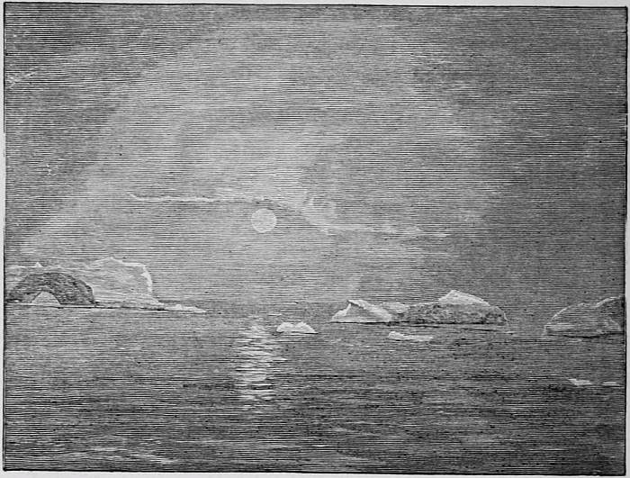
The Coming Arctic Night.
Scarcely were they moored than signs of coming winter crowded fast one after another; the flowers were blackened by frost; long lines of flying water-fowl trended southward, leaving solitary the hardy snow-bird; the sun grew lower from day to day with startling rapidity, and the young ice cemented the separated old floes into one solid roadway for the sledgemen. Kane set about exploring the country and travelled some fifty miles to Mary Minturn River, whence from adjoining high land he had a view of Washington land, the vicinity of Cape Constitution. During this journey he first observed the peculiar ice formation now known as the ice-foot, but then novel. It is best described in his words: “We were on a table or shelf of ice which clung to the base of rocks overlooking the sea, ... with huge angular blocks, some many tons in weight, scattered over its surface.” Hayes and Wilson travelled some fifty miles into the interior till their further progress was stopped by the edge of the inland ice. McGary and Bonsall, with sledge party of seven, made three caches to the northeast, the farthest being in 79° 12´ N., 65° 25´ W., under the face of an enormous glacier, to which the name of Humboldt was given.
The winter passed quietly, the officers making tidal, astronomical, magnetic, and meteorological observations, while the men, engaged in ordinary pursuits, kept in health. Unfortunately fifty-seven, nearly all, of the dogs died, thus depriving Kane of his main reliance for field operations. The extreme cold—the mean temperature for December to March, inclusive, being thirty-two degrees below zero—had reduced the fuel so that the allowance was three buckets a day. Other supplies commenced to show their need or inadequacy; oil for lamps failed, as did fresh meat from game, and unfortunately there was no canned meat, only salted.
Despite his loss of dogs Kane decided on laying out new depots, and with the advance of March he watched eagerly the temperature. From the 10th to the 19th the cold averaged seventy-six degrees below the freezing-point. He started his man-sledge on the 20th, under charge of Brooks, first officer, with seven others at the drag-ropes. Unfortunately the equipment was either somewhat defective or some of the party were inexperienced in the methods needful for self-preservation in such extreme cold. Kane gives no details of the causes of the calamity save to say that “a heavy gale from the north-northeast broke upon the party, and the temperature fell to fifty-seven below zero.”
The first news of the disaster came from Sontag, Ohlsen, and Petersen, who suddenly appeared in the cabin, at midnight of March 31st, swollen, haggard, and hardly able to speak. Kane continues: “They had left their companions in the ice, risking their own lives to bring us the news; Brooks, Baker, Wilson, and Pierre, were all lying frozen and disabled. Where? They could not tell; somewhere among the hummocks to the northeast; it was drifting heavily around them. Irish Tom had stayed to care for the others. It was vain to question them, for they were sinking with fatigue and hunger, and could hardly be rallied enough to tell us the direction.”
Kane instantly organized a relief party of ten men, which, despite his delicate physique, he headed himself. Taking Ohlsen, the most rational of the sufferers, in a fur bag, and as lightly equipped as was possible, the rescuers moved out in a temperature seventy-eight degrees below freezing. Ohlsen fell asleep, but on awakening was of no use as guide owing to his delirious condition. Reaching a large level floe Kane put up his tent and scattered his party to find traces of the lost men. Eighteen hours had now elapsed and Kane’s own party was in a deplorable state, partly owing to the extreme cold and partly to extreme nervousness arising from anxiety and sympathy. He says: “McGary and Bonsall, who had stood out our severest marches, were seized with trembling fits and short breath, and in spite of all my efforts I fainted twice on the snow.” Fortunately Hans, the Esquimau, found a sledge-track which led to the camp in a few hours, where Kane found the four men on their backs, whose welcome greeting, “We expected you: we were sure you would come,” proved how great was their confidence in their commander. The day was extremely cold and most providentially clear and sunny, but even with these favoring conditions it was almost a miracle that they were able to drag the frozen men to the brig. “The tendency to sleep,” says Kane, “could only be overcome by mechanical violence; and when at last we got back to the brig, still dragging the wounded men instinctively behind us, there was not one whose mind was found to be unimpaired.” Baker and Schubert died; Wilson and Brooks finally recovered, losing, however, part of their feet by amputation.
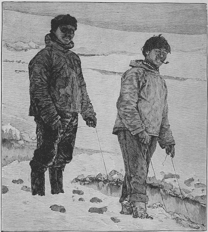
Esquimau Boys Fishing.
Kane determined to lead the next party himself, and near the end of April, 1854, with seven men he attempted to lay down an india-rubber boat high up on the Greenland coast. He had, however, sadly overrated the strength of his men and of himself. About eighty miles from the brig, near Dallas Bay, one man broke down entirely and four others were partly disabled, and their cache was made at that point with many misgivings, as bears had destroyed the stores laid down the previous autumn. The troubles of the party now commenced, for Kane, fainting while making an observation, had to be hauled back by the disabled men. Despite the moderate temperature Kane’s left foot froze, his limbs became rigid and badly swollen, fainting spells were more frequent, and he fell into alternate spells of delirium and unconsciousness, in which state his broken-down sledge crew conveyed him by forced marches to the brig, where, says Hayes, the surgeon, he arrived nearly insensible and so swollen by scurvy as to be hardly recognizable, and in such a debilitated state that an exposure of a few more hours would have terminated his life. Kane’s wonderful recuperative powers speedily restored him from his nearly helpless condition to a state of comparative good health, but he could not conceal his evident inability to personally attempt further sledge journeys that spring.
In this emergency he decided to send his surgeon, Dr. I. I. Hayes, to explore the western shore of Smith’s Strait, from Cape Sabine northward, and for this purpose detailed Godfrey with the seven best dogs available.
The ice over Smith’s Sound was extremely rough, so that progress was slow and tedious. Finally, with his provisions nearly exhausted, Hayes reached land in the vicinity of Dobbin Bay and made his farthest at Cape Hayes, which, according to his observations, was in about 79° 45´ N. Hayes was stricken with snow-blindness; the journey was extremely exhausting; Godfrey broke down, and the dogs were so nearly worn out that at the last camp they abandoned sleeping-bags, extra clothing, and everything except arms and instruments. Kane says that both men were snow-blind on arrival at the brig, and the doctor, in a state of exhaustion, had to be led to his bedside to make his report.
Impressed with Hayes’s success on the west shore of Smith’s Sound, Kane decided to send Morton northward on the Greenland side so as to determine the extent of the frozen channel seen by Hayes from his farthest. Morton was supported by a sledge party of four men, who reached Humboldt glacier after ten days’ travel, and were here joined by Esquimau Hans with a dog-sledge. On the 18th the supporting party turned homeward, while Morton and Hans, with a dog-sledge, started northward, travelling about five miles distant from and parallel with the face of Humboldt glacier.
On June 24th Morton’s northward progress was stopped by very high, perpendicular cliffs washed by open water and free from the customary ice-foot. All efforts to pass around the projecting cliff, to which the name of Cape Constitution was given, proved unavailing. Morton says: “The knob to which I climbed was over five hundred feet in height, and from it not a speck of ice was to be seen as far as I could observe; the sea was open, the swell came from the northward, ... and the surf broke in on the rocks below in regular breakers.”
Morton, in his report, described two islands opposite Cape Constitution; Kennedy Channel as about thirty-five miles wide, running due north and having an unbroken mountainous land along its western limits. Twenty miles, estimated, due south of Cape Constitution, Morton made the latitude, by meridian altitude of the sun, 80° 41´ N., which by dead reckoning made the cape 81° 1´. Kane gives its latitude, corrected by triangulation, as 81° 22´ N.
These discoveries, strengthening Kane’s belief in an open polar sea, caused him to put forth on his return such statements and generalizations as drew forth sharp criticisms, wherein the correctness and value of all the field work of his expedition were impugned.
It would be most gratifying to Americans if adverse criticisms as to distances travelled and astronomical positions determined could be refuted. It is, however, a matter of fact, not of opinion, that nearly all the given latitudes are much too far to the north, while no considerable distance was travelled which was not overestimated from fifty to one hundred per cent. These blemishes on Kane’s great work doubtless arose from two causes: first, his implicit confidence in the ability and accuracy of his subordinates, and, second, to his poetic temperament, which transformed into beauty the common things of life and enhanced their interest by striking contrasts of high lights and deep shadows.
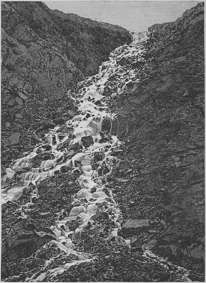
An Arctic Stream.
Subsequent expeditions have surveyed and charted Kennedy Channel with an accuracy leaving little to be desired, and as a result it is now known that the open “sea” seen by Morton was simply the ice-free water of the southern half of Kennedy Channel, which condition obtains during a great part of each year. The descriptions of the region by Morton in his report, though simple, are yet so accurate and free from exaggeration as to prove conclusively his entire honesty. When, however, his astronomical observations and estimates of distances are considered, Morton’s incompetency is apparent, as they are, in common with most of the other field work, erroneous and misleading. The latitude of Cape Constitution was overstated fifty-two geographic miles by Kane and thirty-one miles by Morton, while Kennedy Channel, instead of being thirty-five miles wide, ranges only from seventeen to twenty-five. The farthest mountain seen was Mount Ross, on the north side of Carl Ritter Bay, about 80° 58´ N., more than ninety miles to the southward of its assumed position. Kane’s personal knowledge of Morton’s honesty was so complete that he placed equal confidence in his ability and accuracy, an error of judgment arising largely from Kane’s great affection for his subordinate.
In the meantime the Etah Esquimaux, most fortunately for Kane, had discovered and visited the Advance, and through their friendly offices the expedition profited largely.
The summer of 1854 disclosed the error of wintering in Rensselaer Harbor, for it passed without freeing the brig from ice. The situation, Kane relates, was most unpromising, and near the middle of July he determined on a desperate attempt to communicate with the English expeditionary vessels supposed to be at Beechy Island, several hundred miles to the southwest. Kane with five others started in a whaleboat, but owing to the bad ice returned unsuccessful after an absence of eighteen days.
On August 18th Kane regards it as an obvious fact that they must look another winter in the face, and says: “It is horrible—yes, that is the word—to look forward to another year of disease and darkness to be met without fresh food or fuel. The physical energies of the party have sensibly declined; resources are diminished; there are but fifty gallons of oil saved from the summer seal hunt; we are scant of fuel; our food consists now of ordinary marine stores and is by no means suited to dispel scurvy; our molasses is reduced to forty gallons and our dried fruits seem to have lost their efficiency.”
Under these discouraging circumstances came the most trying experiences of the expedition. The majority of the party entertained the idea that escape to the south by boats was still practicable despite the lateness of the summer, although Kane’s own experience in the previous month had shown the futility of such an effort. Conscious, however, that he could control only by moral influence the majority who were of this opinion, he decided to appeal to them. On August 24th he assembled the entire crew, set forth eloquently that such an effort must be exceedingly hazardous, escape southward almost improbable, and strongly advised them to forego the project. However, he ended by freely according his permission to such as were desirous of making the attempt, provided that they would organize under an officer before starting and renounce in writing all claims upon the expedition. Nine out of the seventeen, headed by Petersen, the Danish interpreter, and Dr. Hayes, the surgeon, decided to attempt the boat journey and left the vessel August 28th. Kane fitted them out liberally, provided every possible appliance to facilitate and promote their success, and gave them a written assurance of a hearty welcome should they be driven to return. One of the party, Riley, rejoined Kane within a few days, and well into the Arctic winter, on December 7th, Bonsall and Petersen returned through the aid of the Esquimaux. They reported to Kane that their associates were some two hundred miles distant, their energies broken, provisions nearly gone, divided in their counsel, and desirous of returning to share again the fortunes of the Advance. Kane immediately sent supplies to the suffering party by the natives, and took active measures to facilitate their return, and on December 12th had the great joy of seeing the entire expedition reunited. In this connection Kane properly notes the humane actions of the Esquimaux, saying: “Whatever may have been their motives, their conduct to our friends was certainly full of humanity. They drove at flying speed; every hut gave its welcome as they halted; the women were ready without invitation to dry and chafe their worn-out guests.”
Kane, it may be added, did not allude in his official report to the Secretary of the Navy to this temporary division of his command, which, however, is told, both in his own narrative and in that of Dr. Hayes, in his “Arctic Boat Journey.”
As winter went on they hunted unavailingly for game, and the abundant supplies hitherto obtained from the Etah Esquimaux failed, owing to the unfavorable ice conditions, which caused a famine among the natives and reduced them to the lowest stages of misery and emaciation. Scurvy with its varying phases also sapped the energies of the crew, while Hayes was disabled from amputation of a portion of his frozen foot.
When practically the entire crew must be said to have been on the sick-list, Blake and Godfrey decided to desert and take their chances with the Esquimaux. The plan being detected by Kane, Blake remained, but Godfrey deserted, and with Hans, the Esquimau, remained absent nearly a month. Godfrey, however, contributed to the support of the expedition by sending supplies of meat, and later returned under duress.
With the returning spring of 1855 the necessity of abandoning the brig was apparent to all; the ship was practically little more than a shell, as everything that could possibly be used without making her completely unseaworthy had been consumed for fire-wood. There remained in April only a few weeks’ supply of food and fuel, while the solidity of the ice in the vicinity of Rensselaer Harbor indicated the impossibility of an escape by vessel. It was no slight task to move the necessary stock of provisions and stores to their boats and to the open water in the vicinity of Cape Alexander. This was, however, safely accomplished by the middle of June, the vessel having been formally abandoned on May 17th. The final casualty in the party occurred near Littleton Island, when Ohlsen, in a tremendous and successful effort to save a loaded sledge from loss in broken ice, so injured himself internally that he died within three days. During this retreating journey Kane records the invaluable assistance of the Esquimaux, who “brought daily supplies of birds, assisted in carrying boat-stores, and invariably exhibited the kindliest feelings and strictest honesty.” Leaving Cape Alexander on June 15, 1854, Cape York was passed on July 21st, and, crossing Melville Bay along the margin of its land ice in five days, Kane reached the north coast of Greenland on August 3d, forty-seven days from Cape Alexander.
At Disco the party met Lieutenant Hartstene, whose squadron, sent to relieve Kane, had already visited Cape Alexander, and learning from the natives of Kane’s retreat by boat to the south turned promptly back to the Greenland ports. Surrounded by all the comforts and luxuries which the means or thoughtfulness of their rescuing comrades of the navy could furnish, Kane and his men made a happy journey southward to meet the grand ovation that greeted them from their appreciative countrymen in New York, on October 11, 1855.
Neither the anxiety of countless friends nor the skill of his professional brethren could long preserve to his family, to the navy, and to the country the ebbing life of the gallant Kane. The disease which for twenty years had threatened his life now progressed with rapidity, and on February 16, 1857, he died at Havana, Cuba.
No single Arctic expedition of his generation added so greatly to the knowledge of the world as did that of Kane’s. In ethnology it contributed the first full account of the northernmost inhabitants of the world, the Etah Esquimaux; in natural history it supplied extensive and interesting information as to the flora and fauna of extreme western Greenland, especially valuable from its isolation by the surrounding inland ice; in physical sciences the magnetic, meteorological, tidal, and glacier observations were extremely valuable contributions; in geography it extended to a higher northerly point than ever before a knowledge of polar lands, and it opened up a practical and safe route for Arctic exploration which has been more persistently and successfully extended poleward than any other.
Of Kane’s conduct under the exceptionally prolonged and adverse circumstances attendant on his second Arctic voyage, it is to be said that he displayed the characteristics of a high and noble character. Considerate of his subordinates, assiduous in performing his multifarious duties as commander, studying ever to alleviate the mental and physical ailments of his crew, and always unsparing of himself whenever exposure to danger, hardships, or privations promised definite results. It is not astonishing that these qualities won and charmed all his associates, equals or subordinates, and that they followed him unhesitatingly into the perils and dangers that Kane’s enthusiastic and optimistic nature led him to brave, with the belief that to will was to do.
The career of Kane cannot be more beautifully and truthfully summarized than was done in the funeral sermon over his bier: “He has traversed the planet in its most inaccessible places; has gathered here and there a laurel from every walk of physical research in which he strayed; has gone into the thick of perilous adventure, abstracting in the spirit of philosophy, yet seeing in the spirit of poesy; has returned to invest the very story of his escape with the charms of literature and art, and dying at length in the morning of his fame, is now lamented with mingled affection and pride by his country and the world.”
X.
ISAAC ISRAEL HAYES,
And The Open Polar Sea.
History affords many examples wherein neither the originator nor the early advocate of a striking idea has reaped fame therefrom, and their names give way to some persistent, tireless worker who forces the subject on public attention by his ceaseless efforts. Among Arctic theories none has more fully occupied and interested the mind of the general public than that of an open, navigable sea in the polar regions. In connection with this theory the minds of Americans turn naturally to Dr. I. I. Hayes, who, not the originator, inherited his belief therein from the well-known Professor Maury, through the mediation of Kane, Hayes’s Arctic commander. DeHaven thought he saw signs of Maury’s ice-free sea to the northward of Wellington Strait, Kane through Morton found it at Cape Constitution, Hayes recognized it a few miles farther up Kennedy Channel, but Markham turned it into a frozen sea in 83° 20´ N. latitude, and Lockwood, from Cape Kane, on the most northerly land of all time, rolled the frozen waste yet to the north, beyond the eighty-fourth parallel, to within some three hundred and fifty miles of the geographical Pole.
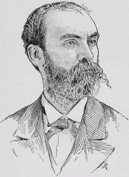
Isaac Israel Hayes.
Isaac Israel Hayes was born in Chester County, Pa., March 5, 1832. He gained the title of doctor by graduation in the University of Pennsylvania, in 1853, in which year, at twenty-four hours’ notice, he accepted the appointment, procured his outfit, and sailed as surgeon of Kane’s Arctic expedition. An account of this voyage appears in the sketch of Dr. Kane, but some further reference to it is now necessary. Hayes, it will be remembered, was the surgeon, a position which exempted him from field-work. However, when Kane and others broke down, Hayes volunteered, and was sent with Godfrey, a seaman, and a team of seven dogs to explore the west coast of Smith Sound. The journey lasted from May 20 to June 1, 1853, and, all things considered, such as defective equipment, rough ice, and attacks of snow-blindness, the results were unusually creditable.
The rough ice travelled over is thus described by Hayes: “We were brought to a halt by a wall of broken ice ranging from five to thirty feet in height.... We had not a foot of level travelling. Huge masses of ice from twenty to forty feet in height were heaped together; in crossing these ridges our sledge would frequently capsize and roll over and over—dogs, cargo, and all.” Hayes finally reached land on May 27th, at a bluffy headland “to the north and east of a little (Dobbin) bay, which seemed to terminate about ten miles inland.” This point, called later Cape Hayes, was placed by him by observations in 79° 42´ N., 71° 17´ W. From his farthest Hayes mentions the sea-floe as continuing in a less rough condition to the northward, and correctly describes the interior of Grinnell Land as a great mountain-chain following the trend of the coast.
His broken sledge and nearly exhausted provisions obliged Hayes to return, and in so doing he crossed Dobbin Bay to, and passed under the shadow of, the noble headland of Cape Hawks, where they gave their dogs the last scrap of pemican. Hayes resolved to here abandon all his extra clothing, sleeping-bags, etc., some forty pounds, a rash act, as they must have been between sixty and seventy miles from the brig, and in case of a storm would have perished. The first day’s return journey the dogs were fed with seal-skin, from old boots, and a little lamp-lard, and the day following with bread crumbs, lard scrapings, and seal-skin off mittens and trousers. The travellers got scanty rest, dozing in the sun on the sledge, and finally reached Rensselaer Harbor snow-blind and utterly exhausted.
Hayes was thus the first white man to put foot on the new land, to which Kane affixed the name of Grinnell. It is impossible to understand Kane’s failure to properly recognize this successful and arduous journey of Hayes, and one looks in vain for confirmation of Kane’s claim that he “renewed and confirmed,” in April, 1854, the work of Hayes and Godfrey, for his own account shows that Kane’s April journey failed completely to reach Grinnell Land.
Two months after his journey to Grinnell Land, Hayes was called on to decide whether he would remain with Kane at Rensselaer Harbor, where the unbroken ice plainly claimed the brig Advance as its own for another year, sharing the hardships and dangers of a second Arctic winter, or, fleeing south without his commander, seek safety and shelter through a boat journey down Smith Sound, and across Melville Bay, to the northern Danish settlement, Upernivik, in Greenland. Hayes, unfortunately for his reputation, yielded to the majority, and nine of the party, headed by Petersen, Sontag, and Hayes, decided to go, while only six white men and Esquimau Hans remained. It is true that Kane had only two weeks before returned from an unsuccessful attempt to reach Beechy Island, as difficult a task as the voyage to Upernivik, which he had quitted his brig to lead in person; but such action should not have been viewed as a justification for again separating the party.
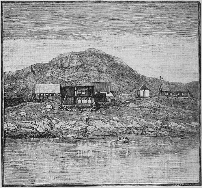
Upernivik.
Hayes alleges in extenuation that Kane had previously announced to the crew that their labors would thereafter be directed homeward, that the attempted journey to Beechy Island was solely to procure aid, that the “boat journey” simply changed the direction of their efforts, save that it was led by Petersen and not by Kane. Further, that the departure of the majority of the crew would give augmented health-conditions, space, and food to those who remained.
Accepting Kane’s permission, freely accorded, as he says, to make the boat journey, liberally equipped with such supplies as the brig had, and assured of a hearty welcome should they return, the boat party left Rensselaer Harbor, August 28, 1853, confident of its ability to succeed.
Sudden cold, sledging accidents, and bad ice soon caused Riley to return to the brig; but despite sea-soaked bedding, injured limbs, and exhausting labor, the rest of the boat party persevered with sledge to the open water, and, launching their whaleboat, proceeded rapidly till a closed ice-pack stopped them at Littleton Island.
It is unnecessary to detail despairing delays or delusive hopes which changing conditions of ice and weather alternately aroused, during their southward journey, nor to recite the hardships and perils arising from violent gales, drifting snow, the disruption and closing of the pack, the severe cold of a rapidly advancing winter, their lack of shelter and insufficiency of proper food. Suffice it to say that, confronted by impassable ice-floes, they were finally forced, with damaged boat, depleted supplies, and impaired strength, to establish winter quarters south of Cape Parry, midway between Whale and Wostenholme Sounds.
The preservation of stores, construction of shelter, and accumulation of means of subsistence now engrossed their entire energies. The construction of a hut, although facilitated by a rocky cavern, proved to be exhausting in the extreme from the difficulty of obtaining material from the frozen soil. Their most skilful hunters kept the field continually, but game failed, and from day to day food supply diminished with, to them, startling rapidity. Eventually reduced to the verge of starvation, they would have perished but for food obtained from the Esquimaux, which, though scanty and irregular, yet sustained life.
Affairs went from bad to worse, and with the increasing cold and diminishing light of December it was decided that they must either perish or return to the brig; either alternative had its advocates. To decide was to act. Petersen negotiated with the Esquimaux, and by judicious admixture of persuasion, command, and force, succeeded in having the entire boat party transported by sledge to the Advance, where they were received with fraternal kindness. Hayes relates, “Dr. Kane met us at the gangway and grasped me warmly by the hand.... Ohlsen folded me in his arms, and, kissing me, threw me into his warm bed.”
The boat journey to Upernivik, which proved dangerous and impracticable to his small party in advancing winter, proved, with the returning summer of 1855, not difficult to the reunited party of Kane, and so ended the boat journey of Hayes and his first Arctic service.
The loss of a portion of his foot, extreme sufferings from exposure, and his great privations in the Kane expedition failed to abate Hayes’s enthusiasm in Arctic exploration. Immediately on his return to the United States, in October, 1855, he advocated a second expedition, with the object of completing the survey of the north coast of Greenland and Grinnell Land, and to make explorations toward the North Pole. His strenuous efforts to excite public interest failed at first; but Hayes devoted himself to lecturing on Arctic subjects, and finally enlisted in his support most of the scientific societies of the country. The advocacy of Professors Bache and Henry, and the support of Grinnell, gave an impulse which finally resulted in the organization of an expedition, under Hayes’s command, and on July 6, 1860, he left Boston on the sailing schooner United States, with a crew of fourteen.
It is not needful to dwell on his outward voyage farther than to say that, in addition to the complement of dogs and stock of furs usually obtained in Greenland, Hayes there recruited dog-drivers, interpreters, and hunters. At Cape York he also added Hans Hendrik, Kane’s dog-driver, who, smitten with the dusky charms of the daughter of Shang-hu, had chosen to remain with the Etah Esquimaux rather than return to Danish Greenland with the Kane retreating party in 1855. Now, five years later, he showed an equal willingness to quit his adopted tribe for expeditionary purposes.
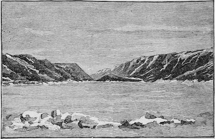
Hayes’s Winter-Quarters.
Profiting by the experience of his predecessor, Hayes was unwilling to push a sailing vessel northward into Kane’s Basin, beyond the seventy-eighth parallel, and wisely decided to establish his winter-quarters in Foulke Fiord, near Littleton Island, twenty miles to the south, and about forty miles west, of Kane’s quarters. Game proved abundant both at sea and on land, pleasant relations were established with their neighbors, the Etah Esquimaux, an observatory built, and scientific observations inaugurated. Indeed everything looked most promising for the future.
An autumnal journey of special interest was Hayes’s visit to “My Brother John Glacier,” near Port Foulke, which, up to that time, was the most northerly and one of the most successful attempts to penetrate the glacier-covering of Greenland, known commonly as the “Inland Ice.” With seven men he penetrated some forty miles or more on the ice, when the temperature, sinking to thirty-four degrees below zero, with wind, compelled their immediate return. The ice changed gradually, as they went inland, from rough to smooth, and the angle of rise decreased from six to two degrees at their highest, over five thousand feet. A snow-storm broke on them, and, as Hayes describes, “fitful clouds swept over the face of the full-orbed moon, which, descending toward the horizon, glimmered through the drifting snow that hurled out of the illimitable distance, and scudded over the icy plains—to the eye, in undulating lines of downy softness; to the flesh, in showers of piercing darts.”
Suddenly misfortunes came on them. Peter, an Esquimau dog-driver, brought from Upernivik, deserted. Hans Hendrik, in his interesting “Memoirs,” says: “In the beginning of the winter Peter turned a Kivigtok, that is, fled from human society to live alone up the country. We were unable to make out what might have induced him to do so. Searching for him, at last I found his footprints going to the hills.” The poor native was never seen alive, but it eventually transpired that he sought shelter in a remote and rarely visited Esquimau hut, where he died of starvation, his body being found in a very emaciated condition by an Etah native the following spring.
Next the dogs began to die of distemper, which led up to the death of Sontag, the astronomer. By the 21st of December only nine remained of thirty fine dogs, and in this contingency it was decided to open up communication with the Esquimaux of Whale Sound, some one hundred and fifty miles to the south, for the purchase of dogs. For this journey Sontag volunteered, and with him went Hans as dog-driver. Hayes waited week after week, but no news came from either Sontag or Hans. Then feelings of uneasiness gave place to alarm and fear; for a journey of Dodge, first mate, proved that the travellers had gone outside Cape Alexander, where the floe had broken, so that possibly they had been lost on drifting ice. Hayes was projecting a personal search on January 29th, when two Esquimaux visited the ship and reported that Sontag was dead. They proved to be advance-couriers of Hans, who arrived a few days later, with only five of his nine dogs remaining.
In his “Memoirs” Hans relates as follows: “It still blew a gale and the snow drifting dreadfully, for which reason we resolved to return.... The ice began breaking up, so we were forced to go ashore and continue our drive over the ice-foot. At one place the land became impassable, and we were obliged to return to the ice again. On descending here my companion (Sontag) fell through the ice, which was nothing but a thick sheet of snow and water. I stooped, but was unable to seize him, it being very low tide. As a last resort I remembered a strap hanging on the sledge-poles; this I threw to him, and when he had tied it around his body I pulled, but found it very difficult. At length I succeeded in drawing him up, but he was at the point of freezing to death, and now in the storm and drifting snow he took off his clothes and slipped into the sleeping-bag, whereupon I placed him on the sledge and repaired to our last resting-place. Our road being very rough, I cried for despair from want of help; but I reached the snow-hut.” He recites that Sontag remained unconscious to his death, and that the breaking up of the ice around Cape Alexander, confirmed by Dodge’s journey, prevented his return to the ship at that time. There was much talk about Sontag’s death, but Hans’s account is doubtless correct.
Sontag was the only trained scientific observer in the party; and in addition, from his skill, experience, and enthusiasm in Arctic work, was almost indispensable to Hayes. His death was a great blow to the party, socially as well as professionally.
In early spring Hayes succeeded in obtaining the co-operation of the Etah Esquimaux in sledging, and in a preliminary journey visited his old winter-quarters, where he had served with Kane six years before. Where they had abandoned the Advance, surrounded by the solid pack, he found ice nearly as high as were her mastheads; no vestige of the vessel remained except a bit of plank, and its fate was a matter of conjecture, though little doubt exists that she was ultimately crushed by the disruption of the pack during some violent gale. It was during this journey that Hayes experienced an intense degree of cold. Stating that the thermometer which hung inside the hut against the snow-wall indicated thirty-one degrees below zero, Hayes says: “We crawled out in the open air to try the sunshine. ’I will give you the best buffalo skin in the ship, Jansen, if the air outside is not warmer than in that den which you have left so full of holes.’ And it really seemed so. Human eye never lit upon a more pure and glowing morning. The sunlight was sparkling all over the landscape and the great world of whiteness; and the frozen plain, the hummocks, the icebergs, and the tall mountains made a picture inviting to the eye. Not a breath of air was stirring. Jansen gave in without a murmur. I brought out the thermometer and set it up in the shadow of an iceberg near by. I really expected to see it rise; but no, down sank the little red column of alcohol, down, down almost to the bulb, until it touched sixty-eight and a half degrees below zero, Fahrenheit, equal to one hundred and a half degrees below the freezing-point of water. It struck me as a singular circumstance that this great depression of temperature was not perceptible to the senses, which utterly failed to give us even so much as a hint that here in this blazing sunlight we were experiencing about the coldest temperature ever recorded.”
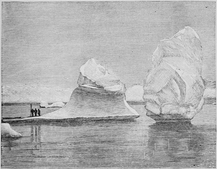
Adrift on a Berg.
After this preliminary journey Hayes laid down supplies at the nearest point on the Greenland shore south of, and facing, Cape Hawks. This place, called Cairn Point, was to be the base of his summer’s campaign to the north. Finally everything was ready for the main journey, and the party started on the night of April 3, 1861. Twelve men, the entire available force, were put into the field: Jansen with an eight-dog sledge, Knorr with a six-dog sledge, and a ten-man sledge on which was mounted a twenty-foot metallic life-boat, with which Hayes hoped to navigate the Polar Sea. The journey lay directly to the north over the frozen surface of Kane Sea, where the difficulties of travel through the broken hummocky ice were so great, and the unfitness of some of the men for Arctic travel so speedily developed, that Hayes was forced to abandon his efforts to get the boat across the frozen sea, which, he says, “could not have been done by one hundred men.” On April 24th Hayes records that he had been twenty-two days from the schooner, and was now distant only thirty miles from Cairn Point. Four days later, still struggling across the rough ice of Kane Sea, the party was practically broken down, being, as Hayes chronicles, “barely capable of attending to their own immediate necessities without harboring the thought of exerting themselves to complete a journey to which they can see no termination, and in the very outset of which they feel that their lives are being sacrificed.”
In this critical condition Hayes changed his plans, and sent back the entire party to the brig, except Knorr, Jansen, and McDonald, whom he selected as best fitted to make the northern journey, which he had decided to make with fourteen dogs and two sledges. Turning northward with renewed confidence and vigor, though yet struggling with various misfortunes through a tangle of broken hummocks, Hayes reached Cape Hawks on May 11th. The condition of the ice may be judged from the fact that he had been thirty-one days in making a distance of eighty miles, a little more than two miles a day. Three days’ farther march took him to Cape Frazier, where the flagstaff erected by him in 1853 yet stood erect. At the end of the next march, where they were driven to the sea ice owing to the impossibility of following the ice-foot, Hayes ascended the hillside, whence, he says, “No land was visible to the eastward. As it would not have been difficult through such an atmosphere to see a distance of fifty or sixty miles, it would appear therefore that Kennedy Channel is somewhat wider than heretofore supposed.”
On May 15th Jansen was disabled for travelling by a sprained back and injured leg, and the next morning was scarcely able to move. Hayes decided to leave the disabled man in charge of McDonald and proceed with Knorr, his purpose being “to make the best push I could and travel as far as my provisions warranted, reach the highest attainable latitude and secure such a point of observation as would enable me to form a definite opinion respecting the sea before me.”
Rough ice and deep snow so impeded his progress the first day that he only made nine miles in as many hours. Ten hours’ march compelled them to again camp, and four hours of the third day brought them to the southern cape of a bay which he determined to cross. After travelling four miles the rotten ice and frequent water-channels proved that the bay was impassable, and therefore they went into camp. The next day Hayes climbed to the top of the cliff, some eight hundred feet high, whence, he says, “the sea beneath me was a mottled sheet of white and dark patches multiplied in size as they receded until the belt of the water-sky blended them together.... All the new evidence showed that I stood upon the shores of the polar basin, and that the broad ocean lay at my feet.... There was seen in dim outline the white sloping summit of a noble head-land, the most northern known land upon our globe. I judged it to be in latitude 82° 30´ N., or four hundred and fifty miles from the North Pole.... There was no land visible except the coast on which I stood.”