Front matter (continued 2)
Reading edition
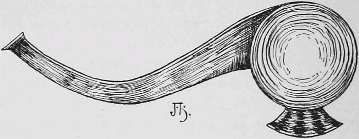
Indian Tomahawk. (From Carver’s Book.)
Among the unfortunates was Carver, who, robbed and stripped by the savages, appealed to a French sentry for protection only to be repelled with abuse. Realizing finally that to remain quiet was to meet certain death, Carver and a few others attempted to escape by breaking unarmed through the surrounding lines of Indian fiends. In this desperate effort for life Carver was twice wounded, badly beaten, seized by two Indians, and led away to death, which he escaped by the appearance of a British officer in full uniform, who was such a prize that his captors left Carver to secure a more valuable victim. Profiting by the respite Carver fled to the nearest woods, where, exhausted and nearly naked, he concealed himself in a thicket until night. For three days he wandered through the densest part of the forest, suffering tortures from travel under such conditions, often in danger of recapture, and without food until he reached, in a nearly exhausted condition, the English settlements.
An attempt at transcontinental exploration was then looked on as foolhardy and visionary in the extreme, even to those friends of Carver who never deserted him. One of these, Dr. Lettsom, wrote in the third edition of Carver’s travels, fifteen years after the journey, as follows: “He suggested an attempt by land across the northwest parts of America, and actually drew a chart of his proposed route for effecting his project, which, however visionary it may now be deemed, affords at least a proof of the enterprising spirit of Carver.”
Unmoved by the sneers of his critics, and undeterred by recollections of Indian cruelty and perfidy, Carver arranged the details of his journey at his private expense, and in June, 1766, he quitted Boston, and travelling by the way of Albany and Niagara reached his headquarters, Michillimackinac, now known as Mackinac. Here he made definite arrangements for his serious work of exploration. At this time English traders extended their journeys to Prairie-du-Chien for the purpose of purchasing furs from Indians rendezvousing there, and with one of these parties Carver was to travel, relying on the Governor of Mackinaw to forward supplies to St. Anthony. Leaving the Fort, September 3d, and travelling by canoe, he reached the islands of the Grand Traverse, and there spent one night. One of the chiefs, to whom a present was given, made, on Carver’s departure, the following prayer, which is worthy of reproduction as a specimen of Indian eloquence: “May the Great Spirit favor you with a prosperous voyage; may He give you an unclouded sky and smooth waters by day, and may you lay down by night on a beaver blanket to uninterrupted sleep and pleasant dreams, and may you find continual protection under the calumet of peace.”
Carver followed the route of Joliet and Marquette through Green Bay and up Fox River to the great town of the Winnebagoes, where he found the Indians presided over by a queen instead of a sachem. Carver speaks of the extreme richness of soil and abundance of cultivated products and wild game, mentioning grapes, plums, Indian corn, beans, pumpkins, squashes, watermelons, and tobacco from cultivation; fish from the lake; wild fowl so abundant that frequently the sun would be obscured by them for some minutes together, while deer, bears, and beavers were very numerous. The usual portage was made by him from the Fox to the Wisconsin River, into which his canoes were launched on the 8th of October. Seven days carried him to Prairie-du-Chien, at the junction of the Wisconsin and Mississippi, which was at that time a town of some three hundred families and had become a great trading mart for the adjacent tribes, who assembled in great numbers annually in the latter part of May.
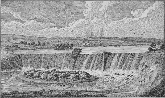
The falls of St. Anthony in the River Mississippi, near 2400 Miles from its entrance into the Gulf of Mexico. (From Carver’s Book.)
At Prairie-du-Chien Carver parted with the traders, who were to winter at that point, and obtaining a Canadian as interpreter and a Mohawk Indian as a servant, he purchased a canoe, and on October 19th, proceeding up the Mississippi, he fell in with a straggling band of Indians which barely failed of plundering him. November 1st brought him to Lake Pepin, near which he discovered what appeared to be the remains of extended intrenchments, centuries old, as he thought, but which are now known to be Indian mounds, probably erected as sites for their wigwams, so as to keep them above the annual overflow and inundation.
The coming of winter and the forming of river ice obliged him to quit his canoe opposite the mouth of the St. Peter, or Minnesota River, whence by land he reached the Falls of St. Anthony on November 17, 1766, probably the first white American to visit them.
The noise and appearance of the Falls of St. Anthony impressed Carver very strongly, and his account of them is worthy of reproduction in view of the changes that have taken place within the past one hundred and thirty years:
“This amazing body of waters, which are above 250 yards over, form a most pleasing cataract; they fall perpendicularly about thirty feet, and the rapids below, in the space of 300 yards more, render the descent considerably greater; so that when viewed at a distance, they appear to be much higher than they really are.
“In the middle of the Falls stands a small island about forty feet broad and somewhat longer, on which grow a few cragged hemlock and spruce trees; and about half way between this island and the eastern shore is a rock lying at the very edge of the Fall, in an oblique position, that appears to be about five or six feet broad and thirty or forty long.”
Leaving the falls, Carver proceeded up the Mississippi to the mouth of the St. Francis, the farthest of Hennepin in 1680, discovering on the way Rum and Goose Rivers. Warned by the severity of the cold that winter was fast coming on, Carver returned to his canoe at the mouth of the Minnesota River and decided to explore that stream, of which only the lower portion had ever been visited—by Le Sueur in 1700.
Following the Minnesota about two hundred miles he reached, on December 7th, the winter camp of a large tribe of Indians, about one thousand in number, who were designated by Carver as the Naudowessie (Santees). Advancing boldly, with his calumet of peace fastened to the prow of his canoe, he was received in a friendly manner. After the usual smoking of the pipe of peace, during which he says the tent was nearly broken down by the crowd of savages, who, as a rule, had never seen a white man, he was treated with great respect.
Among these Indians Carver passed the winter, filling in his five months’ stay by hunting and other Indian amusements. From the Indians he learned that the St. Lawrence, the Mississippi, and the Bourbon (the Red River of the North) had their sources within thirty miles of each other. This led to the natural but erroneous opinion that Carver had reached the highest land of North America, when in reality he was at an elevation of only twelve hundred feet.
Carver also spoke of “the Oregon, or the River of the West,” as having its sources somewhat farther to the west. This is the first time that the word Oregon appears in literature, and Carver gives no account of its meaning.
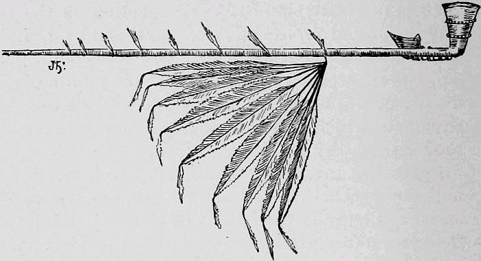
A Calumet. (From Carver’s Book.)
The Indians had traditions as to the extreme plentifulness of gold to the west of the “Shining Mountains,” of which our explorer says, on the strength of Indian reports:
“The mountains that lie to the west of St. Peter are called the Shining Mountains, from an infinite number of crystal stones of an amazing size with which they are covered and which, when the sun shines full upon them, sparkle so as to be seen at a very great distance.”
Carver’s enthusiasm and interest in the West led him to make the following striking prediction, which time has fully justified. He says:
“This extraordinary range of mountains is calculated to be more than three thousand miles in length, without any very considerable intervals, which, I believe, surpasses anything of the kind in the other quarters of the globe. Probably, in future ages, they may be found to contain more riches in their bowels than those of Hindostan and Malabar, or than are produced on the golden coast of Guinea, nor will I except even the Peruvian mines. To the west of these mountains, when explored by future Columbuses or Raleighs, may be found other lakes, rivers, and countries, full fraught with all the necessaries or luxuries of life, and where future generations may find an asylum, whether driven from their country by the ravages of lawless tyrants, or by religious persecutions, or reluctantly leaving it to remedy the inconveniences arising from a superabundant increase of inhabitants; whether, I say, impelled by these or allured by hopes of commercial advantages, there is little doubt but their expectations will be fully gratified in these rich and unexhausted climes.”
Carver described the valley of the Minnesota as a most delightful country, abounding with all the necessities of life, which grow spontaneously. Fruit, vegetables, and nuts were represented as being particularly abundant, and the sugar-maple grew in amazing numbers.
In April, 1767, the Santees descended the Minnesota in order, among other things, to bury their dead near a remarkable cave on Lake Pepin, known to the Indians as the “dwelling of the Great Spirit.”
Finding that supplies had not been sent to the Falls of St. Anthony, Carver returned to Prairie-du-Chien in order to get sufficient stores to enable him to reach Lake Superior, whence he hoped to be able to cross the continent from Grand Portage. Obtaining such supplies, he proceeded up the Mississippi to the Chippeway River, and, after ascending to its head, made portages to the St. Croix, and reached Lake Superior, possibly by the river now known as the Bois Brule.
From this point Carver, in his canoe, skirted the coast of Lake Superior to the Grand Portage, where he awaited the arrival of the Hudson Bay or northern traders, from whom he anxiously hoped to obtain supplies that would enable him to journey west; but he was destined to disappointment, as nothing could be obtained from them. Carver coasted around the north and east borders of Lake Superior, and arrived at the Falls of Ste. Marie the beginning of October, having skirted nearly twelve hundred miles of the shores of Lake Superior in a birch canoe.
The Sault Ste. Marie was then the resort of the Algonquin Indians, who frequented the falls on account of the great numbers of whitefish that filled the waters, particularly in the autumn, when that fish leaves the lakes in order to spawn in shallow running waters.
In November, 1767, Carver arrived at Mackinac, having, as he says, “been sixteen months on this extensive tour, travelled nearly four thousand miles, and visited twelve nations of Indians living to the west and north. His picture of Detroit on his return, in 1768, is of retrospective interest.
“The town of Detroit contains upward of one hundred houses. The streets are somewhat regular, and have a range of very convenient and handsome barracks with a spacious parade at the south end. On the west side lies the King’s Garden, belonging to the Governor, which is very well laid out, and kept in good order. The fortifications of the town consist of a strong stockade, made of round piles, fixed firmly in the ground, and lined with palisades. These are defended by some small bastions, on which are mounted a few indifferent cannon of an inconsiderable size, just sufficient for its defence against the Indians or an enemy not provided with artillery. The garrison in time of peace consists of two hundred men, commanded by a field-officer, who acts as chief magistrate under the Governor of Canada.
“In the year 1762, in the month of July, it rained on this town and the parts adjacent a sulphurous water of the color and consistency of ink, some of which being collected in bottles, and wrote with, appeared perfectly intelligible on the paper, and answered every purpose for that useful liquid. Soon after, the Indian wars already spoken of broke out in these parts. I mean not to say that this incident was ominous of them, notwithstanding it is well known that innumerable well-attested instances of extraordinary phenomena, happening before extraordinary events, have been recorded in almost every age by historians of veracity; I only relate the circumstance as a fact, of which I was informed by many persons of undoubted probity, and leave my readers, as I have heretofore done, to draw their own conclusions from it.”
It is beyond question that certain chapters of Carver’s work, supplementary to his account of his personal explorations, and especially devoted to Indians and to the natural history of the Northwest, are practically translations of the accounts of Charlevoix, Hennepin, and particularly of Lahontan. It does not appear from the first part of the work that Carver was a man endowed with those powers of observation and assimilation which are essential traits for the successful traveller and author.
When the brief recital of his personal travels is examined, it seems difficult to determine on what grounds his truthfulness has been questioned by a few hostile critics. His story is simple and straightforward, devoid of boastfulness, free from any exaggeration as to his personal prowess, and the statement that he passed a winter of five months in the valley of the Upper Minnesota is, in my opinion, worthy of entire credence.
Fortunately, however, evidence of the most convincing character exists as to Carver’s residence among the Naudowessies or Santees. The exhaustive bibliography of the Siouan languages, by Mr. James C. Pilling, indicates that Carver is the first author who ever published a vocabulary of the Santee tongue, and its length, eight pages, renders it evident that it was an original compilation which must have required considerable time and patience.
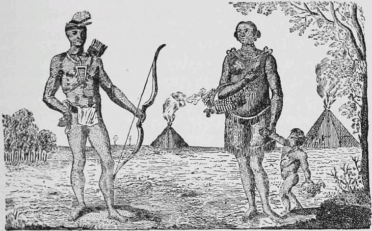
Naudowessie Indians.
Carver’s drawing of “A man and woman of the Naudowessie,” herewith reproduced, if somewhat fanciful in its details, must be considered of historical value as indicating in the main the costumes of the Santees when first visited by the whites.
The importance of Carver’s charts and journals at that time was evident to the Lords Commissioners of Trade and Plantations in England to whom Carver was referred when praying for reimbursement of his expenses. Carver appeared before the Board and, after an examination, was granted authority to publish his papers. Later, after Carver had, as he says, disposed of them and they were nearly ready for the press, an order was issued from the Council Board requiring him to immediately turn in all the originals of his charts, journals, and other papers relative to his discoveries.
Meanwhile interest in the extension of English influence into the interior of North America was waning steadily with the growing conviction that the colonies would establish their independence, and the Government had no mind to reimburse an enterprising American, even though he remained loyal. Carver was reduced gradually to the greatest straits, was compelled to sell his book for a pittance, and finally, his end hastened by lack of proper food and suitable attendance, died in the direst poverty in London, January 13, 1780.
His own generation could best judge as to the timeliness and importance of Carver’s exploration, and as to the value of the information set forth in his book of travels. Suffice it to say that no less than twenty-three editions of this book have appeared, in four languages. This, too, at a time when the war of independence naturally destroyed current interest in the extension of English settlements in the interior of North America.
Explorations, however, are wisely esteemed by posterity according to the results which flow therefrom in the shape of definite additions to the knowledge of the world or in the more important direction of disclosing lands suitable for colonization. In this latter manner the exploration of Jonathan Carver and the accounts of his travels had an important influence. They first brought into popular and accessible form information and ideas concerning the interior parts of North America which before had been practically inaccessible to the general public of England and America.
Twenty-five years after this journey toward the “Shining Mountains” and “Oregon, the River of the West,” the ultimate scheme of Carver found its justification in the success of Alexander Mackenzie, a young Scotchman, who was the first white man to cross the continent of America to the north of Mexico; and yet ten years later Lewis and Clark were despatched on their famous expedition which explored the valley of the Columbia, where in 1810, under the energetic management of John Jacob Astor, arose the trading-post of Astoria, thus turning into reality the dreams and aspirations of Jonathan Carver, the soldier and explorer.
IV.
CAPTAIN ROBERT GRAY,
The Discoverer of the Columbia River.
Within the past century no American explorer has contributed more materially to the welfare of the United States and to its maritime glory than Captain Robert Gray, the discoverer of the Columbia River and the first circumnavigator who carried the flag of the United States around the world.
Robert Gray was born at Tiverton, R. I., in May, 1757, and in early youth, inspired with the spirit of independence which dominated the American Colonies, entered the naval service during the war of the Revolution, wherein he served with credit as an officer.
At the termination of the war it is probable that he continued his natural or acquired vocation as a seaman. At all events, we find him first and foremost among that band of American citizens whose courage, energy, and nautical skill enabled them to attain unsurpassed success as whalers and sealers in the Antarctic Ocean, as traders dealing direct with China, or as explorers and fur dealers on the unsurveyed and dangerous coast of northwest America.
In 1787, J. Barrell, S. Brown, C. Bulfinch, J. Darby, C. Hatch, and J, M. Pintard, merchants of Boston, associated for the purpose of combining the fur traffic of the northwest coast of America with the silk and tea trade of China. For this purpose they sent, under the command of Captain John Kendrick, in 1787, the ship Columbia and the sloop Washington with cargoes of blankets, knives, iron bars, and other articles suitable for the northwest trade. They were provided with sea letters issued according to a resolution of Congress, with passports from the State of Massachusetts, and with commendatory letters from the Spanish minister plenipotentiary to the United States.
Captain Kendrick, who commanded the Columbia, was a man of marked ability and great energy, who withal had most enthusiastic opinions as to the future of the Pacific Coast region, which he believed would in a few years utterly dwarf the growing importance of the Atlantic seaboard. Gray was the master of the Washington, and his professional standing in the eyes of the merchants of Boston was shown by his designation as the most desirable officer to assume command in case of death or injury to Captain Kendrick.
Many aspersions have been cast by English writers on the policy pursued and methods followed by Americans engaged in trading with the Indians of the northwest coast of America. Doubtless such reflections were justified in individual cases of Americans, as of traders of other nationality; but the instructions given by the merchants of Boston to Kendrick and Gray show that fair, honest, and peaceful methods were regarded as the true means of establishing a permanent and profitable trade. Among other injunctions were the following:
“If you make any fort or any improvement of land on the coast, be sure you purchase the soil of the natives.... Let the instrument of conveyance bear every authentic mark that circumstances will admit.... We cannot forbear to impress on your mind our will and expectation that the most inviolable harmony and friendship may subsist between you and the natives, and that no advantage may be taken of them in trading, but that you endeavor by honest conduct to impress on their minds a friendship for Americans.” While enjoining peace, it was not to be a peace on any terms, for thus runs the instructions: “The sea letters from Congress and this State you will show on every proper occasion, and although we expect you will treat all nations with respect and civility, yet we depend you will suffer insult and injury from none without showing that spirit which becomes a free and independent American.”
The vessels sailed from Boston September 30, 1787, via the Cape Verde and Faulkland Islands, and in January doubled Cape Horn, when they thought the perils of storm were past. In latitude 59° S., however, a violent gale arose, which not only separated them, but also seriously damaged the Columbia. The storm over, Kendrick found himself in a sad plight, his consort gone, perhaps lost, his ship in an unseaworthy condition, and the nearest spot for repairs a thousand miles distant. This port, that of the island of Juan Fernandez, if now famous and delightful to the adventurous mind through its associations with the fascinating tale of Robinson Crusoe, was then most objectionable from the fact that it was under Spanish rule and so was to be avoided by Kendrick, whose instructions ran as follows:
“You are strictly enjoined not to touch at any port of the Spanish dominion on the western continent of America, unless driven there by unavoidable accident, in which case you are to give no offence to any of the subjects of his Catholic Majesty.”
Kendrick, to his surprise, was received with great kindness and aided in repairing his injured vessel by Don Blas Gonzales, the humane commandant of the Spanish garrison of Juan Fernandez.
Spain at this time claimed the right of exclusive jurisdiction over the entire western continent of America by virtue of the papal concession, 1493, and by right of discovery. It had failed to colonize the northwest coast of America, but it prohibited other nations from entering in possession. It now illustrated its narrow and jealous policy in its treatment of a subordinate who had ventured to assist a vessel in distress and provided with letters from the accredited minister of Spain to the United States. Ambrose O’Higgins, then captain-general of Chili, under whom Gonzales was serving, on hearing of this act recalled him and put him in arrest, pending definite orders from his own superior, Teodor Lacroix, viceroy of Peru. After due consideration of the case the unfortunate commandant, Gonzales, was cashiered for his remissness in allowing a strange ship to leave Juan Fernandez instead of seizing her and her crew. The viceroy set forth to the captain-general of Chili the legal opinion that by the royal ordinance of November, 1692, every foreign vessel found in those seas without a license from the court of Spain was to be treated as an enemy, even though belonging to a friend or ally of the king, “seeing that no other nation had, or ought to have, any territories, to reach which its vessels should pass around Cape Horn or through Magellan’s Straits.” The viceroy therefore sent a ship from Callao to track or intercept the Columbia; the authorities on the coasts of Peru and Chili were especially enjoined to be vigilant, and in case any foreign vessel should appear in the country to seize her.
Under Gray’s skilful handling the Washington escaped unharmed from the hurricane, and continuing his course toward King George Sound, the concerted rendezvous, he made the American coast, about 46° N., in August, 1788. Here he barely escaped loss of his vessel in trying to cross the bar of an unknown river, probably the Columbia, when his ship grounded. He, however, visited shore, and found that the sea was perchance the less inhospitable of the two, for he was so savagely and violently attacked by swarms of Indians that he was very glad to escape therefrom with one seaman dead and the mate wounded.
Quitting this unfortunate place he sailed north and entered Nootka Sound, Vancouver Island, September 17, 1788, where he found two English vessels, the Felice and Iphigenia, sailing under the Portuguese flag and commanded by Captains Meares and Douglass. There were no signs of the Columbia, but her arrival a few days later relieved Gray from further anxiety in this respect.
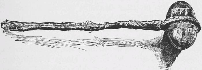
Indian Maul.
Douglass’s vessel, the Iphigenia, was in serious need of supplies and assistance, which Gray generously furnished. Later he not only made to the northward a successful trading trip, but in the following year, in June, 1789, explored the whole east coast of Queen Charlotte Islands, to which he gave the name of Washington Islands, in honor of General Washington, then President of the United States. In another trading excursion from Nootka Sound, Vancouver Island, Gray entered the broad opening southeast of the island and sailed to the east-southeast fifty miles, where he found the passage still five leagues wide. This opening was the Straits of Fuca, and the first authentic exploration of the strait is the account of Gray. The credit of first passing through the entire length of the Straits of Fuca is due to Kendrick, who made the passage in the sloop Washington, after the departure of Gray to China on the Columbia.
The account of the passage of the Washington through the Straits of Fuca was especially called to Vancouver’s attention by the British Admiralty on the occasion of his surveying voyage of 1791, when he was particularly to “examine the supposed Strait of Juan de Fuca, said to be situated between the forty-eighth and forty-ninth north latitude, and to lead to an opening through which the sloop Washington was reported to have passed in 1789, and to have come out again to the northward of Nootka.” Vancouver later denied to Americans the credit of first sailing entirely through the Straits of Fuca, resting his opinion on Gray’s statement that he sailed only fifty miles within it, which was true; the credit belonging to Kendrick in his voyage with the Washington after Gray’s departure from the coast in 1789.
The efforts of Kendrick and Gray resulted in the obtaining of a full cargo of furs, which in accordance with their instructions were to be sold in China. Kendrick, fascinated with the prospects of fortune and success, and perhaps reluctant to face his owners owing to his lack of caution which resulted in the unfortunate killing of some thirty natives, decided to remain on the northwest coast, his imaginary Eldorado.
Gray consequently transferred to the Columbia and set sail for Canton, then the great fur mart of the world. His voyage across the Pacific was prosperous, his furs were readily sold, and after taking a cargo of tea on board, Gray sailed for the Cape of Good Hope, and on the 10th of August, 1790, the Columbia entered the port of Boston, the first vessel to circumnavigate the world under the flag of the United States.
His success and conduct so impressed the owners of the ship that they immediately decided upon sending Gray back to the northwest coast, and seven weeks later, September 28, 1790, he sailed in the Columbia, which was described as a ship of two hundred and twelve tons, manned by thirty men, and equipped with an armament of ten guns.
Gray was also provided with a sea letter signed by George Washington, then President, which ran as follows:
“To all Emperors, Kings, Sovereign princes, State and Regents and to their respective officers, civil and military and to all others whom it may concern.
“I, George Washington, President of the United States of America do make known that Robert Gray, Captain of a ship called the Columbia of the burden of about 230 tons, is a citizen of the United States and that the said ship which he commands belongs to the citizens of the United States; and as I wish that the said Robert Gray may prosper in his lawful affairs, I do request all the before mentioned, and of each of them separately, when the said Robert Gray shall arrive with his vessel and cargo, that they will be pleased to receive him with kindness and treat him in a becoming manner &c. and thereby I shall consider myself obliged.
“September 16, 1790—New York City
(Seal U. S.)
“Geo. Washington,
President.
“Thomas Jefferson,
“Secy of State.”
He further was provided with a similar letter from John Hancock, the Governor of Massachusetts.
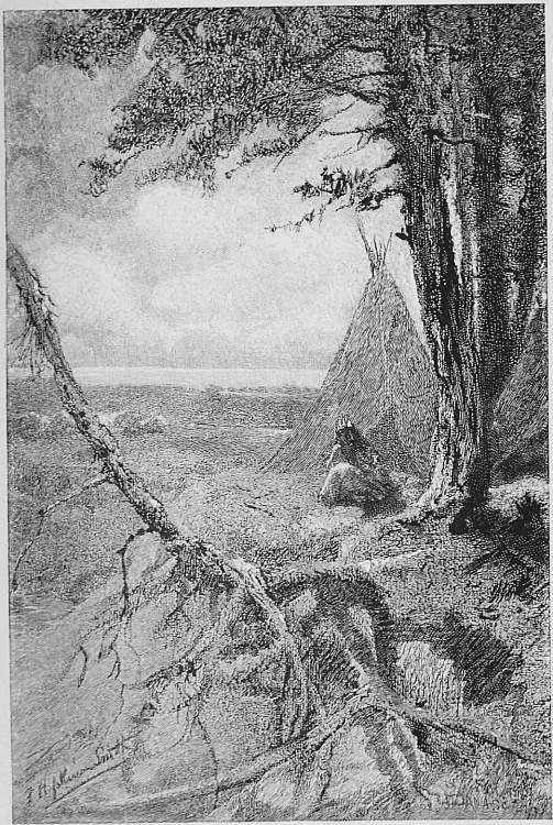
On the Shores of the Pacific.
His letter of instructions from the owners, signed by Joseph Barrell, enjoins, in similar and even stronger terms than those given Kendrick three years before, friendly treatment, strict honesty, honorable conduct, and the avoidance of unjust advantage in trade with the natives, the shunning of Spanish ports, tender treatment of his crew, urgency of despatch in reaching the northwest coast, and the refraining from all unnecessary connections with foreigners or Americans. It further speaks of Gray’s rising reputation, and expresses the belief that a regard for his own honor, and a respect for the sea letter with which the President had honored and indulged him, would cause Gray to doubly exert himself for the success of the voyage.
Gray used such despatch and was so fortunate that he reached Cape Flattery, at the mouth of the Straits of Fuca, June 5, 1791, his voyage of eight months having been devoid of any occurrence worthy of note. Proceeding northward to Queen Charlotte Island for trade, he there fell in with Ingraham, formerly mate of the Columbia, but now, July 23, 1791, in command of the Hope. The autumn was spent in trading and exploring among the islands and along the coast to the east and north of Queen Charlotte Island. During one trip Gray penetrated an inlet near 55° N. latitude, probably the northern extension of Vancouver Strait, to a distance of one hundred miles to the northeastward without reaching the end of the passage, which he supposed to be the Rio de Reyes of Admiral Fonte. Gray’s visit was most unfortunate, for a portion of his crew landing at a port on the mainland in 55° N., on August 22d, a large band of savages fell on the party and killed Joshua Caswell, his second mate, and seamen Joseph Barns and Job Folgier. This fatal spot was therefore named Massacre Cove.
The attitude of the Indians was a matter of constant anxiety, so that Gray and his crew were obliged to exercise the greatest caution in all their intercourse with such tribes as they fell in with. In Pintard Sound, 51° 30´ N., near the entrance, an attack was attempted on the Columbia, which obliged Gray to fire on the Indians, whereby two of the chiefs were killed, but it did not excite lasting resentment, as these savages traded with him later as though nothing had happened.
Returning to Clyoquot, Port Cox, Vancouver Island, with the Columbia, Gray went into winter quarters. The owners had sent out the frames for a sloop of about thirty tons, with three carpenters to build the vessel. A fortified habitation, called Fort Defiance, was constructed for occupancy by the working party, which finished and launched the sloop that winter, christening her as the Adventurer.
In the spring of 1792, while the crews of the Columbia and Adventurer were preparing for sea they were visited by many Indians, who, through their chiefs, established such relations with a Sandwich Islander, who was one of the crew of the Columbia, as to excite Gray’s suspicions. The Islander on being closely questioned by Gray confessed that the Indians had formed a plan to murder the whole party and seize the vessels, the Hawaiian to aid them by wetting the priming of all the guns, and in return be made a chief among the Indians. Gray took immediate steps to keep his crew on their guard during their remaining stay, and thus completely baffled the design of the savages without bloodshed.
In April, 1792, Gray, sending the Adventurer northward under command of Haswell, his first mate, turned himself southward, and on the 29th fell in with Vancouver, who was approaching the northwest coast on a voyage of exploration in the English ship Discovery, with the Rambler under Broughton as a consort.
Vancouver eagerly sought information from Gray as to his knowledge of the coast, which the American gave fully and cheerfully. Gray set forth his voyages in the Straits of Fuca, around Queen Charlotte Island, and further, that in 1788 he had “been off the mouth of a river, in the latitude of 46° 10´, where the outset or reflux was so strong as to prevent his entering for nine days.” This latter information was most surprising and distasteful to Vancouver, who, fitted out at great expense with two vessels for exploration alone, found the accuracy of his own observations of the coast, as recorded in his journal two days earlier, thrown in doubt by the statements of this American trader.
Vancouver had written before meeting Gray: “The several large rivers and capacious inlets that have been described as discharging their contents into the Pacific, between the fortieth and forty-eighth degrees of north latitude, were reduced to brooks insufficient for our vessels to navigate, or to bays inaccessible as harbors. Under the most fortunate and favorable circumstances of wind and weather, so minutely has this extensive coast been inspected, that the surf has been constantly seen to break on its shores from the mast-head.” After hearing Gray’s relation Vancouver wrote: “If any inlet should be found, it must be a very intricate one, and inaccessible to vessels of our burden.... I was thoroughly convinced, as were also most persons of observation on board, that we could not possibly have passed any safe navigable opening harbor or place of security for shipping on this coast.” Later Broughton by Vancouver’s orders entered and surveyed a part of the Columbia in the latter part of October, 1792, when very much to his surprise he found himself preceded by another American trader, Captain Baker, master of the brig Jenny, of Bristol, R.I. Vancouver’s report of the Columbia is scarcely creditable to that great navigator, for he attempted to prove that the mouth of the Columbia is an inlet separate from the main river, and that Gray is consequently not entitled to the credit of discovering the main river, a misstatement that cannot stand either in light of Gray’s journal or the hydrography of the river.
Doubtless Gray was sufficiently irritated by Vancouver’s doubts and criticisms as to the existence and navigability of the unknown river, to cause him to again venture the dangers which had so nearly caused the loss of his vessel on his previous visit. Of it Wilkes wrote: “Mere description can give little idea of the terrors of the bar of the Columbia. All who have seen it have spoken of the wildness of the scene, the incessant war of the waters, representing it as one of the most fearful sights that can possibly meet the eye of the sailor.”
Gray pursued the even tenor of his way to the southward, and within two weeks justified his previous statements by not only entering and navigating the Columbia, but also discovered a haven (Bulfinch or Gray Harbor) affording safe anchorage and shelter for small vessels.
The following extracts from the log-book of the ship Columbia give the account of Gray’s discoveries in his own words:
“1792, May 7. 10 A.M. Being within six miles of the land, saw an entrance in land which had a very good appearance of an harbour.... At half-past three bore away and ran in N.E. by E. sounding from 4 to 5 fathoms, sandy bottom, and as we drew nearer in between the bars had from 10 to 12 fathoms. Having a very strong tide of ebb to stem, many canoes came alongside, and at 5 P.M. came to in 5 fathoms of water, sandy bottom, in a safe harbour well sheltered from the sea by long sand-bars and spits. Our latitude observed this day 46° 58´ N.” This harbor, called Bulfinch by Gray, now properly bears the name of its discoverer.
“10 (May). Fresh breezes and pleasant weather. Many natives alongside, at noon all the canoes left. At 1 P.M. began to unmoor, took up the best bower anchor and hove short on the small anchor; at half-past four being high water hove up the anchor and came to sail and a beating down the harbour.
“11. At half-past 7 we were out clear of the bar and directed our course to the southward along shore. At 8 P.M. the entrance of Bulfinch harbour bore N., distant 4 miles, the S. one extreme of the land, bore SSE. ½ E.: the N. ditto, NNNW. Sent up the main top-gallant yard and set all sail. At 4 (?) P.M. saw the entrance of our desired port, bearing ESE., distance 6 leagues, in steering sails and hauled our wind in shore. At 8 A. (P.?) M. being a little to the windward of the entrance to the harbour, bore away and run in ENE between the breakers having from 5 to 7 fathoms water. When we were over the bar we found this to be a large river of fresh water, up which we stood. Many canoes came alongside. At 1 (11?) P.M. came to with the small bower in 10 fathoms, black and white sand; the entrance between the bars bore WSW, distance 10 miles. The north side of the river, a half mile distant from the ship, the south side 2½ miles distance; a village (Chinook) on the north side of the river, W. by N., distance ¾ of a mile. Vast numbers of natives came alongside. People employed in pumping the salt water out of our water-casks in order to fill with fresh water which the ship floated in. So ends.
*********
“(May) 14. Sailed upwards of 13 or 15 miles, when the channel was so very narrow that it was almost impossible to keep it.... Ship took ground, but she did not lay long before she came off without any assistance.
*********
“The jolly-boat was sent to sound the channel out but found it not navigable any farther up; so, of course, we must have taken the wrong channel.
*********
“15 (May).... In the afternoon Capt. Gray and Mr. Hoskins in the jolly-boat went on shore to take a short view of the country....
“19 (May).... Capt. Gray gave this river the name of Columbia’s river, and the north side of the entrance Cape Hancock, the south side of the entrance, Adams Point.”
The day following (20th) Gray left the river, crossing the bar after several attempts, and sailed northward to rejoin the Adventurer.
Completing his cargo of furs, Gray again visited Canton, and by his former route returned to Boston. He married on the 4th of February, 1794, and died, while in command of a coasting vessel, in the summer of 1806, at Charleston, S. C., leaving a wife and four daughters.
On March 27, 1846, a committee of Congress considered a petition of Martha Gray, his widow, who applied for a pension for his services to the United States in war and as an explorer. The committee in question considered that the most suitable return for Gray’s valuable services would be the grant of a township in Oregon, but as surveys had not yet been made it deferred such action as then inexpedient. It recommended, however, that Congress should pass a bill giving Mrs. Gray the sum of five hundred dollars per annum. In its report the committee said that Gray was the first discoverer of the country; that such discovery conferred on the United States a title to the whole basin drained by the river, known then as Oregon Territory; that the hazard and labor of the journey were great, especially in the unsurveyed bar of the Columbia.
Americans did not confine their title to the valley of the Columbia to the mere right of discovery without occupation and use, but they proceeded to develop its capacities for trade and settlement. From the year 1797 American vessels regularly entered the Columbia and traded with its natives.
When in 1826 the rights of the United States in regard to Oregon were formulated and made the subject of consideration by plenipotentiaries on the parts of Great Britain and the United States, the claims of the latter were urged on three grounds, the most important or first being from their own proper right, which was founded on Gray’s discovery of the Columbia River.
If Vancouver had discovered the Columbia prior to Gray, it is impossible to say what complications and results would have arisen in connection with the extension and development of the United States. It is therefore a source of endless gratification that Captain Robert Gray, by his courage, enterprise, and seamanship, in discovering and entering the Columbia, ultimately secured to the United States this fertile territory, almost twice as extensive in area as Great Britian.
With its six hundred and sixty thousand of inhabitants, its great cities, its enormous accumulations of wealth, the young empire added to the United States through Robert Gray is fast shaping into substance the golden visions of the enthusiastic Kendrick.
V.
CAPTAIN MERIWETHER LEWIS AND LIEUT. WILLIAM CLARK.
First Trans-Continental Explorers of the United States.
The burning genius and intense patriotism of Thomas Jefferson found their most brilliant setting in his draft of the most famous paper in the world, the Declaration of Independence. If Jefferson thus struck the keynote of freedom for America, he was not content with a free people restricted in their habitat to the eastern half of the continent, and in his ripest life gave no more conspicuous evidence of his foresight and statesmanship than in the inauguration of a policy which comprehended in its scope the exploration and settlement of the entire trans-Mississippi region. He not only urged and completed the purchase of Louisiana, but sought the extent of its natural resources, appreciated the undeveloped wealth of the great West, and drafted a scheme of land divisions and settlement which foreshadowed the beneficial homestead legislation of later years.
Jefferson was for years interested in the exploration of the western parts of North America, which were absolutely unknown save the coast-line of the Pacific. In 1784, while in Paris, he met John Ledyard, who had made an unsuccessful effort to organize a company for the fur trade on the western coast of America. Ledyard, by Jefferson’s advice and intercession, attempted to cross by land to Kamschatka, and thence to the west coast of America, and across country to the Missouri River. Ledyard’s arrest in Siberia and expulsion from the country by the Russian Government ended this plan. In 1802 Jefferson initiated, through the American Philosophical Society, a subscription for the exploration of the western parts of North America, by ascending the Missouri River, crossing the Rocky Mountains, and descending the nearest river to the Pacific Ocean. Although only two persons were to go, Meriwether Lewis urgently sought the appointment, and with M. André Michaux the voyage was commenced; but his companion being recalled by the French minister at Washington, the journey was abandoned.
On January 18, 1803, Jefferson, then President, recommended in a confidential message to Congress modifications of the act regarding trade with Indians, and with the view of extending its provisions to the Indians on the Missouri, recommended the exploration of the Missouri River to its source, the crossing of the Rocky Mountains, and descent to the Pacific Ocean by the best water communication. Congress approved the plan and voted money for its accomplishment. Captain Meriwether Lewis, of the United States Army, who had been for nearly two years private secretary to the President, renewed his solicitations for command, which was given him.
Jefferson showed his versatility in the instructions to Captain Lewis, which are a model of fulness and clearness. The route to be followed, natural products and possibilities—animal, vegetable, and mineral—climatic conditions, commercial routes, the soil and face of the country, were all dwelt on. The character, customs, disposition, territory occupied, tribal relations, means of subsistence, language, clothing, disease, moral attributes, laws, traditions, religion, intellectuality, extent and means of trade, war methods, with respect to the Indian tribes visited, were to be studied and reported. The topography of the country was to be accurately determined, astronomically and otherwise, and the maps and notes multiplied to avoid total loss. The good-will of the chiefs was to be sought, peaceful methods pursued, and the inflexible opposition of any extensive force promising bloodshed was to be met by withdrawal and retreat. The country then being outside the limits of the United States, passports from the ministers of Great Britain, Spain, and France were furnished.
Meriwether Lewis was born August 17, 1774, near Charlottesville, Va., being the son of John Lewis and Miss Meriwether, and grand-nephew of Fielding Lewis, who married a sister of George Washington. Volunteering, at the age of twenty, in the militia called out by Washington to put down the Shay rising, he was made ensign of the Second Sub-Legion May 1, 1795, and appointed in First Infantry November, 1796, where he rose to be paymaster and captain in 1800. He was a considerate and efficient officer, an expert hunter, versed in natural history, familiar with Indian character and customs. Appreciating his deficiencies in certain branches of science important in this expeditionary duty, he at once sought instruction from competent professors.
Jefferson describes Lewis as follows: “Of courage undaunted, possessing a firmness and perseverance of purpose which nothing but impossibilities could divert from its direction, ... honest, disinterested, liberal, of sound understanding and a fidelity to truth so scrupulous that whatever he should report would be as certain as seen ourselves.” The management and success of the expedition, it may here be said, fully justified the selection by and encomiums of Jefferson.
Lewis, given his choice of associate, selected William Clark, who was appointed by Jefferson second lieutenant of artillery. Clark was a brother of George Rogers Clark, by whose valor and sagacity the Illinois or Northwest Territory was secured to the United States, and this connection made his selection for further extension of the country seem most fitting. Moreover young Clark had qualifications and experiences which strongly commended him to Lewis. Born in Virginia, August 1, 1770, William Clark had a thorough knowledge of the privations and conditions of frontier life. Skilful as a hunter, a keen observer, familiar with military life from four years of service as a lieutenant of infantry, and developed from his ill health, which caused him to leave the army in 1796, into a magnificent specimen of manhood, he proved so efficient a coadjutor that his name will ever be inseparably associated with that of Lewis.
Lewis left Washington July 5, 1803, his mission being enhanced in its importance by the formal cession of Louisiana to the United States by the treaty of Paris, April 30, 1803, which news reached him July 1st. The rendezvous was at St. Louis, which was reached via Pittsburgh and the Ohio, recruits being selected at various posts, while Lieutenant Clark joined at Louisville, though he was not commissioned in the army till the following March.
When the party reached St. Louis, in December, 1803, formal notice of the transfer of Louisiana had not reached the Spanish commandant, who would not permit their passage westward. They passed the winter in camp opposite the mouth of the Missouri, where they built a barge with sail-power and two smaller boats, with which they started up the Missouri River on May 14, 1804.
The expedition, commanded by Captain Lewis, with Lieutenant Clark as second, comprised thirty-four selected men, eleven being watermen, a negro servant, and a hunter, who was also an interpreter.
The valley of the lower Missouri was well known to the French Canadians, who, pushed westward by the irruption of English settlers in the Illinois region, sought isolation and freedom from foreign restraint in the country west of the Mississippi. St. Louis was their headquarters, but the Missouri was their field of fortune. The village of St. Charles, with its single street, had about five hundred souls, who lived by hunting and trade with the Indians, agriculture being quite neglected; and an outpost of seven poverty-stricken families existed at La Charrette, the advance guard of civilization. But the typical French trader and trapper disdained the shelter of a roof and the restraint of communities. His adventurous spirit pushed his frail bark into the quiet waters of the upper Kansas, through the shallows of the Platte, under the overshading trees of the beautiful James, along the precipitous red-clay cliffs of the Big Sioux, and, in search of the beaver, even penetrated the winding narrows of the Cheyenne and Little Missouri. They did not even stop at transient visits, but, fascinated by the roving, aimless life of the savage, took up abode with him, shared his tepee and wanderings, adopted his customs, took his squaw to wife, until longings strange and uncontrollable drew them back in old age to the home and religion of their youth. One of these venturesome wanderers named Durion, who had lived twenty years among the Sioux, was picked up on the river and accompanied Lewis to the mouth of the James, as a much-needed interpreter.
The mouth of the Platte was passed on July 21st, and on the next day Lewis camped on the site of the present city of Council Bluffs, thus named by Lewis on account of his council with the Ottoes and Missouri Indians at this point. Here the first of a continuing series of presents was given to the grand chief: an American flag, a large medal, which was placed around his neck as a mark of consideration, paint, garters, cloth ornaments, a canister of powder, and the indispensable bottle of whiskey. The subordinate chiefs received inferior medals and presents according to their importance. These presents were made with much form and ceremony, wherein an important part were speeches setting forth the transfer of the territory to the United States, the benefits of peace, and the advantages of trade at the new post to be occupied by Americans.
Both Lewis and Clark had been accustomed to Indian life on the Eastern frontiers, but they found much that was strange and striking among the denizens of the great interior plains. Beyond the breech-cloth a loose buffalo robe usually kept the savage from nudity. The necklace of grizzly bear-claws, the ornaments of porcupine and feathers, the scalp-poles, the conical teepes covered with gayly-figured skins, the blue smoke up-curling from the open tent-top, the hoop-tambourine or half-drum, the queer whip-rattle of the hoofs of goats and deer, the bladder-rattle full of pebbles, the shaven heads of the men, the white-dressed buffalo robe with its jingling rows of porcupine quills and uncouth painted figures, emblematic of the brave’s war-history, the hawk-feather or eagle-plume head-dress worked with porcupine quills, the polecat skin trailing from the young brave’s moccasins, the deer-paunch tobacco-pouch, and a score of other novelties met their observing eyes. Among the Rickarees the octagonal earth-covered lodges, the picketed villages, the cultivated patches of corn, beans, and potatoes, the basket-like boats of interwoven boughs covered with a single buffalo skin, in which squaws paddled unconcernedly over high waves, were unknown phases of savage life.
Even the earth gave up its treasure, and they found the first of the famous petrifactions of the trans-Missouri region in the back-bone of a fish forty-five feet long, in a perfect state.
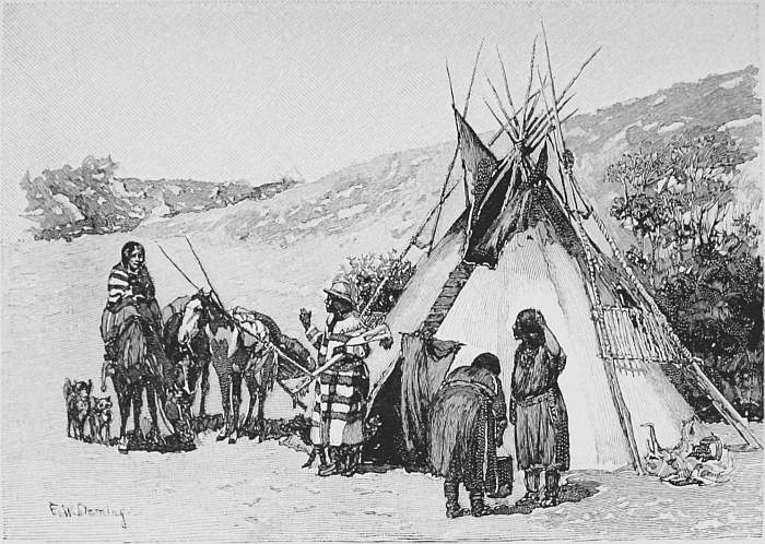
A Blackfoot Tepee.
Game gradually grew plentiful as they ascended the river. Buffalo was not seen till the Big Sioux was reached, but later fifteen herds and three bands of elk were visible at one time, and near Mandan large flocks of goats were seen crossing from their summer grazing grounds to find west of the Missouri winter shelter in the hilly regions. As they passed the Indians drove large flocks of migrating goats into the river, where even boys killed the helpless animals by scores with sticks. Indeed, the Missouri then appears to have been a hunter’s paradise, for there are mentioned among the regular game antelope, bear, beaver, buffalo, badger, deer, elk, goats, and porcupine. Three thousand antelope were seen at one time, and of this animal Lewis accurately remarks: “The antelope possesses most wonderful swiftness, the acuteness of their sight distinguishes the most distant danger, the delicate sensibility of their smell defeats the precautions of concealment, and when alarmed their rapid career seems more like the flight of birds than the movements of an earthly being.”
The river furnished abundant supply of cat and buffalo fish, and feathered game, such as plover, grouse, geese, turkeys, ducks, and pelican, also abounded; among the vegetable products are enumerated several kinds of grapes, currants and plums, wild apples, billberries, cherries, gooseberries, mulberries, raspberries, acorns, and hazel-nuts.
As regards the voyage thus far, it was true that the sail could rarely be used, that the labor of propelling the boats by oar or pole was most laborious, and that the shallows gave great trouble; but the Indians, save a single threatening occasion, were most friendly, and the only death, that of Sergeant Floyd, was from acute disease. Indeed, the journey had been most attractive and free from special hazard, and when rapidly advancing winter obliged them to go into permanent quarters, on October 27th, it seemed rather a long hunting excursion than a dangerous voyage of discovery.
Their winter quarters, called Fort Mandan, were on the eastern side of the Missouri, sixteen hundred miles from St. Louis, and in latitude 47° 22´ N., a short distance above the present city of Bismarck. The buildings were wooden huts, which joined and formed two sides of a triangle, while the third side was of pickets. As the huts opened inward, they had a stockaded place easy of defence.
On his arrival at Fort Mandan, Lewis found a Mr. McCracken, of the Hudson Bay Company, engaged in trading for horses and buffalo robes. During the winter ten or twelve different traders of this company visited Mandan, and although one bore a letter from the chief factor, Mr. Charles Chabouilles, offering any service in his power, yet it was evident to Lewis that these traders were cultivating sentiments unfriendly to Americans among the Indians, and Chaboneau, the interpreter was tampered with; but the prompt and judicious action of Lewis resulted in apologies and promises to refrain from such conduct in future. Laroche, one of the Hudson Bay traders, desired to go west with the expedition, but it was thought best to decline the offer. At this time the nearest English trading-post was at the forks of the Assiniboin, about one hundred and fifty miles distant by the way of Mouse River.
The stay at Fort Mandan was marked by two sad experiences for the Indians encamped near the post: an autumnal prairie fire which burned two Indians to death, and an attack of the Sioux, wherein one Mandan was killed and two wounded. A Frenchman, Jesseaume, living with the Indians, served as interpreter, and they learned much of the Mandans, Rickarees, and Minnetarees. The Rickarees appeared in a very sensible light by refusing spirits, with the remark that they did not use it, and were surprised that their father should present to them a liquor which would make them fools. The sensibilities of these Indians in their peculiar way appeared in a chief who cried bitterly at seeing a court-martial sentence of flogging carried out on a soldier. The chief acknowledged the necessity of exemplary punishment, and said that for the same offence he had killed his braves, but that he never whipped any one, not even children.
The Mandans, through intervention, made peace with the Rickarees, and restored traps and furs which they had taken from French hunters. During the entire winter these Indian tribes were most friendly, and their stores of corn, obtained by the expeditionary force by trade or purchase, were of material benefit to the party. The negro was a constant source of wonder to the crowds of Indians who visited them. The one-eyed great chief of the Minnetarees said that some foolish young men had told him there was a person quite black. When York, the negro, appeared, the one-eyed savage, much surprised, examined the negro closely, and spitting on a finger rubbed the skin in order to wash off the paint, and it was not until the negro showed his curly hair that the Indian could be persuaded he was not a painted white man.
Game, though at some distance, was abundant, and seventy head of large animals were obtained in a hunt of ten days. With regard to the Indians Lewis says: “A camp of Mandans caught within two days one hundred goats a short distance below us. Their mode of hunting them is to form a large strong pen or fold, from which a fence is made of bushes gradually widening on each side; the animals are surrounded by the hunters and gently driven toward this pen, in which they imperceptibly find themselves enclosed, and are then at the mercy of the hunters.
“When the Indians engage in killing buffalo, the hunters mount on horseback and, armed with bows and arrows, encircle the herd and gradually drive it into a plain or open place fit for the movement of horse; they then ride in among them, and singling out a buffalo, a female being preferred, go as close as possible and wound her with arrows till they think they have given the mortal stroke; when they pursue another till the quiver is exhausted. If, which rarely happens, the wounded buffalo attacks the hunter, he evades the blow by the agility of his horse, which is trained for the combat with great dexterity.”
The winter proved to be of unusual severity, and several times the temperature fell to forty degrees below zero, and proof spirits froze into hard ice. The fortitude with which the hardy savages withstood such extreme cold, half naked as they often were, impressed our explorers.
Spring opened early, and on April 7, 1805, Fort Mandan was abandoned, one party of ten with the barge going down the river with despatches and specimens. Lewis and Clark with their party of thirty started up the Missouri in six canoes and two large open boats, which had been constructed by them. They had three interpreters—Drewyer, Chaboneau, and his wife. Drewyer was a Canadian half-breed who had always lived in the woods, and while he had inherited from his mother the intuitive sagacity of the Indian in following the faintest trail, he had also acquired to a wonderful degree that knowledge of the shifts and expedients of camp life which is the resource and pride of the frontier huntsman. Chaboneau’s life had been largely spent among the Blackfeet, by whom his wife, a Snake Indian, had been taken in war and enslaved when a young girl.
At the mouth of the Little Missouri the three French hunters, who had ventured to follow the party, stopped for trapping, as they found beaver very plentiful. Chaboneau Creek, the farthest point on the Missouri yet visited by white men, was passed, and on April 26th they arrived at the mouth of the Yellowstone. Lewis was here particularly pleased with the wide plains, interspersed with forests of various trees, and expressed his opinion that the situation was most suitable for a trading establishment.
Spring had now fairly opened, the trees were in leaf, a flower was seen, and despite the scanty verdure of the new grass, game was very abundant. In many places, however, the barren banks and sand-bars were covered with a white incrustation of alkali salts, looking like frost or newly fallen snow, which were present in such quantities that all the small tributaries of the Missouri proved to be bitter and unhealthy water. Signs of human life became rarer, but now and then they passed an old Indian camp, and near one saw the burial place of an Indian woman. The body, carefully wrapped in dressed buffalo robes, rested on a high scaffold, with two sleds and harness over it. Nearby lay the remains of a dog sacrificed to the shades of his dead mistress. In a bag were articles fitting for women—moccasins, red and blue paint, beavers’ nails, scrapers for dressing hides, dried roots, a little Mandan tobacco, and several plaits of sweet-smelling grass.
The oar was plied unceasingly save when a favoring wind filled their sails and facilitated their progress. In early May they drew up their canoes for the night at the mouth of a bold, beautiful stream, and in the abundant timber found feeding on the young willows so many clumsy porcupines that they called it Porcupine River. Game was present in vast quantities; the elk were tame, and the male buffalo would scarcely quit grazing at the approach of man. As Lewis remarks: “It has become an amusement to supply the party with provisions.”
On May 8th they dined at the mouth of a river flowing from a level, well-watered, and beautiful country. As the water had a peculiar whiteness they were induced to call it Milk River. The Missouri now turned to the southwest and south, the country became more open, and timber, of pine mostly, small and scanty.
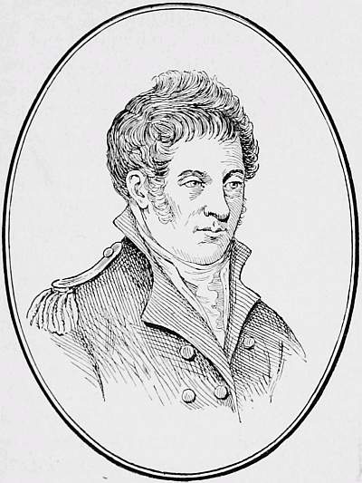
Captain Meriwether Lewis.
Although the buffalo were so tame and harmless that the men drove them out of their way with sticks, yet the grizzly bear never failed to be a dangerous and vicious visitor. One day six good hunters attacked a grizzly, and four firing at forty paces, each lodged a ball in the body, two going through the lungs. The animal ran at them furiously, when the other hunters fired two balls into him, breaking a shoulder. The bear yet pursued them, driving two into a canoe and the others into thickets, from which they fired as fast as they could reload. Turning on them, he drove two so closely that they dropped their guns and sprang from a precipice twenty feet high into the river followed by the bear, who finally succumbed to a shot through the head after eight balls had passed completely through his body. Another bear, shot through the heart, ran a quarter of a mile with undiminished speed before he fell dead.
On the 20th, twenty-two hundred and seventy miles from St. Louis, they came to the greenish-yellow waters of the Musselshell, and a short distance beyond Captain Lewis caught his first glimpse of the Rocky Mountains, the object of his hope and ambition. Beyond the Musselshell their experiences were less pleasant: the country became more barren, game and timber scarce, mosquitoes annoying; the high dry winds, full of sand, made their eyes sore; the sun of midday burned, while almost every night ice or frost chilled them.
The clear waters of the Judith River and its woods beautiful with multitudinous mountain roses, the fragrant honeysuckle, and the tiny red willows delighted their eyes; but the sight of a hundred and twenty-six lately abandoned lodge-fires caused some uneasiness, as indicating a late camping-place of a war-party of vicious northern Minnetarees or Blackfeet.
A few miles farther, as they passed a precipice a hundred and twenty feet high, they saw evidence of the cunning and wasteful methods of hunting by Indians, for the remains of over a hundred buffalo were scattered around, though the stream must have washed many away. Lewis adds: “These buffaloes had been chased down the precipice in a way very common on the Missouri, and by which vast herds are destroyed in a moment. The mode of hunting is to select one of the most active and fleet young men, who is disguised in a buffalo skin round his body. The skin of the head, with the ears and horns, are fastened on his own head in such a way as to deceive the buffalo. Thus dressed he fixes himself at a convenient distance between a herd of buffalo and any of the river precipices, which sometimes extend for several miles. His companions, in the meantime, get in the rear and side of the herd, and at a given signal show themselves and advance toward the buffalo. They instantly take the alarm, and finding the hunters beside them they run toward the disguised Indian or decoy, who leads them on at full speed toward the river, when suddenly securing himself in some crevice of the cliff, which he had previously fixed on, the herd is left on the brink of the precipice. It is then in vain for the foremost to retreat or even to stop; they are pressed on by the hindmost ranks, who, seeing no danger but from the hunters, goad on those before them till the whole are precipitated and the shore is strewed with their dead bodies. Sometimes in this perilous seduction the Indian himself is either trodden under foot or, missing his footing in the cliff, is urged down the precipice by the falling herd.”
The river now took the form of frequent rapids, which made the work of dragging the heavy canoes very painful, and the narrative runs: “The banks are so slippery in some places, and the mud so adhesive, that the men are unable to wear moccasins. One-fourth of the time they are obliged to be up to their arm-pits in the cold water, and sometimes walk for yards over sharp fragments of rocks.”
On June 3d they came to where the river divided into two large streams, and it became of vital importance to the expedition to determine which was the Missouri or Ahmateahza, as the Minnetarees called it, and which they said approached very near to the Columbia. The success of the expedition depended on the right decision, so Captain Lewis concluded to encamp until reconnoitering columns could examine the two forks.
Lewis following up the north branch, two days’ march, decided that it was not the Missouri, and named it Maria’s River. In returning he narrowly escaped slipping over a precipice some ninety feet high. Lewis had just reached a spot of safety when, says the narrative,
“He heard a voice behind him cry out, ‘Good God, Captain, what shall I do?’ He turned instantly and found it was Windsor, who had lost his foothold about the middle of the narrow pass and had slipped down to the very verge of the precipice, where he lay on his belly, with his right arm and leg over the precipice, while with the other leg and arm he was with difficulty holding on to keep himself from being dashed to pieces below. His dreadful situation was instantly perceived by Captain Lewis, who, stifling his alarm, calmly told him that he was in no danger, that he should take his knife out of his belt with the right hand and dig a hole in the side of the bluff to receive his foot. With great presence of mind he did this, and then raised himself on his knees. Captain Lewis then told him to take off his moccasins and come forward on his hands and knees, holding the knife in one hand and his rifle in the other. He immediately crawled in this way till he came to a secure spot.”
One of Lieutenant Clark’s party, on the south fork, at the same time, ran great danger from a grizzly bear which attacked near camp a man whose gun, being wet, would not go off. The man took to a tree, so closely followed by the animal that he struck the hunter’s foot as he was climbing. The bear showed his intention of waiting until the man should be forced to descend, but fortunately alarmed by the cries and signal-shots of a searching-party decamped.
While Lewis and Clark concurred in believing the south fork to be the true Missouri, the rest of the party were unanimous in thinking the north the right course. Finally caching their heaviest boat and all the supplies which could well be spared, the entire party followed the south fork.
Lewis, pushing on confidently with four men, confirmed his opinion by reaching, on June 13th, the great falls of the Missouri, which by their sublime majesty and stupendous magnitude fascinated him. The description of these falls at the time of their first view by civilized man is worthy of reproduction. The river, three hundred yards wide, was shut in by precipitous cliffs, and “for ninety yards from the left cliff the water falls in one smooth sheet over a precipice of eighty feet. The rest of the river precipitates itself with a more rapid current, but received as it falls by the irregular and projecting rocks below, forms a splendid prospect of white foam two hundred yards in length.... This spray is dissipated in a thousand shapes.... As it rises from the fall it beats with fury against a ledge of rocks which extend across the river.” On examination Lewis found that “the river for three miles below was one continued succession of rapids and cascades, overhung with perpendicular bluffs from one hundred and fifty to two hundred feet high; in short, it seems to have worn itself a channel through the solid rock.” At the main falls, five miles above the first, “the whole Missouri is suddenly stopped by one shelving rock, which without a single niche and with an edge as straight and regular as if formed by art, stretches itself from one side of the river to the other for at least a quarter of a mile. Over this the river precipitates itself in an even, uninterrupted sheet to the perpendicular depth of fifty feet, whence, dashing against the rocky bottom, it rushes rapidly down, leaving behind it a spray of the purest foam across the river. The scene was singularly beautiful, without any of the wild irregular sublimity of the lower falls.” In a cottonwood tree, on a small island in the middle of the rapids, an eagle had fixed its nest, a solitary bird which had not escaped the observation of the Indians, who had previously described it to Lewis.
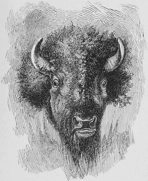
On leaving the falls Lewis saw a herd of a thousand buffalo, and killed one for supper. In his eagerness he failed to reload his rifle, when he beheld a grizzly bear stealing on him and not over twenty paces distant. “He felt that there was no safety but in flight. It was in the open, level plain, ... so that there was no possible mode of concealment.... As soon as he turned the bear ran, open mouthed and at full speed, upon him. Captain Lewis ran about eighty yards, but finding that the animal gained on him fast ... he turned short, plunged into the river about waist deep, and facing about presented the point of his spontoon. The bear arrived at the water’s edge within twenty feet of him, but as soon as he put himself in this posture of defence, the animal seemed frightened and retreated with as much precipitation as he had pursued.”
The means and route for portage presented difficult problems for the exhausted party, as it was clearly evident that the men could not carry the boats on their shoulders such great distances. Fortunately a creek was found at the foot of the falls, where the banks afforded easy access to the highlands. It was first necessary to cross the Missouri, and here the party went into camp while preparations were made for the portage.
Lieut. Clark with a few men carefully surveyed the trail to be followed, others engaged in hunting in order to lay up a store of dried meat, and the handy men of the party set to work on a carriage for the transport of the boats. By good fortune they found a large cottonwood-tree, about twenty-two inches in diameter, large enough to make the carriage-wheels, “perhaps the only tree of that size within twenty miles.” As they had decided to cache a part of their stores and leave their largest boat behind, its mast supplied them with two axle-trees.
In the meantime the survey of Clark showed that the series of cataracts had an aggregate descent of three hundred and sixty-three feet in seventeen miles, and that a very difficult portage of thirteen miles was necessary. The country was barely practicable for travel, and was covered with frequent patches of prickly pear, against the tiny penetrating needles of which the moccasins of the dragging men afforded almost no protection. To add to their misfortunes, when about five miles from their destination the axle-trees, made of the old mast, broke, and then the tongues of green cottonwood gave way. After diligent search sweet-willow trees were found with which they managed, by shifts and expedients familiar to frontiersmen, to patch up the carriage so as to go on. It broke down so completely about a half mile from the new camp that it was easier to carry boat and baggage on their shoulders than to build a new conveyance. The condition of the party is evident from the narrative:
“The men are loaded as heavily as their strength will permit; the crossing is really painful; some are limping with the soreness of their feet, others are scarcely able to stand for more than a few minutes from the heat and fatigue; they are all obliged to halt and rest frequently, and at almost every stopping-place they fall, and many of them are asleep in an instant.”
Later it was needful to repair the carriage and to travel over and over the portage until, after ten days of weary labor, all the equipage was above the falls.
In the meantime the hunters had accumulated nearly half a ton of dried meat, buffalo being plenty. The grizzly bear, however, was also present, active, aggressive, and dangerous as usual. They infested the camp at night, causing much alarm, and once carried off buffalo-meat from a pole within thirty yards of the men. A hunter sent out to bring in meat was boldly attacked by a bear and narrowly escaped death, being pursued to within forty paces of the camp. Another animal was killed when rushing up to attack men who had to climb a tree, while making sufficient noise to attract their rescuer, Drewyer, the interpreter and hunter, who shot him through the head. He proved to be the largest they had seen, being eight feet seven and a half inches long, while his fore feet measured nine inches and hind feet seven inches across, and eleven and three-quarters long exclusive of the talons. Another hunter was attacked by a grizzly, fortunately near the river, so that he was able to conceal himself under a steep bank; otherwise he would probably have lost his life.
The perils of navigation and the chase were not all, for a cloud-burst and hail-storm contributed to their danger and suffering. The hail was so large and driven so furiously by the high wind that it knocked down several of the men, one three times, bruising another very badly and wounding some so that they bled freely. The fallen hail lay in drifts, which in places completely covered the ground, and some of the stones weighed three ounces and measured seven inches in circumference. Clark, Chaboneau and his wife took shelter under shelving rocks in a deep ravine, congratulating themselves on their protected position. Suddenly, however, the rain fell in a solid mass, and instantly collecting in the ravine, came rolling down in a dreadful torrent, carrying rocks and everything before it.
“But for Lieut. Clark, Chaboneau, his wife and child would have been lost. So instantly was the rise of the water, that as Lieut. Clark had reached his gun and began to ascend the bank, the water was up to his waist, and he could scarce get up faster than it rose, till it reached the height of fifteen feet, with a furious current which, had they waited a moment longer, would have swept them into the river just above the Great Falls, down which they must have inevitably been precipitated.”
Though the phases of their daily life brought much that was rough and hard, yet their privations were not unmixed with pleasures, rude though they may seem to the city dweller. Long tramps and exciting rides after game, side marches to commanding hill-tops for grateful views of an unknown country—barren to the eye, perhaps, but grateful to the soul, for were they not the first men of their race who ever looked upon it?—or pleasant journeys through upland forests or the undergrowth of the intervale, to search and gather whatever was beautiful to the eye, novel to the mind, or a welcome addition to their scanty larder; such were their rare pleasures.
Now they waded through waist-high patches of wild rye, recalling with its fine soft beard the waving fields of grain they had left in the far East; again they pushed on in dense copses of the sinuous redwood, whose delicate inner bark furnished pleasant Indian tobacco to the Frenchman and half-breed. Sometimes the trail lay through an open wood with smaller undergrowth, where beds of odorous mint recalled his Virginian home to Lewis; where the delicate mountain-rose, in countless thousands, was born to blush unseen; where, if only one ripened berry to-day invited the hunter, other kinds promised their welcome fruit in due but later season.
Rarely did the dull gray of the sky dim the glory of a whole day, and the short summer showers, freshening the beauty of the landscape and abating the fervid heat of mid-summer, seemed only too infrequent. And above all, the pure, free, upland air, that gives vigor and health to the body, joy and lightness to the heart, almost annihilates distance to the eye; and in breathing which, one drinks into the lungs the very wine of life. Surely more than the heroes of Virgil’s song did they feel that sweet in their memory would abide these days forever.
Of the mountains, now always in sight, and a constant source of inspiration to the eager explorers, those to the north and northwest were yet snow-capped, and Lewis says: “They glisten with great beauty when the sun shines on them in a particular direction, and most probably from this glittering appearance have derived the name of the Shining Mountains.”
During his explorations of the country around the falls Captain Lewis visited a remarkable and beautiful spring, near the present city of Great Falls, Montana. Of it he writes:
“The fountain, which perhaps is the largest in America, is situated in a pleasant level plain, about twenty-five yards from the river, into which it falls over some steep irregular rocks, with a sudden descent of about six feet in one part of its course. The water boils up from among the rocks with such force near the centre, that the surface seems higher than the earth on the sides of the fountain, which is a handsome turf of fine green grass.”
While the main party was making the portage, a detachment was “occupied in fitting up a boat of skins, the iron frame of which, thirty-six feet long, had been prepared for the purpose at Harper’s Ferry. The iron frame is to be covered with skins, and requires thin-shaved strips of wood for lining. The skins necessary to cover it have already been prepared—twenty-eight elk and four buffalo skins.” This experimental boat proved to be a total failure, and it was not till Lewis’s long journey was nearly over that he copied the skin boat of the Indian squaws, which had excited his surprise, and found that the methods of the locality could be followed with advantage in navigation as well as otherwise.
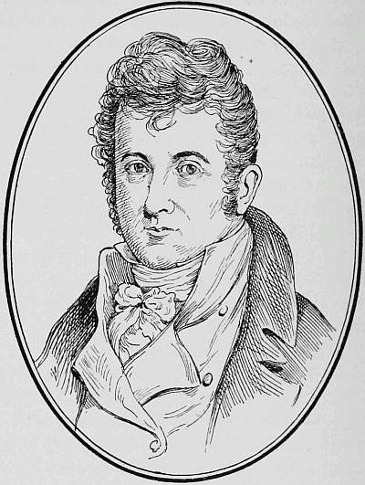
Lieutenant William Clark.
As the six canoes were insufficient to carry all their men and supplies, Clark was sent ahead to find suitable wood for two more, there being no fit trees below the falls. With much difficulty trees were found, and two canoes, three feet wide and twenty-five and thirty-three feet long respectively, were fashioned. Near here a deserted Indian lodge or council house was seen. It was two hundred and sixteen feet in circumference, made of sixteen cottonwood poles, fifty feet long, converging toward the centre, where they were united and secured by large withes of sinewy willow.
Although the swivel and some other articles had been cached at the head of the falls, their loads were yet very heavy, and all walked except those engaged in working the canoe. The windings of the river became very tortuous, and frequent rapids made their progress correspondingly slow and laborious.
Game was less plentiful, and, as it was necessary to save the dried and concentrated food for the crossing of the mountains, it became somewhat of a task to provide food for a party of thirty-two which consumed a quantity of meat daily equal to an elk and deer, four deer or one buffalo. Fortunately, the berries were now ripening, and, as they grew in great quantities, proved a not inconsiderable contribution to their food-supply. Of currants there were red, purple, yellow, and black, all pleasant to the taste; the yellow being thought superior to any other known variety. The purple service-berry and pinkish gooseberry were also favorites. Besides, they made use of the very abundant and almost omnipresent sunflower. Of it Lewis says: “The Indians of the Missouri, more especially those who do not cultivate maize, make great use of the seed of this plant for bread or in thickening their soup. They first parch and then pound it between two stones until it is reduced to a fine meal. Sometimes they add a portion of water, and drink it thus diluted; at other times they add a sufficient proportion of marrow grease to reduce it to the consistency of common dough and eat it in that manner. This last composition we preferred to all the rest, and thought it at that time a very palatable dish.”
The Missouri now took in general a southerly course, and on July 18th they reached a bold clear stream, which was named Dearborn River for the then Secretary of War. They had intended to send back a small party in canoes with despatches, but as they had not met the Snake Indians, and so were uncertain as to their friendliness, it was thought best not to weaken their already small party for hostilities. Lewis decided, however, to send Clark, with three men, in advance to open up communication with these Indians and, if possible, to negotiate for horses. Clark’s journey was a failure, for the Indians, alarmed at the firing of a gun, fled into the mountains.
The mountains now closed in on the explorers and they camped one night at a place named the Gates of the Rocky Mountains. “For five and three-quarter miles these rocks rise perpendicularly from the water’s edge to the height of nearly twelve hundred feet. They are composed of black granite near the base, but ... we suppose the upper part to be flint of a yellowish brown and cream color. Nothing can be imagined more tremendous than the frowning blackness of these rocks, which project over the river and threaten us with destruction.... For the first three miles there is not a spot, except one of a few yards, in which a man could stand between the water and the towering perpendicular of the mountains.”
On July 25th Clark, who was in advance, reached the three forks of the Missouri, where he had to camp, his party worn out, their feet full of prickly pear needles and Chaboneau unable to go farther. The forks were all clear pebbly streams, discharging large amounts of water. The southeast fork was named Gallatin, the middle Madison, and the southwest Jefferson, the latter two, of equal size, being larger branches than the Gallatin.
At the three forks Sacajawea, the wife of Chaboneau, was encamped five years before, when the Minnetarees of Knife River attacked the Snakes, killed about a dozen and made prisoners of her and others of her tribe. Strangely enough Chaboneau nearly lost his life crossing the Madison, where Clark saved him from drowning. Lewis was struck with the seeming indifference of the Snake woman on her return to the spot and her own country.
The party followed Jefferson River, their journey being marked by the killing of a panther seven and a half feet long, and the overturning of a canoe, injuring one of the party, Whitehouse, losing some articles, and wetting others, but the all-important powder was so well packed that it remained dry.
“Persuaded,” says the narrative, “of the necessity of securing horses to cross the mountains, it was determined that one of us should proceed ... till he found the Shoshones, ... who could assist us in transporting our baggage.” Captain Lewis with three men preceded, and on August 11, saw “with the greatest delight a man on horseback, at the distance of two miles, coming down the plain toward them. On examining him with the glass, Captain Lewis saw that he was armed with a bow and a quiver of arrows; mounted on an elegant horse without a saddle, and a small string attached to the under jaw answered as a bridle. Convinced that he was a Shoshonee, and knowing how much of our success depended on the friendly offices of that nation, Captain Lewis was full of anxiety to approach without alarming him, and endeavor to convince him that he was a white man. He therefore proceeded on towards the Indian at his usual pace; when they were within a mile of each other the Indian suddenly stopped, Captain Lewis immediately followed his example, took his blanket from his knapsack, and holding it with both hands at the four corners, threw it above his head and unfolded it as he brought it to the ground, as if in the act of spreading it. This signal, which originates in the act of spreading a robe or skin as a seat for guests to whom they wish to show a distinguished kindness, is the universal sign of friendship among the Indians on the Missouri and Rocky Mountains.” Unfortunately, the brave took alarm at the movement of Lewis’s companions and fled. The next day brought them to the head-waters of the Jefferson. Here, “from the foot of one of the lowest of these mountains, which rises with a gentle ascent for about half a mile, issues the remotest water of the Missouri. They had now reached the hidden sources of that river, which had never yet been seen by civilized man; and as they quenched their thirst at the chaste and icy fountain—as they sat down by the brink of that little rivulet, which yielded its distant and modest tribute to the parent ocean, they felt themselves rewarded for all their labors and all their difficulties.”
Pushing on they soon saw, to the west, high, snow-topped mountains.
“The ridge on which they stood formed the dividing line between the waters of the Atlantic and Pacific Oceans. They followed a descent much steeper than that on the eastern side, and at the distance of three quarters of a mile reached a handsome, bold creek of cold, clear water running to the westward. They stopped to taste for the first time the waters of the Columbia, and, after a few minutes, followed the road across steep hills and low hollows, till they reached a spring on the side of a mountain. Here they found a sufficient quantity of dry willow brush for fuel, and therefore halted for the night, and, having killed nothing in the course of the day, supped on their last piece of pork, and trusted to fortune for some other food to mix with a little flour and parched meal, which was all that now remained of their provisions.”
In the early morn of August 13, Lewis hastened impatiently forward without food, and after a few hours of travel saw three Indians; but they fled. A little later he surprised three women, and succeeded in reaching two, who covered their heads and awaited in silence their expected death. Showing them that he was a white man, and giving them trinkets, they were reassured and recalled their comrade, when he painted their cheeks with vermilion, a Shoshone custom emblematic of peace.
The women pointed out the direction of camp, and Lewis, marching on, soon saw a band of sixty well-mounted Indian warriors riding full speed toward him and his two companions. With perfect composure and undaunted courage Lewis laid down his rifle, and alone marched forward to parley with this horde of unknown savages, relying on the integrity and uprightness of his mission. Received with the greatest cordiality, Lewis at once smoked a pipe of peace with them, and after giving them some blue beads and vermilion went to their camp.
On arrival he was inducted into a council lodge and seated on a robe, when a fire was kindled. “The chief then produced his pipe and tobacco, the warriors pulled off their moccasins, and our party were requested to take off their own. This being done, the chief lighted his pipe at the fire within the magic circle, and then retreating from it, began a speech several minutes long, at the end of which he pointed the stem toward the four cardinal points of the heavens, beginning with the east and concluding with the north.”
By this time the day was well spent, and no food of any kind had passed the lips of Lewis and his men since the previous day. On learning this the chief told him that they only had cakes made of sun-dried service- and choke-berries, which served as a hearty meal to the hungry men. Later an Indian gave Lewis a piece of antelope and a bit of salmon, which satisfied him that he was now on the waters of the Columbia.
The next day they had an experience of the Indian mode of hunting, which is thus described: “The chief game of the Shoshonees is the antelope, which, when pursued, retreats to the open plains, where the horses have full room for the chase. But such is its extraordinary fleetness and wind, that a single horse has no chance of outrunning it or tiring it down, and the hunters are therefore obliged to resort to stratagem. About twenty Indians, mounted on fine horses and armed with bows and arrows, left camp. In a short time they descried a herd of antelopes; they immediately separated into little squads of two or three, and formed a scattered circle round the herd for five or six miles, keeping at a wary distance, so as not to alarm them till they were perfectly enclosed, and usually selecting some commanding eminence as a stand. Having gained their positions, a small party rode toward the herd, and with wonderful dexterity the huntsman preserved his seat, and the horse his footing, as he ran at full speed over the hills and down the steep ravines and along the borders of the precipices. They were soon outstripped by the antelopes, which, on gaining the other extremity of the circle, were driven back and pursued by the fresh hunters. They turned and flew, rather than ran, in another direction; but there, too, they found new enemies. In this way they were alternately pursued backward and forward, till at length, notwithstanding the skill of the hunters, they all escaped; and the party, after running for two hours, returned without having caught anything, and their horses foaming with sweat. This chase, the greater part of which was seen from the camp, formed a beautiful scene; but to the hunters is exceedingly laborious, and so unproductive, even when they are able to worry the animal down and shoot him, that forty or fifty hunters will sometimes be engaged for half a day without obtaining more than two or three antelopes.”
Captain Lewis succeeded with great difficulty in persuading the band of Shoshones to pass over the divide in order to assist in bringing his impedimenta across. The presence of a Shoshone woman, the monstrosity of a man entirely black, favorable barter for their horses were urged; in short he played on their avarice, curiosity, tribal pride, and by questioning their courage succeeded in stimulating them to make the journey.
It transpired that Cameahwait, the Shoshone chief, was the brother of Sacajawea, and one of the Shoshone women, now in camp, had been for some time prisoner with her in the hands of the Minnetarees. The meeting of these Indians after long separation disclosed such emotion as proved their tender feelings and genuine interest in each other.
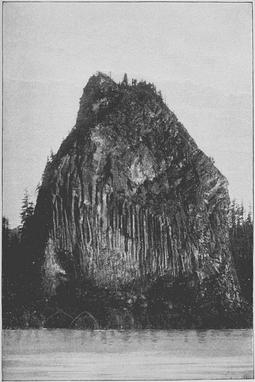
Castle Rock, on the Columbia River.
A long and tedious council was held, with the usual smoke and speeches. Lewis set forth in lively terms the strength of the government, the advantages of trade, and the importance of hastening the day of fire-arms and supplies by facilitating the journey. Meanwhile they were amused, as the Indian must be, by the queer negro, the sagacious and well-trained dog, the rifles, the air-gun, clothing, canoes, etc. All game brought in was divided; the Indians feasted on hulled corn, and presents were liberally distributed.
The good-will of the Shoshones was finally secured, and four horses purchased by barter; so that Lewis was to send Clark ahead to reconnoitre the route along the Columbia, and build canoes if possible, which the Indians declared to be impracticable, as timber was wanting, and the river and mountains impassable. They said that for seven days the route lay over steep, rocky mountains, with no game and only roots for food; then for ten days an arid sandy desert, where men and horses would perish for want of food and water. On inquiry, Clark learned that Nez Percés came from the west by a very bad road towards the north, where they suffered excessively from hunger and travel. Believing that difficulties surmountable to Indians with women and children could not be formidable, Clark pushed on with a guide, but soon found that the Indian accounts had not been exaggerated, as he fell in with the points of four mountains, which were rocky, and so high that it seemed almost impossible to cross them with horses. The road lay over sharp fragments of broken rock which had fallen from the mountains and were strewed in heaps for miles together.
Occasionally he met small parties of Indians, who, in wretched plight themselves, yet acted most generously, giving him, as he says, willingly what little they possessed, which was usually a few dried berries and a bit of salmon, never enough to entirely appease the hunger of his famished men. Clark says:
“Our men, who are used to hardships, but have been accustomed to have the first wants of nature regularly supplied, feel very sensibly their wretched situation; their strength is wasting away; they begin to express an apprehension of being without food in a country perfectly destitute of any means of supporting life, except a few fish.”