The Spanish Entradas (continued 2)
Reading edition
Rumors of the report leaked out and upset the soldiers. Marcos quieted them during one of his sermons: Díaz hadn’t gone far enough. A preacher’s word against that of a frontier roughneck. Coronado, at least, was placated: why let go of either his credulity or his investment this early in the game? But he was worried about dragging the whole cumbersome army over a bad trail into a despoblado lacking in supplies. So he decided to go ahead with a vanguard of 80 horsemen, 30 or so footmen, an unknown number of Indians, some livestock, and the expedition’s five friars. He placed the main army under; Tristan de Arellano, told him to stay in Culiacán for 20 more days and then advance to the Indian town of Corazones in the heart of Sonora, where further instructions would be sent him.
It took Coronado’s vanguard from April 22 to July 7, 1540—eleven weeks, counting rest stops—to cover the thousand miles that separated Culiacán from Cíbola. (During those same weeks De Soto’s hungry men were marching through Georgia into the city of pearls and on across the Appalachians into Alabama.) Hard weeks on rough trails. Contrary to what Marcos had said, they were veering farther and farther from the coast. Yet at that very time, Hernando de Alarcón was sailing northward with three ships loaded with supplies for him. How were they to make contact?
As events developed, they never did, and the vanguard crossed the shimmering San Pedro plains into what was to be the United States with an increasing apprehension that all gates were shutting behind them. They followed the tree-shaded San Pedro River north to the vicinity of Benson, Arizona, and then, with Melchior Díaz pointing the way, left it and worked on through a series of broad-bottomed, mountain-bracketed valleys to the Gila River, reaching it where Mt. Turnbull bulks huge against the sky. An enormity of space and remoteness. One can still feel it, for unlike the southeastern United States, where De Soto marched, this land has been but little scarred by man’s devouring technologies.
64
First Blood at Cíbola
65
At Cíbola, Coronado had his first encounter with the Pueblo world. His army was six months into the expedition and worn down from crossing a wilderness. Food was short, his porters (blacks) and Indians were deserting, horses were dying of exhaustion.
The first sight of Cíbola—the legendary kingdom of the north—dismayed the Spaniards. They found not a shining city of gold but only mud huts stacked one atop another and a crowd of armed warriors. This was Háwikuh, western-most of a cluster of Zuñi towns, now a ruin a few miles south of the present pueblo of the same name.
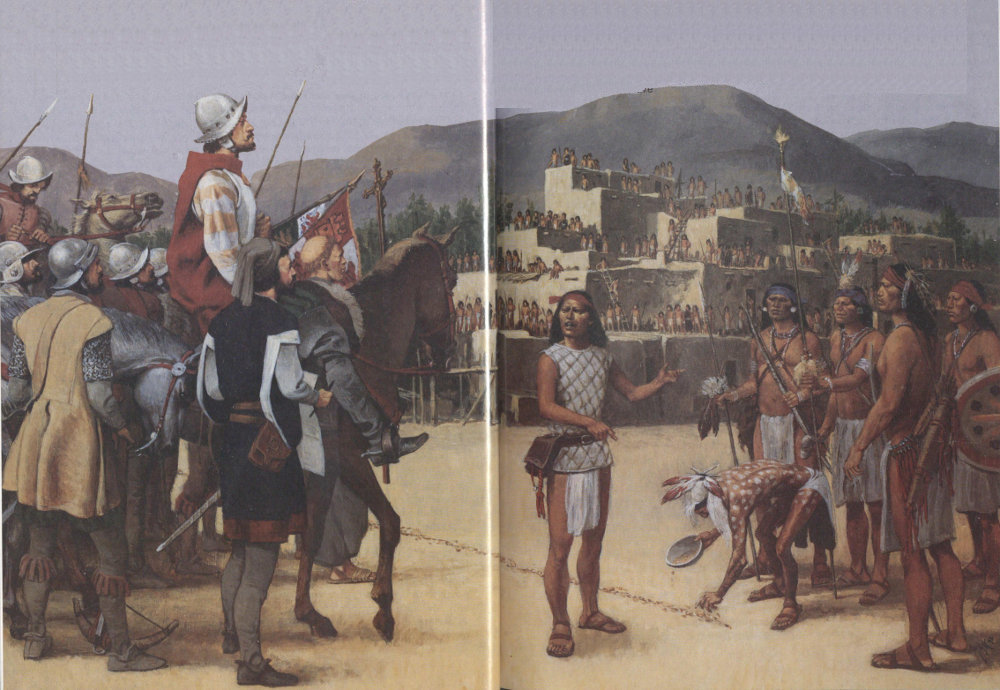
Wanting food, Coronado sent forward a party with an interpreter, friars, and cavalry. This is the moment illustrated by artist Louis S. Glanzman. The interpreter tells Háwikuh’s war leaders that the Spaniards have come to claim the country for King and Savior and wish them no harm. The Indians pay this no attention. An elder draws a line of sacred corn meal in the sand. The Spaniards hesitate. Arrows fly. The army storms the village. Soon a dozen Indians lie dead while the rest flee. The famished soldiers break into the stores. Peace follows and this pueblo becomes Coronado’s base camp for the next few months.
66
They climbed the rough Gila Mountains, found relief in high, open meadows, but then had to scramble over the Natanes Plateau and pitch down a steep Indian trail into the Black River gorge. On beyond that they came to a more difficult crossing of the barranca, as they called the canyon, of the White River. The water was so deep they had to build rafts to get across. Then on through more pines and meadows whose beauty they scarcely noticed. They were so hungry that at one camp they ate lush-looking plants—perhaps wild parsnip, perhaps water hemlocks—that twisted them with cramps; one Spaniard and two blacks perished.
Two days later, amidst bare, rolling hills, they passed the Little Colorado and started up Zuñi Creek. Knowing that Cíbola and its food supplies were near, the men wanted to hurry, but Coronado, ever cautious, sent out scouts under tough Garcia López de Cárdenas, and kept the main force moving slowly behind. Near midnight, Indians attacked the reconnoitering group and stampeded some of its horses. Quelling a brief panic, the invaders swept the Indians aside, but the portent was clear. The Cíbolans were going to defend their homes.
As the Spaniards emerged from a scattering of junipers onto a flat plain, they saw, hardly half a mile away, a low spur protruding from a line of hills. On top of the spur was a city of sorts. Blank tan walls rose three and, in places, four stories high. Clusters of people on top. Cornfields and squat houses at the base of the spur. “There are,” Casteñada wrote in disgust, “haciendas in New Spain which make a better appearance at a distance.” And he added, “Such were the curses that some hurled at Fray Marcos that I pray God may protect him from them.”
Points of view. Modern archeologists have discovered data about the Pueblo (Anasazi) Indians that were unknown to the Spaniards. For one thing, population in general was declining in the 16th century, but towns were growing because survivors were congregating in them, perhaps as a defense against raiding nomads. One major population center was the six, 67 not seven, pueblos of the area now known as the Zuñi reservation, then called Cíbola. (No single “city” had that name; that was just another misunderstanding of Marcos.) The town of Háwikuh lay farthest to the southwest and hence dominated the ancient trade trails leading from the entire Pueblo country to Mexico, the Gulf Coast, and those parts of Southern California bordering on the Pacific. Háwikuh, accordingly—and all Cíbola—seemed important to the inhabitants of a considerable area, a notion Marcos had picked up and relayed to his superiors, as we have seen.
The Spaniards, however, had not come looking for dealers in hides, feathers, and imported sea shells. In spite of doubts and warnings that must have troubled them along the way, it was still impossible for them to adjust in one stunning moment to this thunderclap of reality. They went on doing what they probably would have done if the army of the Grand Khan had advanced to meet them. Cavalrymen made sure their saddle girths were tight, footmen readied their weapons, which had not been well cared for during the march, and together they moved toward the Indians, whose leaders drew magic lines of corn-meal on the ground and blew angrily on conch shell trumpets. With bows and war clubs they gestured for the invaders to leave. No women or children were in sight, and the numbers of warriors indicated that the neighboring towns had sent reinforcements. None seemed awed by the sight of horses.
Dutifully the Spaniards went through the ritual of the requerimiento. Cárdenas, a few cavalrymen, a notary, an interpreter, and two priests approached the Indians. The interpreter read a proclamation stating that God’s representative, the Pope, had awarded this part of the world to the monarchs of Spain. All who submitted to his majesty’s authority and also accepted Christianity with its promises of salvation would be embraced as friends. Those who did not would be treated as enemies.
The answer was a shower of arrows that did no harm. Coronado next went forward, holding out gifts as a sign of peace. Mistaking the offering for timidity, the Indians rushed forward. The invaders countered with a charge. Evidently the horses did inspire terror then, for the Indians broke and fled. Some were downed on the plain, but most gained the town and climbed onto the flat roofs, where they continued their gestures of defiance.
68
To Pecos and Beyond
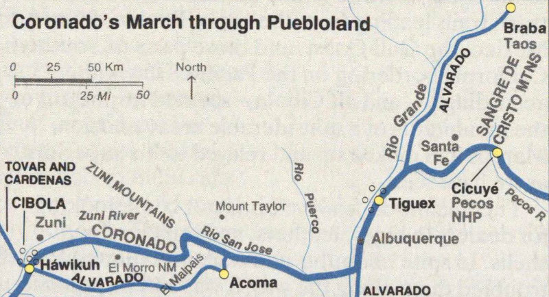
Marching from Cíbola to Pecos, Alvarado’s soldiers saw Puebloland in the morningtide of its history, a time of prosperity and relative peace. Village after village welcomed the Spaniards. At Acoma, built on a mesa, “the natives ... came down to meet us peacefully” and gave the Spaniards supplies for their journey. In Tiguex province, they met Indians “more devoted to agriculture than to war” who gave them food, cloth, and skins. At the huge pueblo of Braba (present Taos), more hospitality. Cicuyé (Pecos), their destination, greeted Alvarado with drums and flutes and plied the soldiers with clothing and turquoise (but the women kept hidden). The record is clear that when the intruders came peacefully, first encounters were not always hostile.
70
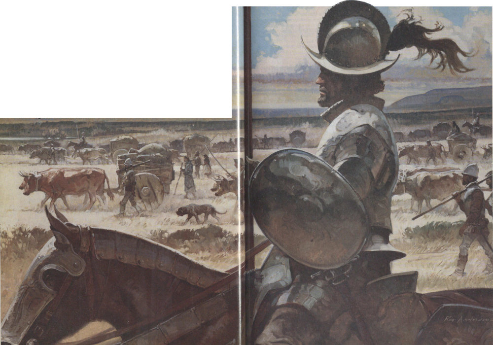
Perhaps there was no gold in the town, but there was food and the Spaniards were half-starved. Coronado deployed horsemen entirely around the town to prevent anyone’s escaping while he himself dismounted and led an attack on foot up the slope toward the pueblo’s single narrow, twisting entry. Clad in gilded armor that attracted attention (and must have been clumsy to run in), he was straightway knocked senseless by a huge stone. Two officers shielded his body while he was dragged to safety.
Advantage of position was with the defenders, and the Spaniards, we are told, were in bad shape. The strings of the crossbows, rotted by the sun, snapped when cranked tight. The arquebusers were too weak from hunger and heat to join the onslaught. Yet no one was killed and only a dozen were hurt. Within less than an hour the town surrendered, an outcome difficult to understand unless the defenders hurled their missiles so wildly that none took effect, whereupon they gave up, terrified by the enemy’s relentless momentum and flashing swords, a weapon they had never before encountered.
After Coronado had recovered from his concussion and his men had sated their hunger on Háwikuh’s corn, beans, and turkeys (which the Indians raised for feathers rather than food), he began assessing his situation. Couriers brought in delegations from the neighboring towns, and he put what he learned from them into a long letter he wrote Mendoza and dated August 3, 1540. It is a prized ethnographical document now because of its generally accurate descriptions of the Pueblos. Mendoza must have found it discouraging. No gold. But Coronado was determined, he wrote, to keep pressing the search. To strengthen his forces he sent orders, via the letter-bearers, for the bulk of the main army to advance to Háwikuh. The remainder were to establish a halfway station beside the long trail. This station was entrusted to Melchior Díaz. As soon as Díaz had put things in shape there, he was to ride to the Gulf in search of Alarcón’s supply ships. Fray Marcos, ill, disgraced, and fearing for his safety, went home with the messengers.
On Cíbola: “Although [the Seven Cities] are not decorated with turquoises, nor made of lime or good bricks, nevertheless they are very good houses, three, four, and five storeys high, and they have very ... good rooms with corridors, and some quite good apartments underground and paved, which are built for winter and are something like hot-houses [kivas].... In [Háwikuh] are perhaps 200 houses, all surrounded by a wall.... The people of these towns are fairly large and seem to me to be quite intelligent ... most of them are entirely naked except for the covering required for decency ... they wear the hair on their heads like the Mexicans, and are well formed and comely ... the food they eat in this country consists of maize, of which they have a great abundance, beans, and game.... They make the best tortillas I have ever seen anywhere, and this is what everybody ordinarily eats.”
—Coronado to Mendoza, 3 August 1540
Meanwhile exploring parties had gone northwest from Háwikuh to lay claim to the “kingdom of Tusayan,” or, as we would say, the Hopi villages. Nothing 71 the Spaniards wanted was there, either—except for ill-understood talk about a big river farther to the west. It could be crucial. It must flow into the sea and might furnish a route inland for Alarcón. Promptly Coronado ordered Garcia López de Cárdenas to investigate.
The result was the first sighting, by Europeans, of the Grand Canyon at a point generally believed to have been Desert View. Awed by the chasm, the party explored along the rim until thirst turned them back. Clearly such a stream could not serve as a supply route.
A few weeks later and many hundreds of miles farther downstream Melchior Díaz at last unearthed (literally) the first clues about Hernando de Alarcón’s whereabouts. After straightening out affairs at the halfway station named San Gerónimo, he led 25 cavalrymen and some Indians west to the Gulf’s torrid coast, driving a herd of sheep along for food. A swing north along the desolate beaches brought him to the banks of a river. He continued along it for perhaps 90 miles, until encountering Indians who showed him where another bearded man like himself had hidden some letters. The documents he dug up have since disappeared, but from other sources it is possible to guess what they said.
Alarcón had reached the river mouth about August 25, 1540. He had been preceded there by Cortés’s man, Francisco de Ulloa, who a year earlier had been trying to find an inlet that would enable his commander to beat Mendoza to the Seven Cities. Because Ulloa believed that Baja California was an island, he had been surprised to find himself pinched into the head of a gulf. A most disconcerting place—shoals, seemingly bottomless mudbanks, and a terrifying tidal bore, raging tumults of water caused when the inflowing tide rushed in a great wave upriver against the current.
The sight had turned Ulloa back, but Alarcón was more persistent. He worked a tortuous way through the shoals and, with waves dashing over the deck of his flagship, rode the bore into the channel on August 26. Unable to sail upward against the current, he anchored his three vessels behind a protecting point. Lowering two ship’s launches, he ticked off 20 men, some to work the oars, the others to walk along the bank, pulling two ropes. Eventually Cócopa Indians appeared, highly excited. None of them understood 72 the lingua franca of his interpreter, but by signs and a passing out of trinkets, Alarcón in time prevailed on them to bring food and to help with the cordelling.
On September 6, two months after the battle at Háwikuh, the slow-moving boats reached, it is believed, a point near the junction of the Colorado and Gila rivers, the site of today’s Yuma, Arizona. Nearby, Alarcón’s interpreter found Indians with whom he could converse. Their news was startling. Far inland, white men were causing trouble among the native inhabitants. Coronado’s army, surely, which Alarcón had been directed to supply. But how?
When none of his own men and none of the Indians would agree to carry a message to Háwikuh, Alarcón decided to return to the ships, take on fresh supplies, and go to Cíbola himself. During the attempt he advanced one day’s journey farther upstream than he had gone before, but then physical difficulties and the growing hostility of the Indians forced him to halt. After burying the letter Díaz found, he returned to Mendoza with valuable information about the new land—but, again, no gold.
Having found the letter, Díaz continued upstream for another five or six days, perhaps to learn whether this was indeed the lower end of the big river about which the Hopis had spoken. Evidently satisfied that it was, he sent the Indian footmen of his party and the sheep across the stream on rafts made of reeds. Riders swam over on their horses, and the whole party turned back downstream. At some point in those grisly deserts, Díaz’s greyhound began tormenting a sheep. Díaz ran at the dog with his lance. The point stuck in the ground. Before he could stop his horse, the butt pierced his groin. His distraught men put him on a litter, recrossed the river (it is very low in the fall of the year), and hurried toward San Gerónimo, to no avail. He died and was buried no one knows where.
Of the Coronado party’s far-flung explorations, the one that had the greatest impact on its future was Hernando de Alvarado’s trip to the Great Plains. It was touched off by the appearance at Háwikuh, late in August, of a still undefined party of Indians—traders probably, but perhaps a group who felt they should learn more about what was going on in Cíbola.
They hailed from the pueblo of Cicuyé, located near a river we call Pecos in north-central New Mexico. 73 (Cicuyé was the inhabitants’ name for their town; Pecos, now applied to both the river and the pueblo ruins, derives from Pekush, a word other Pueblo Indians used in speaking of the settlement.) The travelers were led by an elder whom the Spaniards called Cacique, as if it were a name. (Actually, it was an Arawak word meaning “chief.” The conquistadores had picked it up first in the West Indies and later had applied it to Indian leaders throughout Latin America.) Accompanying Cacique was a husky, talkative young man adorned with drooping mustaches, unusual in an Indian. Coronado’s people named him Bigotes, or, in English, Whiskers. Bigotes apparently spoke some Nahuatl, which meant he could converse after a fashion with a few of the explorers, notably Father Juan de Padilla, who seems to have been going slowly mad. Another attention-catcher among the visitors was an Indian from the Great Plains who had a painted picture of a buffalo on his bare chest.
Coronado considered the newcomers a peace delegation. He gave them glass trinkets, beads, and little bells that entranced them. They responded with head dresses, shields, and a wooly hide that, they signified, had been taken from an animal like the one pictured on the chest of one of their number. As the concept became clearer, pulses jumped, for here was a firm tie-in with Cabeza de Vaca’s story about the huge “cows” of the new land and of multistoried cities nearby.
Eager to learn more, Coronado prevailed on the amiable group to lead a party of his own men eastward to see Cicuyé and its surrounding lands—24 riders, four crossbowmen, Fray Juan de Padilla, and a lay brother, Luís de Ubeda. In high spirits they struck off through a malpais of congealed, jumbled, sharp-edged boulders of black lava that made the riders dismount and lead their suffering animals. This short-cut brought them to the amazing town of Acucu (today’s Acoma), perched on the summit of a butte approachable (as far as the Spaniards saw) only by a stairway carved into the pink sandstone. After an uneasy confrontation at the base of the cliffs, the Indians of Acucu invited them to climb arduously to the top, where they were heaped with presents of hides, cotton cloth, turkeys and other foods.
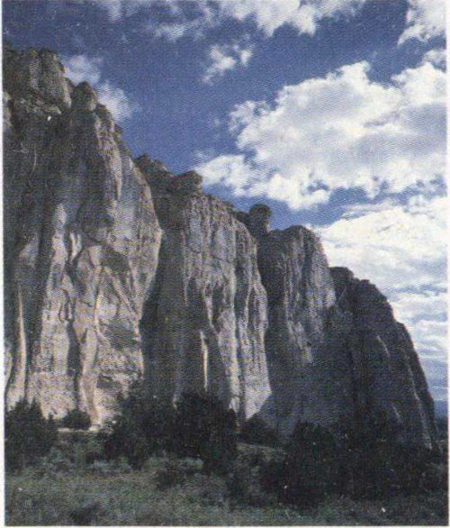
The immense headland of El Morro, also known as Inscription Rock, was a landmark for western travelers. Lured by the shaded pool at the base, they camped nearby and often left a record of their passage in the rock’s soft sandstone face. The party that Coronado dispatched to Acoma in August 1540 passed well south of the mesa and probably never saw it. The main army that ascended the Zuñi Valley several months later may have stopped at El Morro, but if so, they left no inscriptions. The headland is now the centerpiece of El Morro National Monument.
74
Acoma: Ancient Village in the Sky
75
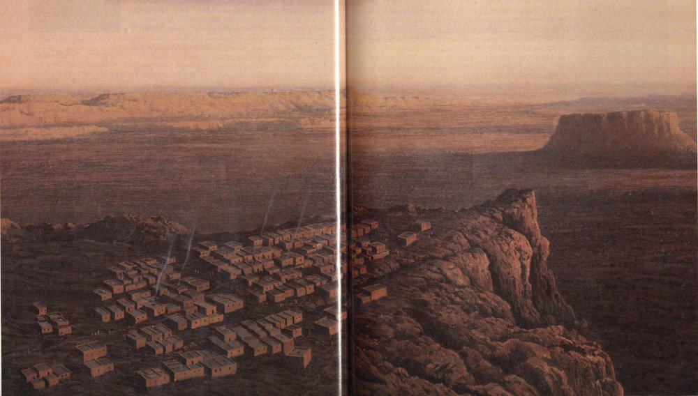
Acoma embodies a thousand years of Pueblo life. According to an origin belief, the first dwellers were guided here by Iatiku, “mother of all Indians.” Archeologists trace occupation to at least late Basketmaker times (AD 700). A few centuries later, ancestral Pueblos are living on top in houses of stone and adobe.
The native word for Acoma is ʔá-·k′u, a word of ancient root that means “place of preparedness.” In September 1540, Alvarado’s men arrived at the great rock and marveled at the sight of the village and its people (about 200) on top. “The village was very strong,” said a Spaniard, so difficult of access that no army could assault it.
The Acomans came down to the plain ready to fight the Spaniards. But when they saw that the intruders could not be frightened off, they offered peace and gave them food and deerskins.
This illustration is artist L. Kenneth Townsend’s interpretation of the village about 1540—a world outside time.
76
Pleasant encounters characterized the rest of the journey east. Alvarado sent a cross ahead of his party to the “province” of Tiguex (rendered Tiwa today), a concentration of 12 pueblos located on both sides of the Rio Grande in a broad valley at the foot of the abrupt Sandía Mountains. Thus prepared, retinues of important elders greeted them, decked out in ceremonial regalia and marching to the shrill piping of bone flutes. Presumably either Alvarado or Fray Padilla read them the requerimiento that made each town subject to the King of Spain. To this they added the Church’s authority by erecting in the villages they visited, as far north as Braba (Taos), large crosses made by Brother Luis de Ubeda with an adze and chisel he had brought along for this purpose. Reactions were surprising, perhaps because the Indians also used varieties of the cross pattern in some of their ceremonies. They eagerly bedecked Brother Luis’s Christian symbols with prayer feathers and rosettes made of plant fiber, sometimes climbing on each other’s shoulders to reach the tops of the cruciforms.
Impressed by Tiguex’s friendly people and stores of food, Alvarado sent Coronado a message suggesting that the recombined army winter there rather than in the high, cold lands of Cíbola. Then on he went across what is now called Glorieta Pass into the valley of the Pecos River.
There on a flat-topped ridge between a tributary stream and the main river was the finest pueblo the Spaniards had seen. The pattern was familiar: terraced houses rising four stories high around several plazas. Additional storage was provided in extensions running out from some of the corners of the main square. Balconies that provided walkways for the people on the upper floors served also to shade those beneath. Ladders running through holes in the walks served in the place of stairs. A constant need for firewood and building material had eliminated the forests for a mile or more around the pueblo, opening fine vistas of the high peaks of the Sangre de Cristo Mountains to the north, the red cliffs of Glorieta Mesa to the west, and the lower Tecolote foothills to the east.
By dominating the main trail linking the Plains Indians and the Pueblos of the Southwest, Cicuyé had become an even more powerful trade center than Háwikuh, and its people boasted that no enemy had been able to conquer them. But what of these bearded 77 strangers who, with their swords and horses, had overrun Háwikuh in a single rush? Acting perhaps on the advice of Bigotes and Cacique, the people of Cicuyé decided to be friendly. An unarmed delegation marched out beating drums, playing on bone whistles, and carrying gifts. They listened blankly to the reading of the requerimiento, which demanded their submission to the King of Spain, then let the strangers rest among them for a few days (meanwhile keeping their young women out of sight), and gladly furnished guides when Alvarado announced he wished to continue far enough east to see the “cows” and the people who lived among them.
The guides were Plains Indians. Though they have been called “slaves” of Bigotes and Cacique, it seems more likely they were traders who, having been stranded in Cicuyé after bartering their goods, earned their keep by performing menial tasks while waiting for an opportunity to return home. One was named Ysopete, and may have been—accounts vary—the youth whose chest bore the tattoo of a buffalo. A Wichita Indian from central Kansas, Ysopete designated his homeland as Quivira: thus a new word in American mythology. With him was El Turco, the Turk, so-called by the Spaniards “because,” wrote Pedro de Castañeda, “he looked like one.” The resemblance probably arose from his turban, a headdress used by the Pawnees of eastern Kansas, or, in the Turk’s language, Harahey.
Shortly after reaching the plains east of the Pecos River, Alvarado’s explorers found themselves in the middle of a vast herd of buffalo. Lancing the huge beasts from a running horse and afterwards dining on the tender, roasted meat of their humps made for high living, but the sport was soon forgotten in a greater excitement. The Turk said he knew where there was gold. In Quivira. And even more in Harahey.
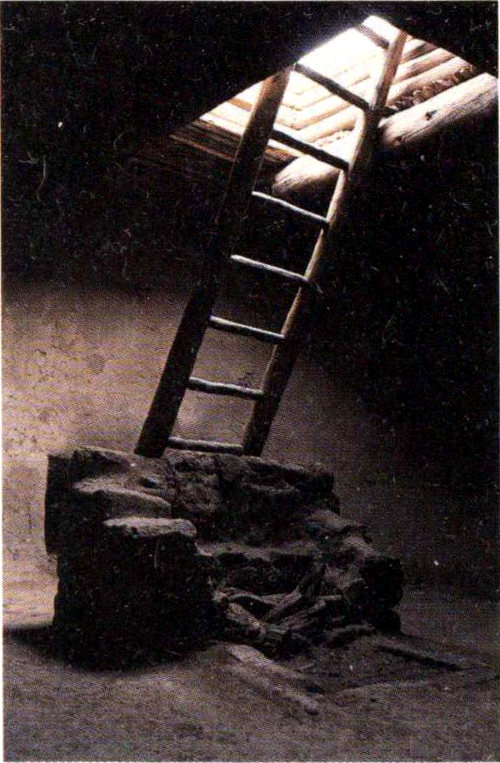
This ancient pueblo kiva at Pecos is one of two restored kivas in the park. At center is the firepit and stone draft deflector.
Did the Pawnee (if he was a Pawnee) really say that? Some anthropologists, Carroll Riley and Mildred Mott Wedell among them, have wondered. As a trader, the Turk knew a smattering of Nahuatl, as did the missionary friar, Juan de Padilla, one of his chief interrogators. To this stumbling lingua franca, El Turco added the fluent sign language of the Plains Indians, bits of which the Spaniards were beginning to pick up, though not as skillfully as they thought. Moreover, the talkers on both sides were discussing 78 ideas and objects the others know nothing about. These opportunities for misunderstanding were immeasurably increased by the determination of Juan de Padilla to find the legendary Seven Cities of Antilia.
A word about Padilla. He had served as a soldier under Cortés in Mexico until deciding to enter the Franciscan order. He was hot-tempered, obstinate, and consumed with the hope of bringing the lost citizens—the wealthy, Christian citizens—of Antilia back into the mainstream of Catholicism. He believed implicitly that their gorgeous metropolises lay somewhere in the north. Meager Háwikuh and the Hopi villages had shocked him profoundly, but word of true urban centers farther east—Quivira!—reinvigorated his faith. He talked earnestly to the Turk about the kind of places he wanted to discover and listened with intense preconceptions to the trader’s answers.
Out yonder, the Turk told him, was a wide river full of fish as big as horses. The canoes on the river held 20 or more rowers to a side, and their lords sat in the sterns under brilliant awnings. This tale corresponds with what the Gentleman of Elvas said about the canoes De Soto saw on reaching the Mississippi half a year later. So maybe El Turco had witnessed, during his wanderings, the Indian flotillas of the lower Mississippi and the fish as well—gar can reach 10 feet in length. The chiefs of the canoe tribes, he went on, were lulled to sleep by little bells of gold (acochis) tinkling in the breeze. They ate (a standard fantasy) from dishes molded out of acochis. But acochis, it developed years later, was a Spanish rendering of hawichis, a generic Pawnee term for any metal. Copper, perhaps? It was rare on the Plains and in the Southwest, but there was some and it was displayed conspicuously by important men.
That may be all the Turk said at first. But it was not all that Padilla and the rest of Alvarado’s explorers heard. They harassed the Indian for proof that he was telling the truth. Frightened, eager to get them off his back, and desirous, possibly, of causing trouble for Bigotes, whom he may not have liked, El Turco said he had once owned a bit of acochis, but that Whiskers had taken it from him. The Spaniards understood that the object was a bracelet.
By then the autumn days were growing cold, and it was time for Alvarado to rejoin the army assembling in the Rio Grande Valley. On his way back through 79 Cicuyé, he confronted Bigotes and Cacique with El Turco’s charge. They said they know nothing about the matter. Reluctant to set himself up as judge without Coronado’s authorization, Alvarado seized the pair, put them in chains—as he later did the Turk and Ysopete when the one-time guides sought to disappear—and hurried out of the pueblo through a shower of curses and arrows hurled after him by the outraged inhabitants.
In Tiguex, too, affability had vanished. To provide shelter for the main army, which was moving eastward in sections, an advance group under hard-fisted Garcia López de Cárdenas had turned the people of Alcanfor pueblo out of their homes to find whatever refuge they could in neighboring towns. Coronado, who had taken a portion of the troops on a swing through the pueblos northwest of Tiguex, had just moved into the new quarters when Alvarado appeared with his captives. Immeasurably relieved by the thought that the costly expedition still might succeed, the general told Padilla, aflame with visions of the Seven Cities, and Alvarado to get the truth from Bigotes however they could. The inquisitors took him into a snowy field and set a war dog on him. Partly it was bluff; the victim was scarred but not disabled. Cacique, too, was attacked by a dog but less severely because of his age. Throughout the ordeal, which created deep resentment along the Rio Grande, both men persistently denied all knowledge of gold.
No dogs were set on the Turk. Though he, along with Ysopete, was also kept in chains so that he would be on hand when needed in the spring, his veracity was not questioned. For if the Turk was not believed, the expedition lost its meaning.
Until spring did arrive, survival was the goal. At first the Spaniards paid for the blankets, warm clothing, and food they requisitioned. Later, when the Indians, who had little surplus, held back, foraging parties roamed far and wide, taking what they desired without recompense, including in at least one case, a Puebloan’s wife.
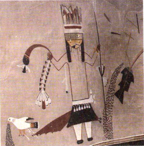
Restored kiva of Kuaua pueblo, now preserved at Coronado State Park, Bernillilo, N.M. This village was long thought to be the Alcanfor pueblo that Cárdenas occupied. Though excavations in the 1930s failed to prove the speculation, the diggers did find these extraordinary kiva murals.
Sensing correctly that the horses were the Spaniards’ main strength, the Indians struck at one part of the herd, killing two dozen or so animals and stampeding many others. Such attacks could portend disaster. With Coronado’s blessing, Cárdenas stormed Arenal, the center of resistance. After breaching the 80 walls with battering rams, the Europeans lighted smudge fires around the houses. As the gasping Indians fled into the open, making signs of peace, mounted horsemen struck down many. Others were tied to stakes and burned alive—a scene the Turk, Ysopete, and Bigotes were forced to watch so that they could tell the people of their villages what happened to rebels.
The episode occurred in December 1540. Shortly afterwards, the main part of the army appeared, worn out by forced marches through heavy snowstorms, but excited by rumors of gold, for the Turk, who by then knew more about the lusts of the invaders than they knew about him, was elaborating on his tales. With little to talk about but warm weather and wealth, the force lost its hold on reality and, like De Soto’s, disintegrated into a kind of insensate organism responding only to the dynamics of survival. When a new center of resistance developed at a pueblo called Moho, the Spaniards burned the town after a long siege, killed many of the men who tried to flee, and made captives (as the requerimiento threatened) of more than a hundred women and children.
Some ambiguity surrounds Coronado’s part in these and other suppressions of “revolt.” Though he was the army’s commanding general, he apparently was never in the field during the moments of greatest carnage. He later testified he never authorized the burning of settlements or the use of dogs in battle. He personally took old Cacique back to Cicuyé and handed him over to his people, promising to release Bigotes as well when the army went through on its way to golden Quivira.
There was a practical side to the generosity, of course. He did not want a hostile fort astride his back trail when he made his final advance. Emphasize final. He badly needed a triumph to save himself from bankruptcy and to make the king’s audiencia understand that what seemed atrocities had been necessary steps on the way to treasure for the empire.
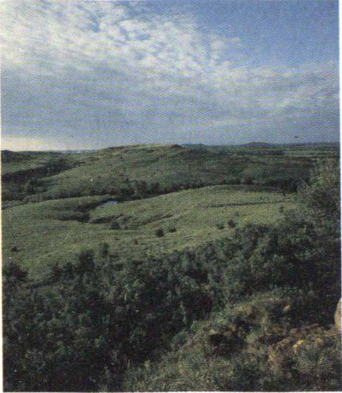
Coronado’s search for Quivira took him as far east as central Kansas. Fragments of chain mail armor found at several sites point to a Spanish presence in the 16th century. Coronado’s men very likely saw country like this near Lindsborg, Kansas.
The eastern advance began April 23, 1541. (Fifteen days later De Soto, heading west, sighted the Mississippi.) Bedlam marked much of the Spaniards’ travel, especially during the daily making and breaking of camp. There were about 300 white soldiers, other hundreds of Mexican Indian allies, some with 81 women and children, a herd of a thousand horses, 500 beef cattle, and 5,000 sheep—or so says Castañeda, possibly with exaggeration. The people of Cicuyé, seeing the mass advancing under a shroud of dust and remembering the fate of Arenal and Moho, became friendly again. They received Bigotes with rejoicing and heaped supplies on his one-time captors—anything to get the invaders moving on.
For many miles the Turk led the army east toward the Canadian River, along the path he had shown Alvarado. They saw so many buffalo—charging bulls killed a few horses—that Coronado would not venture guessing at the numbers. They fell in with a meticulously described, to the joy of future anthropologists, band of nomad Querechos, perhaps forerunners of the Apaches. As spring waned, they found themselves in the Texas Panhandle, atop the featureless immensity of the Llano Estacado, the Staked Plains.
At that point, the Turk, who the previous fall had told Alvarado that Quivira lay northeast, turned southeast. Why? Was he heading toward the lower Mississippi and the kind of civilization he thought the Spanish wanted? Or had he, during the pause in Cicuyé, agreed with the people there to lead the invaders into a trackless part of the plains where they would become lost and, deprived of maize, would starve.
Ysopete, who seems to have developed an acute antipathy for the Turk and who was anxious to reach his home in Kansas, warned Coronado he was being misled. Alvarado voiced suspicions. Coronado, however, clung to his necessary faith in the Turk until they reached a point where the abrupt eastern escarpment of the Staked Plains drops into almost impassable badlands. There at last he put the Turk in irons and turned the piloting over to Ysopete, assisted by some local Teyas Indians.
All this had taken precious time. To speed things along and to make food easier to procure, Coronado ordered the main army to return to Tiguex while he and 30 picked riders, 6 foot soldiers, Juan de Padilla, and a few mule packers scouted out Quivira.[4]
Traveling light and sparing their mounts, Coronado’s group rode northeast for a month. They reached the River of Quivira (now the Arkansas) not far below present-day Dodge City, Kansas, and followed it, still 82 northeast, to its Great Bend, where they left it. A little farther on they found the first Quivira (Wichita) village, a cluster of domed huts built of stout frameworks of logs overlaid with grass, so that they looked like haystacks. The surrounding land, rolling and fertile, produced fine corn, pumpkins, and tobacco. But no gold.
There were another 24 or so similar villages in the kingdom of Quivira. The Spaniards spent nearly a month riding disconsolately among them, gradually absorbing the truth that riches of the kind they wanted lay neither here nor, as far as they could learn, further east. (During the same period., De Soto was arriving at the same opinion while wandering through parts of Arkansas.) Angry questions were inevitable. Why had the Turk sought to mislead them both with his tales and his guidance? Under pressure he said the people of Cicuyé had put him up to it on the supposition he could lure the invaders to their doom. Perhaps they had. Or perhaps El Turco was simply trying, in his extremity, to shift blame.
The last straw came when Ysopete, El Turco’s enemy, said the Pawnee was trying to stir up the Quivirans against the Spaniards. Acting on Coronado’s orders, a party of executioners strangled and buried him, secretly at night lest the Quivirans be aroused.
There were no repercussions. Guided by several young Quivirans, the scouts returned by a direct route to the Rio Grande Valley, arriving in mid-September. In Coronado’s mind, the absence of treasure was conclusive, but among those who had not gone to Quivira were many who believed that if the scouts had continued eastward, they would have found the Seven Cities. Coronado agreed half-heartedly to make another attempt the following spring, but fate intervened. During a horse race with a friend, his saddle girth broke and he was thrown under the hooves of his opponent’s mount. Though his body gradually recovered, his spirits did not. After another miserable winter in Alcanfor, he ordered the army to start home. He was carried much of the way in a litter swung between two mules hitched in tandem.
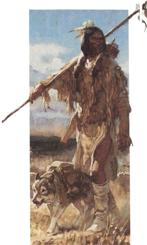
On the great plains Coronado encountered a nomadic people he variously called “Teyas” and “Querechos.” They were the buffalo-hunting Apaches, who followed the migrating herds, packing their goods from place to place on travois hauled by dogs. They impressed the Spaniards more than any Indians they had met. “They are a gentle people, not cruel,” wrote the expedition’s chronicler of the Apaches, “faithful in their friendship, and skilled in their use of sign.”
By dying, De Soto escaped being tried for failure. Not Coronado. He was investigated for derelictions in connection with an Indian rebellion that swept his province immediately after his departure, for mistreating the Indians of Tiguex, and for failing to press 83 on beyond Quivira. Every enemy he had and a pack of opportunists and publicity hunters in quest of an audience took the stand against him, often blurting out scandalous rumors that had nothing to do with the case. Ill, his mind cloudy, he testified poorly in his own defense. But he had supporters, too, and in the end, largely through the help of Viceroy Mendoza, he was cleared of all legal charges. Though he lost the governorship of Nueva Galicia and some of his property there, he retained his seat on Mexico City’s council until his health, poor since his return, broke completely. He died on September 22, 1554, aged 44.
There is a footnote. A few Mexican Indians stayed in Háwikuh and Cicuyé and a survivor or two were found in those towns when Spanish exploration of the Pueblo country resumed four decades later. Some religious people also stayed. One, old Fray Luís de Ubeda, the builder of crosses, settled at Cicuyé, hoping to spread Christianity by baptizing children. His fate is unknown.
Fray Juan de Padilla’s tale is more dramatic. Obsessed with saving Indian souls by bringing them to the Church and dreaming still of the Seven Cities, he accompanied the young Quiviran guides back to their homes from the Rio Grande. Helping him drive along some pack mules, a horse, and a flock of sheep were two Indian donados of Mexico named Lucas and Sebastián, Andrés do Campo, a Portuguese, a black “interpreter,” and a handful of servants. (Indians were not allowed to become full-fledged friars, but if they were “donated” to the Church by their parents, they could, as donados, serve as assistants.)
The missionary adventure was short-lived. While attempting to press on east of Quivira, the group was attacked by unidentified assailants. Padilla died, bristling with arrows. Do Campo, the two donados, and perhaps some others escaped. Separated, the donados and do Campo traveled along different routes from tribe to tribe for at least four years until at last they reached Pánuco, Mexico—trips as astonishing but far less famed than the odyssey of Cabeza de Vaca, whose cross-continental traverse had put all these ill-fated land expeditions into motion. And so, except for the salt-water adventures of Juan Rodríguez Cabrillo, the epics had reached full circle.
84
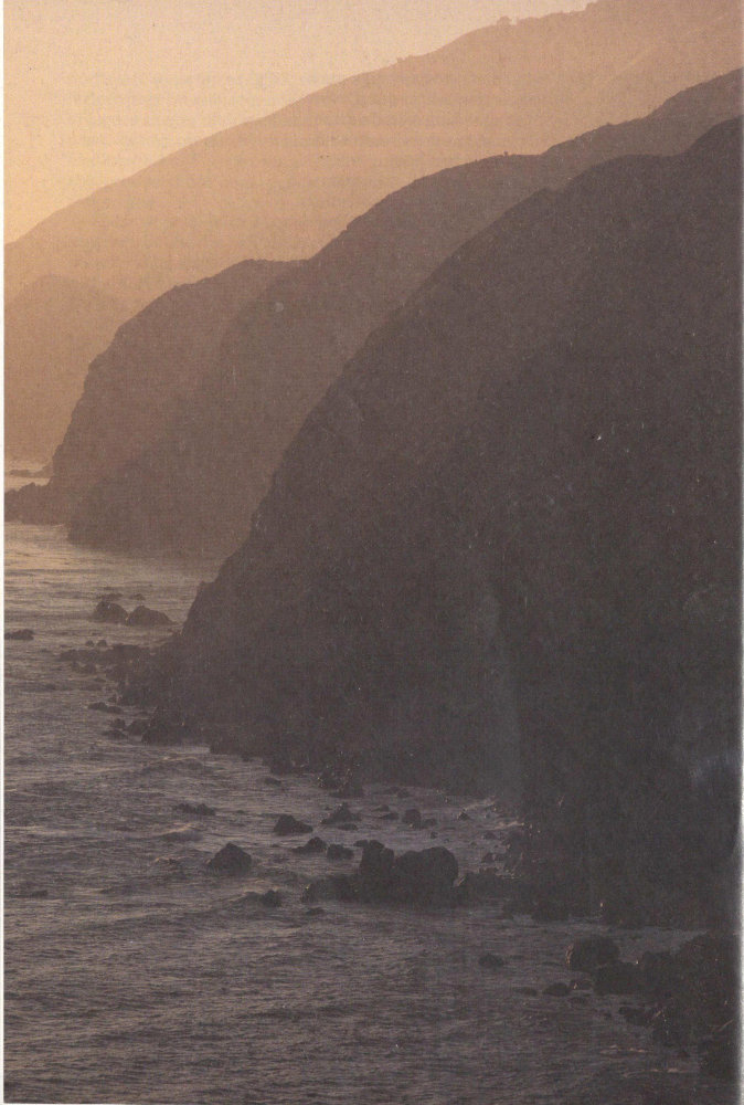
Cabrillo’s voyage of discovery carried him past California’s Big Sur. In four centuries, this coast has lost none of its enchantment.
85
The Seafarers
History has preserved only dim outlines of the remarkable career of Juan Rodríguez Cabrillo, who died in 1543 while attempting to complete the first exploration of California’s coastline. Though he is generally supposed to have been Portuguese, the evidence is too scanty to be sure.[5] There is no firm agreement about the cause or place of his death. He is variously reported to have used two, three, and even four vessels on his great exploration. Even his name has invited speculation. It appears on the few surviving documents he signed in the abbreviated form Juan Rodz. (The Portuguese spelling would normally end in “s,” the Spanish in “z.”) What then of Cabrillo, which means “little goat”? Was it an affectionate nickname that he liked and used informally to distinguish himself from numerous other Juan Rodríguezes, a name as common in Hispanic countries as John Smith is in English-speaking regions? In any event he should be known formally as Juan Rodríguez. The name Cabrillo is, however, so firmly fixed in California history that it will be used in this account.
Whatever his name and origin, Juan Rodríguez Cabrillo learned seafaring in his youth. He arrived in Cuba in the second decade of the 1500s, perhaps as a sailor or, because of his age, as a page. Yet he apparently joined the Narváez expedition that was dispatched from Cuba to arrest Cortés as a crossbowman. Like most of his companions, he deserted Narváez and joined Cortés at Vera Cruz and afterwards survived the grisly noche triste when the Aztecs drove the Spaniards from their capital at Tenochtitlán. Immediately thereafter his chance came to display his nautical skills.
Cortés knew that if he were to recapture lake-bound Tenochtitlán, he would have to control the causeways that linked the city to the mainland. That meant building enough small brigantines to overpower the Aztec war canoes that had harried the retreating 86 Spaniards so mercilessly during the noche triste. According to the soldier-historian Bernal Díaz del Castillo, Cortés put Cabrillo in charge of four “men of the sea” who understood how to make pine tar for caulking ships. But was that all the younger warrior did? Seamen were needed in all phases of the operation, beginning with the prefabrication of thirteen brigantines 50 miles from the capital and then transporting the pieces on the backs of at least 8,000 porters to the shores of the lake, where they were reassembled.
Each brigantine was manned by a dozen oarsmen, who also handled the sails. Each carried several crossbowmen and arquebus marksmen. The little fleet was important enough that Cortés took charge in person. A fortuitous wind enabled the brigantines to hoist sails and smash with devastating effect into a massed gathering of Aztec canoes. Afterwards they fought a dozen fierce skirmishes while protecting the footmen on the causeway—opportunity enough for a good sailor and fighter to catch the general’s eye, if indeed Cabrillo was in the fleet, as he well may have been.
Tenochtitlán regained, the actual conquest of Mexico began. Small bands of Spaniards, reinforced by numerous Indian allies, radiated out in all directions. It is known that Cabrillo participated as an officer of crossbowmen in the conquest of Oaxaca. Later he joined red-bearded Pedro de Alvarado, cousin of Coronado’s officer, Hernando de Alvarado, in seizing Guatemala and El Salvador. During those long, sanguinary campaigns Cabrillo performed well enough that he was rewarded with encomiendas in both Guatemala and Honduras.
An encomienda was a grant of land embracing one or more Indian villages. In exchange for protecting the village and teaching the inhabitants to become Christian subjects of the king, the encomendero was entitled to exact taxes and labor from them. Most grant holders ignored duties while concentrating on the privileges. What kind of master Cabrillo was does not appear. Anyway, for the next 15 years his Indian laborers grew food for slaves he had put to work in placer mines on his lands and in the shipyards he supervised on Guatemala’s Pacific coast. He traded profitably with Peru and meanwhile enriched his personal life by taking an Indian woman as his consort. 87 With her he fathered several children. Later he brought a Spanish wife—Beatriz Sánchez de Ortega—into his extensive and, for the time and place, luxurious household.
Successful shipbuilding helped keep the excitement of the conquistadors high, for if the world was as small as generally believed, China, the islands of Indonesia, and the Philippines, discovered by Magellan in 1521, could not be far away. There might be other islands as well, ruled by potentates as rich as Moctezuma or inhabited by gorgeous black Amazons who allowed men to visit them only on certain occasions and afterwards slew them. There was that mythical “terrestrial paradise” called California in a popular romance of the time, Las Sergas de Esplandián. According to the author, seductive California was ruled by dazzling queen Calafia, whose female warriors wielded swords of gold, there being no other metal in the land, and used man-eating griffins as beasts of burden. What a spot to find!
The ships charged with searching for these places were built of materials hauled overland (except for timber) from the Atlantic to the Pacific by Indian bearers. The vessels were small, ill-designed, cranky, and often did not have decks. Nevertheless, ships sent out into the unknown by Cortés during the early 1530s discovered a strip of coast the sailors believed was part of an island. They were the first, probably, to refer to it as California, perhaps in derision since the desolate area was so totally different from the paradise described in the romance. The notion of nearby Gardens of Eden persisted, however, and interest soared again when Cabeza de Vaca’s party reached Mexico in 1536 with tales of great cities in the north.
Cortés, who considered himself the legitimate adelantado of the north, tried to cut in on Mendoza’s plans to exploit the Vaca discoveries. Rebuffed, he defied the Viceroy by dispatching three ships under a kinsman, Francisco de Ulloa—one of the vessels soon foundered—to search for a sea opening to the lands of Cíbola. Finding himself locked in a gulf, Ulloa retreated along the eastern edge of the 800-mile-long peninsula that we call Baja California, rounded its tip and continued north to within 130 miles or so of the present U.S.-Mexico border. No inlets. His ships battered by adverse winds and his men wracked by 88 scurvy, he returned to Mexico, only to be murdered, it is said, by one of his sailors.
The only man remaining who could have saved Cortés’s dimming star was his old captain, Pedro de Alvarado, then governor of Guatemala. Dreaming of still more wealth in the sea, Alvarado, too, had built a pair of shipyards on the Pacific coast and had put Juan Rodríguez Cabrillo in charge of creating vessels out of materials dragged overland by Indians from the Atlantic. In 1538 Alvarado went to Spain and returned with 300 volunteers and a license to conquer any islands he found in the South Seas. By then he commanded 13 vessels, several of which had been built by Cabrillo. In the fleet were three galleons of 200 tons each, one of which, the San Salvador was owned and piloted by Cabrillo; seven ships of 100 tons, and three lesser brigantines. If Alvarado had thrown in with Cortés ... but prudence dictated that he consult first with Mendoza, who had already invested some money in the building of the armada. So he took the fleet north to the port of Colima, due west of Mexico City and left it at anchor there, under Cabrillo’s watchful eye, while he went inland to dicker with the Viceroy.
In the end Mendoza and Alvarado agreed to share equally in the expenses and profits of a double venture: they would send some ships west to the Philippines and some north to Cíbola and then on to a strait called Anian, which supposedly sliced through the upper latitudes of the continent. The arrangements, which ignored Cortés’s claims, sent the aging conquistador hurrying to Spain in 1540 in search of justice, as he defined justice. He never returned.
Alvarado had no opportunity to exploit the newly opened field. When an Indian revolt broke out in provinces of Jalisco and Michacán, the viceroy called on Alvarado to bring in his volunteers as reinforcements. During an engagement in the summer of 1541, a horse lost its footing on a steep hillside, rolled down and crushed Alvarado to death.
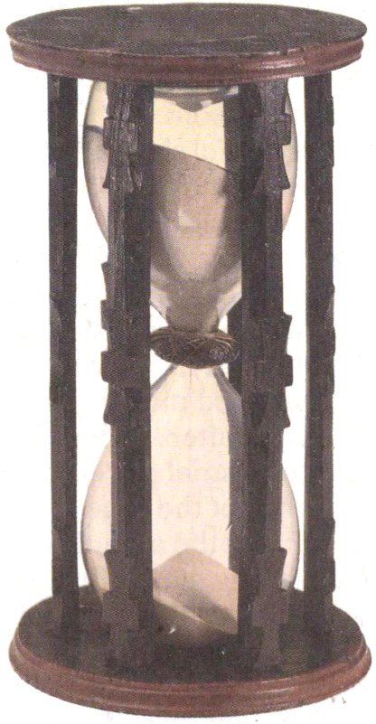
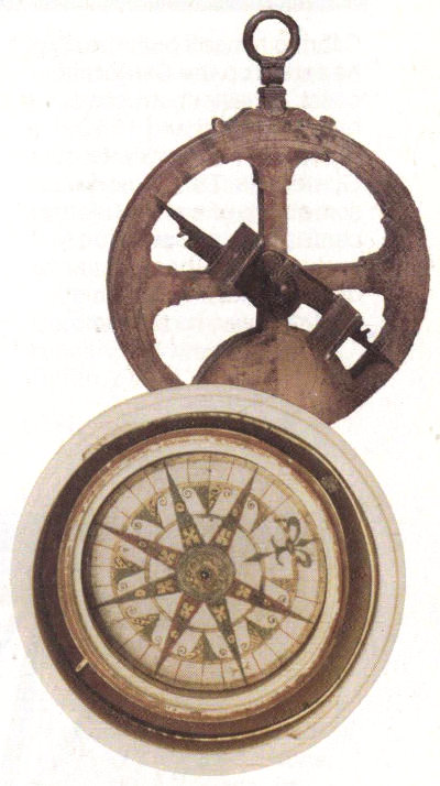
Navigation was still in its infancy in Cabrillo’s day. Mariners sailed by “dead” reckoning, a method of figuring location by multiplying time by estimated speed over a given course. The main instruments were the compass, the hourglass, and the astrolabe. None of these devices was exact, and charts and mathematical tables were often inaccurate. Hence mariners sailed as much by instinct as by science. Skill often meant the difference between a successful voyage and wreck.
Onerous problems followed. Alvarado’s estate had to be put in order; ships had to be refitted; the chaos of an earthquake at Santiago, Guatemala, headquarters of Cabrillo’s holdings, had to be confronted. In due time Mendoza acquired control of the fleet, including the use of Cabrillo’s San Salvador, and in 1542 launched the major explorations previously 89 agreed on. Ruy Lopéz de Villalobos took ships to the Philippines. On June 27 of that same year Cabrillo headed north with three vessels: San Salvador, which he captained; Victoria, commanded by pilot Bartolomé Ferrer (a pilot ranked just below a captain and was far more than a mere guide); and San Miguel, a small brigantine used as a launch and service vessel. It was commanded by Antonio Correa, an experienced shipmaster. More than 200 persons were crowded aboard the three vessels.[6]
Because both Ulloa and Alarcón had reported that the Sea of Cortés was a gulf, Cabrillo made no effort to follow the mainland north, but led his ships directly toward the tip of the peninsula, calling it California without comment, as though the name was already in current use. For nearly three months they sailed along Baja’s outer coast, bordered much of the way by “high, naked, and rugged mountains.” Because they were looking for a river entrance to the interior and for a strait leading to the Atlantic, they sailed as close to land as they dared, constantly tacking in order to defeat the contrary winds and the Pacific’s erratic currents.
About August 20 they passed the most northerly point (Punta del Engaño) reached by Ulloa. A little farther on, where the land was flat, they beached the vessels to make some necessary repairs and, while exploring the neighborhood, found a camp of Indian fishermen. The native leaders, their bodies decorated with slashes of white paint, came on board, looked over the sailors and soldiers and indicated “they had seen other men like them who had beards and had brought dogs, ballestas [crossbows] and swords.” Since there was no mention of horses, the strangers probably had come from ships. Ulloa’s men of 1539? Hernando de Alarcón’s of 1540? Or a later party, for there had been talk of Alarcón’s returning for another venture inland. Mystified, Cabrillo entrusted the Indians with a letter for the bearded ones.
They relaunched the ships and another month dragged by—crosswinds, headwinds, calms. Cabrillo took constant sightings of sun and stars with his massive astrolabe, no small task for he had to stand with his back braced against a mast for steadiness on the heaving deck while he called out the readings that were to be recorded in the log. Speed was computed by throwing a wooden float over the stern and counting the marks flashing by as the line holding it unwound from its reel. Compasses were used, but magnetic declinations were not well understood. All of Cabrillo’s longitudes and latitudes were wide of the mark, but the fault was not entirely his or his instruments. He began his reckonings at a point inaccurately observed by others. Even the precise location of Mexico City was unknown in 1542.
90
San Salvador, Cabrillo’s Flagship
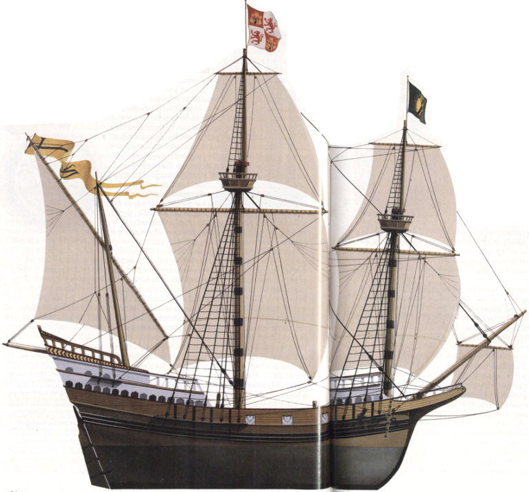
Cabrillo himself built the ship he sailed up the California coast. It was constructed between 1536 and 1540 at Iztapa on the west coast of Guatemala. This region was something of a shipbuilding center, with a reputation for better quality than the yards of Seville, Spain. Much of the labor was furnished by Indians and black slaves, whole villages of whom were conscripted to portage supplies, raise food, cut lumber, trim timbers, and make pitch, rope, and charcoal.
San Salvador was a full-rigged galleon, with an approximate length of 100 feet, a beam of 25 feet, and a draft of 10 feet. The crew numbered about 60: 4 officers, 25 to 30 seamen, and 2 or 3 apprentices, and two dozen or so slaves, blacks and Indians. On the voyage to California, San Salvador also carried about 25 soldiers and at least one priest. The ship was armed with several cannon.
Ship’s fare was wine, hard bread, beans, salt meat, fish, and anything fresh picked up along the way, all washed down by mugs of wine. Officers, who probably brought along food of their own and servants to prepare it, ate better. Slaves lived off rations of soup and bread and scraps left by others.
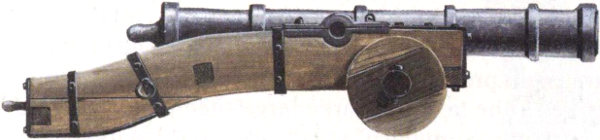
The ship’s cannon probably resembled this Lombardo of the period. It fired a stone ball about 3½ inches in diameter.
This illustration by John Batchelor is based on the research of Melbourne Smith.
92
On September 28, three months after leaving Mexico, the ships crossed the future international border and put into a “very good enclosed port, to which they gave the name San Miguel.” It was our San Diego.
The Indians there were afraid. That evening they wounded, with arrows, three men of a fishing party. Instead of marching forth in retaliation, Cabrillo sailed slowly on into the harbor, caught two boys, gave them presents, and let them go. The kindness worked. The next day three large men partly dressed in furs (the “Summary” says) came to the ship and galloped around to illustrate horsemen killing Indians far inland. Melchior Díaz, fighting Yumans during his crossing of the Colorado in the fall of 1540? Or had word of Coronado’s battles at Háwikuh and on the Rio Grande trickled this far west along the trade trails? In any event, Europeans were no longer a mystery. On three more occasions Cabrillo picked up rumors of Spaniards in the interior.
After easily riding out the first storm of the season in the harbor, the ships sailed on, pausing at Avalon on Santa Catalina Island and later at the island we call San Clemente. Along the way they remarked on the many flat-lying streamers of smoke from Indian villages near San Pedro and, later, Santa Monica Bays (warnings, unrecognizable then, of temperature inversions and smog). Somewhere near modern Oxnard, they spent a few pleasant days with Chumash Indians, admiring their big, conical huts and their marvelous plank canoes. Tantalized by a fresh rumor of Spaniards near a large river (the Colorado?), Cabrillo sent out a letter in care of some Indians “on a chance.” But where the river reached the coast, if it did, he could not learn.
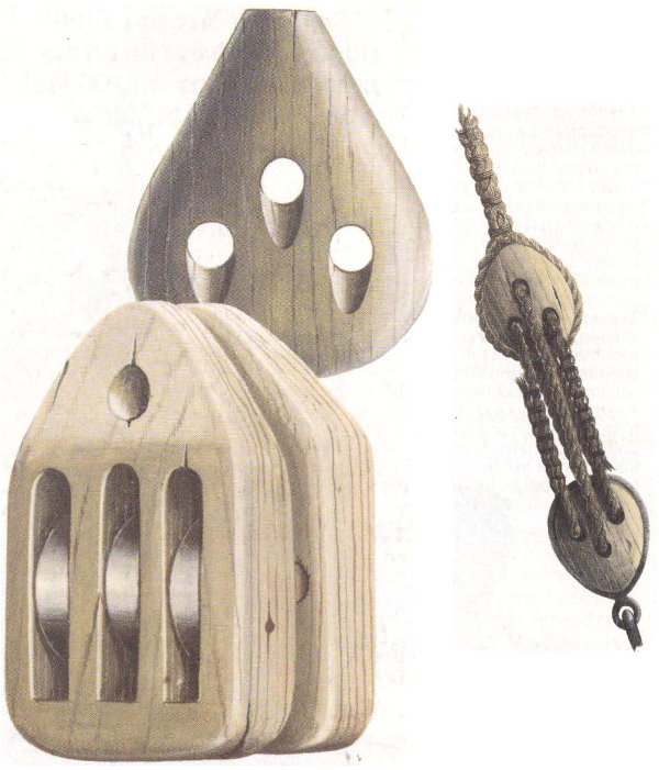
A deadeye and a triple-purchase block of the type used on San Salvador. Deadeyes and lanyards were employed in fixed rigging, frequently to secure shrouds that supported the mast; on the right is a typical setup, by which lines were tightened and secured to the vessel’s frame. A block and tackle were essential for hoisting heavy yards. Drawings by John Batchelor.
The coast from Oxnard to Cabo de Galera (our Point Conception) runs roughly east and west for nearly a hundred miles before bending sharply north. This stretch was heavily populated. Many canoes traveled alongside the ships, and there was a great 93 deal of calling back and forth and exchanges of gifts. A string of islands, also populated, paralleled the shore, forming what is now called the Santa Barbara Channel. On October 18 the Spanish ships endeavored to round Cabo de Galera but were blown by strong winds out to the westernmost of the Channel Islands, one the mariners had not yet explored. They named it Posesión (it is now San Miguel) and remained in the shelter of Cuyler’s Harbor for about a week.
The idyllic days were over—and so, in many critical ways, is agreement between Juan Páez’s “Summary” of Cabrillo’s log and the testimony about the trip given in 1560 to the audiencia of Guatemala by Lázaro de Cárdenas and Francisco de Vargas, both of whom told the court they had been on the trip.
During the stay on Posesión, according to the “Summary,” Cabrillo fell and broke his arm near the shoulder. In spite of that, he resumed the journey, rounded Point Conception, was again driven back, tried once more, and in mid-November succeeded. The fleet soon reached the rugged Santa Lucia Range, in which William Randolph Hearst four centuries later built fabulous San Simeon. For the mariners it was a heart-stopping area—“mountains which seem to reach the heavens.... Sailing close to the land, it appears as though they would fall on the ships. They are covered with snow.”
They may have sailed as far as the vicinity of Point Reyes, a little north of San Francisco Bay, or they may have gone no farther than Monterey Bay, where they almost certainly anchored on November 16. Whatever their northernmost point, they turned back, probably because of bad weather, possibly because of Cabrillo’s sufferings. On November 23 they once again landed on San Miguel Island. There, sensing he was about to die, Cabrillo made the pilot, Bartolomé Ferrer (or Ferrelo in some accounts) swear to continue the explorations. On January 3, 1543, he perished and was buried on the island.
Or was he? In 1901, an amateur archeologist, Philip M. Jones, found on Santa Rosa Island, just east of San Miguel, an old Indian mano, or grinding stone, into one of whose sides a cross and the fused initials JR had been incised. The stone was stored in a basement at the University of California, Berkeley, until 1972, when Berkeley’s noted anthropologist, Dr. Robert Heizer, began wondering whether the curiosity might have once marked Juan Rodríguez’s grave. So far extensive examinations have determined nothing about this additional mystery.
94
The Chumash: Village Dwellers
The Indians that Cabrillo encountered along the Santa Barbara coast were the village-dwelling Chumash. Their villages were groupings of houses, according to a later traveler, with a sweat-house, store-rooms, a ceremonial plaza, a gaming area, and a cemetery some distance off. The houses were cone-shaped, spacious and comfortable. A hole in the roof admitted light and vented smoke from cook fires. Apart from the brief skirmish at San Diego Bay, Cabrillo found the California Indians a gentle, friendly people.
Two views of the Chumash:
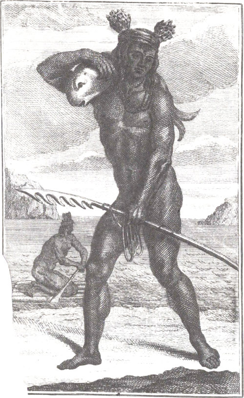
An early illustration of two fishermen, from George Shelvocke’s Voyage Around the World, 1726.
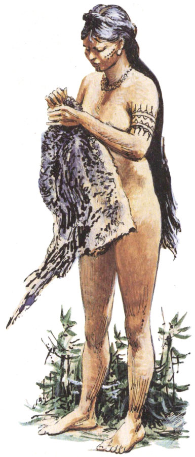
Artist Louis S. Glanzman’s drawing of a woman with a garment. “They were dressed in skins,” said Cabrillo’s diarist, “and wore their hair very long and tied up with long strings interwoven with the hair ... attached to the strings were many gewgaws of flint, bone, and wood.”
95
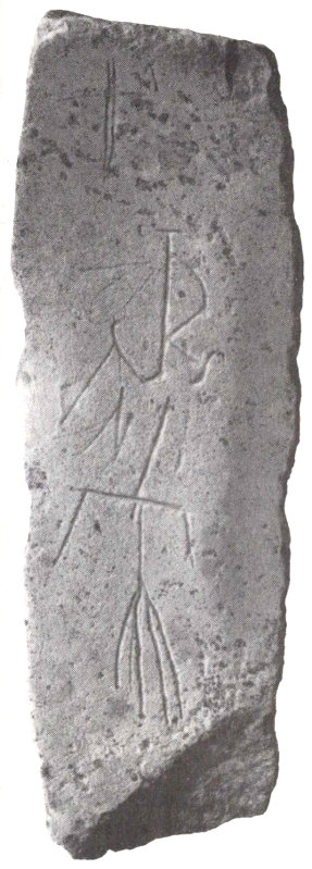
This stone found on Santa Rosa Island may have once marked the burial place of Cabrillo.
And then there is the testimony of Cárdenas and Vargas in 1560. They said, without giving dates, that Cabrillo decided to winter on Posesión, which the witnesses called La Capitana, and that on stepping ashore from the ship’s boats he fell between some rocks, broke his shin bone, and died 12 days later. Vargas adds that the fall resulted from Cabrillo’s hurry to help some of his men, who were battling Indians. A splintered shin bone with its possibilities for gangrene sounds more deadly than a broken arm.
On February 18, 1543, after beating around the Santa Barbara Channel for more than a month, exploring and taking on wood and water, Ferrer resumed the trip, as Cabrillo had asked. Standing well out to sea, he scudded north until on March 1 he was opposite—who knows? Cape Mendocino? The California-Oregon border? The mouth of the Rogue River? Wherever they were, the sea, breaking over the little ships with terrifying fury, was driving them irresistibly toward the rock-punctuated shore. They prayed fervently, and suddenly the wind shifted, driving them south “with a sea so high they became crazed.” The storm separated the ships, San Salvador ran out of food, and the sailors were in dire straits until they were able to land at Ventura and later San Diego, where, in addition to food, they also picked up a half a dozen Indian boys to train as interpreters in case of a repeat journey.
Miraculously, the ships rejoined at Cedros Island off Baja California, and on April 14, 1543, they reached Navidad, nine and a half months after their departure. There was no repeat journey. Like De Soto and Coronado, they had located neither treasure nor shortcuts to the Orient. After that, no one else wanted to try, and Spain’s first great era of exploration of the United States came to an end.
96
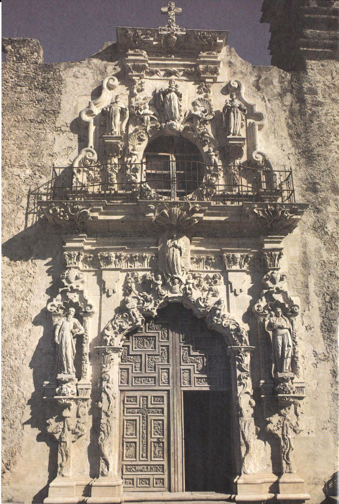
Mission churches were the vanguard of Spanish civilization in the Southwest. They softened the imperatives of the state and eased inexorable cultural transitions. San Jose Mission was established along the San Antonio River in 1720. Still an active parish, the mission today is a unit of San Antonio National Historical Park, Texas.
97