8. Around the Coast. From Morwenstow to Land's End.
Reading edition
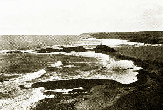
Bude Breakwater
This noble coast—so terrible to sailors—begins with the fine Henna Cliff at Morwenstow. Morwenstow Church contains an early font and has fine Norman arches. Here is Tonacombe, an interesting early Tudor house quite unspoiled. At Morwenstow lived the Rev. Robert Hawker, a poet and character. Bude Haven is a growing seaside place, with golf-links and tolerable bathing. Stratton, of which parish it actually forms or did form a part, has a fine well-cared for church, and above the town is Stamford Hill, where was fought a battle in the Civil War, on May 16, 1643. Sir Bevil Grenville and Hopton commanded the Royalist Army, and the Earl of Stamford the Parliamentarians. The latter were defeated with the loss of 300 men killed and 1700 taken prisoners. One of the old guns marks the site, and an inscription in commemoration of the battle is affixed to the Tree Inn. Widemouth Bay has good sands and promises at some future day to become a sea-bathing place superior to Bude. At Dazard the cliffs are fine; at St Gennys is Crackington Cove with a small beach. Beyond this, High Cliff (705 ft.) is reached, the loftiest headland on the coast. The coast is magnificent to Boscastle. Near this is Pentargon, a beautiful bay into which a little stream leaps in a waterfall. Boscastle is a narrow creek into which only in calm weather can small vessels enter. It is sheltered by a headland in which is a blow-hole. In a lovely valley is the towerless church of Minster. In caves about Willapark seals breed. From hence to Tintagel the cliffs are of slate and are quarried, the slate being let down into boats in the water, when weather permits. Before reaching Tintagel we come to St Neighton's (Nectan's) Kieve, a small waterfall in a glen, where maidenhair fern once abounded.
Tintagel village is separated from the church by a deep glen. The church is on a windy height, and is interesting for its antiquity. Tintagel castle stands on a headland, once an island, but the cliff and a portion of the castle have fallen into the narrow gulf and choked it. The sea has bored a tunnel through the headland, and very little of the castle remains. The walls were of the local slate-stone set in mortar made of sea-shells. In this castle, traditionally, King Arthur was born. There are slate quarries in the neighbourhood, and further inland are the Delabole quarries, from which slate is conveyed to all parts of England.
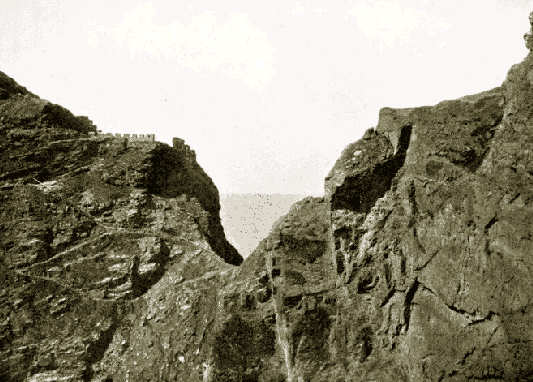
King Arthur's Castle, Tintagel
The small Trebarwith Cove is passed and then we reach Port Isaac Bay, which takes its name, not from the patriarch, but from a Cornish word that signifies a port for corn.
Bodruthan Steps
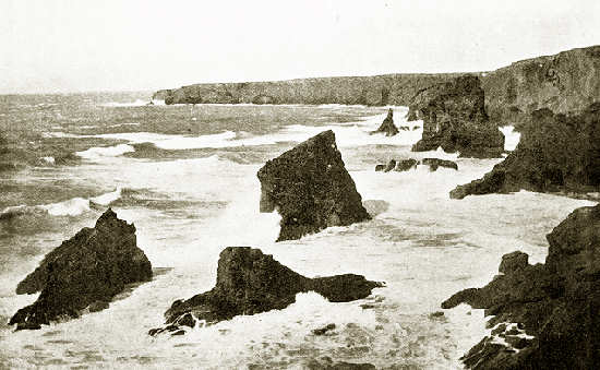
Porthqueen has its pilchard cellars cut out of the rocks; and at the western end of its bay Pentire Head stands out boldly into the Atlantic with a cliff castle at its extreme point. Pentire to some extent shelters Padstow Bay, but the entrance to the harbour is made dangerous by the Doom Bar lying across it. Here the rounded, sand-powdered Bray Hill is supposed to have buried under the drift sand the remains of a Roman town, but that there was such a Roman settlement is very doubtful. Further inland is the church of St Enodoc recently dug out of the sand, and the path to the porch has singular "Lord's Measures" that have been collected and are here planted. They were measures for grain. Of Padstow something shall be said elsewhere. Before reaching Trevose Head is Harlyn Bay, where from under the sand has been dug out a cemetery of the iron age, the skeletons crouching with their chins to their knees, in slate kists or coffins, with bronze ornaments, glass and amber beads, and iron instruments. Here also by the falling of the earth or sand some gold ornaments of the Celtic period were laid bare. On Trevose Head is a lighthouse. In Constantine Bay are the remains of a church half buried in sand, and with bones strewn about it. The font from this abandoned church has been transferred to St Merryn. It is of black Catacluse stone, as are the piers and arches of the church, giving it a sombre look. Passing the little Porthcothan we come to the noble cliffs of Bodruthan Steps, perhaps the finest bit of the north-coast scenery, and then reach Mawgan Porth, the estuary of the tiny stream that waters the vale of Lanherne. Here is the ancient mansion of the Arundells, dating from 1580, granted by Lord Arundell to Carmelite nuns, who came to England, at the outbreak of the French Revolution, in 1794. They have remained here ever since in seclusion. Near the door into their chapel is an old cross with inscription and interlaced work. The church has a beautifully proportioned tower, a good rood-screen, and many monuments of the Arundells, as well as a remarkable Gothic cross. A grove of Cornish elms like whips occupies the bottom of the valley. The church and parish are St Mawgan in Pyder.
Newquay Harbour
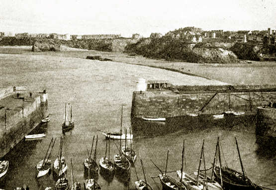
Newquay with its sands is a rapidly growing watering-place, with staring hotels. Crantock church, which once had its canons, is interesting; it has been carefully restored and has a fine rood-screen and loft. On the stalls is carved a dove with a chip of wood in its beak, and the story goes that St Carantoc—who assisted St Patrick in drawing up the Senchus Môr, the code of laws for Christian Ireland—was guided to the site for his church by seeing a dove carry off the shavings of his staff which he was cutting. Perran Bay has sent its sands flying inland, causing a widespread extent of towans or dunes, which have overwhelmed first of all the old church of St Piran or Cieran of Saighir in Ireland, who was buried in it, and then a second church built further inland, which also in turn had to be abandoned. These sand-dunes are a rabbit warren. The old church of St Piran, extremely rude in construction, has been excavated, but the only carved work found has been removed to the museum at Truro. The church resembles one of the early Christian chapels in Ireland. Bones are scattered about around it.
St Agnes—or St Aun's Head as it is locally termed—is but 617 ft. high, but it stands boldly above the sea.
Portreath is a busy little place to which coal-barges come from Cardiff with coal for the Camborne and Redruth mines. Tehidy Park, which stands above it, is an old seat of the Bassets. After passing Navax Point the broad Bay of St Ives opens out, with a lighthouse at each horn, and here again begin the towans or sand-dunes. Hayle is at the mouth of a small stream of the same name, and signifies "saltings." We come now to the town of St Ives, with an interesting church and an old cross. St Ives till about 1410 was but a tiny fishing village and was in the parish of Lelant. Perkin Warbeck landed near here in 1497.
Near this is the Knill monument erected in 1782 by the eccentric John Knill, who left money for an annual procession to it, and a dance of children around it. He intended it to have been his mausoleum, but he died and was buried in London.
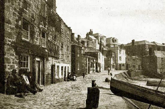
The Wharf, St Ives
Zennor has a curious little church with carved bench ends, on one of which is represented a mermaid, and Zennor "quoit" is thought to be the largest cromlech in England.
The Gurnard's Head has sheer cliffs on east and west, composed of slaty felspar, horneblende and greenstone, whereas the rocks of Zennor are of granite and slate in juxtaposition, and with dykes of granite penetrating the slate. Hills of rock and heather and furze bend round in a crescent terminating on one side at Carnminnis, on the other at Carn Galva, enclosing a great basin that reaches to the cliffs. On the isthmus connecting the headland with the mainland is a ruined chapel, with the altar-stone entire. Three miles westward is Morvah with the interesting Chûn Castle above it, of rude stone forming three concentric rings, and not far off is Chûn cromlech.
We come now to Botallack with its famous mine, carried to a depth of a thousand feet and extending a considerable distance under the sea. In time of storm the booming of the waves overhead and the clashing of stones rolled by the billows is so great that the bravest miners are driven from their work. Tin mining is now but languidly carried on. Although the heights are not great, yet this portion of coast is remarkably fine.
Cape Cornwall exhibits the junction of the slate with the granite. Here also extensive mining has been carried on, and Boswedden, like Botallack, burrowed far under the sea. Near the church of St Just is one of the circles or amphitheatres in which miracle plays were performed. The "Merry Maidens" is a prehistoric stone circle in the neighbourhood with ten stones erect and five fallen.
Whitesand Bay enjoys some slight shelter from the S. and E. winds. It is said that this bay was the landing-place of Athelstan after his conquest of Scilly, of King Stephen in 1135, and of King John when he returned from Ireland. In Sennen Cove is a cluster of fishermen's cottages.
Land's End is the end of Penwith, the "chief headland," and the Bolerium of the ancients. It commands a magnificent view, extending to Cape Cornwall over Whitesand Bay, of the Longships rocks with their lighthouse, and in clear weather of the Scilly Isles. The Wolf lighthouse is planted on a dangerous rock of felspathic porphyry some eight miles S.W. from the shore. The Land's End bristles with sharp fangs of rock, and somewhat resembles the back of an alligator.
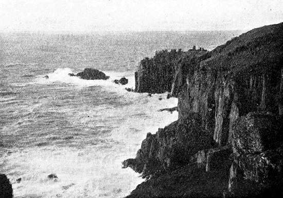
Land's End