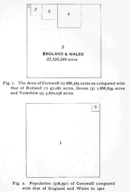
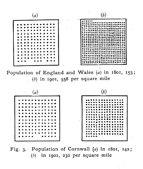
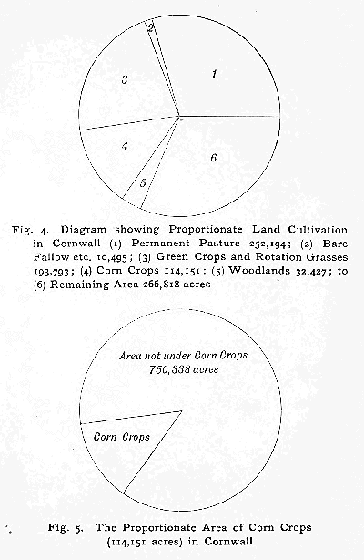
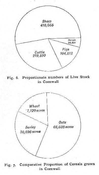
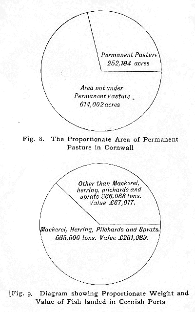
Figures 1 and 2 (Land area and Population)Figure 3 (Population Density)Figures 4 and 5 (Cultivation and Crops)Figures 6 and 7 (Livestock and Cereals)Figures 8 and 9 (Pastures and Fish)
CAMBRIDGE: PRINTED BY JOHN CLAY, M.A. AT THE UNIVERSITY PRESS
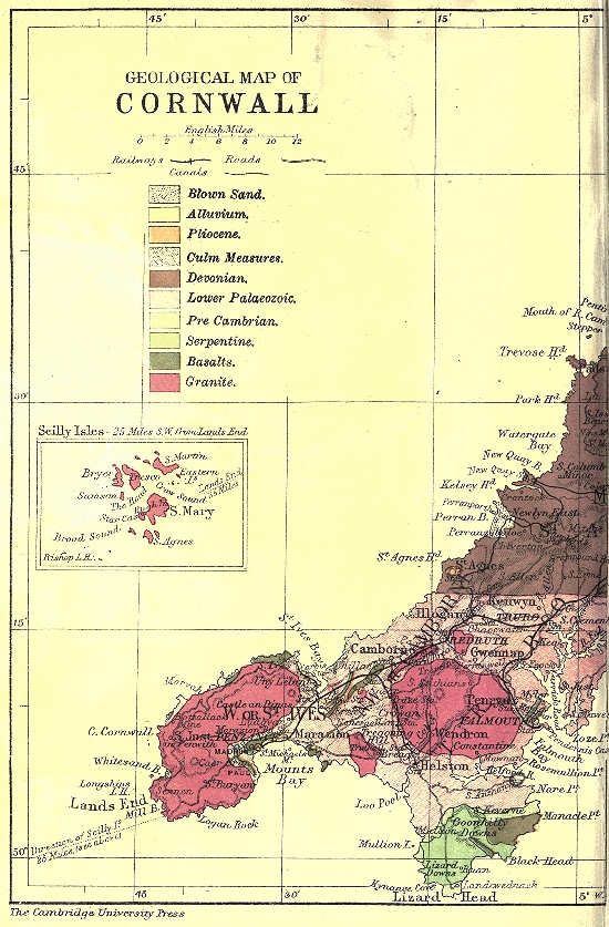
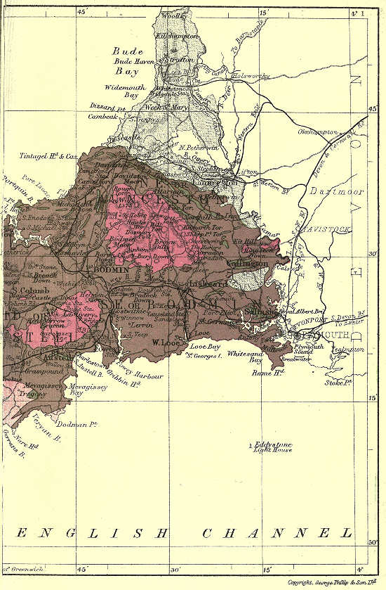
Geological map - westGeological map - east
Explore with AITake your curiosity a little further.