Zion National Park
Reading edition
Legend and History
Zion National Park is a roughly quadrangular area of approximately 120 square miles, sixty-four miles by highway from Cedar City, and sixty miles on an air line north of the rim of Grand Canyon. It was set apart as a National Monument under its Indian name, Mukuntuweap, in 1909. In 1919 its area was enlarged, its name was changed to that given it by the Mormon pioneers, and it was made a National Park.
There are cliff dwelling ruins in Zion Canyon, more in Parunuweap Canyon, and the modern Indians had a reverent acquaintance with its solemn amphitheatres. Several interpretations are given of its Indian name, Mukuntuweap. Major Powell translated it “straight canyon;” another interpretation is “place of many waters;” still another is “place of the gods.” One legend declares that the Paru-sha-pats Indians once saw a light upon the West Temple and supposed it to be a signal fire to warn them of a Navajo raid. But they found that the West Temple is unscalable and decided that friendly rock spirits had produced a supernatural incandescence; and so, to them, it was “Rock-rover’s Land.”
It is certain that the Indians regarded Zion Canyon as a place sacred to spiritual beings; they laid their propitiatory offerings of flesh and fruit at the foot of the crimson crags of Sinawava and none would spend a night in their shadows.
Mormon colonists entered the region about 1858, began its patient reclamation by irrigation, and named the marvelous canyon Little Zion. Major Powell, the famous explorer-geologist reconnoitered the country in 1870. A few years later Captain Dutton studied it and in “The Tertiary History of the Grand Canyon District,” now out of print, presented a picture that is “a classic of inspired description.” From that time until 1909, except for the visits of a few artists and travelers of the adventurous type, Zion was practically unknown. It may now be visited in perfect comfort. Several colleges have sent classes there for summer study.
16
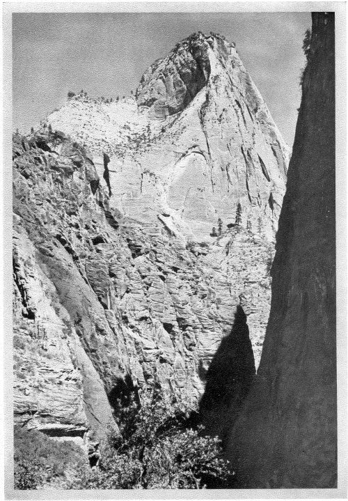
The Mountain of Mystery, Zion National Park
17
Description
The outstanding feature of Zion National Park is Zion Canyon, the stupendous red and white gorge cut by the Mukuntuweap River from the Kolob Plateau through more than 3,000 feet of the Jurassic sandstones of the White and Vermilion cliffs and down into lower beds of mauve sandstone and shales of purple and red. The floor of Zion is 4,100 feet above sea level; the dome of the West Temple rises to 7,650 feet. The canyon is about fourteen miles long and varies in width from about a mile at Springdale to scarcely more than the reach of a man’s outstretched hands in the upper Narrows where the river has cut a channel under the towering cliffs. Imagine, if you can, the overwhelming effect of these painted precipices, nearly 2,000 feet high and both close enough to be touched without moving.
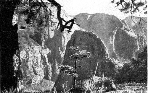
The Temples of Zion
In places the canyon widens into courts and shrines of bewitching beauty, such as the Court of the Patriarchs and the Temple of Sinawava. From the vermilion walls have been chiseled individual buttes and peaks of monstrous greatness and surpassing majesty, among them Angels Landing, the Great White Throne and the Mountain of Mystery. And these soaring scarps and summits present such varied tints and hues of red that the expert in pigments is bewildered; from the delicate pink of a baby’s cheek to deepest carmine, and beyond—from bittersweet and orient pink through orange chrome, flame-scarlet, vermilion, jasper, Pompeiian red and Indian lake to mahogany, ox-blood, maroon and a red that is almost black. In places the walls are topped with creamy white and the green of pines. Everywhere they exhibit a wizardry of massive sculpture. The deep-set river is bordered with the verdure of cottonwoods, box-elders, pines, ferns and flowering shrubs; in mossy caves curtained by little waterfalls, deer cradle their fawns. The radiance of the morning and evening sun upon the tinted towers of Zion is among the finest of its spectacles.
Standing upon the edge of the Park near Springdale is The Watchman, a stately cathedral-like pile of red sandstone. About a mile beyond is Bridge Mountain upon whose upper slope may be discerned a great bow of stone, a natural bridge with a span of 100 feet. Among the Towers of the Virgin stands the Altar of Sacrifice, a buttressed white fane whose summit and wall are stained deep with flowing crimson, suggesting the bloody sacrificial place of some insatiable pagan god. The East Temple, on the right, is a splendid structure of pink and white surmounted by a carmine capstone.
On the left is the Streaked Wall bearing strange white cones, and beyond it is Sentinel Peak. The west wall then recedes to form the fine Court of the Patriarchs whence rise the three stately Patriarchs themselves, jagged pink and white 18 pyramids. Above the east wall stand the Twin Brothers and the Mountain-of-the-Sun, the latter the first to glow in the light of dawn, the last to hold the evening rays. Lady Mountain, Mt. Majestic and Red Arch Mountain next appear, and Angels Landing, a sharp-shorn, pyramidal wedge of Pompeiian red that projects boldly into the canyon and throws off from its foot a fluted ox-blood mass called the Great Organ. Round this the river winds in a serpentine semicircle.
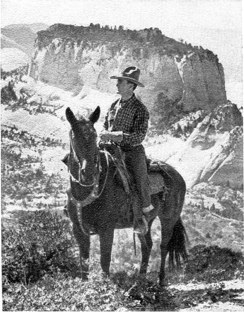
On the West Rim, Zion National Park
The Great White Throne
Just below the great bend in the Mukuntuweap River looms an isolated rock temple of prodigious bulk and imperial majesty, a truncated pyramid or mayhap a flattened dome, its lower half red, its upper half tinting from rosy buff to white, a forest of tall pines, acres in extent, upon its untrodden summit. This colossal butte, “one of the world’s great rocks,” is seen most effectively from the Temple of Sinawava, through the inverted maroon arch between the Great Organ and Angels Landing. It appears completely detached from the east wall, aloof and unscalable. While it has not been officially measured, its crest is probably more than 3,000 feet above the river.
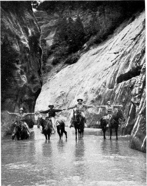
In the Narrows, Zion National Park
To the north is Cable Mountain, whence a rope of steel wire conveys lumber to the valley from the forested plateau. Between it and the next peak is Raining Cave and the site of a cliff dwelling.
The Temple of Sinawava
Beyond the bend the precipices of jasper red confine a flower-dotted meadow shaded by trees, where sphinx-like figures, colossi, and shattered pylons of warm and sombre reds suggest the Egyptian ruins at Karnak and Thebes. Several obelisks rise isolated from the gardens of the shrine. This is the beautiful Temple of Sinawava, the last of the courts as one ascends the Canyon. It was here that President Harding paid his tribute to Zion in 1923.
The Narrows
Half a mile beyond, the dragon’s-blood precipices become more perpendicular and close in toward each other until the gorge seems blocked, but a turn opens new vistas. Now, it is no more than seventy-five feet from cliff to cliff and the stream stretches from wall to wall. But there is one last glorious picture for those who must turn back. A short distance farther up the gorge soars a slender, ethereal cone of pink and 19 white, a peak of such appealing symmetry and delicate tints, so lofty and aspiring, that it evokes a cry of admiration. It is the Mountain of Mystery.
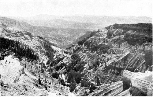
One of the Amphitheatres of Cedar Breaks
The Wet Trail
The Canyon continues some eight miles farther, but its exploration is only for the adventurous few. There is no trail but the winding river which reaches from wall to wall; sudden rainstorms send between the scarred and splintered cliffs a resistless torrent of water. With a competent guide those in search of unusual thrills may ride horseback several miles into the deep sunless cleft where great pendants of rock overhang and shut out the sky; where the churning stream in flood has left intricate cameos and arabesques upon the sandstone; where little waterfalls leap from green ledges; where one may almost touch both sombre walls with outstretched hands; where the stars may be seen by day. Many a time the canyon seems to end with prison-like finality and the sky seems lost forever. It is a travel adventure that may not be had elsewhere and one never forgotten.
Zion from the Rims
Seen from above, the aspect of Zion is wholly different. Instead of a relatively straight and orderly canyon dominantly red in color, it becomes a fantastic maze of white and variegated buttes and cones. Mr. Hal G. Evarts thus described in The Saturday Evening Post his impressions from the West Rim:
“It seemed that we gazed out across some vast oriental city that stretched away for a dozen miles. Scores of gaudy mosques and tinted towers, striped citadels topped by flat-roof gardens rose in countless tiers from this congested, painted metropolis.... And the coloring! Imagine a tremendous city of spires and turrets ..., its buildings catching every dazzling reflection of the sunset.... There were soft apricot and salmon tints, vague pinks and creams; lemon blending into deepest orange, ... with here and there a haunting suggestion of pale mauve. Brilliant red spires stood beside domes of ivory white. In many of these fairy structures the stratifications pitched so abruptly as to lend a spiralling, barber-pole effect....”
And Zion Canyon is but a part of Zion National Park.
20
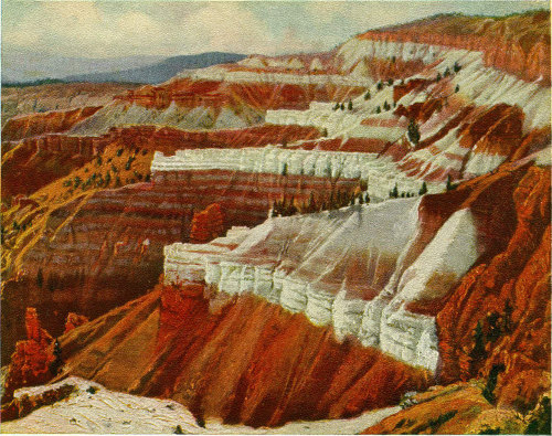
The Painted Buttresses of Cedar Breaks
Cedar City to Cedar Breaks
Cedar Breaks is twenty-three miles by highway east of Cedar City and four-fifths of a mile nearer the sky. Immediately east of the town the road enters the rugged gorge of Coal Creek, its slopes covered with fine forests of conifers and aspens. The walls assume impressive castellated forms that are especially striking at the mouth of Ashdown Gorge, eight miles distant. Ashdown Gorge is an extremely narrow, tortuous and precipitous rift in the plateau, down which rushes a sparkling stream from the vast furrows of Cedar Breaks. About one mile from the mouth and high up the precipice is a natural bridge with an arch of about sixty feet and a span of about seventy feet.
Following Coal Creek, ever upward, the road presently occupies a shelf upon the shoulder of the Markagunt Plateau whence are revealed glorious and almost illimitable panoramas. The whole sweep of the Terraced Plateau country to the south is visible. Some twenty-five miles directly south, slashed into the green of the Kolob Plateau, are the mazy, white-topped temples and towers of Zion, the grand West Temple dominating the scene. The sinuous profiles of the Pink, White and Vermilion Cliffs are discernible; the hazy arch of the Kaibab; and the misty dome of Navajo Mountain, beyond the Colorado. Several volcanic peaks are in the foreground.
This immense range of visibility is one of the strong attractions of the Terraced Plateau country; one sees again and again, in new and startling aspects, the salient features of hundreds of square miles of territory and its spectacular geological structure.
At Midway the road turns northward for three miles through stately pines, firs and spruces and comes without warning to the abyss named Cedar Breaks.
21
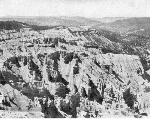
Cedar Breaks