APPENDIX A PICTORIAL MAPS OF THE GALILEAN SATELLITES
Reading edition
These maps were prepared for the Voyager Imaging Team by the U.S. Geological Survey in cooperation with the Jet Propulsion Laboratory, California Institute of Technology and the National Aeronautics and Space Administration. Copies are available from Branch of Distribution, U.S. Geological Survey, 1200 South Eads Street, Arlington, VA 22202, and Branch of Distribution, U.S. Geological Survey, Box 25286, Federal Center, Denver, CO 80225.
178
Preliminary Pictorial Map of Callisto
Atlas of Callisto 1:25,000,000 Topographic Series Jc 25M 2RMN, 1979 I-1239
This map was compiled from Voyager 1 and 2 pictures of Callisto. Placement of features is based on predicted spacecraft trajectory data and is highly approximate. The linkage between Voyager 1 and Voyager 2 pictures is particularly tenuous. Placement errors as large as 10° are probably common throughout the map, and a few may be even larger. Feature names were approved by the International Astronomical Union in 1979. Airbrush representation is by P. M. Bridges.
Jc 25M 2RMN: Abbreviation for (Jupiter) Callisto, 1:25,000,000 series, second edition, shaded relief map, R, with surface markings, M, and feature names, N.
179
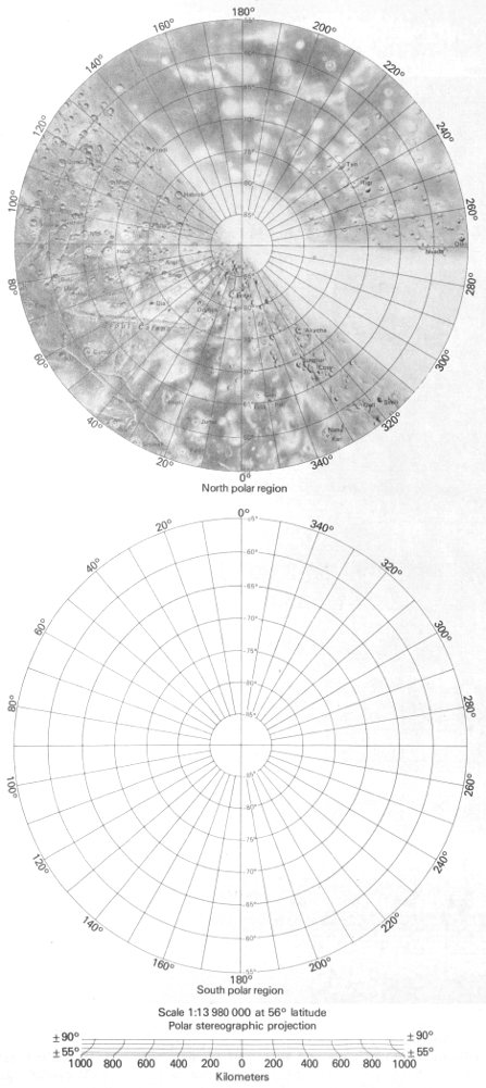
North polar region; South polar region
Scale 1:13 980 000 at 56° latitude
Polar stereographic projection
180
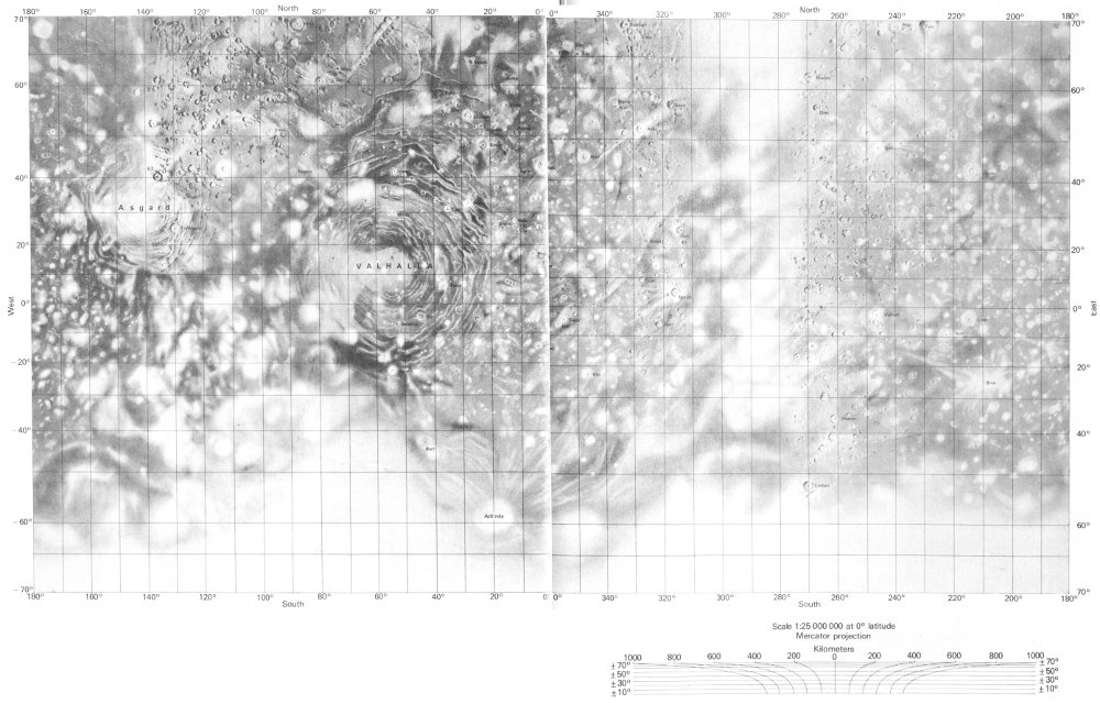
Callisto
Scale 1:25 000 000 at 0° latitude
Mercator projection
182
Preliminary Pictorial Map of Ganymede
Atlas of Ganymede 1:25,000,000 Topographic Series Jg 25M 2RMN, 1979 I-1242
This map was compiled from Voyager 1 and 2 pictures of Ganymede. Placement of features is based on predicted spacecraft trajectory data and is highly approximate. The linkage between Voyager 1 and Voyager 2 pictures is particularly tenuous. Placement errors as large as 10° are probably common throughout the map, and a few may be even larger. A large unresolved discrepancy exists in the area bounded by the -45° and -55° parallels between 120° and 180° longitude. Relative placement of features is distorted in that area. Feature names were approved by the International Astronomical Union in 1979. Airbrush representation is by J. L. Inge.
Jg 25M 2RMN: Abbreviation for (Jupiter) Ganymede, 1:25,000,000 series, second edition, shaded relief map, R, with surface markings, M, and feature names, N.
183
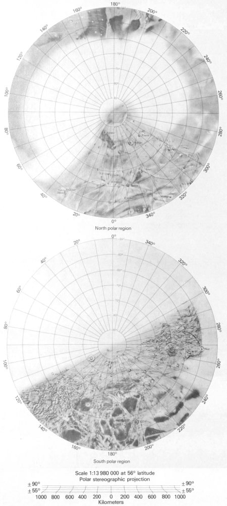
North polar region; South polar region
Scale 1:13 980 000 at 56° latitude
Polar stereographic projection
184
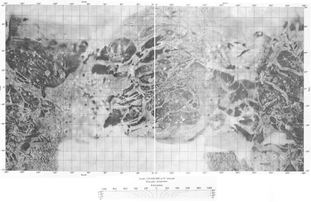
Ganymede
Scale 1:25 000 000 at 0° latitude
Mercator projection
186
Preliminary Pictorial Map of Europa
Atlas of Europa 1:25,000,000 Topographic Series Je 25M 2RMN, 1979 I-1241
This map was compiled from Voyager 1 and 2 pictures of Europa. Placement of features is based on predicted spacecraft trajectory data and is highly approximate. Feature names were approved by the International Astronomical Union in 1979. Airbrush representation is by J. L. Inge.
Je 25M 2RMN: Abbreviation for (Jupiter) Europa, 1:25,000,000 series, second edition, shaded relief map, R, with surface markings, M, and feature names, N.
187
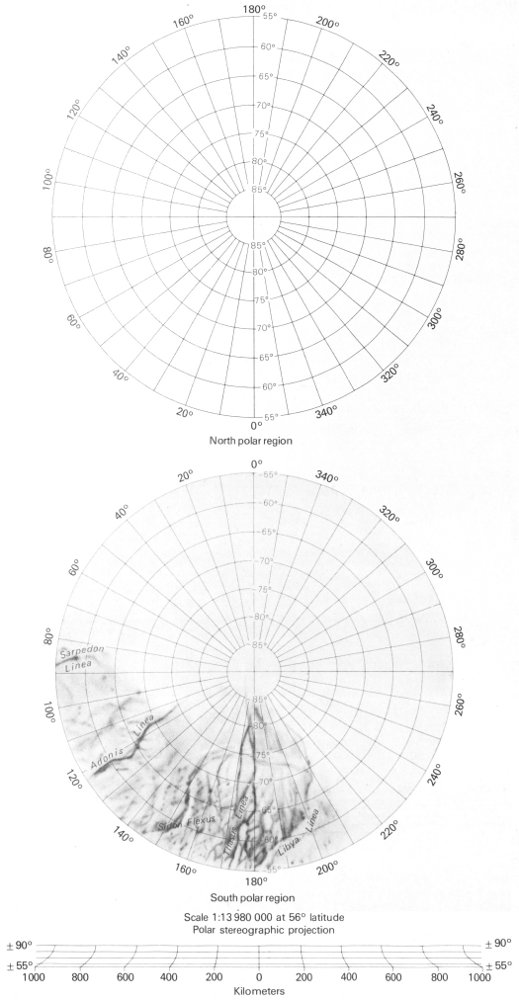
North polar region; South polar region
Scale 1:13 980 000 at 56° latitude
Polar stereographic projection
188
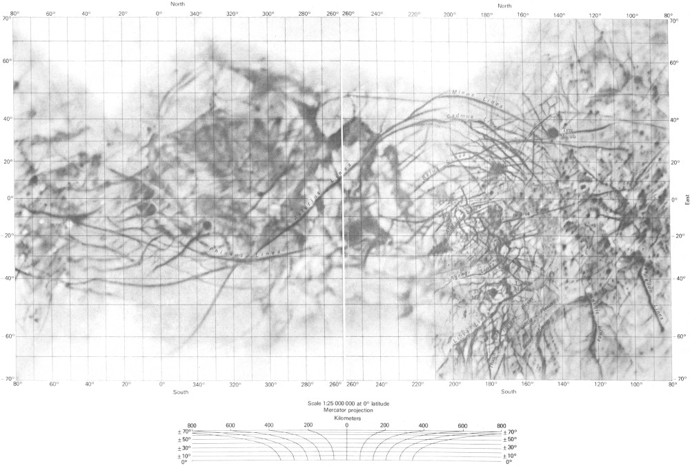
Europa
Scale 1:25 000 000 at 0° latitude
Mercator projection
190
Preliminary Pictorial Map of Io
Atlas of Io 1:25,000,000 Topographic Series Ji 25M 2RMN, 1979 I-1240
This map was compiled from Voyager 1 and 2 pictures of Io. Placement of features is based on preliminary control information provided by M. E. Davies of the Rand Corporation, Santa Monica, California, and is probably accurate within 50 to 100 km. Feature names were approved by the International Astronomical Union in 1979. Airbrush representation is by P. M. Bridges.
Ji 25M 2RMN: Abbreviation for (Jupiter) Io, 1:25,000,000 series, second edition, shaded relief map, R, with surface markings, M, and feature names, N.
191
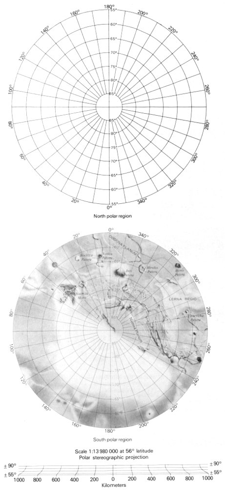
North polar region; South polar region
Scale 1:13 980 000 at 56° latitude
Polar stereographic projection
192
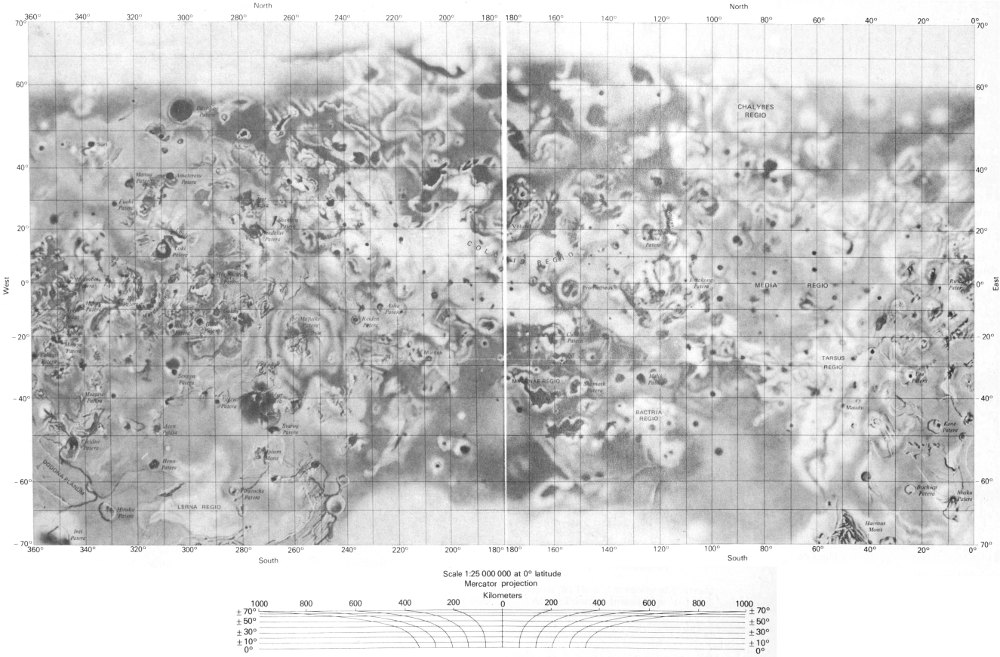
Io
Scale 1:25 000 000 at 0° latitude
Mercator projection
195