LETTER OF TRANSMITTAL (continued 3)
Reading edition
In 1918 a location survey was made from the town of John Day to Prairie City. The line follows the south limit of the valley east from John Day for eight and five-tenths miles and crosses the river to the north side of the valley at the bridge site on the present road. It continues thence along the north side of the valley to Prairie City. The length of this survey is twelve and seventy-four hundredths miles.
C. A. Harrington and R. H. Coppock were the locating engineers on this section. The office work for this survey is finished and plans are complete.
Sarvice Creek-Valades Ranch Port Road Project
(Same as for Wheeler county)
John Day-Fisk Creek Post Road Project
The State Highway Department has submitted to the Government for the purpose of securing Post Road aid, that section of the John Day Highway between John Day and Fisk Creek. This project is five and seventy-two hundredth miles in length and the total estimated cost is $145,051.50. The co-operation is to be on the basis of fifty per cent of the cost from each the State and Government.
Assurance has been received that the project will receive the support of the Government and it is expected that construction work will begin in the near future.
Hall Hill-Prairie City Post Road Project
The Office of Public Roads has approved the application for Post Road aid on the John Day Highway between Hall Hill and Prairie City. The length of this project is two and fourteen hundredths miles. The total estimated cost is approximately $39,000.00. The road is to be graded and surfaced with gravel macadam. This improvement involves also the construction of a fifty foot span bridge near Prairie City. The apportionment of the costs provide for the payment of $19,500.00 by each the State and Government.
Bids were received for this work on November 27 and a contract for the construction was later awarded Kern & Co. of Portland, Oregon. Work will begin in a short time and the bid price for this improvement was $38,987.90.
HARNEY COUNTY
Roads in Harney County are few in number, but the combined mileage of these few is enormous. Fortunately a large portion of the County roads are good most of the year, but during the winter season communication by the valley roads is usually extremely difficult.
Highways are of extreme importance in this County owing to the scarcity of railroads. The value of improved highways is fully appreciated by the people and a very creditable beginning has been made on the roads in the vicinity of Burns. However, County funds are entirely inadequate for the carrying out of a road building scheme of any magnitude.
The State Highway Commission extended aid in 1918 to the amount of $20,000 which appropriation calls for a like amount from the Federal Government. The County joins in the co-operative work to the amount of $8,000.00. This makes a total of $48,000.00 for a beginning. Present plans provide that work shall start early in 1919.
Additional support was secured from the State in the forms of surveys. Approximately nineteen miles of the Central Oregon Highway within Harney County was surveyed in 1918.
Survey of Central Oregon Highway—Burns-Experimental Farm Section
During 1918 the State Highway Commission surveyed a six mile section of the Central Oregon Highway leading east from Burns and past the Government experimental farm. This project begins one and one-half miles east of Burns and ends two miles east of the experimental farm. The plans for this survey are practically completed. This survey was made under the direction of H. B. Wright, locating engineer.
Sage Hen to Burns Section Survey
This is also a section of the Central Oregon Highway and is ten and thirty-nine hundredths miles in length. The line begins near Sage Hen Creek and parallels the present road into Burns, with a considerable saving in distance. This survey was made at the request of the County authorities in order that some improvements they have planned may be placed upon a permanent location. H. B. Wright was locating engineer on this survey.
Glass Butte Section Survey
This is a portion of the survey between Rolyat in Deschutes County and One Hundred Mile Road in Harney County. Fifteen and six-tenths miles are in Deschutes County and fifteen in Harney County. This survey was made at the request of the Counties in order that local funds may be expended on a permanent location. The present road through Glass Butte section between Rolyat and One Hundred Mile Road is in poor material and much longer than necessary. Local plans provide for the opening of the new road as soon as practicable. H. B. Wright, locating engineer for the State Department directed the surveying of this line.
Reconnaissance Survey Burns to Vale
In April, 1918, the State Highway Department made a reconnaissance survey over the route from Burns to Vale. All possible routes were covered in the survey and reported upon fully to the State Highway Engineer and the Commission. The investigation resulted in the establishing of the route from Burns direct to Crane and down the Malheur River through River Side, Juntura, Harper and Vale. This survey was made by M. O. Bennett, division engineer for the State Highway Department.
HOOD RIVER COUNTY
Grading—Cascade Locks to Hood River
That section of the Columbia River Highway from the Multnomah County Line to Hood River passes through the narrowest part of the Columbia River Gorge through the Cascade Range. The steep river banks rise directly up from the water’s edge for a large part of the distance, so the space for both railroad and highway is necessarily restricted. At many points, the right of way of the railroad and highway is contiguous and construction under these conditions involved extremely heavy work which added materially to the cost.
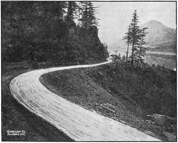
THE COLUMBIA RIVER HIGHWAY WEST OF LINDSAY IN HOOD RIVER COUNTY
Previous to 1915, there was no road through the County, but from the proceeds of a bond issue of $75,000, the County built on State standards a roadway to connect the uncompleted portions. In 1915, the State built about one mile, including the Mitchell Point Tunnel, one of the many scenic features of the Columbia River Highway. One mile of pavement adjoining the Multnomah County pavement was built in 1916 by Mr. S. Benson.
There remained about fourteen miles which require improvement, and on August 7, 1917, contracts were awarded to A. D. Kern for grading of these remaining sections to bring to standard grade and alignment. This improvement eliminated Ruthton Hill, with its narrow, steep grades, three railroad crossings, a narrow, steep grade near Wyeth and the improvement through the village of Cascade Locks to the end of the pavement. The work was divided as follows: Cascade Locks Section, 8.2 miles; Viento Section, 3.6 miles; Ruthton Hill Section, 4.2 miles. These contracts were completed in September, 1918. Due to the close proximity to the railroad tracks, the work required extreme care and watchfulness but was accomplished without accident and without delays to railroad traffic. The costs of construction for each of the three sections follows:
DETAILED EXPENDITURE STATEMENT—GRADING—CASCADE LOCKS SECTION
Engineering $ 8,744.41
Construction—General—
Common Excavation, 60,660 cu. yds. at 42c $ 25,477.20
Intermediate Excavation, 50,645 cu. yds. at 75c 37,983.75
Solid Rock Excavation, 44,500 cu. yds. at $1.15 51,175.00
Overhaul, per 100 lin. ft., 133,229 cu. yds. at 3c 3,996.87
12-inch Reinforced Concrete Pipe, 1,102 lin. ft. at $1.75 1,928.50
18-inch Reinforced Concrete Pipe, 140 lin. ft. at $2.25 315.00
24-inch Reinforced Concrete Pipe, 284 lin. ft. at $3.00 852.00
30-inch Reinforced Concrete Pipe. 72 lin. ft. at $4.25 306.00
Class A Concrete, 80.86 cu. yds. at $20.00 1,617.20
Class C Concrete, 32.43 cu. yds. at $14.00 454.02
Placing Reinforcing Steel, 3,197 lbs. at .001⁄2 15.99
Catch Basins, 9 at $25.00 225.00
Extra Clearing and Grubbing, 5.79 acres at $200.00 1,158.00
Extra Clearing, 4.13 acres at $100.00 413.00
Herman Creek Bridge—
Class A Concrete, 137.61 cu. yds. at $20.00 $ 2,752.20
Class C Concrete, 3.57 cu. yds. at $14.00 49.98
Reinforcing Steel (Placing) 23,000 lbs at .001⁄2 115.00
Reinforcing Steel furnished by State 1,394.32
Removing old bridge and constructing temporary bridge 426.00
Wet excavation for piers 664.86
Concrete toe wall to protect fill 1,547.98
Railing 438.72
Total cost of Herman Creek Bridge 7,389.06
Gorton Creek Bridge—
Excavation for piers $ 483.44
Class A Concrete, 90.85 cu. yds. at $20.00 1,817.00
Placing Reinforcing Steel, 7,378 lbs. at .001⁄2 36.89
Reinforcing Steel furnished by State 447.27
Railing 224.29
Rip-rap 145.01
Total cost of Gorton Creek Bridge 3,153.90
Force Account Work as Follows—
Construction and Removal of temporary bridge over Dry Creek 15.78
Removing Slide from O.-W. R. R. & N. Tracks 95.59
Gravel Surfacing—End of Pavement to Cascade Locks 2,418.55
Railing for Viento Creek Bridge 106.11
Excavating in water and placing Corrugated Iron Pipe 57.92
Excavation and placing drain tile in wet cuts 150.63
Excavation and placing box drain for form crossing 10.44
Riprap on slope to keep fill off O.-W. R. R. & N. Right of Way 177.29
Water pipe and private road crossing 40.16
Sinking test holes in gravel pit at Cascade Locks 24.93
Road crossing for Herman Creek Ranger Station 167.38
Hauling dirt to cover boulders 264.40
Placing concrete pipe 59.03
Flagmen guarding track (Contractor’s force) 1,234.83
Miscellaneous Construction Items Paid Direct by State—
Replacing Fence 18.75
Reinforcing Steel for Concrete Culverts 193.77
Concrete Pipe furnished by State 71.50
Moving Building in Cascade Locks 1,400.00
Guarding O.-W. R. R. & N. Tracks (Ry. Co. Force) 1,343.69
Guarding Western Union Telegraph Line 498.01
Total Construction Cost $ 144,809.25
Grand Total Cost of Job 153,553.66
Deduction for Rental of State Cars and Track 648.81
Total Cash Expenditure $ 152,904.85
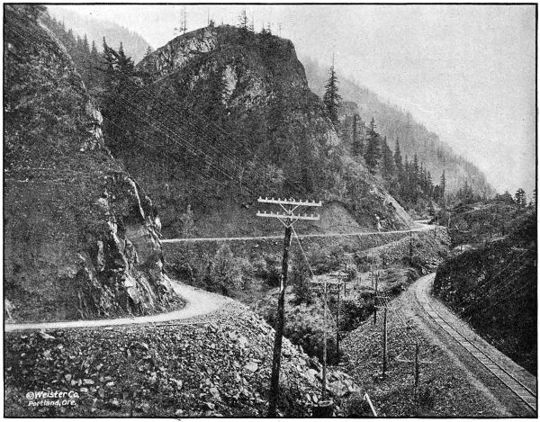
THE COLUMBIA RIVER HIGHWAY NEAR VIENTO IN HOOD RIVER COUNTY. GRADED AND GRAVELED IN 1917 AND 1918
DETAILED STATEMENT OF EXPENDITURES TO NOVEMBER 30, 1918— GRADING AND BRIDGES—VIENTO SECTION
Engineering $ 4,513.24
Guarding O.-W. R. R. & N. Tracks 976.47
Guarding Western Union Telegraph Lines 184.64
Diverting Flume Lines 936.37
Reinforcing Steel Furnished by State 257.79
Contract Work as follows:
Common Excavation, 9,480.4 cu. yds. at 39c $ 3,697.35
Intermediate Excavation, 32,654.9 cu. yds. at 70c 22,858.43
Solid Rock Excavation, 54,031.9 cu. yds. at $1.10 59,435.09
Overhaul, per 100 lin. ft., 82,711 cu. yds. at 3c 2,481.33
12-inch Reinforced Concrete Pipe, 622 lin. ft. at $1.75 1088.50
18-inch Reinforced Concrete Pipe, 304 lin. ft. at $2.25 684.00
Class A Concrete, 62 cu. yds. at $20.00 1,240.00
Class C Concrete, 20.8 cu. yds. at $14.00 291.20
Placing Reinforcing Steel, 3,928 lbs. at .001⁄2 19.64
Rubble Masonry, 12 cu. yds. at $7.00 84.00
Catch Basins, one at $25.00 25.00
Gravel Backfill in Rock cut (Force Account) 181.77
Repairing Lindsay Creek Bridge (Force Account) 149.92
Private Road Approach (Force Account) 168.30
Clearing Rock from Mitchell Point Tunnel (Force Acc′t) 93.94
Viento Creek Bridge—
Class A Concrete, 62.7 cu. yds. at $20.00 $ 1,254.00
Placing Reinforcing Steel, 3,800 lbs. at .001⁄2 19.00
Excavation for Footings (Force Account) 128.27
Material furnished by State 249.70
Total Cost of Viento Creek Bridge 1,650.97
Total Cost to November 30, 1918 $ 101,017.95
15 per cent Retained of Total Amt. ($93,899.74) Earned by Contractors 14,084.96
Total Paid Amount to November 30, 1918 $ 86,932.99
DETAILED STATEMENT OF EXPENDITURES TO NOVEMBER 30, 1918— GRADING RUTHTON HILL SECTION
Engineering $ 4,074.19
Material furnished by State for Concrete Half Viaduct 200.50
Guarding O.-W. R. R. & N. Tracks 804.57
Contract Construction Work as follows:
Common Excavation, 2,669.5 cu. yds. at 39c $ 1,041.10
Intermediate Excavation, 17,109.4 cu. yds. at 70c 11,976.58
Solid Rock Excavation, 79,213.3 cu. yds. at $1.05 83,173.96
Overhaul per 100 lin. ft., 19,500 cu. yds. at 3c 585.00
12-inch Reinforced Concrete Pipe, 536 lin. ft. at $1.75 938.00
18-inch Reinforced Concrete Pipe, 140 lin. ft. at $2.25 315.00
Class C Concrete, 15.4 cu. yds. at $14.00 215.60
Rubble Masonry, 30 cu. yds. at $7.00 210.00
Force Account—
Connecting road with Morton 285.50
Covering sharp rocks with clay 106.48
Reinforced Concrete Viaduct at Ruthton Hill 1,362.51
$ 100,209.73
Less 15 per cent retained pending completion of contract 15,031.46
Total payments to contractor to Nov. 30, 1918 $ 85,178.27
Total expended to November 30, 1918 $ 90,257.53
Macadamizing—Cascade Locks to Hood River
On July 4, 1918, a contract was awarded to A. D. Kern of eighteen miles of gravel surfacing between Hood River and the Multnomah County Line on the basis of cost plus fifteen per cent on labor and supplies and twelve and one-half per cent on equipment; provided, that no percentage should be paid on any cost over $50,000. This work also includes the building of shoulders on the one mile of pavement built by S. Benson in 1916 adjacent to the Multnomah County Line. The gravel for this work was taken from pits at Cascade Locks, Herman, Sonny and Hood River, was loaded by steam shovels, screened at two of the pits and hauled by auto trucks. As a result there is now a gravel surface between Hood River and Cascade Locks. A total of 23,396 cubic yards was placed upon the road at an average cost of $2.88 per cubic yard which represents total cost of excavating, screening, hauling, spreading and rolling.
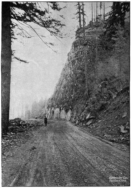
ON THE COLUMBIA RIVER HIGHWAY IN HOOD RIVER COUNTY TWO MILES EAST OF CASCADE LOCKS. GRADED AND GRAVELED IN 1917 AND 1918
Hood River Bridge
The largest concrete bridge so far designed and constructed by the State Highway Department is that spanning Hood River near the city of Hood River. It consists of three arch spans 95 feet, center to center of piers, 110 feet of reinforced concrete approach on the Hood River side and a short approach on the opposite side.
As in other arch work of similar magnitude studied by the Department, it was found economical to support the arch superstructures on ribs instead of using rings extending clear across the roadway, and the open spandrel idea was carried out.
The concrete viaduct approach on the west side crosses three railroad tracks which govern the height of the bridge. In order to minimize this height through concrete girders were used, the girders projecting above rather than below the roadway slab.
The total cost of the structure complete will be about $48,000.00, of which Hood River County will contribute $8,000.00. The bridge was built under contract by Parker & Banfield. Mr. C. E. Carter was resident engineer on the work.
Herman Creek Bridge
This is a ninety-foot reinforced concrete viaduct on the Columbia River Highway near Cascade Locks. This structure was built by A. D. Kern in connection with the grading contract on the Cascade Locks section. The cost complete was $7,389.06.
Gorton Creek Bridge
This is a 50-foot reinforced concrete bridge at Wyeth on the Columbia River Highway. It was built by A. D. Kern under the grading contract for the Cascade Locks Section. The total cost was $3,153.90.
Hood River-Mosier Surveys
Contemplating construction of the Columbia River Highway between Hood River and Mosier to eliminate the high summit, narrow road bed, and excessive grades between these points the Department made very thorough surveys for this important project.
A survey had previously been made developing distance up the Hood River Valley and reaching a summit of 1,107 feet with a corresponding additional length required on the Mosier end, making a total distance of 10.7 miles.
Because of its length and high summit a lower route was considered and a survey was made adjacent to the railroad, using a portion of the old abandoned railroad grade, but involving extremely heavy construction at certain points where the line skirts the high bluffs. The summit on this route was only 160 feet and its length 5.8 miles. However, the railroad company was contemplating a revision in the alignment of their tracks on this section, as well as the construction of a second track, which would still further lessen the space available for a highway. Also taking into consideration the difficult nature of the work and the uncertain cost due to track protection in blasting operations and the limited conditions under which the work must lie done to avoid interference with the railroad traffic, this route was revised in favor of a route further away from the tracks up on the side-hill. The summit reached is 522 feet and the length of this line is 6.3 miles, which includes a development of 5 per cent grade at each end and provides for a 24 foot roadbed.
This adopted route is very scenic and affords a splendid view of the Washington shore, as well as a view up and down the river. The construction is very heavy, being located on steep side-hill slopes and at one point involves a tunnel 200 feet long. This project is divided by the County line, making 4.0 miles in Hood River County and 2.2 miles in Wasco County. This project will be placed upon the 1919 program.
JACKSON COUNTY
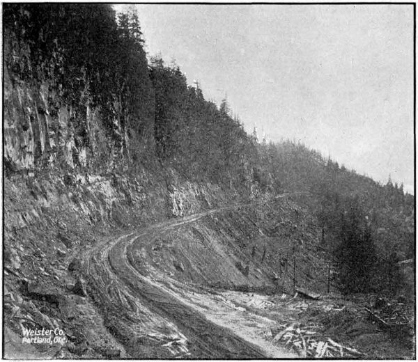
HEAVY GRADING ON RUTHTON HILL IN HOOD RIVER COUNTY. CONSTRUCTED IN 1917 AND 1918
The Highway Department expended in Jackson County during 1917 and 1918 the sum of $86,619.88. The work accomplished with this amount consists of six and five-tenths miles of 16-foot crushed rock macadam in the Siskiyou Mountains, an undergrade crossing with the Southern Pacific Railway just north of Ashland, and 4,200 lineal feet of grading and paving north of Ashland. A survey has also been started on the Ashland-Klamath Falls Road about fifteen miles of which was completed before weather conditions made it necessary to discontinue field work until spring.
Ashland Hill Grading and Undercrossing
On account of a contemplated undergrade crossing with the Southern Pacific Railway, a stretch of 4,200 feet on the Pacific Highway just north of Ashland was left unpaved between Ashland and Medford when the balance of the distance between those points was paved in 1914. In 1917 arrangement was made between the County and Railway Company for the construction of this undercrossing and the State Highway Commission set aside funds to cover the cost of the 4,200 feet of grading in connection therewith.
The Installation of the undercrossing structure was handled by the Southern Pacific Railway Company. The grading was handled by the County grading forces under the supervision of the Highway Department. Mr. F. H. Walker acted as resident engineer. The grading was commenced on January 7, 1918, and completed August 1, 1918. The total cost of the grading was $9,768.88, and was paid entirely from State funds.
COST STATEMENT ASHLAND HILL GRADING
Industrial insurance $ 156.27
Grading, labor, teams, material, etc. 8,928.19
Explosives 102.08
Concrete drainage structures 14.70
Pipe culverts 287.03
Irrigation flume diversions 5.40
Total $ 9,493.67
Engineering 275.21
Total cost $ 9,768.88
Ashland Hill Paving
Bids were called for on August 6, 1918, for the paving of the Ashland Hill Section, but as no satisfactory bids were received the work was undertaken by the Highway Department with State forces. This section of paving is 4,200 feet in length, and the type of pavement laid is a 16-foot concrete, 51⁄2 inches thick at the sides and 61⁄2 inches thick at the center. The mixture was a 1 : 2 : 31⁄2, and a ratio of 5.6 gallons of water per sack of cement was used.
The average haul on material was 1.2 miles and hauling was done by means of trucks. The cement was shipped to the job prior to the beginning of construction and stored at convenient locations near the work.
A sixteen cubic foot Koehring mixer equipped with boom and bucket was used for mixing the aggregate. The pavement, after being struck off, was finished by the roller and belt method. The pavement first being rolled from two to four times depending on the condition of the concrete and later belted with eight and ten inch belts. The eight inch belt being used first. A very satisfactory surface was obtained in this manner.
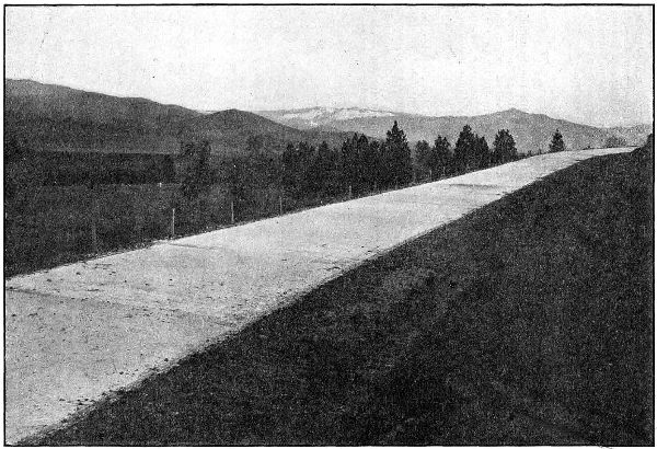
CONCRETE PAVEMENT ON ASHLAND HILL IN JACKSON COUNTY, ON THE PACIFIC HIGHWAY NORTH OF ASHLAND. GRADED AND PAVED IN 1918
Continuous forms were used on this work and 1⁄4x4 inch elastite joints were placed at 30 foot intervals, leaving approximately two inches of concrete above the elastite and giving the pavement the appearance of monolithic construction. It was found that a better riding pavement could be produced in this way as the inequalities at joints were eliminated and we believe that the use of this pavement will justify the adoption of this type on future work.
Gravel and crushed rock shoulders two feet wide were built on this section and the pavement was not covered while curing as the weather was cool and damp. However, the pavement was kept wet by sprinkling when necessary.
The crusher and roller on this work were furnished by Jackson County free of charge.
Mr. J. M. Baker was superintendent of construction on this work.
COST STATEMENT ASHLAND HILL PAVEMENT
4,200 feet 16′ Concrete Pavement Built in 1918
Quan- tity Item Total Cost Unit Cost
7682 sq. yds.—1 : 2 : 31⁄2 Concrete Pavement Average Thickness 6″ $ 14,117.56 $ 1.84
400 cu. yds.—Crushed Gravel in Shoulders 1,000.00 2.50
1000 pounds—Reinf. Steel 70.00 .07
2240 lin. ft.—Expansion Joints 89.60 .04
Total Cost of Construction $ 15,277.16
Engineering 630.87
Grand Total Cost $ 15,908.03
Siskiyou Mountain Macadam
During the 1917 season, 61⁄2 miles of broken stone macadam was constructed on the Pacific Highway in the Siskiyou Mountains. This macadam is sixteen feet in width, and extends from the California State Line to Siskiyou. It was constructed with State forces under the supervision of L. L. Clarke, construction superintendent. A total of 17,780 cubic yards of rock were crushed and placed on the road. The cost of the work complete was $56,252.98.
Survey—Ashland to Klamath Falls
On August 25, 1918, a location survey was started between Ashland and Klamath Falls. After a careful reconnaissance of the low passes, the route via Green Springs Mountain was chosen, as against the Dead Indian Summit, 500 feet higher.
Surveys were continued until November 30, when they were discontinued for the winter months. The present road is in such poor condition, that maintaining a locating party at work during the winter would be very expensive.
During the short time the party was in the field, 15.6 miles of location were staked, a six per cent grade from the summit of Green Springs Mountain toward Ashland being obtained, whereas the present road has many stretches over 20 per cent. Also, over a section between the Green Springs Summit and Jenny Creek, 9 miles to the south, a location has been obtained that will give for the greater distance, very cheap construction and the lightest of grades. This will be appreciated by all who have traveled the present rocky road with its series of bad grades.
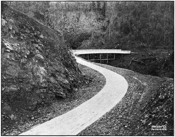
ON THE PACIFIC HIGHWAY SOUTH OF WOLF CREEK IN JOSEPHINE COUNTY. CONSTRUCTED IN 1917 AND 1918
This road is a very vital one to the Rogue River and Klamath Valleys. At present it is only passable during summer months for auto traffic, while a road built on standard line and grades would soon make it an all year highway.
There will be an enormous exchange of commodities between the two valleys when the road is constructed. It will make a three hour auto trip between Ashland and Klamath Falls, which now takes 81⁄2 hours by train via Weed, California.
The location will be resumed in the spring, and continued to Klamath Falls. Surveys have been in charge of Mr. J. H. Scott, locating engineer.
JEFFERSON COUNTY
Jefferson is the only county in Eastern Oregon that has not applied for State aid in some form. This County has been included in the State’s general Post Road scheme and doubtless will receive early attention from the State Highway Commission.
The State Highway Commission has ordered a reconnaissance survey made from Kingsley and Tygh Valley in Wasco County south through the Warm Springs Indian Reservation into Jefferson County along the west side of the Deschutes River. This investigation will be made during the coming spring.
The County is traversed by The Dalles-California Highway which will be a very important road. The Antelope-Mitchell Highway also passes through the northeast corner of the County.
JOSEPHINE COUNTY
During the two year period covered by this report, a very marked improvement has been made in the Pacific Highway across Josephine County. During this time 8.2 miles, or more than one-quarter of the total mileage of this highway in the County, were completed on standard grades and alignment, eliminating some of the heaviest and most dangerous grades between Portland and the California Line. The work done by the State consisted of the grading of a 4.9 mile section between Wolf Creek and Grave Creek in the northern part of the County, and the grading of a one mile section, known as the Locust Hill Section, about three miles south of Grants Pass. The work done by the County consisted of 2.3 miles of grading between Locust Hill and the Jackson County Line. This County work was contracted under State Highway Department specifications and was engineered by the Department engineers.
In addition to this construction work, location surveys were made over 23.6 miles of the Pacific Highway, completing the location across the County. These surveys were made in three sections: One from Wolf Creek to Grave Creek; one from Grants Pass to Grave Creek; and one from Wolf Creek to Stage Road Pass.
The total amount of money expended by the State in Josephine County during the fiscal years 1917 and 1918 was $77,998.14, and the amount expended by Josephine County under State supervision was approximately $8,500.00. Some considerable amount of work was also done by the County in grading just south of Grants Pass. While this work was not under State supervision, it was on the State survey and is standard as regards grade, alignment, cross-section, etc.
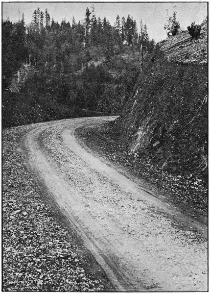
ON THE WOLF CREEK-GRAVE CREEK SECTION OF THE PACIFIC HIGHWAY IN JOSEPHINE COUNTY. GRADED IN 1918
Grading—Wolf Creek to Grave Creek
To eliminate four very heavy grades on the Pacific Highway between Wolf Creek and Grave Creek in Northern Josephine County, the Highway Commission appropriated funds for the grading of a 4.9 mile section between those points. The contract for the work was awarded to the American Exploration and Construction Company of Grants Pass on November 6, 1917. This construction was practically all on steep side-hills, and as only a small part of the material to be moved was hard rock, the job was an ideal one for steam shovel operation and over fifty per cent of the total yardage was moved by this method. The work was handled by the contractors in a very creditable manner, and an excellent roadbed was secured.
The grading was completed on October 20, 1918. The width of roadbed is 20 feet and the maximum grade is 5 per cent. Mr. J. E. Nelson was in charge of the work as resident engineer.
It is expected that this section will be macadamized during the 1919 season.
DETAILED EXPENDITURE STATEMENT—GRADING—WOLF CREEK TO GRAVE CREEK
Engineering $ 4,872.94
Culvert Pipe furnished by State 3,846.45
Payments to Contractor for Work as follows:
Clearing and Grubbing $ 3,500.00
Common Excavation, 29,426 cu. yds. at .45 13,241.70
Intermediate Excavation, 21,258 cu. yds. at .45 9,566.10
Solid Rock Excavation, 21,558 cu. yds. at $1.25 26,947.50
Overhaul, per 100 lin. ft., 6,767 cu. yds. at .02 135.34
12″ Concrete Pipe, 1,077 lin. ft. at .55 592.35
18″ Corr. Galv. Iron Pipe, 581.5 lin. ft. at .40 232.60
24″ Corr. Galv. Iron Pipe, 162.5 lin. ft. at .50 81.25
30″ Corr. Galv. Iron Pipe, 127.5 lin. ft. at .60 76.50
36″ Corr. Galv. Iron Pipe, 166.5 lin. ft. at .75 124.87
Class “A” Concrete, 44.67 cu. yds. at $22.50 1,005.07
Class “C” Concrete, 66.72 cu. yds. at $18.00 1,200.96
6″ Porous Drain Tile, 400 lin. ft. at .40 160.00
Trestle Timber, 45,968 f. b. m., at $45.00 2,068.56
Metal Reinforcement, 2,506 lbs. at .15 375.90
Extra Clearing, 1.75 acres at $100.00 175.00
Painting Railings on Coyote Creek and Dry Gulch Bridges (Force Account) 74.94
Gravel Backfilling for Drain Tile (Force Account) 23.50
Culvert Pipe furnished by State 3,846.45
Total Paid to Contractors 59,582.14
Total Cost of Work $ 68,301.53
Grading—Locust Hill Section
To complete the grading of the Pacific Highway between Grants Pass and Rogue River, the Highway Commission set aside funds for the construction of the Locust Hill Section, a section one mile in length located about three miles south of Grants Pass. The contract for this work was awarded to Albert Anderson & Co. of Grants Pass, and the construction was completed about June 1, 1918.
The necessary engineering supervision of this work was given by Mr. J. E. Nelson, resident engineer of the Wolf Creek-Grave Creek Section.
DETAILED EXPENDITURE STATEMENT—GRADING LOCUST HILL SECTION
Engineering $ 162.88
Construction:
Clearing and Grubbing $ 125.00
Common Excavation, 692 cu. yds. at .53 366.76
Intermediate Excavation, 2,552 cu. yds. at .63 1,607.76
Solid Rock Excavation, 1,954 cu. yds. at $1.20 2,344.80
Overhaul per 100 lin. ft., 3,159 cu. yds. at .03 94.77
12″ Plain Conc. Pipe, 168 lin. ft. at $1.00 168.00
4,707.09
Total Cost $ 4,869.97
County Construction—Locust Hill to Jackson County Line
In the Spring of 1917, the County Court of Josephine County requested the Highway Department to engineer for them the construction of 2.3 miles of grading on the Pacific Highway between Locust Hill and the Jackson County Line. Plans and specifications were prepared for this work by the Highway Department and it was let by the County Court in two units: one to Albert Anderson & Co., of Grants Pass; the other to S. S. Schell of Oakland, Oregon.
The construction engineering was handled by the State Highway Department under resident engineer H. C. Compton. The work was completed in September, 1917, the total cost to the County being approximately $8,500.00.
The final estimate to Albert Anderson & Co., was as follows:
FINAL ESTIMATE TO ALBERT ANDERSON—GRADING BETWEEN LOCUST HILL AND JACKSON COUNTY LINE
Clearing, lump sum bid $ 800.00
Common Excavation, 3,887.1 cu. yds. at .43 1,671.45
Intermediate Excavation, 3,931.3 cu. yds. at .63 2,476.72
Solid Rock Excavation, 650.0 cu. yds. at $1.15 747.50
12″ Plain Concrete Pipe, 320 lin. ft. at .90 288.00
18″ Plain Concrete Pipe, 78 lin. ft. at $1.45 113.10
24″ Plain Concrete Pipe, 56 lin. ft. at $2.10 117.60
Class “C” Concrete, 14.94 cu. yds. at $14.50 216.63
6″ Drain Tile, 100 lin. ft. at .22 22.00
Run-of-bank Gravel, 6 cu. yds. at $1.35 8.10
Overhaul, per 100 lin. ft., 730 cu. yds. at .02 14.60
Total $ 6,475.70
Survey—Wolf Creek to Grave Creek
The old county road between Wolf Creek and Grave Creek on the Pacific Highway in Northern Josephine County, passed over two summits about 250 feet above the valley levels of Grave and Wolf Creeks, giving four long, heavy grades, in some places the grade being as high as 25 per cent. These two summits were about one mile apart, and the nature of the ground was such that support could be had for a practically level grade between the two.
With a view to locating this level grade between the summits and developing five per cent grades down the sides, a preliminary survey was made in October and November, 1916, under the direction of Mr. S. H. Probert. This survey was worked up in the office during January and February, 1917, and in July, 1917, the projected location was staked on the ground by Mr. C. C. Kelley, locating engineer.
The length of the survey was 4.9 miles, the terminal points being about three-quarters of a mile east of Wolf Creek Post Office and about three-quarters of a mile west of the Grave Creek Bridge.
The construction of this section, which was undertaken in the fall of 1917, is described in another article in this report.
Survey—Wolf Creek to Stage Road Pass
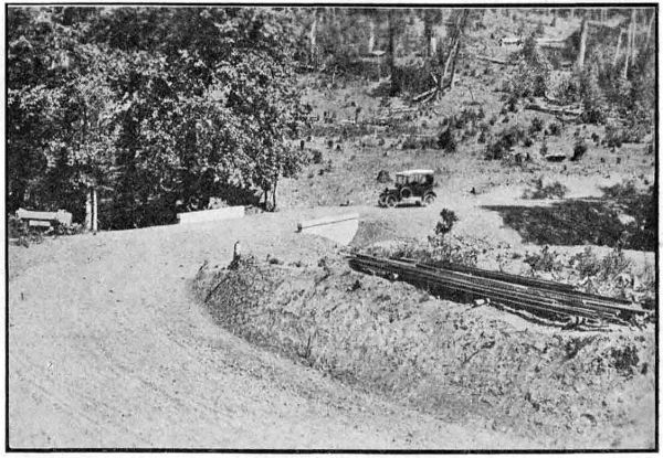
ON THE WOLF CREEK-GRAVE CREEK SECTION OF THE PACIFIC HIGHWAY IN JOSEPHINE COUNTY. GRADED IN 1918
This survey begins about three-quarters of a mile south of the Wolf Creek Post Office and follows, in a general way, the present county roads into the town of Wolf Creek and from Wolf Creek to a point about two miles south of Stage Road Pass. At this point it connects with a survey made by the Highway Department in 1915, and which is the location survey for a five per cent grade down from State Road Pass, which pass is on the line between Douglas and Josephine Counties.
The length of the survey from east of Wolf Creek to the connection with the previous survey is 2.5 miles. It was made in July, 1917, under the direction of Mr. C. C. Kelley, locating engineer.
Survey—Grants Pass to Grave Creek
To complete the location of the Pacific Highway across Josephine County, a survey was made in 1917 between Grants Pass and Grave Creek. This survey follows, in a general way, the present road between those points, deviating from it only where improvements in alignment or grade can be secured. The most important feature of this location is that it is on a five per cent grade over the Sexton Mountain Summit. The total length of the survey is 17.2 miles. Mr. C. C. Kelley was in charge of the work as locating engineer.
KLAMATH COUNTY
In Klamath County the work of the Highway Commission to date has been limited to surveys.
A careful reconnaissance has been made from Klamath Falls to Bend, Klamath Falls to Olene, and Klamath Falls to Ashland. Funds were limited for more extensive surveys during 1918, but the location from Ashland to Klamath Falls (see Jackson County report) was started and will be continued to Klamath Falls in 1919.
A short section between the Klamath Falls City Limits, through Pelican City to a connection with the existing road to Bend was located by the Highway Department in August, 1918, and stakes set for 7,500 feet of grading. This section has since been graded and covered with a cinder surface by the County.
State surveys in this section were in charge of J. H. Scott, locating engineer.
LAKE COUNTY
Grading and Macadamizing Between Lakeview and Paisley
In 1917 the State Highway Commission appropriated funds to assist the County with the grading and macadamizing of a section of the Lakeview-Paisley Road through Crooked Creek Canyon. This work was handled by the County, and the total amount of State funds expended was $15,391.67. The work done consisted of 6.4 miles of grading and 4.0 miles of rock surfacing.
LANE COUNTY
Macadam—Latham to Divide
In 1917 State aid was given to Lane County in the amount of $6,099.86. This money was used in macadamizing the Pacific Highway between Latham and Divide. The work was handled by County forces under the supervision of H. W. Libby, county roadmaster.
Divide Overcrossing
For the elimination of the dangerous grade crossing of the Pacific Highway with the Southern Pacific Railway at Divide, the Highway Department made surveys and prepared plans for an overhead crossing at that point. The Public Service Commission of Oregon ordered that this overhead crossing be built, forty per cent of the cost to be paid by the Railway Company, thirty per cent by the State and thirty per cent by the County.
Bids were received for the construction of the structure and approach fills on September 10, 1918, but before work was begun, the United States Highways Council ordered that construction be delayed until after the war on account of the shortage in steel and cement. Work will, therefore, not be undertaken until the 1919 season.
The structure designed for this overcrossing is a three span reinforced concrete viaduct, providing clearance for the double tracking of the railway. The cost of the structure and the approach fills is estimated to be $19,500.00. In connection with this, about 1.3 miles of new grade must be built to connect with the present road, no part of the cost of which will be shared by the Railway Company. This grading is estimated to cost $9,000.00. As soon as the grading is completed, it will be macadamized by the Highway Commission.
Survey—Goshen to Cottage Grove
In June, 1917, a survey was made from Goshen to a connection with the Pacific Highway south of Cottage Grove. This survey is on the east side of the Southern Pacific Railway from Goshen to Creswell, crosses the railway at grade at that point, and continues on the west side all the way to Cottage Grove, closely following the Southern Pacific alignment the entire distance. The total length of the survey was 18.2 miles. Mr. C. C. Kelley was the locating engineer in charge.
LINCOLN COUNTY
Pioneer Mountain Grading
In 1917, the State Highway Commission extended State aid to Lincoln County in the grading of a one mile section of the Corvallis-Newport Road. This section is in the vicinity of Pioneer Mountain, and is known as the Pioneer Mountain section. The grading was handled by County forces and the total amount of State funds expended was $2,054.05.
Bridge Surveys
In May, 1918, surveys were made by the Department for two large bridges in Lincoln County. One of these was for a bridge over Alsea River near Waldport and the other was for a bridge across the Yaquina River at Toledo. At the present time the only means of crossing the streams at these points is by ferry.
For the Alsea River Crossing a 264 foot bridge has been designed and is now under construction by Curtis Gardner, Bridge Contractor. This bridge consists of one 144 foot medium traffic wood span and 120 feet of wood trestle. The total cost of the structure will be approximately $10,000.00. The construction is under the supervision of the Highway Department, but is being paid for by Lincoln County.
The design has not yet been prepared for the bridge at Toledo, but the total length of the bridge will be about 3,000 feet.
Neskowin-Salmon River Survey
In June, 1918, a survey was made between Neskowin in Tillamook County and Salmon River in Lincoln County. This survey was of a preliminary nature and was made to determine the feasibility of a road between these points. It was found that a five per cent grade could be obtained, but that owing to the extremely rugged nature of the country, a road of standard width and on a standard alignment would be so expensive as to be impracticable at this time.
The total length of the survey was eight miles. Mr. J. H. Scott was in charge of the work as locating engineer.
LINN COUNTY
Albany-Jefferson Survey
A survey of the Pacific Highway between the Marion County Line (Santiam River) and Albany, was made in December, 1917, and a definite route between these two points adopted. In a general way the located route follows the present road. Near the Jefferson end, however, the new location cuts across the property of E. M. Miller, paralleling the Southern Pacific tracks with a net saving of 1,600 feet in distance over that of the present road. Near Miller Station the line again leaves the old road, eliminating four dangerous right angle turns by cutting diagonally across. The new location also provides for the elimination of the present grade crossing on the W. E. Fisher property by means of an overhead crossing just north of the grade crossing.
For the first one-half mile south of the Santiam River Bridge it will be necessary to materially raise the grade of the present road as it is considerably below high water, and therefore subject to overflow. It will also be necessary to construct a few low bridges on this section to provide waterways for flood waters.
It is expected that the Albany-Jefferson Section will be graded and paved during the 1919 season.
MALHEUR COUNTY
Malheur County is an important highway center. It is most favorably situated with respects to highways in Eastern Oregon, in that it serves as a common junction point for the Old Oregon Trail, John Day Highway and Central Oregon Highway. A fourth highway will enter the County from Nevada leading from Winnemucca north through Jordan Valley.
Malheur County is fairly well equipped for road work and has already made a most creditable showing. All the people are good roads boosters, having learned the value and necessity of improved roads. This was proven by their voting a $20,000.00 bond issue at the recent election. The purpose of this fund is to meet the State and Federal appropriation of $80,000.00.
In area, Malheur County is an empire in itself. The natural result is an extra large mileage of roads, and many of them run through mountainous districts. To improve only the main highways in Malheur County is a huge undertaking.
The State Highway Commission fully realizes the inability of most of the counties in Eastern Oregon to cope with the situation and has determined to extend aid in every manner possible. That State aid may be substantial and a benefit to all the counties, the Commission is making an urgent call for more State funds.
In Malheur County near Brogan a 9.85 mile section of the John Day Highway has been surveyed by the State Highway Department. The Commission has set aside $20,000.00 for the construction of this road and an equal amount is requested from the Government. The County has appropriated $13,958.00 for the purpose of co-operating in this construction.
State funds to the amount of $20,000.00 have been set aside for the improvement of a 6.76 mile section of the Central Oregon Highway. This section extends from Vale 6.76 miles west to Burrell’s Ranch. The Government is requested to share in the cost in amount equal to the sum given by the State. The County’s share in this project will be $14,420.00.
The following statement shows the amounts appropriated for expenditure in 1919:
Section State Funds County Funds Government Funds Totals
Cow Valley-Brogan Section $ 20,000.00 $ 13,958.00 $ 20,000.00 $ 53,958.00
Burrell-Vale Section 20,000.00 14,420.00 20,000.00 54,420.00
Both of the above mentioned sections are Post Road Projects. Negotiations with the U. S. Public Roads Office are under way for the grading of the Cow Valley-Brogan Road, and the Burrell-Vale Project will be submitted within a short time. It is hoped construction will begin early in 1919.
Survey of John Day Highway—Cow Valley-Brogan Section
During October and November, 1918, the State Highway Commission made a location survey of a 9.85 mile section of the John Day Highway between Cow Valley and Brogan. The line follows in the direction of the present road, but marked departures from the location were made in several places. Plans for this work are about fifty per cent complete. R. H. Coppock, locating engineer for the State Department, was in charge of this work.
Survey of the Central Oregon Highway—Burrell Ranch-Vale Section
A survey is in progress on the section of the Central Oregon Highway between Burrell’s Ranch and Vale. This line will follow along near what is called the Post Hill road, and will be about seven miles in length. Immediately upon completion of the field work, the plans will be rushed in order that early action may be taken by the U. S. Office of Public Roads. The State Commission’s 1919 construction program includes this section.
The survey is in charge of R. H. Coppock, locating engineer.
Reconnaissance Survey of Central Oregon Highway and Jordan Valley Road
During April, 1918, a reconnaissance survey was made by M. O. Bennett, division engineer, for the Department, over the routes between Burns and Vale for the purpose of establishing a definite route for the Central Oregon Highway. This investigation resulted in the choice of the river route by the State Highway Commission. The route as selected goes direct from Burns to Crane, thence down the Malheur River through Riverside, Juntura and Harper to Vale.
In November, 1918, a reconnaissance survey was made by the State Department for the purpose of establishing the most feasible route between Jordan Valley and Vale and Ontario. This report has not yet been submitted to the Commission, but the findings seem to favor the Sucker Creek Route. This survey was made by Manche O. Bennett, division engineer.
MARION COUNTY
Salem-Aurora Paving
One of the first paving projects to come up for consideration by the State Highway Commission was that of the Pacific Highway between Salem and Aurora in Marion County. Upon investigating this project, it was found that rural mail was carried over practically the entire distance between Salem and Aurora. This fact made the improvement of this road subject to Federal Aid, and as very few sections of State Roads west of the Cascade Mountains will qualify for Federal Aid, it was considered advisable to use some of the Federal money available to the State in the improvement of this section.
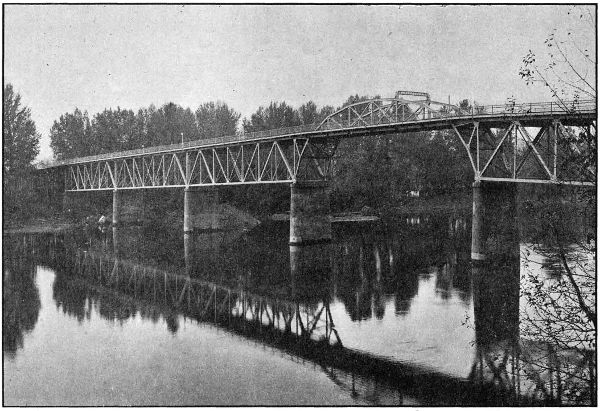
INTERCOUNTY BRIDGE OVER THE WILLAMETTE AT SALEM. BUILT BY MARION AND POLK COUNTIES IN 1917 AND 1918. COST $250,000.00. TOTAL LENGTH 2,220 FEET.
With a view to securing the approval of this project by the Federal Office of Public Roads, and to undertaking the construction during the 1918 season, the necessary surveys were made in January and February, 1918, and the plans submitted to the Office of Public Roads in March, 1918. The final approvement by the Government was received June 15, 1918, and on June 25 proposals for the construction were received and opened. The lowest bid received was from Warren Construction Company, Portland, Oregon, but as it was in excess of the State Highway Engineer’s estimate, and in excess of the available funds, all bids were rejected.
The work would have then been started by the Highway Department with State forces, but it was just at this time that the shortage of labor, materials, transportation facilities, etc., became serious, and the Federal Government called for curtailment of road construction, and the Highway Commission was forced to order the discontinuance of preparation for this paving, as well as for all other proposed work in the State.
Now, that Peace is in sight, there is every reason to believe that the Highway Commission will order that construction begin on the Salem-Aurora Paving at the very earliest date, and its completion may be looked for during the 1919 season.
This paving is to be sixteen feet wide with a two-foot rock shoulder on each side. The type will depend upon the bids received. The paving will start about four miles north of the city limits of Salem and extend to the Marion-Clackamas County Line, just north of Aurora, the total length being eighteen miles. It is estimated that this work will cost $360,000.00.
The Salem Bridge
The new bridge over the Willamette River at Salem, designed and built under the supervision of the State Highway Department, is one of the largest strictly highway bridges erected in the United States in 1918. This structure has a total length of 2,220 feet, and consists of 352 feet of reinforced concrete approach on the Marion County end, six steel spans over the river aggregating 885 lineal feet, and 780 feet of high class pile trestle approach on the Polk County end.
To provide for the river navigation, the U. S. Engineers required a minimum horizontal clearance normal to the channel of 120 feet and a vertical clearance of at least sixty-six feet above low water, in case a high level type of bridge were adopted. After careful study it was decided to construct a high level bridge of the deck type, and to carry the pony channel span on cantilevers projecting from the adjoining spans, giving an arch effect over the channel. By this type of construction, a clear distance of about 145 feet between channel piers was obtained.
To minimize the cost of fabrication and erection of steel, four spans were made practically the same. The east span was necessarily shorter than the typical ones, since otherwise it would place the channel opening too far across the river. This span is not so deep as the adjoining one, and the difference in height is made up by means of a rocker under the small span, which, of course, also serves the purpose of movable shoes. The channel span rests on cast steel rockers on one end, which are carried by a shelf on the cantilever panel. The opposite end of the span was pin connected.
Previous to the design of the bridge, wash borings were made, which indicated in a general way that the bed of the stream was composed of a few feet of gravel, underlaid with sand for a considerable depth. It was accordingly decided to carry the foundations down below the probable point of future scour, and carry the loads entirely upon piling. The two channel piers were sunk about thirty-five feet below low water.
The west approach is carried on fir piling treated in an open vat with carbolineum to a temperature of about 220 degrees F.
Lumber being comparatively cheap, the entire roadway deck of the bridge and wooden approach is composed of fir, three by seven inches and twenty-six feet long on edge, spiked together, thus projecting a foot outside the curb on either side, the roadway being twenty-four feet between curbs. An asphaltic wearing surface three and one-half inches thick effectively waterproofs the wood, and the small interstices between the pieces will allow sufficient circulation of air to preclude any possibility of attack of dry rot. The ends of the floor members were painted with hot carbolineum, as were also the wooden members contiguous to openings in the floor occasioned by expansion joints between spans.
The two five-foot concrete sidewalks are carried on brackets beyond the trusses. The curbs serve as reinforced concrete beams to carry half the sidewalk load to the trusses, there being small concrete struts extending up from the top of the top chords at panel and midpanel points. Between the bottom of the curb and the top of the wooden floor is a three-quarter-inch cushion of “Sarco.” Since the bridge is on a grade, it was necessary to precast this in sheets the width of the curb. When the material hardened, it was rolled up in convenient lengths and placed. It will thus be possible in the future to renew the wooden floor with comparatively little difficulty, although it is believed that the wood floor base, protected as it is now, should last at least fifty years.
On account of the rather extreme length for pony trusses of the channel span, 123 feet between end pins, it was decided to tie the trusses together, and this was accomplished by means of two arched lattice struts placed each twenty feet and six inches from the center of the span.
A final coat of battleship gray paint was applied to the steel work, and has evoked considerable favorable comment, being an innovation from the black paint commonly used in this part of the country.
The bridge was built by the Coast Bridge Company and Robert Wakefield of Portland. The cost of the structure complete was $250,000.00, of which Marion County paid approximately $200,000.00 and Polk County $50,000.00.
The engineering cost for the work is remarkably low. It includes surveys, borings, inspection of cement and steel fabrications, resident engineer’s salary, cost of design, blue prints and supplies and stenographic work, and amounts to $4,600.00, or about one and eight-tenths per cent of the total cost.
Surrey—Salem to Jefferson
A reconnaissance between the city limits of Salem and the Linn County Line (Santiam River) just south of Jefferson, was made in the spring of 1918, and the following facts developed, as regards the comparison of three possible routes between these points:
Via Turner and Marion:
Length, 22.5 miles.
Railroad grade crossings, 5 with main line of Southern Pacific.
Bridges, 9.
Overflow, long stretches.
Light grades—very little rise and fall.
Via Liberty and Ankeny Hill:
Length, 18.6 miles.
No railroad crossings.
Bridges, small.
Undulating steep grades—heavy work to cut to 5 per cent or extensive alignment changes involving added distance.
New right of way required through valuable orchard property.
Present road macadamized or graveled entire length.
Jackson Hill Route:
Length, 17 miles.
No railroad crossings.
Bridges, small.
Five per cent grades.
Good alignment. Low summit obtained by alignment change going to the east of Jackson Hill, involving two miles of new construction.
Right of way required—unimproved except in one instance.
Direct route.
Present road macadamized or graveled except for five miles.
A detailed survey was made over this so-called Jackson Hill route, and its advantages caused the Highway Commission to adopt it as the route of the Pacific Highway between these points. It is estimated the cost will be $109,000.00 to complete the subgrade, and it is expected this project will be commenced in 1919.
MORROW COUNTY
In Morrow County there are found all classes of conditions affecting roads and highway improvement. In some parts of the County there are good natural roads, while in other sections they are extremely poor. As in most other Eastern Oregon Counties, Morrow County has to wrestle with the problem of maintaining a large road mileage with a constant shortage of road funds. Highways are of extreme importance, as there are large agricultural communities that have no railway connections.
During the past two years the highway movement in Morrow County has experienced a wonderful growth. County authorities have broken the bonds of established custom, and have made a most creditable beginning in highway improvement. Although they have been supported by special road taxes, in most of the districts the available funds are far from adequate.
The State Highway Commission early realized the importance of good roads in this County, and took steps to extend the State aid through the Post Road Fund. The plans failed when the U. S. Office of Public Roads found it impossible to co-operate on the projects in question. This failure was due to nonfulfillment of post road requirements. Additional State aid was extended through the provisions of the $6,000,000.00 fund, but the execution of these plans were delayed by war conditions. This fund is still available, and the State Highway Commission will begin work as soon as conditions will permit.
Morrow County has received favorable consideration from the Highway Commission in the matter of surveys, it being the only county in Eastern Oregon in which the total mileage of State roads has been surveyed. Those surveys cover the Columbia River Highway in the north end of the County, and the Oregon-Washington Highway via Heppner, Ione and Lexington.
The Columbia River Highway was first surveyed under the direction of M. O. Bennett, and later additional work was done by Oscar Cutler. This survey was 13.85 miles in length. R. H. Baldock was locating engineer on the Oregon-Washington Highway survey, which has a total length of 66.1 miles.
Heppner Grading—Oregon-Washington Highway
During 1918 Morrow County graded 2.26 miles of standard road adjacent to the town of Heppner. A 1.82-mile section begins at the west city limits of Heppner and extends down Willow Creek on the State survey. Another section extends from the east city limits up Hinton Creek for a distance of .44 miles.
The County paid the total cost of this improvement which required $5,689.19. The State Department supplied the engineering supervision for this work through R. H. Baldock, resident engineer.
Following is a statement of construction quantities:
HEPPNER EAST
Common Excavation, 1,190 cu. yds. at. 43 $ 502.53
Culverts 216.35
Total 718.88
HEPPNER WEST
Common Excavation, 850 cu. yds. at .48 $ 407.01
Intermediate Excavation, 2,150 cu. yds. at $1.11 2,385.30
Culverts 2,178.00
Total $ 4,970.31
Jones Hill Grading
The 3.22-mile section of the Oregon-Washington Highway known as the Jones Hill Grade, lies about ten miles east of Heppner, and extends over the divide between Hinton and Butler Creeks. The State location involved the construction of an entirely new road. This improvement was paid for in full by the County, the total cost being $25,050.26.
R. H. Baldock, resident engineer for the State Highway Department, was the engineer in charge.
Construction quantities are shown in the following statement:
Rock Excavation, 6,200 cu. yds. at $3.98 $ 18,504.26
Common Excavation, 7,300 cu. yds. at .59 4,350.00
Culverts 2,200.00
Total cost $ 25,054.26
Heppner Macadam
After grading the 1.82-mile section of the Oregon-Washington Highway west of Heppner, and .44 miles east, Morrow County proceeded to surface with a standard waterbound macadam. This work was done on a force account basis by the United Contracting Co. and Warren Construction Co. The work was completed and opened to traffic in July, 1918.
The 2.26 miles of macadam cost the County a total of $19,280.35. A total of 4,208 cubic yards of rock was placed, making the unit cost $4.56 per cubic yard. Crushed trap rock was secured from a quarry near the city limits, and suitable binder material was found near at hand. The engineer in charge was R. H. Baldock of the State Department.
MULTNOMAH COUNTY
Although the assessed valuation of Multnomah County is more than thirty-five per cent of the total assessed valuation of the entire State, this County has renounced all claim to any share of the State Funds available for road purposes, and will construct and maintain in a high state of improvement, at its own expense, all State Roads within its boundaries. This liberal attitude of the people of Multnomah County is to be commended, and it makes available for expenditure in counties outside of Multnomah County, a much greater amount of money than would otherwise be the case.
The roads of Multnomah County represent some of the heaviest grading construction, some of the best improved and some of the most scenic highways to be found anywhere in the world. The Upper Columbia River Highway is by many considered the most scenic highway in the United States, and attracts a multitude of tourists annually.
An interesting tabulation of the amounts expended by Multnomah County in the construction of the Columbia River Highway, both above and below Portland, is appended:
COLUMBIA RIVER HIGHWAY, EAST 82D STREET VIA SANDY ROAD TO HOOD RIVER COUNTY LINE
Section Miles Pavement Grading Bridges Total
Sandy Road to Troutdale 10.29 $ 183,001.41 $ 5,000.00 $ 14,845.33 $ 202,846.74
Sandy Cut-off to Auto Club Bridge 2.47 47,506.74 94,389.04 ... 141,895.78
Columbia River Highway to County Line 26.68 495,507.75 601,012.13 169,586.71 1,266,106.59
Totals 39.44 $ 726,015.90 $ 700,401.17 $ 184,432.04 $ 1,610,849.11
Total Construction Cost $ 1,610,849.11
Engineering 72,004.95
Grand Total $ 1,682,854.06
VISTA HOUSE AT CROWN POINT
Building $ 68,314.36
Retaining Walls and Pavement 30,833.69
Total $ 99,148.05
ST. HELENS ROAD, PORTLAND TO COLUMBIA COUNTY LINE LENGTH, 16 MILES
1915 1916 1917 1918 Totals
Regrade and Macadam ... $ 35,330.82 $ 16,444.10 ... $ 51,774.92
Hard Surface $ 80,944.11 4,111.79 200,047.81 41,393.37 326,497.08
Shoulders ... 5,081.80 ... ... 5,031.80
Drainage ... ... 5,022.19 ... 5,022.19
Bridges ... 28,591.39 14,203.21 ... 42,794.60
Right of Way and Miscellaneous ... ... 2,538.06 ... 2,538.06
Engineering, Superintendence and Overhead 3,500.00 3,400.00 16,667.87 2,000.00 25,567.87
Total $ 84,444.11 $ 76,465.80 $ 254,933.24 $ 43,393.37 $ 459,226.52
SUMMARY
Pavement $ 326,497.08
Bridges 42,794.60
Grading 64,366.97
Engineering and Overhead 25,567.87
Grand Total $ 459,226.52
POLK COUNTY
The work of the State Highway Department in Polk County during 1917 and 1918 has been confined chiefly to the design and the supervision of construction of bridges. In addition to the design and supervision of the Salem Bridge which is partly within Polk County, and which is described in detail in an article in the chapter devoted to Marion County, the Department has handled, at the request of the Polk County Court, the following bridge work, all of which has been paid for by the County.
Between Monmouth and Dallas a 37 foot reinforced concrete bridge was built over a slough on the Mulkey Cut-off. This bridge complete cost $1,898.17.
The Hollingshead Bridge over the Little Luckiamute River south of Dallas is a 72 foot covered wooden span on concrete piers. This bridge was built at a cost of $3,615.00.
A 160 foot suspension foot-bridge was built over the Big Luckiamute River at a cost of $500.00, to accommodate school children attending the Montgomery School.
The LaCreole Creek Bridge in Dallas is a reinforced concrete arch structure seventy feet long. This bridge was not designed by the Highway Department, but the Department supervised its construction. It is a very pretty structure with sidewalks and lighting fixtures. It was built at a cost of $10,755.68.
SHERMAN COUNTY
Sherman County is so situated with respect to the State Highway System, that its boundaries include a comparatively small mileage of State roads. This however, is no indication of the value improved roads will be in the County. The situation is of both state wide and local importance.
This County is found with many miles of good natural road. In addition they have graded a large mileage and in some localities unusual attention is given to road maintenance. The County is fairly well equipped for road work and have plans for quite an extensive program.
State aid in Sherman County thus far has been confined to highway surveying, but the State Highway Commission has definite plans for extending aid in the construction of the Deschutes and John Day River Bridges and the grading of the Columbia River Highway. It is expected this work will start early the coming season.
The Deschutes River Bridge.
Various attempts have been made by Sherman, Wasco County and the State to raise funds for the construction of the Deschutes River Bridge on the Columbia River Highway. Success crowned these efforts recently when a final agreement was reached between the three.
The total estimated cost of this bridge is between $70,000.00 and $75,000.00. The State Department plans call for a reinforced concrete structure about 600 feet in length.
Sherman County has pledged $25,000 towards defraying the cost of the bridge providing funds are raised for completing same. This condition has been met by the State Highway Commission and negotiations are already underway for securing right-of-way. In this connection it is pertinent to state that Wasco County also has appropriated $25,000.00 for co-operation in this work. The State’s share of the cost will be approximately $25,000.00, according to the present estimate.
Columbia River Highway Survey
During 1918 the State Department made a location survey of the Columbia River Highway between the Deschutes and John Day Rivers. The line follows the river canyon through Sherman, Biggs and Rufus. The length of this survey is 14.66 miles. The field work only has been completed on this survey and construction plans will be made up soon. C. S. Noble was the locating engineer for the Department.
John Day Bridge
This inter-county bridge will be located on the Columbia River Highway across the John Day River, below McDonald, and will obviate the necessity for the toll ferry at McDonald.
As designed, the crossing calls for 2-123 foot wooden deck spans on concrete piers and about 120 feet of high class wooden approach and 100 feet of fill. The cost, which is estimated to be $20,000.00, will be borne by Sherman and Gilliam Counties, and the State, and it is probable that construction work will start next spring.
TILLAMOOK COUNTY
Paving—Tillamook South
A contract was awarded on August 7, 1917, to Oskar Huber of Portland for the grading and paving of a five mile section extending south from the end of the paving then in place about three miles south of Tillamook City.
The old road which this paving was to follow in a general way contained many sharp curves and had a roadbed not eighteen feet wide on the average. On this was a light surfacing of gravel and rock macadam about twelve feet in width. The roadbed was widened to a twenty-four foot width, all excessively sharp curves were eliminated, and all wooden culverts, trestles, and bridges were replaced with modern concrete structures, and the decking on two steel bridges renewed and paved.
As there is available in this vicinity no ledge rock, it was found necessary to haul and crush large boulders from the creek bed to provide the necessary rock for the base and mixture. Some sand was obtained locally, but most of it had to be shipped in from Portland and hauled to the work from Tillamook.
The job was completed by December 15th of this year, and on account of the unusually bad conditions faced by the contractor as regards labor and materials, Mr. Huber is to be commended for the prompt completion of the work as well as for the excellence of construction.
By an arrangement between the County and the Highway Commission the County pays for all grading in connection with this improvement and also for twenty-five per cent of the cost of the paving. The total cost of the grading and paving complete is $109,250.00 of which the County will pay $34,325.00 and the State $74,925.00.
Mr. C. W. Wanzer was in charge of this work as resident engineer.
DETAILED STATEMENT OF EXPENDITURES TO NOVEMBER 30, 1918— GRADING AND PAVING—TILLAMOOK SECTION
Engineering $ 6,391.47
Contract Construction Work as follows—
Common Excavation, 10,835.3 Cu. Yds. at 60c $ 6,501.18
Intermediate Excavation, 1,959.5 Cu. Yds. at 90c 1,763.55
Overhaul, per 100 Lin. ft., 6,314.8 Cu. Yds. at 2c 126.30
12-inch Reinf. Conc. Pipe (Placing only) 84 Lin. ft. at 48c 40.32
18-inch Reinf. Conc. Pipe (Placing only) 607 Lin. ft. at 78c 473.46
24-inch Reinf. Conc. Pipe (Placing only) 384 Lin. ft. at $1.16 445.44
36-inch Reinf. Conc. Pipe (Placing only) 64 Lin. ft. at $1.80 115.20
Clearing and Grubbing (Force Account) 543.75
Moving Fences (Force Account) 4.00
Standard Bitulithic Pavement, 47,555.5 Sq. Yds. at $1.42 67,528.81
Broken Stone Loose measure, 8,840 Cu. Yds. at $2.20 19,448.00
Crushed Stone Shoulders, 7,466 Lin. ft. at 6c 447.96
Total Amount Earned by Contractors to Nov. 30, 1918 97,437.97
Less 15% retained pending completion 14,615.69
Total Payments to Contractor to November 30, 1918 82,822.28
Total Expenditure to November 30, 1918 89,213.75
Paid by State 63,203.90
Paid by County 26,009.85
Total $ 89,213.75
Three Rivers Forest Project
A Federal Aid Forest Road Project is now under construction between Hebo and Dolph in Tillamook County. This project is 10.3 miles in length, includes grading and nine foot rock surfacing, and is estimated to cost $122,000.00 of which $21,500.00 will be paid by the County, $50,250.00 by the State, and $50,250.00 by the Federal Government.
This work is handled under the supervision of Federal Office of Public Roads. The contract was awarded to the Tillamook County Court, but the State’s Attorney General ruled that the Court had no authority which would allow them to contract to do work of this nature. To facilitate matters the Highway Commission took the contract over from the County, and the work is now in progress, the Highway Department acting as contractors and being paid for the work at the unit prices originally bid by Tillamook County.
It was so late in the year when this work was taken over by the State that little work can be done until the 1919 season. Work is in progress, however, on camp construction, clearing, and such other portions of the work as can be done during the winter months.
Mr. J. M. Baker is superintendent of construction on this work.
Tillamook-Cloverdale Survey
On the Tillamook-Cloverdale road a preliminary survey has been completed from Tillamook to Hebo, a distance of 18 miles, and of this about nine miles have been located. This is a very important section as it is the most direct route from the Willamette Valley to the beaches of Tillamook County, and is not served with a railroad. The engineer in charge of this work was Mr. C. A. Dunn.
UMATILLA COUNTY
The highway problem of Umatilla County is of greater magnitude than it would seem to be at first consideration. The fact that the County is well supplied with rail transportation only renders the demand for highways more urgent. Soil conditions are generally unfavorable for good natural roads although gravel deposits suitable for highway construction are found in most localities.
The County has made constant efforts towards an improved system of roads, but with 3,000 miles of county roads to care for and with considerable bridge work in the program, the available funds are found to be entirely inadequate. The main roads or trunk highways through the County have had the benefit of a large percentage of local funds but owing to a large mileage and character of improvement necessary, there remains a great deal yet to be done.
When the State of Oregon voted to expend $6,000,000.00 in surfacing roads constructed by the counties, Umatilla County was among the first to take advantage of the State aid. The State Highway Commission extended additional aid through the Post Road Fund, but these plans were later cancelled owing to requirements of the U. S. Office of Public Roads.
The State Highway Department has surveyed the Old Oregon Trail for the entire distance across the County and 42.2 miles of the Oregon-Washington Highway have been surveyed. In addition a considerable mileage of reconnaissance surveys have been made preliminary to definite location.
In 1917 and 1918 the State Highway Department expended $162,625.56 in constructing eleven miles of pavement near Pendleton. The cost of maintenance on this road has been divided equally between the State and County.
Funds were set aside by the State Highway Commission in 1917 to macadamize the 40 mile section of Old Oregon Trail from Pendleton west to the Morrow County line. War conditions caused a postponement of this improvement. The funds are still intact and work will proceed as soon as conditions will permit. Following are statements showing amounts of State funds expended in Umatilla County and funds appropriated to be expended in 1919.
Expended in 1917 and 1918 for paving on Wild Horse Road and Pendleton-Reith Section $ 162,626.56
Appropriated to be expended in 1919 on macadamizing Old Oregon Trail from Pendleton to Morrow County line near Umatilla 180,000.00
Wild Horse Paving
The State Highway Commission on June 29, 1917, let a contract to the Warren Construction Company for paving a ten mile section of the Wild Horse Road northeast of Pendleton and one mile of the Old Oregon Trail leading west from Pendleton. The pavement laid was bitulithic and the subgrade was an old macadam road built by the County. The macadam road was of insufficient width for supporting a 16 foot pavement, which condition required widening of the grade, re-ditching and the placing of extra crushed rock for base.
The widening of the road bed was done with County funds expended under the direction of the State Highway Department. The work of widening the grade cost the County, $9,975.00 for the 11 miles.
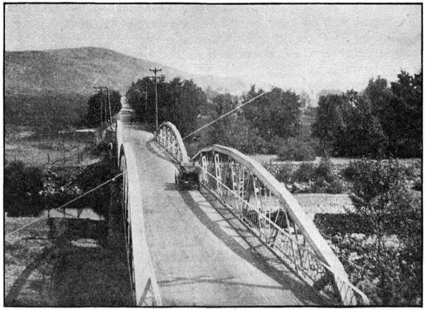
ON THE PAVED ROAD BETWEEN PENDLETON AND ADAMS IN UMATILLA COUNTY. PAVED IN 1917
Paving work begun in July, 1917, and an excellent pavement of the standard two-inch bitulithic type was secured, with a six inch crushed rock base. The total cost of this work was $162,626.56 or $14,784.22 per mile. M. O. Bennett was the engineer in charge and Chas. Noble was the inspector on this work. Following is a detailed cost statement:
DETAILED COST STATEMENT—WILD HORSE PAVING
Standard Bitulithic Pavement, 103,543.79 sq. yds. at $1.29 $ 133,571.49
Broken Stone loose measure. 10,994.8 cu. yds. at $1.87 20,560.28
Crushed stone. 115,600 lin. ft. at 5c 5,780.00
Extra work on road approaches 104.91
$ 160,016.68
Engineering and Inspection 2,609.88
Total $ 162,626.56
Wild Horse Grading
When plans were made in 1917 for the Wild Horse paving. 16 feet was the width decided upon. Upon investigation it was found this would require widening of the old road bed from one foot to five feet, re-ditching for a large part of the 10 miles and the replacing of several culverts.
This work was done under the direction of the State Highway Department and the entire cost was defrayed from County funds. The total cost to the County was $9,975.00. Oscar Cutler of the State Highway Department was resident engineer in charge.
Pendleton-Pilot Rock Section—Grading and Macadamizing
Upon the completion of the survey by the State Highway Department of the section of the Oregon-Washington Highway between Pendleton and Pilot Rock, the Umatilla County Court started grading. Where the construction is light the road grader was used to great advantage. Through the aid of the Division Office of the State Department new right-of-way was secured in some places and the alignment of the road naturally improved.
During September and October, 1918, the section between Pendleton and the County Poor Farm was graded and macadamized on a six per cent development over Grave Yard Hill. This work, both grading and macadamizing is of excellent character and will soon be opened to traffic. W. C. Crews, engineer for the State Department made the relocation on this section and was resident engineer during construction. The following is a statement showing quantities and total and unit costs:
Item and quantity Total cost Unit cost
Excavation, 4,795 cu. yds $ 3,164.70 $ .66
Gravel, 2,000 cu. yds 2,600.00 1.30
Concrete Bridge 1,600.00
Total cost $ 7,364.70
An additional four miles from the County Poor Farm south was graveled by the County with an expenditure of $2,000.00.
Survey of Columbia River Highway and Old Oregon Trail
During 1917 and 1918 the State Highway Department made a location survey over the entire east and west route across Umatilla County, excepting the six mile section between Pendleton and the Indian Agency. On this six miles a base line survey only was made.
The section of this road between the Morrow County Line and Pendleton is a part of the Columbia River Highway and has a total length of 40.5 miles. It passes through Umatilla, Hermiston, Stanfield, Echo and Reith. From Pendleton east the road is known as the Old Oregon Trail.
The survey in the east end of the County begins at the Umatilla Indian Agency, follows the general direction of the present road up Cabbage Hill, passes through Meacham and ends at the Union County Line near Kamela. A five per cent grade was secured on the Cabbage Hill climb. The total length of this section is 26.8 miles. R. H. Baldock and Oscar Cutler were the locating engineers on this work. The plans for this survey are practically complete.
Survey of Oregon-Washington Highway
The State survey of the Oregon and Washington Highway extends from the end of the pavement ten miles northeast of Pendleton, through Pendleton, and Pilot Rock to the Morrow County Line west of Butter Creek. This survey was made in 1917 and a section south of Pendleton was relocated in 1918. The total length of this line is 42.2 miles. R. H. Baldock and Oscar Cutler were the locating engineers on this work and the revision was made under the direction of W. C. Crews.
UNION COUNTY
In the matter of highway improvement Union County has shown considerable progress. Substantial road building machinery is owned by the County in units sufficient to allow work to proceed simultaneously in various sections of the County. It is noticeable however that most of their work has been done (and justifiably so) on local and feeder roads rather than on trunk highways. Local funds and equipment are inadequate to make all the improvements needed when the mountainous sections of the main roads are considered.
As in other counties the State Highway Commission easily recognized the necessity and importance of co-operation and accordingly in 1917 plans were laid and steps taken to extend State and Federal Aid.
During 1917 and 1918 a total of 83.54 miles of survey was made on the two principal roads of the County. 45.26 miles on the Old Oregon Trail and 38.28 miles on the La Grande-Joseph Highway.
Agreements were signed by the Secretary of Agriculture providing for co-operation with the State on equal basis, for the grading of a six mile section between Union and Telocaset and a 9.37 mile section between Elgin and Minam. The respective amounts expended on each of these projects to the date of this report, November 30, 1918, are: $16,642.29 and $3,838.44. State funds amounting to $5,000.00 have been expended for grading in cooperation with the County on the La Grande-Hot Lake Section. This road is 7.95 miles in length and involves the opening of a new road for the entire distance. The State Highway Commission has set aside funds for graveling this section preparatory to surfacing. The completion of these three projects will require approximately $66,737.06 from the State, $35,575.50 from the Federal Government, and $3,000 from the County.
The following summary shows for each project amounts expended to date and funds set aside to be expended during 1919:
EXPENDED IN 1917 AND 1918
State Funds County Funds Govern- ment Funds Total
Union Telocaset $ 16,642.29 ... ... $ 16,642.29
Elgin-Minam 3,838.44 ... ... 3,838.44
La Grande-Hot Lake 5,000.00 $ 3,000.00 ... 8,000.00
Total $ 25,480.73 $ 3,000.00 ... $ 28,480.73
APPROPRIATED FOR EXPENDITURE IN 1919
State Funds County Funds Govern- ment Funds Total
Union Telocaset ... ... $ 15,000.00 $ 15,000.00
Elgin-Minam $ 16,737.06 ... 20,575.50 37,312.56
La Grande-Hot Lake 50,000.00 $ 3,000.00 ... 53,000.00
Total $ 66,737.06 $ 3,000.00 $ 35,575.50 $ 105,312.56
The absence of figures in the column headed “County funds” in the above tabulation is explained by the fact that Union County, in the matter of co-operation, has agreed to expend certain sums on other roads than those mentioned in the table. The County’s appropriation for the improvement of the La Grande-Kamela section of the Old Oregon Trail is $40,000.00 and $10,000.00 additional has been stipulated for use in improving the Elgin-Willow Creek Section of the La Grande-Joseph Highway. The County has also provided funds for the completion of the grading between La Grande and Hot Lake.
Union-Telocaset Section Grading
In August, 1918, the State Highway Commission called for bids on the grading of a six mile section between Union and Telocaset. The Union County Court was the successful bidder and the Commission awarded the contract but it later developed that the County could not legally hold the position of contractor in doing State work. As the other bids were unsatisfactory the situation resulted in the State taking over the work and doing it with the State forces, and by November 30, the project was about 60% complete. The total estimated cost of this work is $30,000.00 and $16,642.29 has been expended to date. Mr. R. A. Pratt is resident engineer in charge.
Elgin-Minam Section
The State Highway Commission opened bids on the grading of a 9.37 mile section between Elgin and Minam Hill. In the letting of this work they experienced the same difficulty as with the Union-Telocaset work. (See report on the Union-Telocaset grading). The subsequent action of the State Highway Commission in taking the contract over to be done by State forces resulted in work starting in August, 1918. Owing to weather and soil conditions work on this section has closed down for the winter. The amount expended is $3,838.44 and the total estimated cost is $41,151.00. Mr. R. A. Pratt, resident engineer for the State Highway Department was in charge of this work and Mr. C. A. Dunn was superintendent.
La Grande-Hot Lake Grading
In November, 1917, the State Highway Department appropriated $5,000.00 to co-operate on the grading of that section of the Old Oregon Trail between Hot Lake and La Grande. Grading work started within the month and two miles were graded when work was closed for the winter.
This work was continued during the present season and up to November 30, about five miles of grade had been completed. In addition to the $5,000.00 of State money the County has expended about $3,000.00. It will require about $3,000.00 to complete the grading and an additional $5,500.00 for bridges. The bridge plans call for concrete structures.
Survey of the Old Oregon Trail, Union County
The State Highway Department has made a location survey of 45.26 miles of the Old Oregon Trail in Union County. The survey begins at the Union-Umatilla County Line near Kamela and continues through La Grande, Hot Lake and Union and ends at Telocaset. Office plans are complete for most of this work. Locating engineer D. D. Glass made the survey from La Grande to Telocaset and R. H. Baldock, locating engineer, was in charge of the work between Kamela and La Grande.
Survey of La Grande-Joseph Highway, Union County
In 1917 a final location survey was made from La Grande to Minam, a distance of 38.28 miles. D. G. Glass, locating engineer for the State Department, was in charge of the crews. Beginning at La Grande the line runs through Island City, and Elgin and ends at Minam at the confluence of the Minam and Wallowa Rivers. Plans for this work are practically complete. The location from Island City to Elgin is to be reconsidered with the view of making some changes in the route.
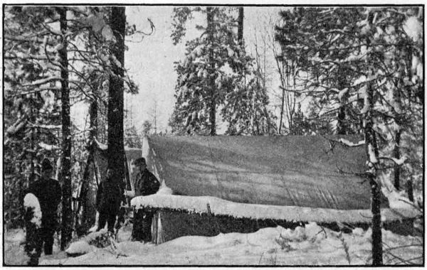
A SURVEY CAMP IN EASTERN OREGON
Union-Telocaset Post Road Project
A co-operative agreement between the State and Government provides for the construction of a portion of the Old Oregon Trail between Union and Telocaset. This section, six miles in length, begins at Union and follows up Pyles Canyon near the location of the present road to a point 1.5 miles north of Telocaset.
The total estimated cost of this project is $30,000.00 making $15,000.00 to be paid by each the State and Government. Union County joins in the co-operation of the work, in case the total cost exceeds the amount stipulated in the Federal agreement. If the total cost should exceed the estimate given in the project agreement, the County agrees to pay the full amount of such cost.
Work was started on this section August, 1918, and $20,575.50 had been expended to November 30. R. A. Pratt is resident engineer for the Department. The work is being done by the State forces under the supervision of C. A. Dunn, assistant engineer.
Elgin-Minam Post Road Project
The State Highway Commission secured an agreement with the U. S. Office of Public Roads providing for the construction of a 9.37 mile section of the La Grande-Joseph Highway. The survey for this improvement begins at Elgin and follows east in the direction of the present road to the top of Minam Hill.
It is estimated that this work will cost $41,151.00 or $20,575.50 for each the State and Government. In case the cost of this work exceeds the estimate shown in the project agreement, the County agrees to pay such cost. In this manner Union County is co-operating in this improvement.
Work opened up here in August under the supervision of C. A. Dunn, assistant engineer, for the Department. State forces are employed on force account basis. The expenditures to November 30 amount to $3,838.44, and the project is about 10% completed. R. A. Pratt is resident engineer for the State Department.
WALLOWA COUNTY
Wallowa County’s road problem is entirely local in character as this district is not touched by a trunk road of the State system. Some very good natural roads are found in this district, while others are very bad. The latter designation applies more especially to some of the mountain roads, which are extremely narrow and very dangerous.
The La Grande-Joseph Highway is very important locally, since it is the only road connecting the valley with outside points. The people in general are very much interested in highway possibilities, but the County funds have proven inadequate to make much of a showing towards permanent work. Most of the available County funds are required for maintenance of the existing roads, many of which extend through mountainous areas. Additional State aid is much needed if any substantial improvements are hoped for.
A general reconnaissance survey was made in October, 1918, by the State Highway Department from Elgin to Joseph. The purpose was to gather general information for the use of the State Highway Commission. This survey was made by M. O. Bennett, division engineer for Eastern Oregon.
During this visit the matter of Post Road Aid was taken up with the County authorities. It was understood that the County would make application at once, but it appears that no further action was taken.
The State Highway Commission has extended aid to Wallowa County by co-operating on the Flora-Enterprise Forest Road and also helped to secure Government aid on the same project. The County made an appropriation to help in the construction of this road. Work is in progress on this road under the direction of the U. S. Office of Public Roads. The following statement shows the estimate cost and segregation of funds:
State appropriation $ 12,324.00
Federal appropriation 12,324.00
County appropriation 5,000.00
Total estimated cost $ 29,648.00
WASCO COUNTY
The Dalles-Three Mile Post Road Project
An appropriation has been made, by the State Highway Department, from the Post Road Fund for co-operation in the paving of a two mile section of The Dalles-California Highway between the east city limits of The Dalles and Three Mile Creek.
A project statement has been prepared, requesting $14,830.00 from the U. S. Office of Public Roads. The State will supply a like amount and Wasco County $4,000.00. This makes a total of $33,660.00 which is the estimated cost of the project.
The present gravel road will serve as a base for the pavement which is to be 16 feet wide. The improvement will include re-ditching of the road bed and the installation of culvert pipe in several places.
It is planned that work will start early in 1910.
The Pine Hollow-Kingsley Post Road Project
The section of The Dalles-California Highway in Wasco County between Pine Hollow, near Dufur, and Kingsley is designated by the State Highway Commission as a Post Road. This section is 4.0 miles long and follows near the line of the present road. The project begins at the road forks 21⁄4 miles south of Dufur and ends at a point on the present road 11⁄2 miles north of Kingsley.
The plans provide for the grading of the road bed, the estimated cost of which is $14,500. The State and Government are each requested to appropriate $2,500.00 and the County will expend $9,500.00. It is expected this work will be done in 1919.
Antelope Grade Post Road Project
The State Highway Commission has designated as a Post Road a three mile section of The Dalles-California Highway immediately north of Antelope. This is known as the Antelope Grade Section. The new road will be a 6% grade along near the present road.
The total estimated cost of grading to standard width and properly draining is $30,000.00; and the funds are to be provided as follows: State $2,500.00; Government, $2,500.00; and Wasco County, $25,000.00.
It is hoped this work will start early in 1919.
Survey—Seufert to the Deschutes River
A survey was made in April, 1918, for the Columbia River Highway between Seufert and the Deschutes River, along the river for the purpose of comparison with a previous survey over the hill, conforming closely to the present road.
This route, which was subsequently adopted, has a summit of 210 feet against 780 feet on the hill route, and a length of 12.8 miles, a saving of 2.7 miles in distance. Between The Dalles and Seufert about two miles was graded to standard width and grade in 1917. The proposed route follows close to the railroad, which is crossed near Big Eddy on a proposed overhead bridge and utilizes the old State Portage Railroad roadbed, as well as the already graded bank of the Government canal. Near Celilo, another overhead crossing of the O.-W. R. R. & N. Co. tracks is proposed, and from this point to the Deschutes River the highway is located between the Oregon Trunk Railroad and the O.-W. R. R. & N. Co., using about two miles of abandoned railroad roadbed.
This improvement requires only very light construction, except for short distances, and it is believed it can be kept free from drifting blow sand by the use of sand fences, as the Portage Railroad is used where the sand is the worst, and this was kept open with very little maintenance. With a smooth roadbed, and with nothing to cause drifting, it is thought that the maintenance on this account will be negligible.
The route is attractive, as it makes available at close range the Locks at Big Eddy, the Celilo Canal, and the magnificent Celilo Falls. The estimated cost of this project is $142,500.00. It is proposed to include this project in the 1919 program.
Deschutes River Bridge.
Among the bridges expected to be built in the near future is the proposed reinforced concrete arch bridge over the Deschutes river at Miller, about a mile above the river’s mouth. This will be a State and Inter-county structure, and will connect Sherman and Gilliam Counties on the Columbia River Highway, and will be located a few hundred feet below the present old wooden toll bridge which it will replace.
The design, which is practically completed, contemplates seven arch spans aggregating 580 feet in length with a filled approach at either end. The estimated cost of the bridge is $75,000.00.
WASHINGTON COUNTY
During 1917 and 1918, the State Highway Department in co-operation with Washington County has completed the grading, bridging and paving of the West Side Highway across that County. This work has involved the grading and paving of 12.5 miles and the construction of three bridges and one undergrade railway crossing. On this work, when final payments are complete, the State will have expended $292,000.00 and the County will have expended $10,000.00.
In addition to this construction, the Department has made surveys between Beaverton and Hillsboro and between Forest Grove and Gaston, and has furnished the County engineering services in connection with the grading of these two sections.
Paving—Multnomah County Line to Newberg
The pavement on the West Side State Highway between the Multnomah County Line and Newberg is 15.7 miles in length, of which 12.5 miles is in Washington County and 3.2 miles in Yamhill County. This pavement is a two-inch standard bitulithic surface on a crushed rock base. It is sixteen feet wide with a two-foot macadam shoulder on each side. The grading in Washington County and the paving in both Washington and Yamhill Counties was done by Oskar Huber of Portland under a contract awarded him on July 30, 1917. The work was started in August, 1917, and was completed in October, 1918.
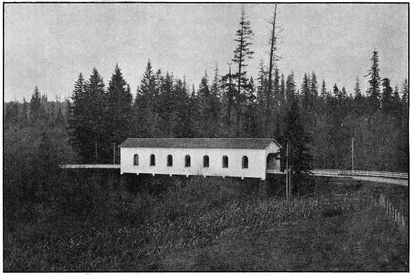
COVERED WOOD BRIDGE OVER THE TUALATIN RIVER ON THE WEST SIDE HIGHWAY IN WASHINGTON COUNTY BUILT IN 1918
The grading in Washington County will cost complete approximately $39,699.85 of which Washington County has paid $9,395.00. The part of the paving within Washington County will cost complete $234,750.00 all of which is paid for from State Funds.
DETAILED STATEMENT OF EXPENDITURES TO NOVEMBER 30, 1918 GRADING AND PAVING MULTNOMAH COUNTY LINE TO NEWBERG
Engineering $ 9,445.56
Right-of-Way Costs 49.98
Construction:
Crushed Stone Shoulders, 163,663.4 lin. ft. @ .06 $ 9,819.80
Standard Bitulithic Pavement, 149,764.4 Sq. Yds. @ $1.28 191,698.43
Broken Stone, Loose Measure, 34,885.75 Cu. Yds. at $2.40 83,725.80
Clearing and Grubbing 1,250.00
Common Excavation, 46,773.9 Cu. Yds. @ .34 15,903.13
Intermediate Excavation, 9,224.4 Cu. Yds. @ .62 5,719.13
Solid Rock Excavation, 385 Cu. Yds. @ $1.15 442.75
Overhaul per 100 Lin. Ft., 172,279.2 Cu. Yds. @ .01 1,722.79
12-inch Reinf. Conc. Pipe, 1,568 Lin. Ft. @ $1.25 1,960.00
24-inch Reinf. Conc. Pipe, 52 Lin. Ft. @ $2.45 127.40
36-inch Reinf. Conc. Pipe, 96 Lin. Ft. @ $4.25 408.00
6-inch Porous Drain Tile, 7,191 Lin. Ft. @ .15 1,078.65
Rip-Rap, 32 Cu. Yds @ $2.75 88.00
Force Account:
Lowering and lengthening existing culverts 1,081.67
Replacing bridge approach at Tualatin River 50.27
Special wide ditches alongside road near Four Corners 814.50
Back-fill and planking at Onion Flat Trestle 405.94
Tearing down old trestles at Onion Flat 55.33
Replacing private water supply crossing 13.31
Rebuilding Right of Way Fences 70.85
Grading at Middleton R. R. Crossing 1,970.47
Blind Drains 189.68
New 30-foot Culvert 223.60
New 42-foot Culvert and special fill over it 468.26
Drain Tiling, back-filled with rock 582.09
Total amount earned by Contractor to Nov. 30, 1918 $ 319,869.85
Less amount retained pending completion of contract 50,388.46
Total paid contractor to November 30, 1918 269,481.39
Total expended to November 30, 1918 $ 278,976.93
Onion Flat Bridge
This crossing consists of a laminated wood deck on heavy stringers supported by a series of creosoted pile bents. It is on the West Side Highway about four miles southwest of Tigard and is designed for heavy traffic loading.
An asphaltic wearing surface prevents moisture coming in contact with the wooden floor and with the treated piling tends to give the maximum length of life to the main members of the structure. This bridge is 600 feet long and cost complete $8,372.22.
Fanno Creek Bridge
The Fanno Creek bridge at Tigard on the West Side Highway consists of a superstructure similar to the Onion Flat bridge, carried on wood bents on concrete foundations. A sidewalk was built on one side to accommodate pedestrians. The bridge is 70 feet long and cost $1,882.81.
Tualatin River Bridge
The bridge consists of a covered Howe truss wooden bridge of 144 foot span and 166 lineal feet of pile trestle approach.
Like the others constructed by the State on main highways, this bridge is of heavy traffic design, and the bridge and approaches have laminated wood floors with asphaltic wearing surfaces. Windows are provided at panel points to provide light and to add to the appearance of the structure. Cost $12,968.60.
Votaw Undercrossing
A grade separation was made on the West Side Highway near Votaw, wherein a wooden trestle was constructed to carry the Southern Pacific line above the roadway. The structure was designed and built under the supervision of the railroad’s engineering department.
Final settlement has not yet been made with the Railway Company, but it is estimated that the State’s share of the cost of this structure will be $4,000.00. The balance of the cost will be paid by the Railway Company, no share of the cost being borne by the County.
Survey—Beaverton to Hillsboro
A location survey was started January 1, 1918, from the West City limits of Beaverton and completed to the city limits of Hillsboro, a distance of 7.7 miles. The alignment parallels the Southern Pacific Railway on the north side of the tracks and eliminates four grade crossings. The entire section was graded by Washington County during the 1918 season.