Volume 2 — CONTENTS OF VOLUME II
Reading edition
PAGE
Maps and Plans in Volume IIvii
Conspectus of Eventsxi
Pronunciation of Spanishxiii
CHAPTER
XXI.Behind the Scenes at Mexico1
XXII.Vera Cruz17
XXIII.Cerro Gordo37
XXIV.Puebla60
XXV.On to the Capital79
XXVI.Contreras and Churubusco99
XXVII.Negotiations120
XXVIII.Molino del Rey, Chapultepec and Mexico140
XXIX.Final Military Operations165
XXX.The Naval Operations189
XXXI.The Americans as Conquerors210
XXXII.Peace233
XXXIII.The Finances of the War253
XXXIV.The War in American Politics268
XXXV.The Foreign Relations of the War294
XXXVI.Conclusion310
Notes on Volume II327
Appendix (Lists of Sources)517
Index563
MAPS AND PLANS IN VOLUME TWO
As equally good sources disagree sometimes, a few inconsistencies are unavoidable. Numerous errors have been corrected. An asterisk indicates an unpublished source. Statements, cited in the notes, have also been used.
1.The Fortress of San Juan de Ulúa in 185421
From a *plan in the War Dept., Washington.
2.Siege of Vera Cruz: General Plan24
From a map drawn by McClellan from surveys done by six American officers (N. Y. City Public Library); *a map drawn by order of Lieut. Col. Henry Wilson (War Dept., Washington).
3.Siege of Vera Cruz: The American Works28
From a map drawn by Lieut. Foster, based on surveys of four American officers (War Dept., Washington).
4.From Vera Cruz to Perote39
Based on a map issued by Manouvrier and Snell, New Orleans, 1847 (Papers of N. P. Trist).
5.Contour Lines near Cerro Gordo40
From a *drawing in the War College, Washington.
6.Battle of Cerro Gordo: General Map43
Based on a map drawn by Lieut. Coppée from the surveys of Maj. Turnbull and Capt. McClellan (Sen. Ex. Doc. 1; 30 Cong., 1 sess.); a map drawn by McClellan (Mass. Hist. Society); a *sketch of a reconnaissance by Lieut. Tower (War Dept., Washington); *Croquis de la Posición del campo de Cerro Gordo, 1847 (War Dept., Washington); a plan by I. A. de Soiecki (Vera Cruz City archives); and a *sketch by Lieut. Thos. Williams (among his letters).
7.Battle of Cerro Gordo: Central Portion51
Based on the same sources as No. 6 supra.
8.From Jalapa to Puebla61
Based on a Fomento Dept. map.
9.Profile of the Route from Vera Cruz to Mexico62
From a map published by Manouvrier and Snell, New Orleans, 1847 (Papers of N. P. Trist).
10.A Part of the Valley of Mexico80
From a map surveyed and drawn by Lieut. M. L. Smith and Bvt. Capt. Hardcastle (Sen. Ex. Doc. 11; 31 Cong., 1 sess.); and a map by Balbontín (Invasión Americana).
11.Battles of August 19 and 20, 1847: General Map100
Based on a map drawn by Hardcastle from the surveys of Maj. Turnbull, Capt. McClellan and Lieut. Hardcastle (Sen. Ex. Doc. 1; 30 Cong., 1 sess.); the Smith and Hardcastle map (No. 10 supra); a *map drawn by Capt. Barnard from the surveys of Capt. Mason and Lieuts. Beauregard, McClellan, and Foster (War Dept., Washington); a map drawn by Hardcastle from the surveys of Mason and Hardcastle (Sen. Ex. Doc. 1; 30 Cong., 1 sess.); a map in Apuntes; and a map drawn by McClellan (Mass. Hist. Society).
12.Battle of Contreras108
Based on the Turnbull map (No. 11 supra); a *plan of Capt. Gardner (Pierce Papers); *notes by Capt. Henshaw on a map by Hardcastle (Mass. Hist. Society); a *sketch by Lieut. Collins, 4th Artillery (Collins Papers); New Orleans Picayune, Sept. 12, 1847; a plan by Balbontín (Invasión Americana); and a map in Apuntes.
13.Battle of Churubusco111
Based on the Turnbull map (No. 11 supra); a map drawn by Hardcastle from the surveys of Mason and Hardcastle (Sen. Ex. Doc. 1; 30 Cong., 1 sess.); and a sketch by Balbontín (“Invasión Americana”).
14.The Tête de Pont, Churubusco112
*Drawn by Lieuts. Beauregard and Tower from Beauregard’s survey (War Dept., Washington).
15.Profile of East Curtain, Tête de Pont, Churubusco113
*Drawn by Beauregard from the surveys of Lieuts. McClellan, Beauregard, and Foster (War Dept., Washington).
16.The Fortifications of Churubusco Convent114
*Drawn by Beauregard and Tower from Beauregard’s survey (War Dept., Washington).
17.Battles of Mexico: General Map141
Based on a map drawn by Hardcastle from the surveys of Turnbull, McClellan, and Hardcastle (Sen. Ex. Doc. 1; 30 Cong., 1 sess.); and a map drawn by McClellan and Hardcastle (published by the government).
18.Battle of Molino del Rey143
Based on the maps specified under No. 17 supra;a sketch by Hardcastle (Sen. Ex. Doc. 1; 30 Cong., 1 sess.); and a sketch in New Orleans Picayune, Oct. 17, 1847.
19.Battle of Chapultepec150
Based upon the maps specified under No. 17 supra; a *sketch drawn by Tower from surveys of Beauregard and Tower (War Dept., Washington); a plan accompanying Gen. Quitman report (Sen. Ex. Doc. 1; 30 Cong., 1 sess.); *recollections of Señor D. Ignacio Molina, Chief Cartographer of the Fomento Dept., Mexico.
20.Blindage at Chapultepec151
21.The Citadel, Mexico, in 1840 (War Dept. *plan, Washington)159
22.Alvarado, Mexico198
A *plan by J. L. Mason (War Dept., Washington).
23.A Part of Tabasco River205
Based on a map in Ho. Ex. Doc. 1; 30 Cong., 2 sess.
24.Guaymas, Mexico206
From a plan in Ho. Ex. Doc. 1; 30 Cong., 2 sess.
25.Mazatlan, Mexico207
From a *drawing by Commander Wouldridge of Brigantine Spy (Admiralty Papers, Public Record Office, London).
26.The Tip of Lower California207
Based on a map in Sen. Ex. Doc. 18; 31 Cong., 1 sess.
27.Territory acquired from Mexico241
CONSPECTUS OF EVENTS
1845
March. The United States determines to annex Texas; W. S. Parrott sent to conciliate Mexico.
July. Texas consents; Taylor proceeds to Corpus Christi.
Oct.17. Larkin appointed a confidential agent in California.
Nov.10. Slidell ordered to Mexico.
Dec.20. Slidell rejected by Herrera.
1846
Jan.13. Taylor ordered to the Rio Grande.
Mar.8. Taylor marches from Corpus Christi.
21. Slidell finally rejected by Paredes.
28. Taylor reaches the Rio Grande.
Apr.25. Thornton attacked.
May8. Battle of Palo Alto.
9. Battle of Resaca de la Palma.
13. The war bill becomes a law.
June5. Kearny’s march to Santa Fe begins.
July7. Monterey, California, occupied.
14. Camargo occupied.
Aug.4. Paredes overthrown.
7. First attack on Alvarado.
13. Los Angeles, California, occupied.
16. Santa Anna lands at Vera Cruz.
18. Kearny takes Santa Fe.
19. Taylor advances from Camargo.
Sept.14. Santa Anna enters Mexico City.
20–24.Operations at Monterey, Mex.
22–23.Insurrection in California precipitated.
23.Wool’s advance from San Antonio begins.
25.Kearny leaves Santa Fe for California.
Oct.8.Santa Anna arrives at San Luis Potosí.
Oct.15.Second attack on Alvarado.
24.San Juan Bautista captured by Perry.
28.Tampico evacuated by Parrodi.
29.Wool occupies Monclova.
Nov.15.Tampico captured by Conner.
16.Saltillo occupied by Taylor.
18.Scott appointed to command the Vera Cruz expedition.
Dec.5.Wool occupies Parras.
6.Kearny’s fight at San Pascual.
25.Doniphan’s skirmish at El Brazito.
27.Scott reaches Brazos Id.
29.Victoria occupied.
1847
Jan.3.Scott orders troops from Taylor.
8.Fight at the San Gabriel, Calif.
9.Fight near Los Angeles, Calif.
11.Mexican law regarding Church property.
28.Santa Anna’s march against Taylor begins.
Feb.5.Taylor places himself at Agua Nueva.
19.Scott reaches Tampico.
22–23.Battle of Buena Vista.
27.Insurrection at Mexico begins.
28.Battle of Sacramento.
Mar.9.Scott lands near Vera Cruz.
29.Vera Cruz occupied.
30.Operations in Lower California opened.
Apr.8.Scott’s advance from Vera Cruz begins.
18.Battle of Cerro Gordo; Tuxpán captured by Perry.
19.Jalapa occupied.
May15.Worth enters Puebla.
June6.Trist opens negotiations through the British legation.
16.San Juan Bautista again taken.
Aug.7.The advance from Puebla begins.
20.Battles of Contreras and Churubusco.
Aug. 24–Sept. 7. Armistice.
Sept.8.Battle of Molino del Rey.
13.Battle of Chapultepec; the “siege” of Puebla begins.
14.Mexico City occupied.
22.Peña y Peña assumes the Presidency.
Oct.9.Fight at Huamantla.
20.Trist reopens negotiations.
Nov.11.Mazatlán occupied by Shubrick.
1848
Feb.2.Treaty of peace signed.
Mar.4–5.Armistice ratified.
10.Treaty accepted by U. S. Senate.
May19, 24.Treaty accepted by Mexican Congress.
30.Ratifications of the treaty exchanged.
June12.Mexico City evacuated.
July4.Treaty proclaimed by President Polk.
THE PRONUNCIATION OF SPANISH
The niceties of the matter would be out of place here, but a few general rules may prove helpful.
A as in English “ah”; e, at the end of a syllable, like a in “fame,” otherwise like e in “let”; i like i in “machine”; o, at the end of a syllable, like o in “go,” otherwise somewhat like o in “lot”; u like u in “rude” (but, unless marked with two dots, silent between g or q and e or i); y like ee in “feet.”
C like k (but, before e and i, like [A]th in “thin”); ch as in “child”; g as in “go” (but, before e and i, like a harsh h); h silent; j like a harsh h; ll like [B]lli in “million”; ñ like ni in “onion”; qu like k; r is sounded with a vibration (trill) of the tip of the tongue (rr a longer and more forcible sound of the same kind); s as in “sun”; x like x in “box” (but, in “México” and a few other names, like Spanish j); z like [A] “thin.”
Words bearing no mark of accentuation are stressed on the last syllable if they end in any consonant except n or s, but on the syllable next to the last if they end in n, s or a vowel.
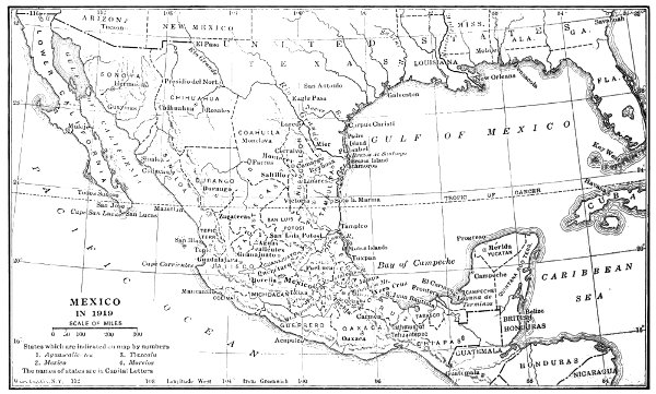
MEXICO IN 1919
Larger image
THE WAR WITH MEXICO