PART III. (continued 2)
Reading edition
“It thus appears that the Proboscidea, Hyracoidea, certain edentata, the antelopes, the giraffes, the hippopotami, the most specialized ruminants, and among the rodents, the anomalures, dormice and jerboas, among monkeys the baboons, may all have enjoyed their original adaptative radiation in Africa; that they survived after the glacial period, only in the Oriental or Indo-Malayan region, and that this accounts for the marked community of fauna between this region and the Ethiopian as observed by Blanford and Allen.
“Against the prevalent theory of Oriental origin of these animals are: first, the fact observed by Blanford and Lydekker in the Bugti Beds (Sind) that the Oligocene or lower Miocene fauna of the Orient is markedly European in type; second, that if these animals had originated in Asia some of them would have found their way to North America; third, the fact that all these animals appear suddenly and without any known ancestors in older geological formations. These are the main facts in favor of the Ethiopian migration hypothesis.”
That Professor Osborn’s main contention has already been partly proved by the Fayûm mammal discoveries is apparent, and how far his detailed remarks are confirmed will be seen when the new fauna has been more completely explored and examined.
The following is a list of the new species already obtained:—
Upper Eocene. Middle Eocene.
Mammalia
Arsinoitherium Zitteli, Beadnell. Barytherium grave, Andr.
„ Andrewsii, Lankester. Mœritherium Lyonsi., Andr.
Palæomastodon Beadnelli, Andrews. „ gracile, „
„ minor, „ „ sp., „
Mœritherium Lyonsi, „ Eosiren libyca, „
„ trigodon, „ Zeuglodon Osiris, Dames.
Megalohyrax eocænus, „ „ Zitteli, v. Stromer.
„ minor, „ „ Isis, Beadn. (M.S.).
Saghatherium antiquum, Andr. and Beadn.
„ minus, „ „
„ magnum, Andr.
Ancodus Gorringei, Andr. and Beadn.
Geniohyus mirus, Andr.
„ fayumensis, Andr.
„ major, „
Phiomia serridens, Andr. and Beadn.
Pterodon africanus, Andr.
„ macrognathus, Andr. and another much smaller and imperfectly known creodont.
Birds.
Eremopezus libycus, Andr.
Reptiles.
Testudo Ammon, Andr. Gigantophis Garstini, Andr.
Pelomedusa progaleata, v. Reinach. Pterosphenus (Mœriophis) Schweinfurthi, Andr.
Podocnemis fayumensis, Andr. Psephophorus eocænus, Andr.
„ Blanckenhorni, v. Reinach. Thalassochelys libyca, Andr.
„ „ var. ovata, v. Reinach. Podocnemis antiqua, „
Stereogenys libyca. Andr. „ Stromeri, v. Reinach.
Tomistoma sp. „ „ var. major, v. Reinach.
Crocodilus sp. Stereogenys Cromeri, Andr.
„ podocnemioides, v. Reinach.
Tomistoma africanum, Andr.
Fish.
Occasional fragments of siluroids and rays. Propristis Schweinfurthi, Dames.
H.—The absence of Miocene deposits in the Fayûm.
No traces of deposits of this age having been met so far south as the Fayûm we may presume that in Miocene times the area had become land, the sea margin having receded northwards. The slight depression of Mogara, some 100 kilometres further north-west, is however cut out in Lower Miocene beds, lithologically somewhat similar to the Upper Eocene and Oligocene deposits of the Fayûm. Probably similar conditions obtained throughout, and the existence of vertebrate remains indicates the persistence of river-currents from the south. The fauna of the Mogara beds has only as yet been very incompletely examined, the locality being rather inaccessible.[85]
Section XII.—PLIOCENE.
We have presumed that in Miocene times the Fayûm remained land, no traces of deposits of that age having been recorded; possibly the area underwent considerable denudation during the Miocene and early Pliocene periods, but of this it is difficult to adduce definite evidence. The records of Pliocene times in the Fayûm may be classed as follows:—
(J). Marine deposits of Middle Pliocene age.
(K). Borings on rock surfaces, exact age doubtful.
(L). Gravel Terraces, probably late Pliocene. ⎱ ⎰ (or early Pleistocene).
(M). Gypseous Deposits, probably latest Pliocene.
J.—Marine Deposits: Middle Pliocene.
In Middle Pliocene times the area, which had probably undergone considerable denudation, was again invaded by the sea, and we find at Sidmant el Jebel, on the south-east side, definite evidence of deposits of this age in the shape of sands containing such well known forms as Ostrea cucullata and Pecten benedictus.
The beds in question reach an altitude of from 60 to 70 metres and were first brought to notice by Schweinfurth. Although they are in reality on the Nile Valley side of the separating ridge or saddle, there is little doubt that the same beds will, when looked for, be found within the Fayûm depression in places where they have been preserved. As has already been mentioned this south-eastern side of the Fayûm yet remains to be examined and mapped in detail, and the determination of the relation of these marine sands to the gravel terraces shortly to be described is a matter of primary importance for the proper interpretation of their relative ages.
K.—Borings on Rock surfaces; of doubtful age.
There are within the Fayûm depression numerous rock-surfaces pierced by borings, apparently the work of marine boring mollusca but naturally offering no exact evidence as to their age and origin. These borings are found at two distinct levels, approximately from zero to 20 metres above sea-level, and at 112 metres above sea-level.
(α) Low level borings.
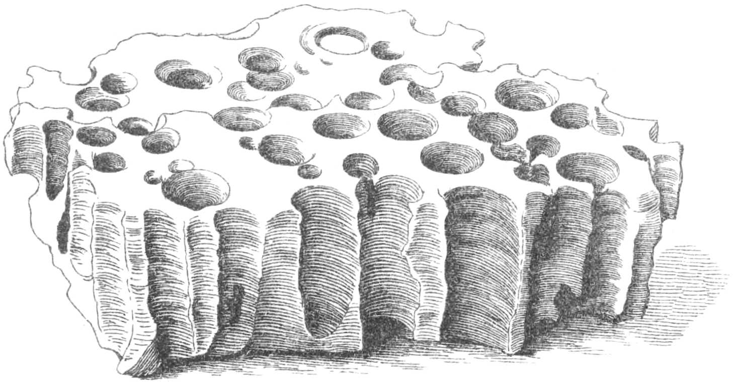
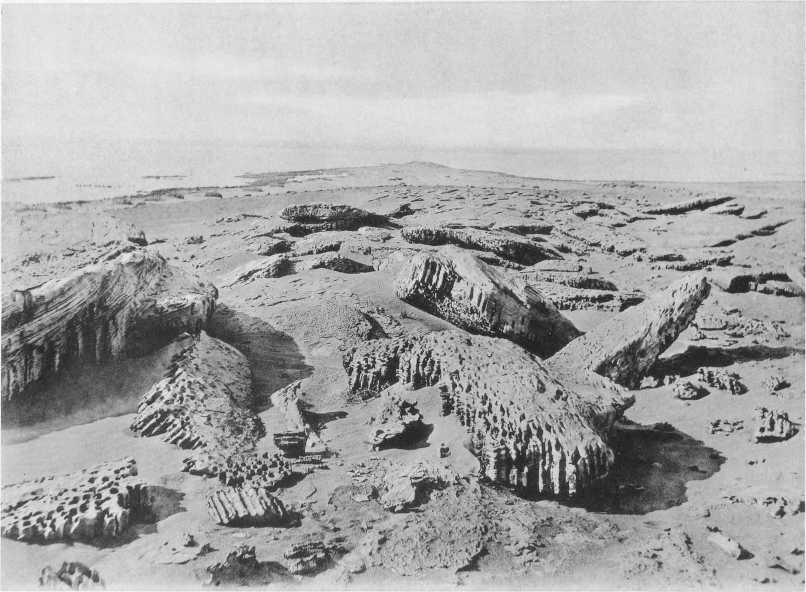
Between Tamia and Dimê, near the eastern end of the Birket el Qurûn, the lowest ground, consisting of poor sandy land with tamarisk scrub, bordering the lake and cultivation, is bounded by a low escarpment of beds of the Birket el Qurûn series. Along certain horizons one or more beds of calcareous sandstone weather into large globular masses, which as already pointed out are in reality huge concretions, but which may have been further rounded by water-action. The chief point is, however, the fact that these blocks are honey-combed in the most remarkable way by beautiful examples of borings; their presence was first noticed by Schweinfurth. The globular masses of sandstone, often several feet in diameter, are worn on the surface into a number of parallel ledges, each of which is perforated with countless numbers of vertical holes, averaging 10 millimetres in diameter (maximum 15 millimetres), placed at right angles to the ledges; these holes are not, as a rule, connected from one ledge to another. They occur in every stage of perfection, from hollows as small as the finger tips and only a few millimetres deep, to long completed chambers which generally show considerable tapering, and are often placed so close together that the dividing wall is pierced.
Fig. 7 and Plate XIII show the appearance of these bored rocks.
Fig. 7.—Block of sandstone pierced by numerous borings.
At El Kenîsa, a promontory jutting out into the lake, sandstones showing shell-borings occur at a height of 14 metres above sea-level. Between Dimê and the lake a calcareous sandstone contains many borings, 66 metres above the lake-level, or about 22 metres above sea-level.
Plate XIII. BORINGS IN FALSE-BEDDED SANDSTONE, TWO KILOMETRES SOUTH OF DIMÊ.
(β) High level borings.
Further west, but at a considerably higher level, borings are again met with. In this case a hard compact limestone, forming a dip-slope surface on the top of the lower cliff of the Qasr el Sagha series, was found pierced with borings, similar in character to those of the lower level. The exact locality where these high level borings were observed is 14 kilometres west of the western end of the lake and 16 kilometres north-east of the eastern extremity of Gar el Gehannem. The height was determined as 156 metres above the Birket el Qurûn, or 112 metres above sea-level, and we have every reason to believe these figures to be approximately correct. Up to the present time borings at this altitude have not been met with in any other locality.
At first sight it seems surprising that the occurrences should be so limited, but it should be remembered that only in those cases where borings were made in the very hardest and most durable rocks could they have been preserved to the present time. Considering the amount of denudation which has taken place in the area since the Pliocene period it is surprising that any of the rocks which formed the actual surface of the country at that date should still be preserved; and in all probability the comparatively few records that exist to-day owe their preservation to the protection afforded by superficial deposits. Under the present rigorous desert conditions, when the whole surface is subjected to continual and rapid changes of temperature, and every exposed rock is being worn down by the natural sandblast, it must be admitted that in a comparatively short time every trace of the borings now exposed will have been removed. At the same time the denudation of superficial deposits will probably lay bare other bored rock-surfaces, and the conserving nature of drift sand itself where accumulated to even a limited degree must not be forgotten.
L.—Gravel Terraces: ? Upper Pliocene.
On the north, east, and south-east sides of the Fayûm, well marked terraces of gravel are found at certain levels up to a maximum of about 170-180 metres above sea-level. Nine kilometres east of Sêla the summit of the ridge separating the Fayûm and the Nile Valley is formed of thick deposits of gravel, laid irregularly and unconformably on the top of limestones belonging to the Birket el Qurûn series. The lowest terrace occurs only 15 metres above the canal[86] running along the outside of the cultivation. The main deposit of gravel is laid on the top of the limestones and marls at 70 metres above the canal; it is some 50 metres thick (summit 120 metres above canal) and consists of a mass of well-rolled flint and quartz pebbles, with blocks of limestone (frequently full of well-known Eocene fossils such as Carolia placunoides). Large well rounded blocks of grey quartzite and pebbles of black quartzite also occur, besides rounded blocks of silicified wood. A certain amount of false-bedding occurs and false-bedded sand was noticed in places. Numerous derived rolled fossils are present, but no contemporaneous remains were found. On the summit of the ridge is situated the remnant of an old pyramid-like building.
Fig. 8 shows the relation of these gravels to the underlying rocks.
Fig. 8.—Sketch showing relations of Middle Eocene to Pliocene Gravel Terraces on the east side of the Fayûm. Birket el Qurun series.—(a) Clays, marls and limestone; (b) Limestones with Operculina (O. discoidea?). Pliocene (to Pleistocene); (c) Coarse deposits of gravel, etc., with huge blocks of derived Eocene limestone with Carolia, etc.; (d) sands and sandrock with leaves of hard sandstone; (e) sand, gravel and conglomerate.
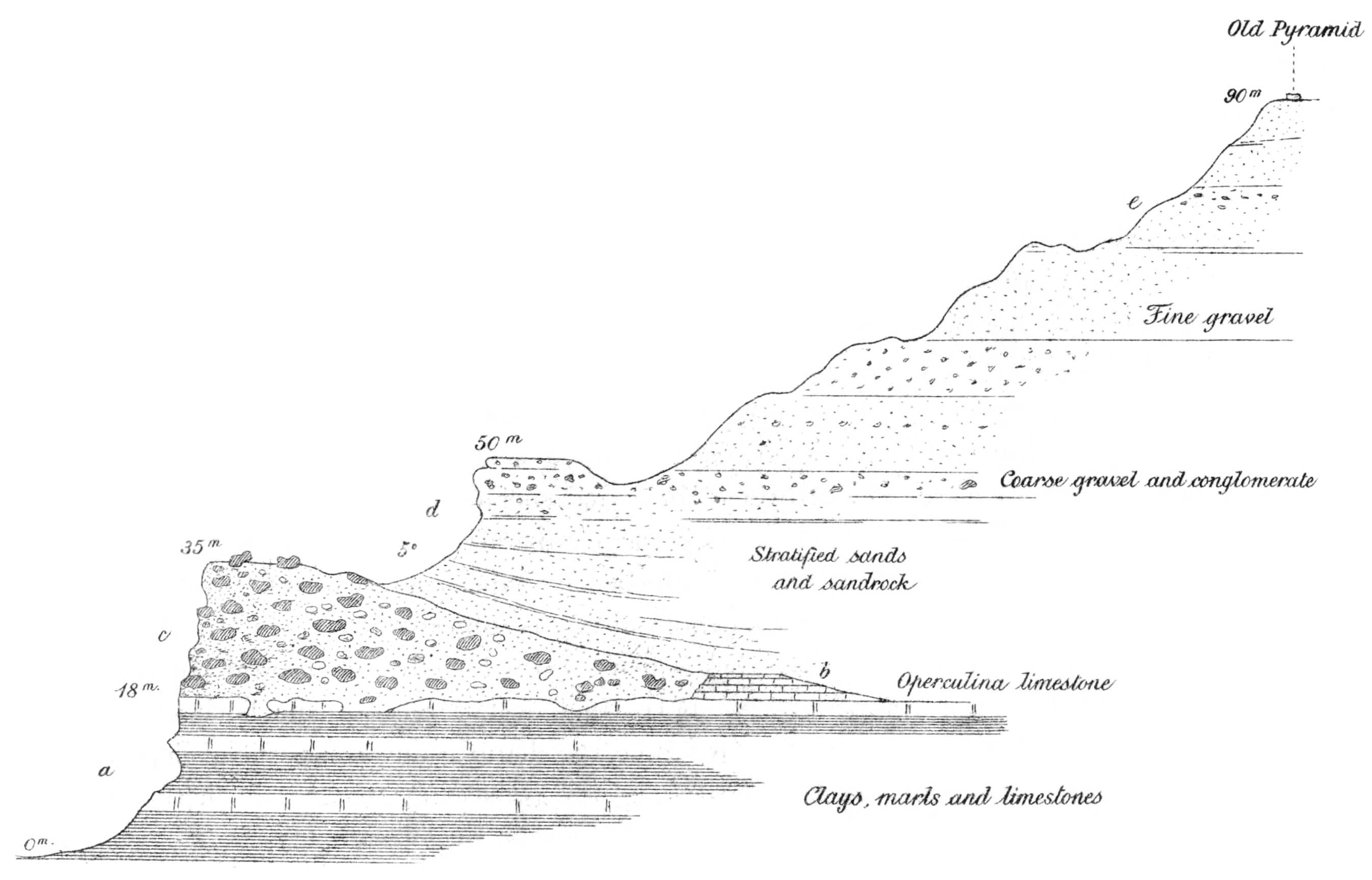
At the spur of the cliff immediately to the east the terrace is laid on to limestones of the Birket el Qurûn series at a height of 32 metres above the canal. Enormous blocks of Carolia-limestone, some exceeding 3 × 2 × 1·5 metres in measurement, are included in this deposit; such blocks cannot have been transported far, and were doubtless derived from formerly-existing higher beds in the immediate neighbourhood. The matrix of the deposit is usually crushed limestone with sand and gravel. Occasional fragments of silicified wood (and further west large logs), evidently derived from the Fluvio-marine beds, also occur.
In favoured localities the relation of the gravels to the Eocene is still better seen; the lower beds of the terrace here are sometimes formed of sands and sandy beds dipping 10° eastward.
At the little promontory 9 kilometres east of Sersena the same deposits reach an altitude of 157 metres above the canal below.
Further north another cake of gravel caps the summit, attaining here 60-70 metres above the canal-level. Probably these deposits were originally more or less connected and continuous, but since their deposition denudation must have removed the greater part, as they are now only found here and there capping the highest points of the escarpment along the east side of the Fayûm. Such isolated gravel-capped hills occur notably 12 kilometres east of Roda, 16½ kilometres east and 17½ kilometres north-east of Tamia.
Along the north side of the Fayûm the same deposits are found, in some cases covering large areas.
Twenty-five kilometres N.N.E. of Tamia the Eocene beds, here an alternating series of clays and limestones, are capped by a deposit consisting of coarse rolled gravel, with blocks of silicified wood enclosed in a sandy gypseous base, some 10 metres thick. A larger and similar deposit caps the next high ground four kilometres to the west, and about 9 kilometres N.N.E. of Garat el Faras; in this case it forms a round-topped gravelly hill-range, attaining a height of about 165 metres above the canal to the south-east. The loose gravel at many points passes into hard conglomerate, notably in the hills 9 kilometres east and 4 kilometres north-east of Garat el Gindi. At the former spot the conglomerate is composed of blocks of limestone, with round pebbles of flint and quartz, sandstone and quartzite, and fragments of silicified wood, cemented by sand and calcareous material. Blocks of silicified wood also occur strewn on the surface of these gravel deposits.
In the hills north-east of Garat el Gindi the gravel deposits do not occupy the summit of the escarpment but occur laid on to a platform of beds belonging to the Qasr el Sagha series. Behind, another escarpment, that of the Fluvio-marine series, rises to the plateau summit.
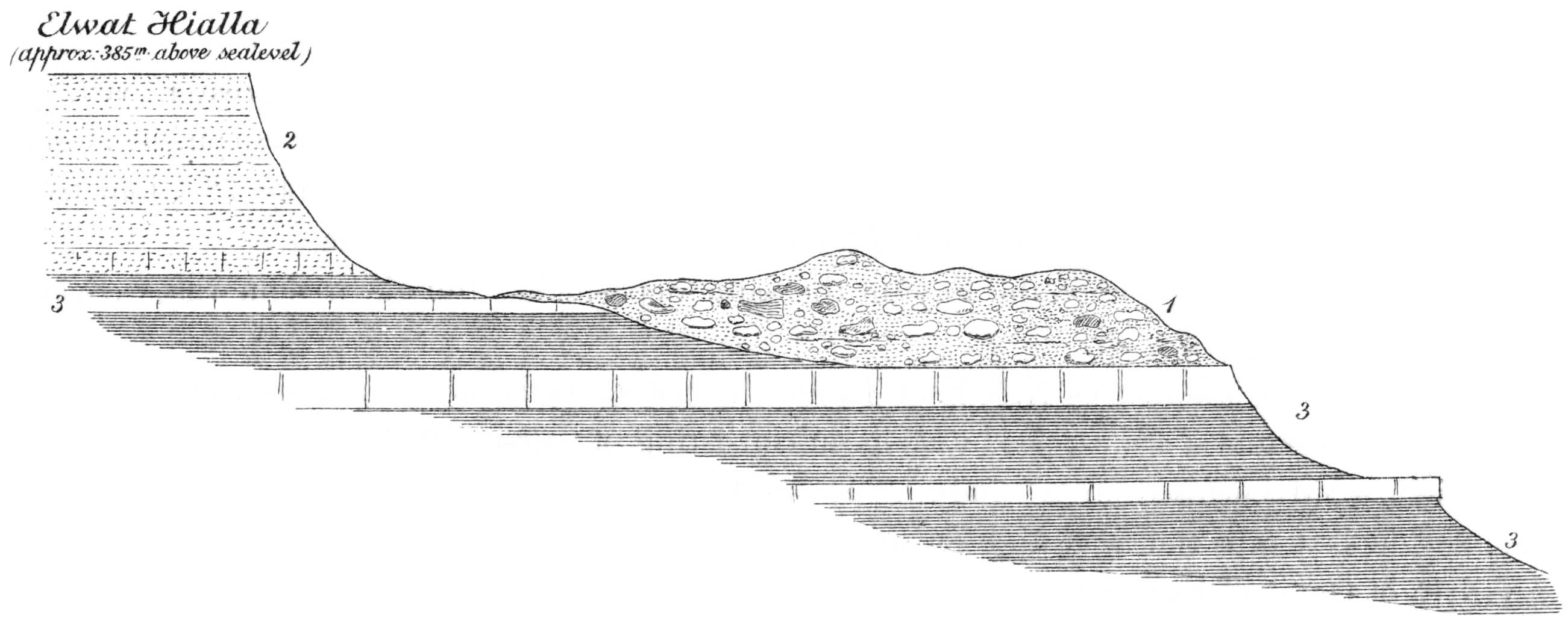
Fig. 9 will show the general relation of the different formations in this part of the district.
Near Elwat Hialla the deposits contain numerous blocks of basalt in addition to the usual constituents. The basalt is derived from the sheets interbedded at the base of the Oligocene a little to the north. As these gravels are here close to that formation, blocks of sandstone, basalt, and silicified wood now form a large proportion of the constituents.
Along the north side of the Fayûm depression, to the west of Elwat Hialla, the gravel terraces are almost absent, having been removed nearly completely by denudation. That the terraces once existed throughout this region is however shown by the small patches met with to the north-east of Widan el Faras, the eastern extremity of Jebel el Qatrani, and at several points high up on the escarpments as far west as the western end of the lake. Beyond the latter point these terrace gravels have not been noticed; the slopes of the depression become more and more obscured by loose superficial flints washed down from the plateau, and the existence of underlying terrace gravels could only be shown by detailed mapping.
PLIOCENE (to Pleistocene) —1. Terrace of gravel and conglomerate. UPPER EOCENE-OLIGOCENE —2. Sands and sandstones. MIDDLE EOCENE —3. Clays, marls and limestones of the Upper Mokattam. Fig. 9.—Sketch-Section through summit of Fayûm Escarpment at Elwat Hialla.
Near Widan el Faras the terrace occurs at a level of about 220 metres above the Birket el Qurûn, or 175 metres above sea-level, and consists of a 10-metre thickness of a semi-consolidated mass of boulders and pebbles of sandstone, limestone, and basalt, with fine gravel and sand, unconformably laid on to the variegated sandstones of the Fluvio-marine series.
In the neighbourhood of the Survey’s main excavations for fossil bones, to the north of Garat el Esh, several local remnants of the formerly more or less continuous gravel terrace were detected[87]. The height was probably more accurately determined here than elsewhere and the upper limit of the deposits was found to lie at approximately 170 metres above sea-level; this figure may indeed be taken as the average height of the Pliocene terraces throughout the Fayûm.
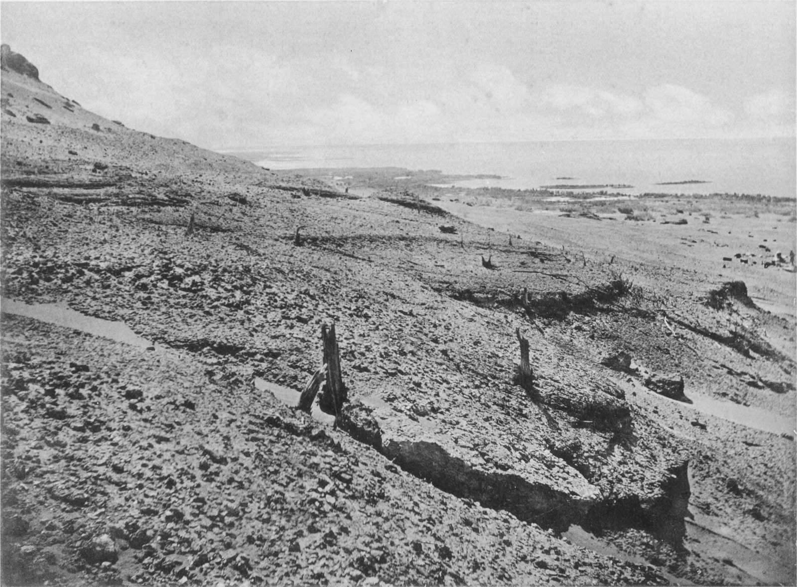
Plate XIV. PLEISTOCENE LACUSTRINE CLAYS WITH TAMARISK STUMPS IN SITU AT 50 METRES ABOVE PRESENT SURFACE OF THE BIRKET EL QURUN.
Briefly then we have shown the existence of the well marked remains of a gravel terrace 170-180 metres above sea-level, throughout the south-east, east, and north sides of the Fayûm depression, and the first question that suggests itself with regard to these deposits is, whether they are of marine or of freshwater origin? From their position in part capping and in part perched on the flanks of the escarpments, it is evident that the depression of the Fayûm must have been partly formed before their deposition; probably it had approximately obtained to its present form and dimensions, except as to depth. The terrace certainly marks the shoreline of the sheet of water in which its constituents were deposited, and the surface of this water must have attained a height of nearly 200 metres above present sea-level. It is not unlikely that some of the extensive plains of the Fayûm may owe their existence in part to the presence in Pliocene times of the sea or of a large inland lake, that they may in fact be plains of denudation. The plain above the escarpment of the Qasr el Sagha series, lying between 150 and 200 metres above sea-level, and stretching throughout a large part of the north of the Fayûm, has characters which tend to support this idea.
Unfortunately the gravels are entirely barren of contemporaneous organic remains, with one exception; near Ez. Qalamsha some examples of Ostrea cucullata were discovered, and these we believe to have truly belonged to the lower beds of the terraces and not to have been derived from the undoubted marine Middle Pliocene beds of Sidmant. If the existence of O. cucullata in these terraces could be confirmed we should undoubtedly class them as marine and of Middle Pliocene age. But the single evidence of the Qalamsha shells is not sufficient, and confirmatory occurrences must be obtained and, if possible, the relation of the terraces to Schweinfurth’s marine Sidmant beds determined, which has not been yet done.
M.—Gypseous deposits, probably dating from the close of the Pliocene Period.
Of distinctly later date than the gravel-terraces are the widely distributed gypseous deposits of the Fayûm and Nile Valley. These deposits are found covering the plain which separates the Nile Valley cultivation from the Fayûm depression, gradually rising from the level of the former until they overlie the gravels capping the summit overlooking the Fayûm (Section XXI).
Near the Pyramid of Medum the following beds are seen at the edge of the desert plain:—
Top. Metres.
Pure, gravelly, or marly gypsum 1-2
Clayey shales with gypsum and salt 1-1½
White marly limestone with much salt and fish-remains (fish-scales, etc.) probable part of Ravine beds. 2
Yellow sandstone with fish-scales, etc. 3
The gravel deposits along the east side of the Fayûm are always capped by a gypseous bed. The latter is often 2 metres thick and frequently occurs as solid and almost pure white crystalline gypsum; sometimes it is calcareous and is frequently deposited in a tufaceous manner, especially resembling a tufa on the weathered surface. At other times it passes into a yellowish compact mass and may be very saliferous.
Frequently the deposit is full of rounded pebbles, the latter being often in the greater proportion and forming a sort of gypsum-cemented conglomerate. Not unfrequently it is impossible to draw any divisional line between the terrace gravels and the gypseous gravels above. Probably they are both closely connected and of Upper Pliocene age.
N.—Summary of the Pliocene Period.
From the above descriptions it is probable that the Pliocene period is represented in the Fayûm by the following:—
(1) Marine beds of Sidmant, undoubtedly of Middle Pliocene age and reaching a level of from 60 to 70 metres above present sea-level.
(2) Borings on exposed rock-surfaces at two distinct levels, the lower 0-20 metres, the higher some 112 metres, above sea-level. These borings appear to be the work of marine boring mollusca, and although those on the lower level may perhaps be of Middle Pliocene age with the Sidmant beds, the similar examples discovered at a much higher altitude (112 metres), point to the sea having attained a much higher level in later, perhaps Upper Pliocene, times.
(3) An extensive beach or terrace of gravel on the south-east, east, and north sides of the Fayûm, attaining a maximum level of about 170 to 180 metres above sea-level.
All the known facts seem to be satisfied if we imagine that in the Middle Pliocene the sea occupied the area, depression probably continuing until the 112 metre level with the highest borings was reached. Perhaps the lowest part of the terraces was formed during this time. In the later Pliocene times we may infer that the area was occupied, up to 180 metres above present sea-level, by a vast inland lake, perhaps of brackish water, connected with the sea on the one hand and the fiord or lakes of the Nile Valley on the other, the deposits of which have been described elsewhere[88].
Along the margins of this gigantic lake, these great accumulations of gravel might well have been formed, chiefly of material derived from the immediate shores, augmented perhaps by a certain amount of sediment brought by river-currents from the south.
Finally, from the way in which the gypsum and gypseous deposits are laid on the terrace gravels, and from their extension and thickness, we may presume that they were deposited on the bottom of just such a lake on evaporation of its water, when the sulphate of lime in solution, becoming more and more concentrated, may have been finally precipitated.[89]
Section XIII.—PLEISTOCENE.
The course of events in Pleistocene times is at present obscure. As far as can be judged it was during this period that a freshwater lake, the precursor of the great Mœris, came into existence. It might be thought that the early Pleistocene prehistoric lake was a relic of the still older body of water of Pliocene times, in which the gravel terraces and gypseous deposits were laid down. But such a remnant would have been of a high degree of salinity and could not have given rise to the fresh water Mœris. Most probably at the close of the Pliocene period, after the formation of the gypseous deposits, the area became elevated and cut off from the sea and from the Nile Valley marine fiord; probably an extensive body of water remained as an isolated lake, but this, cut off from external supply, would have gradually evaporated, its salt being left as a superficial deposit on the dried up bed. In early Pleistocene times we may presume the area became dry and was gradually eroded to its present shape and depth. The superficial deposits of salt and gypsum were for the most part removed as the depression was deepened, while the continuous terrace of gravel laid round the greater part of the rim was broken through, except where protected in favourable localities, the constituents being washed down and spread out over the lower ground. In course of time the region was moulded to its present form and dimensions, or rather to what it would be if the local alluvial deposits were stripped off and the water of the lake baled out. The area was an inland depression, probably sparsely vegetated like the rest of the higher country and separated from the Nile Valley by a low rocky ridge surmounted by a more of less continuous terrace of gravel of considerable height and thickness. In our opinion desert conditions had already set in before the early Nile broke down the ridge and formed a lake in the Fayûm; the date when this important event first took place is a matter of considerable doubt, as has already been mentioned (pp. 24, 25). We know that at the close of the Pliocene period the Nile Valley was a marine fiord (connected with the Fayûm and the Mediterranean) which was replaced in Pleistocene times, probably in consequence of slight elevation, by a series of fresh water lakes throughout the valley. These lakes were probably two or three in number and drained one into the other; the exact position of the barriers is as yet a matter of conjecture. Within these lakes thick lacustrine deposits were accumulated, so that the basins eventually became to a great extent silted up. In later Pleistocene times drainage down the Nile Valley appears to have become more pronounced, the barriers between the lakes were broken down and the river cut for itself a channel through the lacustrine beds, filling up the old lake basins. From this time onwards to early prehistoric times the bed of the river would appear to have steadily fallen, as it eroded its channel deeper and deeper. That this early Nile was a river of considerable size is evident from the amount of erosion it accomplished in the trough of the valley, whence the older lacustrine beds have been almost completely removed. Probably in the lower part of its course it swept against the base of the dividing ridge between the Nile Valley and the Fayûm depression. If, as we imagine, the river was at that time flowing some 20 metres higher than at present its currents would have met with little resistance from the loosely cemented terrace of gravel which formed the upper part of the dividing ridge. Once this was broken down the waters must have poured into the depression behind, until a lake of considerable size was formed. The sediment spread out over the floor in the shape of a fan, while at the same time deposits of sands and fine clays, blown and washed into the waters from the surrounding shores, were being slowly accumulated in the quieter and more remote parts of the lake.
For some time subsequent to the first connection between the Fayûm depression and the Nile, the latter continued to fall in level owing to continued erosion along its course, possibly the Fayûm again became completely isolated for a time. Subsequently in the earliest historic times under changed conditions the river commenced to carry and lay down the modern alluvial deposit of “Nile mud”, and from this time to the present day its bed has gradually risen. This is shown by the high Nile flood-readings on the early gauges of the Nile Valley; the nilometer at Roda shows a difference of 1·22 metres in 1026 years, or an annual rise of 0·12 centimetre, which is equivalent to 12 metres in 10,000 years[90]. Whether there was ever complete disconnection between the Nile and the originally formed lake in Pleistocene times is uncertain, but even so it was probably only during a comparatively short period: in early historic times the rise of the Nile bed must have brought about a reconnection.
The geological evidence for the existence of a great freshwater lake in Pleistocene and prehistoric times is afforded by the well-marked lacustrine clays and sands which are found over such a large area of the northern and western deserts of the Fayûm; the great extent of this lake will be seen by an examination of the accompanying maps. Its area must have been about 2250 square kilometres or about ten times the size of the modern Birket el Qurûn. The western limit may even have been further west than shown on fig. 10.,[91] as some of the desert in the neighbourhood of Gar el Gehannem is very low-lying; or there may have existed subsidiary lakes in that direction. The upper limit of these ancient lacustrine clays is between 22 and 23 metres above sea-level, which exactly agrees with the figure adduced by Sir Hanbury Brown as the height of the more modern Lake Moeris from the evidence of levels. That Lake Moeris was simply the older prehistoric lake placed under artificial control admits of no doubt; the difficult question being as to when the lake first came into existence in prehistoric times.
The clays abound in freshwater shells and semi-fossil fish-bones of exactly the same species of fish (siluroid, etc) as still inhabit the Birket el Qurûn; probably some are even hardly different specifically from the Middle Eocene forms of the district. In addition remains of large animals are common, and include Hippopotamus, Elephas, Bubalis, sheep or goat, and Canis, with crocodiles and turtles, etc.[92]
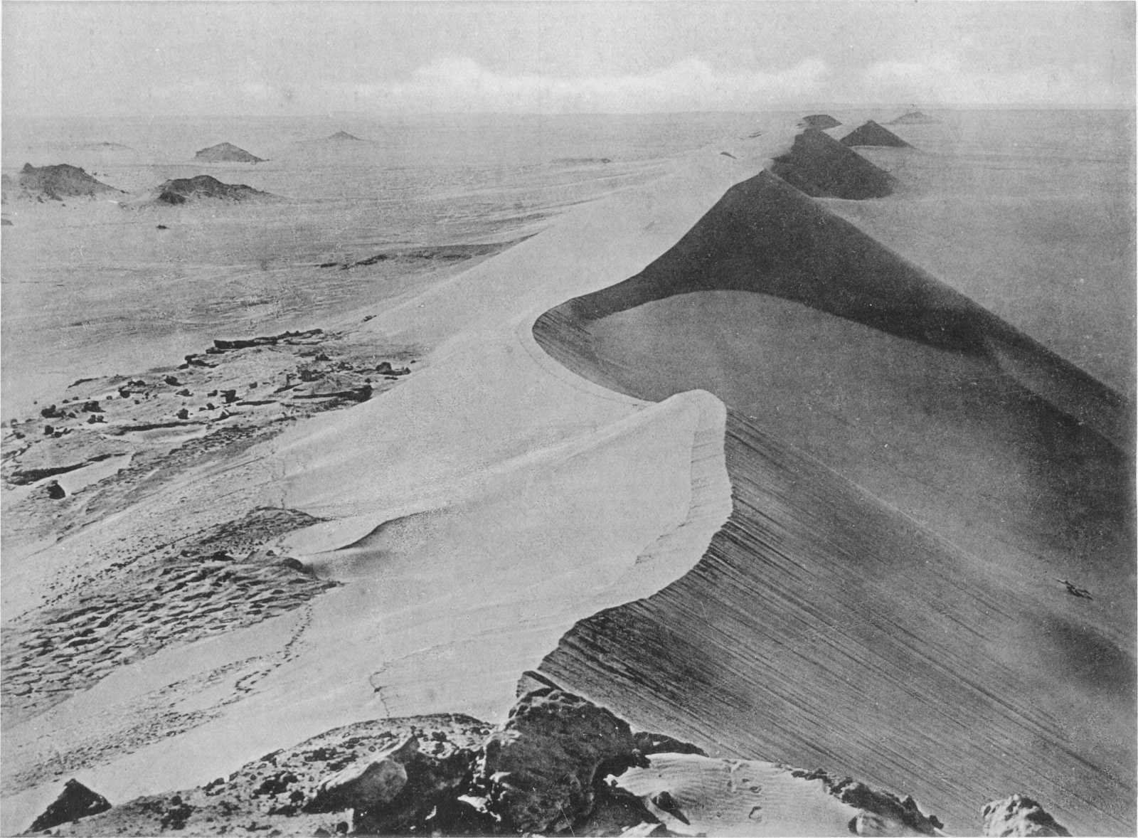
Plate XV. ISOLATED SAND-DUNE NEAR GAR EL GEHANNEM.
Martens[93] has described the following species of mollusca from Schweinfurth’s collections:—
Unio abyssinicus, Mart.
U. Schweinfurthi, Mart.
Corbicula fluminalis, var. consobrina Caill.
Neritina nilotica, Reev.
Valvata nilotica, Jick.
Cleopatra pirothi, Jick.
C. pirothi, var., unicarinata, Mart.
Bithynia aff. Boissieri, Charp.
Melania tuberculata, Müll.
Limnaea natalensis, Krauss.
L. mœris, Mart.
L. palustris, Müll.
Planorbis subangulata, Phil.
Blanckenhorn has pointed out[94] that this fauna is of special interest and differs from all fossil and living faunas in Egypt. It might be compared with the Melanopsis-fauna of the Nile Valley if the exceptional Limnaea were replaced by Melanopsis or Paludina. Its Unio Schweinfurthi recalls the youngest alluvial deposits of the Nile Valley, 2nd Cataract, Kom Ombo and Silsila; at these places, however, the beds containing the species in question are at least 20 metres above mean water level of the present day.
The sub-fossil fauna of the Fayûm alluvium, in addition to those forms everywhere met with in the Nile Valley, includes Neritina nilotica and Melania tuberculata, which are common forms of the Melanopsis stage, as well as Unio abyssinicus and Valvata nilotica. In common with the present fauna of the Birket el Qurûn it has the five forms belonging to the genera Corbicula, Neritina, Valvata, Melania, and Planorbis. The sub-fossil fauna, which passes into the modern fauna of the Birket el Qurûn, shows connection with the Mediterranean and Blue Nile, but has a total absence of White Nile forms such as Ampullaria, Lanistes, Cleopatra bulimoides, Spatha and Aetheria. Moreover Limnæa palustris, although identical with the form found on other Mediterranean coasts, is as yet entirely unknown from the Nile Valley. Blanckenhorn concludes that the diluvial subfossil deposits of the Fayûm were produced when the climate of Egypt was damper and more Europæan, the Nile carrying more arenaceous sediment in place of the mud of to-day and running at higher level, as it did when the shells of Unio Schweinfurthi were enclosed in the deposits of Jebel Silsila. Blanckenhorn thinks the Nile obtained access to the depression during the last European ice period. This last supposition, coupled with the above comparison of the Fayûm fresh-water fauna with the Melanopsis stage of the Nile Valley Pleistocene series, shows that in regarding the early Fayûm lake as dating from prehistoric times Blanckenhorn and the writer are in agreement.
Section XIV.—RECENT.
We may divide the Recent period into two epochs, Prehistoric and Historic, always remembering that the line of demarcation is not much more distinct than that between Recent and Pleistocene.
O.—Prehistoric.
The abundance of worked flints on the desert just within and around the site occupied by the Fayûm lake in late Pleistocene and prehistoric times, shows that the shores were eventually inhabited by people who made and used these primitive tools. That the edge of the lake was abundantly wooded is shown by the thousands of well preserved tamarisk stumps met with at the present day in situ (Plate XIV) in the clays throughout the former margin of the lake.
The implements occur chiefly along the margin of the highest level of the old lake, and have probably in many cases been buried in the lake clays until the present time, which would account for their beautiful state of preservation. We have not, however, yet actually detected them enclosed within the clays, although commonly found lying on the clean wind-worn surface. From the fine degree of workmanship we may undoubtedly refer these flint implements to the Neolithic or later stone-age, although the exact date is doubtful. That they were made and used while the lake still stood at its highest level seems certain, but as we have shown above, the lake, as a sheet of water up to 23 metres above sea-level or thereabouts, probably existed far anterior to the Egyptian historic period. They might, on the other hand, as far as the evidence from the position of the lake goes, have been used by the inhabitants of the lake-margin down to the great reclamation which took place in Ptolemaic times. As it seems impossible to date them by comparison with flints of known age from any Egyptian period, we may perhaps conclude that they are at least of older date than the earliest Egyptian records.[95]
P.—Historic.
In historical times, under conditions almost identical with those of the Nile of to-day, there would have been an annual inflow during the flood and outflow back to the Nile when the latter subsided; during the inflow a constant supply of Nile mud was brought into the lake and deposited on the surface of the earlier alluvium, continually augmenting the thickness of the latter and raising its surface, until in the central area marshy land began to appear. In the XII Dynasty this natural backwater of the Nile, which acted as a more or less efficient regulator of high and low floods, was brought under human control by Amenemhat I, and a considerable area of land reclaimed from the shallowest part of the lake, or that part of the country now lying near Edwa, Medinet el Fayûm, etc. The new artificially controlled lake was called Moeris, and its wonders are mentioned by Herodotus, Diodorus Siculus, Strabo and Pliny.
The actual position of Lake Moeris has been the subject of much discussion, the late Linant de Bellefonds[96] having asserted that it was a high-level lake, quite distinct from the Birket el Qurûn, occupying the gap in the hills by which the Bahr Yusef enters the Fayûm, its encircling bank commencing at Edwa and passing through Biahmu, Medinet, etc. Sir Hanbury Brown has,[97] however, completely demolished Linant’s theory, which is shown to be absolutely untenable; and has proved conclusively that the ancient Mœris occupied the greater part of what is now the cultivated land, as well as the area covered by the present lake and a considerable part of the surrounding desert, the reclaimed land being in fact part of the very district Linant supposed the lake to have occupied. Since the publication of Brown’s work complete corroborative evidence has been forthcoming from two distinct sources, one archæological, the other geological. The latter has already been mentioned.
Fig. 10.—Sketch Map showing approximately the site of Lake Moeris.
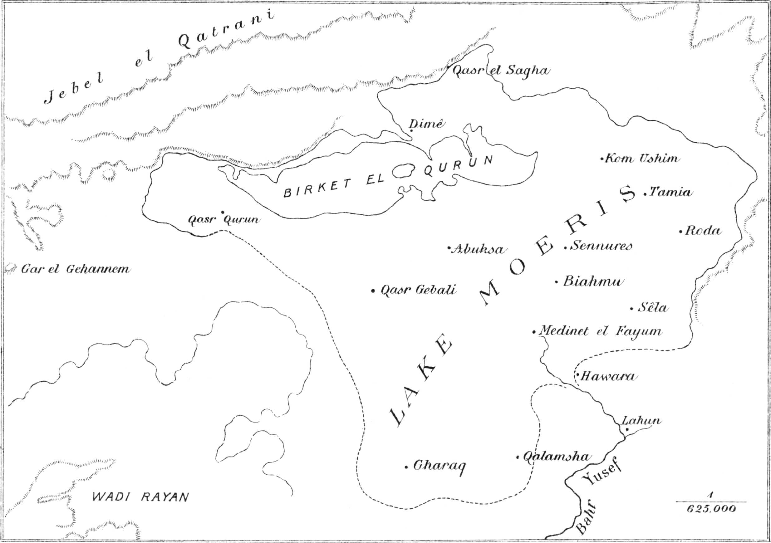
It was clear from the map of Claudius Ptolemy that the route through the Fayûm to the Oasis Parva left Bacchias near the north end of the lake, and passing between Arsinœ and Lake Mœris, reached Dionysias near the other end. The archæological researches of Messrs. Grenfell and Hunt[98] have shown that Bacchias occupied the site of the modern Um el Atl close to one end of the Birket el Qurûn, while Dionysias was probably in the neighbourhood of Qasr el Banat or Qasr el Qurûn. Thus the Ptolemaic Lake Mœris was almost identical with the modern Birket el Qurûn. Neither did the sites excavated yield a trace of anything older than the third century B.C. Theadelphia and Philoteris were founded in the reign of the second Ptolemy, when a great reclamation of the land from the lake took place, and probably Euhemeria, Dionysias, Karanis and Bacchias date from the same reign.
The archæological evidence is thus briefly summed up by Grenfell and Hunt: “Originally the lake filled the whole basin of the Fayûm, the first reclamation being carried out by Amenemhat I, who built the great dam at El Lahûn, where the Bahr Yusef enters the province, and recovered the high ground near the entrance as far as Biahmu, and a point between Abshawai and Agamiin. This remained the Pharaonic province until the time of Herodotus, when the water still came up to the colossi at Biahmu. Subsequently all the land now cultivated below the level of the Pharaonic province was reclaimed, chiefly in the reign of Ptolemy Philadelphus, when Lake Mœris was reduced nearly to the size of its modern representative, the Birket el Qurûn”.
Present day Fauna of the Birket el Qurûn.As mentioned above, the Pleistocene fauna of the Fayûm differs in one or two particulars from the fauna of the present day. The commonest living molluscan forms include the following:—
Corbicula fluminalis.
Neritina nilotica.
Cleopatra bulimoides.
Hydrobia stagnalis.
Valvata nilotica.
Melania tuberculata.
Planorbis Ehrenbergi.
P. marginatus var. subangulata.
Blanckenhorn[99] has pointed out that in this fauna Hydrobia stagnalis, as a typical brackish water form is of special interest. The species appears to have established itself in the Birket el Qurûn in modern times, as it has not been found in the youngest alluvium of the lake, nor is it known in the modern Nile fauna.
Modern Deposits: Blown Sand and Erosion.Except for the gradual accumulation of silt over the bed of the Birket el Qurûn—sand and clay carried in by the wind and the fine sediment borne by the feeder canals—the only modern deposits of any importance are those of blown sand. The extensive arenaceous deposits of younger Tertiary age, forming the greater part of the continent from the latitude of the Fayûm to the Mediterranean shores, yield as a result of the action of denudation a constant and abundant supply of the raw material. The sand carried southwards by the prevailing winds accumulates as dunes in the lowest parts of the depressions, on the slopes of cliffs, and in all the less exposed localities. Wind swept areas remain free or are only gradually encroached on by slowly growing linear dunes originating in the wind-shadow of some protecting hill or ridge. An unique example of such a dune is to be seen at the south end of the well-marked ridge a few kilometres east of Gar el Gehannem (Plate XV).
The main accumulations of blown sand are in the southern part of the Fayûm; large areas of the floors of Wadis Rayan and Moêla are covered with dunes, while in their immediate neighbourhood the material has accumulated to such an extent as to blot out entire cliffs and valleys; immediately to the west of Gharaq a considerable area is covered with small but steep dunes; and finally must be mentioned the great linear belt of sand, known as the Ghart el Khanashat, which starting from a point about midway between the Wadi Natrûn and Mogara comes to an abrupt termination some 24 kilometres before gaining the northern escarpment of the Fayûm depression (see page 23).
As might be expected in an area like the Fayûm, where sedimentary rocks of every type are met with, and where the wind never wants for a sufficient supply of the necessary sand, superficial erosion is everywhere well marked. We do not propose to study here the action of wind-borne sand and it will be sufficient to mention two localities where the effects are best seen; one is in the neighbourhood of Garat el Esh, where the most remarkable scoring and grooving is to be seen on the two beds of limestone capping the upper and lower cliffs of the Middle Eocene; the other is the Zeuglodon Valley, and here the sculpturing of the sandstone of the Birket el Qurûn series is of the finest and most unique description.
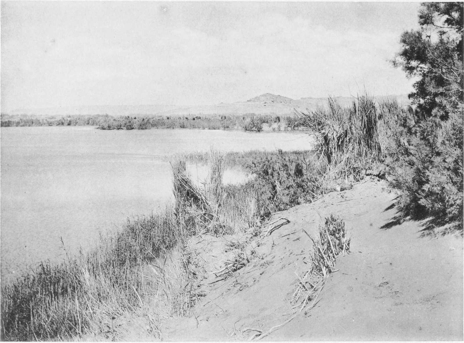
Plate XVI. THE BIRKET EL QURUN NEAR THE WESTERN END.