THE EXPLORATION OF THE ROAD (continued 2)
Reading edition
When one considers the condition of the terrain immediately to the east, the loss is not to be marvelled at. The hillside of Upwood Scrubbs falls very steeply into the valley by which the modern high-road climbs up to Caterham. It is an incline down which not even a primitive road would have attempted to go, and when one gets to the valley below the whole place is so cut up with the modern road, the old Roman road a little way to the east, and the remnants of a quarry just beyond, that it would have been impossible in this half-mile for the trace of the Pilgrim's Way to be properly preserved. I will, however, make this suggestion: that it descended the hillside diagonally going due NE. from the summit to the old gravel pit at the bottom, that then it curved round under the steep bank which supports Woodlands House, that is Dialbank Wood, went north of Quarry Cottage, and so reached the face of the hill again where the lane is struck which skirts round the southern edge of Marden Park. This, I say, will probably be found to be the exact track; but it is quite certain that the Way cannot have run more than a couple of hundred yards away from this curve. It cannot have been cut straight across the valley, for the steepness of the valley-side forbids that, and, on the other hand, there would have been no object in going much further up the valley than was necessary in order to save the steep descent.
At any rate, the gap is quite short and the road is easily recovered after the combe and the high-road are passed; it is thence identical with the lane I have spoken of above. This lane is called Flower Lane. It follows the 600-feet contour-line and winds therefore exactly round the outline of the hill. It passes the lodge of Marden Park, and within a few hundred yards comes to a place where the modern road bifurcates. The good macadamised lane goes straight on and somewhat downwards towards the plain. Another, less carefully made, begins to wind up the hill above one. From this point onward the Old Road takes again to the rough ground.
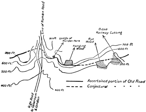
There lies just before one on the hillside a wood, called 'The Hanging Wood.'
We skirted the south edge of this wood and found beyond it a field in which the track is lost;[31] nor was the task of recovering it an easy one, for the light was just failing, and here, as always where cultivation has risen above the old level, the Old Road is confused and destroyed.
We had, however, over these few yards an excellent clue. In a wood called 'The Rye Wood' just in front of us the track of the Old Road is not only clearly marked, but has been preserved by local traditions. For this NW. corner of the Rye Wood we made, through the south of the spinney called 'Hogtrough Spinney.'
Just beyond the Rye Wood, the hillside is pierced by a deep railway cutting which is the entrance to Oxted Tunnel. This cutting comes right across the line of the Old Road. We made for this point (which is a few yards north of the first bridge), but when we reached it, it was quite dark, and if we had covered in that day but eighteen miles or so, it must be remembered how much of our time had been spent in the perpetual checks of this division.[32]
We reluctantly determined, then, to abandon the hillside for that evening, and to go down to the plain and sleep. The nearest place of hospitality was Oxted. We made for that village in the darkness, stumbling along the railway-line, and in the inn we met a third companion who had come to join us, and who would accompany us now as far as Canterbury.
When we had eaten and drunk wine, and had had some quarrelling with a chance traveller who suffered terribly from nerves, we left our entertainment. We slept, and the next morning, before it was light, we all three set out together, taking the northern road towards the hill.
Titsey to Wrotham
Sixteen miles
Beyond the railway-cutting, the road is recovered, as I have said, by tradition and by a constant use which lasted almost to our own time.[33] It goes beneath the large wood which here clothes the hill, and after a partial loss in the field next the park, leads up to the farm known as 'Limpsfield Lodge Farm'; it comes to the paling of the park just north of the farm.
Across Titsey Park the track of the road is clear, and its interest is the greater from the anxiety which the owners of the place have shown to discover its antiquities.
A little off the Way, at the base of the hill, was discovered in 1867 a Roman villa, situated thus (as at Walton Heath, at Colley Hill, at Bletchingly, as later on at Burham, or, to take a remote instance, as in the case of the Roman village on the Evenlode, or again, that at Bignor) not right on the road itself, but from a quarter to half a mile off it. So the heirs of the Roman owners, the feudal lords, built their manor-houses off the roads and led to them by short perpendicular ways and avenues such as you may still see approaching half the French chateaux to-day.
It is probable (to guess at matters of which there is no proof) that while this road, serving no strategical purpose, leading to no frontier, and communicating between no two official centres of Roman life, was not used in the official system, the country people continued to make it one of their main ways, and that in the profound peace which the southern civilisation had imposed, the rich built for pleasure or to superintend their farms, along what was nothing but a British way.
Henceforward antiquities of every kind were to meet us as we advanced, because the Old Road on its way to the Straits gained importance with every ten miles of its way. Tributary roads continually fell into it: one had come in long ago at Alton, from Portsmouth and the Meon valley; at Farnham, a second had joined, which as the reader knows was probably older than the Old Road itself; others at the Guildford gap, others from the Weald and from the north as well at Dorking, another at Gatton, another at the Caterham Road: and each would swell the traffic and the movement upon this principal line of advance towards the Straits of Dover. More were to come. One of the highest importance (for it led from London along the valley of the Darent) was to join us at Otford; the last and perhaps the greatest, beyond the Medway, in the stretch before Boxley. With each of these the importance and the meaning of the road developed, and the increasing crowd of memories or records was like a company coming in on either side to press on with us to Canterbury.
Before leaving Titsey Park, the Old Road showed another of its characteristics in passing again just south of the site where the old church once stood; thenceforward for many miles it becomes a good modern lane, pursuing its way without deviation for five miles due east along the slope of the hills. Of this part, as of all such sections of our way, where a modern road coincides with the prehistoric way, there is little to be said. The level was not high, nor the vale immediately beneath us broad. Above us from the main ridge was granted, I knew by many journeys, that great vision: the whole southern plain, and above the near sand-hills, at one sweep, half the county of Sussex. But the matter of our journey forbade the enjoyment of such a sight, just as the matter of my book forbids me to speak of the very entertaining people of all kinds who came across us during these days and days, especially in the inns.
The road continues thus, following a contour between four and five hundred feet above sea-level, crosses the Kentish Border, and remains a good, well-kept lane, until it reaches the border of Chevening Park.
The right-of-way along the road across the park (where, of course, it has ceased to be a lane, and is no more than an indication upon the turf) has ceased since the passing of an Act of Parliament in the late eighteenth century, which Act diverts the traveller to the south, round the enclosure. But the direction taken by the Old Road across this ground is fairly evident until the last few hundred yards.
On the eastern side of the Park it is continued for about 200 yards as a footpath. It is then lost under the plough; but a lane, some seven furlongs further on to the east, recovers the alignment,[34] and leads straight on to the crossing of the Darent, down just such a spur as marked the crossing of the Mole, while above us went a flanking road, marked by stunted trees, on the windy edge of the Downs.
Following it thus we passed the northernmost of the two railway arches, went down the hill a mile or so, crossed the plain that was till recently marshy and difficult, and entered the village of Otford by the bridge and over the ford whereby, certainly since Edmund Ironside, and probably for many thousands of years before that, men had come to it.
Indeed, here, where the Old Road falls into the valley of the Darent, its importance in recorded history, which had been growing steadily as we went eastward, was suddenly increased for us, and the cause was the reception at this point of its tributary from London. From Otford the Old Road becomes strategic. It is the road by which marched the defending forces when invasion was threatened from the Thames estuary. It becomes hierarchic; the power of Canterbury seizes it; and it becomes royal, perpetually recalling the names and at last the tyranny of the kings. The battle against the invader, the king's progress to the sea, the hold of the Church upon the land it traverses, fill all the final marches from the crossing of the Darent to that of the Stour. Something of military history as at Alton, at Farnham, and just down the Stane Street at Anstie Bury, had attached even to the earlier part of so ancient a way—but from Otford onward it is greatly emphasised.
As one comes down from the chalk pit above the river one is crossing what is probably the site of Edmund Ironside's great and successful struggle with the Danes in 1016, when he defeated Canute and drove him across the river, and pursued the rout mile upon mile to Aylesford. Half a mile further down on the plain, just before you get into the village, is the field where Offa is said to have achieved the supremacy of England by the conquest of Kent in 773.
It is only a doubtful bit of tradition, but it is worth recording that one more battle was fought here—as the populace believed—in the very first struggle of all—in the legendary fifth century. It is said that the Saxons were defeated here by the British, and that they also retreated towards Aylesford.
Canterbury had shown its influence long before this valley. We had seen the chapels and had but just left Brasted, whose allegiance to the archbishop was old beyond all record. But from Otford onward the power of the See became peculiar and more definite.
First there was the string of great palaces, Otford, Wrotham, Maidstone, Charing: Otford, Wrotham, and Charing especially, standing as they did directly upon the Old Road and created by it. We saw them all. They are in ruins.
Their authority, their meaning, had been suddenly destroyed. No one had claimed or supported their enormous walls. The new landlords of the Reformation, the swarm, the Cecils and the Russells and the rest, seem for once to have felt some breath of awe. The palaces were permitted to die. I imagined as I saw them one by one that the few stones remaining preserved a certain amplitude and magnificence; it may have been nothing but the fantasy of one who saw them thus for the first time, his mind already held for so many days by the antiquity of the Road.
They are forgotten. They were great for their time. Their life was intense. The economic power of the throne and of the chief altar in England ran through them. Otford at Domesday had its hundred small farms, its six mills; it was twice the size of Westerham. Wrotham and Charing, somewhat less, were yet (with Maidstone) the chief centres of Kent south of the Downs.
And apart from the See the Church in general held all the line. At Boxley, eldest daughter of Waverley, Clairvaux and the spirit of St. Bernard showed; it became as great as the palaces. Hollingbourne, fifty years before the Conquest, had been granted to St. Augustine's, a hundred years before that Lenham to Christchurch. The connection of Charing with Canterbury was so old that men believed their 'Vortigern' to have dedicated its land, and the church could show, even of writing, a parchment older than Alfred by a hundred years.
All these things had gone as utterly as the power to build and to think and to take joy in the ancient manner; the country-side we were treading held their principal and silent memorials.
For upon all this—which was England and the people—had fallen first the crown and then the rich, but the crown had begun the devastation.
I have said that from Otford the Old Road becomes royal, for it is at Otford that the road from Greenwich, after following the valley of the Darent, falls into the Pilgrim's Way. From Westminster by water to Greenwich, from Greenwich down here to Otford, and thence along the Old Road to the sea, had been a kind of sacred way, for the kings, who used as they went the great palaces of the Archbishops for their resting-places. By this road, last of so many, went Henry VIII. to the Field of the Cloth of Gold. It was an alternative to the straight road by Watling Street, and an alternative preferred from its age and dignity.
Then came its ruin. The grip of the crown caught up all the string of towns and villages and palaces and abbeys. You see the fatal date, '20th November, 29th Henry VIII.' recurring time and time again. Otford is seized, Wrotham is seized, Boxley, Hollingbourne, Lenham, Charing, and with these six great bases, a hundred detached and smaller things: barns, fields, mills, cells—all the way along this wonderful lane the memory of the catastrophe is scarred over the history of the country-side like the old mark of a wound, till you get to poor Canterbury itself and find it empty, with nothing but antiquarian guesses to tell you of what happened to the shrine and the bones of St. Thomas.
The Holy Well at Otford, its twin at Burham, the rood of Boxley, the block of Charing were trampled under. The common people, first apathetic, then troubled,—lastly bereft of religion, lost even the memory of the strong common life as the old men died; sites which had been sacred ever since men had put up the stones of Addington or Trottescliffe, or worshipped Mithra on the bank of the Medway, or put the three monoliths of Kit's Coty House together to commemorate their chief, or raised the hundred stones—all these were utterly forgotten.
It was not enough in this revolution that the Church should perish. The private lands of the most subservient were not safe—Kemsing, for example. It was the Manor of Anne Boleyn's father: it may be imagined what happened to such land. I know of no district in England where the heavy, gross, and tortured face of Henry in his decline haunts one more. Sacredness is twofold—of pleasure and pain—and this, the sacred end of our oldest travel, suffered in proportion to its sanctity.
When we had passed the Darent at Otford and climbed the hill beyond, we came upon a section of the road which might be taken as a kind of model of its character along these hills.
It is a section six miles long, beginning upon the hillside just above Otford station and ending near the schoolhouse above Wrotham. But in this short distance it gives examples of nearly all the points which it is the business of this book to describe. There is indeed no part of it here which requires to be sought out and mapped. The whole is known and has a continuous history; and such certitude is the more valuable in a typical division, because it permits us to deduce much that can elsewhere be applied to the less known portions of the road.
The Old Road runs here (as throughout nearly the whole of its course between Dorking and Canterbury) up on the bare hillside above the valley. The road appears, as one walks it, to run at the same level all along the hillside, but really it is rising as the floor of the valley rises, in order to keep continuously at the same distance above it. Its lowest point is not much under 300 feet, but its highest is just over 500.
Immediately below it lies that string of habitations which everywhere marks its course, and between which it was originally the only means of communication. Just as Bletchingly, Reigate, Limpsfield, Westerham, Brasted, and the rest stood below its earlier course, and just as in its further part we shall find Hollingbourne, Harrietsham, Lenham and Charing, so here there runs a little succession of hamlets, churches, and small towns, which are the centres of groupings of arable land in the valley floor, while above them the Pilgrim's Road follows just above the margin of cultivation. Their names are Kemsing, Heaverham, St. Clere, Yaldham, and at last Wrotham.
The section further gives an admirable example of the way in which the Old Road was gradually replaced.
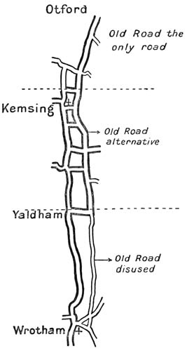
These six miles of its length may, for the purpose of the illustration they afford, be divided into three nearly equal parts by the village of Kemsing, and the hamlet of Yaldham. Each of these divisions shows the Old Road in one of its three historical phases: first as the only artery of the country-side, then as an alternative way supplemented by a valley road, and finally as a decayed and unused path whose value has been destroyed by the more modern highway below it. It is astonishing to see with what precision each of these phases is shown, how exactly each division ends, and how thoroughly the character of each is maintained.
In the first, from Otford to Kemsing, a distance of about two miles, one can see the two valley villages below one, and the track one follows is the only good road between them, though it lies above them both and can only be reached from either by a short rising lane. A short cut across the fields connects the two places, but if one wishes to use a proper and made way, there is none to take but that which still represents the Old Road, and so to go up out of Otford and then down into Kemsing. One has to do, in other words, exactly what was done for centuries when the archbishops came up to London from Canterbury; wherever one may desire to halt one has to leave the Old Road and come down from it to the village below.
In the second part, between Kemsing and Yaldham, the modern influence has been sufficient to provide an alternative. The distance is somewhat more than two miles. The Pilgrim's Way runs up along the hillside, a metalled lane, while below in the valley the old footpaths and cart tracks have been united into a modern permanent road, and a man going from Kemsing through Heaverham to Yaldham need not take the Pilgrim's Road above as his ancestors would have had to do, but can go straight along the lower levels.
Finally, with Yaldham and on to Wrotham the more common condition of modern times asserts itself. The lower valley road becomes the only important one, the Pilgrim's Road above dwindles into, first, a lane very little used and falling into decay, then a path thick with brambles and almost impassable. A man going from Yaldham to Wrotham nowadays is bound to use the modern valley road. When we had pushed through the brambles of the deserted path for perhaps a mile and a half, the way broadened out again, crossed the London Road, and turning the corner of the hill overlooked the church and roofs of Wrotham a hundred feet below.
Of Wrotham, the second link in that chain of palaces which afforded shelter to the Archbishop and to the King, as the one journeyed to Lambeth, the other to the sea-coast, I have already spoken. I desire here to discuss rather the topographical interest of the corner upon which we stood and its connection with the prehistoric road which it was our principal business to examine.
And for that purpose, though it occupied but the last part of a day, I would devote to a separate division the passage of the Medway which was now at hand.
Wrotham to Boxley
Eleven miles
At Wrotham is a kind of platform, or rather shoulder, which is made by such a turning of the great chalk hills as I shall presently describe. This turning revealed to us the plain at our feet as we came round the corner of the hill and saw before us the whole valley of the Medway.
We were perhaps some hundred feet above Wrotham and five hundred above the sea as we stood upon this platform before noon, and overlooked the great flats and the distant river and the further hills.
It is a view of astonishing effect, such as I did not know to be in south England; for our rivers are small, and, exquisite as is their scenery, they do not commonly impress the mind with grandeur. The Medway, perhaps because it is the relic of some much greater river now drowned by the sinking of the land, perhaps because its tidal estuary lends it twice a day an artificial breadth, gives one the impression of those continental streams, the Seine or the Meuse, which are sufficient to animate a whole country-side, and which run in so wide a basin that a whole province attaches to their name.
The manner of this landscape was that of a great gesture; its outline was like the movement of a hand that sketches a cartoon; its sweep was like the free arm of a sower sowing broadcast. The bank, moreover, upon which the Old Road here stands is so steep that it produces an effect of greater height and whatever expansion of the mind accompanies a wide horizon.
There dominated that view a character of space and dignity which not even the Itchen valley from the heights, nor the Weald from the crest of the Surrey Downs, could equal. The crossings of the Wey, of the Mole, and of the Darent, the valleys which there interrupted the general line of our hillside road, seemed narrow and familiar as one gazed upon this much greater plain.
Far off, miles and miles away, the hills continued their interminable line. The haze, and a certain warm quality in the winter light, added to the vastness of the air, and made the distant range seem as remote as a to-morrow; it was lost in a grey-blue that faded at last into a mere sky upon the extreme east.
Along those hills our way was clearly to be continued. Their trend was not, indeed, due east and west as the Old Road had run so long: they turned a little southerly; but the general line, bending down to Canterbury and to the Straits, followed that crest, and its furthest visible height was not far distant from our goal.
Just opposite us, upon the further side of the valley, was faintly to be discerned such another shoulder as that upon which we stood. We made it out upon our map to bear the good name of 'Grey Wethers,' as does that rock far off eastwards, out of which was built Stonehenge. Upon that shoulder had stood the abbey of Boxley. It marked the point where, beyond the valley, the Pilgrim's Way is recognised again. But in the interval between, across this broad flat valley, its passage had never been fixed.
We might have thought, had we not hitherto learnt much of the Old Road, that no problem was there, save to cross in a direct line the valley before us, and make by evening that further shoulder of 'Grey Wethers,' where we should find the road again; but we had followed the track too long to think that it could so easily be recovered. We guessed that in so wide a gap as was here made by the Medway in the line of hills a difficulty, greater than any we had yet met, would arise, and that we should not overcome it without a longer search than had been necessary at the Wey or even the Mole.
We were now familiar with such platforms and such views. Upon a lesser scale we had felt their meaning when we stood upon the rock of St. Catherine's at evening and considered the crossing of the Wey; or on that other spur, eastward of Dorking, when we had seen Box Hill beyond the valley under the growing night. They also, the men long before us, had chosen such particular places from whence to catch the whole of a day's march, and to estimate their best opportunity for getting to the further shore.
We knew how difficult it was to trace again their conclusion, and to map out the Old Road in places like these.
To debate its chances and draw up the main line of our decision, we went down into Little Wrotham, and at an inn there which is called the 'Bull,' we ate beef and drank beer, spoke with men who knew the fords and the ferries, compared our maps with a much older one belonging to the place, and in general occupied our minds with nothing but the passage of the river: the passage, that is, which alone concerned us; the place where men, when men first hunted here, fixed their crossing-place, and carried the Old Road across the tide-way of the stream.
Now, having said so much of the landscape, it is necessary to turn to the more minute task of topography. For it is the business of this book not to linger upon the pleasures of our journey, but to reconstitute an ancient thing. And for that purpose a simple sketch-map will explain perhaps as much as words can do.
The features of this map are very few, but their comprehension will be sufficient for my readers to grasp the matter upon which we are engaged.
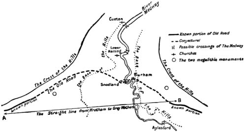
A single heavy line indicates the crest of the hills—a crest from over six hundred to over seven hundred feet in height. A dotted line indicates the limit of what may be called the floor of the valley. The brackets )( show the four possible crossings of the river. Two points, numbered A and B, mark the 'shoulders' or platform. The first (A) above Wrotham, the second (B) at Grey Wethers. Finally, the megalithic monument at Coldrum and that near Grey Wethers (whose importance will be seen in a moment) are marked with circles.
Far up the valley on each hill continues the remnant of an ancient road, and the reader will see from this, that, as in the valley of the Mole and of the Darent, our difficulties were confused and increased from the fact that, quite apart from the crossing of the river, other prehistoric tracks led off northwards upon either side of the river, whose crossing was our concern.
The great main range of chalk which runs all across south-eastern England; the range whose escarpment affords for sixty miles a platform for the Old Road is broken, then, by the Medway, which cuts through it on its way to the sea. But there is not only a gap; it will be seen that the hills 'bend up,' as it were, upon either bank, and follow the stream northward, making a kind of funnel to receive it. The effect of this is best expressed by saying, that it is as though the Medway valley had been scooped out by a huge plough, which not only cut a five-mile gap in the range, but threw the detritus of such a cutting to left and right for miles beyond the point of its passage. It is at the mouth of this gap that the two shoulders or turning-places are to be found; one on the west at Wrotham, the other on the east at Grey Wethers: while beyond them the Downs turn northward either way, to sink at last into the flats of the Thames estuary.
The interval between these 'shoulders' was the most considerable of any that had to be filled in all our exploration.
The reason that this gap in the Old Road should be found at such a place was evident. It was here that the road had to cross the most important of the rivers it meets upon its course, the Medway. Alone of the rivers which obstruct the road, it is a tidal stream, and, as though in recognition of its superior claim, the hills receded from it more grandly than they had from the Wey at the Guildford, or the Mole at the Dorking passage. They left six miles of doubtful valley between them, and across these six miles a track had to be found.
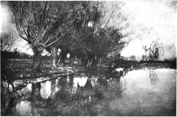
THE MOST IMPORTANT OF THE RIVERS IT MEETS UPON ITS COURSE, THE MEDWAY
A clear statement of the problem will lead one towards its solution.
I have said that for several miles before Wrotham, the chalk hills, well defined and steep, running almost due east and west, present an excellent dry and sunny bank for the road. As one goes along this part of one's journey, Wrotham Hill appears like a kind of cape before one, because beyond it the hills turn round northward, and their continuation is hidden. I have also told how, a long way off, over the broad flat of the Medway valley, the range may be seen continuing in the direction of Canterbury, and affording, when once the river is crossed, a similar platform to that from which one is gazing.
We knew, also, that the road does, as a fact, follow those distant hills, precisely as it had the range from which we made our observation, and if no physical obstacles intervened, the first travellers upon this track would undoubtedly have made a direct line from the projecting shoulder of Wrotham Hill to the somewhat less conspicuous turning-point which marks the further hills of Grey Wethers, where also Boxley once stood.
But obstacles do intervene, and these obstacles were of the most serious kind for men who had not yet passed the early stages of civilisation. A broad river with a swift tidal current, flanked here and there (as tidal rivers always are before their embankment) by marshes; a valley floor of clay, the crossing of which must prove far more lengthy than that of any they had hitherto encountered, made the negotiation of this gap a difficult matter. Moreover, the direct line would have led them by the marshiest way of all: the fields of Snodland brook.
Oddly enough the difficulty of rediscovering the original track by which the road forded the Medway, does not lie in the paucity of evidence, but rather in the confusion arising from its nature and amount. So great is this confusion that some authorities have been content to accept alternative routes at this point.
Savage trails, however, never present alternatives so widely separate, and least of all will they present any alternative, even one neighbouring the main road, where a formidable obstacle has to be overcome: to do so would be to forfeit the whole value which a primitive road possesses as a guide (for this value depends upon custom and memory), and when a tidal river had to be traversed, a further and very cogent reason for a single track was to be found in the labour which its construction upon a marshy soil involved.
If some one place of crossing had held a monopoly or even a pre-eminence within the limits of recorded history, the evidence afforded by it would be of the utmost value. But an indication of this simplicity is lacking.
It is certain that within historic times and for many centuries continuously, the valley and the river were passed at four places, each of which now may lay a claim to be the original passage.
The modern names of these places are, in their order from the sea, Cuxton, Lower Halling, Snodland, and Aylesford.
Before proceeding I must repeat what was said above, that two tracks of great antiquity continue the Old Road northward on each side of the Medway far beyond any point where it would have crossed; these tracks (I have called them elsewhere 'feeders') are not only clearly defined, but have each received the traditional name of the Pilgrim's Way, and their presence adds a considerable complexity to the search for the original passage.
So much of the elements of the problem being laid down, let us now recapitulate certain features which we have discovered to be true of the road in the earlier part of its course, where it had to cross a river, and certain other features which one knows to be common to other British track-ways over valleys broader than those of the Mole or the Wey. To these features we may add a few others, which are conjecturally those that such a road would possess although we might have no direct evidence of them.
A list of these features will run very much as follows:—
(1) The road will attempt the shortest passage of the valley floor, the breadth being more or less of an obstacle, according as the soil is more or less low, covered, or damp.
(2) It will seek for a ford.
(3) Other things being equal, it would naturally cross a river as high up as possible, where the stream was likely to be less difficult to ford.
(4) It would cross in as immediate a neighbourhood as possible to that height upon which survey could be made of the opportunities for crossing.
(5) The nature of the bottom at the crossing would influence it greatly, whether that bottom were gravel and sand, or treacherous mud. Moreover, a primitive road would often leave evidence of its choice by the relics of good material thrown in to harden the ford.
(6) A point of so much importance would probably be connected with religion, and almost always with some relic of habitation or weapons.
(7) It would often preserve in its place-name some record of the crossing.
(8) It would (as we had found it at Dorking and at Otford) choose a place where a spur on either side led down to the river.
To these eight points may be added the further consideration, that whatever was the more usual crossing in early historic times affords something of a guide as to prehistoric habits, and, finally, that where a tidal river was concerned, the motives which were present on any river for seeking a passage as far up stream as possible would be greatly strengthened, for the tide drowns a ford.
Now, in the light of what the map tells us, and of these principles, let us see where the crossing is most likely to be found, and having determined that, discover how far the hypothesis is supported by other evidence.
To begin with Cuxton:
At Cuxton the firm land of the hills comes upon either side close to the river. An ancient track-way upon either side leads very near to the point of crossing and cannot be followed, or at least nothing like so clearly followed further down the valley. At Cuxton, moreover, as a constant tradition maintains, the crossing of the river by pilgrims was common.
On the other hand there is nothing approaching a ford at this place. The bottom is soft mud, the width of the river very considerable, the tidal current strong, and of all the points at which the river might have been crossed, it is the most distant from the direct line; indeed, compared with the next point, Lower Halling, a traveller would add five or six miles to his journey by choosing Cuxton.
Now, consider Aylesford, the other extreme; the highest up as Cuxton is the lowest down the river of the four points. Aylesford has many powerful arguments in its favour. It has produced one of the most interesting and suggestive prehistoric relics in England: I mean that 'Aylesford pottery' which is an imitation, or possibly even an import, of the pottery of northern Italy in the first or second centuries before our area. It has furnished a mass of other antiquities: armillae of gold have been found in the river and British coins and graves on the northern bank. It preserves in the last part of its name the tradition of a ford, and though 'ford' in place-names by no means always signifies a ford any more than 'bridge' signifies a bridge, yet in this case we have historic knowledge that a ford existed; and (as is most frequently the case) the ford has been bridged.
A further argument, and in its way one of the strongest that could be adduced, is the position of the place in the earliest of our annals. Whether 'the Horse and the Mare,' Vortigern, and the rest are wholly legendary or not, cannot be determined. Certainly the texture of the story is fabulous, but Bede and 'Nennius' have both retained the memory of a great battle fought here, in which the British overcame the Pirates, and what is most significant of all, the legend or memory records a previous retreat of the Saxons from a defeat at Otford. We know, therefore, that a writer in the seventh century, though what he was writing might be fable, would take it for granted that a retreat westward from Otford would naturally lead along some road which passed the Medway at Aylesford. We get another much later example of the same thing when Edmund Ironside, after his great victory at Otford over the Danes, pursued them to Aylesford, and was only prevented from destroying them by their passage over the river under the cover of treason.
This is very strong evidence in favour of Aylesford, and when one remembers that the manor was ancient demesne, its antiquity and importance are enhanced.
But against Aylesford there are three strong arguments. They are not only strong, they are insuperable. The first is the immense width of valley that would have to be crossed to reach it. That is, the immense tract of uncertain, wooded way, without a view either of enemies or of direction.
The second is the clay. A belt of gault of greater or lesser width stretches all along the Downs just below the chalk. Here it is particularly wide, and no straight line can be taken from Wrotham to the Aylesford gravels without crossing nearly two miles of this wretched footing, which, throughout its course, the road has most carefully avoided. That a ford of great antiquity was there; that the men of the sandy heights used it; that the Romans used so admirable a ford (it is gravel near the river on either side), that they bridged it, that they made a causeway over the clay, and that this causeway and that bridge were continuously used after their time, I am willing to believe; but not that the prehistoric road along the chalk hills could have waded through all that clay to reach it, and have gone out of its way into the bargain.
Thirdly, there is the clinching fact that a number of prehistoric remains, Kit's Coty House and the rest, lie to the north of such a crossing, and that to reach Boxley itself, a site indubitably dependent upon the prehistoric road, a man crossing at Aylesford would have to turn back upon his general direction.
It must further be remembered that by the seventh century some of the valleys had acquired firm roads, inherited from the old civilisation, and that in the rout after a battle, an army making for a tidal river, and not able to choose their own time of crossing (as can a wayfarer), would certainly make for a point as far up the stream as possible and for a bridge.
If Cuxton and Aylesford, then, are to be neglected (as I think they certainly must be), there remain only Lower Hailing and Snodland.
At first sight the weight of argument is for Lower Halling, and if the various parts of such an argument as I adduce have different proportions from those I lend them, one might conclude that at Lower Halling was the original passage of the Medway.
True, there is for the passage at Lower Halling but one evidence that I can discover, but it is an evidence of the greatest weight, and such an one as is often permitted alone to establish a conclusion in archæology. It is this, that there was good surface over the original soil from the Pilgrim's Way on the hills above, right down to the river-bank at this point. No clay intervenes between the chalk and gravel. The primitive traveller would have had fairly dry land all the way down to the river. Even beyond the river the belt of alluvial soil is less broad than it is at Snodland; and altogether, if the geological argument alone were considered, the decision undoubtedly would be given to this place.
The claims of Snodland are asserted by a number of converging arguments. I will enumerate them, and it will, I think, be seen that though each is individually slight, the whole bundle is convincing.
First.—The spur, which leaves the main range of hills for the river (such a spur as has elsewhere, at Shalford, and at Dorking, and at Otford, attracted the Old Road towards the ford it points to), touches indeed both Snodland and Lower Halling on either side, but with this great difference—that Snodland is on the south, Lower Halling upon the north of the ridge. The elevation is not pronounced, the slope is slight, but a little experience of such ground at various seasons will determine one that the southern bank would be chosen under primitive conditions. In such a conformation the southern bank alone has during the winter any chance of drying, and in a dry summer, it matters little whether a slope be partly of clay[35] (as is the descent to Snodland) or of chalk (as is that to Lower Halling). During more than half the year, therefore, the descent to Snodland was preferable; during the other half indifferent.
Secondly.—Immediately before and beyond the Lower Halling crossing no antiquities of moment have been discovered: a grave, possibly Roman, is, I believe, the only one. At Snodland, and beyond its crossing, they are numerous. An ancient and ruined chapel marks the descent from the hills. The church itself has Roman tiles. Beyond the river, the Roman villa which was unearthed in 1896 by Mr. Patrick is precisely upon the road that would lead from such a crossing up to the Pilgrim's Way upon the hill. Close by the origin of this lane from the ford to the hillside were discovered the fragments of what some have believed to be a Mithraic temple; and earlier, in 1848, Roman urns and foundations were found near the road at Little Culand.
Thirdly.—The crossing at Snodland is shallower than that at Lower Halling, and (though I do not pretend that the artifice is prehistoric) the bottom has been artificially hardened.
Fourthly.—There stands at Snodland a church, past the southern porch of which goes the road, and when the river is crossed, and the same alignment followed along the bank upon the further side for a little way, the track again passes by a church, and again by its southern porch.
Fifthly.—The 'Horseshoe Reach'—the reach, that is, between Snodland and Burham—has always marked the limit between Rochester's jurisdiction over the lower, and Maidstone's over the upper, Medway. This is of great importance. All our tidal rivers have a sea-town and a land-town; the limits up to which the seaport has control is nearly always the traditional crossing-place of the river. Thus Yarmouth Stone on the Yare divides the jurisdiction of Norwich from that of Yarmouth; it is close to the Reedham Ferry, which has always been the first passage over the river. For London and the Thames we have the best example of all—Staines.
Finally, it is not extravagant to note how the megalithic monument (now fallen) near Trottescliffe, corresponds to Kit's Coty House on the opposite shoulder beyond the valley. The crossing at Snodland would be the natural road between the two.
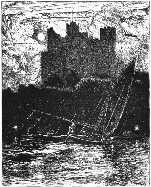
ROCHESTER
These seven converging lines of proof, or rather of suggestion—seven points which ingenuity or research might easily develop into a greater number—seem to me to settle the discussion in favour of Snodland.[36]
By that ferry then we crossed. We noted the muddy river, suggestive of the sea, the Medway, which so few miles above suggests, when it brims at high tide, a great inland river. It has hidden reaches whose fields and trees have quite forgotten the sea. We passed by the old church at Burham. We were in a very field of antiquity[37] as we went our way, and apart from the stones and fragments it has left, we were surrounded by that great legend which made this place the funeral of the first barbarians.
It was already nearly dark when we came to the place where that old sphinx of three poised monoliths, Kit's Coty House, stands in a field just north of the lane; the old circle of stones, now overthrown, lay below us to the south.
We would not pass Kit's Coty House without going near it to touch it, and to look at it curiously with our own eyes. Though we were very weary, and though it was now all but dark, we trudged over the plough to where it stood; the overwhelming age of the way we had come was gathered up in that hackneyed place.
Whether the name be, or be not, a relic of some Gaelic phrase that should mean 'the grave in the wood,' no one can tell. The wood has at any rate receded, and only covers in patches the height of the hill above; but that repeated suggestion of the immense antiquity of the trail we were pursuing came to us from it again as we hesitated near it, filled us with a permanent interest, and for a moment overcame our fatigue.
When we had struck the high-road some yards beyond, just at the place where the Pilgrims Way leaves it to reach the site where Boxley Abbey once stood, our weakness returned. Not that the distance we had traversed was very great, but that this kind of walking, interrupted by doubts and careful search, and much of it of necessity taken over rough land, had exhausted us more than we knew.
With difficulty, though it was by a fine, great falling road, we made the town of Maidstone, and having dined there in the principal inn to the accompaniment of wine, we determined to complete the journey, if possible, in the course of the next day.
Boxley to Canterbury
Twenty-six miles
From Boxley to Charing the Old Road presents little for comment, save that over these thirteen miles it is more direct, more conspicuously marked, and on the whole better preserved than in any other similar stretch of its whole course. The section might indeed be taken as a type of what the primitive wayfarers intended when the conditions offered them for their journey were such as they would have chosen out of all. It is not a permanent road as is the section between Alton and Farnham, therefore nothing of its ancient character is obliterated. On the other hand, it is not—save in two very short spaces—interfered with by cultivation or by private enclosure. This stretch of the road is a model to scale, preserved, as though by artifice, from modern changes, and even from decay, but exhibiting those examples of disuse which are characteristic of its history.
The road goes parallel to and above the line where the sharp spring of the hill leaves the floor of the valley; it commands a sufficient view of what is below and of what lies before; it is well on the chalk, just too high to interfere with cultivation, at least with the cultivation of those lower levels to which the Middle Ages confined themselves; it is well dried by an exposure only a little west of south; it is well drained by the slope and by the porous soil; it is uninterrupted by combes, or any jutting promontories, for the range of the hills is here exactly even. In a word, it here possesses every character which may be regarded as normal to the original trail from the west of England to the Straits of Dover.
The villages which lie immediately below it are all at much the same distance—from a quarter to half a mile: it can be said to traverse one alone—Detling, and this it passes through to the north. The others, Harrietsham, Hollingbourne, Lenham, Charing, are left just to the south. They are now connected by the high-road which joins up the valley, and were once, it may be presumed, isolated from each other by the common fields and the waste of each village, or if connected, connected only by paths. They may have depended, during many centuries, for their intercommunication, upon the Old Road, to which each of them possesses a definitely marked line of approach: and the Old Road remains the typical main artery, which passes near, but not through, the places it serves.[38]
This thirteen miles of the way is often vague, and is indeed actually broken at one point between Cobham Farm and Hart Hill, a mile and a half east of Charing; but it is a gap which presents no difficulty. The alignment is precisely the same before and after it; it is but seven furlongs in extent; it has been caused by the comparatively recent ploughing of this land during the two generations of our history when food was dear.
From Boxley to Lenham the plain beneath the Old Road is drained by a stream called the Len, tributary to the Medway. Just before or at Lenham is the watershed: a parting of no moment, not a ridge, hardly observable to one standing above it on the hillside. It is the dividing line between the basins of the Medway and the Stour. All the hydrography of south-eastern England presents this peculiarity. The watersheds are low; the bold ranges do not divide the river-basins, because the water system is geologically older than the Chalk Hills.
The Stour rises in Lenham itself, but its course has at first no effect upon the landscape, so even is the plain below. A village, which preserves the great Norman name of the Malherbes, stands on the watershed: the whole flat saddle is a rich field diversified by nothing more than slight rolls of land, in between which the spring comes as though up from a warmer earth, long before it touches the hills.
It is peculiar in England, this county of Kent, and especially its valleys. I had known it hitherto only as a child, a stranger, but no one who has so visited it in childhood can forget the sheep in the narrow lanes, or the leaning cones of the hop-kilns against the sky: the ploughlands under orchards: all the Kentish Weald.
At Charing the great hills begin to turn a corner. The Stour also turns, passes through a wide gap, and from east and south begins to make north and east straight for Canterbury; henceforward the spirit of Canterbury and the approach to it occupies the road.
We had reached the end of that long, clean-cut ridge which we had followed all the way from Farnham, the ridge which the four rivers had pierced in such well-defined gaps. Charing is the close of that principal episode in the life of the Way.
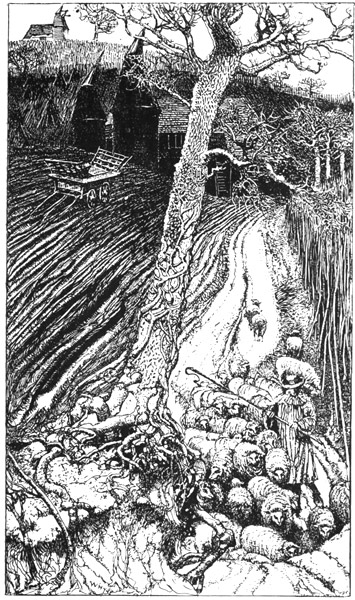
THE SHEEP IN THE NARROW LANES, OR THE LEANING CONES OF THE HOP-KILNS AGAINST THE SKY
Charing again was the last convenient halt in any rich man's journey until, say, a hundred and fifty years ago. It is something under sixteen miles from Canterbury, following the track of the Old Road, and even the poor upon their pilgrimages would have halted there; though the slow progress of their cumbersome caravans may have forced them to a further repose at Chilham before the city was reached.
Charing, therefore, was designed by its every character to be a place of some importance, and was a very conscious little town.
It counts more in Domesday than any other of the valley villages between Maidstone and the cathedral; it possessed the greatest and the first of those archiepiscopal palaces, the string of which we came on first at Otford; it has a church once magnificent and still remarkable after its rebuilding, and it maintains to this day an air of prosperity and continued comfort. The inn is one of the best inns to be found on all this journey; the whole village may be said, in spite of its enemies,[39] to be livelier in the modern decay than the other remote parishes of that plain.
We had imagined, before seeing the ground, that, after Charing, we should have some difficulty in tracing the Old Road.
The Ordnance map, which has given it the traditional name of the Pilgrim's Road all through this valley, not only drops the title immediately after Charing, but, for some reason I do not understand, omits to mark it at all along the skirts of Longbeech wood.
When we came to follow it up, however, we found it a plainly-marked lane, leading at much the same height round the shoulder of the hill, to the western lodge of Lord Gerrard's park. Just before we entered that park two local names emphasised the memories of the road: the cottage called 'Chapel' and the word 'Street' in 'Dun Street' at the lodge.
Within the fence of this park it is included. For nearly a mile the fence of the park itself runs on the embankment of the Old Road. At the end of that stretch, the fence turns a sharp angle outwards, and for the next mile and a half, the road, which is here worn into the clearest of trenches and banks, goes right across the park till it comes out on the eastern side a few yards to the south of the main gates. The Old Road thus turns a gradual corner, following the curve of the Stour valley.
The modern road from Charing to Canterbury cuts off this corner, and saves a good two miles or three, but the reasons which caused men in the original condition of the country to take the longer course of the Old Road are not far to seek.
There is, first, that motive which we have seen to be universal, the dryness of the road, which could only be maintained upon the southern side of the hill.
Next, it must be noted that these slopes down to the Stour were open when the plateau above was dense forest. This in its turn would mean a group of villages—such a group is lacking even to this day to the main road, and the way would naturally follow where the villages lay.
Finally, the water-supply of the plateau was stagnant and bad; that of the valley was a good running stream.
In its passage through Eastwell Park, the road passed near the site of the house, and it passed well north of the church, much as it had passed north of the parishes in the valley we had just left. This would lead one to conjecture, I know not with what basis of probability, that a village once existed near the water around the church at the bottom of the hill. If it did, no trace of it now remains, but whether (already in decay) it was finally destroyed, as some have been by enclosure, or whether the church, being the rallying-point of a few scattered farmhouses (as is more often the case), was enclosed without protest and without hurt to its congregation, I have no means of determining. It is worth noting, that no part of the Old Road is enclosed for so great a length as that which passes from the western to the eastern lodge of Eastwell Park. Nearly two miles of its course lies here within the fence of a private owner.
It is odd to see how little of the road has fallen within private walls. In Hampshire nothing of it is enclosed; in Surrey, if we except the few yards at Puttenham, and the garden rather than the park at Monk's Hatch, it has been caught by the enclosures of the great landlords in four places alone: Albury, Denbies, Gatton, and Titsey. It passes, indeed, through the gardens of Merstham House, but that only for a very short distance.
In Kent, Chevening has absorbed it for now close upon a century; then it remains open land as far as this great park of Eastwell, and, as we shall see, passes later through a portion of Chilham.
Clear as the road had been throughout Eastwell Park (and preserved possibly by its enclosure), beyond the eastern wall it entirely disappears. The recovery of it, rather more than half a mile further on, the fact that one recovers it on the same contour-line, that the contour-line is here turned round the shoulder of the hill which forms the entrance into the valley of the Stour, give one a practical certainty that the Old Road swept round a similar curve, but the evidence is lost.[40]
The portion near Boughton Aluph is perfectly clear; it goes right up under the south porch. It has disappeared again under the plough in the field between the church and Whitehill Farm. There it has been cut, as we had found it so often in the course of our journey, by a quarry. Another field has lost it again under the plough; it reappears on the hillside beyond in a line of yews.[41] But within a hundred yards or so there arises a difficulty which gave rise to some discussion among us.
A little eastward of us, on the way we had to go, the range of hills throws out one of those spurs with a re-entrant curve upon the far side, which we had previously discovered in Surrey above Red Hill and Bletchingly. It was our experience that the Old Road, when it came to an obstacle of this kind, made for the neck of the promontory and cut off the detour by passing just north of the crest. The accompanying sketch will explain the matter.
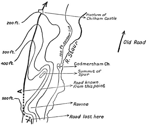
We knew from the researches of others that the road was certainly to be found again at the spot marked A. It was our impression, from a previous study of the map, that the trail would make straight for this point from the place where I was standing (X). But we were wrong. At this point the road turned up the hill, its track very deeply marked, lined with trees, and at the top with yews of immense antiquity. The cause of this diversion was apparent when we saw that the straight line I had expected the road to follow would have taken it across a ravine too shallow for the contours of the Ordnance map to indicate, but too steep for even a primitive trail to have negotiated. And this led me to regret that we had not maps of England such as they have for parts of Germany, Switzerland, and France, which give three contour-lines to every 100 feet, or one to every 10 metres.
We followed up the hill, then, certain that we had recovered the Old Road. It took the crest of the hill, went across the open field of Soakham, plunged into a wood, and soon led us to the point marked upon my sketch as A, where any research of ours was no longer needed. It is from this place that a man after all these hundred miles can first see Canterbury.
We looked through the mist, down the hollow glen towards the valley between walls of trees. We thought, perhaps, that a dim mark in the haze far off was the tower of the Cathedral—we could not be sure. The woods were all round us save on this open downward upon which we gazed, and below us in its plain the discreet little river the Stour. The Way did not take us down to that plain, but kept us on the heights above, with the wood to our left, and to our right the palings of Godmersham.
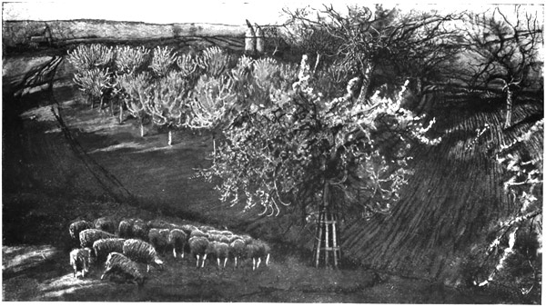
THE PLOUGHLANDS UNDER ORCHARDS: ALL THE KENTISH WEALD
We had already learnt, miles westward of this, that the Old Road does not take to the crest of a hill without some good reason, but that once there it often remains, especially if there is a spur upon which it can fall gently down to the lower levels.
The lane we were following observed such a rule. It ran along the north of Godmersham Park, just following the highest point of the hill, and I wondered whether here, as in so many other places, it had not formed a natural boundary for the division of land; but I have had no opportunity of examining the history of this enclosure. Chilham Park marches with Godmersham; where one ends and the other begins the road passed through the palings (and we with it) and went on in the shape of a clear ridge, planted often with trees, right down to the mound on which stands Chilham Castle.
Down in the valley below, something much older bore witness to the vast age of this corner of inhabited land: the first barrow to be opened in England; the tomb in which Camden (whom Heaven forgive) thought that a Roman soldier lay; in which the country people still believe that the great giant Julaber was buried, but which is the memorial of something far too old to have a name.
This castle and this grave are the entry into that host of antiquities which surrounds upon every side the soil of Canterbury. In every point of the views which would strike us in the last few miles, the history of this island would be apparent.
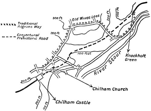
From the mound on which Chilham Castle stands to the farm called Knockholt, just two miles away, is what I believe to be a gap in the Old Road, and I will give my reasons for that conviction. Did I not hold it, my task would be far easier, for all the maps give the Way continuously from point to point.
Up to the mound of Chilham the path is clear. After Knockholt it is equally clear, and has, for that matter, been studied and mapped by the highest authority in England.[42] But to bridge the space between is not as easy as some writers would imagine.
It will be apparent from this sketch-map that between Chilham and Knockholt there rises a hill. On the south-east of it flows the Stour, with the modern main road alongside of it; on the north two lanes, coming to an angle, lead through a hamlet called Old Wives' Lees.
There is a tradition that the pilgrims of the later Middle Ages went through Chilham and then turned back along these northern lanes, passing through Old Wives' Lees. This tradition may be trusted. They may have had some special reason, probably some devotional reason, for thus going out of their way, as we found them to have had at Compton. If their action in this is a good guide (as their action usually is) to the trace of the Old Road, well and good; there is then no appreciable gap, for a path leads to Knockholt and could only correspond to the Old Road; but I should imagine that here, as at Merstham, the pilgrims may have deceived us. They may have made a detour for the purpose of visiting some special shrine, or for some other reason which is now forgotten. It is difficult to believe that a prehistoric trail would turn such sharp corners, for the only time in all this hundred and twenty miles, without some obvious reason, and that it should choose for the place in which to perform this evolution the damp and northern side of a rather loamy hill. I cannot but believe that the track went over the side of the hill upon the southern side, but I will confess that if it did so there is here the longest and almost the only unbridged gap in the whole of the itinerary. I am confirmed in my belief that it went over the southern side from the general alignment, from the fact that the known path before Chilham goes to the south of the castle mound, that this would lead one to the south of the church, and so over the southern shoulder of the hill; but, if it did so, ploughed land and the careful culture of hop-gardens have destroyed all traces of it. I fancied that something could be made of an indication about a quarter of a mile before Knockholt Farm, but I doubt whether it was really worth the trouble of examining.[43]
From the farm, right up through Bigberry Wood, we were on a track not only easy to recognise, but already followed, as I have said, by the first of authorities upon the subject.
We came after a mile of the wood to the old earthwork which was at once the last and the greatest of the prehistoric remains upon the Old Road, and the first to be connected with written history.
It was a good place to halt: to sit on the edge of the gravelly bank, which had been cast up there no one knows how many centuries ago, and to look eastward out towards Canterbury.
The fort was not touched with the memory of the Middle Ages: it was not our goal, for that was the church of St. Thomas, but it was the most certain and ancient thing of all that antiquity which had been the meaning of the road, and it stood here on the last crest of so many heights from which we had seen so many valleys in these eight days.
History and the prehistoric met at this point only.
Elsewhere we had found very much of what men had done before they began to write down their deeds. We had passed the barrows and the entrenchments, and the pits from whence coins with names, but without a history or a date, had been dug, and we had trodden on hard ground laid down at fords by men who had left no memory. We had seen also a very great many battlefields of which record exists. We had marched where Sweyn marched; Cheriton had been but a little way upon our right; we had seen Alton; the Roman station near Farnham had stood above us; the great rout of Ockley had lain not far off below our passage of the Mole; and we had recalled the double or treble memory of Otford, and of the Medway valley, where the invader perpetually met the armies of the island.
But in all these there were two clean divisions: either the thing was archaic—a subject for mere guess-work; or it was clear history, with no prehistoric base that we knew of behind it.
On this hill the two categories mingled, and a bridge was thrown between them. For it was here that the Roman first conquered. This was that defence which the Tenth Legion stormed: the entrenchment which was the refuge for Canterbury; and the river which names the battle was that dignified little stream the Stour, rolling an even tide below.
The common people, who have been thought to be vacant of history, or at the best to distort it, have preserved a memory of this fight for two thousand years.
I remembered as I sat there how a boy, a half-wit, had told me on a pass in Cumberland that a great battle had been fought there between two kings; he did not know how long ago, but it had been a famous fight. I did not believe him then, but I know now that he had hold of a tradition, and the king who fought there was not a George or a James, but Rufus, eight hundred years before. As I considered these things and other memories halting at this place, I came to wish that all history should be based upon legend. For the history of learned men is like a number of separate points set down very rare upon a great empty space, but the historic memories of the people are like a picture. They are one body whose distortion one can correct, but the mass of which is usually sound in stuff, and always in spirit.
Thinking these things I went down the hill with my companions, and I reoccupied my mind with the influence of that great and particular story of St. Thomas, whose shadow had lain over the whole of this road, until in these last few miles it had come to absorb it altogether.
The way was clear and straight like the flight of a bolt; it spanned a steep valley, passed a windmill on the height beyond, fell into the Watling Street (which here took on its alignment), and within a mile turned sharp to the south, crossed the bridge, and through the Westgate led us into Canterbury.
We had thoroughly worked out the whole of this difficult way. There stood in the Watling Street, that road of a dreadful antiquity, in front of a villa, an omnibus. Upon this we climbed, and feeling that a great work was accomplished, we sang a song. So singing, we rolled under the Westgate, and thus the journey ended.
There was another thing to be duly done before I could think my task was over. The city whose name and spell had drawn to itself all the road, and the shrine which was its core remained to be worshipped. The cathedral and the mastery of its central tower stood like a demand; but I was afraid, and the fear was just. I thought I should be like the men who lifted the last veil in the ritual of the hidden goddess, and having lifted it found there was nothing beyond, and that all the scheme was a cheat; or like what those must feel at the approach of death who say there is nothing in death but an end and no transition. I knew what had fallen upon the original soul of the place. I feared to find, and I found, nothing but stones.
I stood considering the city and the vast building and especially the immensity of the tower.
Even from a long way off it had made a pivot for all we saw; here closer by it appalled the senses. Save perhaps once at Beauvais, I had never known such a magic of great height and darkness.
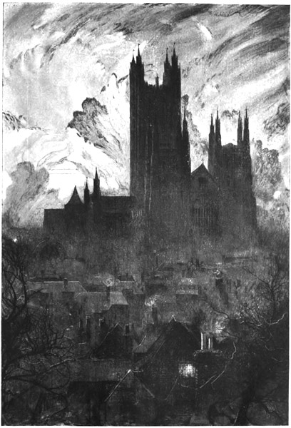
SUCH A MAGIC OF GREAT HEIGHT AND DARKNESS
It was as though a shaft of influence had risen enormous above the shrine: the last of all the emanations which the sacred city cast outwards just as its sanctity died. That tower was yet new when the commissioners came riding in, guarded by terror all around them, to destroy, perhaps to burn, the poor materials of worship in the great choir below: it was the last thing in England which the true Gothic spirit made. It signifies the history of the three centuries during which Canterbury drew towards it all Europe. But it stands quite silent and emptied of every meaning, tragic and blind against the changing life of the sky and those activities of light that never fail or die as do all things intimate and our own, even religions. I received its silence for an hour, but without comfort and without response. It seemed only an awful and fitting terminal to that long way I had come. It sounded the note of all my road—the droning voice of extreme, incalculable age.
As I had so fixed the date of this journey, the hour and the day were the day and hour of the murder. The weather was the weather of the same day seven hundred and twenty-nine years before: a clear cold air, a clean sky, and a little wind. I went into the church and stood at the edge of the north transept, where the archbishop fell, and where a few Norman stones lend a material basis for the resurrection of the past. It was almost dark.... I had hoped in such an exact coincidence to see the gigantic figure, huge in its winter swaddling, watching the door from the cloister, watching it unbarred at his command. I had thought to discover the hard large face in profile, still caught by the last light from the round southern windows and gazing fixedly; the choir beyond at their alternate nasal chaunt; the clamour; the battering of oak; the jangle of arms, and of scabbards trailing, as the troops broke in; the footfalls of the monks that fled, the sharp insults, the blows and Gilbert groaning, wounded, and à Becket dead. I listened for Mauclerc's mad boast of violence, scattering the brains on the pavement and swearing that the dead could never rise; then for the rush and flight from the profanation of a temple, and for distant voices crying outside in the streets of the city, under the sunset, 'The King's Men! The King's!'
But there was no such vision. It seems that to an emptiness so utter not even ghosts can return.
In the inn, in the main room of it, I found my companions. A gramophone fitted with a monstrous trumpet roared out American songs, and to this sound the servants of the inn were holding a ball. Chief among them a woman of a dark and vigorous kind danced with an amazing vivacity, to the applause of her peers. With all this happiness we mingled.
View larger image