MAPS, DIAGRAMS, AND ILLUSTRATIONS
Reading edition
EXHIBITED AT THE ROYAL GEOGRAPHICAL SOCIETY, PERTAINING TO THE NORTH ATLANTIC TELEGRAPH.
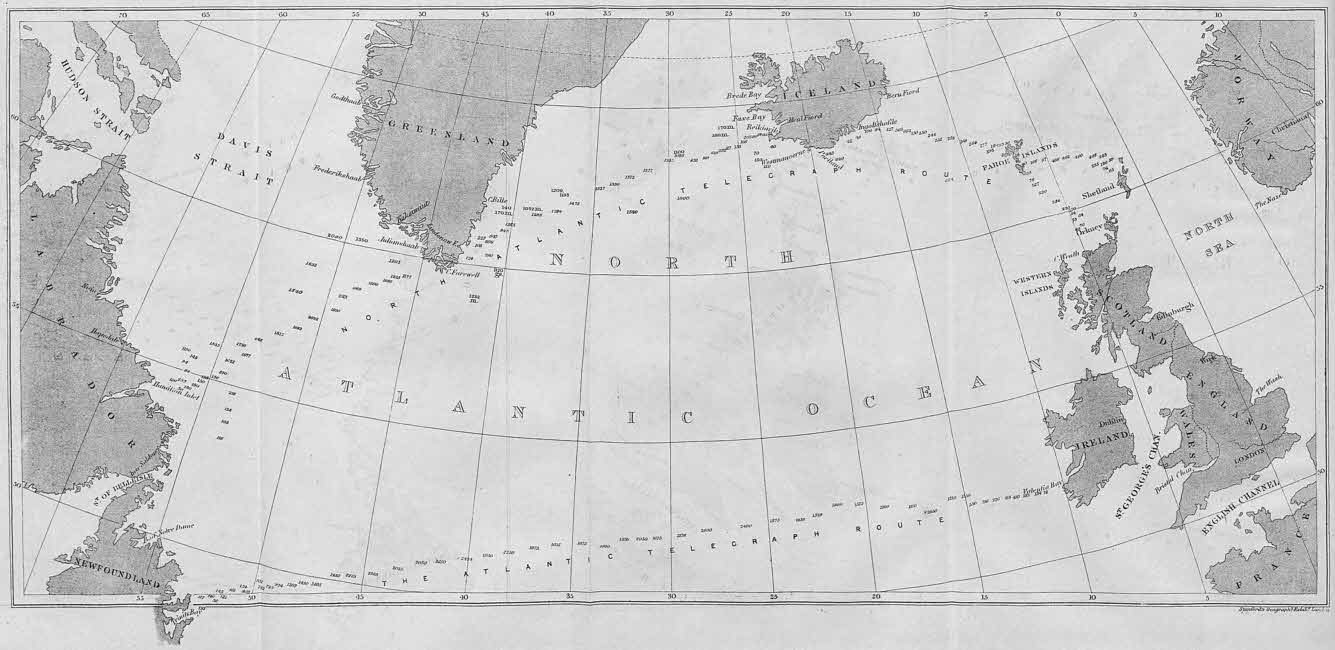
1. A Large Spherical Map, embracing the seas and lands to be traversed by the proposed North Atlantic Telegraph; also of the Continents of Europe and North America.
2. A Map, showing the rivers, lakes, geysers, mountains, glaciers, plains, farms, and towns of Iceland; also the track travelled over by Dr. John Rae, Commander of the Land Expedition of the North Atlantic Telegraph, and of the proposed route of the line across Iceland.
3. A Large Map of the Færöe Isles, and another of the Stromöe Isle, showing the mountains, valleys, fiords, bays, and towns; and the track travelled over by the Land Expedition, and the route proposed for the Telegraph.
4. A Map of the Atlantic Ocean, with all the deep-sea soundings taken by the British and American Governments north of the Tropics, showing the superior favourable depths of the seas on the North Atlantic Telegraph route.
5. A Map of Greenland, showing the mountains, islands, unexplored regions, glaciers, and fiords, south of the Arctic Circle.
6. A Large Map of Julianshaab District, South Greenland, showing the mountain ranges, groups of isles, the many long, deep, and wide fiords in which the Telegraph Cables can be safely laid, and beyond the reach of icebergs.
7. Charts of the various bays and fiords examined by Mr. Allen Young, Commander of the “Fox” Expedition, and reported by him as suitable and safe places for the landing of the cables on the coasts of the Færöe Isles, Iceland, and Greenland.
8. Maps, with the deep-sea soundings, taken by Sir Leopold M‘Clintock, on the proposed North Atlantic Telegraph route, viâ the Færöe Isles, Iceland, and Greenland; and with the soundings taken by Commander Daymon on the route of the late Atlantic Telegraph from Ireland to Newfoundland.
9. A Diagram, showing the mode of telegraphic manipulation over air lines, with the earth forming half of the circuit, connecting the respective voltaic batteries.
10. A Large Diagram, illustrating the mode of coupling together two or more electric circuits by mechanical contrivances, so as to overcome great distances by a combination of separate and independent circuits, charged respectively by batteries; precisely as can be practically applied and operated on the proposed North Atlantic Telegraph.
11. Model Stations, with telegraphic apparatuses, representing Europe, Færöe Isles, Iceland, Greenland and America; by which dispatches were sent by the motion of the finger from Europe to America, and simultaneously to the Færöe Isles, Iceland, and Greenland, precisely as can be done on the proposed North Atlantic Telegraph; so that dispatches need not be re-written at the respective places, but sent instantaneously from Europe to America, in the same manner as is daily done from London to St. Petersburg, to Vienna, to Constantinople, and other places far distant.
12. A Chart of the surveys of Hamilton’s Inlet and the sea adjacent thereto, by Sir Leopold M‘Clintock’s expedition, showing that the water is sufficiently deep to permit a heavy shore cable to lie in safety.
13. One Hundred and Sixty Stereoscopic Views, illustrating the people, houses, churches, farms, towns, bays, mountains, valleys, water-falls, geysers, and various subjects of interest on the route of the proposed telegraph at the Færöe Isles, Iceland, and Greenland; taken by Mr. John E. Woods, of the “Fox” Expedition.
14. Specimens of deep-sea soundings, taken on the route of the proposed telegraph, exhibited through microscopes. [These soundings have been examined by the philosopher Ehrenberg, and they prove his theory of life at the bottom of the ocean; and, also that the bottoms of the respective seas are highly favourable for the proposed telegraph.]