Book 4 — A LETTER FROM MAXIMILIANUS TRANSYLVANUS TO THE MOST REVEREND CARDINAL OF SALZBURG, VERY DELIGHTFUL TO READ, CONCERNING THE MOLUCCA ISLANDS, AND ALSO MANY OTHER WONDERS, WHICH THE LATEST VOYAGE OF THE SPANIARDS HAS JUST DISCOVERED. (continued 2)
Henry Edward John Stanley Stanley translation
Borney is a large island, and there is also in it cinnamon, mirabolams, and camphor, which is worth much in these countries; and they say that when they die they embalm themselves with it. Borney is in 5° 25′ latitude—that is, the port itself—and 201° 5′ of longitude from the line of demarcation, and from here we sailed and returned by the same road; and this port of Borney lies E.N.E. W.S.W. with the isle of Mazaba, and in this course there are many islands; and from the cape at the N.E. of Bornei to Quipit is E.W. 1⁄4 N.E. S.W.
We sailed from Borney, and returned by the same course which we had come, and so we passed between the head of the isle of Bornei and Poluan; and we went to the W.,[448] to fall in with the isle of Cuagayan; and so we went by the same course to make for the island of Quipit on the S. side, and in this course, between Quipit and Cuagayan, we saw to the S. an island which they call Solo, in which there are many pearls, very large—they say that the king of this island has a pearl like an egg. This island is in 6° latitude; and so, going on this course, we fell in with three small islands; and further on we met with an island named Tagima, and they say there are many pearls there; and this island lies with Solo N.E. S.W. 1⁄4 E.W., and Tagima is in 65⁄6°. It is opposite the Cape of Quipit, and the said cape is in 71⁄4°, and lies with Paluan E.S.E. W.N.W.
From here we coasted the island of Quipit on the south side, and we went to E. 1⁄4 S.E. as far as some islets; and along the coast there are many villages, and there is much good cinnamon in this island, and we bought some of it; and there is much ginger on this coast; and so we went to E.N.E., until we saw a gulf; then we went to S.E. until we saw a large island, and thence to the cape at the east of the island of Quipit, and at the cape of this island there is a very large village, which collects much gold from a very large river, and this cape is 1911⁄2° of the meridian.
We sailed from Quipit to go to Maluco, and went to S.E., sighting an island called Sibuco; after that we went to S.S.E., and saw another island, called Virano Batolague; and we went by the same course as far as the cape of this island, and after that we saw another, which they call Candicar; and we went to the E. between the two, until we went ahead of it; and there we entered a channel between Candicar and another, which they call Sarangani; and at this island we anchored and took a pilot for Maluco; and these two islands are in 42⁄3°, and the cape of Quipit in 71⁄4°, and the Cape of Sibuco, on the south side, is in 6°, and the Cape of Virano Batologue in 5°, and from the Cape of Quipit and Candicar the run is from N.N.W. to S.S.E., without touching any cape.
We sailed from Sarangani, and went S. 1⁄4 S.E., until we came opposite an island called Sanguin, and between the two are many islets, and they are on the West side, and this island is in 32⁄3°. From Sanguin we went S. 1⁄4 S.E. to an island called Sian; between them there are many islets, and this island is in just 3°. From Sian we went to S 1⁄4 S.W., as far as an island called Paginsara, it is in 11⁄6°; and from this island to Sarangani the run is N.S 1⁄4 N.E. S.W. in sight of all these islands.
From Paginsara we went to S. 1⁄4 S.E., until we came between two islets, which lie together, N.E. and S.W., and that one to the N.E. is named Suar, and the other is named Atean, and one is in 1° 45′, and the other in 11⁄2°.
From Atean we went S.S.E. until we sighted the Molucos, and then we went to East, and entered between Mare and Tidori, at which we anchored, and there we were very well received, and made very good arrangements for peace, and made a house on shore for trading with the people, and so we remained many days, until we had taken in cargo.
The islands of the Malucos are these: Terrenate, Tidori, Mare, Motil, Maquian, Bachian, and Gilolo, these are all those which contain cloves and nutmeg; and there are also several others among them, the names of which I will mention, and in what altitude they are, and the first is Terrenate, which is on the side of the equinoctial line.
Terrenate is in altitude of 1° 0′
Tidori„„ 0 30
Mare„„ 0 15
Motil is on the line 0
Maquian is to the south 0 15
Cayoan„„ 0 20
Bachian„„ 1
La Talata„„ 1 1⁄4
La Talata (Lata-lata) lies north of Terrenate N.N.E. and S.S.W., and that which is on the equinoctial line is 190° 30′ of longitude from the line itself, and the island of Motil itself with Cagayan lies N.W. and S.E., and with Tagima, which is opposite the island of Quipit, it lies N.E. and S.W. 1⁄4 N.S., but in these courses one cannot venture to pass, for they say there are many shoals, and so we came by another course, coasting the said islands. From the islands of Maluco we sailed Saturday, 21st December, of the said year 1521, and we went to the island of Mare, and there took in wood to burn, and the same day we sailed and went to S.S.W., making for Motil, and thence we went by the same course, making for Maquian, and thence we went to S.W., running by all these islands, and others, which are these:—Cuayoan, Laboan, Agchian, Latalata, and other small islands, which remain in the N.W. quarter, and now I will say in what latitude and longitude are each one separately, and which are those which contain cloves and other spices. The first to the North is Terrenate, which is in 1° North, and Tidore 40′ and Mare 15′ and Motil on the equinoctial line, and these lie North and South. The others to the South are these: Maqui is in 20′ Cuayoan in 40′ and Laboan in 1°, and Latalata in 1° 15′ and Bachian lies with Terrenate E.N.E. and W.S.W.; and to the S.E. of all these islands there is a very large island called Gilolo, and there are cloves in it, but very few; therefore there are seven islands which contain cloves, and those which have a large quantity are these: Terrenate, Tidore, Motil, Maqui, and Bachian, which are the five principal ones, and some of them contain nutmeg and mace. Motil is on the line, and is in longitude of the meridian of 191° 45′
From Latalata we went to S.W. 1⁄4 W., and fell in with an island which is called Lumutola, it is in 13⁄4°, and on the W. side there is another island called Sulan, and at these islands there are many shoals, and from hence we took the course to the South, towards an island named Buro, and between these three, there is another island which is named Fenado, it is in 21⁄2°, and Buro is in 31⁄2°, and it lies with Bachian N.E. and S.W. 1⁄4 N.S. in longitude 194°; and to the East of Buro there is a very large island called Ambon, in which they make much cotton cloths, and between it and Buro there are some islets; take care of them, for this it is necessary to coast the island of Buro to the East, and to the South of it. I took the sun in 70° 24′, it had 22° 36′ declination, and so the latitude came to be 3°. I was in the Southern part of the island, and this was on the 27th of December, on Friday. On the 28th of the said month, I did not take the sun, but we were in the neighbourhood of the said isle of Buro, and Bidia, which, lies to the eastward.
Sunday, 29th, I took the sun in 711⁄2°, it had 22° 21′ declination, and our distance came to be 3° 51′, and we were opposite the isle of Ambon.
On the 30th I took the sun in the altitude of the day before, in calm, it was Monday.
On the 31st I did not take the sun, we were a matter of 12 leagues from the Isle of Ambon E.N.E. and W.S.W., the day was Tuesday.
1522—
The 1st day of January, 1522, I took the sun in barely 73°, it had 21° 54′ declination, the altitude came to be 4° 45′.
On the 2nd of the month, I took the sun in 733⁄4°, it had 213⁄4° declination, our distance came to be 51⁄2°, the course was to S.W., and it was Thursday.
Friday, 3rd, I did not take the sun, but the ship made the course of S.S.W., in latitude of 61⁄3°, after that we took the course to N.W.
On the 4th of the month I did not take the sun, but we were in 5¾°, the course was to N.W., and the day Saturday.
Sunday, the 5th, I took the sun in 75°, it had 21° 14′ declination, the latitude came to 6° 14′.
On the 6th, Monday, I took the sun in 76°, it had 21° 2′ declination, the latitude came to be 7° 2′.
On the 7th, I took the sun in 762⁄3°, it had 20° 50′ declination, the latitude came to be 71⁄2°, and the course was to S.W. Tuesday.
On the 8th of the month, I took the sun in 771⁄2°, it had 20° 37′ declination, and the latitude came to be 8° 7′, the course was to S.W., and the day Wednesday, and this day we saw some islands, which lie East and West, and this day we entered between two of them, which are these, Lamaluco and Aliguom; between them are two little ones which you will leave on the right hand after entering the channel, they are inhabited; this channel lies N.E. S.W. 1⁄4 E.W., with Buro, and all these islands are ten in number, and they lie E.W. 1⁄4 N.E. S.W., and they have of longitude a matter of 50 leagues; we ran along them, with very bad weather from the South; we coasted them and anchored off the last, which is called Malua, which is in 81⁄3°, the others are named Liaman, Maumana, Cui, Aliguim, Bona, Lamaluco, Ponon, Vera. We sailed from Malua and went to the South, and found the island of Timor, and we coasted the coast from east to west, on the north side of this island, which is in the latitude of 9°, and the nearest land on the north side, and this land will have 10 leagues journey, and this coast lies with Buro N.E. S.W. 1⁄4 N.S., in longitude of 197° 45´, and of this island of Timor we coasted all the coast from east to west, as far as the village of Manvai; and first we came near the village of Queru, and from Queru to Manvai, the coast runs N.E. S.W 1⁄4 N.S., and here I took the sun on the 5th day of February, in 862⁄3°, and it had 12° 44′ declination, so that the latitude came to be 9° 24′, and this island is very large and populous, and all the island has much sandal wood, and there are many towns in it.
On the 8th of February I took the sun in 871⁄2°, and it had 11° 42′ of declination, with which our distance came to be 91⁄6°, and we were at the head of the island of Timor, at the West end, and from here to the Eastern cape the coast runs E.N.E. to W.S.W., and it was Saturday.
Sunday, 9th of the said month, I took the sun in 881⁄6°, and it had 111⁄3° declination. Our latitude came to be 9° 35′, and we were at the most salient cape of all the island, and from there it goes falling off to the S.W. and S.
On the 10th of the same month I took the sun in 881⁄4°, it had 10° 58′ declination; our latitude came to be 9° 28′, and the head of the island lay to the south, and the day was Monday.
On the 11th, Tuesday, I took the sun in 881⁄4°, it had 91⁄3° declination; the latitude came to 9° 35′, and we were in calm.
Wednesday, the 12th, I did not take the sun, but we were becalmed in the neighbourhood of where we were the the day before, or a little more.
On the 13th I took the sun in 892⁄3°; it had 9° 52′ declination; the latitude came to 10° 32′, and we were in the neighbourhood of islands of which we do not know the names, nor whether they are inhabited. They lie E.S.E. and W.N.W. with the west cape of Timor, and from here we took our course to the Cape of Good Hope, and went to W.S.W.
[After this the course was W.S.W. for several days, and there is nothing worthy of note till Tuesday, the 18th of March, when the Victoria discovered Amsterdam Island.]
On the 18th of the said month (March), I took the sun in 491⁄2°, it had 2° 55′ declination, the latitude came to be 37° 35′, and whilst taking the sun we saw a very high island, and we went towards it to anchor, and we could not fetch it; and we struck the sails and lay to until next day, and the wind was W.; and we made another tack to the north under storm sails;[449] and this was on the 19th, and we could not take the sun; we were east and west with the island, and it is in 38°[450] to the south, and it appears that it is uninhabited, and it has no trees at all, and it has a circumference of a matter of six leagues.
On the 20th of the said month, Thursday, I did not take the sun, but we were east and west with the island, and we went to N.W. and to N.N.W. and 1⁄4 N.W., and for the whole course I put down a matter of 15 leagues to the N.N.W., and in the latitude of 351⁄2°.
On the 22nd of the said month I took the sun in 501⁄4°: it had 4° 27′ declination; the latitude came to 36° 18′. The day before we had struck the sails until the morning of the said Saturday, and this day we set sail and went to the N.W.
•• •••
On the 8th of the said month (May) I did not take the sun; but, according to the run we had made, we thought we were ahead of the Cape, and on this day we saw land, and the coast runs N.E. and S.W. and a quarter east and west; and so we saw that we were behind the Cape a matter of 160 leagues, and opposite the river Del Infante,[451] eight leagues distant from it in the offing; and this day we were lying to with winds from the west and west-north-west, and it was Thursday.
On the 9th I did not take the sun, but we made land and anchored, and the coast was very wild, and we remained thus till next day; and the wind shifted to W.S.W., and upon that we set sail, and we went along the coast to find some port for anchoring and taking refreshments for the people who were most suffering, which we did not find. And we stood out to sea, to be at our ease; and we saw many smokes along the coast, and the coast was very bare, without any trees, and this coast runs N.E. and S.W.: it is in 33° latitude, and it was Saturday, 10th of May.
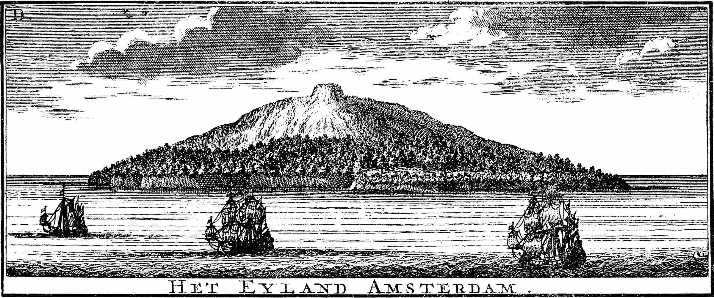
Het Eyland Amsterdam.
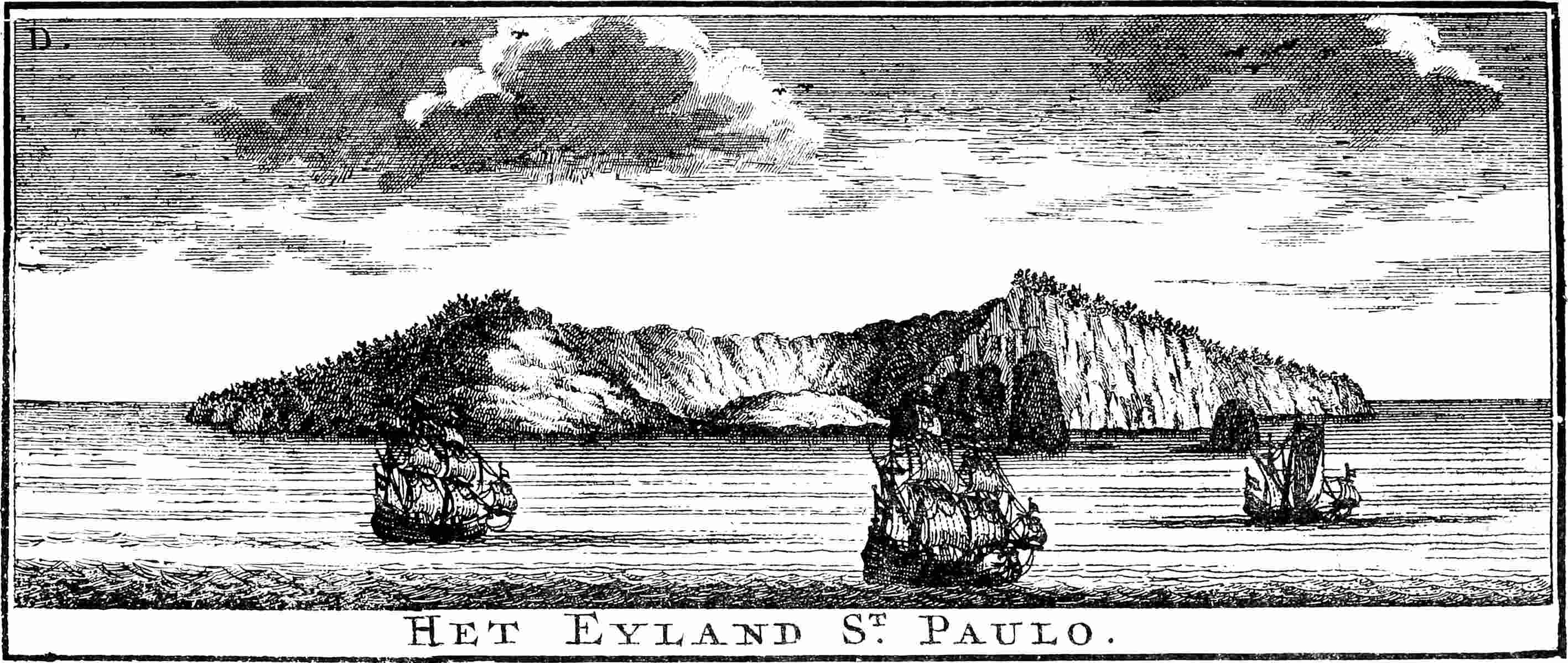
Het Eyland S
t
.
Paulo.
•• •••
Friday, the 16th (May), I took the sun in 331⁄4°; it had 21° 6′ declination; the latitude came to 35° 39′, and we were E.S.E. and W.N.W., with the Cape of Good Hope twenty leagues off from it; and this day we sprung our fore-mast and fore-yard, and we were all day hove to, and the wind was W.
[The Victoria doubled the Cape of Good Hope between the 18th and the 19th of May, and arrived] on the 9th of the month of July, and anchored in the port of Rio Grande in Santiago [of the Cape Verde Islands], and they received us very well, and gave us what provisions we wanted; and this day was Wednesday, and they reckoned this day as Thursday, and so I believe that we had made a mistake of a day; and we remained there till Sunday in the night, and we set sail for fear of bad weather and the difficulty of the port; and on the morrow we sent our boat on shore to get more rice, which we wanted, and we were standing off and on till it came.
On the 14th of July, Monday, we sent our boat on shore for more rice, and it came at midday, and returned for more, and we were waiting for it till night, and it did not come; and we waited till next day, and it never came; then we went near the port to see what the matter was, and a boat came and told us to give ourselves up, and that they would send us with a ship which was coming from the Indies, and that they would put some of their people in our ship, and that the gentlemen had so ordered. We required them to send us our boat and men, and they said that they would bring an answer from the gentlemen; and we said we would take another tack, and would wait: and so we took another tack, and we made all sail, and went away with twenty-two men, sick and sound, and this was Tuesday, the 15th of the month of July. On the 14th I took the sun. This town is in 15° 10′.
•• •••
September, 1522.
On the 4th of the said month, in the morning, we saw land, and it was Cape St. Vincent, and it was to the north-east of us, and so we changed our course to the S.E., to get away from that Cape.
The manuscript has at the end: Vto Simancas, 8 Setiembre, 1783, Muñoz.
D. Juan Bautista Muñoz, who died in 1822 or 1823, made a large collection of transcripts from the Simancas and Seville archives, which Navarrete made use of. In 1793 Muñoz published the first volume of his Historia del Nuevo Mundo, which he never finished.