JÖKUL-RANGES AND VOLCANOES ON THE SOUTH COAST.
Ólafur Pálsson translation
At ten o’clock P.M., August 3, the anchor was heaved and we sailed for the east of the island.
The bay at Reykjavik is very lovely. Every crevice of the Essian mountains is distinctly shown; while the positive colours and delicate tints of these and other heights rising far inland, which the eye takes in, in sweeping round the semicircle from Snæfell to Skagi, are bright, varied, and beautiful beyond description. Deep indigoes dashed with purple, violet peaks, pale lilac ranges; and, relieved against them, cones of dazzling snow and ice glittering like silver, side by side with rosy pinks and warm sunny browns, all rising over a foreground of black lava. The sky overhead is blue; and the northern horizon lit up with a mellow glow of golden light.
161The frigate Artemise, the brig Agile, the Danish schooner Emma, and several trading vessels lying at anchor, animate the scene.
Snæfell Jökul—rising to the north-west on the extreme of yonder narrow ridge that runs out due west into the sea for nearly fifty miles, separating the Faxa from the Breida fiord—dome-shaped, isolated and perpetually covered with snow, is now touched with living rosy light.
At its foot lie the singular basaltic rocks of Stappen, somewhat like the Giant’s Causeway, or the island of Staffa in the Hebrides. Indeed, stapp is the same word as staff, and indicates the character of the columnar formation.
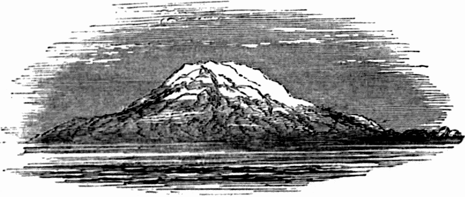
SNÆFELL JÖKUL—FROM FIFTY MILES AT SEA.
For the first time, since leaving home, we see the stars. One or two, only, are shining in the quivering blue overhead, with a quiet, subdued, pale golden light. I made a sketch of Snæfell as it appeared from the quarter deck of the steamer at a distance of fifty miles; it seemed a low cone rising from the sea. As the evening was calm and beautiful, ere retiring, we walked the deck till a late 162hour, musing on the structure and marvellous phenomena of this half-formed chaotic island, where Frost and Fire still strive for the mastery before our very eyes.
August 4.—On getting upon deck, I found we were past Cape Reykjanes, and making for the Westmanna Islands. Eldey—the rock like a meal-sack—lies, in the distance, far astern.
My place at table is between Dr. Mackinlay and Mr. Haycock, the latter being next the chairman Rector Jonson who is going to Copenhagen; Mr. Murray, Mr. Cleghorn, Professor Chadbourne and Dr. Livingston sit opposite. The Danes are all congregated at the other end of the table with the captain.
Half-past three P.M. Saw Eyafialla Jökul, and Godalands Jökul, Myrdals Jökul, and Kötlugjá. These form part of the most southern range of snow-mountains in the island, and rise distinctly over a dark greenish and purple range of hills, away to the east on our port bow. Eyafialla is the second highest mountain in Iceland, being next in height to Oræfa Jökul. It has a distinct crater. Only one violent eruption, that of A.D. 1612, is recorded previous to A.D. 1821. “But on the night between the 20th and 21st December, of that year, the lofty Eyafialla Jökul, of which the movement of A.D. 1612, was the only one formerly known, burst its icy covering, and began to cast out ashes, stones, and dust, accompanied with a strong flame. It continued till January throwing out great quantities of pumice ashes, which covered all the surrounding fields; and in February 1822, a lofty pillar of smoke still rose from the crater. In June of the following year it again began to burn, and on the 26th of the same month, destroyed a 163part of the adjacent land; but after pouring out some streams of water, in the beginning of July, it was once more quiet. In this month also the Kötlugjá, after sixty-eight years repose, threw out sand and ashes, covering nearly one hundred square miles of ground.”[18]
Kötlugjá—the gjá, fissure, or chasm of Kötlu—is not a separate mountain with a crater, but simply a yawning rent, so large as to resemble an extensive valley, situated on the north-west shoulder of Myrdals-Jökul, which is a lofty ice-mountain. From its inaccessibility it has never been explored, having been only examined from a distance. The rent is visible from the sea.
Records of volcanic eruptions occurring throughout the island have, in general, been carefully kept by the Icelanders from the earliest times; but in this case, from the proximity of numerous other volcanic vents, and the distance of the spectators, along with the long continued and intermittent nature of single eruptions—sometimes lasting for years—there appears to be some confusion in the various accounts, which renders it difficult to reckon the number of
KÖTLUGJÁ’S ERUPTIONS.
The first outbreak, which, by the way, is the earliest recorded date of an eruption in the island—being before Eldborg to which that honour is usually assigned—occurred in the year A.D. 894, and the last in A.D. 1823.[19] 164The number of them during that period is reckoned by the best authorities at fourteen, the longest interval between two eruptions being 311 years, and the shortest 6. As its devastations have only been less terrible than those of Skaptár, we shall now, after presenting a concise table of dates, glance at the various eruptions of Kötlugjá, extracting or briefly condensing from reliable sources, dwelling more particularly on those of A.D. 1625, and 1755, two of the most fearful and destructive.
165For the table, and the collecting of many of the facts and paragraphs which follow relating to Kötlugjá, I am indebted to my friend Dr. Lauder Lindsay.
1st eruption A.D. 894. Interval since previous eruption.
2d ” 934. ” ” 40 years.
3d ” 1245. ” ” [20]311 ”
4th ” 1262. ” ” 17 ”
5th ” 1311. ” ” 49 ”
6th ” 1416. ” ” 105 ”
7th ” 1580. ” ” 164 ”
8th ” 1612. ” ” 32 ”
9th ” 1625. ” ” 13 ”
10th ” 1660. ” ” 35 ”
11th ” 1721. ” ” 61 ”
12th ” 1727. ” ” [21]6 ”
13th ” [22]1755. ” ” 28 ”
14th ” 1823. ” ” 68 ”
The first eruption, in A.D. 894, destroyed the pasture lands between the hill called Hafrsey, and the Holmsá river. Eight farms were abandoned, and the district of country in question is still almost entirely a sandy desert.
The second, A.D. 934, was also a formidable one, and formed the extensive sandy desert now known as the Solheima-sand, a tract about twenty miles long; and formed altogether of volcanic sand, ashes, or lapilli, and pumice.
The third, in A.D. 1245, covered a tract of country, though of what extent we are not informed, with sand and ashes to the depth of six or eight inches.
166The fourth, A.D. 1262, or, according to some writers, 1263, was attended by such an ejection of dust and ashes, that the sun could not be seen at mid-day in serene weather. During this eruption, the large river called Fulilækr, the Jökulsá—or Jökul river—which divides the Skoga-sand from the Solheima-sand, suddenly made its appearance.
The fifth, in A.D. 1311 (some say 1332), appears to have been more destructive to life than any of the previous ones. Many farms were destroyed in the district called Myrdals-sand; several sand-hills and other hills were formed, and several marshes sprang into existence. It vomited ashes and sand during the greater part of the winter, and, melting the ice about the crater, the inhabited tract in the vicinity was inundated, and all the inhabitants except two perished in the flood. Another account states that this eruption was known as “Sturluhlaup,” from only one man of the name of Sturla having been saved, of those overwhelmed by the volcanic ejections.
The sixth, A.D. 1416. The lava or water-floods took the direction of Hjörleifshöfdi, an isolated hill and promontory on the coast of the Myrdals-sand, considerably to the south-east of Kötlugjá.
The seventh, A.D. 1580. During this eruption it is stated that Myrdals Jökul was rent asunder, and as the name Kötlugjá is now first given to the crater or fissure of eruption, it is probable that at this date the chasm was first recognised or discovered, if not formed. This eruption was characterized by fire, darkness, and a rain of ashes, as well as by water-floods; one of which latter went eastward toward the monastery of Thyckvaboe, and 167another southward to Myrdal. Many farms were destroyed, but there appears to have been no loss of human life.
The eighth, in 1612, was attended, it is conjectured, by a subsidence to some extent of the Fall-Jökul, which is situated between Eyafialla and Myrdals Jökul, as well as of the lower lands between Langanes and Thorsmerkr. The accompanying fire was such, that the eruption was visible extensively in the north of Iceland.
The ninth, in A.D. 1625, was “one of the grandest and most devastating eruptions of Kötlugjá that has ever occurred.” Its historian is Thorsteinn Magnússon, at the time sysselman or sheriff of Skaptafells-syssel (or district), who lived in the monastery of Thyckvaboe. His account was published in Copenhagen in A.D. 1627. According to him, ‘at daybreak on the second of September it began to thunder in the Jökul; and about 8 o’clock A.M. floods of water and ice were poured down upon the low country, and carried away upwards of 200 loads of hay[23] which lay in the fields about Thyckvaboe. These floods continued to be poured forth like a raging sea till past one o’clock in the afternoon, when they gradually diminished, but were succeeded by terrible darkness, earthquakes, thunder, flames, and showers of sand. Nor was it in the immediate vicinity of the crater alone that the fire appeared, but down in the inhabited tract, at the distance of nearly twenty miles from the mountain, igneous 168vapours were seen attaching themselves to the clothes of the inhabitants. (?) This dreadful scene continued, with little variation, till the 13th of the month. It was frequently so clear at night that the mountains, with all their clefts and divisions, were seen as distinctly at the distance of twenty miles as they were in the clearest day. Sometimes the flames were pure as the sun, sometimes they were red, and at others they discovered all the colours of the rainbow. The lightenings were visible now in the air, and now running over the surface of the ground; and such as witnessed them were more or less affected in such parts of their bodies as were uncovered. [!] These flashes were accompanied by the loudest claps of thunder, and darted backwards and forwards; now to the ground, and now into the air, dividing sometimes into separate bolts, each of which appeared to be followed by a separate report; and after shooting in different directions, they instantly collected again, when a dreadful report was heard, and the igneous appearance fell like a waterspout to the ground, and became invisible. While the showers of sand lasted, it was frequently so dark in the day time that two individuals holding each other by the hand could not discover each other’s face.’ Dr. Hjaltalin states that the water-floods, bearing large masses of ice, ‘surrounded the monastery of Thyckvaboe, with its adjacent farms, one of which was overflowed by the stream; but the people saved themselves on a high hill, where the flood could not reach them. The flood was followed by such heavy shots and continual thunder, that the people thought the heavens would burst to pieces, and they were surrounded with continual flashes of lightning. The pasturages 169were so covered with ashes and pumice, that cattle, horses, and sheep could not get any food, and were seen running about in wild confusion. During the eruption such a darkness prevailed sometimes that days were darker than nights; and it is related that showers of ashes from this eruption reached the town of Bergen in Norway, which is the greatest distance to which volcanic ashes were ever thrown from Iceland.’ The account in the ‘Islendingur’ of June 16, p. 45, mentions further, that the mixed water and ice flood flowed in cascades and waves over Myrdals-sand; that the inhabitants fled to the heights for safety; that the depth of the water-flood, which surrounded the monastery of Thyckvaboe, was such that a large ocean-vessel might have sailed between the byres and the principal building, and that there was an excessive falling of sand in the district to the north-east of Kötlugjá, called the Skaptártunga. This eruption thus lasted for about twelve days, wholly destroying many farms, and partially destroying or rendering temporarily useless others. The damage done was greatest in the low lands to east, north-east, and south-east of Kötlugjá.
The tenth, A.D. 1660—commencing on 3d November—“appears scarcely to have been less formidable than the preceding eruption. Water-floods overwhelmed and destroyed the farm and church of Höfdabrekka, which latter was cast into the sea immediately adjoining, apparently by an earthquake-shock. Only such articles were saved from the building as could, at the moment, be snatched away by the clergyman Jón Salamonsson. The quantity of sand, ashes, and sulphur, thrown out and deposited on the coast about Höfdabrekka was such, 170that what formerly was a depth of twenty fathoms of sea water, became at once dry land. Such is the account in the ‘Islendingur.’ Dr. Hjaltalin says the clouds of pumice, ashes, and sand, rendered the atmosphere, in the vicinity of Kötlugjá, very dark during nine days. Many farms were destroyed. Flames and ashes were ejected during the greater part of winter. Henderson asserts, that ‘the quantity of ice, &c., carried down by the inundation, was so great, that where it was deposited, it rose to the height of forty-nine fathoms above the surface of the former depositions. The church of Höfdabrekka’ constructed wholly of wood, and of limited dimensions, ‘was observed to swim among the masses of ice, to a considerable distance in the sea, ere it fell to pieces.’ The volcano appears, with some intermission, to have erupted sand the two following years.”
The eleventh, A.D. 1721, began at nine A.M. on the 11th May. Dr. Hjaltalin says “the narrative of this eruption proceeds from certain of the inhabitants of the north of Iceland, who observed the phenomena from the distance of about 100 English miles! These distant witnesses, state that the eruption was preceded by heavy shots, like shots of artillery, lasting less or more for several days, and distinctly heard by them in the north of the island. These sounds were followed by a heavy fire—which expression seems translateable as vivid flames—also visible at the great distance above named. The flames or fire were followed by clouds of ashes, so dense and so extensive, as to have produced complete darkness for some hours, at the remoteness of 80 or 100 miles.” “The ‘Islendingur’ refers to an earthquake 171chiefly felt in Myrdal, but extending eastward to Lidu, and westward to Fljótshlíd. About noon of the same day—11th May—the earth became fissured at various points; loud sounds were heard, and lastly, flames, with steam or smoke, were seen to issue from Kötlugjá. A water-flood now descended from the volcano, bearing huge pieces of ice, resembling in bulk small islands; which icebergs sailed along as rapidly as a ship in a good breeze. These icebergs were borne by the flood from Höfdabrekka eastward to Hjörleifshöfdi and Hafrsey. One village was destroyed in the east of the Myrdals-sand district.” Again, Henderson states, p. 213,[24] the “inundations lasted nearly three days, and carried along with them such amazing quantities of ice, stones, earth, and sand, that the sea was filled with them to the distance of three miles from the shore. The sun was darkened by the smoke and ashes which were thrown into the air; sand and pumice were blown over almost the whole island; and the ice and water desolated a considerable tract of grass land, over which they flowed.”
The twelfth, A.D. 1727, is believed to have been of little intensity or importance.
The eruption which follows—the thirteenth, that of 1755—is the “most celebrated of all the outbreaks of Kötlugjá, on account alike of its grandeur, its duration, and its frightful results—an eruption which has since caused Kötlugjá to be dreaded by the Icelanders as one of their most dangerous volcanoes, if not their most 172dangerous one.” It began about noon on the 17th of October, and “continued, with intermissions, till 25th August 1756—its duration, therefore, being nearly a year. The ‘Islendingur’ gives a very short reference merely; but the accounts of Dr. Hjaltalin and of Henderson are comparatively full. According to Dr. Hjaltalin, the eruption was preceded by a series of earthquakes, beginning in September; they were especially severe in the north-east of Iceland, near Cape Langanes, about 150 or 180 miles distant from Kötlugjá. In this district they overthrew several farms; and in a milder degree they were felt over a considerable extent of country. The eruption itself began at ten A.M. of 17th October, about a fortnight prior to the earthquake which destroyed Lisbon. Vivid flames shot towards the sky, accompanied by severe earthquakes, sounds like thunder, and lightnings. The volcano was enveloped in smoke or steam; showers of ashes and pumice fell constantly, while volcanic bombs were hurled high into the air. The latter must have been of great size, for they were seen bursting, and the accompanying detonating reports were heard at a distance of upwards of a hundred miles. The days, it is said, were darker than the nights; and the flames and bombs gave so unearthly a character to the scene, that the poor inhabitants fancied that the day of judgment had arrived, and that our globe was bursting into atoms. Over large tracts of country, the soil was covered with sand and ashes to a depth of two or three feet; cattle, horses, and sheep, consequently died in great numbers. This devastation caused a famine and pestilence among the inhabitants, who perished by the hundred. The eruption was violent for fourteen days. The water-floods 173overflowed the district of Myrdals-sand, which is about twenty miles long and sixteen broad. Five parishes were more or less devastated, and fifty farms were destroyed. These were the more local disasters; but, in addition to this, the sand and ashes were spread over a great portion of the island, producing fatal epidemics and epizöotics,[25] and it is said even the wild-fowl fled from many parts of the island. The earthquakes were characterized by distinct wave-like motions of the land, which fluctuated like an agitated ocean, and the same earthquake-waves were propagated from the coasts outward to sea, to the serious damage of the shipping.” Henderson says—vol. 1. p. 314—“The inhabitants of the track about Kötlugjá were first apprised of the impending catastrophe on the forenoon of the 17th October, by a number of quick and irregular tremifactions, which were followed by three immense floods, from the Jökul, that completely overflowed Myrdals-sand, and carried before them almost incredible quantities of ice and gravel. Masses of ice, resembling small mountains in size, pushed one another forward, and bore vast pieces of solid rock on their surface. After the rocking had continued some time, an exceedingly loud report was heard, when fire and water were observed to be emitted alternately by the volcano, which appeared to vent its rage through three apertures situated close to each other. At times the column of fire was carried to such a height that it illuminated the whole of the surrounding atmosphere, and was seen at the distance of one hundred and eighty miles; at other times the air was so filled 174with smoke and ashes that the adjacent parishes were enveloped in total darkness. Between these alternations of light and obscurity, vast red-hot globes were thrown to a great height, and broken into a thousand pieces. The following night presented one of the most awful and sublime spectacles imaginable. An unremitting noise, like that produced by the discharge of heavy artillery, was heard from the volcano. A fiery column of variegated hues rose into the atmosphere; flames and sparks were scattered in every direction, and blazed in the most vivid manner.”
“The eruption continued with more or less violence till the 7th of November, during which period dreadful exundations of hot-water were poured forth on the low country; and the masses of ice, clay, and solid rock, that they hurled into the sea, were so great that it was filled to the distance of more than fifteen miles; and, in some places, where it was formerly forty fathoms deep, the tops of the newly deposited rocks were now seen towering above the water. A violent eruption happened again, on the 17th of November, when the volcano remained inactive till the following year, during which it emitted fire and water five times—viz., on January 15, June 28 and 29, and August 12 and 25.”
“The principal damage occasioned by these eruptions, consisted in the destruction of the pasture-grounds throughout the most part of the syssel—or district. Numbers of the cattle were carried away by the deluge; and the mephitic substances, with which everything was impregnated, brought on a raging mortality in different parts of the country. On the breaking forth of the water, a number of people fled for refuge to an insulated 175mountain called Hafrsey, where they were obliged to stay seven days without either meat or drink; and were exposed to the showers of stones, fire, and water which fell around them. The lightning, which was very violent during the eruption, penetrated through solid rocks, and killed two people and eleven horses, three of which were in a stable. One of the persons killed was a farmer, whom it struck dead as he left the door of his house. What is remarkable, his upper clothes, which were of wool, bore no marks of fire, but the linen he had under them was burned; and when he was undressed, it was found that the skin and flesh of his right side were consumed to the very bone. [!] His maid-servant was struck with the lightning at the same time; and though her clothes were instantly changed, it continued to burn in the pores of her body, and singed the clothes she put on. [!] She died a few days afterwards, having in the meantime suffered inexpressible pain.”
This eruption, Henderson very truly remarks, becomes the more noteworthy from “the terrible convulsions to which at the same time a great part of the terrestrial globe was subjected. Not only were the British isles rocked by repeated and violent shocks of an earthquake, houses thrown down, rocks split, and the waters of the sea and lakes[26] heaved up; but in Norway, Sweden, Germany, Holland, France, and Italy, the same phenomena were experienced. Spain and Portugal, however, suffered most from the shocks. Numerous villages, convents, and churches were demolished; the largest mountains 176shaken from the foundations, and the low grounds inundated by the swelling and overflowing of the rivers. Lisbon, in particular, exhibited a scene the most tragical and melancholy. The most ponderous edifices were heaved up and shaken; steeples, towers, and houses thrown down; the ground and streets danced under the feet of the inhabitants; and many thousands of them were buried in the ruins. Nor was the earthquake confined to Europe. It stretched over into Barbary, and destroyed upwards of a dozen of cities on the coasts of Africa. Its concussions were also felt in Persia, in the West Indies, and in America.”[27] Sir George S. Mackenzie and Sir William Hooker[28] both also describe this eruption in their respective works of travel, but the incidents do not differ from those given above. The latter writer characterizes the sounds accompanying the eruption as “most frightful and horrible roarings.” The illuminations at night were so vivid, “that heaven and earth seemed to be equally in a state of conflagration.” On the 19th of October a column of smoke issued from the volcano, which column was black by day; but the smoke was intermixed with balls and sparks of fire, which by night lighted up the whole of the Myrdal district, while the country to the east thereof was in darkness both day and night. “Ashes fell like rain” in Faröe, 300 miles distant, and subterranean noises were heard as far as the Guldbringu and Kiosar syssels—80 to 90 miles distant.
177The fourteenth, A.D. 1823, began on the 1st and ended on the 26th July. The phenomena were, as usual, chiefly water-floods, showers of ashes, slight earthquakes, and vivid lightnings, which latter struck several persons. Only one farm, Solheimar, was destroyed, and comparatively little damage was done elsewhere; altogether the eruption was one of the mildest and most innocuous hitherto recorded of Kötlugjá.
These glimpses of the recorded volcanic history of that one spot on which we now gaze, will convey to the reader some idea of the terrific visitations to which the islanders are exposed; even when there are not lava streams licking up rivers, pastures, farms, and people in their fiery floods, filling up whole valleys or rushing out into the sea and forming capes, hissing, the while, louder than the Midgard Serpent, which encompasses the whole earth.
White fleecy clouds come and go, at times muffling the summit of these jökuls, which are deemed the most picturesque in Iceland, if we except Snæfell on the west coast, and Oræfa on the south-east.
After passing the Westmanna islands and the east-most mouth of the Markarfliót river, which sweeps round the north and west sides of Eyafialla Jökul, the south-east mountain ranges, on which we have long been gazing, begin; the general character of the coast, north of this point, having been low like the Guldbringu syssel. This district has been rendered classic ground, as the scene of Njal’s Saga,[29] and we only wish it were permitted us to land and visit Bergthorsknoll and Lithend, to cross 178the rivers, scamper over the plains, or scale the Three-corner mountain. It is now clear, and one can take in the general character of the whole district at a glance.
The colour of the sea now assumed a light green aspect, broken here and there by white crested waves. Snow patches lay on the rugged purple hills; these, again, were touched with lines of intense fiery gold, actually excandescent. Sea-birds flitted past like white gleams; and, altogether, the scene, flooded with golden light, presented a magnificent study of colour. I made jottings of the outlines, tints, and atmospheric effects, for a water colour drawing; to be painted “some day”—that unattainable period when so many things are to be done, but which ever recedes from us like the horizon line; luring us on and on, and cheating us from day to day with a vague phantom shadow of
“Something evermore about to be.”
The Skogar-foss—force or waterfall—yonder, falling sheer over the rock cliffs into the sea, gently sways to and fro in the wind. It falls from so great a height that it appears to lose itself in vapour or dust, like the Staubach. There is an old tradition that an early colonist—Thrasi—before dying, buried a chest of gold and jewels in the deep rock-basin into which this magnificent sheet of water tumbles.[30]
179Sun-gleams rest on the snow-mountains and play on the ice of the glaciers. These are very numerous near the coast, the ice being generally of a light whity-green colour and corrugated in wavy lines.
As the weather is clear and bright, we see the coast near Portland to more advantage than on our first approach to the island. The wild fantastic promontories, rock-islets, and needle shaped drongs—serrated, peaked and hummocky—resemble the ruins of old castles and cathedrals. The likeness of one of them to Iona, already remarked upon, is now even still more apparent. Behind these rocks is a low range of hills, beyond which rise the jökuls.
The summits of these mountains are white with perpetual snow. The shoulders shade downwards into pale green ice, which terminates abruptly at the edge of a dark rugged precipitous line of rock that descends sheer into the valley behind the low range of hills next the sea. The precipice looked as if the sides of the mountains had, in some way, been sliced down, say from a third of their height, leaving the snowy summits and icy shoulders untouched.
Glaciers were formed, wherever the nature of the slope would admit of them. In some instances they seemed to approach the brink of the precipice and overhang it; but more frequently they chose places where rents, chasms, irregularities, or depressed spaces, occurring between any two mountains in the range, broke the wall, and thus afforded an incline plane all the way down to the valley.
Many whales continue to sport round the vessel, spouting up jets of water, tumbling about and showing 180the whole of their large tails. At times they leap nearly altogether out of the sea, and fall with a great splash. They often remain perfectly motionless for a considerable time. When diving down, both the rounded shape of the fish, and the peculiar parabolic motion with which it rises and falls, make the ridge of the back with its dorsal fins resemble the segment of a great black revolving disk, like a monster saw-wheel. Gulls, skuas, and pheasant-tailed ducks are flying about.
A lot of beer-drinking and meerschaum-smoking Danes are on board, going to Copenhagen. The smell of tobacco is felt everywhere, above, below, and at all hours. Their voices are frequently heard during the day calling for “snaps.” They consider a glass of this spirit indispensible for breakfast, and take it every morning to begin with. However, the hours passed very pleasantly on shipboard. The following
ICELANDIC STATISTICS
will interest the reader. From the last census—1855—we learn that the population of the island is 64,603; of that number 52,475 live by farming, and 5,055 by fishing, thus accounting for nearly three-fourths of the whole population. In exact figures the number is only 923 short of that proportion.
There were then in the island 65 persons deaf and dumb, and 202 blind. Curious to observe that, although there previously had been and again may be, there was not then a single watchmaker on the island. The extreme paucity of common tradesmen—less than 11 to the 1000—indicates a very primitive pastoral state of society amongst the islanders; home wants being 181generally supplied by home skill. The following table is constructed, from data contained in the census, to show at a glance the various occupations of the Icelanders, and also what relative proportion these bear to each thousand of the population.
Total numbers in the island at census in 1855. Proportion to each 1000 of the whole population.
Clergymen, professors and teachers at the college, and employés at churches 2,365 36.61
Civil officers 454 7.03
Do. out of office 140 2.17
Farmers who live by agriculture 52,475 812.27
Farmers who depend chiefly on the fisheries 5,055 78.25
Tradesmen as follows:
Bakers 10 0.16
Coopers 35 0.55
Gold and silversmiths 80 1.24
Carpenters 61 0.94
Blacksmiths 80 1.24
Masons 6 0.09
Millers 4 0.07
Turners 8 0.13
Boat builders 38 0.59
Shoemakers 18 0.28
Tailors 27 0.41
Joiners 174 2.69
Saddlers 46 0.71
Weavers 20 0.30
Men who live by other industrial occupations 103 1.59
Merchants and innkeepers 730 11.30
Pensioners, and people living on their own means 356 5.51
Day labourers 523 8.09
Miscellaneous occupations not classed 586 9.07
Paupers 1,207 18.68
Prisoners 2 0.3
——— ———
64,603 1000
182There are only sixty-three native Icelandic surnames. Few people have got any; the custom is, after telling one’s own christian name, when asked whose son are you? to answer in old Hebrew fashion, son of, or daughter of so and so. There are 530 men’s christian names, and 529 women’s names in use; so that there need be no lack for choice of names in a large family. Many of them, slightly modified in spelling, are familiar to us, but chiefly as surnames, e.g. Kettle, Halle, Ormur, Gils, Olafur, &c.
The number of individuals bearing certain names, is all duly recorded in the last census. I note a few of them, from which the reader may infer that Casa’s droll extravaganza, depreciating the name John under its various forms, is as applicable to Iceland as to Italy; and that Sigridur, Kristin, and Helga, are favourite names among the ladies.
The figures in the following list indicate the total number of persons, in the whole island, who bear these respective names.
Andros, 136; Ausumunder, 125; Bjarni, 869; Einer, 878; Eiriken, 351; Gísli, 681; Gunnar, 150; Halldor, 428; Johann, 494; Johannus, 498; Jón, 4827; Magnus, 1007; Odin, 169; Olafur, 992; Thordur, 445; Thorwaldsen, 106 &c.
Female names:—Anna, 869; Elin, 438; Elizabeth, 194; Gróa, 269; Halldóra, 515; Helga, 1135; Johanna, 630; Kristin, 1615; Rosa, 269; Sigridur, 2641; Lilja, 120; Soffia, 182; Thorbjörg, 436; Sessilja, 326 &c.
Half-past 6 P.M. Looking back to Portland Huk, over the light-green sea with its white crested waves, 183the reddish brown fantastic islets, and the singular arched opening in the rock—Dyrhólaey—show distinctly and beautifully against the amber light of the horizon.
As we paced the deck, talking about the old Norse language—which is still spoken in Iceland as it used to be in the eighth and ninth centuries in Norway, Sweden, and Denmark, in the Orkney, Shetland, and Faröe islands, in the two northern counties of Scotland, and in other Scandinavian settlements along the British coast—Dr. Mackinlay remarked, that “so well had the language been preserved, an Icelander of the present day had no difficulty in understanding the most ancient writings of his country.” This can be said of no other tongue in western Europe.
To this—the very language of the Vikings—both the old lowland Scotch, and, at a further remove, our modern English, chiefly owe their directness, expressiveness, and strength.
Many words, which we now use with a secondary or restricted meaning, still retain their primitive signification in Icelandic. Thus the word “smith”—a contraction for smiteth—which with us is restricted to a worker in metals, in Icelandic still retains its old sense of handcraftsman. Hence the Icelander not only talks of a goldsmith as a guldsmidr, a silversmith as silfursmidr, but of a saddler as södlasmidr, a cooper as a koparsmidr, a shoemaker as a skórsmidr, a joiner as a trésmidr, a builder as a husasmidr, a printer as a prentsmidr, a blacksmith as a jarnsmidr, a cabinet-maker as a skrinsmidr, a watchmaker as an ursmidr, and, in a metaphorical sense, of a poet or ode-writer as an odarsmidr; just as the Anglo-Saxons talked of a warrior as a war-smidr.
184Over a narrow strip of low sand-beach, the near snow-mountains and icefields, like frosted silver burnished in parts, now lie gleaming with dazzling brightness in the sun; coloured here and there with living gem-like streaks of opal, amber, crimson, and orange which glow yet more intensely, as if the snow and ice had been magically touched with an unextinguishable pencil of fire.
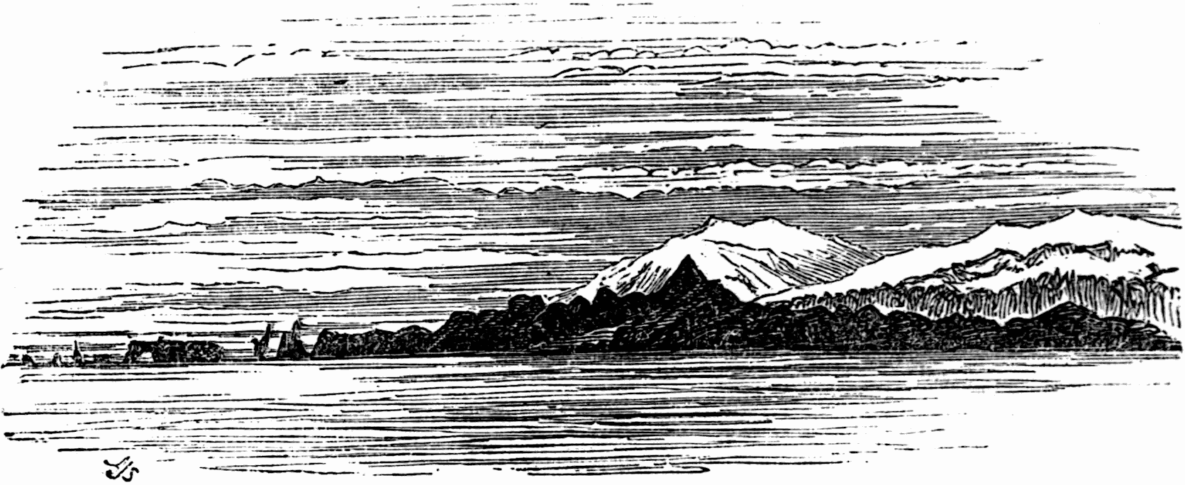
PART OF MYRDALS JÖKUL AND KÖTLUGJÁ RANGE.
Portland point is left astern, and over it, dark clouds, of a leaden hue and ruddy edges, came down to within a short distance of the transparent glowing horizon. The coast-range and islets, off the point, are deep purple, relieved against a narrow golden belt of light below the leaden cloud. In it, hang motionless a few cloud streaks—light, fleecy, purplish gray—and, lower down, others of only a lighter amber than the pure ether in which they float.
The sea is of a light sap green; the level sun-glare slants across the wake of the steamer, and touches the crested waves; while a line of light, like a silvery mist, marks the edge of the sea, by running along the coast at the foot of the snow-capped hills. Sea-gulls flying about 185are following the vessel, and screaming with delight or expectation. All is a perfect study of colour—warm purples, glowing ambers, fiery crimsons, and cool greens—each heightened by neutral tints in the clouds, and crests of white foam, little more than a ripple, on the green sea. I walked the deck for two hours with the captain, and turned in at eleven o’clock.
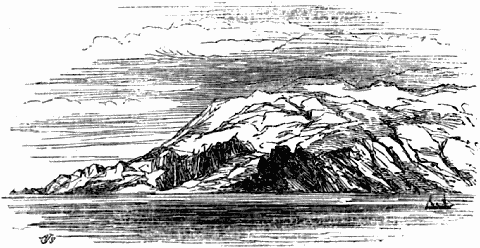
ORÆFA JÖKUL.
Friday morning. We are passing Oræfa Jökul, which, by the latest measurement, rises 6,405 English feet above the sea level, and is the highest mountain in the island. It is an immense mass, covered with snow and ice, and exhibiting glaciers creeping down to the sea. Sometimes the internal heat of this volcano melts and cracks the surface ice-mail, so that it splinters and rushes down the sides as an avalanche of ice and water, filling up hollows and valleys. When in action it only ejects ashes and pumice; never lava.[31] By the side of the 186mountain is a gently sloping snow-field, with several pointed black peaks rising abruptly out of it. This field stretches away far inland. Dr. Mackinlay tells me that, from the land-side, Oræfa appears a double-peaked broad shouldered mountain; one of the peaks or ridges presenting a deep scarped side like that of Salisbury Crags.[32]
With but few interruptions, a chain of snow-mountains stretches across the island, from Snæfells Jökul in the west, to Thrandar Jökul in the east; while the central desert or plain, running across from sea to sea between this range and that on the south-east, is nearly 100 miles broad, from 2000 to 2200 feet above the sea level, and only 400 or 500 feet from the snow-line. The south-east corner of the island is an enormous unexplored snow or ice plateau, called Klofa or Vatna Jökul, of about 2400 square miles, chiefly covered with, or at all events surrounded by ranges of jökuls, over which Oræfa, the most southern jökul of this unexplored region and the king of Iceland mountains, keeps watch and ward.
Away to the north-west, bounding this icy region on the west, rises Skaptár Jökul, by far the most destructive volcano in the island.[33] And “in no part of the world,” remarks Dr. Lindsay, “are volcano phenomena on so gigantic a scale as in Iceland. In it there are lava streams fifty miles long, twelve to fifteen miles broad and six hundred feet deep. Portions of these streams 187sometimes form hills as high as Arthur’s Seat or Salisbury Crags; and such is the persistence of the heat, that rents in the lava have been found still smoking, or filled with hot water, so long as eleven years after an eruption. In no part of the world of the same extent, are there so many widely separate vents or foci—about twenty—of subterranean igneous action. The boiling springs which are most numerous, show of themselves that such action is going on under the whole island. The calculations of Professor Bischoff show, that the mass of lava thrown up by the eruption of Skaptár Jökul, A.D. 1783, was greater in bulk than Mont Blanc. A larger mass of lava by far, than was ever thrown out from a single volcano, at any time, in any part of the world.”
As a particular example of the ravages produced by these terrible convulsions of nature may give the reader a clearer and more vivid idea of their action, than any general description, we shall select the
ERUPTION OF SKAPTÁR JÖKUL,
in 1783; it having been not only very violent, but the one of which we possess the fullest and most authentic accounts.
“The preceding winter and the spring of that year had been unusually mild, and nothing seemed to foretell the approaching danger, till towards the end of May, when a light bluish fog was seen floating along the ground, succeeded in the beginning of June by earthquakes, which daily increased in violence till the 8th of that month. At nine in the morning of that day 188numerous pillars of smoke were noticed rising in the hill country towards the north, which, gradually gathering into a dark bank, obscured the atmosphere, and proceeding in a southerly direction against the wind, involved the whole district of Sida in darkness, showering down sand and ashes to the thickness of an inch. This cloud continued to increase till the 10th, when fire-spouts were observed in the mountains, accompanied by earthquakes. Next day the large river Skaptaá, which in the spring had discharged a vast quantity of fetid water, mixed with gravel or dust, and had lately been much swollen, totally disappeared. This incident was fully accounted for on the 12th, when a huge current of lava, burst from one side of the volcano, and rushed with a loud crashing noise down the channel of the river, which it not only filled, but even overflowed, though in many places from four to six hundred feet deep and two hundred broad. The fiery stream after leaving the hills, threatened to deluge the low country of Medalland, when a lake that lay in its way intercepted it during several days. But at length the incessant torrents filled the basin, and proceeded in two streams, one to the east, where its progress was for a short time interrupted by the Skalarfiall, up which, however, the accumulating flood soon forced its way, rolling the mossy covering over the mountain before it like a large piece of cloth. The other current directed its progress towards the south, through the district of Medalland, passing over some old tracts of lava, which again began to burn, whilst the air in its cavities escaped with a strange whistling noise, or suddenly expanding, threw up immense masses into the air to the height of more than 120 feet. The waters of 189the rivers, swollen by the melting of the Jökuls in the interior, and intercepted in their course by the glowing lava, were thrown into a state of violent ebullition, and destroyed many spots spared by the fire. In this district, the liquid matter continued to flow to the 20th of July, following principally the course of the Skaptaá, where it poured over the lofty cataract of Stapafoss, filling up the enormous cavity the waters had been hollowing out for ages. During the whole of this eruption, the atmosphere was filled with mephitic vapours, or darkened with clouds of ashes, by which the sun was either concealed from the miserable inhabitants, or appeared like a blood-red globe, adding to their terror and consternation.
“The molten elements had so long confined their fury to the Skaptaá, that the inhabitants of the eastern district on the Hverfisfliot, though much incommoded by the showers of ashes, hoped to escape its more immediate visitations. But on the 28th of June, a cloud of sand and smoke caused so thick a darkness, that in the houses at noon, a sheet of white paper, held opposite the window, could not be distinguished from the black walls, whilst red-hot stones and dust burnt up the pastures, poisoned the waters, and threatened to set fire to the dwellings. On the 3d of August a thick vapour rising from the Hverfisfliot, the entire disappearance of its waters, and a foaming fire-stream, which on the 9th rushed with indescribable fury down its bed, overflowing the country in one night to the extent of more than four miles, converted the fearful anticipations of the natives into dreadful realities. The eruptions of sand, ashes, pumice, and lava continued till the end of August, when 190the volcano appeared completely exhausted; but flames were still seen in February, 1784, and thick clouds of smoke, even in July of that year. The whole catastrophe closed in August with an earthquake of such extreme violence that men were thrown to the ground.
“The immediate source whence this enormous mass of matter issued is entirely unknown, being situated in that great central desert of sand and snow which none of the natives have ever penetrated; and no traditions of any former occurrence of this kind have been preserved. Some persons who went up into the mountains during the continuance of the eruption were, in consequence of the thick smoke, compelled to return, and some subsequent attempts met with no better success. It is not even known whether the current that flowed from the Skaptaá and that in the Hverfisfliot proceeded from the same crater; it is, however, probable their sources were different though closely connected.
“The extent of the lava can only be accurately known in the inhabited districts. The stream that flowed down the Skaptaá is calculated at about fifty miles in length, by twelve or fifteen at its greatest breadth: that in the Hverfisfliot at forty miles in length by seven in breadth. In the narrow channel of the Skaptaá it rose to 500 or 600 feet; but in the plains its extreme height does not exceed 100, and in many places is only eight or ten feet. From its immense thickness, it was a long time in cooling, being so hot in July 1784, twelve months after the eruption, that Mr. Stephenson could not cross it, and even then sending up a thick smoke or steam. In the year 1794 it still retained an elevated temperature, emitting vapours from various places, and many of its 191crevices being filled with warm water. This long retention of heat will appear more extraordinary, when we consider the numerous globular cavities and fissures it contained, permitting a free circulation of the water and atmosphere.
“The destructive effects of this volcano were not confined to its immediate vicinity, vast quantities of sand and ashes being scattered over the remoter parts of the country, and some were conveyed to the Faröe islands, a distance of nearly 300 miles.[34] The noxious vapours that for many months infected the air were equally pernicious to man and beast, and covered the whole island with a dense fog which obscured the sun, and was perceptible even in England and Holland. The steam rising from the crater, or exhaled from the boiling waters, was condensed in the cooler regions of the atmosphere, and descended in floods that deluged the fields and consolidated the ashes into a thick black crust. A fall of snow in the middle of June, and frequent showers of hailstones of unusual magnitude, accompanied with tremendous thunder-storms, tearing up huge fragments of rock, and rolling them down into the plains, completed the scene of desolation. The grass and other plants withered, and became so brittle that the weight of a man’s foot reduced them to powder; and even where the pastures seemed to have recovered, the cattle refused to touch them, dying of actual starvation in the midst of the most luxuriant herbage. Small unknown insects covered many of the fields, while other portions of the soil, formerly the most fertile, were changed by the ashes into marshy wastes overgrown with moss and equiseta. 192A disease resembling scurvy in its most malignant type attacked both men and cattle, occasioned in the former no doubt by the want of food, and the miserable, often disgusting, nature of that which alone they could obtain. Many lived on the bodies of those animals which had perished from hunger or disease, whilst others had recourse to boiled skins, or substances still more nauseous and unwholesome. The numerous earthquakes, with the ashes and other matter thrown into the sea, caused the fish to desert many parts of the coast; whilst the fishermen, seldom daring to leave the land enveloped in thick clouds during most of the summer, were thus deprived of their usual stock of winter provisions. We cannot better conclude this frightful catalogue of evils, than by the following summary of the numbers of men and cattle more or less immediately destroyed by it in two years. The most moderate calculation makes these amount to 1300 human beings, 19,488 horses, 6,801 horned cattle, and 129,937 sheep.” Stephenson makes these numbers still higher and says, “9,336 men, 28,000 horses, 11,461 cattle, and 190,488 sheep.”[35]
Fine dust and vapour from this terrific eruption overspread Asia, Europe, and America during the whole summer. Franklin speculated on the cause of this haze, and Dr. Mackinlay reminded me that Cowper, who frequently refers to it in his letters, has, in the second Book of the “Task,” a beautiful allusion to it, and also 193to the earthquake in Calabria which occurred nearly at the same time as the Skaptár eruptions:
“Fires from beneath, and meteors from above,
Portentous, unexampled, unexplained,
Have kindled beacons in the skies; and th’ old
And crazy earth has had her shaking fits
More frequent, and foregone her usual rest.
Is it a time to wrangle, when the props
And pillars of our planet seem to fail,
And Nature, with a dim and sickly eye,
To wait the close of all?”
A.D. 1784, the year after the outbreak of Skaptár, which left the whole island in mourning, was almost as memorable for earthquakes, not only in Iceland, but in many parts of the world widely separated from each other, as 1755 had been in connection with the eruption of Kötlugjá.
Most of the Icelandic mountains are volcanic, and, from the native history, we learn the frequency with which they have manifested this character. Let us glance at the following brief sketch of their
VOLCANIC HISTORY,
chiefly compiled by the author of “Iceland, Greenland, and the Faröe Islands.”
Of these mountains, this writer says, “most of them seem now to be in the state of intermittent activity, in which more or less violent paroxysms occur at intervals of longer or shorter duration; and, but for the uncertainty of these periods, we might consider some as in a state of complete repose. These alternations of movement and rest seem common to the separate members and to the 194whole system; there being many years in which the island remains undisturbed, whilst at other epochs it appears as if entirely devoted to the fury of contending elements. The most terrible of the volcanoes known in ancient times were Hekla, Oræfa-Jökul, and the Kötlugjá; to which have recently[36] been added Krabla, Leirhnukr, and Skaptáfells, which commenced only in the 18th century. The earliest record of such an occurrence is that of Eldborg,[37] in the western part of the island, said to have happened in the 9th or 10th century. This was followed by the eruption from the mountains in Guldbringu syssel in the year 1000, at the time when the althing was deliberating as to the reception of the Christian religion. In the 11th century Hekla appeared in a state of violent commotion, which extending, in the middle of the 12th, to many others, devastated the land from north to south, and was accompanied by destructive earthquakes. In the beginning and at a later period of the 13th century, the south-western quarter was particularly excited; whilst in the middle of the succeeding one, the island was desolated by the most terrible convulsions, concluding in 1391 with a violent earthquake, felt over the whole country. From this date till the beginning of the 16th, the volcanoes were comparatively quiet; but at that period, and in the end of the century, they raged both in the south and the north. The 17th was again an interval of repose, in which only the southern ones were active; but the eighteenth age proved that their energies had undergone no diminution, by eruptions even more violent than those of the fourteenth. Between 1720 and 1730 the same 195mountains were in incessant action, accompanied by earthquakes; whilst in the north, Krabla and Leirhnukr began their devastations. In the years 1753 and 1755 the Skeidará and Kötlugjá Jökuls poured out every variety of volcanic matter. In 1766 Hekla again commenced, and the destructive outbreak of the Skaptár in 1783 closed these frightful scenes. From that time till 1821, with the exception of some slight agitations, and probably a few inconsiderable eruptions in the desert part of the country, no displays of volcanic action occurred.”
Eyafialla Jökul continued in eruption from A.D. 1821 till 1822. In July 1823 it again began to burn. In the same month Kötlugjá, covered nearly 100 miles of ground with sand and ashes. “In July 1825, both sides of the island were visited by earthquakes, accompanied by destructive hurricanes and floods; whilst on the 13th of February 1827, there was an eruption of the Skeidará Jökul.”
The subjoined list of Icelandic volcanoes, with the dates of their eruptions, is transcribed from the same source, and presented to the reader, not by any means as complete, but as the best to which I at present have access. It will aid him in realizing the fearful results of these terrific energies so frequently at work.
“Hekla, 1004, 1029, 1105, 1113, 1157, 1206, 1222, 1294, 1300, 1340, 1374, 1390, 1436, 1510, 1554, 1583, 1619, 1625, 1636, 1693, 1728, 1754, 1766.
Guldbringu Syssel, 1000.
Eyafialla Jökul, 1821.
Solheima Jökul, about 900, 1245, 1262, 1717.
Kötlugjá or Myrdals-Jökul, 894, 1311, 1416, 1580, 1625, 1661, 1721, 1727, 1755, 1823.
196Skaptár-Jökul, 1783.
Sida-Jökul, in tenth century, and in 1753.
Skeidarár-Jökul, 1725, 1727, 1827.
Oræfa-Jökul, 1362, 1720, 1727, 1755.
Hnappafell’s-Jökul, 1332, 1772.
Heinaberg’s-Jökul, 1362.
Trolladynger, 1151, 1188, 1340, 1359, 1475, 1510.
Herdubreid, 1340, 1510, 1717.
Krabla, and Leirhnukr, 1725-1730.
Grimsvatn, 1716.
Eldborg, end of ninth or beginning of tenth century.
Submarine eruption, Breida fiord, 1345.
Submarine Reykjanes, 1211, 1226, 1238, 1240, 12—, 1340, 1422, 1583, 1783, 1831.”
Here are records of nineteen vents and seventy-seven eruptions. “These have occurred in about ten centuries, or, on an average, one in thirteen years. The most violent paroxysms seem to have occurred in 1340, 1362, 1725-1730, and 1754-1755. To complete this view of internal activity, we may add, that the following years were distinguished by violent earthquakes; 1181, 1182, 1211, 1260, 1261, 1294, 1300, 1311, 1313, 1339, 1370, 1390, 1391, 1552, 1554, 1578, 1597, 1614, 1633, 1657, 1661, 1706, 1755, 1784, 1789, 1808, 1815, 1825.”
197
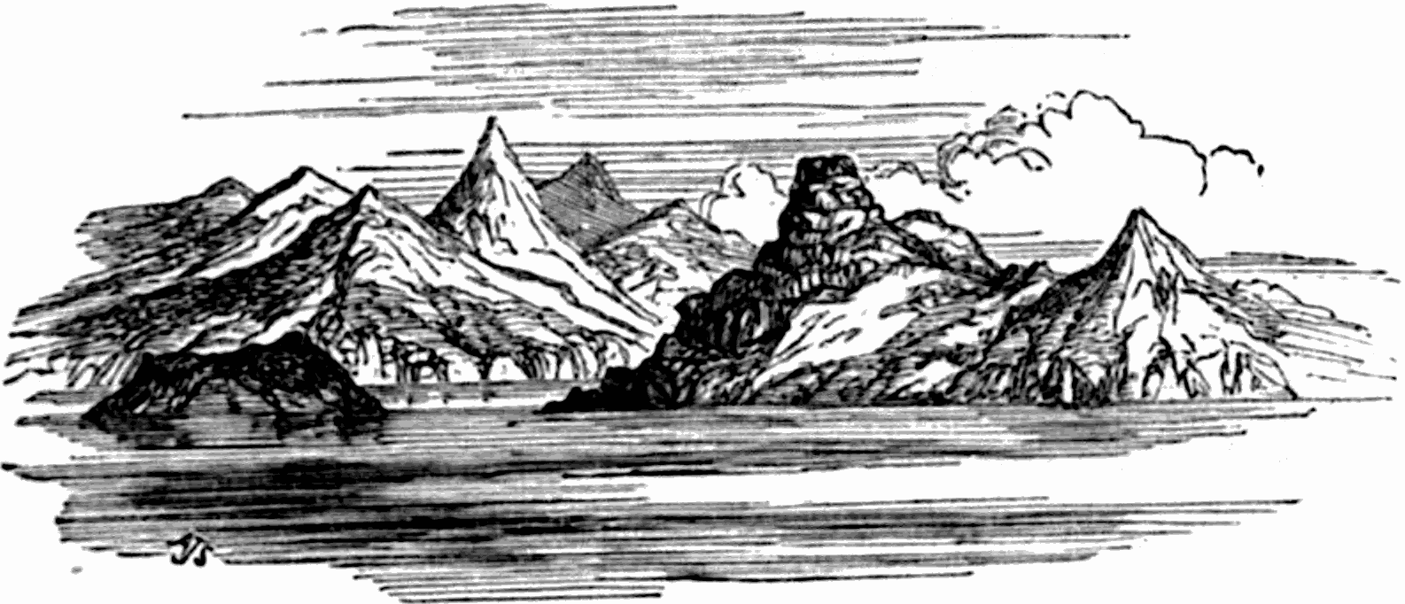
ENTRANCE TO REYDARFIORD.