7. Round the Coast—(a) Along the East from Fair Isle to Unst
Reading edition
The extent of coastline is enormous, and only the outstanding features can be noted here.
Fair Isle, rock-bound, precipitous and lonely, with but one or two small creeks where vessels may shelter, has two lighthouses, each with a fog-siren and a group-flashing white light—the Scaddon, visible 16 miles, and the Scroo, visible 23 miles. It was on Fair Isle that El Gran Grifon, one of the Armada ships, was wrecked in 1588.
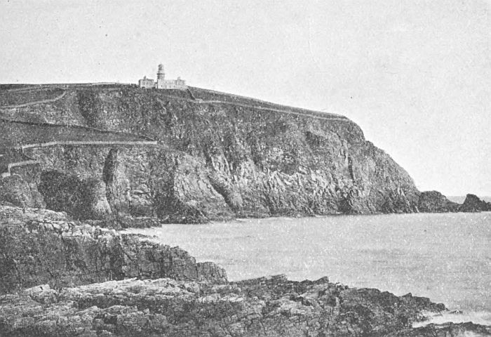
Sumburgh Head and Lighthouse
Sumburgh Head, the most southerly point of the Mainland, is also capped with a lighthouse, perched 300 feet above the swirling eddies of the Roost. Erected in 1820, it was the first lighthouse on the Shetland coast. Its group-flashing white light is visible 24 miles in clear weather. North of Sumburgh Head are Grutness Voe and the Pool of Virkie, with their low-lying sandy shores; while near by are Sumburgh House and the ruins of Jarlshoff. From this point northward the coast is rocky, with moderately low cliffs, which are broken up by the inlets of Voe and Troswick. The next conspicuous point is the headland of Noness, crowned by a small, quick-flashing white light, a guide to the busy fishing centre of Sandwick, and the fine sandy bay of Levenwick, which lies directly opposite. Passing through Mousa Sound, we have on the right the low-lying grazing island of Mousa with its famous Pictish castle, and on the left Sandlodge, near which are disused copper-mines. Two miles north of Mousa is the low-lying point of Helliness, having at its base the small harbour of Aithsvoe. From here onwards the coast is of varying heights, and broken by the exposed creeks of Fladdabister, Quarff, Gulberwick, Sound and Brei Wick. Bressay lighthouse, which has a revolving red and white light, visible 16 miles, shows the way to Bressay Sound and the harbour of Lerwick.
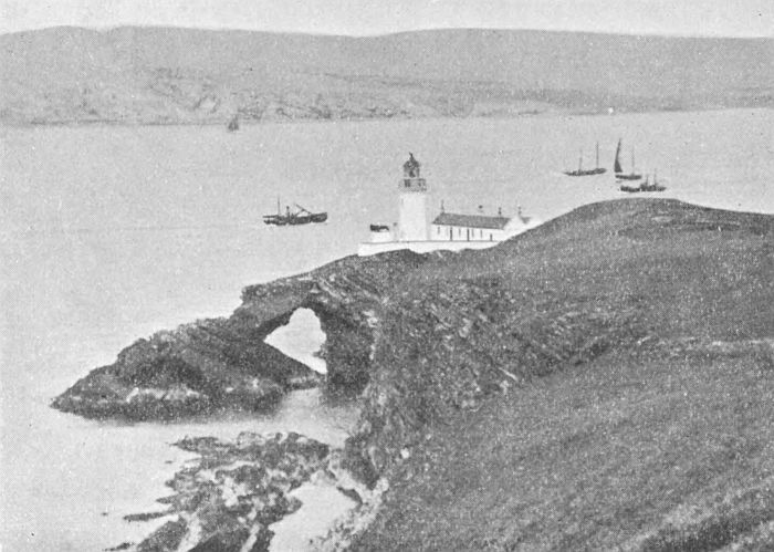
Bressay Lighthouse and Foghorn
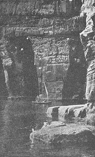
Cliff Scenery, Noss. Bressay
The shores of Bressay are low-lying on the west and north; but on the south are the high cliffs of the Ord and Bard, the latter having the Orkneyman’s Cave and the mural arch of the Giant’s Leg at its base. On the east side of Noss Isle the cliffs are also high, forming the favourite breeding-ground of myriads of sea-birds. The diversity of the coastline, with the sudden transition from an uninteresting shore to bold, precipitous cliffs, is owing to the dip of the rock-strata. If the dip is to the sea, there is a more or less gradual slope to the shore; but if the dip is from the sea, then there is the towering cliff, facing the waves like a giant wall. A good example of this is in the island of Noss, which is 592 feet high at the Noup, and gradually slopes down to near sea-level at the western side. The general outline of the cliffs, too, depends on the texture of the rocks. With sandstone, they tower up in regular layers like a wall, bold and massive, with clear-cut caves and tall stacks. With schistose and granite rocks, however, the cliffs are more broken and rugged.
Proceeding from the north entrance of Lerwick harbour, we find a light on Rova Head, with red, white and green sectors, guiding the mariner to and from this narrow channel. The sea is dotted with a number of rocks and holms, requiring a skilled pilot to negotiate. Towards the west open up the fine bays of Dales Voe, Laxfirth, Wadbister Voe and Catfirth; and off the point of Hawksness is the Unicorn rock, on which the ship that was chasing the Earl of Bothwell was wrecked (1567).
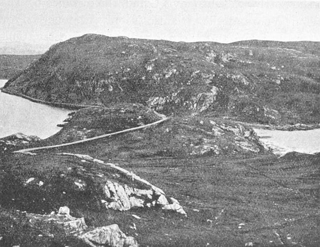
Mavis Grind, looking south
Facing the bold promontory of the Mull of Eswick stands the Maiden Stack; to seaward the Hoo Stack and Sneckan; and extending eastward a succession of rocks and skerries, which go by the name of the “stepping stones.” Passing the bay of South Nesting, we approach the “bonnie isle” of Whalsay, with the fine bay of Dury Voe opposite. Between Whalsay and the land lie a number of isles, the largest being West Linga, while from the outer side, islands and rocks stretch in an easterly direction, the farthest group being called Out Skerries. The largest of these, Housay, Bruray and Grunay, are inhabited; while on a small isle, called Bound Skerry, is erected a fine lighthouse, which shows a bright revolving white light, visible a distance of 18 miles round. Passing Vidlin Voe and doubling the long promontory of Lunna Ness, we reach Yell Sound. On the right lies the island of Yell; on the left the triple openings of Swining Voe, Collafirth and Dales Voe; and further on Firths Voe and Tofts Voe, with the ferry of Mossbank between. After Orka Voe, we round Calback Ness and enter the fine bay of Sullom Voe, extending about eight miles inland. Only a narrow neck of land separates it from Busta Voe on the west, while a little to the northwards, at Mavis Grind, the distance between Sullom Voe and the Atlantic is only a stone’s throw. After Gluss Voe and the pretty bay of Ollaberry, Collafirth is reached, and then Burravoe, the farthest roadstead in Yell Sound. Looking back from this point, we view the whole Sound with its many isles and holms, low-lying, and affording good pasture for sheep. The largest are Lamba, Brother Isle, Bigga, and Samphrey. Near Samphrey are the Rumble Rocks, with a beacon to aid navigation.
Returning to Yell Sound, we find on its north side the two harbours of Hamnavoe and Burravoe, in Yell. Proceeding north through the Sound, we pass the bay of Ulsta and the Ness of Sound. From Ladie Voe to Gloup Holm the coast is bold and rocky, with only one inlet, Whale Firth, which runs inland till it almost meets Mid Yell Voe. In the extreme north is Gloup Voe. Blue Mull Sound, which separates Yell from Unst, has the harbour of Cullivoe near the middle and Linga Island at the south entrance. On the east coast of Yell are the fine bays of Basta Voe and Mid Yell Voe, with the island of Hascosay between.
Across Colgrave Sound lies Fetlar, one of the most fertile of the islands. It is elevated towards the north-east, where Vord Hill rises 521 feet. Hereabout the coast is precipitous and very imposing. The principal openings are Tresta Wick in the South and Gruting Wick in the east. Brough Lodge is a calling-place for steamers.
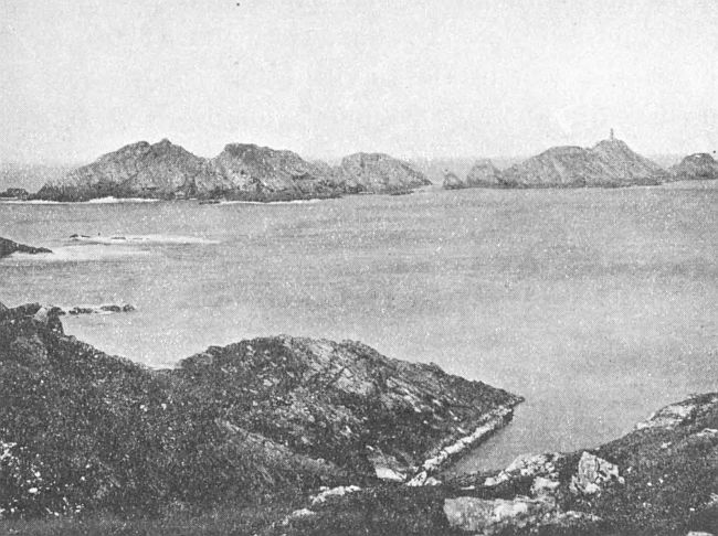
Muckle Flugga Lighthouse
(Most northerly part of the British Isles)
Unst is the most northerly part of the British Isles. In the south is the harbour of Uyea, east of which is Muness with Muness Castle. The principal harbour in Unst is Balta Sound, completely protected by the islands of Balta and Huney. Further north is Haroldswick, named after Harold Fairhair of Norway, who landed here on his expedition against his rebellious subjects. After passing the sandy bay of Norwick and rounding Holm of Skaw, we reach the northern extremity of Unst. The heights of Saxa Vord and Hermaness hem in the entrance to Burrafirth. Rising from a group of rocks, about a mile to seaward, is the Flugga, with a fine lighthouse, which shows a fixed light, with white and red sectors. From Hermaness to Blue Mull Sound, the west of Unst is bold and rocky, with only one inlet of importance, Lunda Wick.