Front matter
Reading edition
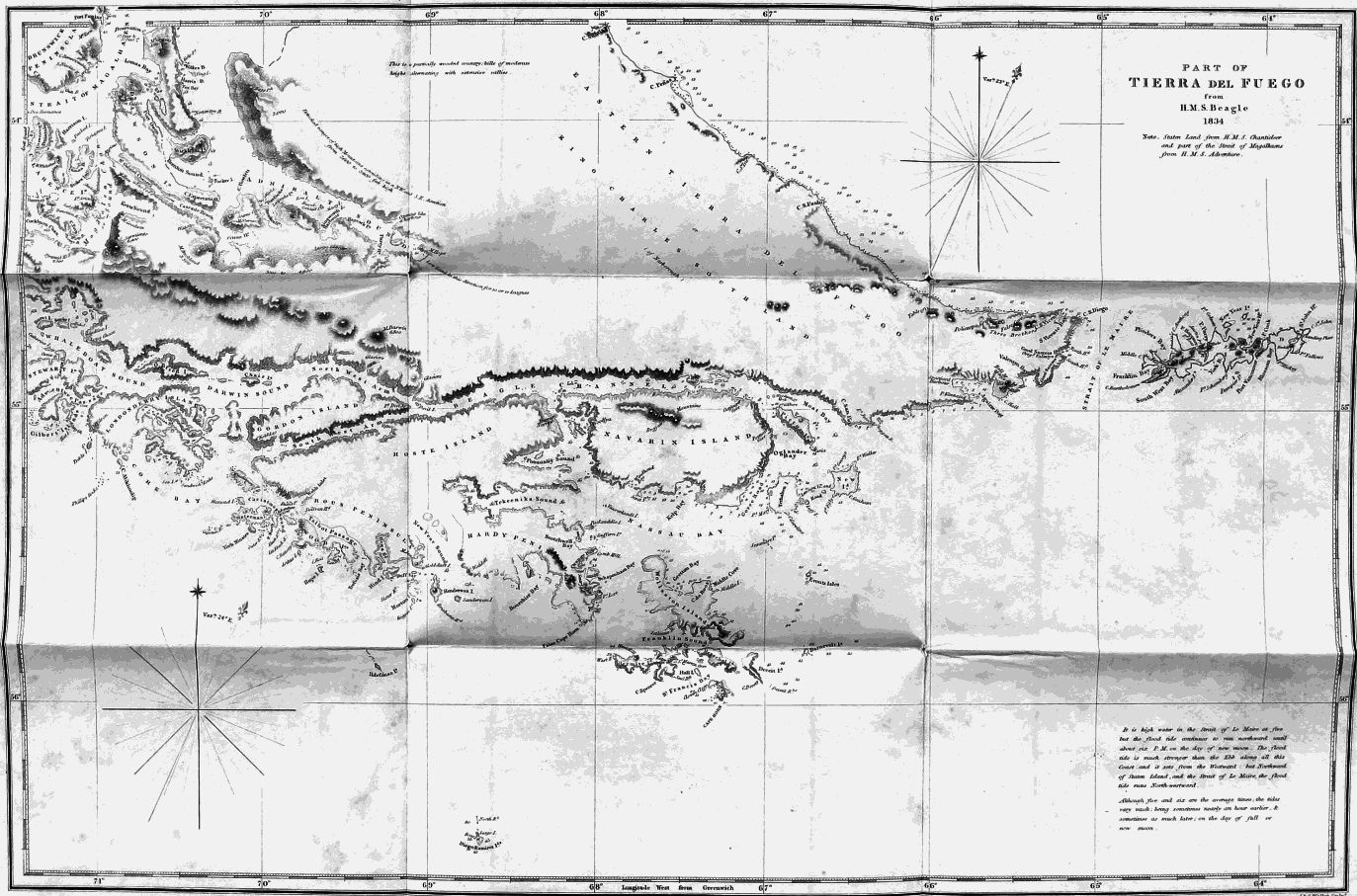
Published according to Act of Parliament by Henry Colburn 1839.
PART OF
TIERRA DEL FUEGO
from
H.M.S. Beagle
1834
Note. Staton Land from H.M.S. Chanticleer and part of Strait of Magalhaens from H.M.S. Adventure.
It is high water in the Strait of Le Maire at five but the flood tide continues to run northward until about six P.M. on the day of new moon. The flood tide is much stronger than the Ebb along all this coast and it sets from the Westward, but Northward of Staton Island and the Strait of Le Maire the flood tide runs North-westward. Although five and six are the average times the tides vary much being sometimes nearly an hour earlier & sometimes as much later on the day of full or new moon.
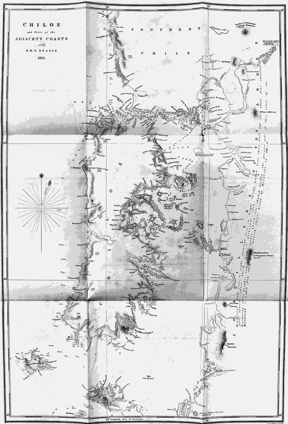
Published according to Act of Parliament by Henry Colburn 1839.
CHILOE
and Parts of the
ADJACENT COASTS
from
H.M.S. BEAGLE
1835.
VOYAGES
OF THE
ADVENTURE AND BEAGLE.
VOLUME II.
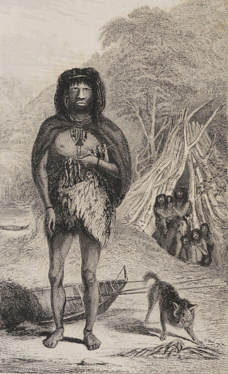
Published by Henry Colburn, Great Marlborough Street, 1838.
C. Martens.
T. Landseer.
FUEGIAN.
(YAPOO TEKEENICA)
AT PORTRAIT COVE