TABLE OF ILLUSTRATIONS.
Reading edition
1. Mount Vernon farms, to face pageiv
2. Mount Vernon hills—made as early as 1747, traced from original, to face page9
3. Plan of Major Lawrence Washington's turnip field, traced from original, to face page14
4. Plan of survey of land known as "Hell Hole," traced from original, to face page24
5. Mount Vernon river front at mouth of Hunting creek, traced from original, to face page52
6. Surveying or measuring land, a study traced from original, to face page56
7. Lost river, traced from the original, to face page73
8. Plat of Francis Jett's land, traced from the original, to face page76
9. Plat of Elizabeth Washington's land, traced from the original, to face page76
10. Plat of survey for Richard Barnes, Gent., copied from Sparks, to face page79
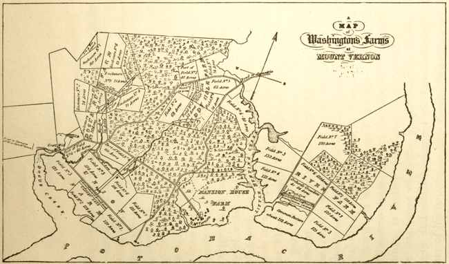
A Map of Washington's Farms at Mount Vernon